Items Similar to Antique Map of Rhodesia & British Central Africa – Published by Philip, 1895


Want more images or videos?
Request additional images or videos from the seller
1 of 10
Antique Map of Rhodesia & British Central Africa – Published by Philip, 1895
$407.58
£302.77
€340
CA$565.96
A$617.60
CHF 323.94
MX$7,500.95
NOK 4,046.20
SEK 3,823.86
DKK 2,588.38
About the Item
Antique Map of Rhodesia & British Central Africa – Published by George Philip & Son, 1895
This detailed antique map titled "Rhodesia & British Central Africa" was published in 1895 by George Philip & Son, London and Liverpool. It offers a fascinating cartographic snapshot of southern and central Africa during the height of British colonial expansion, just a few years after the establishment of British South Africa Company control in the region.
The map covers an expansive area from the Congo Free State in the north to the northern part of Bechuanaland (modern Botswana) in the south, and from the Atlantic to the Indian Ocean. It includes what was then termed North-Western and Southern Rhodesia (now Zambia and Zimbabwe), Nyasaland (now Malawi), and parts of Mozambique and Angola. The boundaries of British protectorates, tribal regions, and European-settled areas are outlined in color, reflecting the colonial administrative divisions of the late 19th century.
Prominent features include Lake Nyasa (now Lake Malawi), the Zambezi River, Victoria Falls, and major towns such as Salisbury, Blantyre, and Fort Jameson. Mountain ranges, rivers, trade routes, telegraph lines, and railway projects are all illustrated in fine engraved detail. A color-coded key at the lower right corner indicates political boundaries, telegraph lines, and altitudes above sea level. The map is drawn to a scale of 1:3,000,000 and printed on a large folio sheet, providing both geographical precision and visual impact.
This map was published at a pivotal time, just before Southern Rhodesia became a self-governing colony in 1923. It reflects the imperial ambitions and geopolitical structure of British Africa following the "Scramble for Africa," when European powers competed for territorial control across the continent.
Condition: Excellent overall condition. Original hand coloring. Light age toning at the edges, minor centerfold creasing as issued. Clean and unmarked, with strong paper and sharp engraved detail.
Framing tips: This colonial-era map displays well in a dark wood or ebonized frame, paired with a cream or buff-colored mat to highlight the fine linework and color borders. Ideal for historical, academic, or travel-themed interiors.
Technique: Engraving with original hand color
Maker: George Philip & Son, London & Liverpool, 1895
- Dimensions:Height: 15.56 in (39.5 cm)Width: 20.08 in (51 cm)Depth: 0.01 in (0.2 mm)
- Materials and Techniques:Paper,Engraved
- Place of Origin:
- Period:Late 17th Century
- Date of Manufacture:circa 1895
- Condition:Condition: Excellent overall condition. Original hand coloring. Light age toning at the edges, minor centerfold creasing as issued. Clean and unmarked, with strong paper and sharp engraved detail.
- Seller Location:Langweer, NL
- Reference Number:Seller: BG-137981stDibs: LU3054346159432
About the Seller
5.0
Recognized Seller
These prestigious sellers are industry leaders and represent the highest echelon for item quality and design.
Platinum Seller
Premium sellers with a 4.7+ rating and 24-hour response times
Established in 2009
1stDibs seller since 2017
2,647 sales on 1stDibs
Typical response time: <1 hour
- ShippingRetrieving quote...Shipping from: Langweer, Netherlands
- Return Policy
Authenticity Guarantee
In the unlikely event there’s an issue with an item’s authenticity, contact us within 1 year for a full refund. DetailsMoney-Back Guarantee
If your item is not as described, is damaged in transit, or does not arrive, contact us within 7 days for a full refund. Details24-Hour Cancellation
You have a 24-hour grace period in which to reconsider your purchase, with no questions asked.Vetted Professional Sellers
Our world-class sellers must adhere to strict standards for service and quality, maintaining the integrity of our listings.Price-Match Guarantee
If you find that a seller listed the same item for a lower price elsewhere, we’ll match it.Trusted Global Delivery
Our best-in-class carrier network provides specialized shipping options worldwide, including custom delivery.More From This Seller
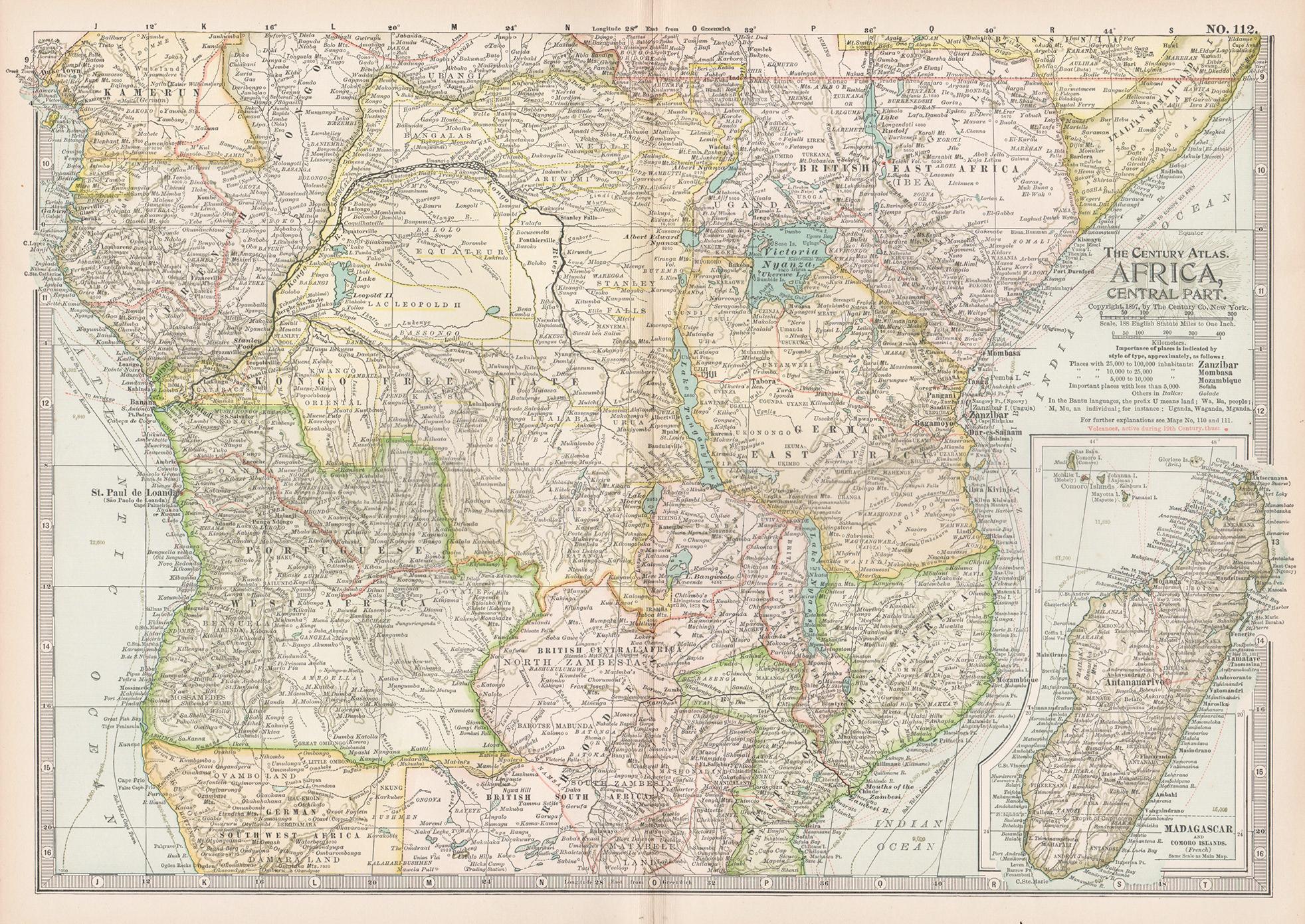
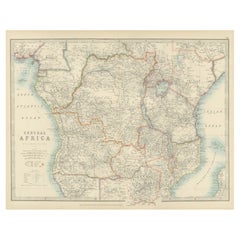
View AllAntique Map of Central Africa, 1903, With Colonial Territories Explorers Routes
Located in Langweer, NL
Antique Map of Central Africa, 1903, Featuring Colonial Territories and Explorers’ Routes
This antique map, titled "Central Africa," was engraved and published in 1903 by W. & A.K. ...
Category
Early 20th Century Maps
Materials
Paper
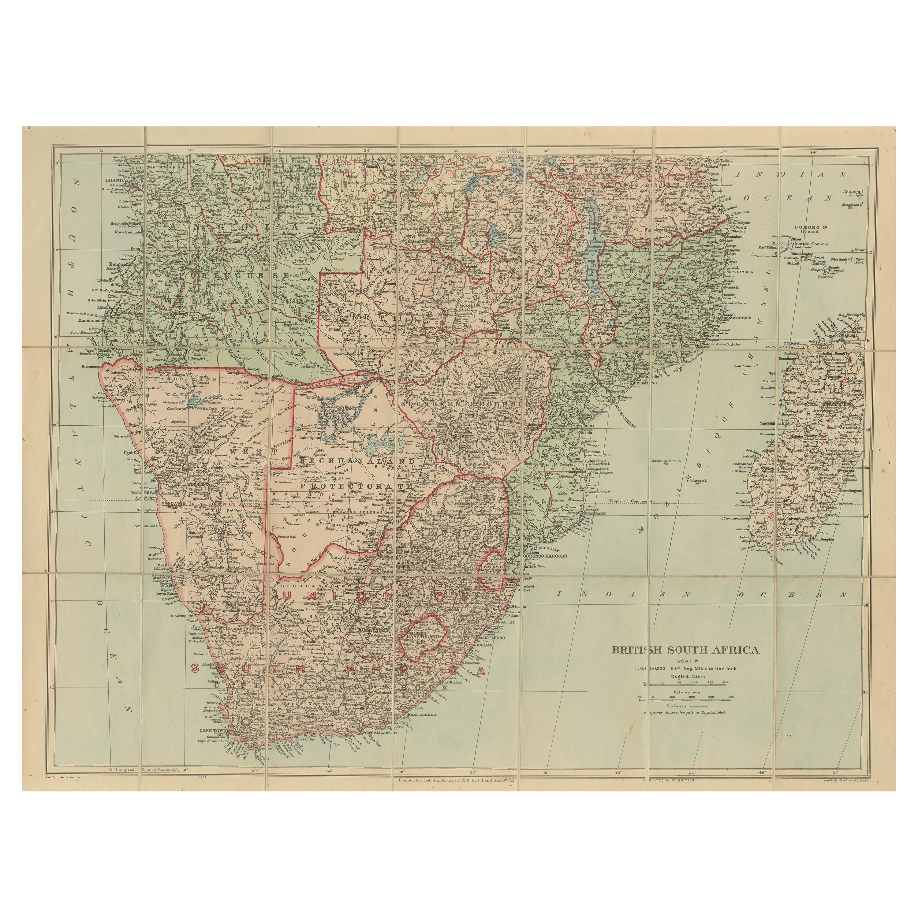
Antique Map of British South Africa – Colonial Territories & Railways, c.1920s
Located in Langweer, NL
Antique Map of British South Africa – Colonial Territories & Railways, c.1920s
This large and detailed folding map depicts British South Afric...
Category
Early 20th Century English Maps
Materials
Paper
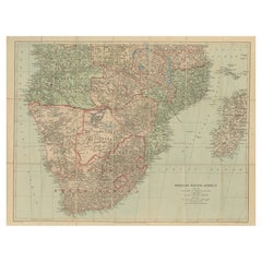
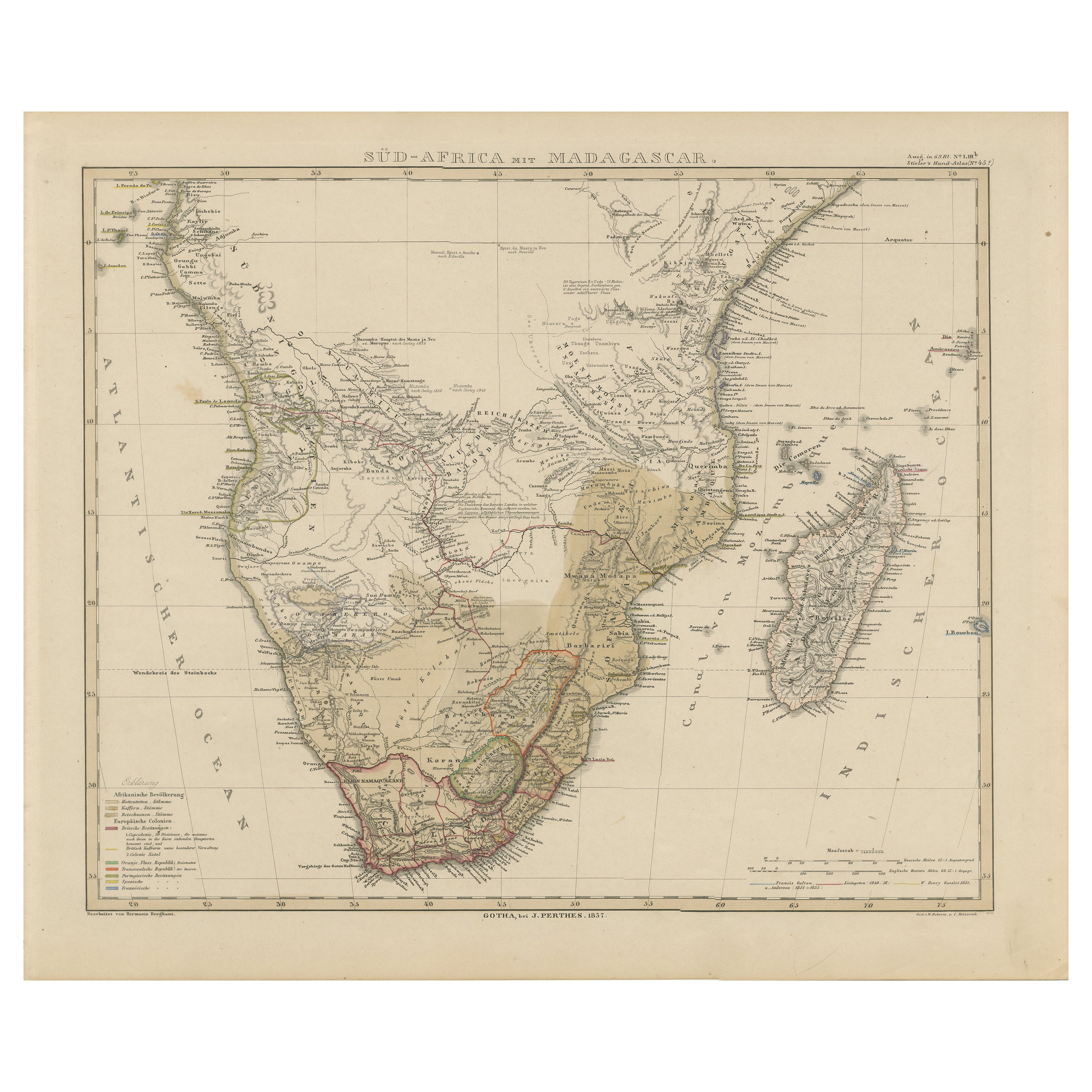
Southern Africa & Madagascar Antique Map – Beautiful 1857 Edition
Located in Langweer, NL
Southern Africa and Madagascar Map 1857
This detailed antique print shows “Süd-Africa mit Madagascar” meaning “Southern Africa with Madagascar,” published in 1857 by Justus Perthes ...
Category
Antique Mid-19th Century German Maps
Materials
Paper
Antique Map of Africa, Highlighting Colonial Divisions, Geographic Features 1903
Located in Langweer, NL
Title: Antique Map of Africa, 1903, Highlighting Colonial Divisions and Geographic Features
Description: This antique map, titled "Africa," was engraved and published in 1903 by W. ...
Category
Early 20th Century Maps
Materials
Paper

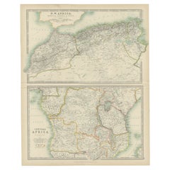
Antique Map of N.W. Africa & Central Africa by Johnston (1909)
Located in Langweer, NL
Antique map titled 'N.W. Africa & Central Africa'. Original antique map of N.W. Africa & Central Africa. This map originates from the ‘Royal Atlas of Modern Geography’. Published by ...
Category
Early 20th Century Maps
Materials
Paper
$239 Sale Price
20% Off
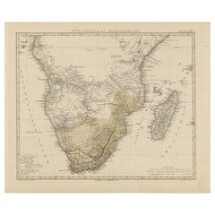
Antique Map of Southern Africa by Levasseur, 1875
Located in Langweer, NL
Antique map titled 'Afrique Méridionale'. Large map of Southern Africa. This map originates from 'Atlas de Géographie Moderne Physique et Politique' b...
Category
Antique Late 19th Century Maps
Materials
Paper

$383 Sale Price
20% Off
You May Also Like
Africa. Central. Century Atlas antique vintage map
Located in Melbourne, Victoria
'The Century Atlas. Africa. Central'
Inset map of 'Madagascar'.
Original antique map, 1903.
Central fold as issued. Map name and number printed on the reverse corners.
Sheet 29.5cm...
Category
Early 20th Century Victorian More Prints
Materials
Lithograph

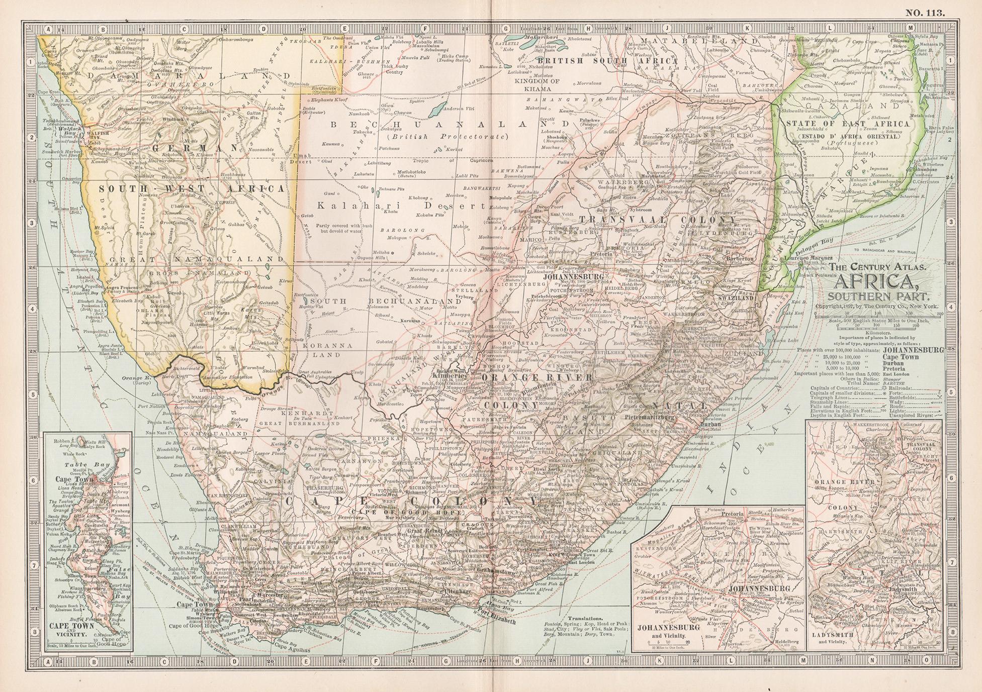
Africa. Southern Part. Century Atlas antique vintage map
Located in Melbourne, Victoria
'The Century Atlas. Africa. Southern Part'
Original antique map, 1903.
Inset maps of 'Cape Town', 'Johannesburg' and 'Ladysmith'.
Central fold as issued. Map name and number printe...
Category
Early 20th Century Victorian More Prints
Materials
Lithograph

Africa. North-West Part. Century Atlas antique vintage map
Located in Melbourne, Victoria
'The Century Atlas. Africa. Southern Part'
Original antique map, 1903.
Central fold as issued. Map name and number printed on the reverse corners.
Sheet 40cm by 29.5cm.
Category
Early 20th Century Victorian More Prints
Materials
Lithograph

Africa. North-East Part. Century Atlas antique vintage map
Located in Melbourne, Victoria
'The Century Atlas. Africa. North-East Part'
Original antique map, 1903.
Inset map of 'Nile Delta and Suez Canal'.
Central fold as issued. Map name and nu...
Category
Early 20th Century Victorian More Prints
Materials
Lithograph

Large Original Vintage Map of South Africa, circa 1920
Located in St Annes, Lancashire
Great map of South Africa
Original color.
Good condition / repair to a minor edge tear middle bottom
Published by Alexander Gross
Unframed.
...
Category
Vintage 1920s English Edwardian Maps
Materials
Paper

Original Antique Map of Africa by Dower, circa 1835
Located in St Annes, Lancashire
Nice map of Africa
Drawn and engraved by J.Dower
Published by Orr & Smith. C.1835
Unframed.
Free shipping
Category
Antique 1830s English Maps
Materials
Paper

More Ways To Browse
Antique South Africa
Salisbury Antique
Pair Of Danish Chairs
Veneer Dining Tables
1970 Italian Armchair
Furniture Uk
House Of Denmark Table And Chairs
Louis Marble Top Side Table
Antique Russian Rugs
Baker Furniture By
For Kids
Sterling Silver Flatware Set Service For 12
Tufted Bar
Pair Of French Antique Armchairs
1970s Brass Glass Coffee Table
Antique Column Base
Charles Rennie Mackintosh For Cassina
Glass Salt