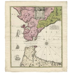
Antique Map of the Strait of Gibraltar by Homann Heirs, circa 1730
View Similar Items


Want more images or videos?
Request additional images or videos from the seller
1 of 6
Antique Map of the Strait of Gibraltar by Homann Heirs, circa 1730
About the Item
- Creator:Homann Heirs (Artist)
- Dimensions:Height: 25.6 in (65 cm)Width: 22.64 in (57.5 cm)Depth: 0.02 in (0.5 mm)
- Period:
- Date of Manufacture:circa 1730
- Condition:Please study images carefully.
- Seller Location:Langweer, NL
- Reference Number:Seller: BG-020891stDibs: LU305438765153
About the Seller
5.0
Platinum Seller
These expertly vetted sellers are 1stDibs' most experienced sellers and are rated highest by our customers.
Established in 2009
1stDibs seller since 2017
1,947 sales on 1stDibs
More From This SellerView All
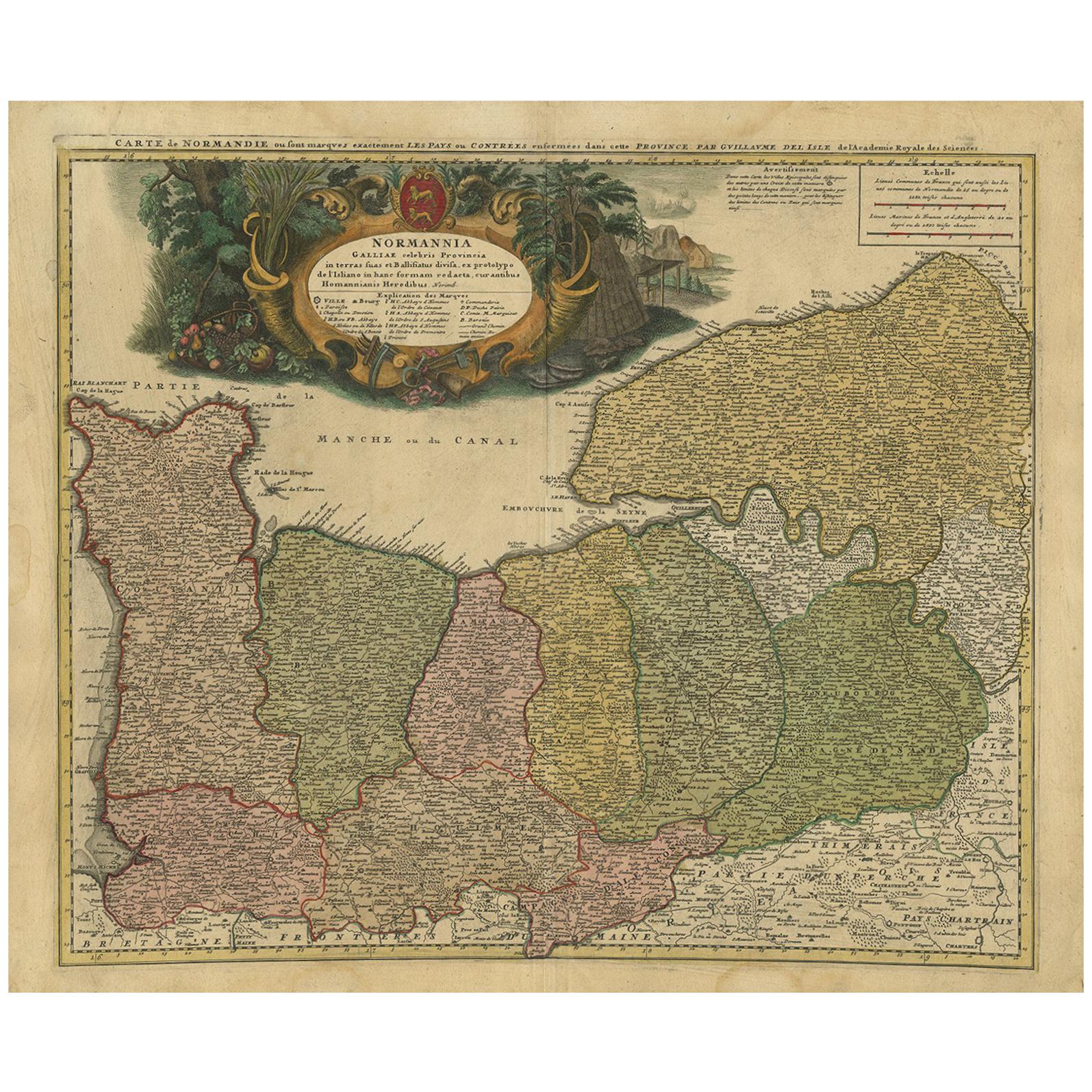
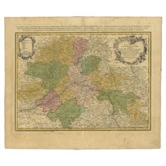
- Antique Map of the Danube River and Surroundings by Homann Heirs, c.1730By Homann HeirsLocated in Langweer, NLAntique map titled 'Danubii Fluminus (a fontibus prope Doneschingam usq Posonium urbem defignati) Pars Superior, in qua Suevia, Bavaria, Asutria, Stiria, Carinthia, Carniola, Tyrolis...Category
Antique 18th Century Maps
MaterialsPaper
- Antique Map of the Baltic Region by Homann Heirs, c.1730Located in Langweer, NLAntique map titled 'Regnum Borussiae gloriosis auspicijs Seerenissimi et Potentissimi Princip Friderici III (..).' Detailed map of the Baltic region from Memel to Pomerania, extendin...Category
Antique 18th Century Maps
MaterialsPaper
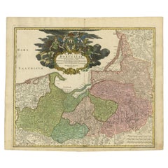 $413 Sale Price20% Off
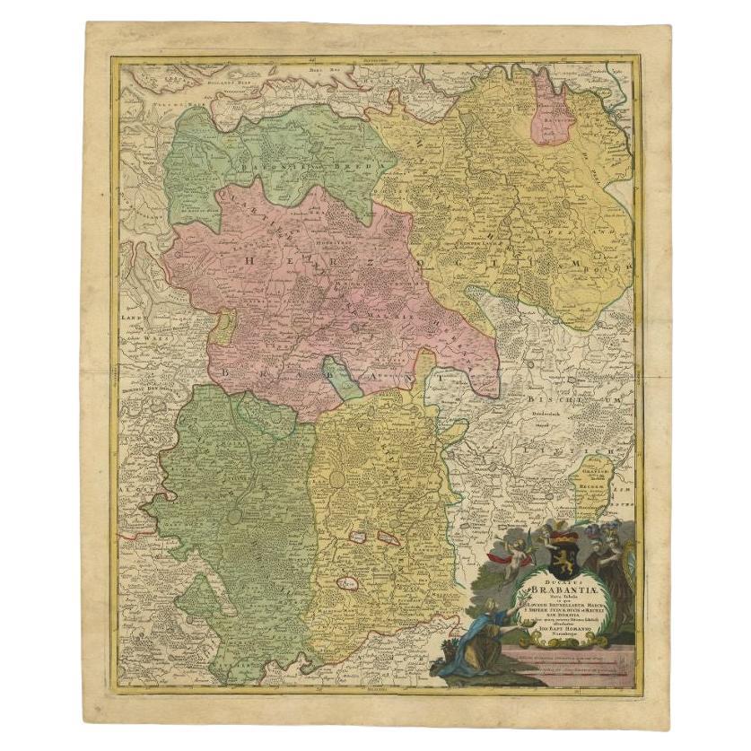
 - Antique Map of the Seventeen Provinces by Homann Heirs, 1748By Homann HeirsLocated in Langweer, NLAntique map titled 'Belgii Universi seu Inferioris Germaniae quam XVII Provinciae (..)'. Map of the Seventeen Provinces after Tobias Meier, published by Homann's Heirs in 1748. The S...Category
Antique 18th Century Maps
MaterialsPaper
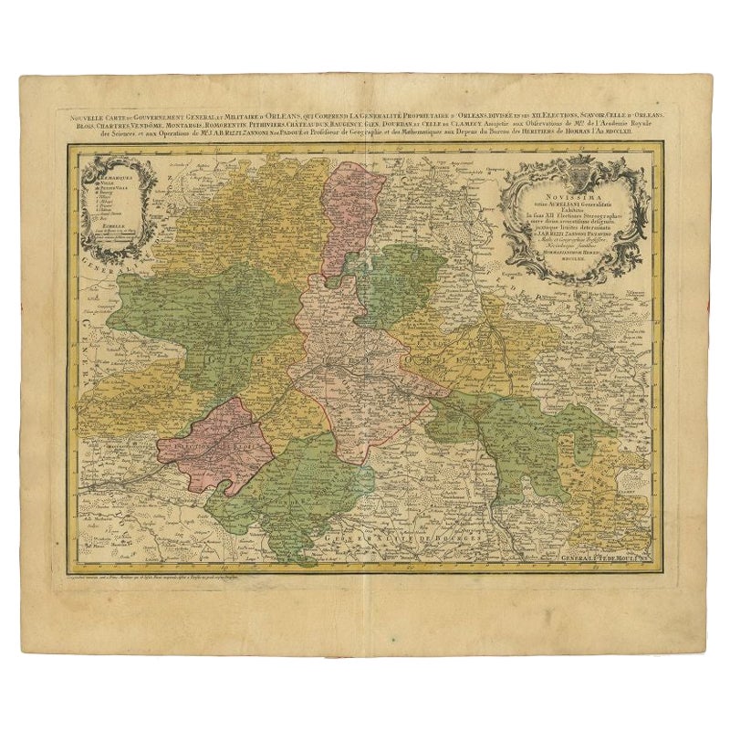
- Antique Map of the Region of Orleans by Homann Heirs, c.1760By Homann HeirsLocated in Langweer, NLAntique map titled 'Novissima Totius Aureliani Generalitatis (..) - Nouvelle Carte du Gouvernement General et Militaire d'Orleans (..).' Detailed map by Rizzi Zononi covering the vic...Category
Antique 18th Century Maps
MaterialsPaper
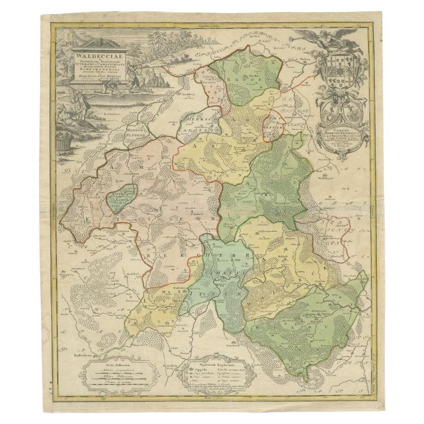
- Antique Map of the Waldeck Region of Germany by Homann Heirs, circa 1733By Homann HeirsLocated in Langweer, NLAntique map titled 'Waldecciae ac finitimorum Dominiorum (.)'. Map of the Waldeck region of Germany. With decorative cartouche depicting people mining, fishing and deer hunting with ...Category
Antique 18th Century Maps
MaterialsPaper
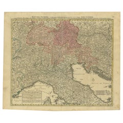
- Antique Map of Northern Italy by Homann Heirs, c.1730Located in Langweer, NLAntique map titled 'Domini Veneti cum vicinis Parmae Mutinae, Matuae et Mirandol (..).' Detailed map of northern Italy by J. B. Homann. This map shows Venice and its adjacent states ...Category
Antique 18th Century Maps
MaterialsPaper
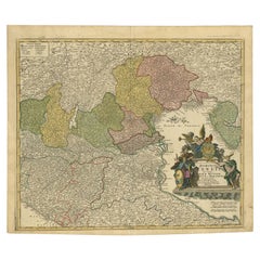 $457 Sale Price20% Off

You May Also Like
- Hand-Colored 18th Century Homann Map of the Danube, Italy, Greece, CroatiaBy Johann Baptist HomannLocated in Alamo, CA"Fluviorum in Europa principis Danubii" is a hand colored map of the region about the Danube river created by Johann Baptist Homann (1663-1724) in his 'Atlas Novus Terrarum', publish...Category
Antique Early 18th Century German Maps
MaterialsPaper
- Sweden & Adjacent Portions of Scandinavia: A Hand-Colored 18th C. Map by HomannBy Johann Baptist HomannLocated in Alamo, CAThis hand-colored map of Sweden and adjacent portions of Scandinavia entitled "Regni Sueciae in Omnes suas Subjacentes Provincias accurate divisi Tabula Generalis" was created by Joh...Category
Antique 1720s German Maps
MaterialsPaper
- 1861 Topographical Map of the District of Columbia, by Boschke, Antique MapLocated in Colorado Springs, COPresented is an original map of Albert Boschke's extremely sought-after "Topographical Map of the District of Columbia Surveyed in the Years 1856 ...Category
Antique 1860s American Historical Memorabilia
MaterialsPaper
- Hand Colored 18th Century Homann Map of Austria Including Vienna and the DanubeBy Johann Baptist HomannLocated in Alamo, CA"Archiducatus Austriae inferioris" is a hand colored map of Austria created by Johann Baptist Homann (1663-1724) and published in Nuremberg, Germany in 1728 shortly after his death. ...Category
Antique Early 18th Century German Maps
MaterialsPaper
- The Kingdom of Naples and Southern Italy: A Hand-Colored 18th Century Homann MapBy Johann Baptist HomannLocated in Alamo, CA"Novissima & exactissimus Totius Regni Neapolis Tabula Presentis Belli Satui Accommo Data" is a hand colored map of southern Italy and the ancient Kingdom of Naples created by Johann...Category
Antique Early 18th Century German Maps
MaterialsPaper
- Hand-Colored 18th Century Homann Map of the Black Sea, Turkey and Asia MinorBy Johann Baptist HomannLocated in Alamo, CAAn attractive original early 18th century hand-colored map of the Black Sea and Turkey entitled "Carte de L'Asie Minevre ou de la Natolie et du Pont Evxin Tiree des Voyages et des Ob...Category
Antique Early 18th Century German Maps
MaterialsPaper


