Items Similar to Constantinople – Panoramic Hand-Colored Engraving, Augsburg, circa 1720


Want more images or videos?
Request additional images or videos from the seller
1 of 11
Constantinople – Panoramic Hand-Colored Engraving, Augsburg, circa 1720
$671.30
£498.68
€560
CA$932.18
A$1,017.22
CHF 533.55
MX$12,354.50
NOK 6,664.33
SEK 6,298.13
DKK 4,263.22
About the Item
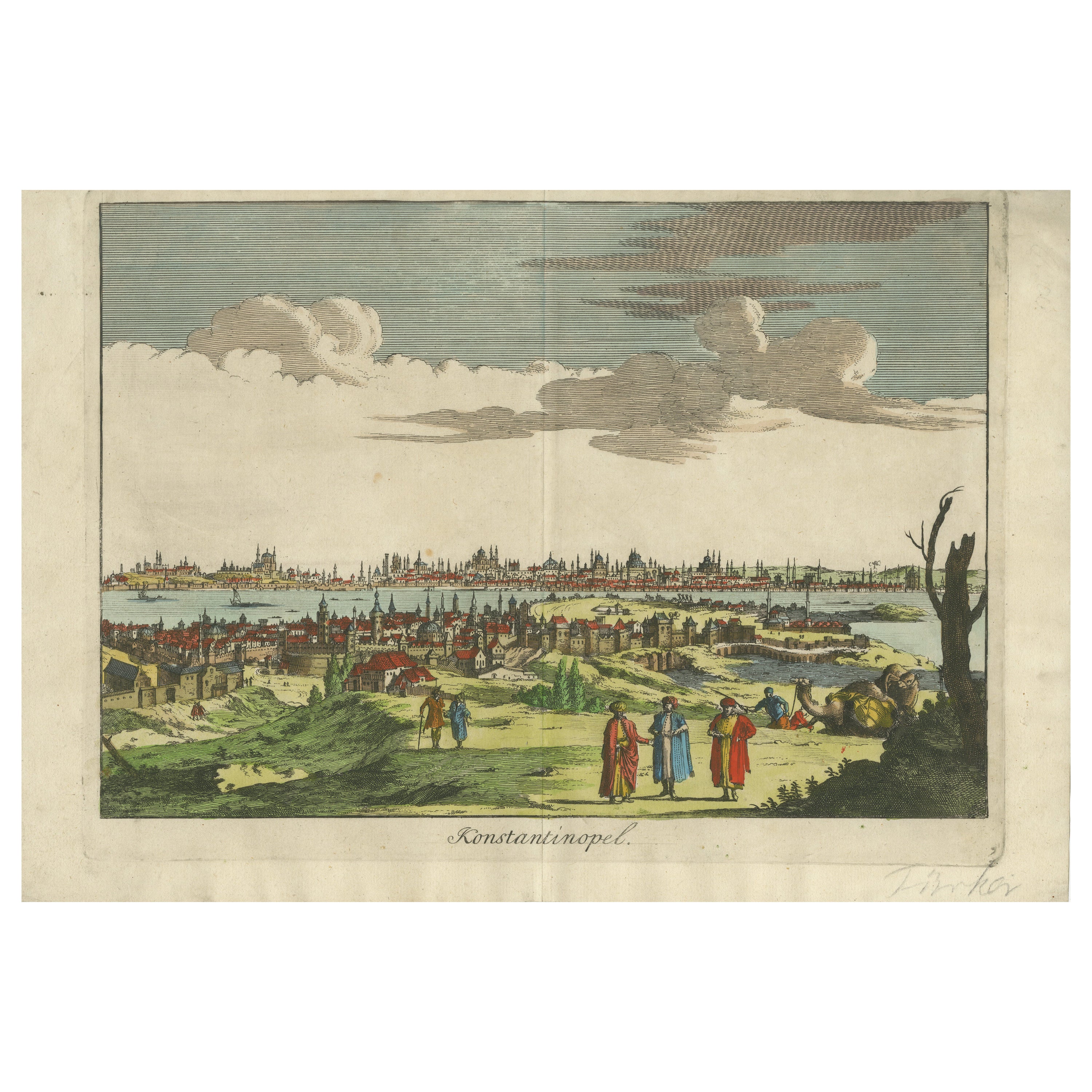
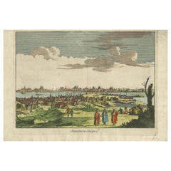
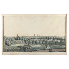
Constantinople – Panoramic Hand-Colored Engraving, Augsburg, circa 1720
This panoramic hand-colored engraving presents a sweeping bird’s-eye view of Constantinople (modern-day Istanbul) as seen from the hills of Pera or Galata, looking across the Golden Horn toward the historic peninsula of the city. The skyline is dominated by a dense forest of minarets, domes, and towers, with iconic Ottoman architecture clearly visible, including what appear to be the Hagia Sophia and the Blue Mosque among many other grand structures. The city is shown in vibrant color with great attention to detail, emphasizing its role as a powerful imperial capital.
In the foreground, three elaborately dressed Ottoman figures stand in conversation, accompanied by a camel and additional travelers resting beneath a tree. These figures, commonly included in 18th-century views of the East, serve both as decorative ethnographic elements and to provide a sense of scale and exoticism. Their presence reflects the European fascination with the Ottoman world during the Baroque period.
The lower margin is simply titled "Constantinople" in capital letters, without a legend or publisher information. However, the engraving style, composition, and coloring strongly suggest it was produced in Augsburg, Germany, likely by or after an artist such as Friedrich Bernhard Werner or a contemporary. Augsburg was a major center for the production of such topographical prints during the early 18th century, particularly under publishers like Martin Engelbrecht or Jeremias Wolff.
These views were popular with European collectors for both their artistic appeal and their role as windows into faraway empires. They offered dramatic yet semi-accurate impressions of foreign cities, combining architectural survey with theatrical staging and ornamental figures.
Condition: Very good condition. Wide margins with minor toning and faint spotting. The hand-coloring is strong and well-preserved. Vertical plate mark visible. Clean image area with minimal wear.
Framing tips: Ideal for display in a walnut or ebonized frame with a gold liner. Pair with a light cream or pale parchment mat to highlight the warm tones and dramatic skyline.
Technique: Copperplate engraving with original hand-coloring
Maker: Anonymous Augsburg engraver, after F. B. Werner or similar, c.1720
- Dimensions:Height: 9.45 in (24 cm)Width: 12.52 in (31.8 cm)Depth: 0.01 in (0.2 mm)
- Materials and Techniques:Paper,Engraved
- Place of Origin:
- Period:
- Date of Manufacture:circa 1730
- Condition:Condition: Very good condition. Wide margins with minor toning and faint spotting. The hand-coloring is strong and well-preserved. Vertical plate mark visible. Clean image area with minimal wear.
- Seller Location:Langweer, NL
- Reference Number:Seller: BG-138981stDibs: LU3054346174772
About the Seller
5.0
Recognized Seller
These prestigious sellers are industry leaders and represent the highest echelon for item quality and design.
Platinum Seller
Premium sellers with a 4.7+ rating and 24-hour response times
Established in 2009
1stDibs seller since 2017
2,641 sales on 1stDibs
Typical response time: <1 hour
- ShippingRetrieving quote...Shipping from: Langweer, Netherlands
- Return Policy
Authenticity Guarantee
In the unlikely event there’s an issue with an item’s authenticity, contact us within 1 year for a full refund. DetailsMoney-Back Guarantee
If your item is not as described, is damaged in transit, or does not arrive, contact us within 7 days for a full refund. Details24-Hour Cancellation
You have a 24-hour grace period in which to reconsider your purchase, with no questions asked.Vetted Professional Sellers
Our world-class sellers must adhere to strict standards for service and quality, maintaining the integrity of our listings.Price-Match Guarantee
If you find that a seller listed the same item for a lower price elsewhere, we’ll match it.Trusted Global Delivery
Our best-in-class carrier network provides specialized shipping options worldwide, including custom delivery.More From This Seller
View AllKonstantinopel – Panoramic View of Istanbul by François Halma, 1705
Located in Langweer, NL
Konstantinopel – Panoramic View of Istanbul by François Halma, 1705
This engaging hand-colored engraving of “Konstantinopel” offers a sweeping panoramic view of 18th-century Istanbu...
Category
Antique Early 18th Century Dutch Maps
Materials
Paper
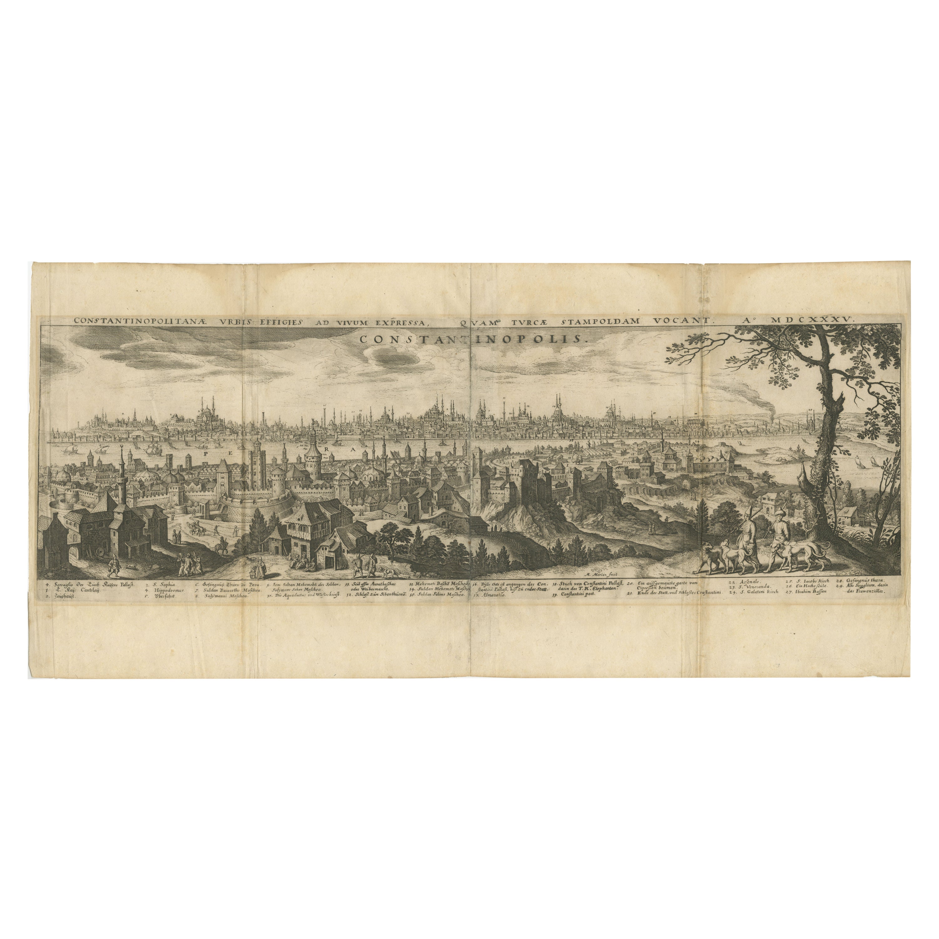
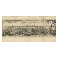
Constantinople – Panoramic Engraving by Matthäus Merian the Elder, 1635
Located in Langweer, NL
Constantinople – Panoramic Engraving by Matthäus Merian the Elder, Frankfurt, 1635
This finely detailed copperplate engraving presents a sweeping bird’s-eye view of Constantinople (...
Category
Antique Early 17th Century German Maps
Materials
Paper
Constantinople (Istanbul) – City View by Werner and Gläser, Augsburg ca.1730
Located in Langweer, NL
Constantinople (Istanbul) – Panoramic City View by Werner and Gläser, Augsburg c.1730
This striking hand-colored copper engraving offers a grand panoramic view of Constantinople (mo...
Category
Antique Early 18th Century German Maps
Materials
Paper

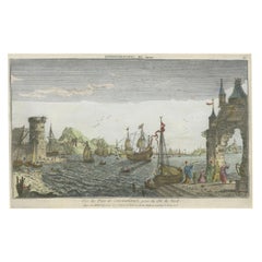
Contemporary Handcolored Optical View of Constantinople, ca.1760
Located in Langweer, NL
"Vue du Port de Constantinople, prise du côté du Nord". Contemporary handcolored optical view, Paris, J. Chereau, ±1760.
Description: This contemporary handcolored optical view, tit...
Category
Antique 1760s Prints
Materials
Paper
$853 Sale Price
20% Off
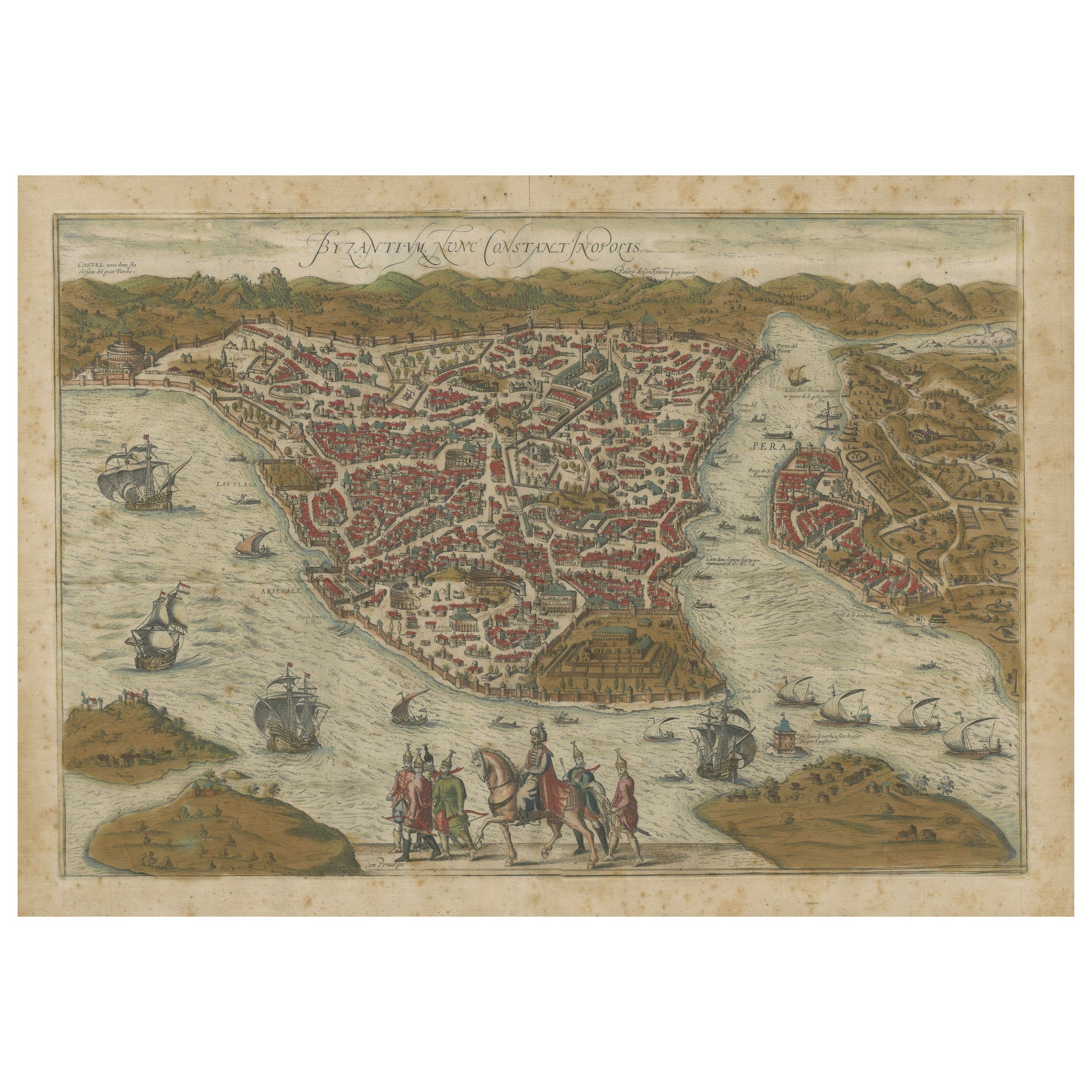
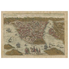
Byzantium Nunc Constantinopolis – Braun & Hogenberg View of Istanbul, 1572
Located in Langweer, NL
Byzantium Nunc Constantinopolis – Braun & Hogenberg View of Istanbul, Cologne, 1572
This iconic 16th-century bird’s-eye view titled “Byzantium Nunc Constantinopolis” presents the ci...
Category
Antique 16th Century German Maps
Materials
Paper
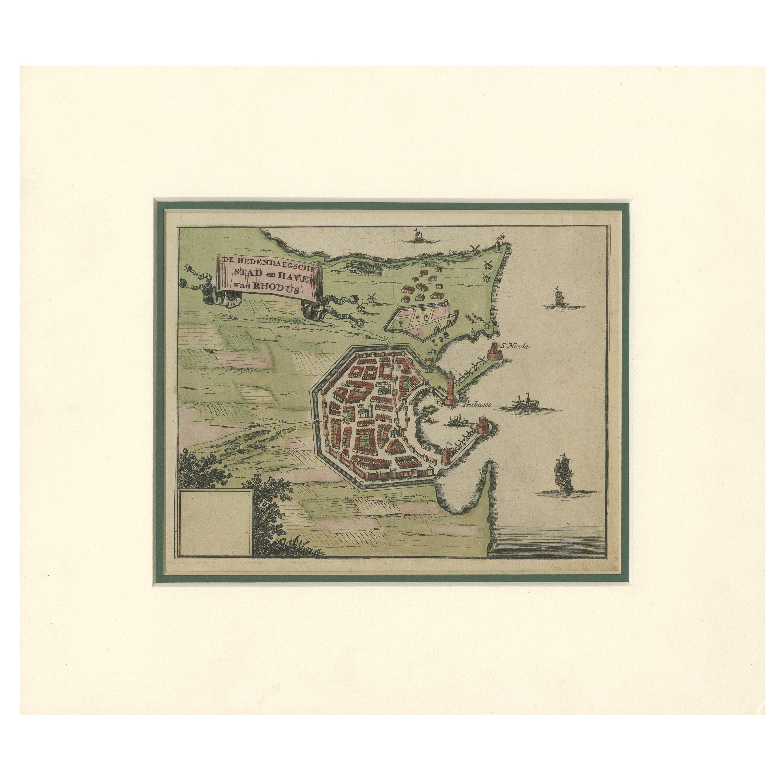
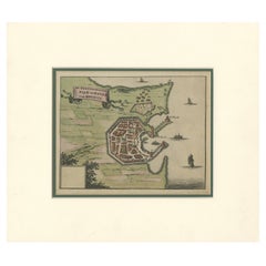
City and Harbour of Rhodes – Olfert Dapper, 1688 Hand-Coloured Engraving
Located in Langweer, NL
City and Harbour of Rhodes – Olfert Dapper, 1688 Hand-Coloured Engraving
Description:
This historical hand-coloured copperplate engraving, titled “De hedendaegsche Stad en Haven van...
Category
Antique Late 17th Century Dutch Maps
Materials
Paper
You May Also Like
Ancient View of Constantinople - Original Lithograph - Mid-19th Century
Located in Roma, IT
Ancient View of Costantinople is an original modern artwork realized in the first half of the 19th Century.
Original B/W Lithograph on Ivory Paper.
Inscripted on the lower margin ...
Category
Early 19th Century Old Masters Figurative Prints
Materials
Lithograph
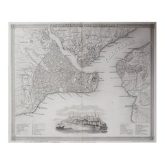
Original Antique Map or City Plan of Istanbul, Turkey. Circa 1835
Located in St Annes, Lancashire
Nice map of Istanbul
Drawn and engraved by J.Dower
Published by Orr & Smith. C.1835
Unframed.
Free shipping
Category
Antique 1830s English Maps
Materials
Paper
Southern & Eastern Europe: A Large 17th C. Hand-colored Map by Sanson & Jaillot
By Nicholas Sanson d'Abbeville
Located in Alamo, CA
This large hand-colored map entitled "Estats de L'Empire des Turqs en Europe, ou sont les Beglerbeglicz our Gouvernements" was originally created by Nicholas Sanson d'Abbeville and this version was published by Hubert Jaillot in "Atlas Nouveau" in Paris in 1692. It depicts the territories of the Ottoman Empire in Europe, predominantly Eastern Europe. Highlights include, the Mediterranean Sea, the Adriatic Sea, the Black Sea, the Dalmation Coast including present day Croatia, Bosnia and Herzegovina, Montenegro, Serbia, Slovenia, Italy, Greece, North Macedonia, Turkey, Romania, Hungary, Albania, Kosovo, Bulgaria, Transylvania, Moldova and southern portions of France, Switzerland, Germany, and Poland..
The map consists of two sheets joined as one along a vertical joint. The map has original hand-coloring. It is printed on antique hand-made laid, chain-linked paper with wide margins. The sheet measures 24.88" high and 38" wide. There is a central vertical joint, as issued. The map is in very good condition.
Nicholas Sanson d'Abbeville (1600-1667) was one of the greatest French cartographather of French cartography. Sanson opened his first printing business in Paris in 1638. The king recognized his skill and knowledge and made him the official geographer to the court. He eventually served two kings in this capacity. Sanson was succeeded by his sons and son...
Category
1690s Landscape Prints
Materials
Engraving

Danube River, Italy, Greece and Croatia: A Hand-colored 18th C. Homann Map
By Johann Baptist Homann
Located in Alamo, CA
"Fluviorum in Europa principis Danubii" is a hand-colored map of the region about the Danube river created by Johann Baptist Homann (1663-1724) in his 'Atlas Novus Terrarum', publish...
Category
Early 18th Century Old Masters Landscape Prints
Materials
Engraving

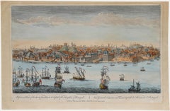
Laurie and Whittle - 1794 Engraving, A General View of the City of Lisbon
Located in Corsham, GB
A vibrant and captivating print depicting an expansive view of Lisbon, with ships sailing in the foreground. Inscribed within the plate below the image. On paper.
Category
Early 18th Century Landscape Prints
Materials
Engraving
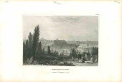
Hand Colored Copperplate Engraving of Copenhagen, Denmark
Located in Kastrup, DK
Hand-colored copperplate engraving depicting an interesting old view of Copenhagen seen from Frederiksberg Castle Gardens, approximate. 1790-1800.
Framed in a mahogany frame from sam...
Category
Antique Late 18th Century Danish Louis XVI Prints
Materials
Glass, Mahogany, Paper
More Ways To Browse
German Engraving
Antique Mosque
Istanbul Antique
Iconic Ottoman
Pair Of Danish Chairs
Veneer Dining Tables
1970 Italian Armchair
Furniture Uk
House Of Denmark Table And Chairs
Louis Marble Top Side Table
Antique Russian Rugs
Baker Furniture By
For Kids
Sterling Silver Flatware Set Service For 12
Tufted Bar
Pair Of French Antique Armchairs
1970s Brass Glass Coffee Table
Antique Column Base