Items Similar to Daily Telegraph War Map 1877 – Ottoman Empire, Balkans & Constantinople Antique
Want more images or videos?
Request additional images or videos from the seller
1 of 12
Daily Telegraph War Map 1877 – Ottoman Empire, Balkans & Constantinople Antique
$1,422.95
£1,057.87
€1,200
CA$1,971.96
A$2,198.35
CHF 1,146.53
MX$26,583.18
NOK 14,412.46
SEK 13,637.07
DKK 9,135.91
About the Item
Daily Telegraph War Map 1877 – Ottoman Empire, Balkans & Constantinople Antique Map
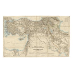
This large lithographed folding map was published as War Map No. 7 by The Daily Telegraph, London, during the Russo-Turkish War (1877–1878). These maps were issued in sequence to inform readers of the newspaper about the unfolding events of the conflict, which centered on the struggle between the Russian and Ottoman Empires.
The map focuses on Constantinople (Istanbul), the Sea of Marmara, and the Dardanelles, the key strategic straits linking the Black Sea and the Mediterranean. It extends north into Bulgaria and the lower Danube, south into Asia Minor, and west across the Balkans. Insets include:
* A detailed plan of Constantinople
* The Bosphorus and Dardanelles (The Narrows)
* Asia Minor and The Turkish Empire
* The Black Sea
* The Balkan States
Topography is shown with shaded relief, while towns, fortresses, railways, and communication routes are carefully marked. The map was designed to help British readers follow military movements in an area of intense geopolitical rivalry.
Condition: Good. Original folds as issued with minor fold wear and linnen backing. Light age toning and some handling signs, but colors remain strong.
Framing tips: A float-mount in a thin black or walnut frame works well for 19th-century newspaper war maps, highlighting their bold lithography. A cream or pale green mat complements the hand-tinted color scheme.
Technique: Lithograph with original color
Maker: Published by The Daily Telegraph, London, c. 1877
This series of Daily Telegraph War Maps is highly collectible, both for its military history value and as an example of the intersection of journalism and cartography in the 19th century.
- Dimensions:Height: 30.32 in (77 cm)Width: 39.38 in (100 cm)Depth: 0.04 in (1 mm)
- Materials and Techniques:
- Place of Origin:
- Period:
- Date of Manufacture:1877
- Condition:Condition: Good. Original folds as issued with minor fold wear and linnen backing. Light age toning and some handling signs, but colors remain strong.
- Seller Location:Langweer, NL
- Reference Number:Seller: BG-13846-31stDibs: LU3054346393202
About the Seller
5.0
Recognized Seller
These prestigious sellers are industry leaders and represent the highest echelon for item quality and design.
Platinum Seller
Premium sellers with a 4.7+ rating and 24-hour response times
Established in 2009
1stDibs seller since 2017
2,589 sales on 1stDibs
Typical response time: <1 hour
- ShippingRetrieving quote...Shipping from: Langweer, Netherlands
- Return Policy
Authenticity Guarantee
In the unlikely event there’s an issue with an item’s authenticity, contact us within 1 year for a full refund. DetailsMoney-Back Guarantee
If your item is not as described, is damaged in transit, or does not arrive, contact us within 7 days for a full refund. Details24-Hour Cancellation
You have a 24-hour grace period in which to reconsider your purchase, with no questions asked.Vetted Professional Sellers
Our world-class sellers must adhere to strict standards for service and quality, maintaining the integrity of our listings.Price-Match Guarantee
If you find that a seller listed the same item for a lower price elsewhere, we’ll match it.Trusted Global Delivery
Our best-in-class carrier network provides specialized shipping options worldwide, including custom delivery.More From This Seller
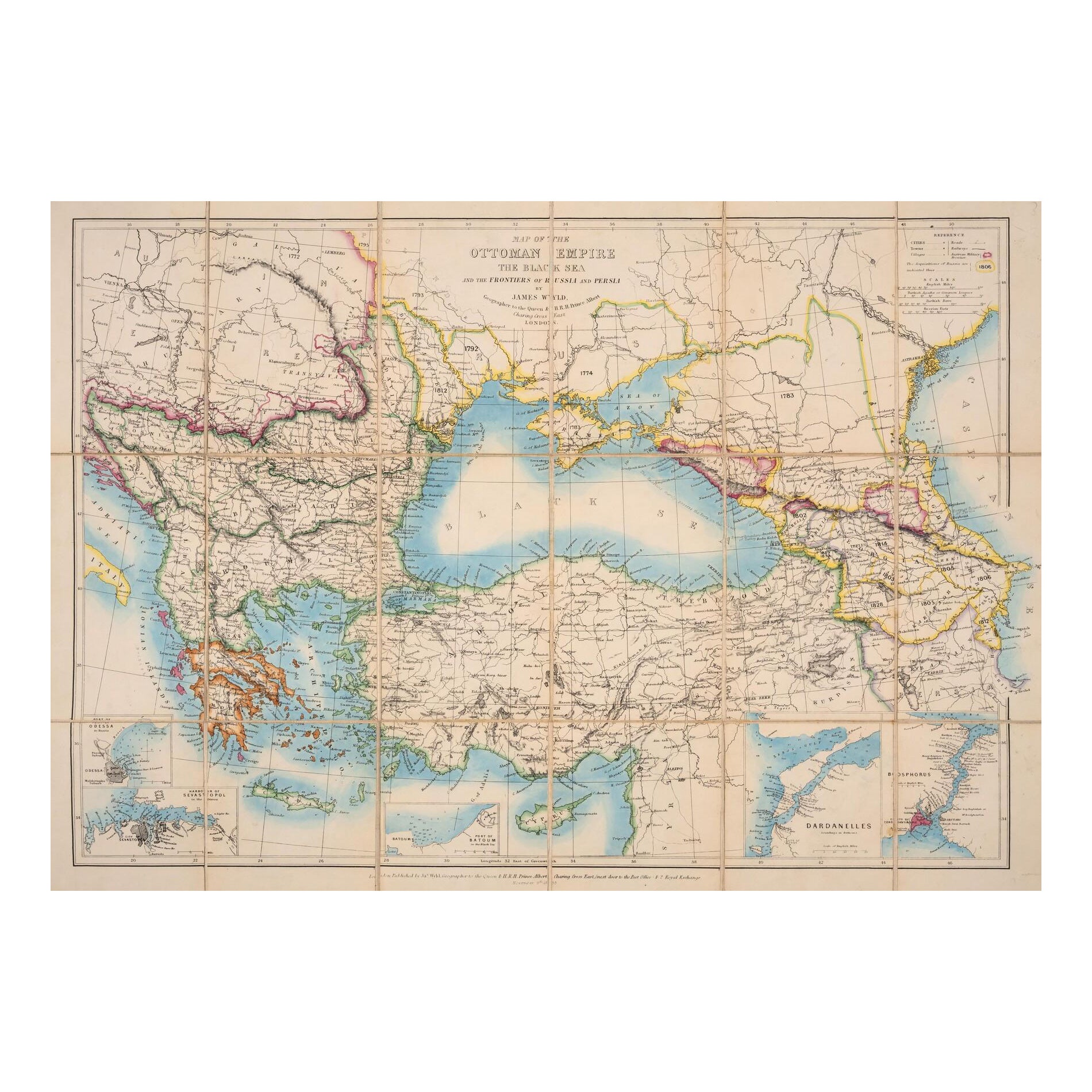
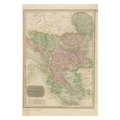
View All1853 Wyld Map of Turkey in Asia, the Balkans, and the Ottoman Empire
Located in Langweer, NL
James Wyld's 1853 Map of the Ottoman Empire and Adjacent Regions
James Wyld's 1853 map, "Map of the Ottoman Empire, The Black Sea and the Frontiers of Russia and Persia," offers a m...
Category
Antique 1850s English Maps
Materials
Paper

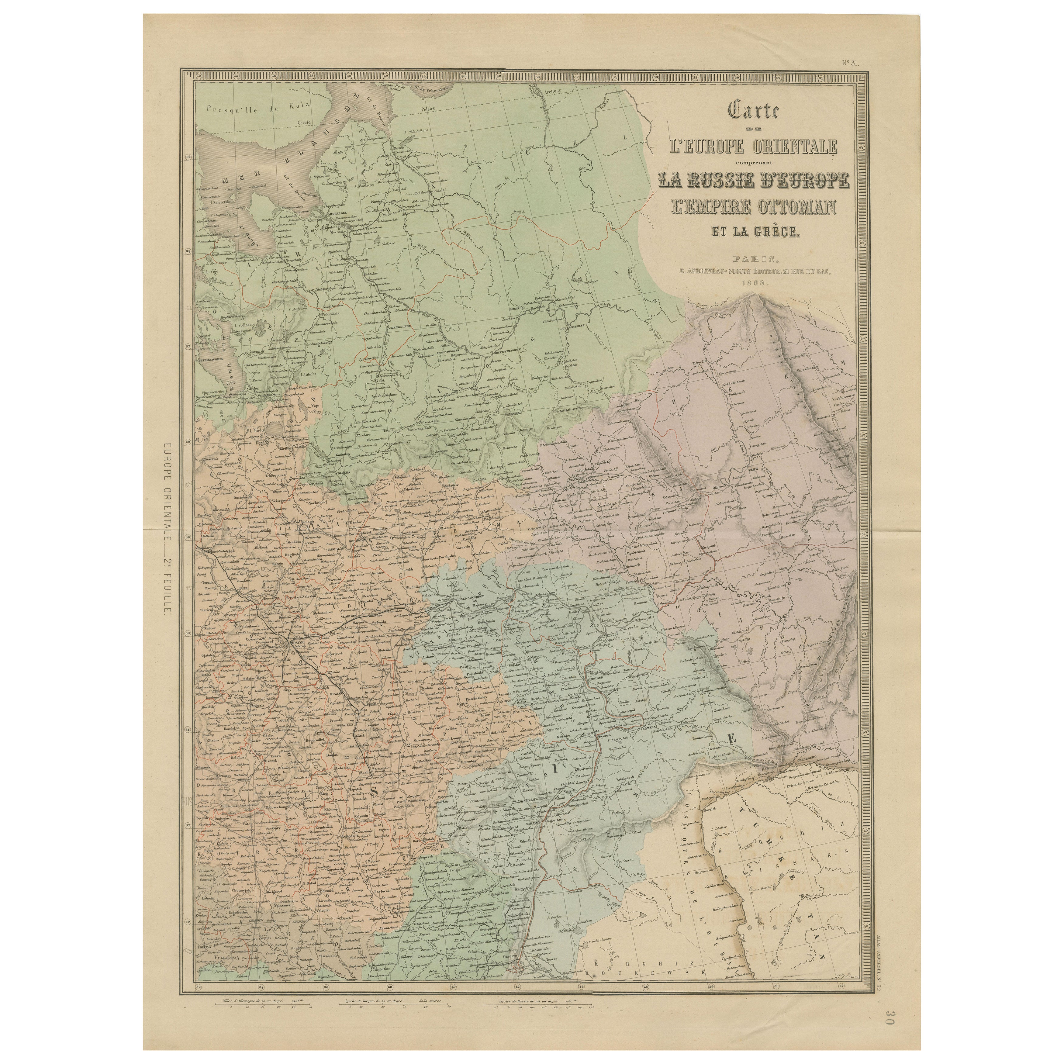
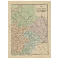
Antique Map of Eastern Europe – Russia, Ottoman Empire & Greece, 1868
Located in Langweer, NL
Antique Map of Eastern Europe – Russia, Ottoman Empire and Greece by Andriveau-Goujon, 1868
This detailed antique map titled “Carte de l’Europe Orientale, la Russie d’Europe, l’Empi...
Category
Antique Mid-19th Century French Maps
Materials
Paper
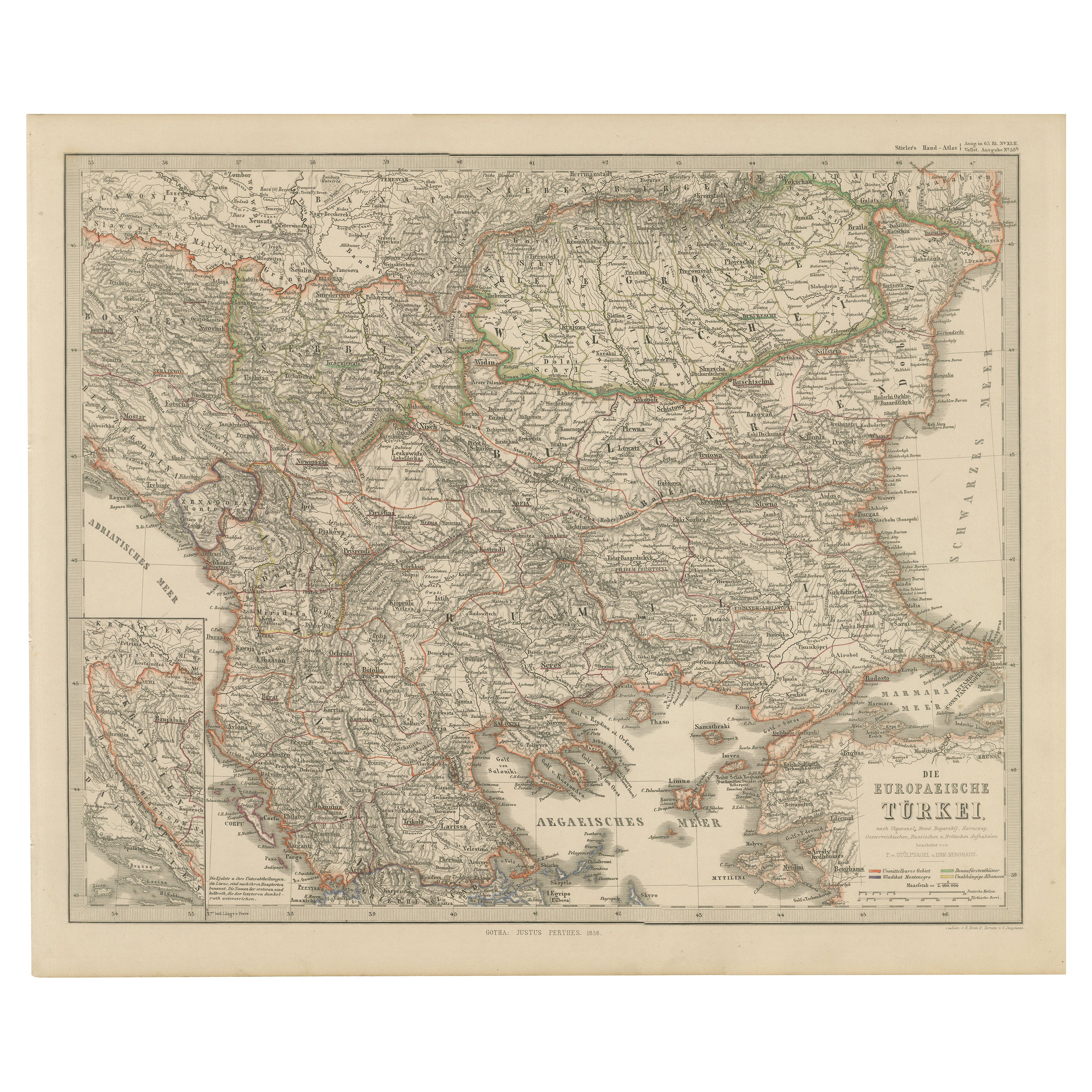
European Turkey Map – Detailed Balkan Ottoman Provinces 1858
Located in Langweer, NL
European Turkey and Greece Map – Balkans and Ionian Islands 1857
This detailed antique print shows “Die Europäische Türkei, Griechenland und die Ionische...
Category
Antique Mid-19th Century German Maps
Materials
Paper

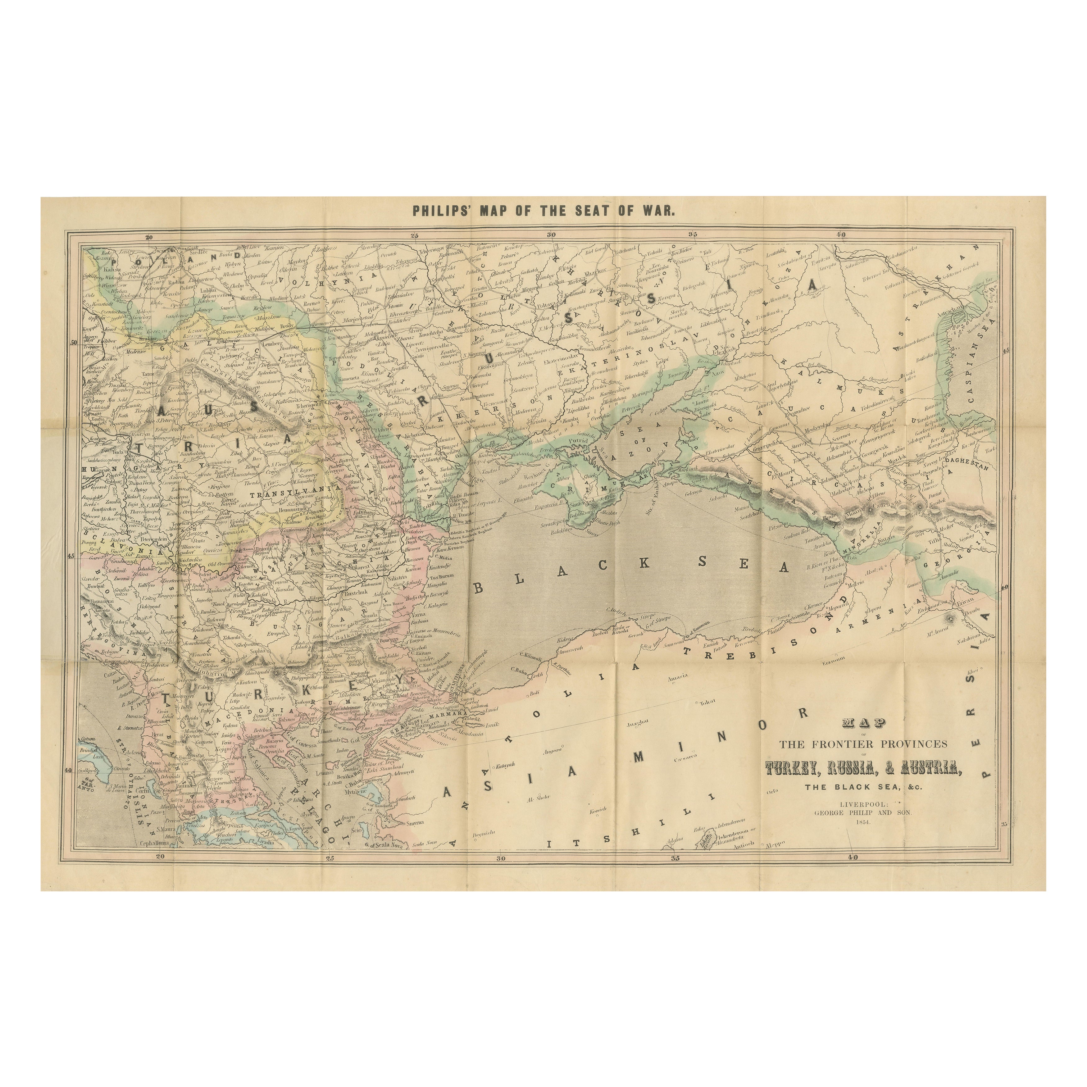
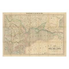
Philips Map of the Seat of War 1854 – Black Sea, Turkey & Russia Antique Map
Located in Langweer, NL
Philips Map of the Seat of War 1854 – Black Sea, Turkey & Russia Antique Map
This folding map, titled “Philips’ Map of the Seat of War”, was published in Liverpool by George Philip ...
Category
Antique 1850s English Maps
Materials
Paper
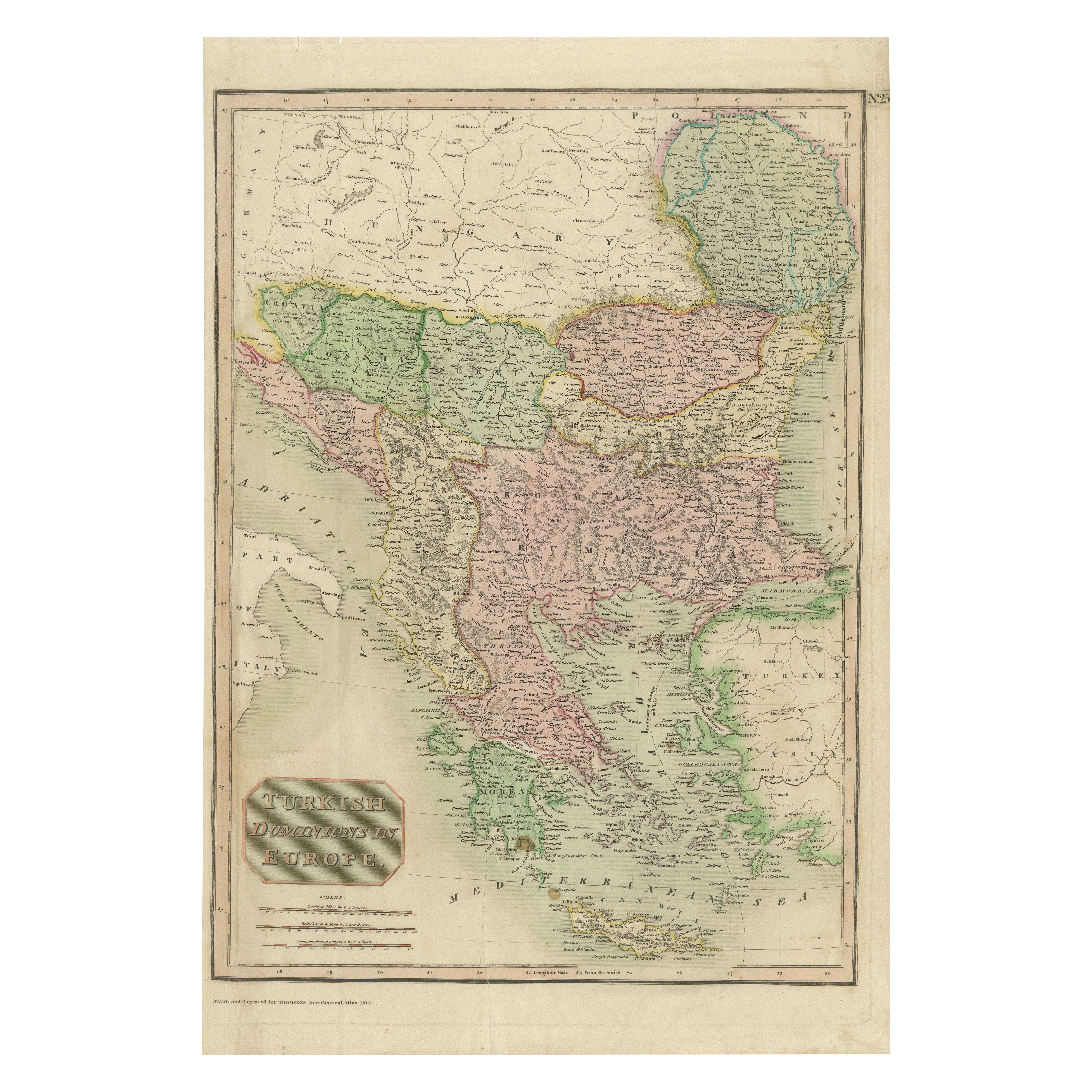
Map of Turkish Dominions in Europe, Ottoman Balkan Territories 1813
Located in Langweer, NL
Map of Turkish Dominions in Europe, Ottoman Balkan Territories 1814
This antique map titled "Turkish Dominions in Europe" provides a detailed depiction of the Balkan Peninsula and a...
Category
Antique 1810s Maps
Materials
Paper
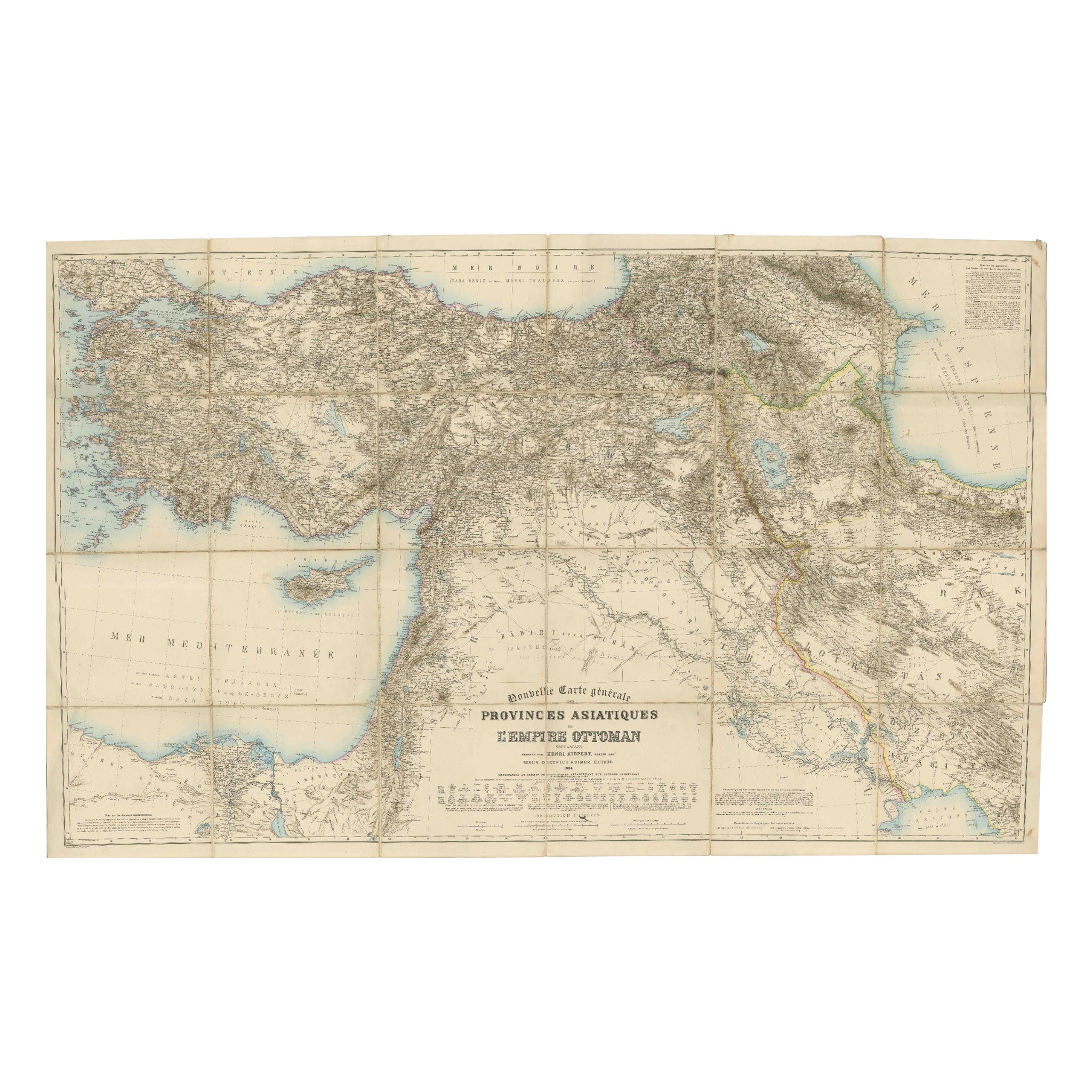
Large 1884 Kiepert Map of Asian Ottoman Provinces – Anatolia, Syria, Mesopotamia
Located in Langweer, NL
1884 Kiepert Map of Asian Ottoman Provinces – Anatolia, Syria, Mesopotamia
This remarkable mid-19th-century folding map is titled “Nouvelle Carte générale des Provinces Asiatiques d...
Category
Antique 1880s English Maps
Materials
Paper
You May Also Like
Russia, Western and Southern Part. Century Atlas antique vintage map
Located in Melbourne, Victoria
'The Century Atlas. Russia, Western and Southern Part'
Original antique map, 1903.
Inset map tilted 'St Petersburg and Environs'.
Central fold as issued. Map name and number printe...
Category
Early 20th Century Victorian More Prints
Materials
Lithograph

Russia in Europe with Poland and Finland. Century Atlas antique vintage map
Located in Melbourne, Victoria
'The Century Atlas. Russia in Europe with Poland and Finland'
Original antique map, 1903.
Central fold as issued. Map name and number printed on the reverse corners.
Sheet 40cm by ...
Category
Early 20th Century Victorian More Prints
Materials
Lithograph

Map of Eastern Roman Empire -Vintage Offset Print - Early 20th Century
Located in Roma, IT
This map of Eastern Roman Empire is a vintage offset print realized in the early 20th Century.
The state of preservation of the artwork is aged with dif...
Category
Early 20th Century Figurative Prints
Materials
Offset

1849 Map of "Europaische Russland", 'Meyer Map of European Russia', Ric. R017
Located in Norton, MA
1849 Map of
"Europaische Russland"
( Meyer Map of European Russia)
Ric.r017
A lovely map of European Russia dating to 1849 by Joseph Meyer. It covers the European portions of...
Category
Antique 19th Century Unknown Maps
Materials
Paper

Large Original Antique Map of Italy. John Dower, 1861
Located in St Annes, Lancashire
Great map of Italy
Lithograph engraving by John Dower
Original colour
Published, 1861
Unframed
Good condition / repair to top right corner seen in last image
Category
Antique 1860s English Victorian Maps
Materials
Paper

Austria-Hungary, Western Part. Century Atlas antique vintage map
Located in Melbourne, Victoria
'The Century Atlas. Austria-Hungary, Western Part'
Original antique map, 1903.
Central fold as issued. Map name and number printed on the reverse corners.
Sheet 40cm by 29.5cm.
Category
Early 20th Century Victorian More Prints
Materials
Lithograph
