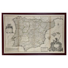
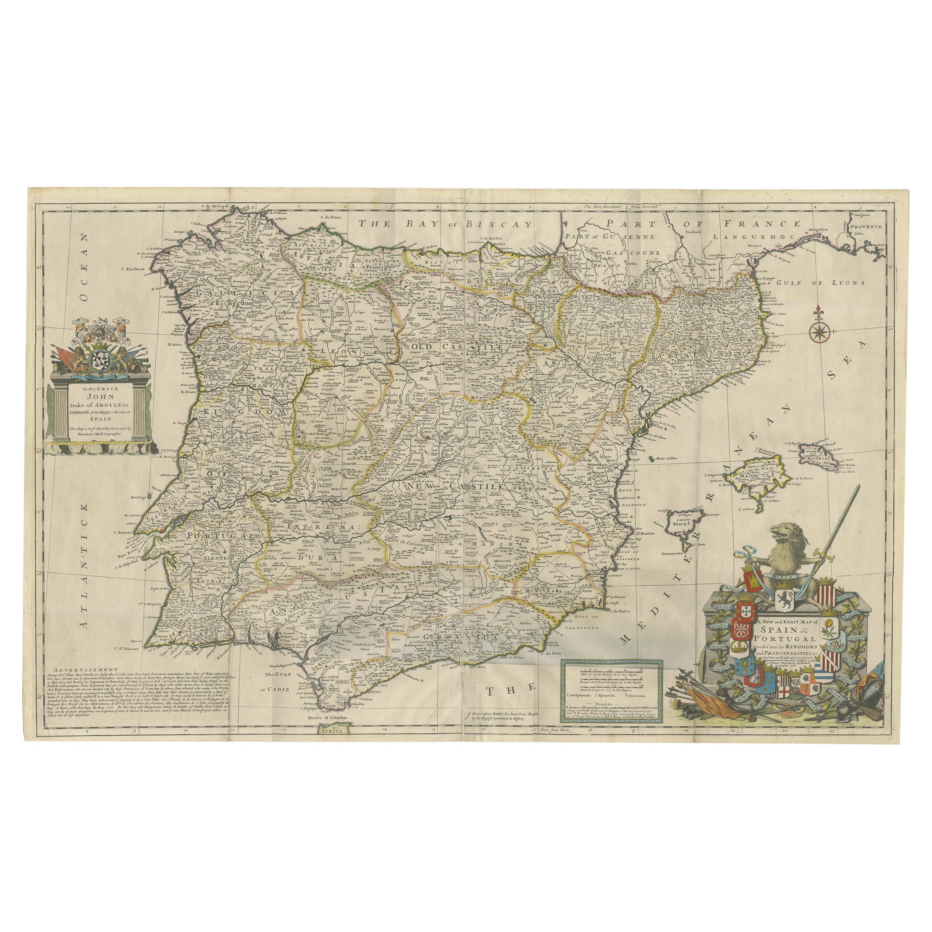
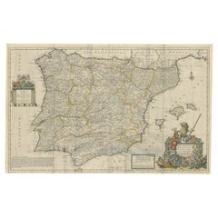
Framed Hand-Colored Early 18th Century Herman Moll Map of Spain and Portugal
View Similar Items


Want more images or videos?
Request additional images or videos from the seller
1 of 12
Framed Hand-Colored Early 18th Century Herman Moll Map of Spain and Portugal
About the Item
- Creator:Herman Moll (Artist)
- Dimensions:Height: 27.88 in (70.82 cm)Width: 42.13 in (107.02 cm)Depth: 0.88 in (2.24 cm)
- Materials and Techniques:Paper,Engraved
- Place of Origin:
- Period:1710-1719
- Date of Manufacture:1711
- Condition:Wear consistent with age and use.
- Seller Location:Alamo, CA
- Reference Number:Seller: # 47001stDibs: LU5206225283552
About the Seller
5.0
Vetted Seller
These experienced sellers undergo a comprehensive evaluation by our team of in-house experts.
1stDibs seller since 2020
12 sales on 1stDibs
More From This SellerView All
- 18th Century Hand Colored Map of Spain and Portugal by VisscherBy Nicolaes Visscher IILocated in Alamo, CAThis is an early 18th century map of Spain and Portugal, with attractive original hand-coloring, entitled "Hispaniae et Portugalliae Regna per Nicolaum Visscher cum Privilegio Ordinu...Category
Antique Early 18th Century Dutch Maps
MaterialsPaper
- South America: Hand-colored 18th Century Framed Map by Thomas JefferysBy Thomas JefferysLocated in Alamo, CAThis detailed hand-colored map of South America by Thomas Jefferys was published in London in 1750. The map shows countries, early colonial possessions, towns, rivers, mountains, and...Category
Antique Mid-18th Century English Maps
MaterialsPaper
- 18th Century Hand-Colored Homann Map of Germany, Including Frankfurt and BerlinBy Johann Baptist HomannLocated in Alamo, CAAn 18th century hand-colored map entitled "Tabula Marchionatus Brandenburgici et Ducatus Pomeraniae quae sunt Pars Septentrionalis Circuli Saxoniae Superioris" by Johann Baptist Homa...Category
Antique Early 18th Century German Maps
MaterialsPaper
- Scandinavia & Portions of Eastern Europe: 18th Century Hand-Colored Homann MapBy Johann Baptist HomannLocated in Alamo, CAAn early 18th century hand-colored copper-plate map entitled "Regni Sueciae in omnes suas Subjacentes Provincias accurate divisi Tabula Generalis" by Johann Baptist Homann (1663-1724...Category
Antique Early 18th Century German Maps
MaterialsPaper
- Hand Colored 18th Century Homann Map of Austria Including Vienna and the DanubeBy Johann Baptist HomannLocated in Alamo, CA"Archiducatus Austriae inferioris" is a hand colored map of Austria created by Johann Baptist Homann (1663-1724) and published in Nuremberg, Germany in 1728 shortly after his death. ...Category
Antique Early 18th Century German Maps
MaterialsPaper
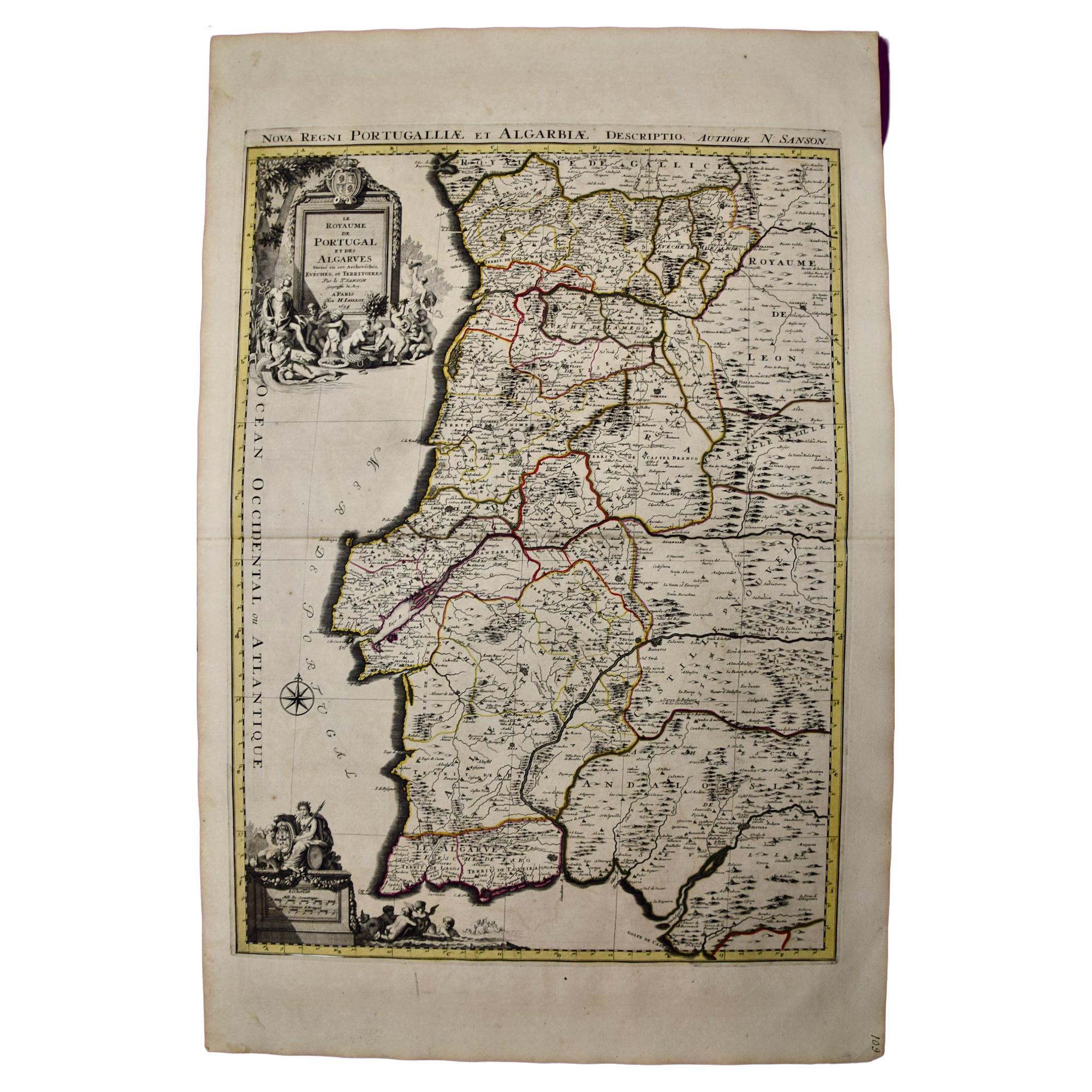
- Portugal: A Large 17th Century Hand-colored Map by Sanson and JaillotBy Nicolas SansonLocated in Alamo, CAThis large hand-colored map entitled "Le Royaume de Portugal et des Algarves Divisee en see Archeveches, Eveches et Territoires Par le Sr Sanson" was originally created by Nicholas S...Category
Antique 1690s French Maps
MaterialsPaper


You May Also Like
- Beautiful Large Scale Map of Spain and Portugal Published by Herman Moll in 1711Located in Langweer, NLTitle: A New and Exact Map of Spain & Portugal Author: Herman Moll Date: 1711 Medium: ?Hand-colored copperplate engraving Condition: Very good - light age toning, light wear and discoloration along issued quatrefolds, surface dirt, minor creasing throughout,. Large engraved map on two conjoined sheets, contemporary outline colouring with some later enhancement inches. Herman Moll (c. 1654-1732) was one of the most important London mapmakers in the first half of the eighteenth century. Moll was probably born in Bremen, Germany, around 1654. He moved to London to escape the Scanian Wars. His earliest work was as an engraver for Moses Pitt on the production of the English Atlas, a failed work which landed Pitt in debtor's prison. Moll also engraved for Sir Jonas Moore, Grenville Collins, John Adair, and the Seller & Price firm. He published his first original maps in the early 1680s and had set up his own shop by the 1690s. Moll's work quickly helped him become a member of a group which congregated at Jonathan's Coffee House at Number 20 Exchange Alley, Cornhill, where speculators met to trade stock. Moll's circle included the scientist Robert Hooke...Category
Antique 1710s Maps
MaterialsPaper
 $2,196 Sale Price20% Off
 - Four 18th Century Engraved and Hand-Colored Maps by WeigelBy Christoph WeigelLocated in Copenhagen, KSmall collection of four engraved maps of Italy, Balkan and of Central Asia. Two are of Italy, one Corsica and Northern Italy and the other of the Southern Italian boot...Category
Antique 18th Century German Maps
MaterialsPaper
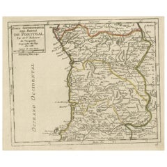
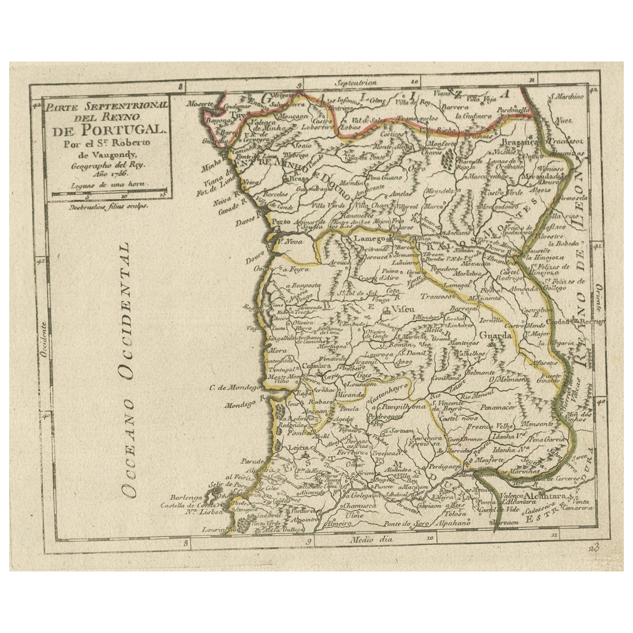
- Antique Hand-Colored Map of Northern Portugal, 1756Located in Langweer, NLAntique map Portugal titled 'Parte Sepentrional del Reyno de Portugal'. Antique map of Northern Portugal. This map originates from 'Atlas Port...Category
Antique 1750s Maps
MaterialsPaper
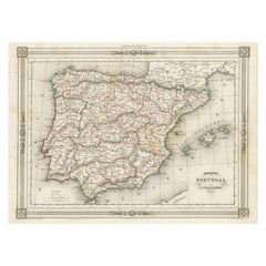
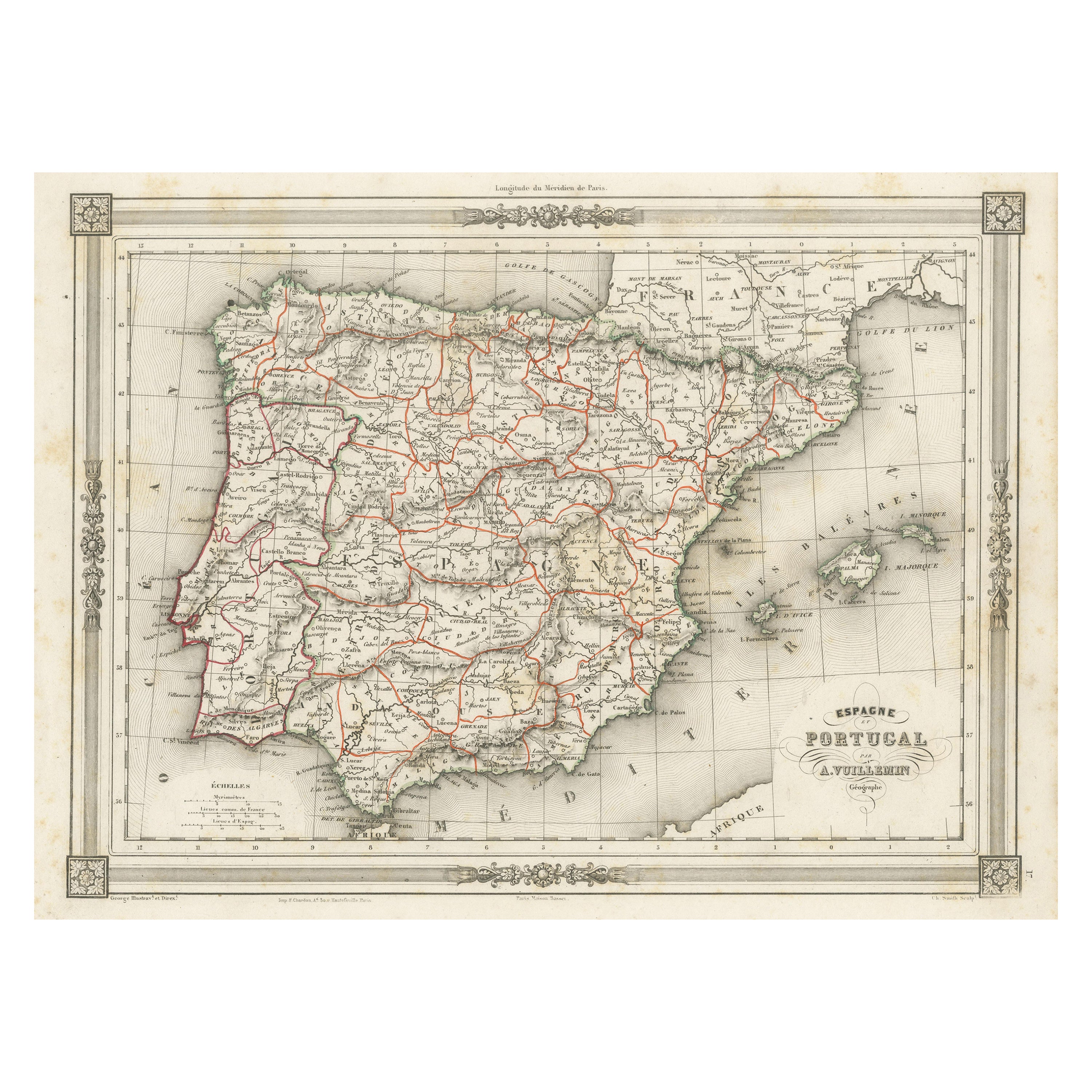
- Antique Map of Spain and Portugal, with Frame Style BorderLocated in Langweer, NLAntique map titled 'Espagne et Portugal'. Attractive map of Spain and Portugal. The map covers all of Spain and Portugal from France to the Mediterranean Sea and includes the Baleari...Category
Antique Mid-19th Century Maps
MaterialsPaper
- Antique Map of Denmark by Moll 'circa 1730'By Herman MollLocated in Langweer, NLAntique map titled 'Denmark, agreeable to Modern History'. Uncommon map of Denmark by Herman Moll, published, circa 1730.Category
Antique Mid-18th Century Maps
MaterialsPaper
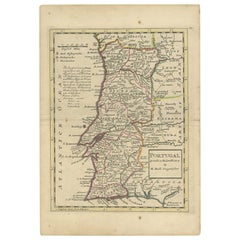
- Antique Map of Portugal by Moll, 1727Located in Langweer, NLAntique map Portugal titled 'Portugal Agreeable to Modern History'. Detailed map of Portugal showing major routes, waterways, arch bishoprics, bis...Category
Antique 18th Century Maps
MaterialsPaper