Items Similar to Johnson’s Illinois Map, USA c.1864 – Hand-Colored with Chicago Courthouse View

Want more images or videos?
Request additional images or videos from the seller
1 of 10
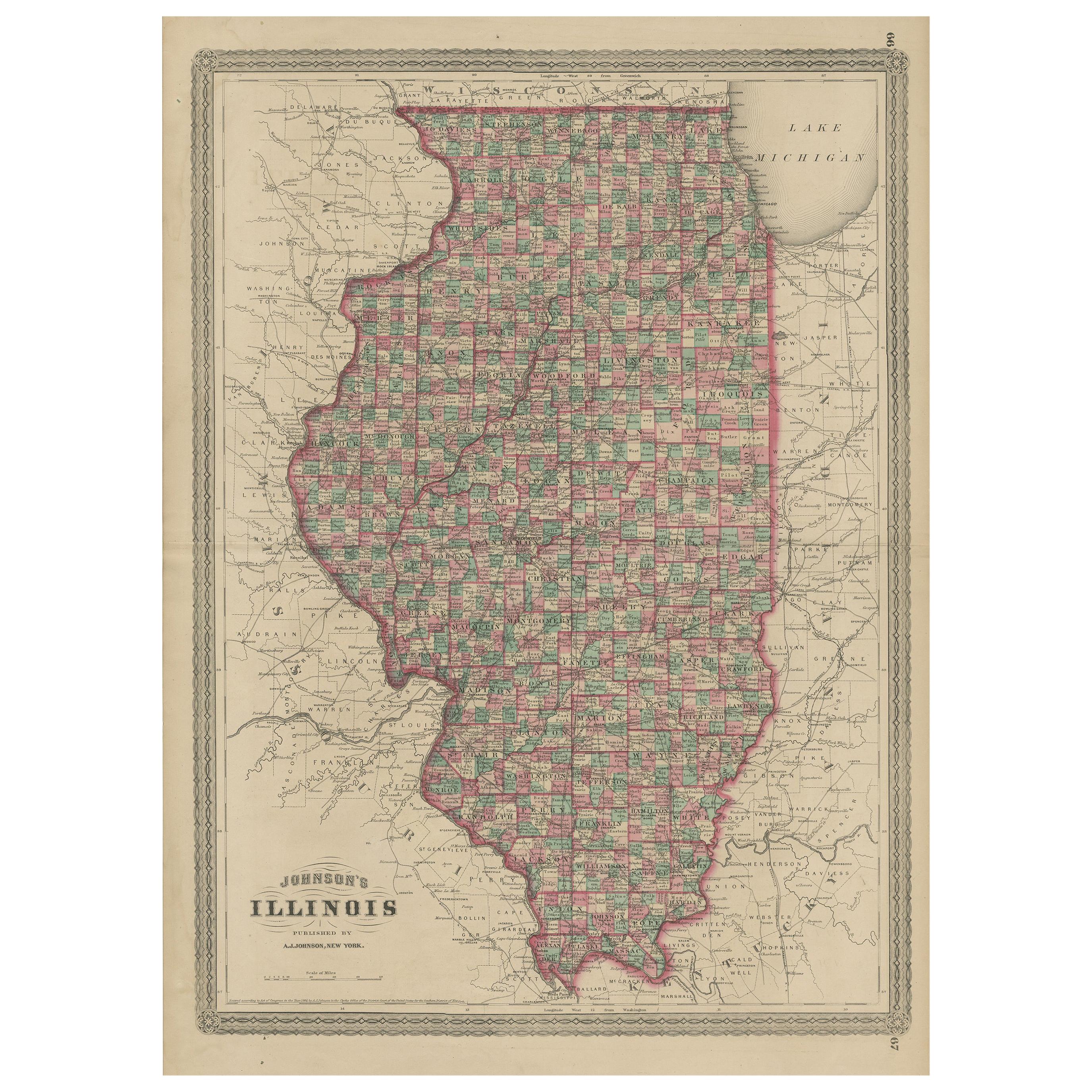
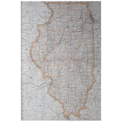
Johnson’s Illinois Map, USA c.1864 – Hand-Colored with Chicago Courthouse View
$323.66
£240.44
€270
CA$449.44
A$490.45
CHF 257.25
MX$5,956.63
NOK 3,213.16
SEK 3,036.60
DKK 2,055.48
About the Item
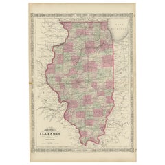
Johnson’s Illinois Map, USA c.1864 – Hand-Colored with Chicago Courthouse View
This is a finely engraved and hand-colored map titled Johnson’s Illinois, published by Johnson and Ward in New York circa 1864. It depicts the state of Illinois in detail with counties shaded in pastel pink and green wash colors. The map shows cities, towns, counties, rivers, railroads, and canals with clarity.
Major cities such as Chicago, Springfield, Peoria, Quincy, and Galena are marked. The map includes an inset vignette illustration of the Court House in Chicago, adding historical and decorative value. Railroads are prominently shown, reflecting the rapid development of Illinois as a transportation hub in the mid-19th century.
Johnson’s distinctive decorative border frames the map with interlaced geometric and floral motifs, typical of his atlas publications. Johnson and Ward were leading American publishers known for combining cartographic accuracy with aesthetic presentation. Their state maps remain highly collectible for their detailed depiction of counties and transport routes during a period of economic expansion and urban growth.
Condition report:
Good condition. Strong impression with bright original hand coloring. Light general age toning and minor marginal handling marks typical for antique atlas maps. Only very small tears visible in borders. Wide margins and plate mark intact.
Framing suggestion:
Frame with a simple dark wood or black frame and an archival off-white or cream mat to highlight the pastel coloring, engraved detail, and decorative border. Use UV-protective glass to preserve paper quality and prevent fading.
- Dimensions:Height: 18 in (45.7 cm)Width: 14.06 in (35.7 cm)Depth: 0.01 in (0.2 mm)
- Materials and Techniques:
- Place of Origin:
- Period:
- Date of Manufacture:circa 1864
- Condition:Good condition. Strong impression with bright original hand coloring. Light general age toning and minor marginal handling marks typical for antique atlas maps. Only very small tears visible in borders. Wide margins and plate mark intact.
- Seller Location:Langweer, NL
- Reference Number:Seller: BG-13952-431stDibs: LU3054345730322
About the Seller
5.0
Recognized Seller
These prestigious sellers are industry leaders and represent the highest echelon for item quality and design.
Platinum Seller
Premium sellers with a 4.7+ rating and 24-hour response times
Established in 2009
1stDibs seller since 2017
2,641 sales on 1stDibs
Typical response time: <1 hour
- ShippingRetrieving quote...Shipping from: Langweer, Netherlands
- Return Policy
Authenticity Guarantee
In the unlikely event there’s an issue with an item’s authenticity, contact us within 1 year for a full refund. DetailsMoney-Back Guarantee
If your item is not as described, is damaged in transit, or does not arrive, contact us within 7 days for a full refund. Details24-Hour Cancellation
You have a 24-hour grace period in which to reconsider your purchase, with no questions asked.Vetted Professional Sellers
Our world-class sellers must adhere to strict standards for service and quality, maintaining the integrity of our listings.Price-Match Guarantee
If you find that a seller listed the same item for a lower price elsewhere, we’ll match it.Trusted Global Delivery
Our best-in-class carrier network provides specialized shipping options worldwide, including custom delivery.More From This Seller
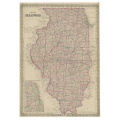
View AllAntique Map of Illinois by Johnson, 1872
Located in Langweer, NL
Antique map titled 'Johnson's Illinois'. Original map of Illinois. This map originates from 'Johnson's New Illustrated Family Atlas of the World' by A....
Category
Antique Late 19th Century Maps
Materials
Paper

$239 Sale Price
20% Off
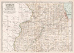
Rare 1864 Civil War Era Map of Illinois with Lake Michigan Detail
Located in Langweer, NL
Title: Rare 1864 Civil War Era Map of Illinois with Lake Michigan Detail
Description: This intricately detailed antique map, titled "Johnson's Illinois," was published in 1864 by Jo...
Category
Antique 1860s Maps
Materials
Paper
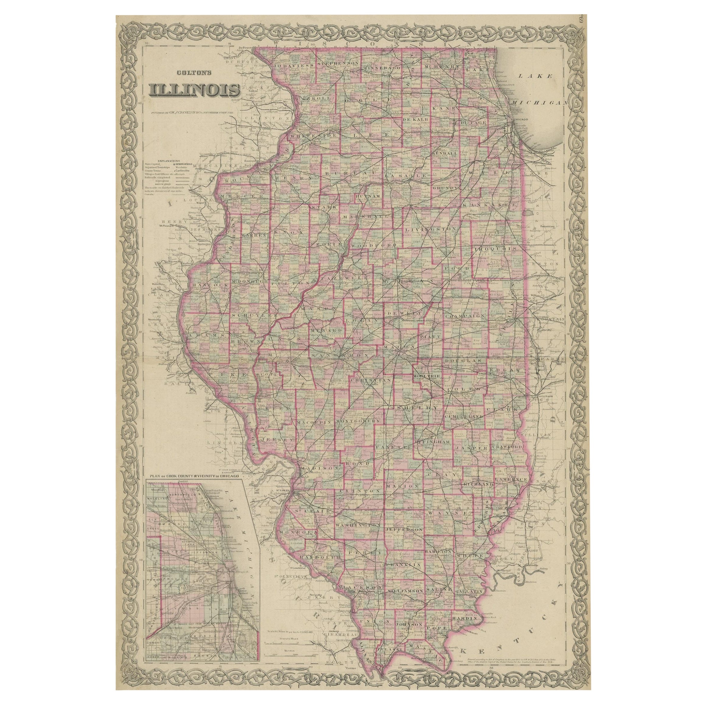
Colton's Map of Illinois, with an Inset of Chicago
Located in Langweer, NL
Antique map titled 'Colton's Illinois'. Antique map of Illinois, a state in the Midwestern United States. With an inset map of of Cook County &...
Category
Antique Mid-19th Century Maps
Materials
Paper
$230 Sale Price
20% Off
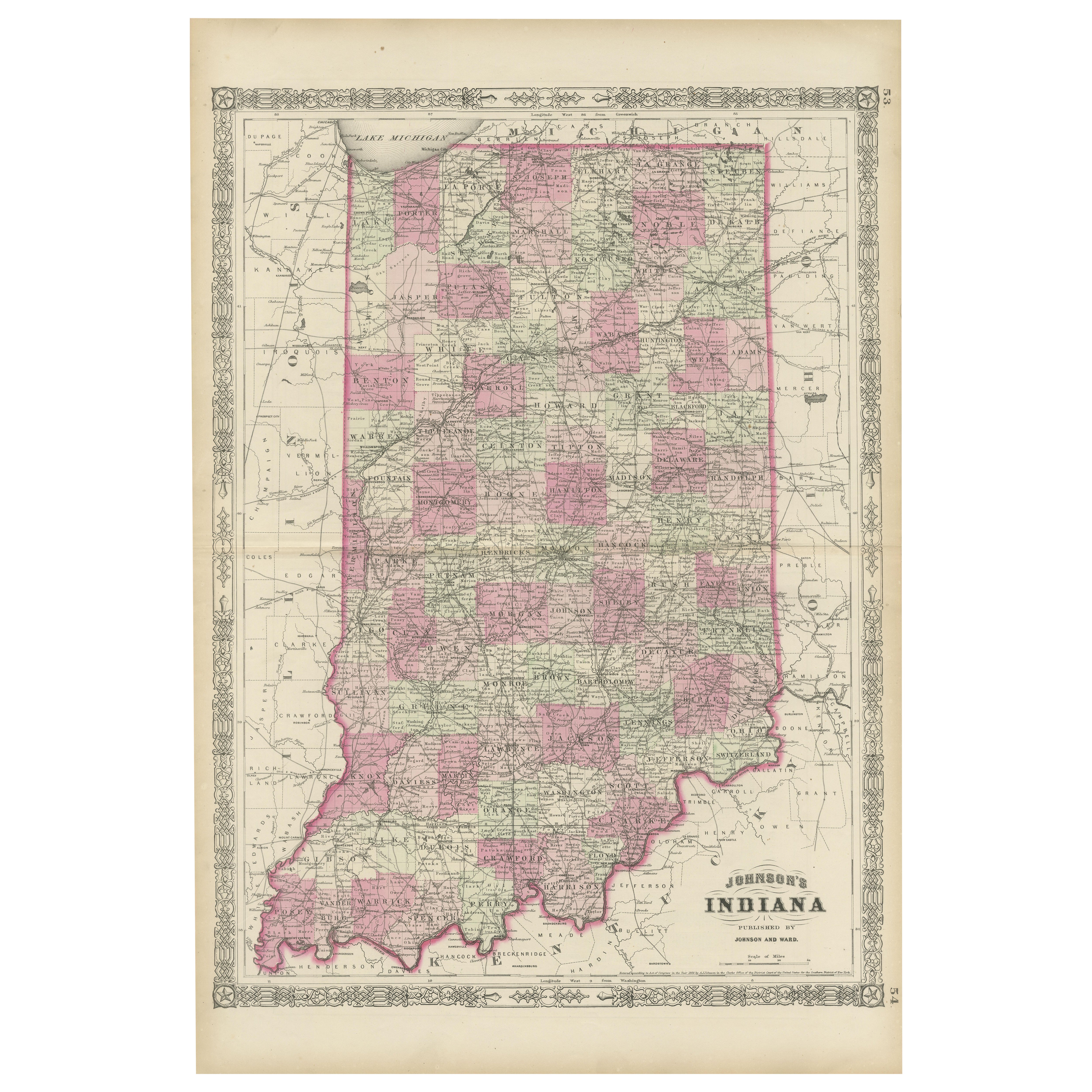
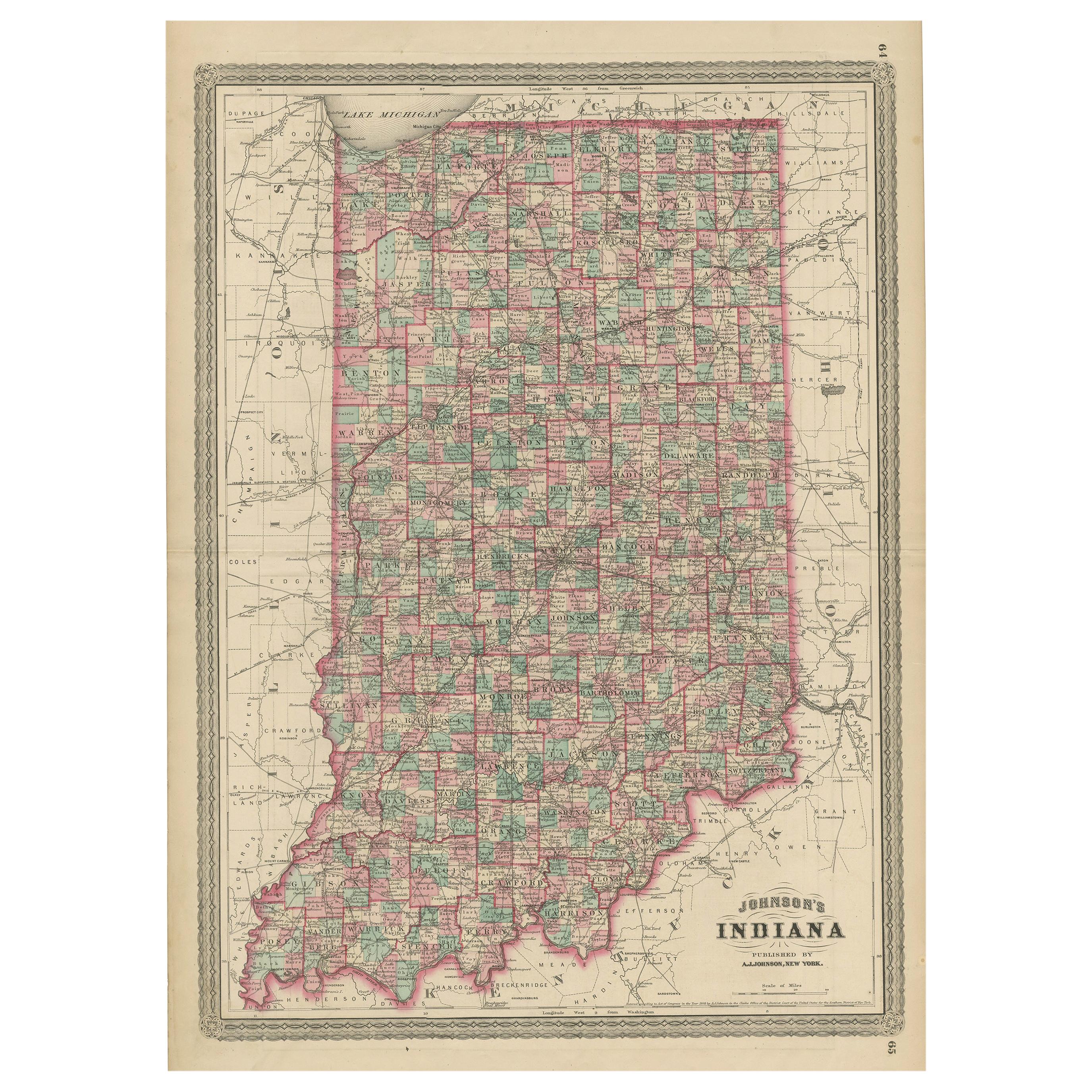
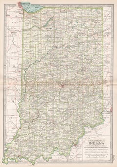
Decorative 1864 Civil War Era Map of Indiana with Lake Michigan Detail
Located in Langweer, NL
Title: Rare 1864 Civil War Era Map of Indiana with Lake Michigan Detail
Description: This finely detailed antique map, titled "Johnson's Indiana," was published in 1864 by Johnson a...
Category
Antique 1860s Maps
Materials
Paper

Antique Map of Indiana by Johnson, 1872
Located in Langweer, NL
Antique map titled 'Johnson's Indiana'. Original map of Indiana. This map originates from 'Johnson's New Illustrated Family Atlas of the World' by A.J. ...
Category
Antique Late 19th Century Maps
Materials
Paper

$179 Sale Price
40% Off
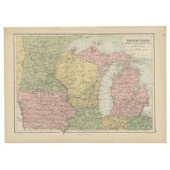
Antique Map of Western States, Michigan, Wisconsin, Iowa by A & C. Black, 1870
Located in Langweer, NL
Antique map titled 'Western States, Michigan, Wisconsin, Minnesota, Iowa with portions of Illinois & Indiana'. Original antique map of Western States, Michigan, Wisconsin, Minnesota,...
Category
Antique Late 19th Century Maps
Materials
Paper
You May Also Like
Large Original Antique Map of Illinois, USA, 1894
By Rand McNally & Co.
Located in St Annes, Lancashire
Fabulous map of Illinois
Original color
By Rand, McNally & Co.
Published, 1894
Unframed
Free shipping.
Category
Antique 1890s American Maps
Materials
Paper
Illinois, Northern Part. USA. Century Atlas state antique vintage map
Located in Melbourne, Victoria
'The Century Atlas. Illinois, Northern Part'
Original antique map, 1903.
Central fold as issued. Map name and number printed on the reverse corners.
Sheet 29.5cm by 40cm.
Category
Early 20th Century Victorian More Prints
Materials
Lithograph
Original Antique Map of the American State of Illinois ( Northern Part ), 1903
Located in St Annes, Lancashire
Antique map of Illinois ( Northern part )
Published By A & C Black. 1903
Original colour
Good condition
Unframed.
Free shipping
Category
Antique Early 1900s English Maps
Materials
Paper

Original Antique Map of the American State of Illinois ( Southern Part ), 1903
Located in St Annes, Lancashire
Antique map of Illinois ( Southern part )
Published By A & C Black. 1903
Original colour
Good condition
Unframed.
Free shipping
Category
Antique Early 1900s English Maps
Materials
Paper

Indiana. USA. Century Atlas state antique vintage map
Located in Melbourne, Victoria
'The Century Atlas. Indiana.'
Original antique map, 1903.
Central fold as issued. Map name and number printed on the reverse corners.
Sheet 40cm by 29.5cm.
Category
Early 20th Century Victorian More Prints
Materials
Lithograph
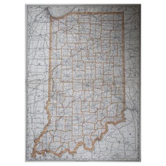
Large Original Antique Map of Indiana, USA, 1894
By Rand McNally & Co.
Located in St Annes, Lancashire
Fabulous map of Indiana.
Original color.
By Rand, McNally & Co.
Published, 1894.
Unframed.
Free shipping.
Category
Antique 1890s American Maps
Materials
Paper
More Ways To Browse
Midcentury Furniture Chicago
Antique Furniture Illinois
China Silk Rug
Chrome Glass Coffee Tables
Antique Italian Chairs
Beni Ourain Rugs
French Iron And Glass Table
Glass Top Wood Base Coffee Tables
T Chair
Antique Silver Basket
Antique Walkers
Ebony Wood Furniture
Opalescent Glass
Pair Of Danish Chairs
Veneer Dining Tables
1970 Italian Armchair
Furniture Uk
House Of Denmark Table And Chairs