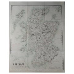
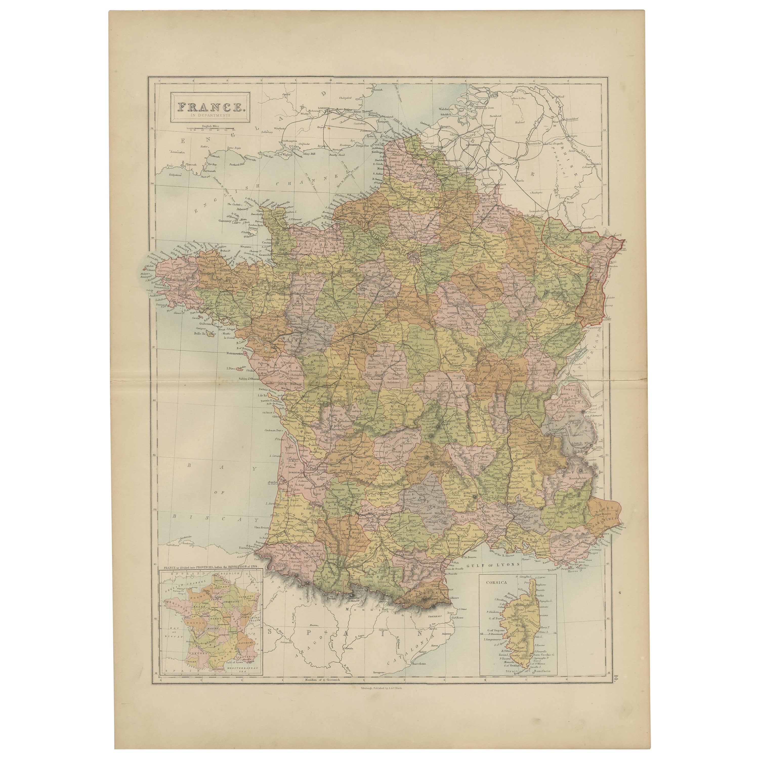
Large Original Antique Map of Scotland, circa 1870
View Similar Items


Want more images or videos?
Request additional images or videos from the seller
1 of 5
Large Original Antique Map of Scotland, circa 1870
$136.50List Price
About the Item
- Dimensions:Height: 22.5 in (57.15 cm)Width: 17.25 in (43.82 cm)Depth: 0.07 in (1.78 mm)
- Style:Georgian (Of the Period)
- Materials and Techniques:Paper,Other
- Place of Origin:
- Period:
- Date of Manufacture:1870
- Condition:Wear consistent with age and use.
- Seller Location:St Annes, GB
- Reference Number:1stDibs: LU1836321870042
About the Seller
4.9
Platinum Seller
Premium sellers with a 4.7+ rating and 24-hour response times
1stDibs seller since 2016
3,105 sales on 1stDibs
Typical response time: 1 hour
Associations
International Confederation of Art and Antique Dealers' Associations
Authenticity Guarantee
In the unlikely event there’s an issue with an item’s authenticity, contact us within 1 year for a full refund. DetailsMoney-Back Guarantee
If your item is not as described, is damaged in transit, or does not arrive, contact us within 7 days for a full refund. Details24-Hour Cancellation
You have a 24-hour grace period in which to reconsider your purchase, with no questions asked.Vetted Professional Sellers
Our world-class sellers must adhere to strict standards for service and quality, maintaining the integrity of our listings.Price-Match Guarantee
If you find that a seller listed the same item for a lower price elsewhere, we’ll match it.Trusted Global Delivery
Our best-in-class carrier network provides specialized shipping options worldwide, including custom delivery.More From This Seller
View AllOriginal Antique Map of South America. C.1780
Located in St Annes, Lancashire
Great map of South America
Copper-plate engraving
Published C.1780
Two small worm holes to left side of map
Unframed.
Category
Antique Early 1800s English Georgian Maps
Materials
Paper

Original Antique Map of Spain and Portugal, circa 1790
Located in St Annes, Lancashire
Super map of Spain and Portugal
Copper plate engraving by A. Bell
Published, circa 1790.
Unframed.
Category
Antique 1790s English Other Maps
Materials
Paper

Original Antique Map of Europe, Arrowsmith, 1820
Located in St Annes, Lancashire
Great map of Europe
Drawn under the direction of Arrowsmith.
Copper-plate engraving.
Published by Longman, Hurst, Rees, Orme and Brown, 1820
...
Category
Antique 1820s English Maps
Materials
Paper

Original Antique Map of Ireland- Kerry. C.1840
Located in St Annes, Lancashire
Great map of Kerry
Steel engraving
Drawn under the direction of A.Adlard
Published by How and Parsons, C.1840
Unframed.
Category
Antique 1840s English Maps
Materials
Paper

Original Antique Map of China, Arrowsmith, 1820
Located in St Annes, Lancashire
Great map of China
Drawn under the direction of Arrowsmith
Copper-plate engraving
Published by Longman, Hurst, Rees, Orme and Brown, 1820
Unfr...
Category
Antique 1820s English Maps
Materials
Paper

Original Antique Map of Hungary, Arrowsmith, 1820
Located in St Annes, Lancashire
Great map of Hungary
Drawn under the direction of Arrowsmith.
Copper-plate engraving.
Published by Longman, Hurst, Rees, Orme and Brown, 1820
Unframed.
Category
Antique 1820s English Maps
Materials
Paper

You May Also Like
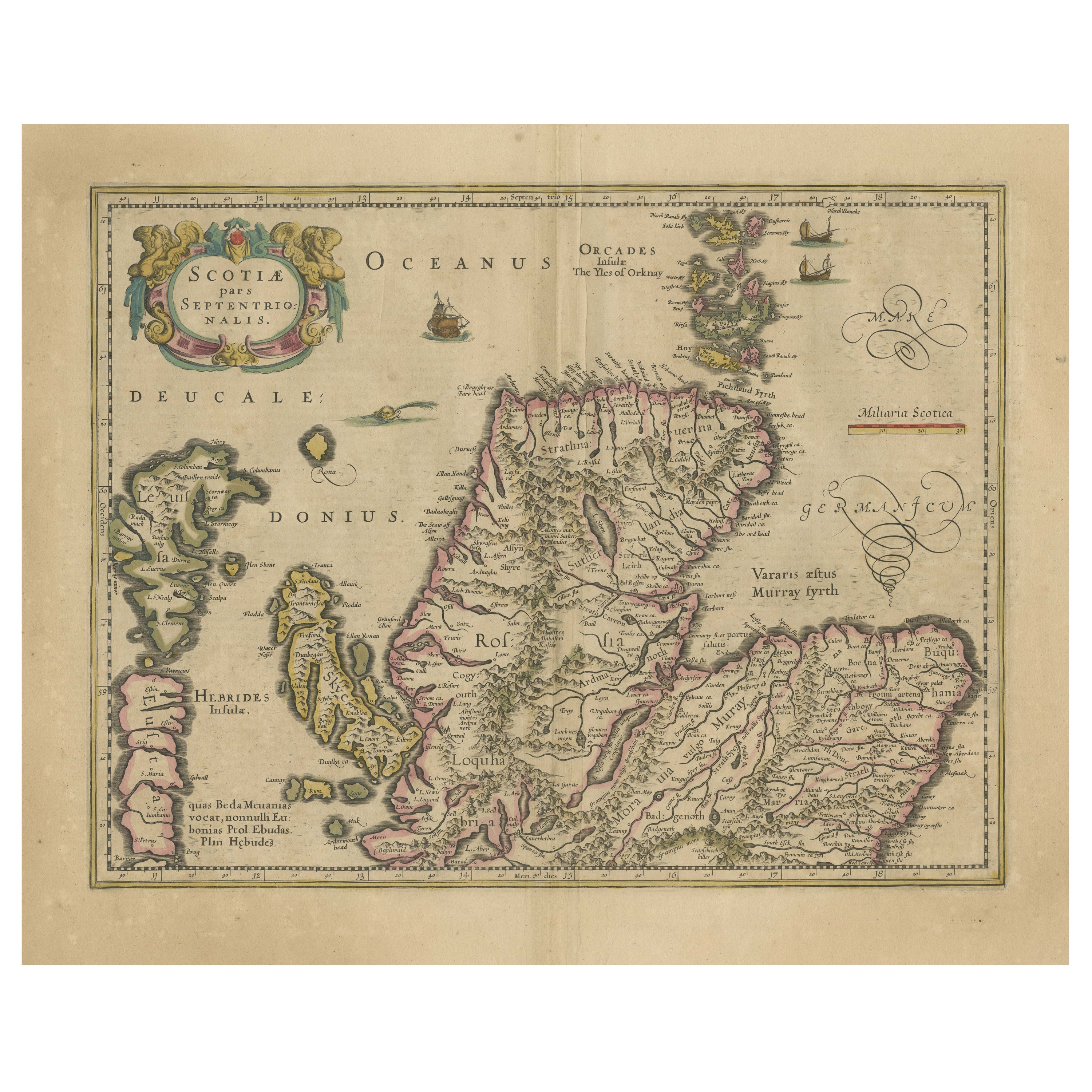
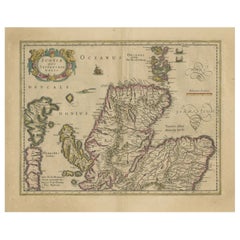
Original Antique Map of the Northern Part of Scotland, circa 1640
Located in Langweer, NL
The antique map, titled 'Scotiae pars septentrionalis,' depicts the northern part of Scotland. Crafted by Hondius around 1640, this map is a historical treasure showcasing the geogra...
Category
Antique Mid-17th Century Maps
Materials
Paper
$847 Sale Price
20% Off
Original Antique Map of England, Ireland, Scotland and Wales
Located in Langweer, NL
Antique map titled 'Les Isles Britanniques, ou sont les Royaumes d Angleterre (..)'. Detailed map of England, Ireland, Scotland and Wales, with French coast and part of the Netherlan...
Category
Antique Early 18th Century Maps
Materials
Paper

$279 Sale Price
20% Off
Antique Map of Western Europe by H. Kiepert, circa 1870
By Heinrich Kiepert
Located in Langweer, NL
Antique map titled 'Gallia, Britannia, Germania'. This map depicts a large part of Western Europe including countries like Germany, France, Great Britain, The Netherlands and more. T...
Category
Antique Late 19th Century Maps
Materials
Paper

$154 Sale Price
20% Off
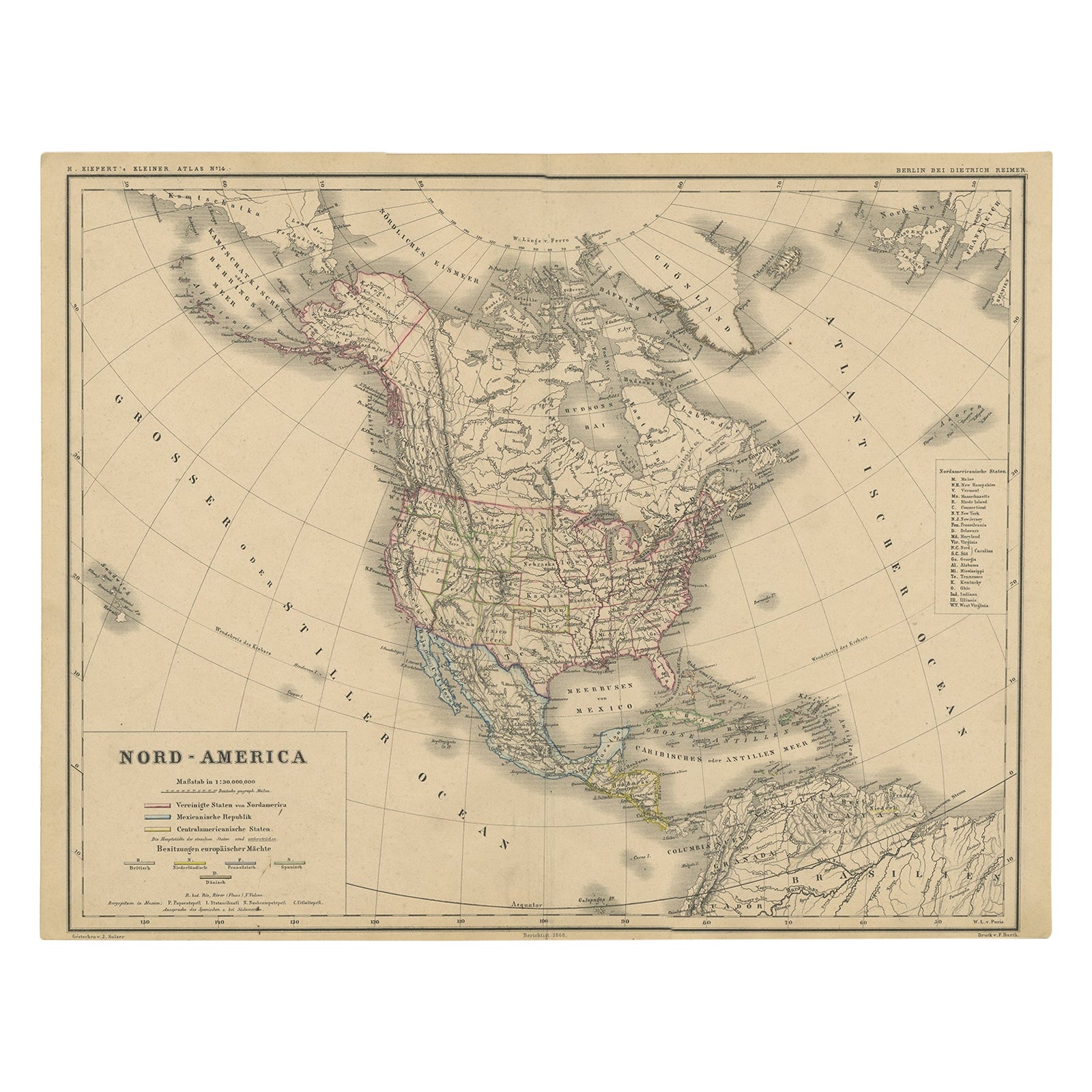
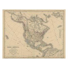
Old Original Antique German Map of North America, ca.1870
Located in Langweer, NL
Antique map titled 'Nord-America'.
Old map of North America. This map originates from 'H. Kiepert's Kleiner Atlas der Neueren Geographie für Schule und Haus'.
Artists and Engrave...
Category
Antique 1870s Maps
Materials
Paper
$471 Sale Price
20% Off
Antique Map of Italy and Greece by H. Kiepert, circa 1870
By Heinrich Kiepert
Located in Langweer, NL
Antique map titled 'Italiae pars media'. This map originates from 'Atlas Antiquus. Zwölf Karten zur Alten Geschichte' by H. Kiepert. Published in Berlin, circa 187.
Category
Antique Late 19th Century Maps
Materials
Paper

$144 Sale Price
20% Off
Antique Map of Egypt and Palestina by H. Kiepert 'circa 1870'
By Heinrich Kiepert
Located in Langweer, NL
Antique map titled 'Aegyptus, Phoenice et Palestina'. With inset maps of Tyrus, Alexandria and Hierosolyma. This map originates from 'Atlas Antiquus. Zwölf Karten zur Alten Geschicht...
Category
Antique Late 19th Century Maps
Materials
Paper

$154 Sale Price
20% Off