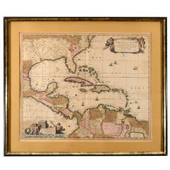
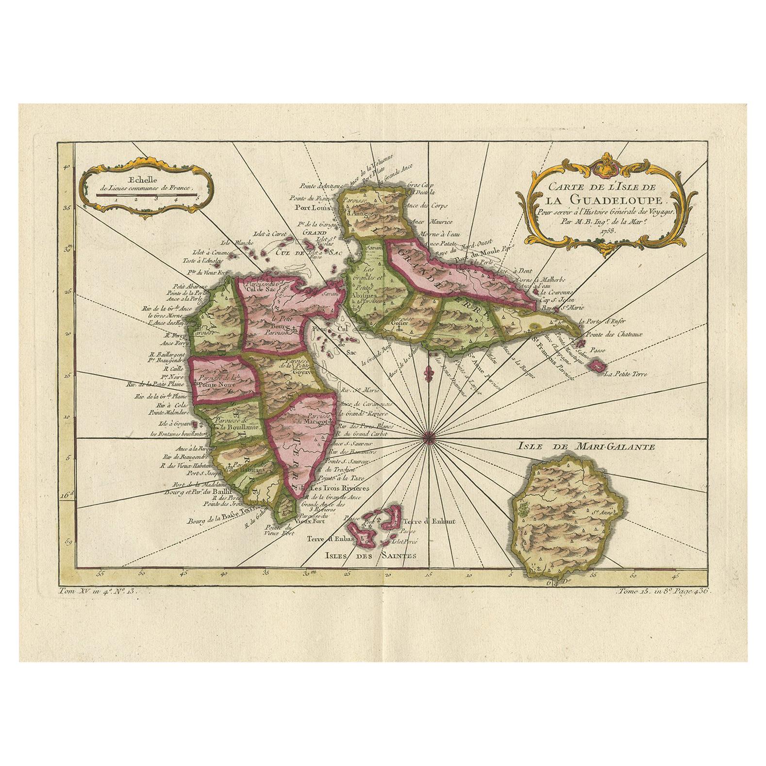
A Late 17th Century Handcolored Map of the Caribbean
View Similar Items


1 of 9
A Late 17th Century Handcolored Map of the Caribbean
About the Item
- Creator:Nicolas Joannes Piscator (Designer)
- Dimensions:Height: 23.5 in (59.69 cm)Width: 27.5 in (69.85 cm)
- Materials and Techniques:
- Place of Origin:
- Period:
- Date of Manufacture:Late 17th Century
- Condition:
- Seller Location:New York, NY
- Reference Number:1stDibs: 1208039129170
Authenticity Guarantee
In the unlikely event there’s an issue with an item’s authenticity, contact us within 1 year for a full refund. DetailsMoney-Back Guarantee
If your item is not as described, is damaged in transit, or does not arrive, contact us within 7 days for a full refund. Details24-Hour Cancellation
You have a 24-hour grace period in which to reconsider your purchase, with no questions asked.Vetted Professional Sellers
Our world-class sellers must adhere to strict standards for service and quality, maintaining the integrity of our listings.Price-Match Guarantee
If you find that a seller listed the same item for a lower price elsewhere, we’ll match it.Trusted Global Delivery
Our best-in-class carrier network provides specialized shipping options worldwide, including custom delivery.You May Also Like
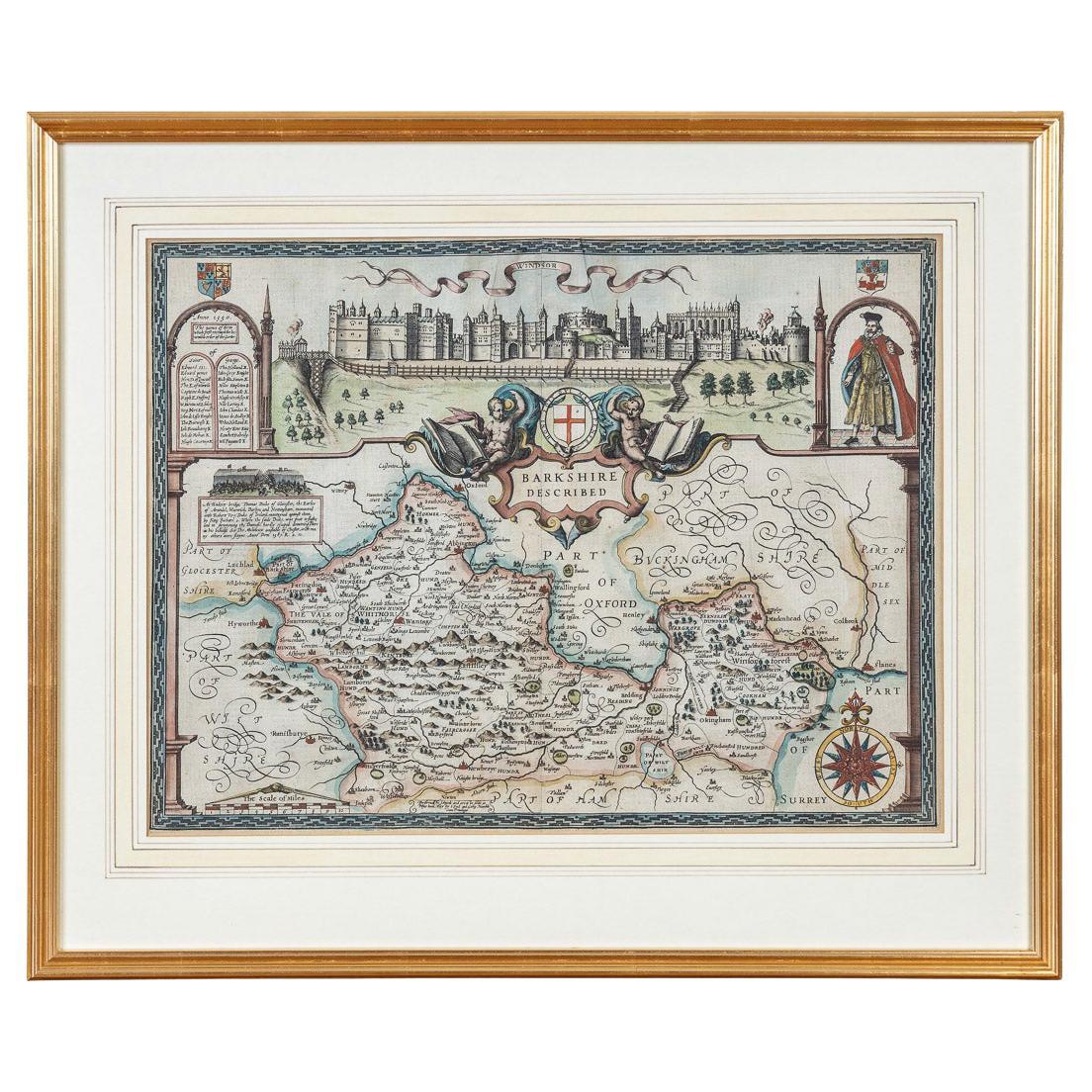
17th Century John Speed Map of the Barkshire Described, c.1616
By John Speed
Located in Royal Tunbridge Wells, Kent
Antique 17th century British very rare and original John Speed (1551-1629) map of the Barkshire Described, J. Sud and Georg Humble, publication (1616 or lat...
Category
Antique 17th Century British Maps
Materials
Paper

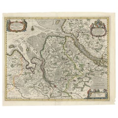
17th Century Nicolas Visscher Map of Southeastern Europe
Located in Hamilton, Ontario
A beautiful, highly detailed map of southeastern Europe by Nicolas Visscher. Includes regions of Northern Italy (showing the cities Bologna, Padua, and Venice), Bohemia, Austria (sho...
Category
Antique 17th Century Dutch Maps
Materials
Paper

$1,350 Sale Price
38% Off
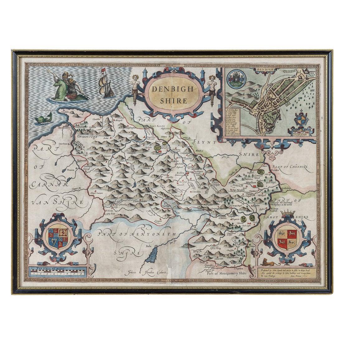
17th Century John Speed Map of Denbighshire, c.1610
By John Speed
Located in Royal Tunbridge Wells, Kent
Antique early 17th century British very rare and original John Speed, hand coloured map of Denbighshire, dated 1610, by John Sunbury and George Humble. John...
Category
Antique 17th Century British Maps
Materials
Wood, Paper

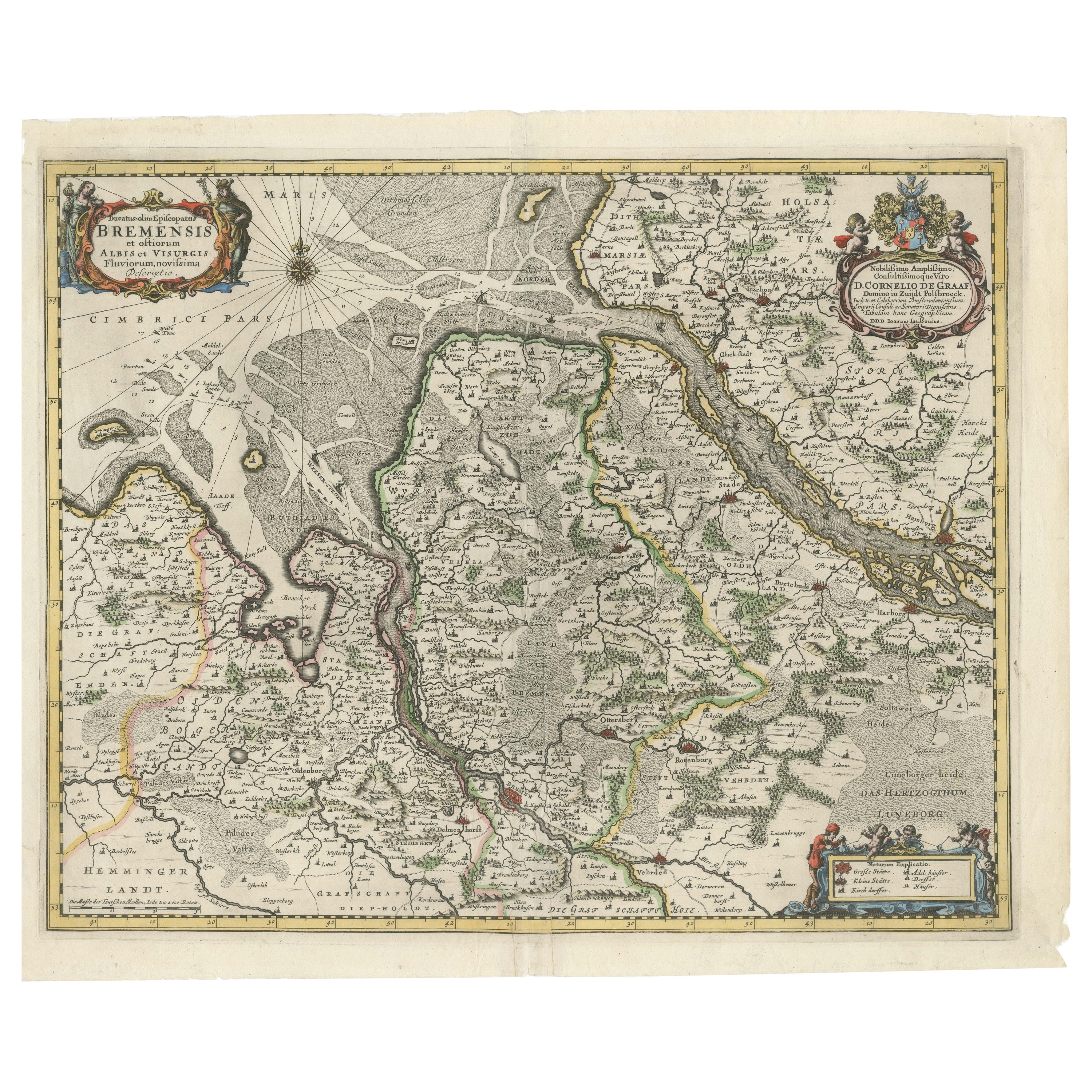
Johannes Janssonius' 17th-Century Map of the Duchy of Bremen in Germany
Located in Langweer, NL
The map titled "Ducatus olim Episcopatus Bremensis et ostiorum Albis et Visurgis Fluviorum novissima Descriptio" by Johannes Janssonius provides a rich historical and geographical il...
Category
Antique 1650s Maps
Materials
Paper
$716 Sale Price
20% Off
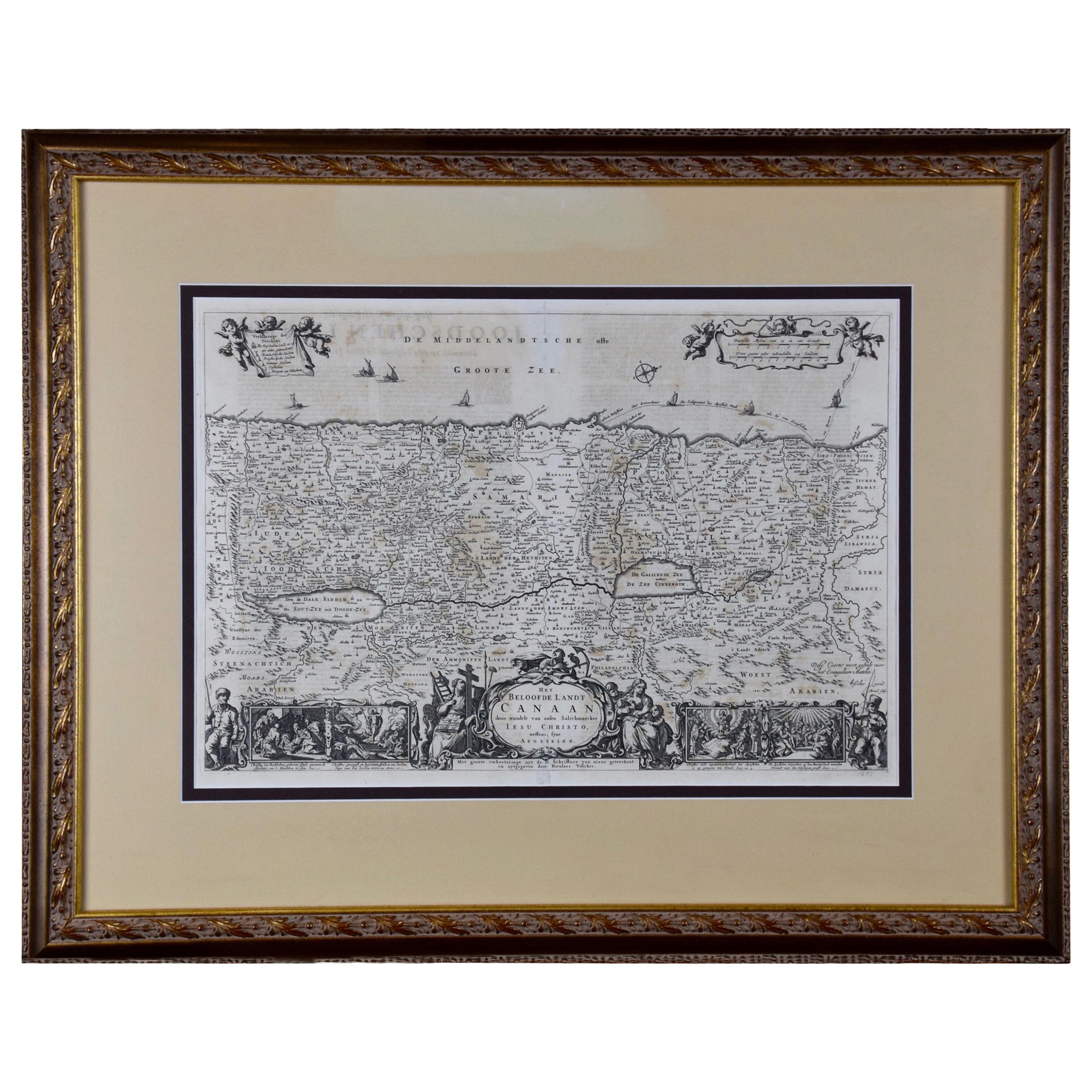
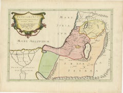
17th-Century Map of the Latin Patriarchate of Jerusalem by Melchior Tavernier
Located in Langweer, NL
Title: 17th-Century Map of the Latin Patriarchate of Jerusalem by Melchior Tavernier
Description: This rare 17th-century map by Melchior Tavernier illustrates the geographical ext...
Category
Antique 1640s Maps
Materials
Paper
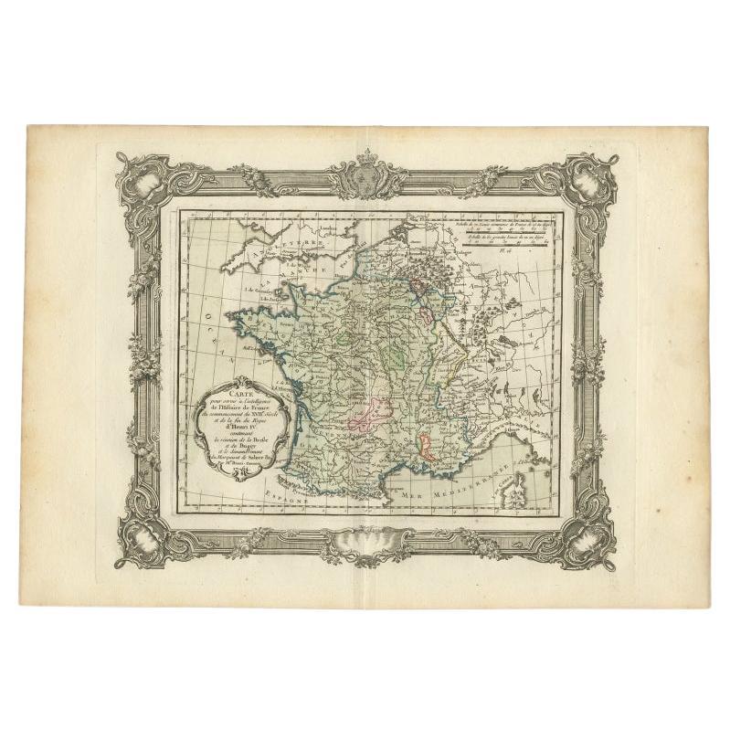
Antique Map of France at the Beginning of the 17th Century by Zannoni, 1765
By G. A. Rizzi-zannoni
Located in Langweer, NL
Antique map France titled 'Carte pour servir à intelligence de l'Histoire de France (..)'. Beautiful old map of France. This map originates from 'At...
Category
Antique 18th Century Maps
Materials
Paper
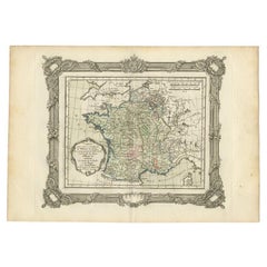
$148 Sale Price
20% Off
Recently Viewed
View AllMore Ways To Browse
Cape Dutch Furniture
Vintage Art Deco Glass Coffee Table
Vintage Ceramic Stool
Vintage Glass Ash Trays
Walnut Pool Table
White Armchair With Brass Legs
White French Settee
Woven Modernist Chair
1900s Chair With Upholstery
1930s Phone
1960s Metal Benches
1960s Swivel Chairs Pair
54 Round Dining Table
7 Chair Fritz
70s Console Table
Aluminum Group Desk Chairs By Charles Eames
Antique American Silver Pitchers
Antique Ottoman Silk