Items Similar to Map of Dordogne France with Périgueux and Château de Jumilhac, 19th Century
Want more images or videos?
Request additional images or videos from the seller
1 of 10
Map of Dordogne France with Périgueux and Château de Jumilhac, 19th Century
About the Item
Map of Dordogne France with Périgueux and Château de Jumilhac, 19th Century
Description:
This richly detailed 19th-century map of the Dordogne department in southwestern France was drawn by Alexandre Vuillemin and published by Migeon in Paris for the *Nouvel Atlas Illustré*. The map masterfully combines cartographic precision with elegant engravings that highlight the historical and cultural significance of this beloved region of Aquitaine.
The map outlines Dordogne in soft green hand-coloring, with towns, rivers, and roadways finely engraved. The departmental capital, Périgueux, is centrally located and clearly labeled, along with other important towns such as Bergerac, Sarlat, Nontron, and Ribérac. The rolling hills, intersecting river valleys, and dense forests of the Périgord region are suggested through detailed topographical lines.
At the lower left is a charming vignette of Périgueux with its cathedral dome rising above a riverside village scene. To the lower right, the Château de Jumilhac appears perched on a slope, representing the region’s long architectural history and noble estates. The upper left features a portrait of François Fénelon, the theologian and writer born in Périgord in the 17th century. His inclusion reflects the department’s intellectual heritage. The heraldic crest of Dordogne also appears in the upper right.
Dordogne is famous for its culinary and cultural wealth, particularly its foie gras, truffles, walnuts, and wines. Bergerac, located in the southwestern part of the department, is a key wine-producing area within the Bergerac AOC, known for its red, white, and rosé wines. The vineyards here produce wines from Bordeaux varietals such as Merlot, Cabernet Sauvignon, and Sauvignon Blanc, with increasingly refined expressions gaining international recognition. The region is also steeped in prehistoric significance, home to the Lascaux caves and numerous archaeological sites.
This map is a decorative and historical homage to Dordogne’s blend of gastronomy, viticulture, literature, and rural charm. It is a superb piece for collectors with interests in French culture, food, wine, and history.
Condition summary:
Very good condition with light toning and a few small foxing marks, mainly around the margins. The engraving remains crisp and the hand coloring is well preserved.
Framing tips:
Pair this map with a warm walnut or golden oak frame to reflect the earthy tones of Dordogne. A cream or soft green mat will complement the coloring and highlight the detailed vignettes. Use UV-protective glass for long-term display and preservation.
- Dimensions:Height: 12.8 in (32.5 cm)Width: 10.28 in (26.1 cm)Depth: 0.01 in (0.2 mm)
- Materials and Techniques:Paper,Engraved
- Place of Origin:
- Period:
- Date of Manufacture:circa 1850
- Condition:Very good condition with light toning and a few small foxing marks, mainly around the margins. The engraving remains crisp and the hand coloring is well preserved.
- Seller Location:Langweer, NL
- Reference Number:Seller: BG-13331-231stDibs: LU3054345363672
About the Seller
5.0
Recognized Seller
These prestigious sellers are industry leaders and represent the highest echelon for item quality and design.
Gold Seller
Premium sellers maintaining a 4.3+ rating and 24-hour response times
Established in 2009
1stDibs seller since 2017
2,467 sales on 1stDibs
Typical response time: 1 hour
- ShippingRetrieving quote...Shipping from: Langweer, Netherlands
- Return Policy
Authenticity Guarantee
In the unlikely event there’s an issue with an item’s authenticity, contact us within 1 year for a full refund. DetailsMoney-Back Guarantee
If your item is not as described, is damaged in transit, or does not arrive, contact us within 7 days for a full refund. Details24-Hour Cancellation
You have a 24-hour grace period in which to reconsider your purchase, with no questions asked.Vetted Professional Sellers
Our world-class sellers must adhere to strict standards for service and quality, maintaining the integrity of our listings.Price-Match Guarantee
If you find that a seller listed the same item for a lower price elsewhere, we’ll match it.Trusted Global Delivery
Our best-in-class carrier network provides specialized shipping options worldwide, including custom delivery.More From This Seller
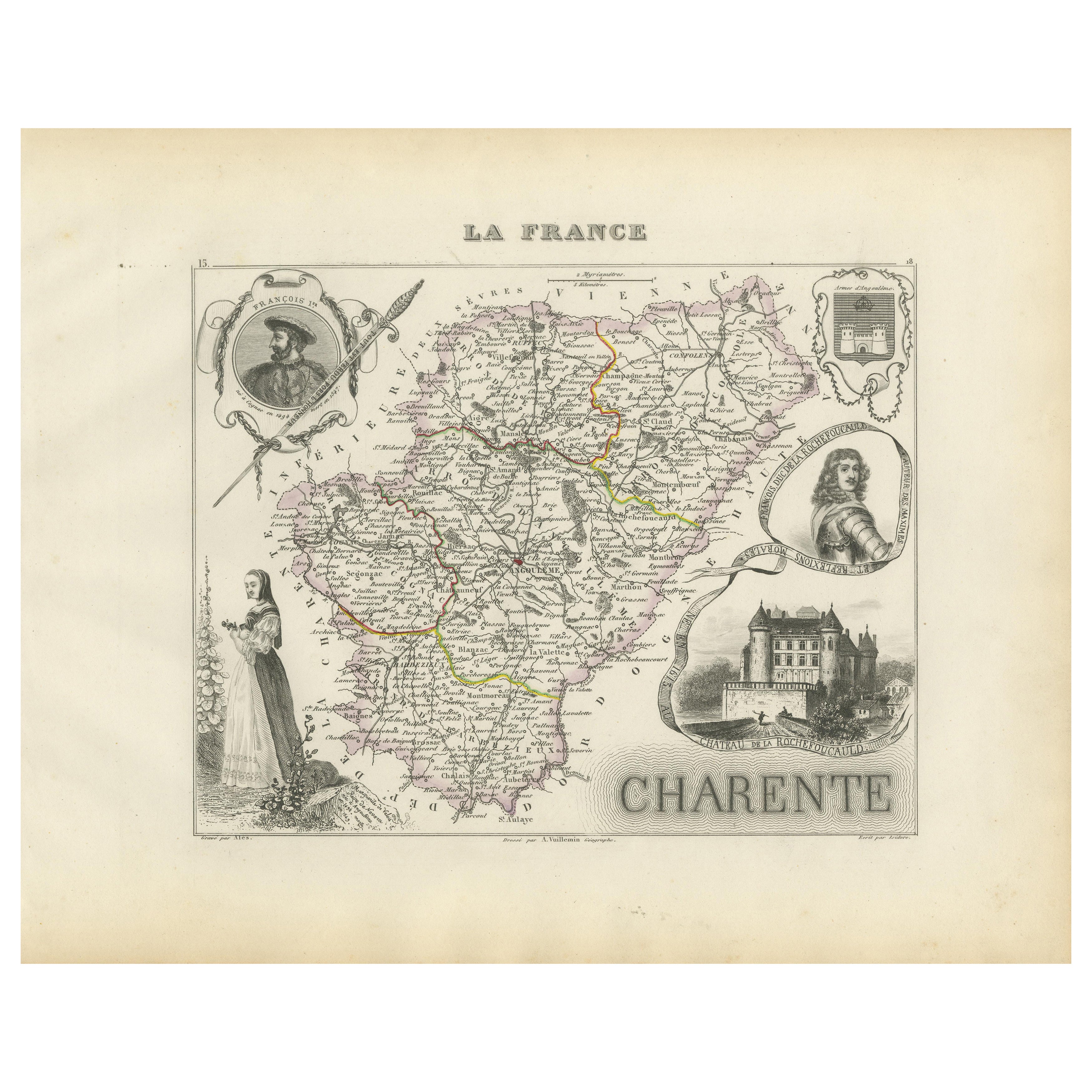
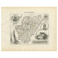
View AllMap of Charente France with Cognac Region and Château de La Rochefoucauld, 1850
Located in Langweer, NL
Map of Charente France with Cognac Region and Château de La Rochefoucauld, 19th c
Description:
This richly illustrated 19th-century map of the Charente department in southwestern Fr...
Category
Antique Mid-19th Century French Maps
Materials
Paper
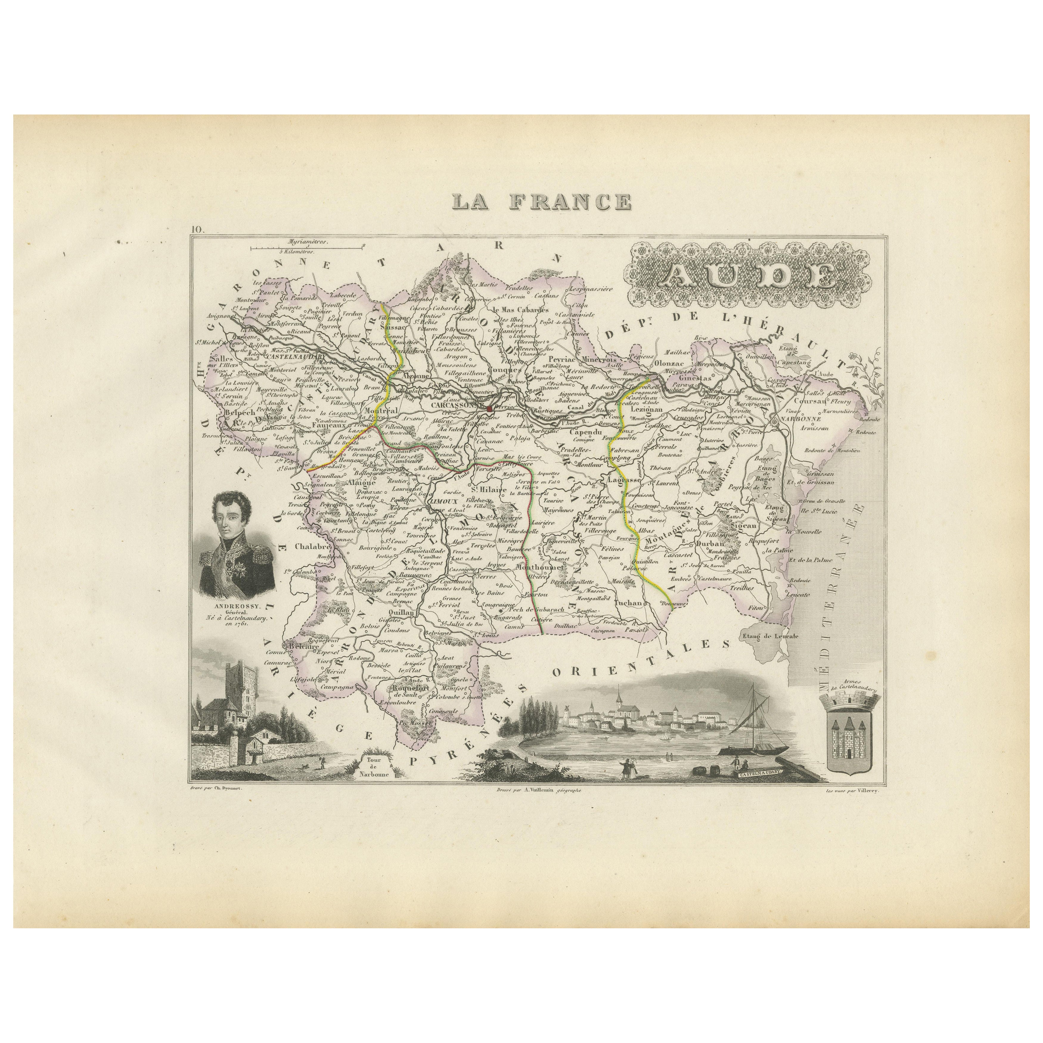
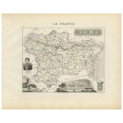
Map of Aude France with Carcassonne and Languedoc Vineyards, 19th Century
Located in Langweer, NL
Map of Aude France with Carcassonne and Languedoc Vineyards, 19th Century
Description:
This elegant 19th-century map of Aude, a department in southern France along the Mediterranean...
Category
Antique Mid-19th Century French Maps
Materials
Paper
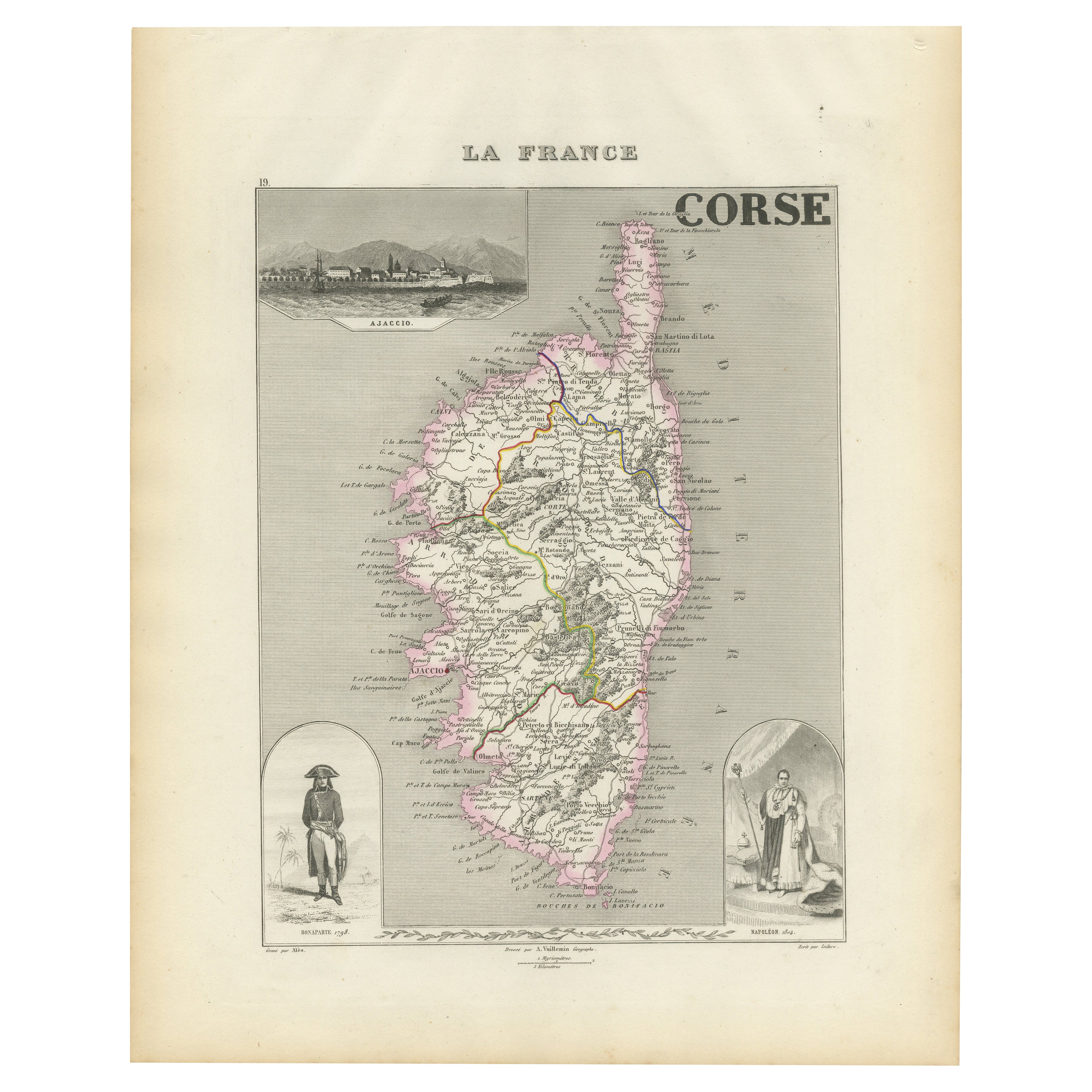
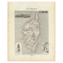
Map of Corsica France with Ajaccio and Napoleon Portraits, 19th Century
Located in Langweer, NL
Map of Corsica France with Ajaccio and Napoleon Portraits, 19th Century
Description:
This finely engraved 19th-century map of Corsica, the Mediterranean island region of France, was...
Category
Antique Mid-19th Century French Maps
Materials
Paper
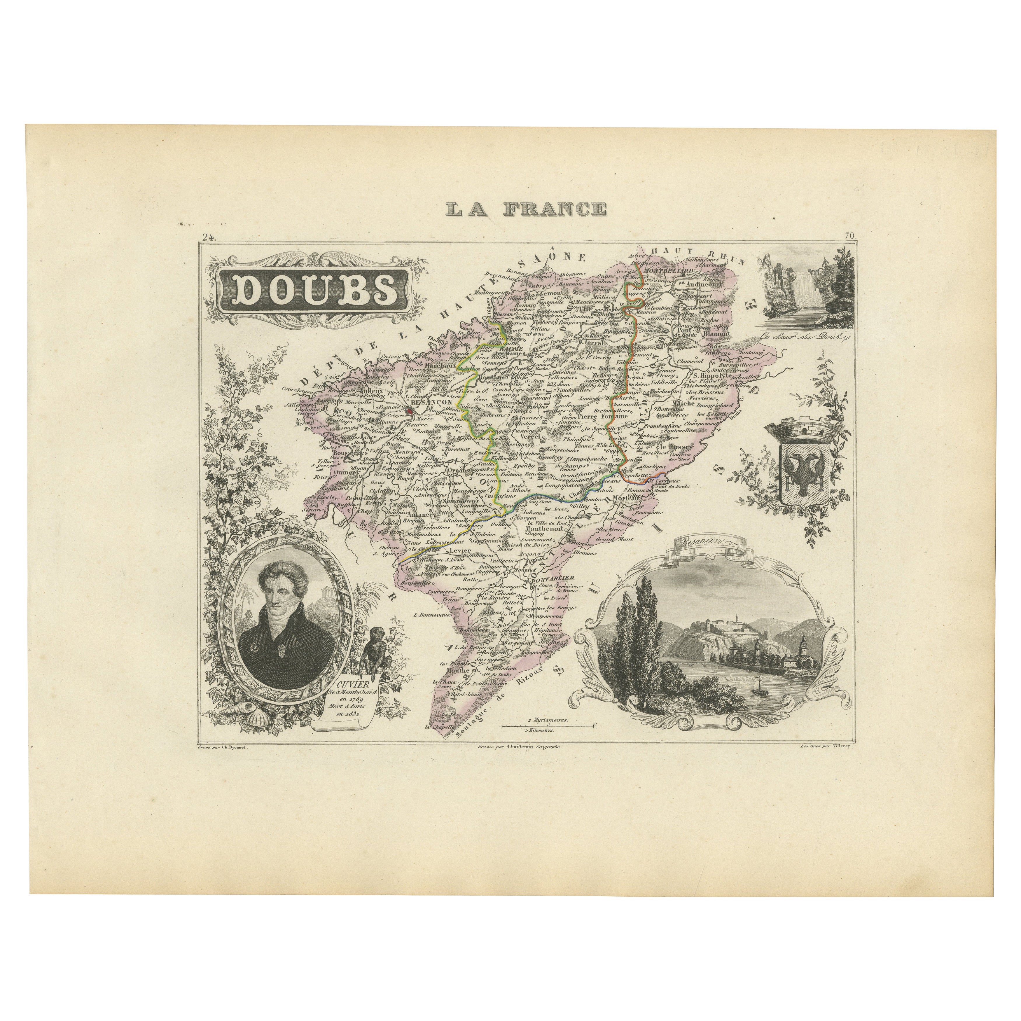
Map of Doubs France with Besançon and Swiss Border Landscape, 19th Century
Located in Langweer, NL
Map of Doubs France with Besançon and Swiss Border Landscape, 19th Century
Description:
This decorative 19th-century map of the department of Doubs in eastern France was drawn by Al...
Category
Antique Mid-19th Century French Maps
Materials
Paper

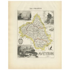
Map of Aveyron France with Rodez, Millau and Wine Routes, 19th Century
Located in Langweer, NL
Map of Aveyron France with Rodez, Millau and Wine Routes, 19th Century
Description:
This detailed and decorative 19th-century map of Aveyron, a department in southern France, was dr...
Category
Antique Mid-19th Century French Maps
Materials
Paper
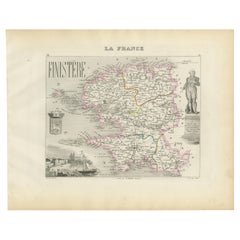
Map of Finistère France with Brest, Quimper and Brittany Coastline, 19th Century
Located in Langweer, NL
Map of Finistère France with Brest, Quimper and Brittany Coastline, 19th Century
Description:
This richly engraved 19th-century map of Finistère, the westernmost department of mainl...
Category
Antique Mid-19th Century French Maps
Materials
Paper
You May Also Like
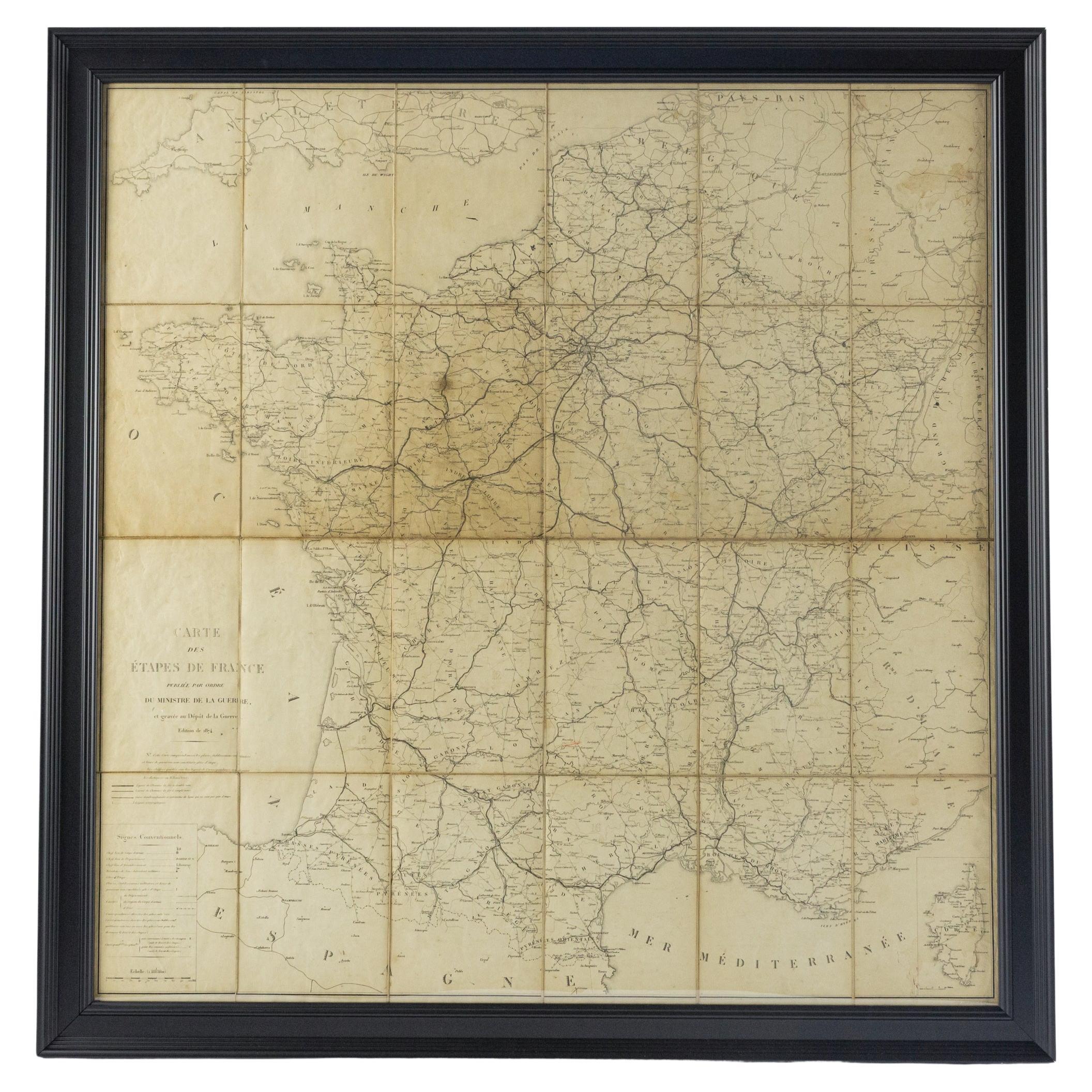
Large 19th Century Map of France
Located in Pease pottage, West Sussex
Large 19th Century Map of France.
Remarkable condition, with a pleasing age worn patina.
Recently framed.
France Circa 1874.
Category
Antique Late 19th Century French Maps
Materials
Linen, Paper

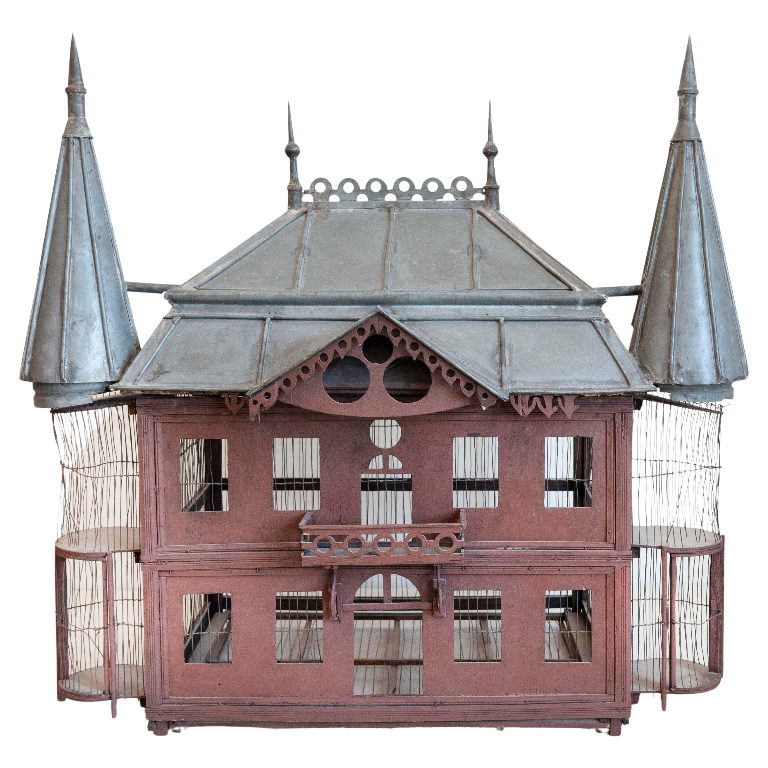
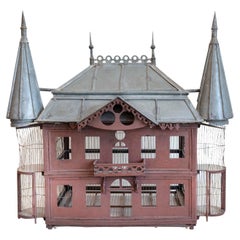
French 19th Century Medieval Château Pewter and Wood Birdcage with Turrets
Located in Atlanta, GA
A large 19th century pewter and wood decorative birdcage shaped as a French medieval château. This exquisite French château birdcage is a definite must in terms of decorative accents...
Category
Antique 19th Century French Bird Cages
Materials
Pewter
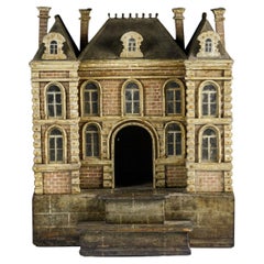
Impressive Early 19th Century Model Chateau
Located in Pease pottage, West Sussex
Extraordinary Early 19th Century Chateau Model found untouched in its original painted finish. impressive attention to detail with some carved brickwork,...
Category
Antique Early 19th Century French Architectural Models
Materials
Wood
19th Century Reprint of 16th Century Harbor Map of Copenhagen
Located in Haddonfield, NJ
This reprint of 1587 antique map of Copenhagen, Denmark retains its original mid-century mat and has been recently reframed in classic wood frame. The muted sepia colored map is a wo...
Category
Antique 1880s Danish Baroque Maps
Materials
Wood, Paper
America "Amérique Septentrionale": A 19th Century French Map by Delamarche
By Maison Delamarche 1
Located in Alamo, CA
This framed mid 19th century map of North America entitled "Amérique Septentrionale" by Felix Delamarche was published in Paris in 1854 by Quay de l'Horloge du Palais, avec les Carte...
Category
Antique Mid-19th Century American Other Maps
Materials
Paper

19th Century Lithograph Map of Lower Manhattan, New York
Located in Haddonfield, NJ
1859 hand colored map of Lower Manhattan or New Amsterdam by George H. Moore.
Category
Antique 19th Century English Folk Art Maps
Materials
Paper
