Items Similar to Maryland, D.C. & Delaware Antique Map – Old Line State Railroads, c.1888

Want more images or videos?
Request additional images or videos from the seller
1 of 12
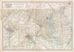
Maryland, D.C. & Delaware Antique Map – Old Line State Railroads, c.1888
$548.74
£405.69
€460
CA$754.78
A$838.99
CHF 439.78
MX$10,246.07
NOK 5,490.39
SEK 5,165.43
DKK 3,501.97
About the Item
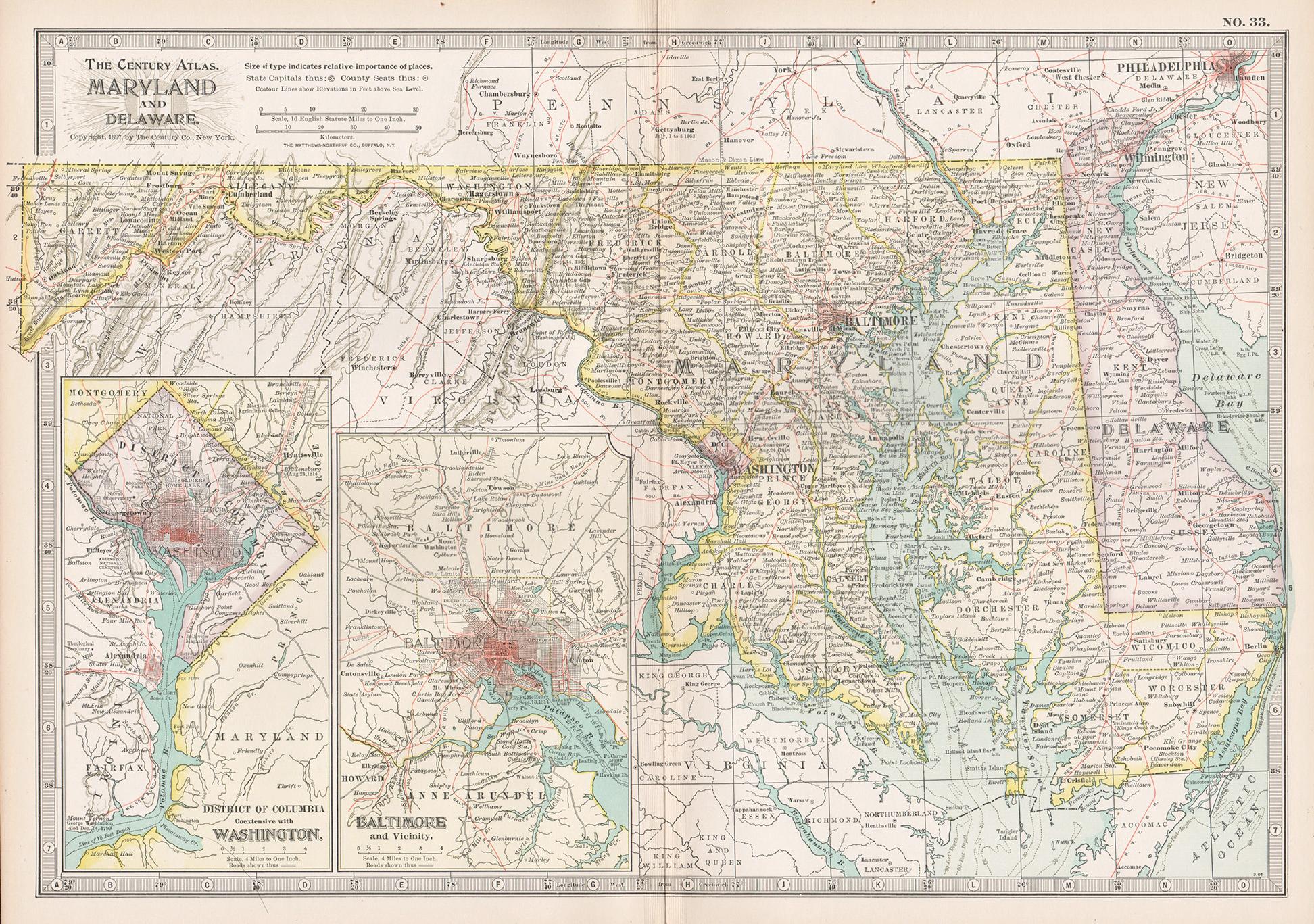
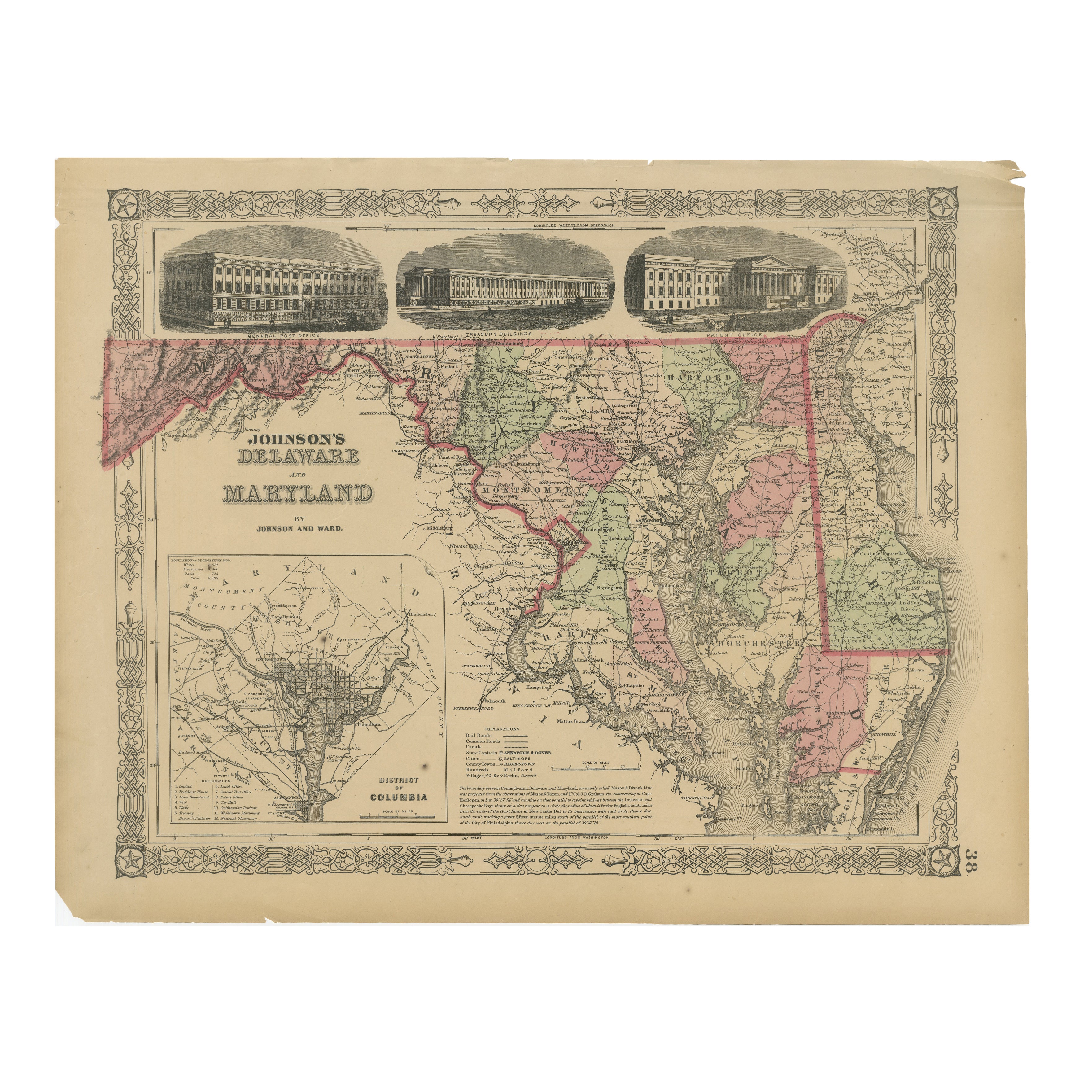
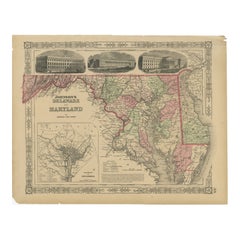
Antique Map of Maryland, Delaware & Washington D.C. – Rand McNally, circa 1888
This antique map of Maryland, Delaware, and Washington, D.C., was published by Rand, McNally & Co. around 1888. Taken from one of their authoritative late 19th-century atlases, it provides a detailed record of the Mid-Atlantic region at a time of industrial expansion and political significance.
The map covers the entirety of Maryland and Delaware, highlighting counties, towns, rivers, and transport routes with fine engraving. Baltimore, Annapolis, and Wilmington are clearly marked as major centers, while smaller towns and rural areas are equally well represented.
Railroads are depicted in red and blue, forming an intricate network connecting Baltimore and Washington with neighboring Pennsylvania, Virginia, and New Jersey. Chesapeake Bay dominates the map, engraved with careful linework that emphasizes its importance as a natural harbor and shipping corridor.
A particularly attractive feature is the large inset of Washington, D.C., showing a fully detailed street grid, parks, and government buildings, providing a precise portrait of the nation’s capital during the late 19th century. This inset makes the map not only historically significant but also visually compelling.
Collectors will appreciate this as a fine example of Rand McNally’s cartography, combining geographical clarity with decorative appeal and political interest.
Condition report:
Very good condition with light age toning. Original center fold as issued with slight darkening along the crease. Plate mark visible. Margins clean with only minor handling wear. Strong impression with excellent detail.
Framing tips:
A black or dark walnut frame with a cream or ivory mat will highlight the engraving. A double mat—ivory outer and muted blue inner—will emphasize the Chesapeake Bay and D.C. inset, drawing attention to the map’s most distinctive features.
Technique: Lithograph with original outline color
Maker: Rand, McNally & Co., Chicago, circa 1888
- Dimensions:Height: 14.18 in (36 cm)Width: 20.67 in (52.5 cm)Depth: 0.01 in (0.2 mm)
- Materials and Techniques:Paper,Engraved
- Place of Origin:
- Period:
- Date of Manufacture:1888
- Condition:Very good condition with light age toning. Original center fold as issued with slight darkening along the crease. Plate mark visible. Margins clean with only minor handling wear. Strong impression with excellent detail.
- Seller Location:Langweer, NL
- Reference Number:Seller: BG-12794-221stDibs: LU3054346449442
About the Seller
5.0
Recognized Seller
These prestigious sellers are industry leaders and represent the highest echelon for item quality and design.
Platinum Seller
Premium sellers with a 4.7+ rating and 24-hour response times
Established in 2009
1stDibs seller since 2017
2,604 sales on 1stDibs
Typical response time: <1 hour
- ShippingRetrieving quote...Shipping from: Langweer, Netherlands
- Return Policy
Authenticity Guarantee
In the unlikely event there’s an issue with an item’s authenticity, contact us within 1 year for a full refund. DetailsMoney-Back Guarantee
If your item is not as described, is damaged in transit, or does not arrive, contact us within 7 days for a full refund. Details24-Hour Cancellation
You have a 24-hour grace period in which to reconsider your purchase, with no questions asked.Vetted Professional Sellers
Our world-class sellers must adhere to strict standards for service and quality, maintaining the integrity of our listings.Price-Match Guarantee
If you find that a seller listed the same item for a lower price elsewhere, we’ll match it.Trusted Global Delivery
Our best-in-class carrier network provides specialized shipping options worldwide, including custom delivery.More From This Seller
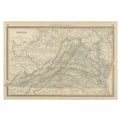
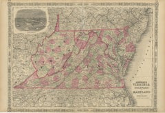
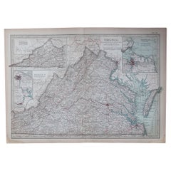
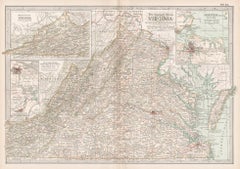
View AllAntique Virginia Map c.1888 – Railroads, Towns & The Old Dominion
Located in Langweer, NL
Antique Map of Virginia – Rand McNally, circa 1888
This antique map of Virginia was published by Rand, McNally & Co. around 1888. Drawn from one of their influential late 19th-centu...
Category
Antique Late 19th Century American Maps
Materials
Paper
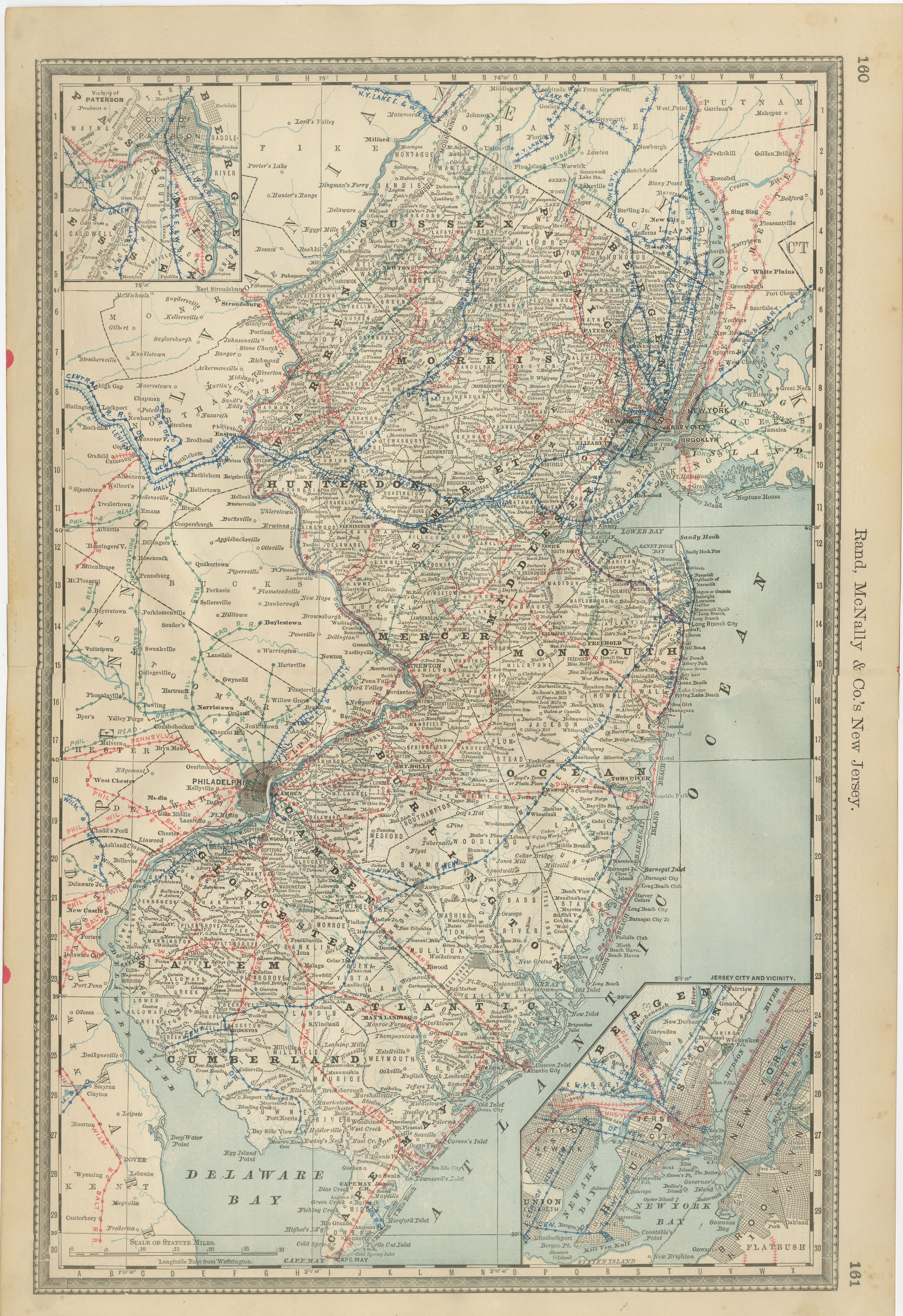
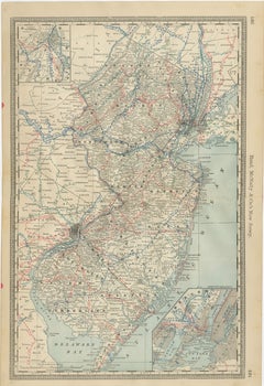
New Jersey Antique Map – The Garden State, Railroads & Counties, c.1888
Located in Langweer, NL
Antique Map of New Jersey – Rand McNally, circa 1888
This antique map of New Jersey was published by Rand, McNally & Co. around 1888. It offers a detailed late 19th-century portrait...
Category
Antique Late 19th Century American Maps
Materials
Paper
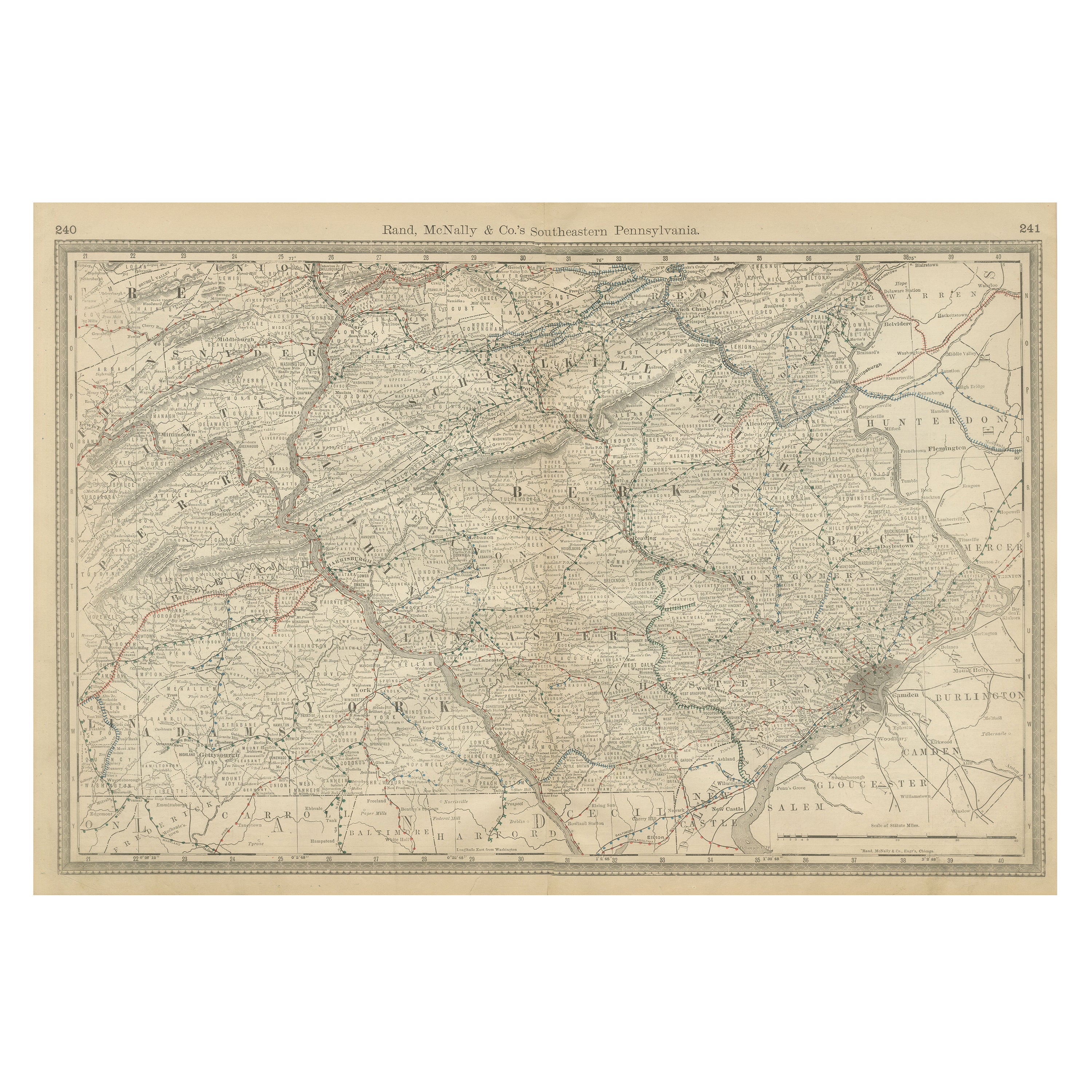
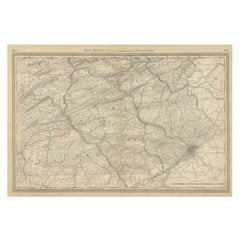
Pennsylvania 1888 Antique Map – The Keystone State, Southeastern Railroads
Located in Langweer, NL
Antique Map of Southeastern Pennsylvania – Rand McNally, circa 1888
This antique map of southeastern Pennsylvania was published by Rand, McNally & Co. around 1888, taken from one of...
Category
Antique Late 19th Century American Maps
Materials
Paper
Delaware and Maryland Map – Johnson, Hand-Colored with Insets, 1864
Located in Langweer, NL
Johnson’s Delaware and Maryland Map, USA c.1864 – Hand-Colored with Insets
This is a finely engraved and hand-colored map titled Johnson’s Delaware and Maryland, published by Johnso...
Category
Antique Mid-19th Century American Maps
Materials
Paper
1864 Johnson's Map of Virginia, Delaware, and Maryland with Fort Monroe Inset
Located in Langweer, NL
Title: 1864 Johnson's Map of Virginia, Delaware, and Maryland with Fort Monroe Inset
Description: This 1864 map titled "Johnson's Virginia, Delaware, and ...
Category
Antique 1860s Maps
Materials
Paper
$286 Sale Price
20% Off
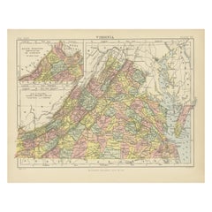
Antique Map of Virginia, with Inset Map of the South Western Continuation
Located in Langweer, NL
Antique map titled 'Virginia'. Original antique map of Virginia, United States. With inset map of the south western continuation of Virginia. T...
Category
Antique Late 19th Century Maps
Materials
Paper
$276 Sale Price
20% Off
You May Also Like
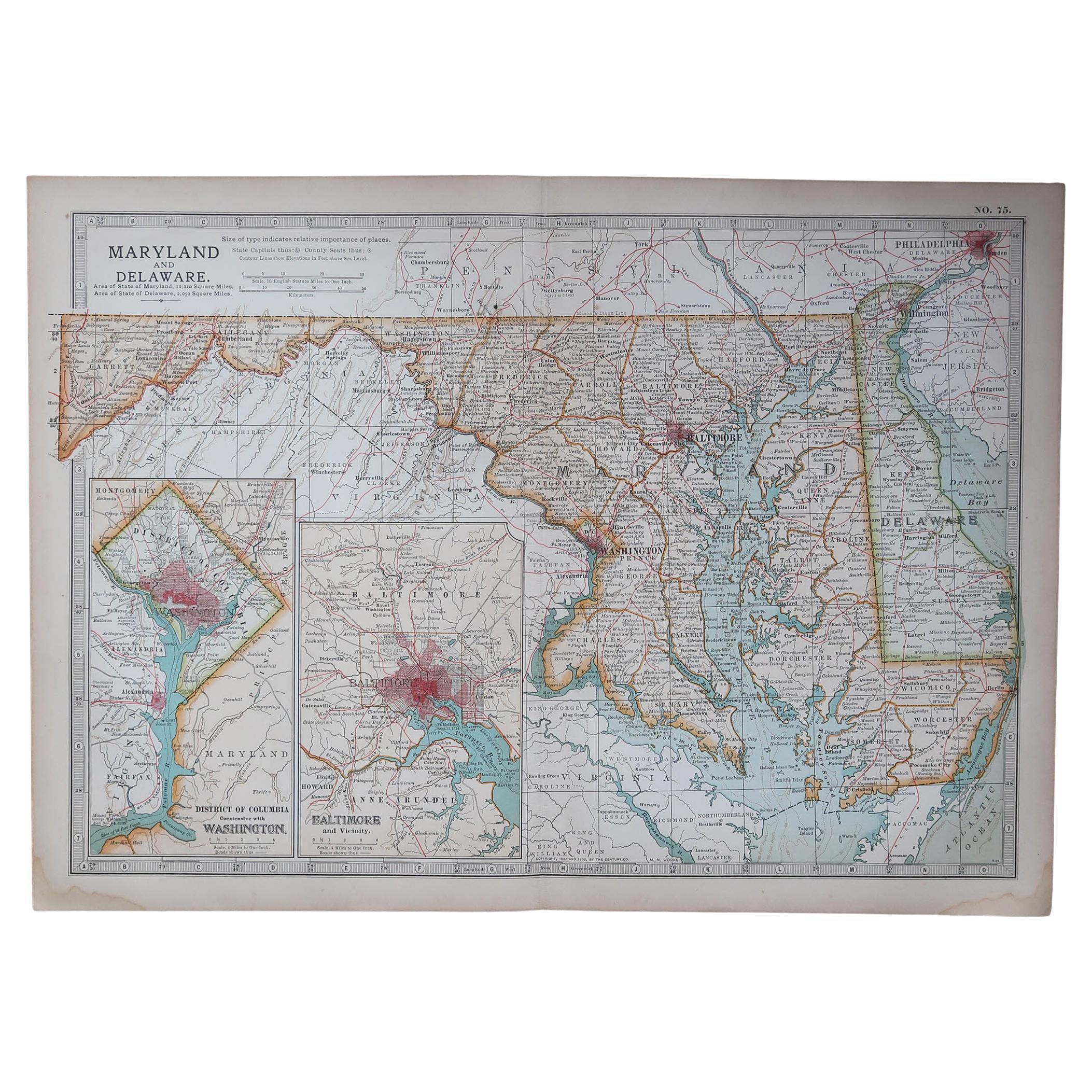
Maryland and Delaware. USA. Century Atlas state antique vintage map
Located in Melbourne, Victoria
'The Century Atlas. Maryland and Delaware.'
Original antique map, 1903.
Central fold as issued. Map name and number printed on the reverse corners.
Sheet 29.5cm by 40cm.
Category
Early 20th Century Victorian More Prints
Materials
Lithograph
Original Antique Map of the American State of Maryland & Delaware, 1903
Located in St Annes, Lancashire
Antique map of Maryland And Delaware
Published By A & C Black. 1903
Original colour
Good condition
Unframed.
Free shipping
Category
Antique Early 1900s English Maps
Materials
Paper
Large Original Antique City Plan of Baltimore, USA, 1894
By Rand McNally & Co.
Located in St Annes, Lancashire
Fabulous colorful map of Baltimore
Original color
By Rand, McNally & Co.
Published, 1894
Unframed
Free shipping.
Category
Antique 1890s American Maps
Materials
Paper
Original Antique Map of the American State of Virginia, 1903
Located in St Annes, Lancashire
Antique map of Virginia
Published By A & C Black. 1903
Original colour
Good condition
Unframed.
Free shipping
Category
Antique Early 1900s English Maps
Materials
Paper
Virginia. USA. Century Atlas state antique vintage map
Located in Melbourne, Victoria
'The Century Atlas. Virginia'
Original antique map, 1903.
Central fold as issued. Map name and number printed on the reverse corners.
Sheet 29.5cm by 40cm.
Category
Early 20th Century Victorian More Prints
Materials
Lithograph
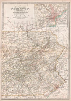
Pennsylvania, Eastern Part. USA. Century Atlas state antique vintage map
Located in Melbourne, Victoria
'The Century Atlas. Pennsylvania, Eastern Part.'
Original antique map, 1903.
Central fold as issued. Map name and number printed on the reverse corners.
Sheet 40cm by 29.5cm.
Category
Early 20th Century Victorian More Prints
Materials
Lithograph