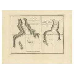
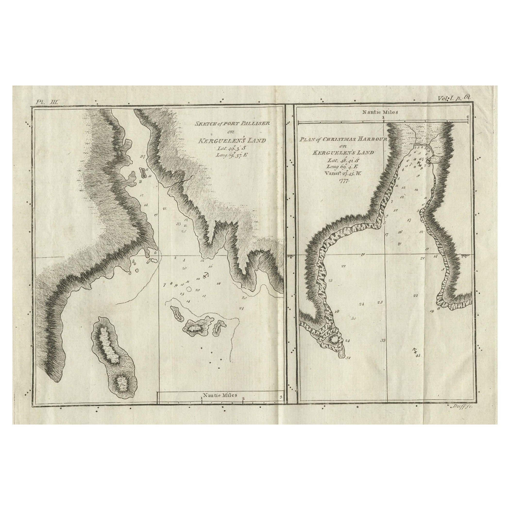
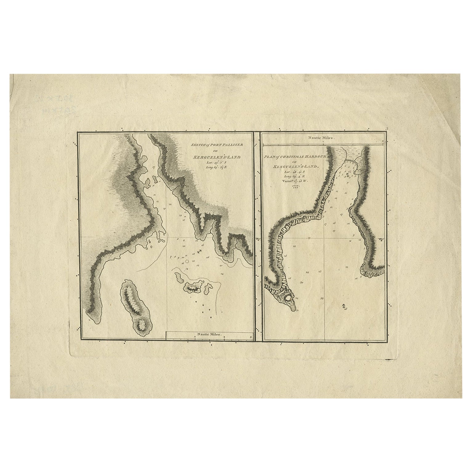
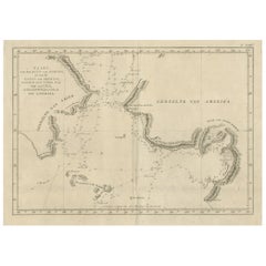
New Hebrides Original Map of Port Sandwich by Cook, 1803
View Similar Items


Want more images or videos?
Request additional images or videos from the seller
1 of 5
New Hebrides Original Map of Port Sandwich by Cook, 1803
About the Item
- Dimensions:Height: 13 in (33 cm)Width: 9.06 in (23 cm)Depth: 0 in (0.01 mm)
- Materials and Techniques:
- Period:
- Date of Manufacture:1803
- Condition:Condition: Very good, general age-related toning. Please study image carefully.
- Seller Location:Langweer, NL
- Reference Number:Seller: BG-11487-471stDibs: LU3054327616332
About the Seller
5.0
Platinum Seller
These expertly vetted sellers are 1stDibs' most experienced sellers and are rated highest by our customers.
Established in 2009
1stDibs seller since 2017
1,932 sales on 1stDibs
More From This SellerView All
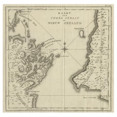
- Antique Map of Cook's Strait in New Zealand, 1803Located in Langweer, NLAntique map New Zealand titled 'Kaart van Cooks Straat in Nieuw Zeeland'. Antique map of Cook's Strait in New Zealand. Originates from 'Reizen ...Category
Antique 19th Century Maps
MaterialsPaper
 $569 Sale Price20% Off
 - Antique Map of Suffren Island by Cook, 1803Located in Langweer, NLAntique map Australia titled 'Gezigt van het Eil. Suffren'. Antique map of Suffren Island. Originates from 'Reizen Rondom de Waereld door James C...Category
Antique 19th Century Maps
MaterialsPaper
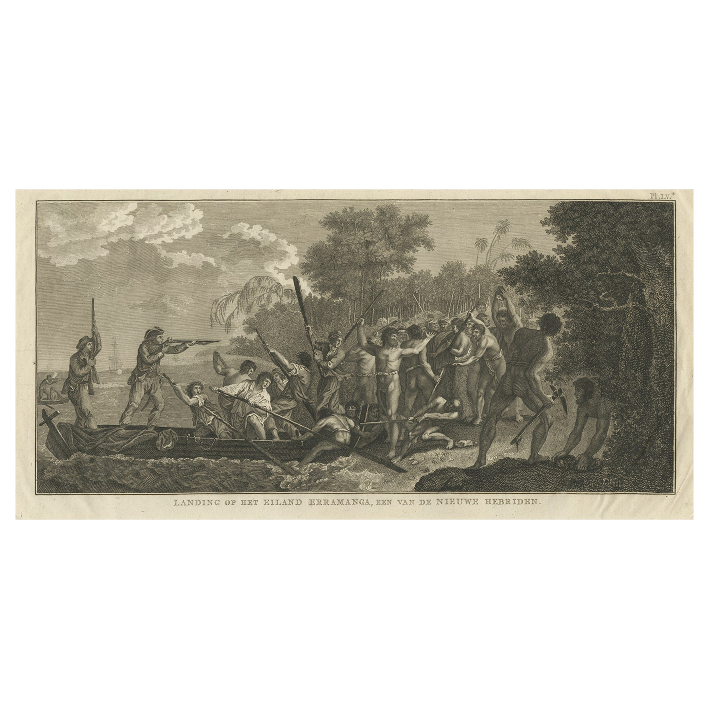
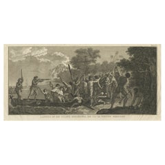
- Capt. Cook Aiming His Gun Near Islands of the New Hebrides, Vanuatu, 1803Located in Langweer, NLAntique print New Hebrides titled 'Landing op het Eiland Erramanga, een van de Nieuwe Hebriden'. Antique print depicting the landing at one of the isl...Category
Antique Early 1800s Prints
MaterialsPaper
 $551 Sale Price40% Off
 - Antique Map of the Friendly Islands by Cook, 1803Located in Langweer, NLAntique map Friendly Islands titled 'Kaart van de Vrienden Eilanden'. Antique map of the Friendly Islands depicting Rotterdam or Anamocka, Middelburg or Eaoowe and Amsterdam or Tonga...Category
Antique 19th Century Maps
MaterialsPaper
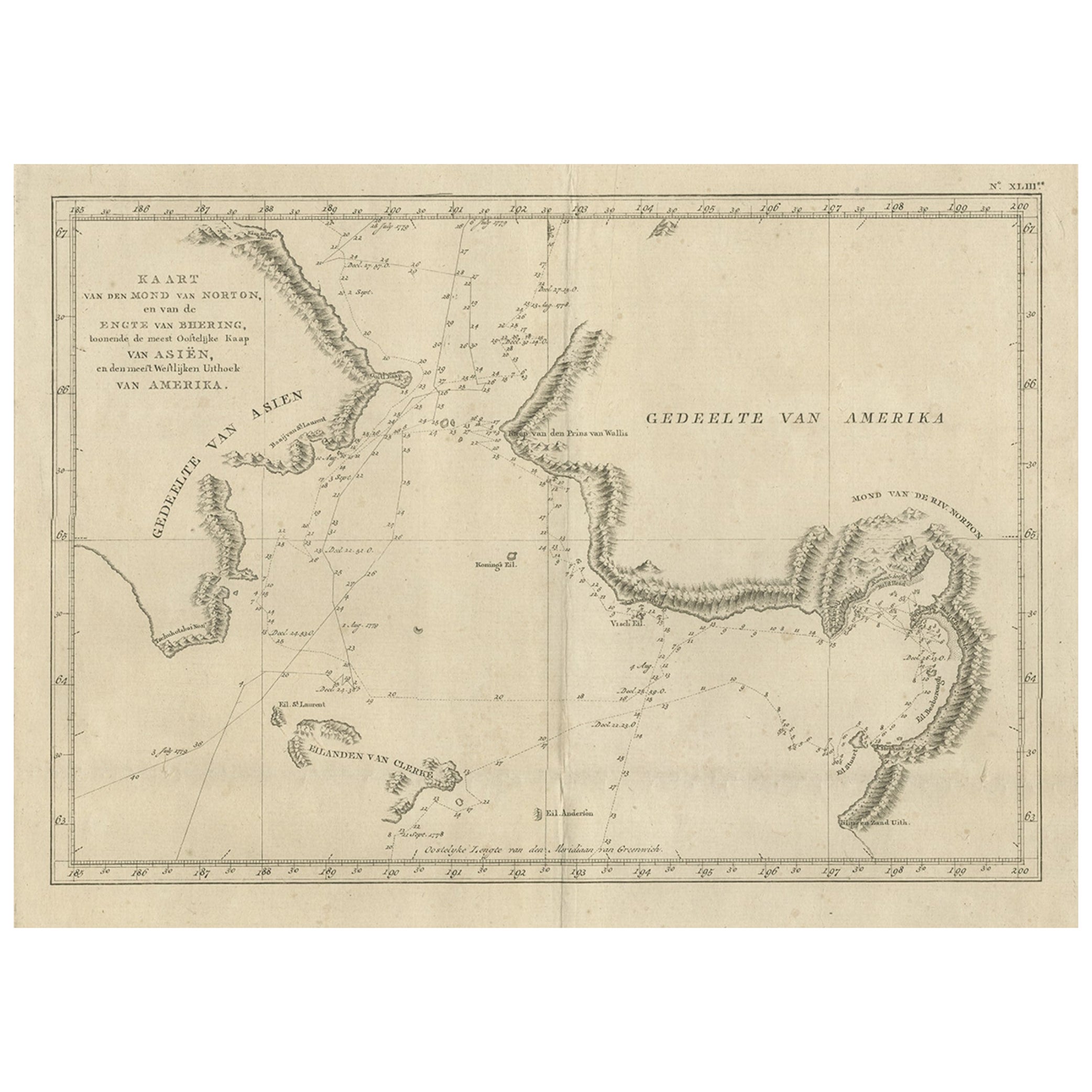
- Original Copper Engraved Map of the Bering Strait by Captain Cook, 1803Located in Langweer, NLAntique map titled 'Kaart van den Mond van Norton, en van de Engte van Bhering, toonende de meest Oostlijke Kaap van Asien, en den meest Westlijken Urthoek van Amerika'. Map of t...Category
Antique Early 1800s Maps
MaterialsPaper
- Antique Map of the Friendly Islands by Cook, 1803Located in Langweer, NLAntique map Friendly Islands titled 'Kaart van de Vrienden-Eilanden'. Antique map of the Friendly Islands depicting Rotterdam or Anamocka, Middelburg or Eaoowe and Amsterdam or Tonga...Category
Antique 19th Century Maps
MaterialsPaper


You May Also Like
- Captain Cook's Exploration of Tahiti 18th C. Hand-Colored Map by BellinBy Jacques-Nicolas BellinLocated in Alamo, CAThis beautiful 18th century hand-colored copper plate engraved map is entitled "Carte de l'Isle de Taiti, par le Lieutenant J. Cook" was created by Jacques Nicolas Bellin and publish...Category
Antique Mid-18th Century French Maps
MaterialsPaper
- Antique 1803 Italian Map of Asia Including China Indoneseia IndiaLocated in Amsterdam, Noord HollandAntique 1803 Italian Map of Asia Including China Indoneseia India Very nice map of Asia. 1803. Additional information: Type: Map Country of Manufacturing: Europe Period: 19th centu...Category
Antique 19th Century European Maps
MaterialsPaper
 $584 Sale Price20% Off
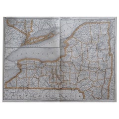
 - Large Original Antique Map of New York, USA, 1894By Rand McNally & Co.Located in St Annes, LancashireFabulous map of New York. Original color. By Rand, McNally & Co. Published, 1894 Unframed Free shipping.Category
Antique 1890s American Maps
MaterialsPaper
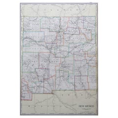
- Large Original Antique Map of New Mexico, Usa, C.1900Located in St Annes, LancashireFabulous map of New Mexico. Original color. Engraved and printed by the George F. Cram Company, Indianapolis. Published, C.1900. Unframed. Free shipping.Category
Antique 1890s American Maps
MaterialsPaper
- Original Antique Map of New Brunswick and Nova Scotia, 1889Located in St Annes, LancashireGreat map of New Brunswick and Nova Scotia Drawn and Engraved by W. & A.K. Johnston Published By A & C Black, Edinburgh. Original colour Unfr...Category
Antique 1880s Scottish Victorian Maps
MaterialsPaper
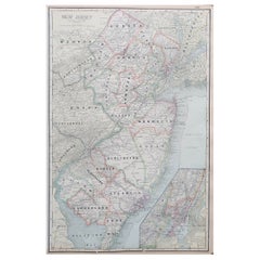
- Large Original Antique Map of New Jersey, USA, circa 1900Located in St Annes, LancashireFabulous map of New Jersey Original color Engraved and printed by the George F. Cram Company, Indianapolis. Published, circa 1900 Unframed Repairs to minor edge tearsCategory
Antique 1890s American Maps
MaterialsPaper