Austrian Maps
to
24
24
1
23
1
1
23
1
1
1
13,720
1,081
395
269
253
24
24
24
Place of Origin: Austrian
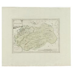
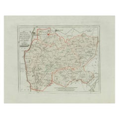
Zevenwolden, Friesland – von Reilly antique map, 1791
Located in Langweer, NL
Title: Zevenwolden, Friesland – von Reilly antique map, 1791
Fine late-18th-century engraved map of the region of Zevenwolden in Friesland, the Netherlands. Published in 1791 for Fr...
Category
18th Century Antique Austrian Maps
Materials
Paper
Ottoman Empire in Europe – Antique Map by Reilly, Vienna, 1796
Located in Langweer, NL
Map of the Ottoman Empire in Europe – Reilly, Vienna circa 1794-1796
This large original antique map, titled “Karte von dem Oschmanischen Reiche in Europa,” was published between 17...
Category
Late 18th Century Antique Austrian Maps
Materials
Paper
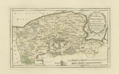
Antique Map of Leeuwarden and Dokkum, Friesland by von Reilly, 1791
Located in Langweer, NL
Antique Map of Leeuwarden and Dokkum, Friesland by von Reilly, 1791
Original hand-colored map titled 'Der Provinz Oostergo fünf nördliche Grietenyen, mit der Stadt Leeuwarden und D...
Category
Late 18th Century Antique Austrian Maps
Materials
Paper
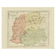
Antique General Map of Friesland – Dutch Provincial Map by von Reilly, 1791
Located in Langweer, NL
Antique General Map of Friesland by von Reilly, 1791
Original engraved map titled Friesland No. 640, published in Vienna in 1791. This sheet is the general overview of the province ...
Category
18th Century Antique Austrian Maps
Materials
Paper
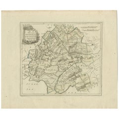
Antique Map of Zevenwolden, Friesland by von Reilly, 1791
Located in Langweer, NL
Antique Map of Zevenwolden, Friesland by von Reilly, 1791
Original engraved map titled Der Provinz Zevenwolden fünf westliche Grietenyen No. 644, published in Vienna in 1791. This s...
Category
18th Century Antique Austrian Maps
Materials
Paper
Antique Map of Sneek and Bolsward, Friesland – Dutch Provincial Map, 1791
Located in Langweer, NL
Antique Map of Sneek and Bolsward, Friesland by von Reilly, 1791
Original engraved map titled Der Provinz Westergo drey mittlere Grietenyen, mit der Stadt Bolsward und Sneek No. 641...
Category
18th Century Antique Austrian Maps
Materials
Paper
Antique Dutch Map – Westergo Region in Friesland by von Reilly, 1791
Located in Langweer, NL
Antique Map of Westergo, Friesland by von Reilly, 1791
Original engraved map titled Westergoo No. 640, published in Vienna in 1791. This sheet presents the region of Westergo, the h...
Category
18th Century Antique Austrian Maps
Materials
Paper
Antique Map of Eastern Oostergo, Friesland by von Reilly, 1791
Located in Langweer, NL
Antique Map of Eastern Oostergo, Friesland by von Reilly, 1791
Original engraved map titled Der Provinz Oostergo sechs östliche Grietenyen No. 643, published in Vienna in 1791. This...
Category
18th Century Antique Austrian Maps
Materials
Paper
Antique Map of Leeuwarden and Dokkum, Friesland by von Reilly, 1791
Located in Langweer, NL
Antique Map of Leeuwarden and Dokkum, Friesland by von Reilly, 1791
Original engraved map titled Der Provinz Oostergo fünf nördliche Grietenyen, mit der Stadt Leeuwarden und Dokkum ...
Category
18th Century Antique Austrian Maps
Materials
Paper
Antique Map of Oostergo, Friesland by von Reilly, 1791
Located in Langweer, NL
Antique Map of Oostergo, Friesland by von Reilly, 1791
Original engraved map titled 'Oostergo No. 643', published in Vienna in 1791. This map depicts the historic region of Oostergo...
Category
18th Century Antique Austrian Maps
Materials
Paper
Antique Map of Southern Westergo, Friesland by von Reilly, 1791
Located in Langweer, NL
Antique Map of Southern Westergo, Friesland by von Reilly, 1791
Original engraved map titled Westergoo Norde, published in Vienna in 1791. This sheet depicts the southern and coasta...
Category
18th Century Antique Austrian Maps
Materials
Paper
Antique Map of Franeker and Harlingen, Friesland by von Reilly, 1791
Located in Langweer, NL
Antique Map of Franeker and Harlingen, Friesland by von Reilly, 1791
Original engraved map titled Der Provinz Westergo vier nördliche Grietenyen mit der Stadt Franeker und Harlingen...
Category
18th Century Antique Austrian Maps
Materials
Paper
Rare 1791 von Reilly Map of Friesland Province, Netherlands, 18th Century
Located in Langweer, NL
Antique General Map of Friesland by von Reilly, 1791
Original engraved map titled *Friesland*, published in Vienna in 1791. This is the general overview map of the province of Fries...
Category
Late 18th Century Antique Austrian Maps
Materials
Paper
Rare Antique Hand-Colored Map of Eastern Friesland by von Reilly, 1791
Located in Langweer, NL
Antique Map of Eastern Friesland by von Reilly, 1791
Original engraved map titled Der Provinz Vriesenland vier östliche Grietenyen, published in Vienna in 1791. This detailed sheet ...
Category
Late 18th Century Antique Austrian Maps
Materials
Paper
Antique Map of Sneek and Surroundings, Friesland by von Reilly, 1791
Located in Langweer, NL
Antique Map of Sneek and Surroundings, Friesland by von Reilly, 1791
Original 18th-century engraved map titled Der Provinz Westergo drey mittlere Grietenyen, mit der Stadt Bolsward ...
Category
Late 18th Century Antique Austrian Maps
Materials
Paper
Antique Map of Zevenwolden by Von Reilly, 1791
Located in Langweer, NL
Friesland Zevenwouden eastern districts map, Reilly, Vienna, c.1791–95
Description:
Engraved map with original hand color of the Zevenwouden (Seven Forests) region in Friesland, Net...
Category
18th Century Antique Austrian Maps
Materials
Paper
Antique Map of Oostergo, Friesland, by Von Reilly, 1791
Located in Langweer, NL
Title: Oostergo, Friesland – von Reilly antique map, 1791
Fine original 18th-century engraved map of Oostergo, one of the historic quarters of Friesland, the Netherlands. Published ...
Category
18th Century Antique Austrian Maps
Materials
Paper
Austria by Wolfgang Lazius – A Magnificent 16th-Century Map from Ortelius, 1592
Located in Langweer, NL
Title:
Avstriae Descrip – Wolfgang Lazius’ Map of Austria, 16th Century
Description:
This extraordinary map of Austria pays homage to the Austrian humanist and cartographer Wo...
Category
16th Century Antique Austrian Maps
Materials
Paper
Rare 1791 von Reilly Map of Franeker and Harlingen, Friesland, Netherlands
Located in Langweer, NL
Antique Map of Franeker and Harlingen by von Reilly, 1791
Fine original map titled Der Provinz Westergo vier nördliche Grietenyen mit der Stadt Franeker und Harlingen, published in ...
Category
18th Century Antique Austrian Maps
Materials
Paper
Two Impressive Huge Midcentury World Map Wall Globes, 95" Diameter, 1950s
Located in Vienna, AT
We proudly offer this outstanding pair of very large wall-mounted modernist globes / world maps with an incredible diameter of 95 inches each. Unique one-of-a-kind sculptures depicti...
Category
Mid-20th Century Mid-Century Modern Austrian Maps
Materials
Aluminum, Iron
Antique map Westerkwartier Groningen by von Reilly, Vienna, 1791
Located in Langweer, NL
Title: Antique map Westerkwartier Groningen by von Reilly, Vienna, 1791
Engraved map with original hand color of the Westerkwartier (western quarter) of the province of Groningen, N...
Category
18th Century Antique Austrian Maps
Materials
Paper
Antique Map of Friesland by Von Reilly, 1791
Located in Langweer, NL
Antique map titled 'Friesland'. Map of the province of Friesland, the Netherlands. This map orginates from 'Schauplatz der fünf Theile der Welt'. Artists and Engravers: Franz Joseph ...
Category
18th Century Antique Austrian Maps
Materials
Paper
Bolsward & Sneek, Westergo (Friesland) – von Reilly antique map, 1791
Located in Langweer, NL
Title: Bolsward & Sneek, Westergo (Friesland) – von Reilly antique map, 1791
Description:
Crisp late-18th-century map of the Westergo region in Friesland focusing on the “drey mittl...
Category
18th Century Antique Austrian Maps
Materials
Paper
Antique Map of the Region of Gaasterland, Friesland, The Netherlands, 1791
Located in Langweer, NL
Antique map of Gaasterland with towns of Friesland by von Reilly, 1791
Antique engraved map with original hand color of the southern Friesland region known as Gaasterland, titled “D...
Category
18th Century Antique Austrian Maps
Materials
Paper
Related Items
Antique Map of Principality of Monaco
By Antonio Vallardi Editore
Located in Alessandria, Piemonte
ST/619 - "Old Geographical Atlas of Italy - Topographic map of ex-Principality of Monaco" -
ediz Vallardi - Milano -
A somewhat special edition ---
Category
Late 19th Century Other Antique Austrian Maps
Materials
Paper
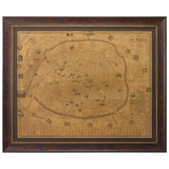
Plan of Paris, France, by A. Vuillemin, Antique Map, 1845
Located in Colorado Springs, CO
This large and detailed plan of Paris was published by Alexandre Vuillemin in 1845. The map conveys a wonderful amount of information and is decorated throughout with pictorial vigne...
Category
1840s Antique Austrian Maps
Materials
Paper
Original Antique Map of North America by Dower, circa 1835
Located in St Annes, Lancashire
Nice map of North America
Drawn and engraved by J.Dower
Published by Orr & Smith. C.1835
Unframed.
Free shipping
Category
1830s Antique Austrian Maps
Materials
Paper
Original Antique Map of The World by Dower, circa 1835
Located in St Annes, Lancashire
Nice map of the World
Drawn and engraved by J.Dower
Published by Orr & Smith. C.1835
Unframed.
Free shipping
Category
1830s Antique Austrian Maps
Materials
Paper
Large European 1930's Nautical Map Reader Magnifying Glass
Located in Haddonfield, NJ
This European set of two nautical magnifying glass map-readers are quite unusual and rarely found. It is fully encased in it's heavy wooden and metal enforced box. Hailing from betwe...
Category
1930s Industrial Vintage Austrian Maps
Materials
Metal
$2,000 Sale Price
20% Off
H 5.95 in W 15.8 in D 15.8 in
Caravaggism in Europe by Benedict Nicolson
Located in Middletown, NY
Torino: Umberto Allemandi, 1990. Second Edition, Revised and Enlarged by Luisa Vertova.
3 volumes in slipcase with text and 1648 palates covering Caravaggio and Italian Caravaggism...
Category
Late 20th Century Austrian Maps
Materials
Paper
Celestial Table Globe, Charles-François Delamarche, Paris, 1791
By Charles Francois Delamarche
Located in Milano, IT
Celestial table globe
Charles-François Delamarche
Paris, 1791
It measures: 17.13 in in height, Ø max 27.7 in; the sphere Ø 7.09 in
(h 43.5 cm x Ø max 27.7 cm; the sphere Ø 18 cm).
W...
Category
1790s Other Antique Austrian Maps
Materials
Metal
Original Antique Map of Sweden, Engraved by Barlow, 1806
Located in St Annes, Lancashire
Great map of Sweden
Copper-plate engraving by Barlow
Published by Brightly & Kinnersly, Bungay, Suffolk. 1806
Unframed.
Category
Early 1800s Antique Austrian Maps
Materials
Paper
Large Original Antique Map of Ireland. C.1900
Located in St Annes, Lancashire
Fabulous map of Ireland
Original color.
Engraved and printed by the George F. Cram Company, Indianapolis.
Published, C.1900.
Unframed.
Free shipping.
Category
1890s Antique Austrian Maps
Materials
Paper
Original Antique Map of Spain and Portugal, circa 1790
Located in St Annes, Lancashire
Super map of Spain and Portugal
Copper plate engraving by A. Bell
Published, circa 1790.
Unframed.
Category
1790s Other Antique Austrian Maps
Materials
Paper
1812 United States Map, by Pierre Tardieu, Antique French Map Depicting the U.S.
By Pierre François Tardieu
Located in Colorado Springs, CO
1812 "United States of Nth America -- Carte des Etats-Unis De L'Amerique Septentrionale" Two-Sheet Map by Tardieu
This attractive map, published in Paris in 1812, is one of the most rare large format maps from the period. It features a view of the East Coast of the U.S. from Maryland to just below South Carolina. Additionally, Ellicott’s plan for the City of Washington D.C. is included at the top right and an illustration of Niagara Falls is shown at the bottom right with a description in both French and English. This extremely detailed map not only depicts the mountainous regions of the southeastern U.S., but also includes names of regions, rivers, and towns.
Based on the first state of Arrowsmith’s 4-sheet map of the United States, this map is completely engraved by Tardieu in Paris and showcases high quality engravings. This detailed map of the recently independent United States includes one of the largest and earliest examples of the Ellicott plan of Washington DC.
The artist, Pierre François Tardieu (PF Tardieu) was a very well-known map engraver, geographer, and illustrator. Awarded a bronze medal by King Louis-Phillipe for the accuracy and beauty of his map-making, Tardieu produced many fine works including maps of Louisiana...
Category
1810s Antique Austrian Maps
Materials
Paper
$5,750
H 43.5 in W 48 in D 2.25 in
1864 Map of North America, Antique Hand-Colored Map, by Adolphe Hippolyte Dufour
Located in Colorado Springs, CO
Offered is a map of North America entitled Amerique du Nord from 1864. This rare, separately published wall map was produced by Adolphe Hippolyte Dufour. This map includes vibrant an...
Category
1860s Antique Austrian Maps
Materials
Paper
$4,500
H 44.5 in W 33 in D 1.5 in
Previously Available Items
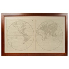
Antique World Map Published in Vienna 1786 by Franz Anton Schraembl
Located in Milan, IT
Large world map by cartographer Jean Baptist D'Anvile revised and republished in Vienna in 1786 by Franz Anton Schraembl. It is a geographical map prin...
Category
1780s Antique Austrian Maps
Materials
Glass, Wood, Paper
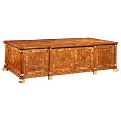
Imperial Map Desk of the Habsburg Empire
Located in New Orleans, LA
This monumental, one-of-a-kind map desk hails from the Imperial Palace of the Habsburg Emperor Franz Joseph I, ruler of both Austria and Hungary from 1848 until 1916. The incredible, massive desk features 28 flat drawers — seven on each side — which were used to store not only important maps of the empire, but also irreplaceable architectural drawings of palaces, cathedrals and other civil structures. Biedermeier in style, it is crafted from birch, which was then one of the rarest, most expensive materials used by cabinet makers. It is absolutely, without question, the finest desk of its kind in existence, and it is certainly without peer in terms of engineering, craftsmanship and provenance.
The entire surface of the giant desk...
Category
19th Century Other Antique Austrian Maps
Materials
Satinwood, Walnut, Wood
Two 19th Century Austrian Parade Pickle Helmets
Located in Buchanan, MI
Two 19th century Austrian parade pickle helmets. Letter with gilt metal mounts.
Category
19th Century Antique Austrian Maps
Materials
Leather
La France School Map from Austrian Library
Located in Los Angeles, CA
Extra Large map lithograph on canvas .
Category
1960s Vintage Austrian Maps
Recently Viewed
View AllMore Ways To Browse
Table Vigneron
Tall Wooden Cabinets
Tea Caddy Japan
Tea Clipper
Teak Desk By Kai Kristiansen
Teak Fish
Theodore Alexander Chest
Tigers Eye Sculptures
Tip Top Table
Tole Cabinets
Torring Denmark
Toso Bird
Trapezoid Cabinet
Tree Trunk Sculptures
Tulip Vase Silver
Unusual Dresser
Used 2 Drawer Wood File Cabinet
Used Communion Set
