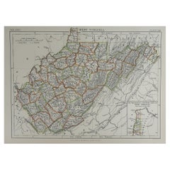
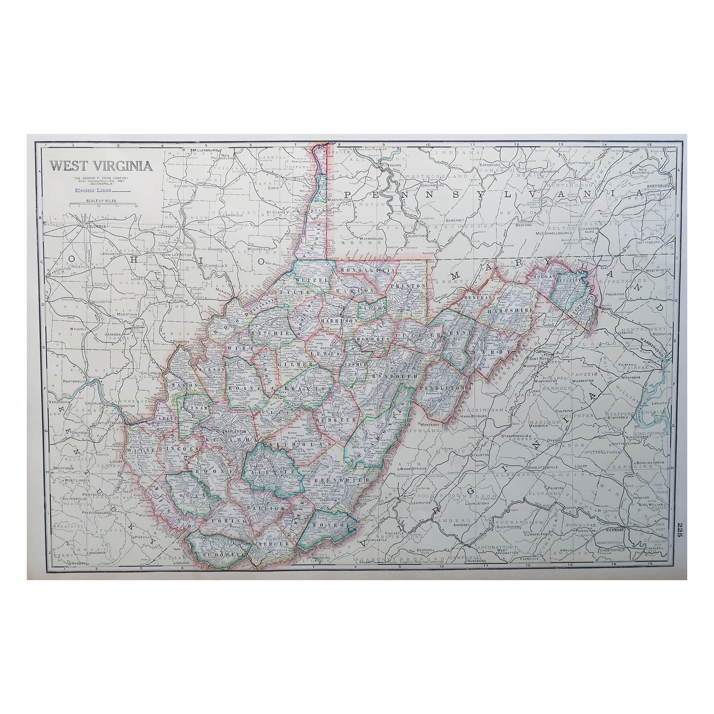
Original Antique Map of The American State of West Virginia, 1889
View Similar Items


Want more images or videos?
Request additional images or videos from the seller
1 of 5
Original Antique Map of The American State of West Virginia, 1889
About the Item
- Dimensions:Height: 8 in (20.32 cm)Width: 11 in (27.94 cm)Depth: 0.07 in (1.78 mm)
- Style:Victorian (Of the Period)
- Materials and Techniques:Paper,Other
- Place of Origin:
- Period:
- Date of Manufacture:1889
- Condition:Wear consistent with age and use.
- Seller Location:St Annes, GB
- Reference Number:1stDibs: LU1836324700292
About the Seller
4.9
Platinum Seller
These expertly vetted sellers are 1stDibs' most experienced sellers and are rated highest by our customers.
1stDibs seller since 2016
2,595 sales on 1stDibs
Associations
International Confederation of Art and Antique Dealers' Associations
More From This SellerView All
- Original Antique Map of the American State of Nevada, 1889Located in St Annes, LancashireGreat map of Nevada Drawn and Engraved by W. & A.K. Johnston Published By A & C Black, Edinburgh. Original colour Unframed.Category
Antique 1880s Scottish Victorian Maps
MaterialsPaper
- Original Antique Map of the American State of Oregon, 1889Located in St Annes, LancashireGreat map of Oregon Drawn and Engraved by W. & A.K. Johnston Published By A & C Black, Edinburgh. Original colour Unframed.Category
Antique 1880s Scottish Victorian Maps
MaterialsPaper
- Original Antique Map of the American State of Pennsylvania, 1889Located in St Annes, LancashireGreat map of Pennsylvania Drawn and Engraved by W. & A.K. Johnston Published By A & C Black, Edinburgh. Original colour Unframed. Repair to a minor tear on bottom edge.Category
Antique 1880s Scottish Victorian Maps
MaterialsPaper
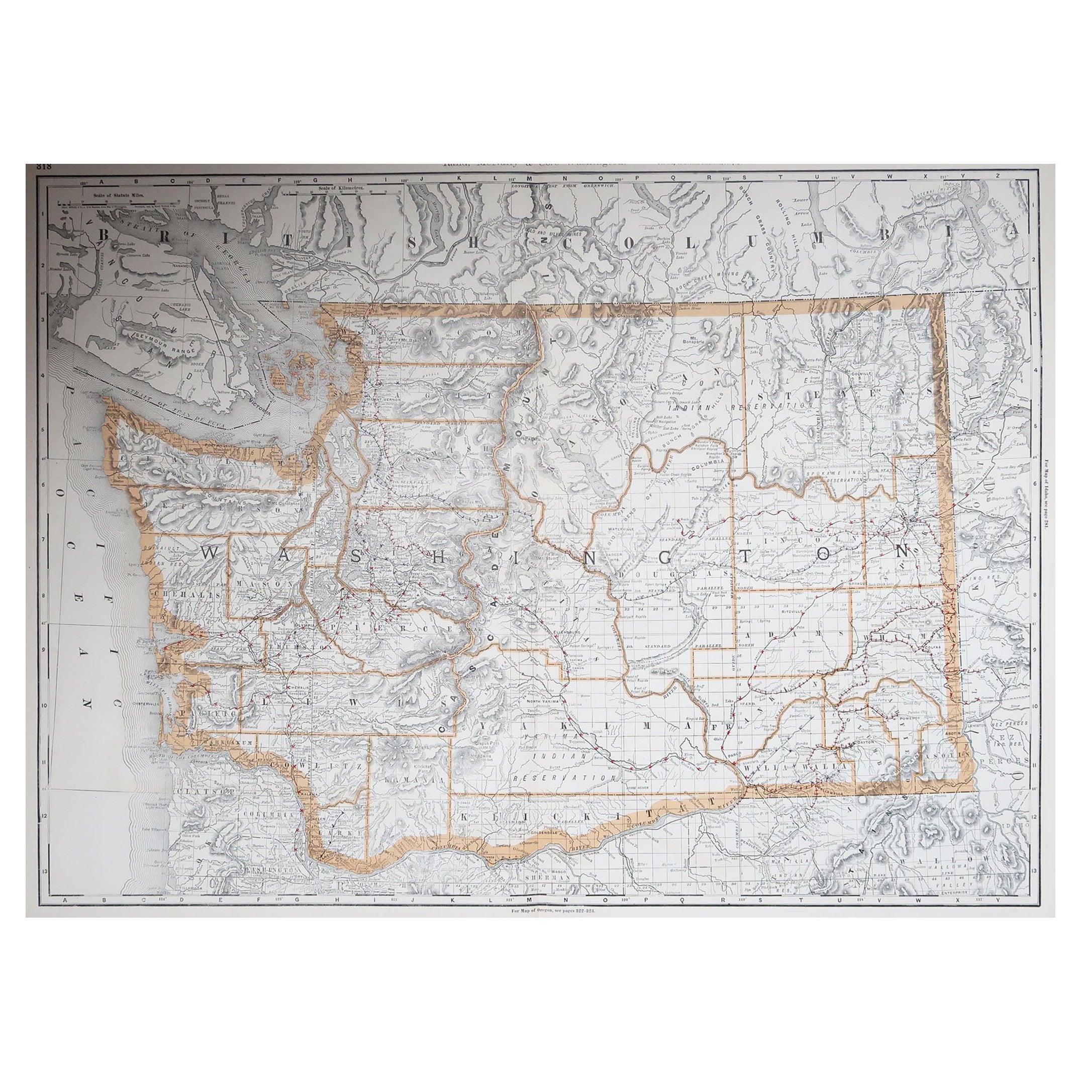
- Original Antique Map of the American State of Washington, 1889Located in St Annes, LancashireGreat map of Washington Drawn and Engraved by W. & A.K. Johnston Published By A & C Black, Edinburgh. Original colour Unframed.Category
Antique 1880s Scottish Victorian Maps
MaterialsPaper
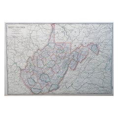
- Large Original Antique Map of West Virginia, USA, C.1900Located in St Annes, LancashireFabulous map of West Virginia Original color Engraved and printed by the George F. Cram Company, Indianapolis. Published, C.1900 Unframed Free shipping.Category
Antique 1890s American Maps
MaterialsPaper
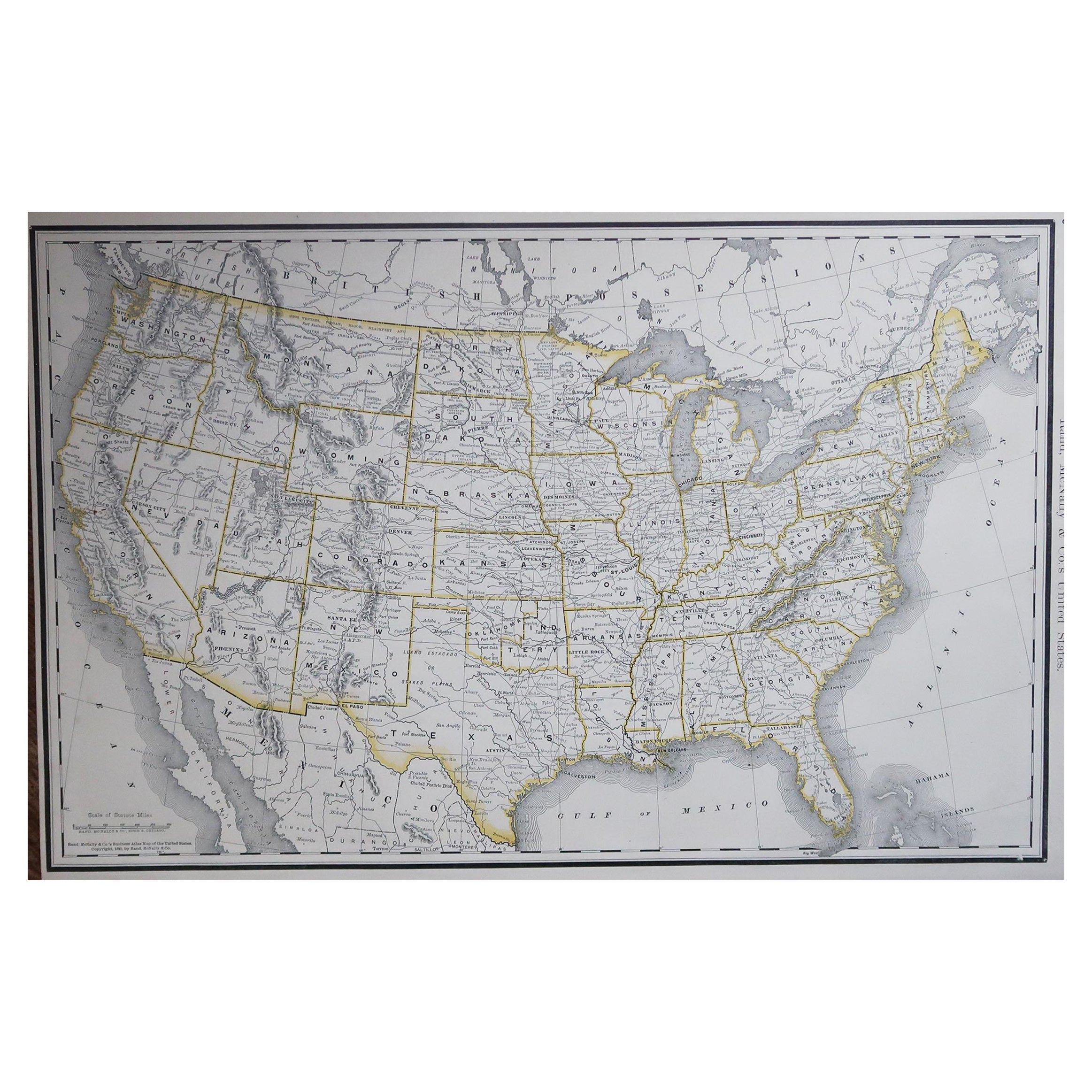
- Original Antique Map of The United States of America, circa 1890Located in St Annes, LancashireGreat map of the USA By The Stanford's Geographical Establishment Original colour Unframed.Category
Antique 1890s English Victorian Maps
MaterialsPaper


You May Also Like
- Gold Leaf Foil Pictorial Plan Map of the West Country of England Antique StyleLocated in GBWe are delighted to offer for sale this lovely Antique style pictorial plan map of the West Country of England etched in gold leaf foil This is a very interesting and decorative p...Category
20th Century English Adam Style Maps
MaterialsGold Leaf
 $245 Sale Price30% Off
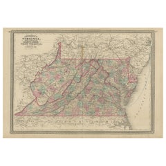
 - Antique Map of Virginia, with Inset Map of the Northern Part of West ViriginiaLocated in Langweer, NLAntique map titled 'West Virginia'. Original antique map of Virginia, United States. With inset map of the 'Panhandle' or northern part of West...Category
Antique Late 19th Century Maps
MaterialsPaper
- Antique Map of Virginia, Delaware, Maryland & West Virginia by Johnson, 1872Located in Langweer, NLAntique map titled 'Johnson's Viriginia (..). Original map of Virginia, Delaware, Maryland and West Virginia. This map originates from 'Johnson's New I...Category
Antique Late 19th Century Maps
MaterialsPaper
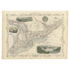
- Beautiful Decorative Hand-Colored Antique Map of West Canada, 1851Located in Langweer, NLDescription: Antique map of Canada titled 'West Canada'. With decorative vignettes titled Kingston and Falls of Niagara. Originates from 'The Illustrated Atlas, And Modern History Of The World Geographical, Political, Commercial & Statistical, Edited By R. Montgomery Martin'. Published; John Tallis London, New York, Edinburgh & Dublin. 1851. Drawn and Engraved by J. Rapkin. Artists and Engravers: John Tallis (1817-1876) was a British map...Category
Antique 1850s Maps
MaterialsPaper
- Original Engraved Antique Map of the World, Colorful and Decorative, C.1780By Pierre François TardieuLocated in Langweer, NLAntique map titled 'Mappemonde en Deux Hemispheres ou l'on a Indique les Nouvelles Decouvertes' - This handsome double hemisphere map presents a ...Category
Antique 18th Century Maps
MaterialsPaper
- Antique Map of North America by Dufour 'circa 1834'Located in Langweer, NLAntique map titled 'Amérique Septentrionale'. Uncommon map of North America. Published by or after A.H. Dufour, circa 1834. Source unknown, to be determined.Category
Antique Mid-19th Century Maps
MaterialsPaper