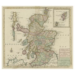
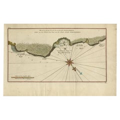
Original Antique Map of Scotland & The Orkney and Shetland islands, c1750
View Similar Items


Want more images or videos?
Request additional images or videos from the seller
1 of 7
Original Antique Map of Scotland & The Orkney and Shetland islands, c1750
About the Item
- Dimensions:Height: 15.16 in (38.5 cm)Width: 17.13 in (43.5 cm)Depth: 0 in (0.02 mm)
- Materials and Techniques:
- Period:1750-1759
- Date of Manufacture:circa 1750
- Condition:Repaired: Repair on folding line. Small hole above map, outside image border. Wear consistent with age and use. Condition: Good, repair on folding line. Small hole above map, outside image border. Original/contemporary hand coloring, please study image carefully.
- Seller Location:Langweer, NL
- Reference Number:Seller: BG-11537 1stDibs: LU3054327093442
About the Seller
5.0
Platinum Seller
These expertly vetted sellers are 1stDibs' most experienced sellers and are rated highest by our customers.
Established in 2009
1stDibs seller since 2017
1,946 sales on 1stDibs
More From This SellerView All
- Antique Map of Scotland With an Inset Map of the Shetland Islands, 1854Located in Langweer, NLStunning Map of Scotland that will look beautiful in any setting framed on the wall. Description: Large Antique map titled 'Scotland with its Islands, drawn from the Topographical surveys...Category
Antique 1850s Maps
MaterialsPaper
 $1,031 Sale Price24% Off
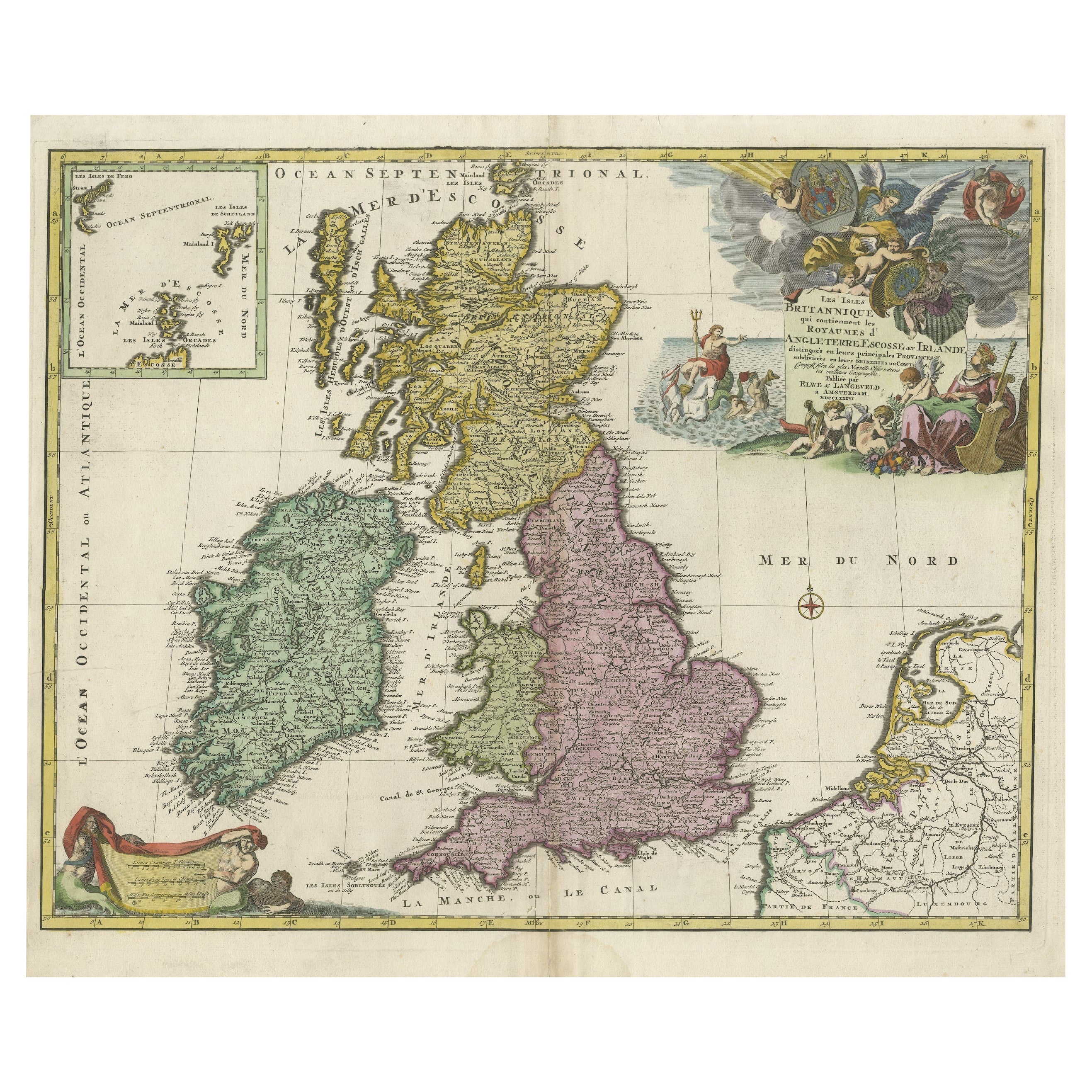
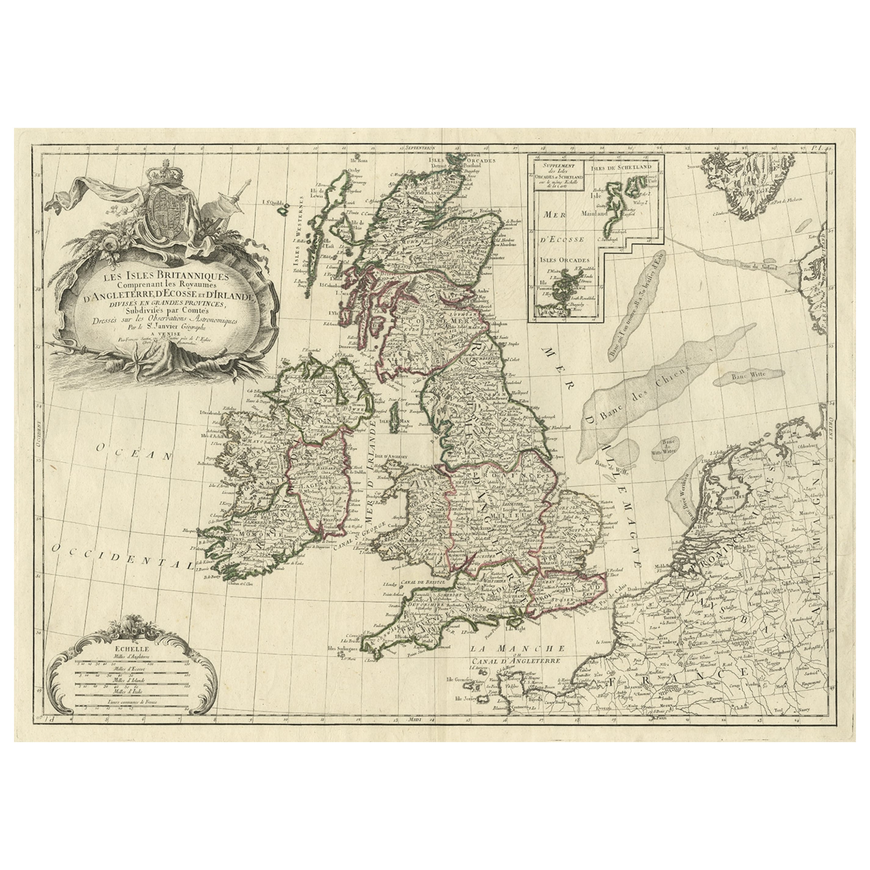
 - Old Map of the UK & Ireland, Insets of Orkney, Shetland and Faroe Islands, 1786Located in Langweer, NLTitle: "Les Isles Britanniques qui contiennent les Royaumes d'Angleterre, Escosse, et Irlande". Hand-colored engraved map with 2 (large) decorative cartouches, inset map of the O...Category
Antique 1780s Maps
MaterialsPaper
 $1,038 Sale Price30% Off
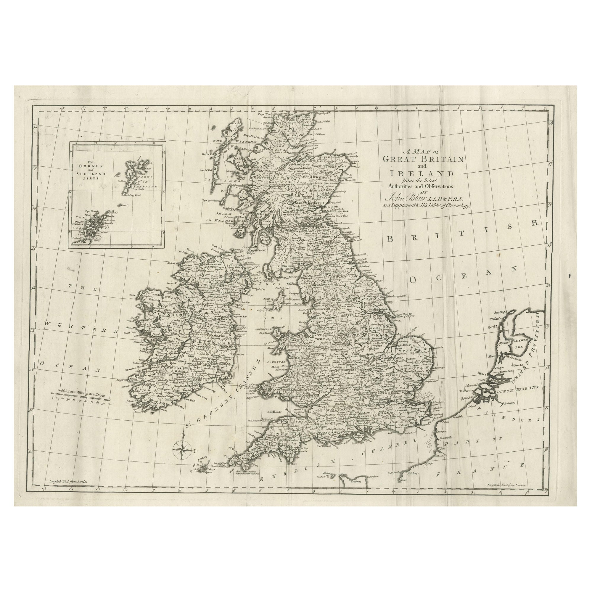
 - Large Antique Map of the British Isles, with inset of the Orkneys and ShetlandsLocated in Langweer, NLAntique map titled 'A Map of Great Britain and Ireland (..)'. Large antique map of the British Isles, with part of the French and Dutch coasts, and an inset of the Orkneys and Shetla...Category
Antique Late 18th Century Maps
MaterialsPaper
- Antique Sea Chart of the Shetland Islands, Scotland, ca.1745Located in Langweer, NLAntique map of Scotland titled 'Nieuwe Paskaard van Hitland met de daar omleggende eylanden na de nieuwe aftekening gemaakt by den Lofwaarden en onvermoeyden Hit en Zeeman Ian Bruyst...Category
Antique 1740s Maps
MaterialsPaper
 $1,099 Sale Price20% Off
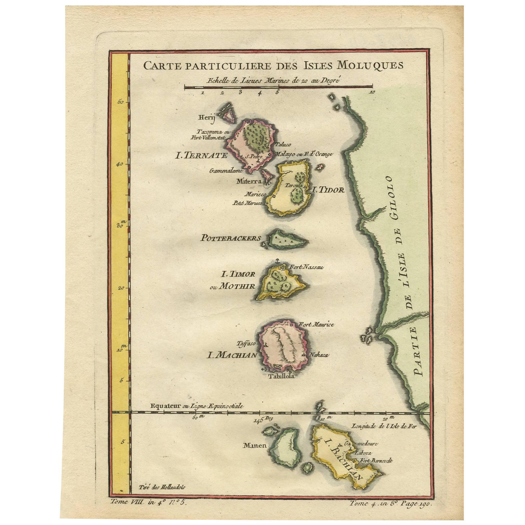
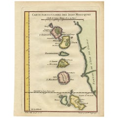
 - Antique Map of the Moluques Islands, Part of Indonesia, circa 1750Located in Langweer, NLMap of the Moluques (also known as the Moluccas, Moluccan Islands or simply Maluku). Depicts the islands of Herij, Ternate, Tidor, Pottebackers, Timor, Machian and Bachian.Category
Antique Mid-18th Century Maps
MaterialsPaper
 $150 Sale Price34% Off
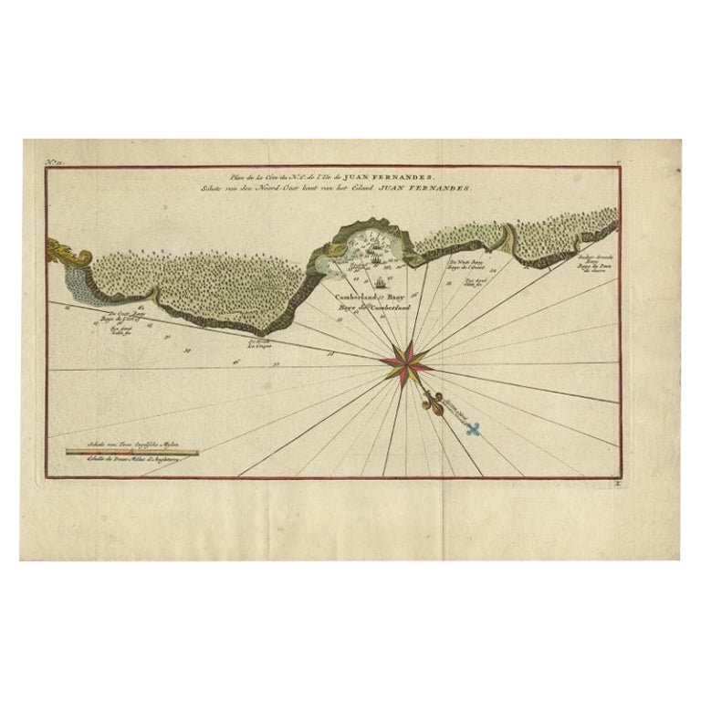
 - Antique Map of Juan Fernandez Island, Chile, c.1750Located in Langweer, NLAntique map titled 'Plan de la Côte du N.E. de l 'Ile de Juan Fernandes'. Map of the northeast coast of the island of Juan Fernandez with Cumberland Bay, South America. In 1740 A...Category
Antique 18th Century Maps
MaterialsPaper
You May Also Like
- Original Antique Map of The World by Thomas Clerk, 1817Located in St Annes, LancashireGreat map of The Eastern and Western Hemispheres On 2 sheets Copper-plate engraving Drawn and engraved by Thomas Clerk, Edinburgh. Published by Mackenzie And Dent, 1817 ...Category
Antique 1810s English Maps
MaterialsPaper
- Original Antique Map of Spain and Portugal, circa 1790Located in St Annes, LancashireSuper map of Spain and Portugal Copper plate engraving by A. Bell Published, circa 1790. Unframed.Category
Antique 1790s English Other Maps
MaterialsPaper
- Original Antique Map of Ireland- Tipperary and Waterford. C.1840Located in St Annes, LancashireGreat map of Tipperary and Waterford Steel engraving Drawn under the direction of A.Adlard Published by How and Parsons, C.1840 Unframed.Category
Antique 1840s English Maps
MaterialsPaper
- Original Antique Map of The Netherlands, Sherwood, Neely & Jones, Dated 1809Located in St Annes, LancashireGreat map of The Netherlands Copper-plate engraving by Cooper Published by Sherwood, Neely & Jones. Dated 1809 Unframed.Category
Antique Early 1800s English Maps
MaterialsPaper
- Original Antique Map of The Netherlands, Engraved by Barlow, Dated 1807Located in St Annes, LancashireGreat map of Netherlands Copper-plate engraving by Barlow Published by Brightly & Kinnersly, Bungay, Suffolk. Dated 1807 Unframed.Category
Antique Early 1800s English Maps
MaterialsPaper
- Original Antique Map of China, Arrowsmith, 1820Located in St Annes, LancashireGreat map of China Drawn under the direction of Arrowsmith Copper-plate engraving Published by Longman, Hurst, Rees, Orme and Brown, 1820 Unfr...Category
Antique 1820s English Maps
MaterialsPaper


