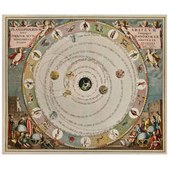
Planisphaerium Arteum, 1708
View Similar Items


1 of 1
Planisphaerium Arteum, 1708
About the Item
- Creator:Andreas Cellarius (Maker)
- Dimensions:Height: 18 in (45.72 cm)Width: 21 in (53.34 cm)Depth: 0.2 in (5.08 mm)
- Period:1700-1709
- Date of Manufacture:1708
- Condition:
- Seller Location:Houston, TX
- Reference Number:1stDibs: LU129322936182
You May Also Like
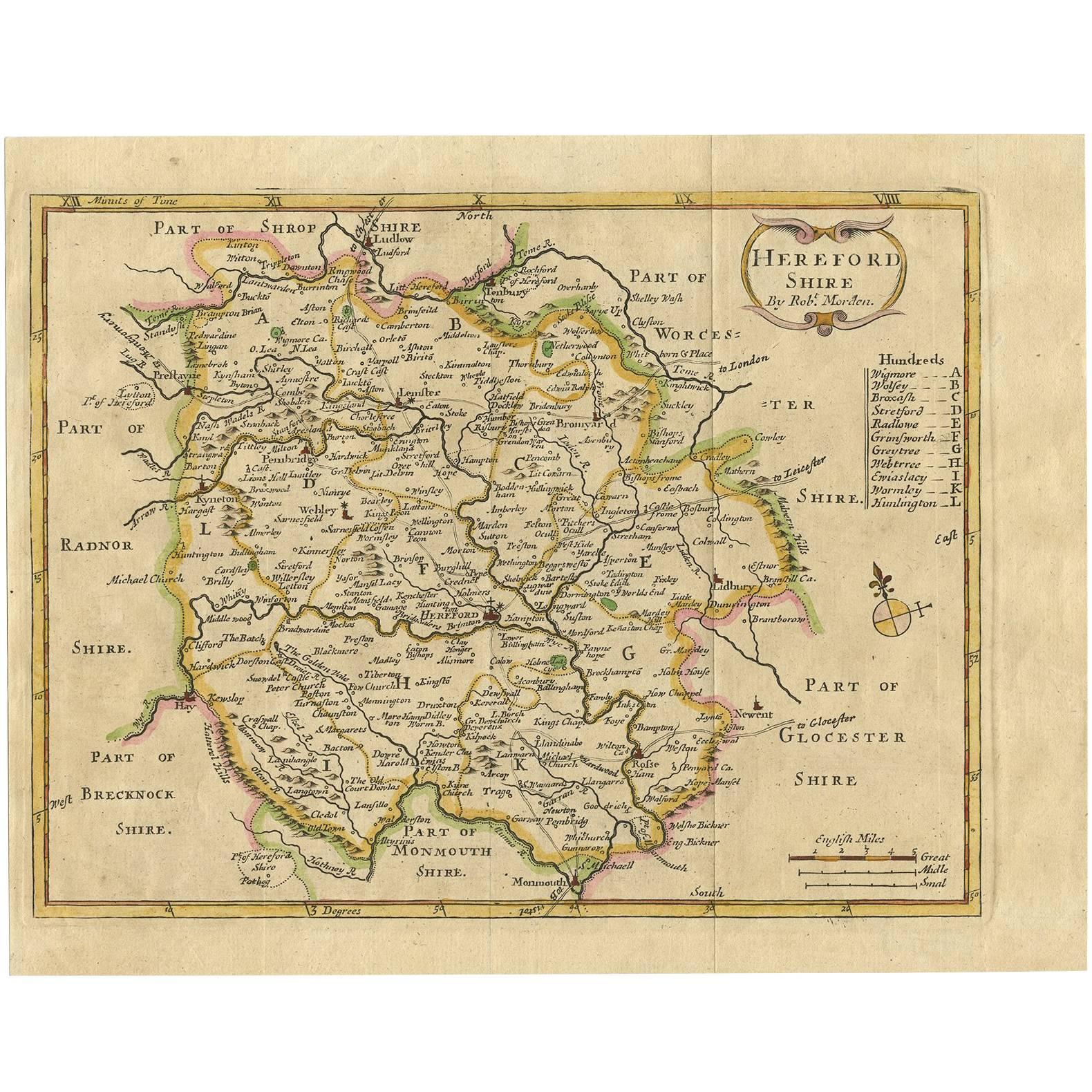
- Antique Map of Herefordshire 'England' by R. Morden, 1708Located in Langweer, NLThis antique County map of Herefordshire by Robert Morden was first published in 1701 in a work entitled 'The New Description and State of England'...Category
Antique Early 18th Century Maps
MaterialsPaper
 $164 Sale Price37% Off
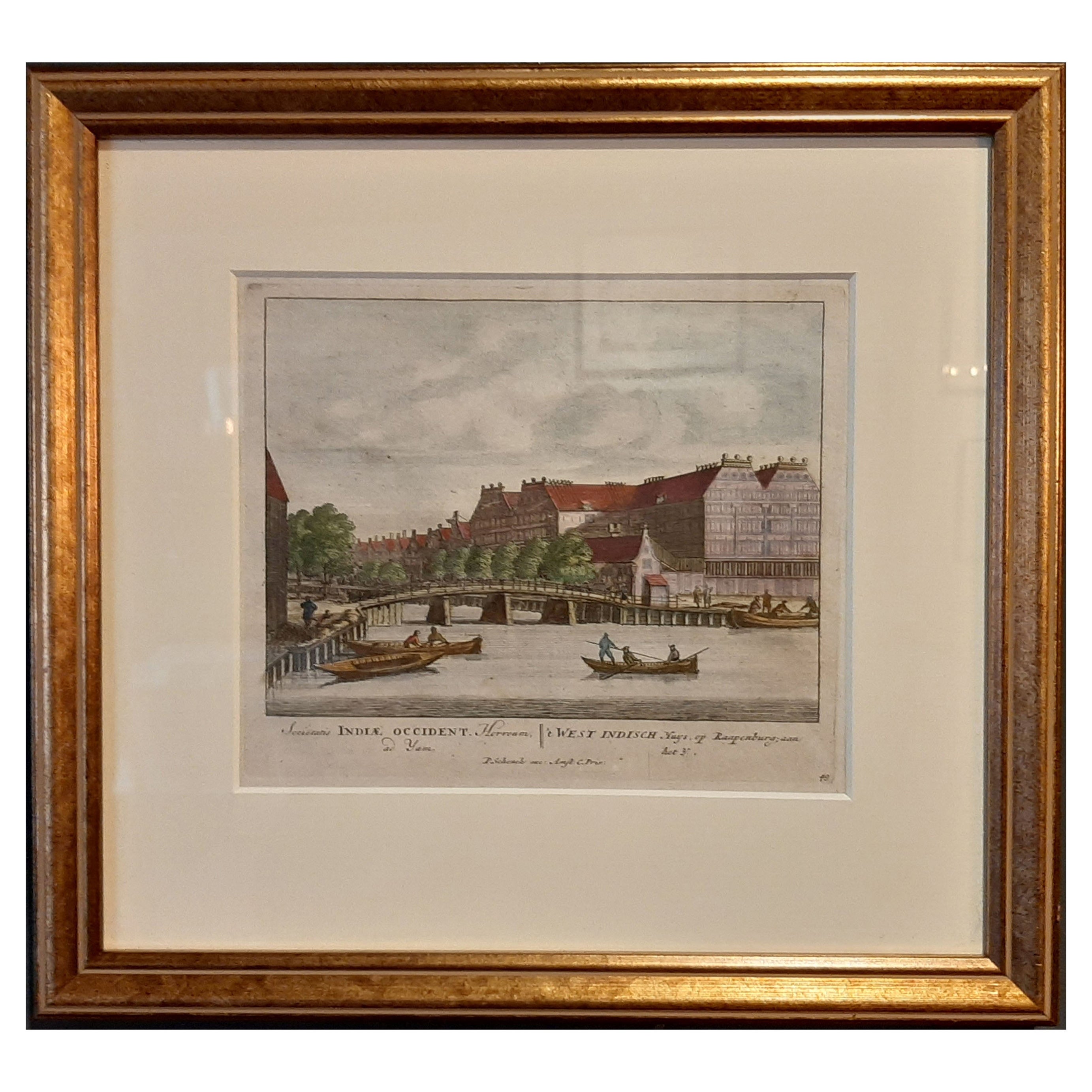
 - Framed View of the Brouwersgracht in Amsterdam, the Netherlands, 1708Located in Langweer, NLAntique print titled 'Societatis Indiae Occident (..) - West Indisch Huys op Raapenburg (..)'. Despite the title suggesting this print is a view of the West-Indisch House in Amst...Category
Antique Early 1700s Maps
MaterialsPaper
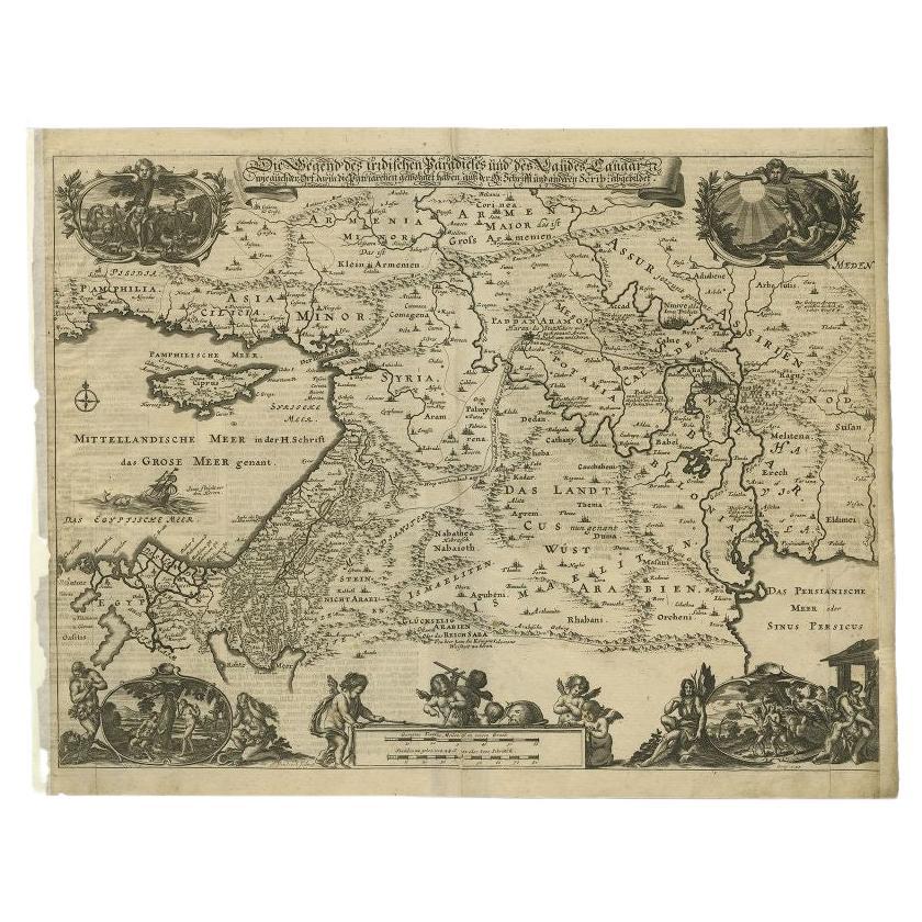
- Antique Map of the Middle East by Von Sandrart, 1708Located in Langweer, NLAntique map titled 'Die Gegend des Irdlisches Paradieses und des Landes Kanaan.' Map of the Middle East with a prominent Cyprus. The map shows the route of Abraham from Ur. Charming ...Category
Antique 18th Century Maps
MaterialsPaper
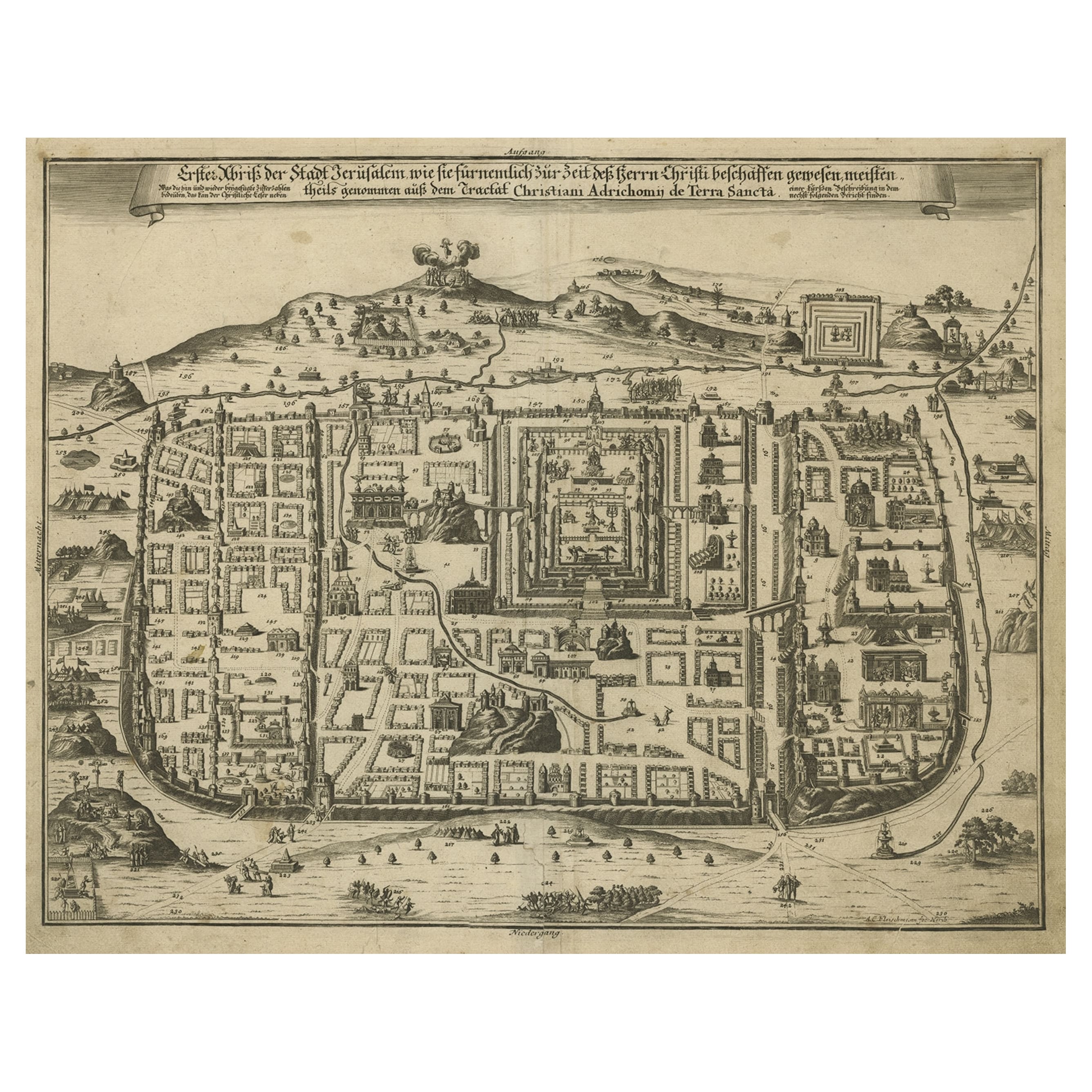
- Spectacular Antique Original Engraving of a Town Plan of Jerusalem, 1708Located in Langweer, NLDescription: Antique map titled 'Erster Abriss der Stadt Jerusalem wie sie Furnemblich zur Zeit des Hernn Christi beschaffen (..).' Spectacular town plan...Category
Antique Early 1700s Maps
MaterialsPaper
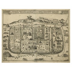 $1,182 Sale Price20% Off
 - Antique Map of the Eastern Hemisphere by Valk & Chenk '1708'Located in Langweer, NLAntique map titled 'Hemispherium Orbis Antiqui, Cumzonis Circulis, Et Sity populorum Diverso'. Decorative example of Andreas Cellarius's map of the Eastern Hemisphere, illustrating with climatic zones ranging from Frigida Borealis to Torrida, with planetary details superimposed. The elaborate border includes fine scrollwork, numerous putti, and additional diagrams showing armillary spheres and climatic zones. Andreas Cellarius was born in 1596 in Neuhausen and educated in Heidelberg. He emigrated to Holland in the early 17th century and 1637 moved to Hoorn, where he became the rector of the Latin School. Cellarius' best known work is his Harmonia Macrocosmica, first issued in 1660 by Jan Jansson, as a supplement to Jansson's Atlas Novus. The work consists of a series of Celestial Charts...Category
Antique Early 18th Century Maps
MaterialsPaper

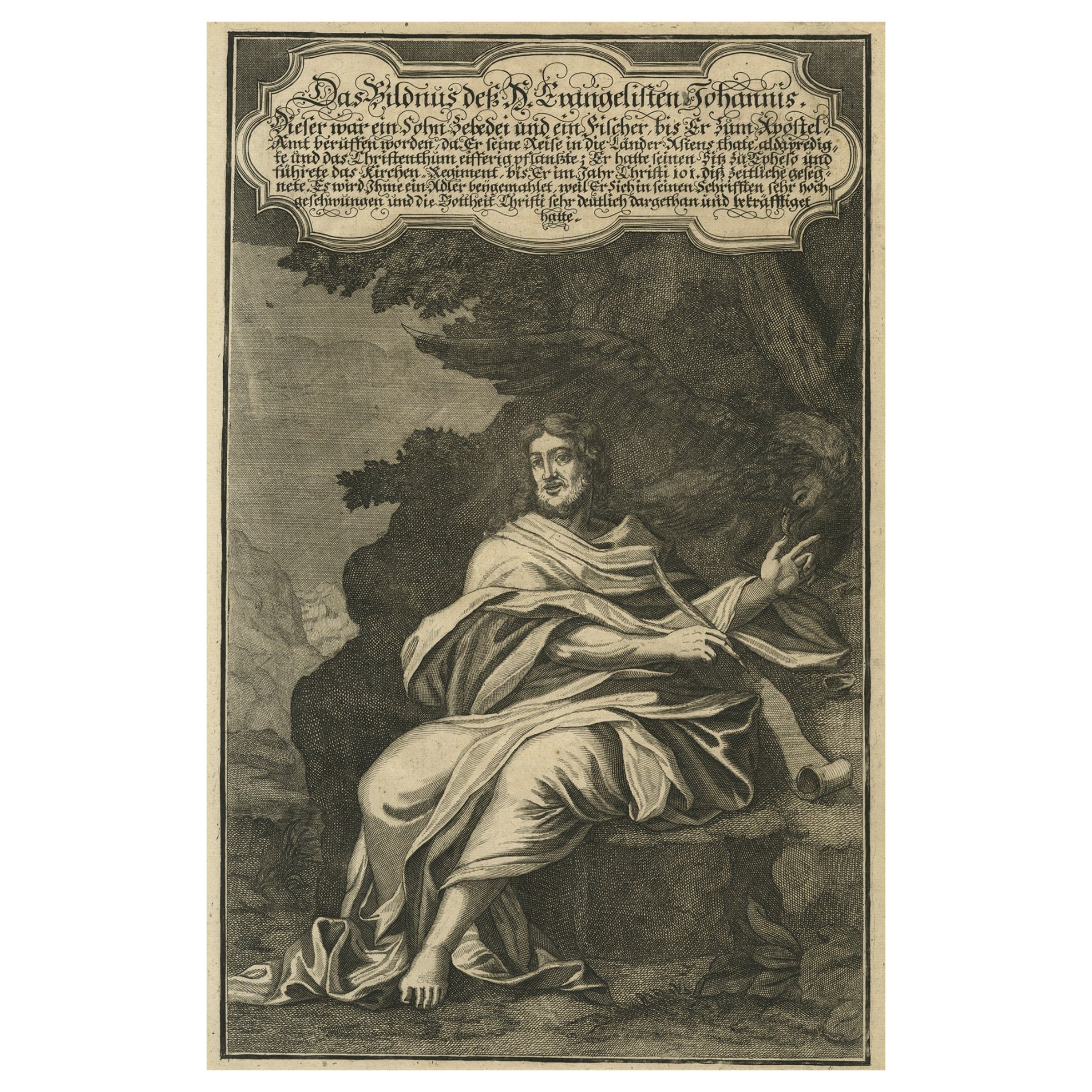
- Original Antique Copper Engraving of a Portrait of John the Evangelist, 1708Located in Langweer, NLAntique print, titled: 'Das Bildnus des H. Evangelisten Johannis (…).' - This original antique plate shows a portrait of John the Evangelist. From: Biblia : das ist die gantze He...Category
Antique Early 1700s Prints
MaterialsPaper


Recently Viewed
View AllMore Ways To Browse
Ree Brown
Winkler Prins
Very Large Map
Antique American Victorian Furniture
A Plan City And Castle Of Batavia
Cheshire Map
John Speed Isle Of Wight Maps
Malacca Strait Map
Antique Map Of South Korea
Antique Compass France
Isle Of Wight Maps
Carl Probst
Guatemala Antique Map
Antique Maps Washington Dc
Cyclades Map
Dao Antique Map
Eso Antique Maps
Map Of Charlevoix