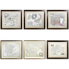
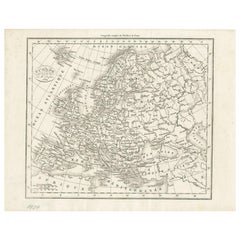
Six Framed Maps of Europe
View Similar Items


Want more images or videos?
Request additional images or videos from the seller
1 of 11
Six Framed Maps of Europe
About the Item
- Dimensions:Height: 30 in (76.2 cm)Width: 34 in (86.36 cm)Depth: 1 in (2.54 cm)
- Sold As:Set of 6
- Place of Origin:
- Period:1680-1689
- Date of Manufacture:1700
- Condition:Minor fading.
- Seller Location:Essex, MA
- Reference Number:1stDibs: LU83816832383
About the Seller
4.9
Gold Seller
These expertly vetted sellers are highly rated and consistently exceed customer expectations.
Established in 1985
1stDibs seller since 2007
815 sales on 1stDibs
Typical response time: 2 hours
Associations
The Art and Antique Dealers League of America
More From This SellerView All
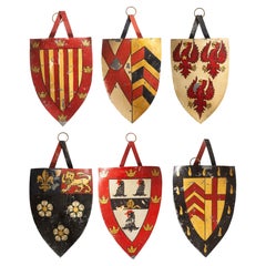
- Set of Six Painted Tole Oxford and Cambridge College CrestsLocated in Essex, MAShield shape each painted with a different college. Some identified on recerse.Category
Antique Late 19th Century English Decorative Art
MaterialsTin
- Pair of European Reverse Paintings on GlassLocated in Essex, MAAllegorical scenes with ebonized frames.Category
Antique 1790s European Decorative Art
MaterialsGlass
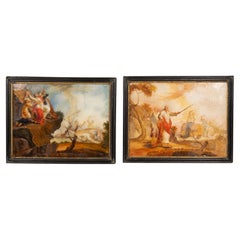 $1,250 / set
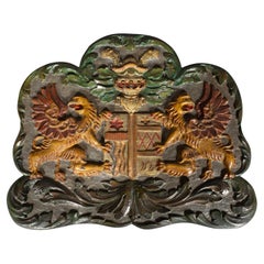
 - European Painted Wood Coat Of ArmsLocated in Essex, MAFeaturing a pair of winged griffons flanking a coat of arms with helmet.Category
Antique Early 19th Century European Arms, Armor and Weapons
MaterialsWood
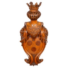
- European Carved Oak Coat Of ArmsLocated in Essex, MAWell carved cartouche with three central roundels under a jousting helmet and crown.Category
Antique Mid-19th Century European Renaissance Revival Arms, Armor and We...
MaterialsOak
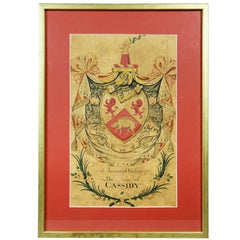
- Framed Coat of Arms for CassidyLocated in Essex, MAWatercolor on paper " The Armorial Ensign Of The Name Of Cassidy".Category
Antique Early 19th Century English Georgian Decorative Art
MaterialsOther
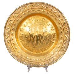
- European Brass Alms PlateLocated in Essex, MAAlms plates were used to collect donations during church services. This plate depicts Adam And Eve.Category
Antique Early 18th Century European Baroque Decorative Art
MaterialsBrass
You May Also Like
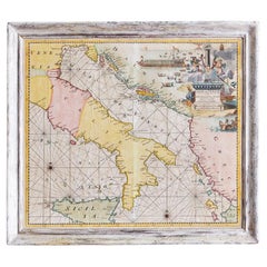
- 17th Century Nicolas Visscher Map of Southeastern EuropeLocated in Hamilton, OntarioA beautiful, highly detailed map of southeastern Europe by Nicolas Visscher. Includes regions of Northern Italy (showing the cities Bologna, Padua, and Venice), Bohemia, Austria (sho...Category
Antique 17th Century Dutch Maps
MaterialsPaper
 $1,350 Sale Price38% Off
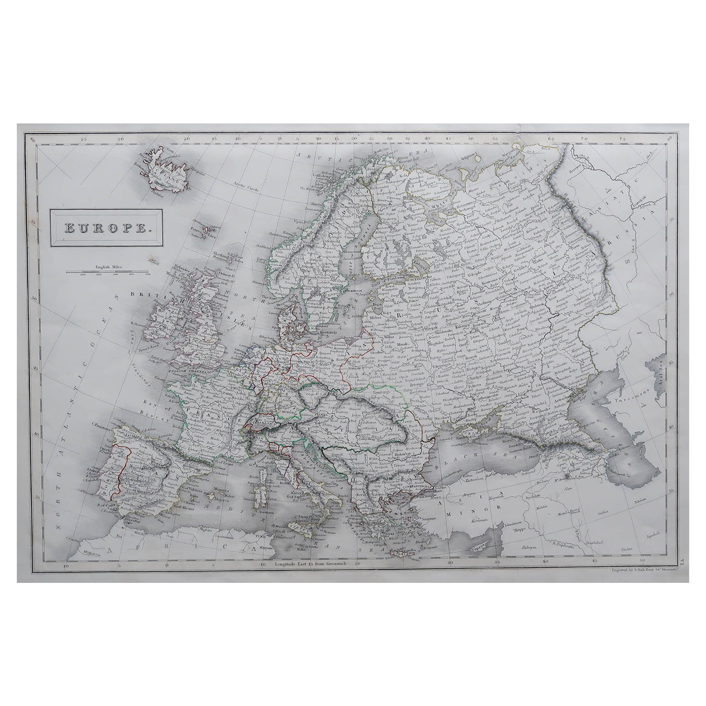
 - Large Original Antique Map of Europe by Sidney Hall, 1847Located in St Annes, LancashireGreat map of Europe Drawn and engraved by Sidney Hall Steel engraving Original colour outline Published by A & C Black. 1847 Unframed Free shipping.Category
Antique 1840s Scottish Maps
MaterialsPaper
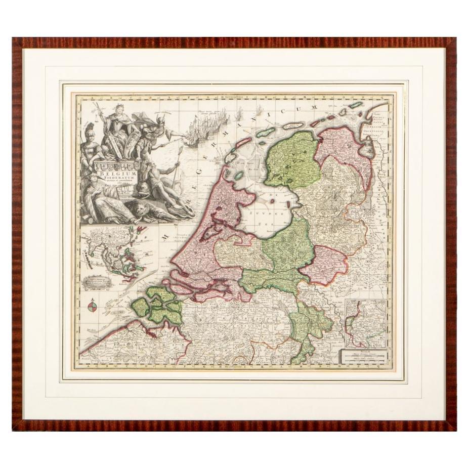
- Matthaus Seutter, Framed 1730 Color Engraving Map of "Belgium Fonderatum"Located in Bridgeport, CTLabel on verso. From Grosser Atlas. The name Belgium comes from the ancient designation "Gallis Belgica". Figural decoration upper left. M. Seutter was a famed German mapmaker in the...Category
Antique 18th Century European Renaissance Maps
MaterialsBrass
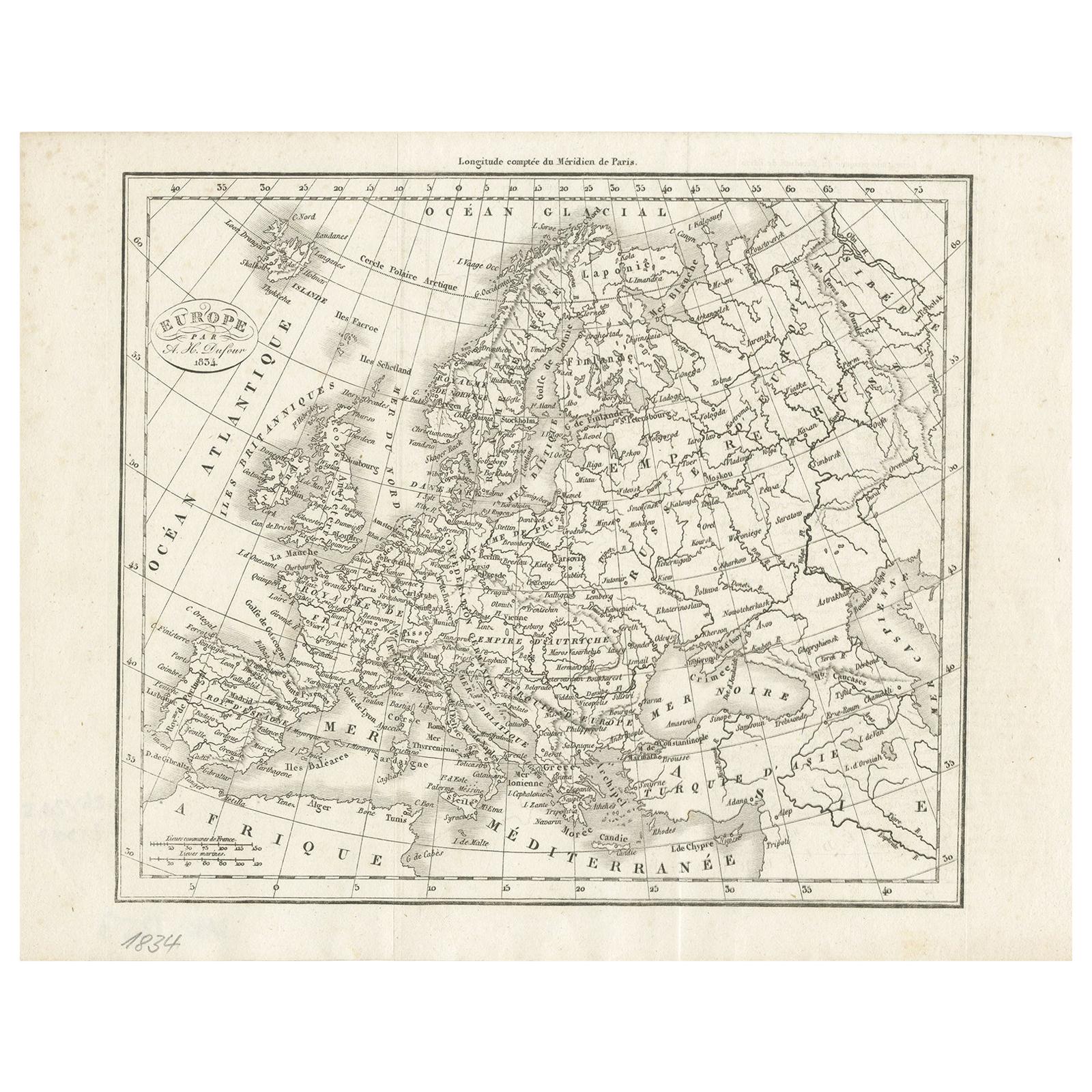
- Nice Decorative Black and White Small Antique Map of Europe, 'circa 1834'Located in Langweer, NLAntique French map titled 'Europe par A.H. Dufour'. Uncommon map of Europe. Published by or after A.H. Dufour, circa 1834. Source unknown, to be d...Category
Antique Mid-19th Century Maps
MaterialsPaper
 $175 Sale Price20% Off
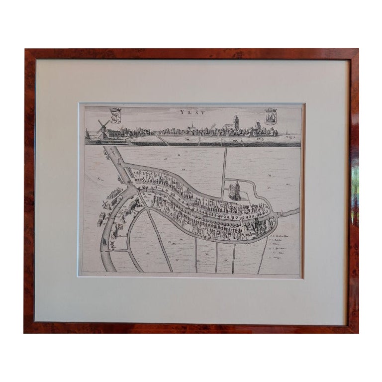
 - Antique City View and Map of IJlst, City in Friesland, Holland, Framed, 1664Located in Langweer, NLAntique map titled 'Ylst'. Old map and city view of the city of IJlst, Friesland. This map originates from 'Beschrijvinge van de Heerlyckheydt van Frieslandt' by B. Schotanus à Sterr...Category
Antique 17th Century Maps
MaterialsPaper
 $439 Sale Price20% Off
 - Antique Hand-Coloured Map of Venice with Vintage Frame, Italy, Late 18th CenturyLocated in Copenhagen K, DKItaly, late 18th Century Antique hand-coloured map of Venice. Measures: H 52 x W 59 cm.Category
Antique Late 18th Century Italian Decorative Art
MaterialsOther