Items Similar to Solar System Map – Planetary Orbits and Data Chart, Published in 1857
Video Loading
Want more images or videos?
Request additional images or videos from the seller
1 of 11
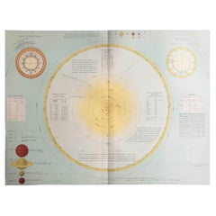
Solar System Map – Planetary Orbits and Data Chart, Published in 1857
$519.14
£394.73
€440
CA$726.18
A$792.57
CHF 416.28
MX$9,626.08
NOK 5,223.47
SEK 4,902.08
DKK 3,351.40
About the Item
Solar System Map – Planetary Orbits and Data Chart 1857
This antique print shows a detailed diagram of the solar system titled “Planeten-System der Sonne” meaning “Planetary System of the Sun”. It depicts the sun at the centre surrounded by the orbital paths of all known planets of the time: Mercury, Venus, Earth, Mars, Jupiter, Saturn, Uranus, and Neptune, along with their relative sizes illustrated at the top left. The print also includes asteroid belt information, orbital inclinations, tables of planetary data, and detailed astronomical calculations relevant to mid-19th century celestial mechanics.
Published in 1857 in Gotha by Justus Perthes as part of Adolf Stieler’s renowned Hand-Atlas, this engraving was created under the supervision of notable German cartographers and astronomers, including Heinrich Berghaus. The atlas itself was an esteemed reference in academic and scientific circles for its accuracy and clarity in geographical and astronomical knowledge.
This map is particularly significant for its presentation of Uranus and Neptune, the latter discovered only a decade earlier in 1846. It provides insights into contemporary understandings of planetary distances, orbital periods, and comparative diameters. The inclusion of asteroid discovery data up to 1856 reflects the intense scientific interest in minor planets during this era.
Technique: Copperplate engraving with original outline hand colouring to delineate planetary orbits and highlight key features. The engraving demonstrates fine precision with extensive German-language notations and numerical tables.
Condition summary: Excellent impression with strong paper quality. Minimal age toning. No tears, repairs, or significant foxing observed. Colours remain clear and fresh.
Framing tips: This planetary system print will look impressive in a dark or black wooden frame to accentuate its scientific clarity, paired with a wide off-white or light cream mount to soften the presentation and ensure focus remains on the intricate engraving. UV-protective glass is recommended to prevent fading and maintain the sharpness of its detailed lines and text.
- Dimensions:Height: 14.77 in (37.5 cm)Width: 17.88 in (45.4 cm)Depth: 0.01 in (0.2 mm)
- Materials and Techniques:Paper,Engraved
- Place of Origin:
- Period:
- Date of Manufacture:1857
- Condition:Condition summary: Excellent impression with strong paper quality. Minimal age toning. No tears, repairs, or significant foxing observed. Colours remain clear and fresh.
- Seller Location:Langweer, NL
- Reference Number:Seller: BG-05552-31stDibs: LU3054345808492
About the Seller
5.0
Recognized Seller
These prestigious sellers are industry leaders and represent the highest echelon for item quality and design.
Platinum Seller
Premium sellers with a 4.7+ rating and 24-hour response times
Established in 2009
1stDibs seller since 2017
2,694 sales on 1stDibs
Typical response time: <1 hour
- ShippingRetrieving quote...Shipping from: Langweer, Netherlands
- Return Policy
Authenticity Guarantee
In the unlikely event there’s an issue with an item’s authenticity, contact us within 1 year for a full refund. DetailsMoney-Back Guarantee
If your item is not as described, is damaged in transit, or does not arrive, contact us within 7 days for a full refund. Details24-Hour Cancellation
You have a 24-hour grace period in which to reconsider your purchase, with no questions asked.Vetted Professional Sellers
Our world-class sellers must adhere to strict standards for service and quality, maintaining the integrity of our listings.Price-Match Guarantee
If you find that a seller listed the same item for a lower price elsewhere, we’ll match it.Trusted Global Delivery
Our best-in-class carrier network provides specialized shipping options worldwide, including custom delivery.More From This Seller
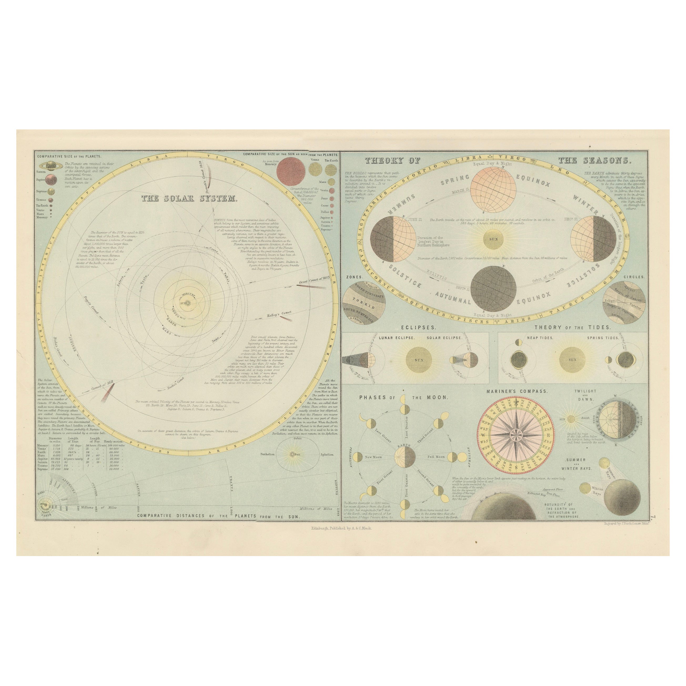
View AllAntique Astronomical Chart of the Solar System and Seasons – Black’s Atlas, 1884
Located in Langweer, NL
Antique Astronomical Chart of the Solar System and Seasons – Black’s Atlas, 1884
This striking scientific chart comes from the New and Revised Edition of Black’s General Atlas of th...
Category
Antique 1880s Scottish Maps
Materials
Paper
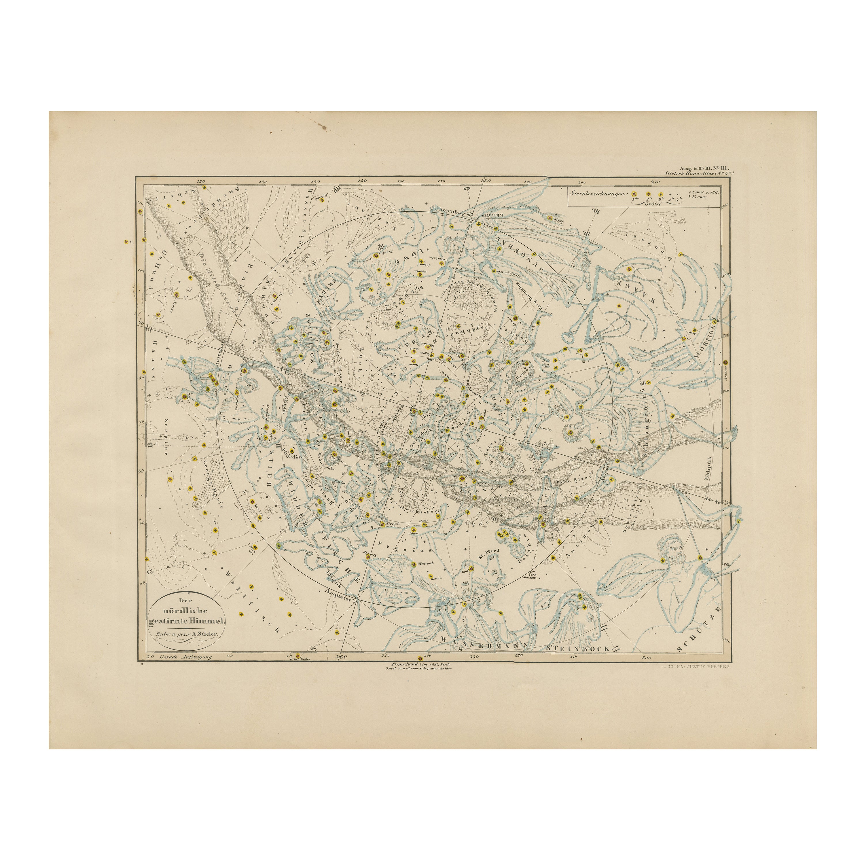
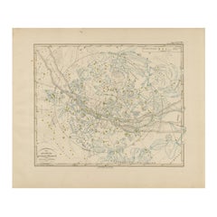
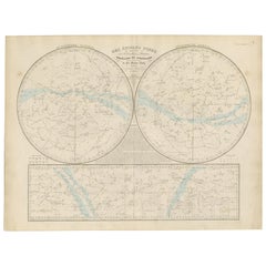
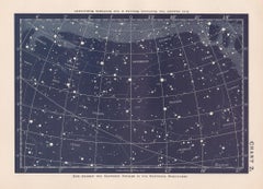
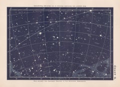
Northern Hemisphere Star Map – Constellations & Astronomical Chart, c.1858
Located in Langweer, NL
Northern Hemisphere Star Map – Constellations & Astronomical Chart c.1858
This attractive antique print shows the northern starry sky titled “Der nördliche gestirnte Himmel”, meanin...
Category
Antique Mid-19th Century German Maps
Materials
Paper
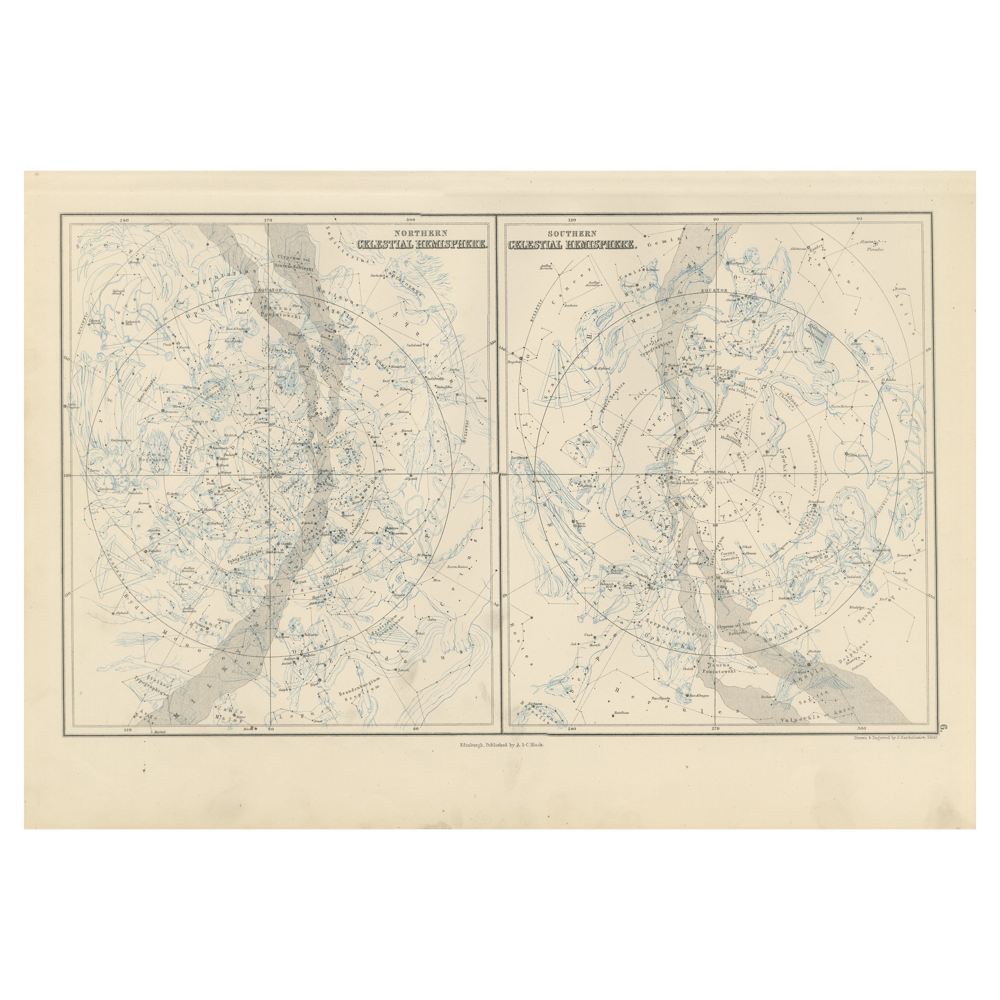
Antique Celestial Charts of the Northern and Southern Hemispheres, 1884
Located in Langweer, NL
Antique Celestial Charts of the Northern and Southern Hemispheres, 1884
This finely engraved double celestial chart comes from the New and Revised Edition of Black’s General Atlas o...
Category
Antique 1880s Scottish Maps
Materials
Paper

Antique Celestial Star Map – Northern & Southern Hemispheres, 1860
Located in Langweer, NL
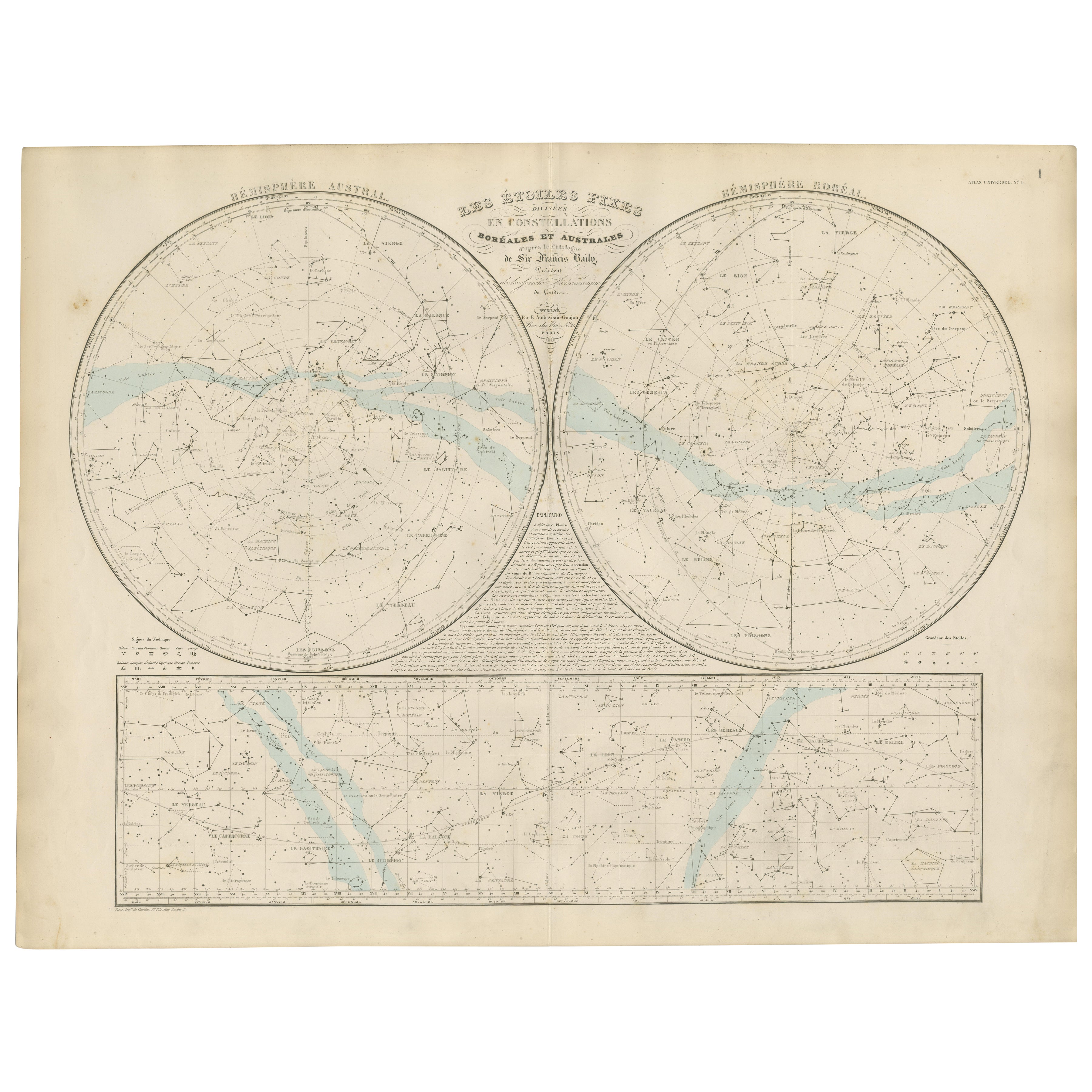
Antique Celestial Star Map – Northern & Southern Hemispheres, Andriveau-Goujon 1860
This elegant antique celestial chart, published in Paris in 1860 by the noted French cartographer...
Category
Antique Mid-19th Century French Maps
Materials
Paper
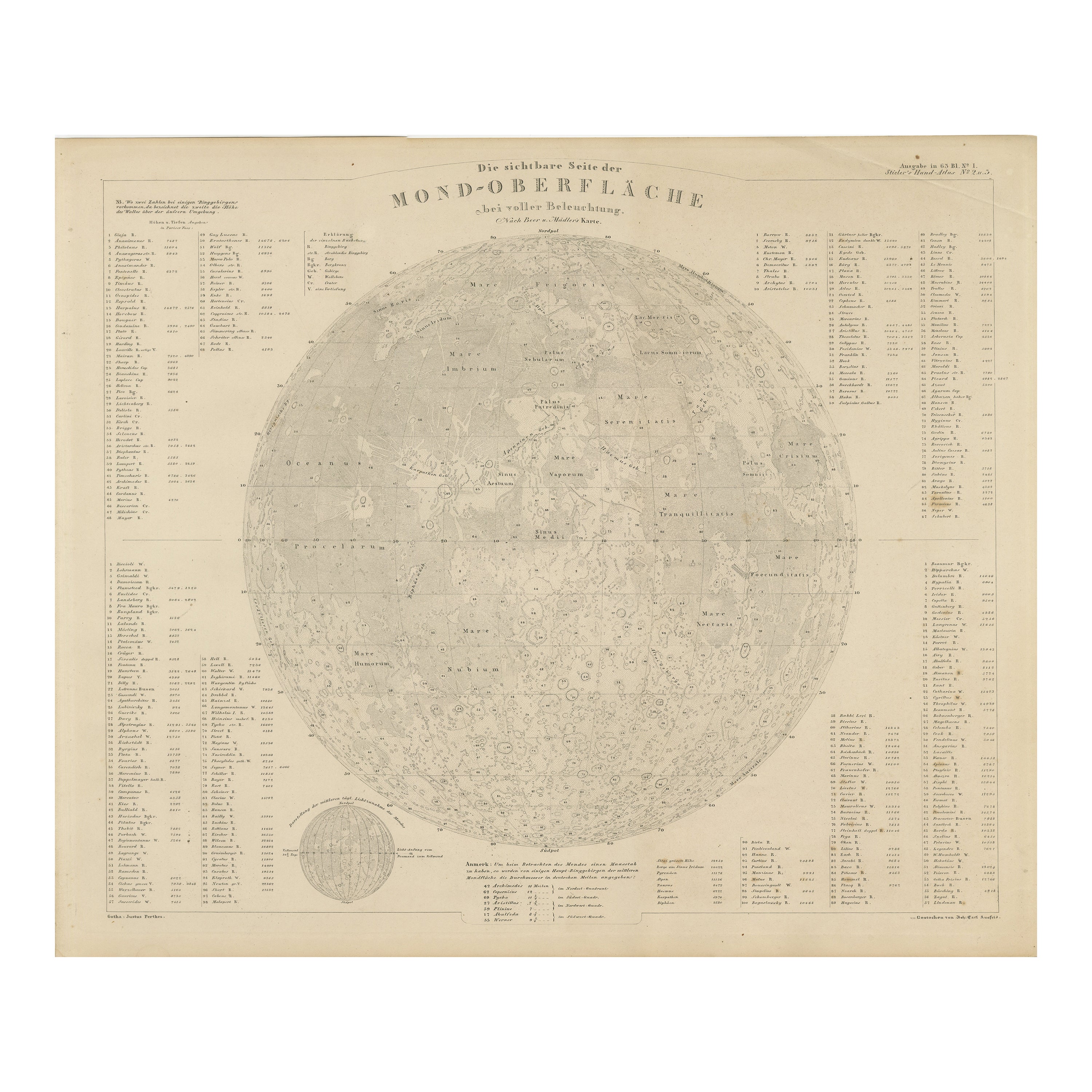
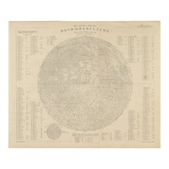
Visible Side of the Moon Map – Detailed Lunar Crater Chart, Published in 1858
Located in Langweer, NL
Visible Side of the Moon Map – Detailed Lunar Crater Chart 1858
This fascinating antique print shows the visible side of the moon with incredible precision and detail. It depicts th...
Category
Antique Mid-19th Century German Maps
Materials
Paper
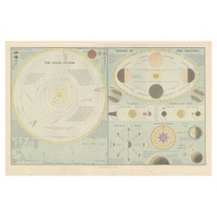
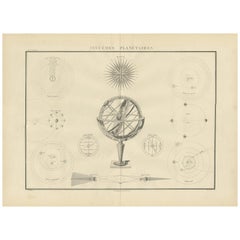
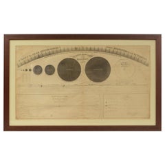
Antique Chart of Celestial and Scientific Models by Lapie, 1842
Located in Langweer, NL
Antique print titled 'Systèmes Planétaires'. Chart of various celestial and scientific models. Includes an armillary sphere and various models of the universe, the season, eclipses, a Copernican, Tycho...
Category
Antique Mid-19th Century French Prints
Materials
Paper
$707 Sale Price
25% Off
You May Also Like
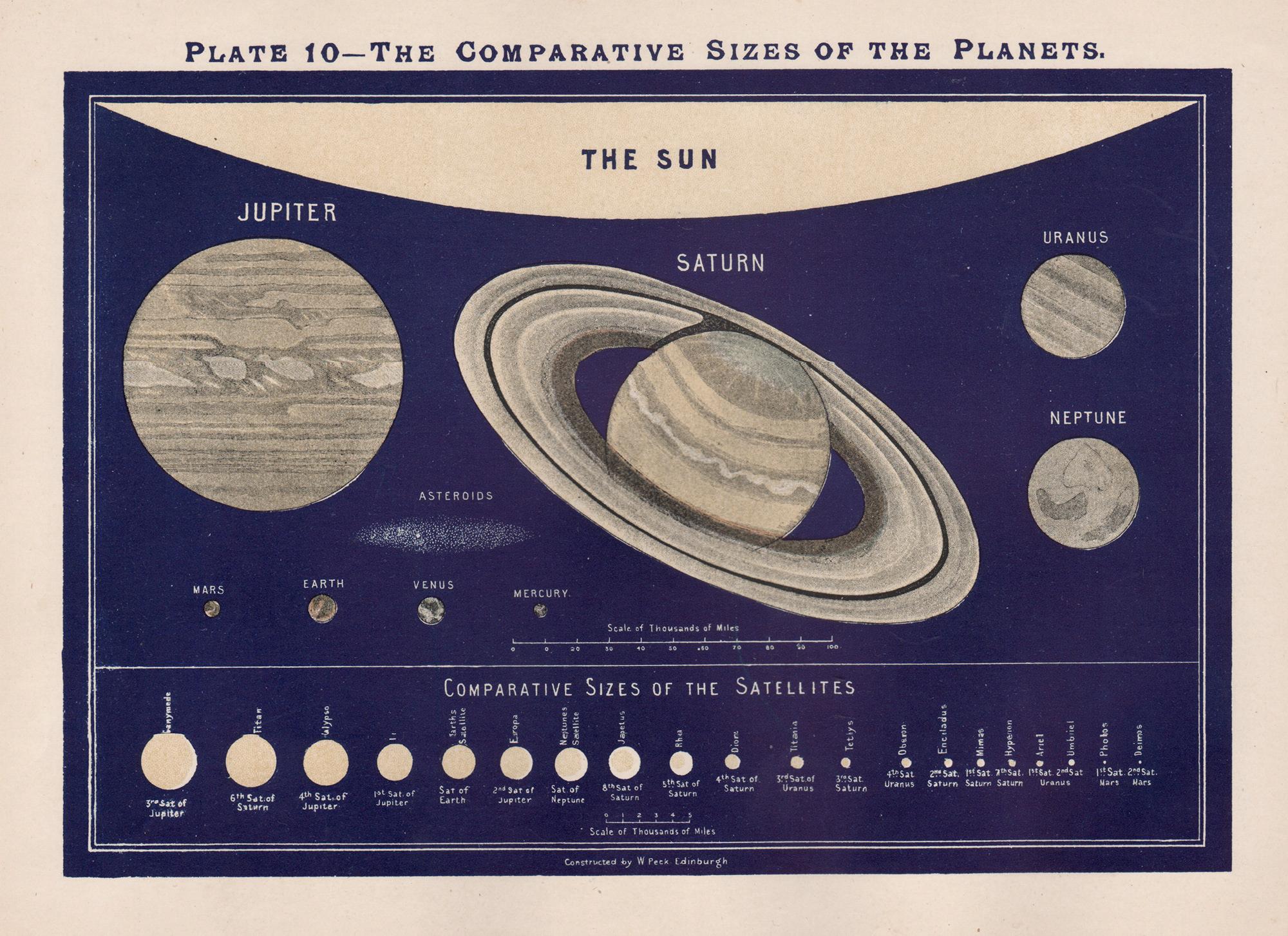
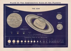
The Comparative Sizes of the Planets. Antique Astronomy diagram
Located in Melbourne, Victoria
Colour lithograph, 1890. 210mm by 285mm (sheet). From W Peck's 'A Handbook and Atlas of Astronomy', 1890. Sir William Peck FRSE FRAS (1862 – 1925) was a Scottish astronomer and scien...
Category
Late 19th Century Victorian More Prints
Materials
Lithograph
Star Chart. Antique Astronomy celestial print
Located in Melbourne, Victoria
Colour lithograph, 1890. 210mm by 285mm (sheet). From W Peck's 'A Handbook and Atlas of Astronomy', 1890. Sir William Peck FRSE FRAS (1862 – 1925) was a Scottish astronomer and scien...
Category
Late 19th Century Victorian More Prints
Materials
Lithograph
Original Antique Astronomy Print. C.1900
Located in St Annes, Lancashire
Great image of the solar system
Unframed.
Chromo-lithograph
Published, C.1900
The measurement is the paper size of the print
Free shipping.
Category
Antique Early 1900s English Folk Art Prints
Materials
Paper
Star Chart. Antique Astronomy celestial print
Located in Melbourne, Victoria
Colour lithograph, 1890. 210mm by 285mm (sheet). From W Peck's 'A Handbook and Atlas of Astronomy', 1890. Sir William Peck FRSE FRAS (1862 – 1925) was a Scottish astronomer and scien...
Category
Late 19th Century Victorian More Prints
Materials
Lithograph
1855 Astronomical Plate of Distance of the Planets by FJ Huntington New York
Located in Milan, IT
Plate of the distance of the planets “Entered according to Act of Congress in the year 1855 by F.J. Huntington in the Clerk's Office of the District Court of the United States for th...
Category
Antique 1850s American Scientific Instruments
Materials
Glass, Wood, Paper
Original Antique Map of The Eastern Hemisphere by Dower, circa 1835
Located in St Annes, Lancashire
Nice map of the Eastern Hemisphere
Drawn and engraved by J.Dower
Published by Orr & Smith. C.1835
Unframed.
Free shipping
Category
Antique 1830s English Maps
Materials
Paper

More Ways To Browse
Orbital Table
Belter Table
China Silk Rug
Chrome Glass Coffee Tables
Antique Italian Chairs
Beni Ourain Rugs
French Iron And Glass Table
Glass Top Wood Base Coffee Tables
T Chair
Antique Silver Basket
Antique Walkers
Ebony Wood Furniture
Opalescent Glass
Pair Of Danish Chairs
Veneer Dining Tables
1970 Italian Armchair
Furniture Uk
House Of Denmark Table And Chairs