Etched Maps
2
to
2
2
2
2
1
1
2
2
2
2
Technique: Etched
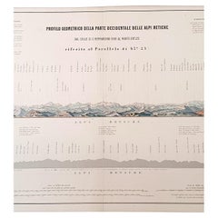
1880s Map of The Italian Alps from Milan to Lake Garda
Located in Roma, IT
Geographical Map of the Profile and Elevation of the Italian Alps from Milano to Lake Garda. The map features the name of each peak and key cities including Monza, Brescia and Bergam...
Category
1880s Italian Antique Etched Maps
Materials
Parchment Paper
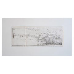
Antique Italian Map of Viaggio da Roma a Napoli 1775
Located in Roma, IT
An original print from 1775 showing an early route map of the journey from Rome to Naples. This route map was part of a collection of travellers routes published in a book translated...
Category
1770s Italian Antique Etched Maps
Materials
Parchment Paper
Related Items
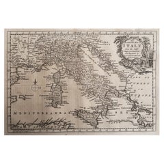
Original Antique Map of Italy. C.1780
Located in St Annes, Lancashire
Great map of Italy
Copper-plate engraving
Published C.1780
Unframed.
Category
Early 1800s English Georgian Antique Etched Maps
Materials
Paper
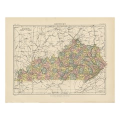
Antique Map of Kentucky
Located in Langweer, NL
Antique map titled 'Kentucky'. Original antique map of Kentucky, United States. This print originates from 'Encyclopaedia Britannica', Ninth E...
Category
Late 19th Century Antique Etched Maps
Materials
Paper
Old Map of the Mughal Empire, Persia in the West to Lake Chimay etc., ca.1685
Located in Langweer, NL
Antique map titled 'L'Empire du Grand Mogol'. Old map of India and Central Asia.
The map extends from Persia in the West to Lake Chimay and the Bay of Bengal...
Category
1680s Antique Etched Maps
Materials
Paper
H 9.85 in W 14.57 in D 0 in
Antique Map of Oregon
Located in Langweer, NL
Antique map titled 'Oregon'. Original antique map of Oregon, United States. This print originates from 'Encyclopaedia Britannica', Ninth Edition. Publish...
Category
Late 19th Century Antique Etched Maps
Materials
Paper
Antique Map of Moldova to Thessaly and from the Adriatic to the Black Sea, 1880
Located in Langweer, NL
Antique map titled 'Turquie d'Europe'.
Map of the european parts of Turkey. The map covers from Moldova to Thessaly and from the Adriatic to the Black Sea. Greece and the island ...
Category
1880s Antique Etched Maps
Materials
Paper
H 18.71 in W 13.59 in D 0 in
Antique Map of Asia from the Middle East to the Coast of Alaska, 1816
Located in Langweer, NL
Antique map titled ‘L’Asie‘. This is an original antique map of Asia, by Hérisson, taken from atlas ""Nouv. Abrége de Géographie"". An engraved map with coloring of Asia from the Mid...
Category
19th Century Antique Etched Maps
Materials
Paper
Map of The Italian Peninsula with the islands of Sicily, Sardinia, Corsica, 1880
Located in Langweer, NL
This map, titled "ITALIA, Sicilia, Sardinia, Corsica," represents the Italian Peninsula along with the islands of Sicily, Sardinia, and Corsica. Inset maps offer detailed views of "R...
Category
1880s Antique Etched Maps
Materials
Paper
Free Shipping
H 15.56 in W 18.51 in D 0 in
Antique Map of the Region of Lake Geneva by Janssonius '1657'
Located in Langweer, NL
Antique map 'Das Wiflispur Gergow'. Detailed map of Switzerland showing Waadt and the Lake of Geneva and the city of Geneva, Fribourg and partly Bern. This map originates from 'Atlas...
Category
Mid-17th Century Antique Etched Maps
Materials
Paper
Antique Map of Italy by R. Bonne, circa 1780
Located in Langweer, NL
Beautiful map of Italy, Corsica, Sardinia and Sicily. Highly detailed, showing towns, rivers, some topographical features and political boundaries. Published by R. Bonne, circa 1780.
Category
Late 18th Century Antique Etched Maps
Materials
Paper
Antique Map of Arkansas
Located in Langweer, NL
Antique map titled 'Arkansas'. Original antique map of Arkansas, United States. This print originates from 'Encyclopaedia Britannica', Ninth Edition. P...
Category
Late 19th Century Antique Etched Maps
Materials
Paper
Antique Map of The Regions of Italy and Sicily during the Roman Empire, 1880
Located in Langweer, NL
This map is an original antique engraving titled "ITALIAE REGIONES IIII SICILIA," which translates to "The Regions of Italy and Sicily." This detailed historical map portrays the reg...
Category
1880s Antique Etched Maps
Materials
Paper
Free Shipping
H 18.51 in W 15.56 in D 0 in
Antique Map of Algeria, 1880
Located in Langweer, NL
Antique map titled 'Algérie. Old map of Algeria. This map originates from 'Géographie Universelle Atlas-Migeon' by J. Migeon.
Artists and Engravers: Published by J. Migeon. Review...
Category
19th Century Antique Etched Maps
Materials
Paper
Previously Available Items
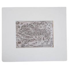
17th Century Miniature Map of Venice
Located in Roma, IT
An extraordinary miniature map of the ancient city of Venice published in Padua by Matteo Cadorin in the 1670 edition of Francesco Scoto's 'Itinerary of Italy' guide.
This delightf...
Category
1670s Italian Antique Etched Maps
Materials
Parchment Paper
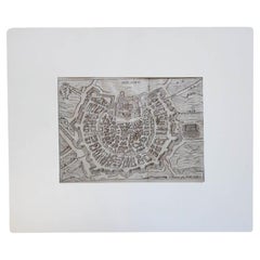
17th Century Miniature Map of Milan
Located in Roma, IT
An extraordinary miniature map of the ancient city of Milan published in Padua by Matteo Cadorin in the 1670 edition of Francesco Scoto's 'Itinerary of Italy' guide.
This delightfu...
Category
1670s Italian Antique Etched Maps
Materials
Parchment Paper
17th Century Miniature Map of Florence
Located in Roma, IT
An extraordinary miniature map of the ancient city of Florence. Published in Padua by Matteo Cadorin in the 1670 edition of Francesco Scoto's 'Itinerary of Italy' guide.
This delig...
Category
1670s Italian Antique Etched Maps
Materials
Parchment Paper
Roggeveen's Hand Colored Chart of Cape Cod and the Islands, 1675
By Arent Roggeveen
Located in Nantucket, MA
Pascaert van Nieu Nederland Van Hendrick Christiaens Eyland tot Staten hoeck of Cabo Cod, by Arent Roggeveen, published in circa 1675, an extremely rare first edition chart printed o...
Category
1670s Dutch Other Antique Etched Maps
Materials
Paper
A Rare French Engraved Map of The Southeastern United States. R.Bonne Circa 1780
Located in Hollywood, SC
A rare framed French engraved map on paper of the southeastern United States including Virginia, North Carolina, South Carolina, and Georgia. Rigobert Bonne, Paris Circa 1780. Plat...
Category
1780s French Louis XVI Antique Etched Maps
Materials
Paper, Wood
H 16.5 in W 21 in D 1 in
