Items Similar to Vincenzo Coronelli's Colored Map of the New World Western Hemisphere Framed 47"
Want more images or videos?
Request additional images or videos from the seller
1 of 13
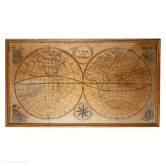
Vincenzo Coronelli's Colored Map of the New World Western Hemisphere Framed 47"
About the Item
A Framed Reproduction of Coronelli's Map of the New World, Attributed to Trevor James Company. The map shows the Western Hemisphere including the discoveries made by Abel Tasman in Australia and an early image of the New Zealand coastline, plus California as an Island. The treatment of the Northeastern Coast of Asia and Japan are also quite unusual, including a representation of Terra di Iesso, the mythical land bridge which was frequently shown to extend from Asia to Alaska, with only the Straits of Anian separating the two continents.
The decorative borders include co-ordinates and descriptions of signs of the zodiac.
The map is from Coronelli's Atlante Veneto. The Atlante was professionally designed as a continuation of Blaeu's Atlas Maior and by 1701 was extended to embrace up to twelve volumes.
Framed in wood with a burlwood finish, naturally distressed and gold trim. Framed Under Glass
Dimensions:
38" x 2" x 47"; picture area 27.5" x 36.5"
- Similar to:Vincenzo Coronelli (Artist)
- Dimensions:Height: 47 in (119.38 cm)Width: 38 in (96.52 cm)Depth: 2 in (5.08 cm)
- Materials and Techniques:
- Period:
- Date of Manufacture:20th Century
- Condition:Wear consistent with age and use.
- Seller Location:Dayton, OH
- Reference Number:Seller: 421511stDibs: LU5343240435402

About the Seller
5.0
Platinum Seller
Premium sellers with a 4.7+ rating and 24-hour response times
Established in 2010
1stDibs seller since 2020
1,552 sales on 1stDibs
Typical response time: <1 hour
- ShippingRetrieving quote...Shipping from: Dayton, OH
- Return Policy
Authenticity Guarantee
In the unlikely event there’s an issue with an item’s authenticity, contact us within 1 year for a full refund. DetailsMoney-Back Guarantee
If your item is not as described, is damaged in transit, or does not arrive, contact us within 7 days for a full refund. Details24-Hour Cancellation
You have a 24-hour grace period in which to reconsider your purchase, with no questions asked.Vetted Professional Sellers
Our world-class sellers must adhere to strict standards for service and quality, maintaining the integrity of our listings.Price-Match Guarantee
If you find that a seller listed the same item for a lower price elsewhere, we’ll match it.Trusted Global Delivery
Our best-in-class carrier network provides specialized shipping options worldwide, including custom delivery.More From This Seller
View All20th Century Large Vintage Oval Wall Map of the World Globe Conference Table 13'
Located in Dayton, OH
Monumental oval classroom map of the world / wall globe from the second half of the 20th century. A two piece sculpture design made with heavy wood and metal trim paneling. Can be ...
Category
20th Century Maps
Materials
Metal

$2,400 Sale Price
20% Off
Antique Chicago Illinois National Map Commercial Rollup Classroom Census Map 47"
Located in Dayton, OH
Antique early to mid 20th century double sided hanging map titled the New Commercial and Census Map of Illinois, Edition 1073. Verso shows the National Map of Chicago and Suburbs - O...
Category
Early 20th Century North American Maps
Materials
Paper

$940 Sale Price
20% Off
Antique Colored Belgium Map Flandria Gallica Flanders Henricus Hondius
Located in Dayton, OH
Antique hand colored map of Flanders, Belgium, engraved by Henricus Hondius.
Sans frame - 21.25” x 18”.
Category
Antique 19th Century Renaissance Maps
Materials
Paper

$280 Sale Price
20% Off
Vintage Oversized New York City Lower Manhattan 1840s Map Print
Located in Dayton, OH
Vintage late 20th century reproduction print of New York City featuring lower Manhattan in 1840.
Category
Late 20th Century Victorian Maps
Materials
Paper

$800 Sale Price
20% Off
18th Century Antique Conrad Lotter Septentrionalis Meridionalis American Maps
Located in Dayton, OH
Pair of rare hand colored maps from the 1770's, depicting "America Septentrionalis" (North America), engraved by Georg Friedrich Lotter and America Meridionalis (South America), engr...
Category
Antique 18th Century Maps
Materials
Paper
$2,400 Sale Price
20% Off
Antique 1844 J Calvin Smith JH Colton Midwest United States Survey Map 27"
By J.H. Colton
Located in Dayton, OH
Antique framed black and white map of seven Midwestern American states. Guide Through Ohio, Michigan, Indiana, Illinois, Missouri, Wisco...
Category
Antique 1840s Maps
Materials
Paper

$940 Sale Price
20% Off
You May Also Like
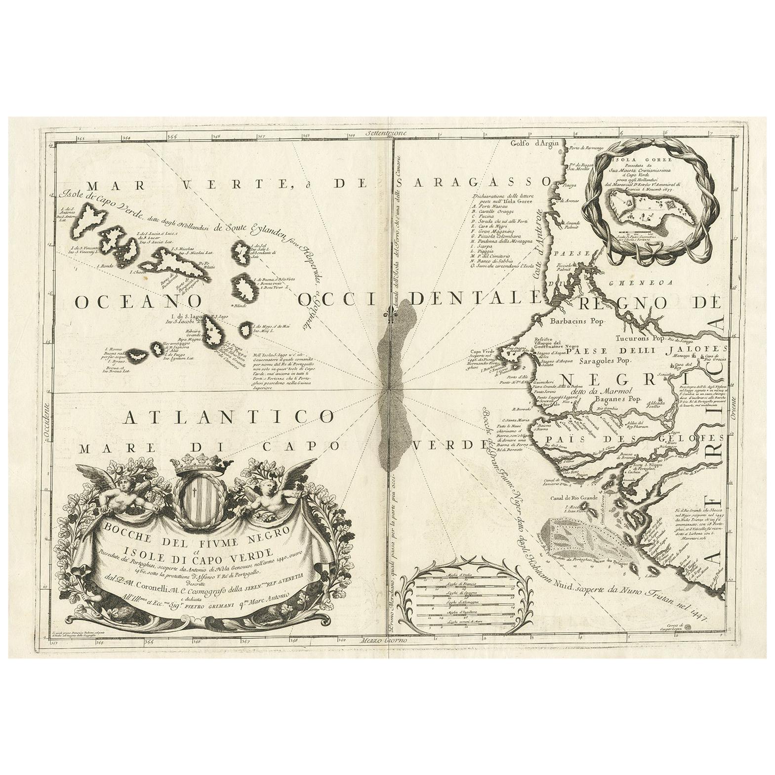
Antique Map of Western Africa and the Cape Verde Islands by Coronelli, 1691
By Vincenzo Coronelli
Located in Langweer, NL
Antique map titled 'Bocche del Fiume Negro et Isole di Capo Verde'. Antique map of Western Africa with the Cape Verde Islands and an inset of Goree Island. Originates from 'Atlante V...
Category
Antique Late 17th Century Italian Maps
Materials
Paper
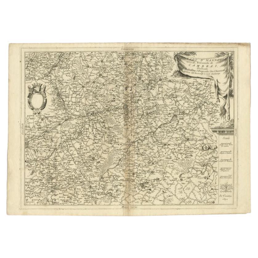
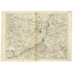
Detailed Antique Map of Western Belgium and Eastern France by Coronelli, 1690
By Vincenzo Coronelli
Located in Langweer, NL
Antique map titled 'Contado d'Hannonia (..)'. Map of western Belgium and eastern France, from south of Brussels (not shown) to Cambrai, France, generally centered around the towns of...
Category
Antique 17th Century Maps
Materials
Paper

$449 Sale Price
20% Off
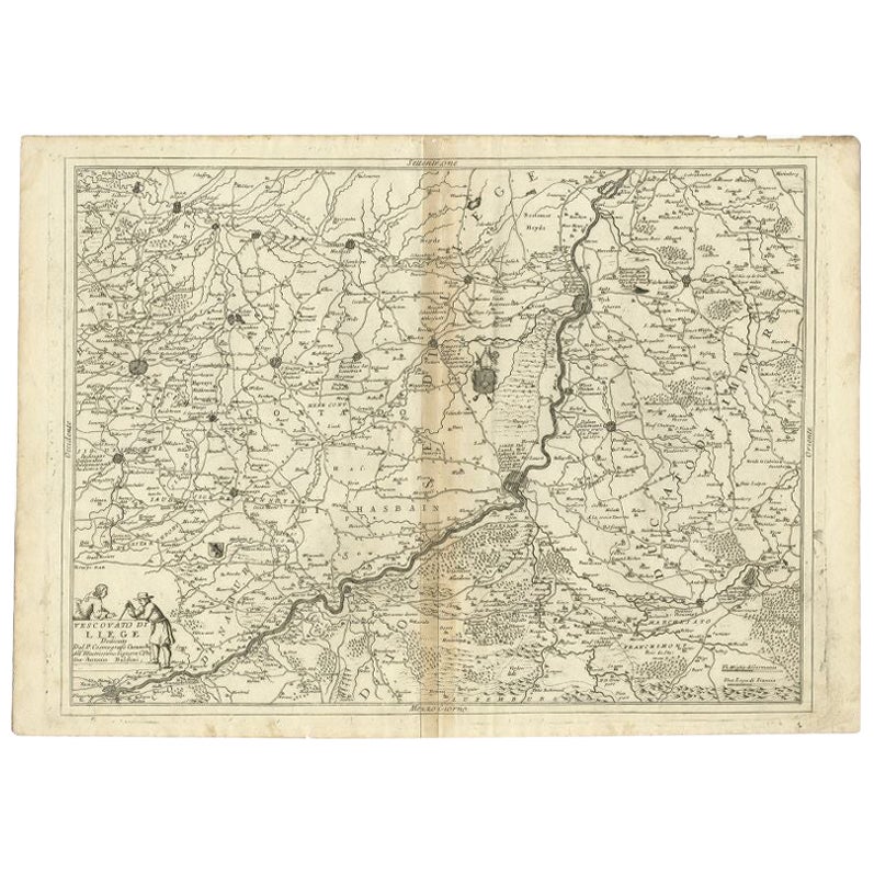
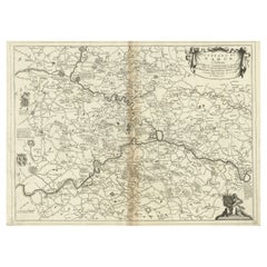
Antique Map of the Region of Liege by Coronelli, 1690
By Vincenzo Coronelli
Located in Langweer, NL
Antique map titled 'Vescovato di Liege (..)'. Map of the Belgium area centered on Liege and the course of Meuse/Maas River. Also depicts the cities of Maastricht, Namur and Tienen. O...
Category
Antique 17th Century Maps
Materials
Paper
$422 Sale Price
20% Off
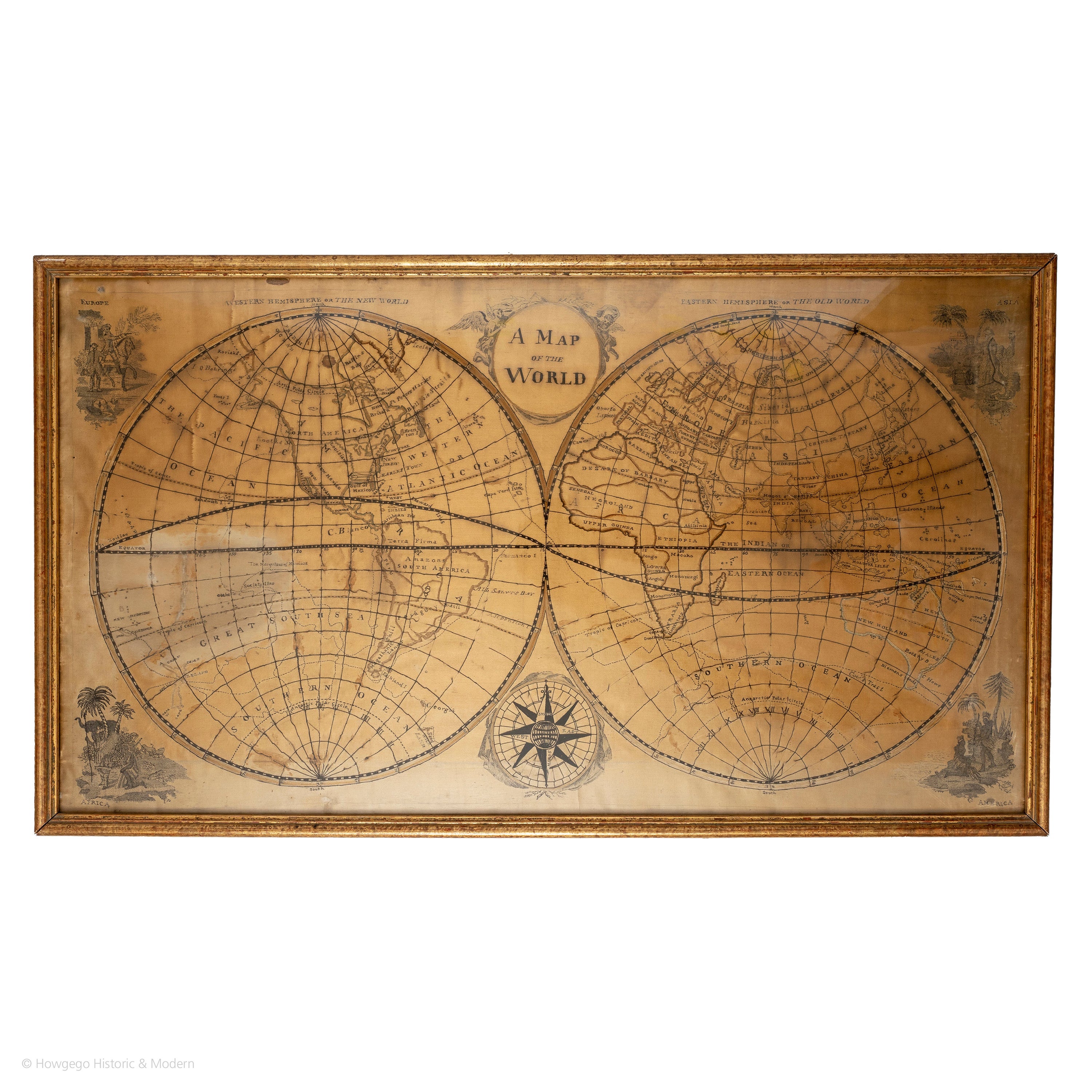
Map Silk Embroidered Western Eastern Hemisphere New Old World Asia America Afri
Located in BUNGAY, SUFFOLK
A rare, late-18th century, silk, embroidered, double hemisphere, world map, blackwork, sampler, showing the tracks of captain cook’s three voyages
- Illustrating public understanding of the world in the late-18th century and the recent discoveries of the time delineating the tracks of Captain Cook’s three voyages.
- Shows the incentive for further exploration during the 19th century as no mass is indicated within the southern polar region, the interior portions of western North America, Africa, and Australia are still relatively void of detail even though California is no longer shown as an island.
- Includes beautifully worked allegories of the four continents Asia, the Americas, Africa & Europe, a cartouche being supported by two angels and a compass
- The cream, silk ground is finely embroidered with a variety of stiches in black, silk threads emulating the black ink on maps.
-“Recent international conflicts and voyages by Captain Cook and others made the study of geography exciting at the time this map was made. Elaborate embroidered maps...
Category
Antique 18th Century British Georgian Maps
Materials
Silk
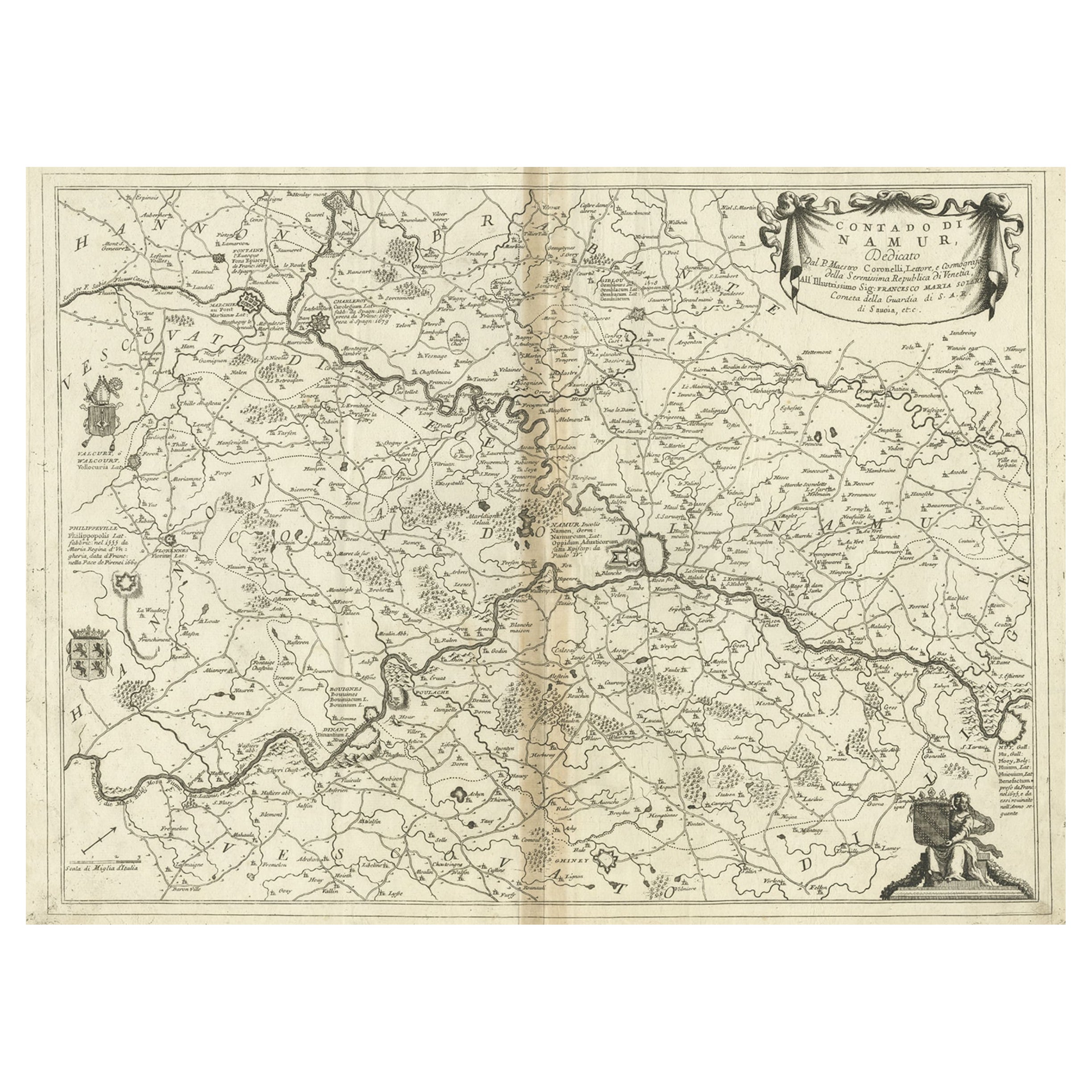
Antique Map of the Namur Region in France by Coronelli, c.1695
By Vincenzo Coronelli
Located in Langweer, NL
Antique map titled 'Contado di Namur (..)'. Old map of the Namur region in central Belgium. Includes several coats of arms.
Artists and Engravers: The remarkable Vincenzo Coronell...
Category
Antique 17th Century Maps
Materials
Paper
$431 Sale Price
20% Off
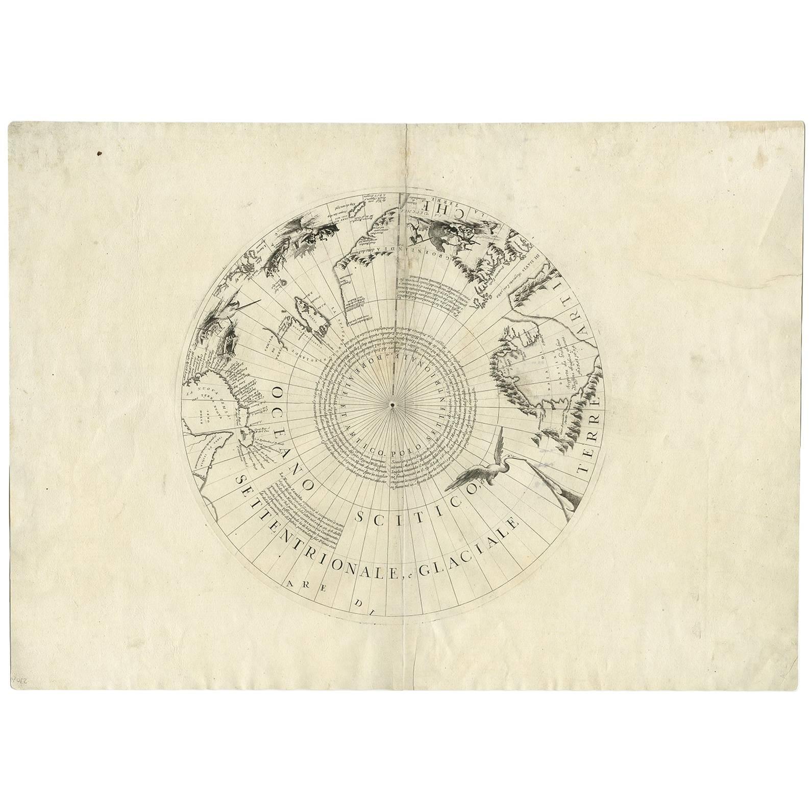
Antique Map of the North Pole by V.M. Coronelli, circa 1692
By Vincenzo Coronelli
Located in Langweer, NL
Globe gore by Vincenzo Maria Coronelli shows the North Pole with the coasts of Canada, Greenland, Scandinavia and Siberia, and is decorated with pictorial scenes of bear, seal and wh...
Category
Antique Late 17th Century Maps
Materials
Paper

Recently Viewed
View AllMore Ways To Browse
Japanese Picture Frame
Vintage Zodiac Glasses
Burlwood Frame
Vintage Zodiac Map
Iron Scroll Coffee Table
Iron Scroll Console Table
Italian Rattan Stools
Italian Tumbler
Jansen Mirror Table
Japanese Export Silver
Jens Quistgaard For Dansk Teak
Karabagh Kilim
Kartell Four
King Louis Dining Table
Kitchen Furniture Bakelite
Leather Accent Chairs Pair
Library Wall Panels
Long French Bench