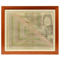
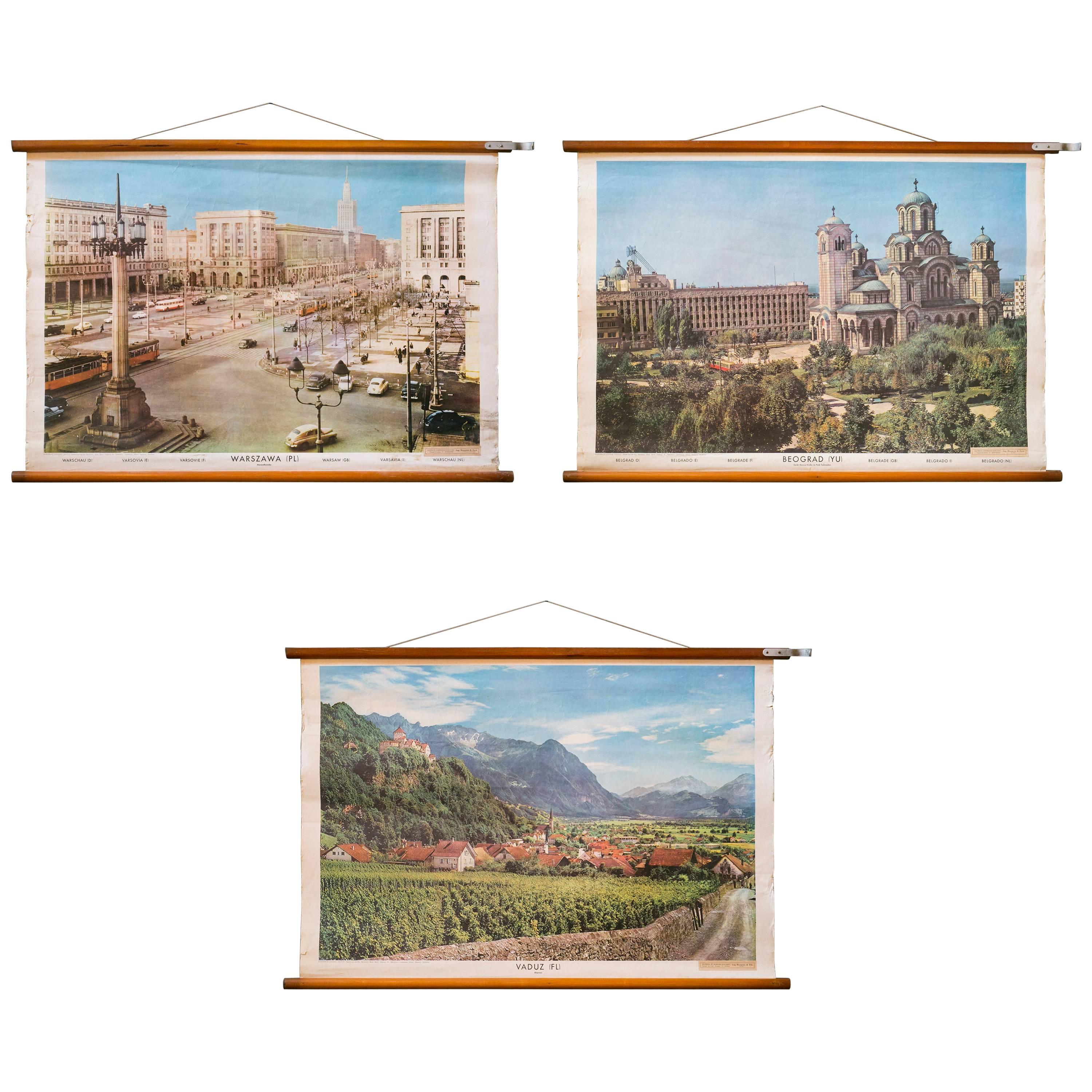
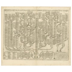
1731 Original German Engraving Print Chart of European Distances by T. Mayer
View Similar Items

Want more images or videos?
Request additional images or videos from the seller
1 of 19
1731 Original German Engraving Print Chart of European Distances by T. Mayer
About the Item
About the Seller
4.9
Platinum Seller
Premium sellers with a 4.7+ rating and 24-hour response times
Established in 1999
1stDibs seller since 2014
397 sales on 1stDibs
Typical response time: 1 hour
Authenticity Guarantee
In the unlikely event there’s an issue with an item’s authenticity, contact us within 1 year for a full refund. DetailsMoney-Back Guarantee
If your item is not as described, is damaged in transit, or does not arrive, contact us within 7 days for a full refund. Details24-Hour Cancellation
You have a 24-hour grace period in which to reconsider your purchase, with no questions asked.Vetted Professional Sellers
Our world-class sellers must adhere to strict standards for service and quality, maintaining the integrity of our listings.Price-Match Guarantee
If you find that a seller listed the same item for a lower price elsewhere, we’ll match it.Trusted Global Delivery
Our best-in-class carrier network provides specialized shipping options worldwide, including custom delivery.More From This Seller
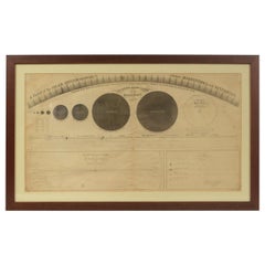
View All1855 Astronomical Plate of Distance of the Planets by FJ Huntington New York
Located in Milan, IT
Plate of the distance of the planets “Entered according to Act of Congress in the year 1855 by F.J. Huntington in the Clerk's Office of the District Court of the United States for th...
Category
Antique 1850s American Scientific Instruments
Materials
Glass, Wood, Paper
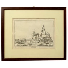
Engraving Print from the Panckoucke Encyclopédie Nautical Subject 1782-1832
Located in Milan, IT
Print by engraving on copper plate from the Panckoucke Encyclopédie méthodique, end of the 18th century,volume Marine Planches (more than 1,500 figures dealing with all subjects on the marina: planes, construction, carpentry, tree trunks, armaments of maneuvers, ropes, sails, artillery, ship maneuvers and combat tactics). This is the plate no. n. 24, pag. 69 fig. 341 ; with frame cm 38.3 x 31.5. Ship ropes are depicted. The Print has the "Benard direxit...
Category
Antique 1790s French Nautical Objects
Materials
Paper
Engraving Print from the Panckoucke Encyclopédie Nautical Subject 1782-1832
Located in Milan, IT
Print by engraving on copper plate from the Panckoucke Encyclopédie méthodique, end of the 18th century, volume Marine Planches (more than 1,500 figures dealing with all subjects on ...
Category
Antique 1790s French Nautical Objects
Materials
Paper
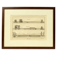
Engraving Print from the Panckoucke Encyclopédie Nautical Subject, 1782-1832
Located in Milan, IT
Print by engraving on copper plate from the Panckoucke Encyclopédie méthodique, end of the 18th century, volume Marine Planches (more than 1,500 figures dealing with all subjects on the marina: planes, construction, carpentry, tree trunks, armaments of maneuvers, ropes, sails, artillery, ship maneuvers and combat tactics). This is the plate no. n. 26, pag. 70 fig. 350-353; with frame cm 38.3 x 31.5. Ship ropes are depicted. The Print has the "Benard direxit...
Category
Antique 1790s French Nautical Objects
Materials
Paper
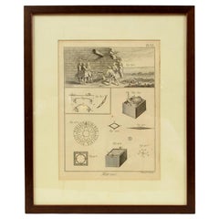
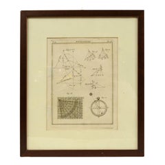
Engraving on Copper Print from the Volume Navigazione Nautical Subject 1790
Located in Milan, IT
Print by engraving on copper plate Tav III TIX fig. 17-22 from the volume Navigazione; with frame 28 x 33. Some calculations are depicted. Very good condition.
Shipping is insured by...
Category
Antique 1790s Italian Nautical Objects
Materials
Paper
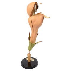
1930s Germany Botanical Model of the Lamium Purpureum Flower
Located in Milan, IT
Educational model of the Lamium purpureum L. (false purple nettle) flower made of painted papier mâché with a Bakelite base from the 1930s, German ma...
Category
Vintage 1930s German Scientific Instruments
Materials
Parchment Paper
You May Also Like
Framed 1731 Color Engraving, Map of Rotterdam by Matthaus Seutter, "Roterodami"
Located in Bridgeport, CT
"Roterodami". Seutter (1678-1757) was an important German 18th century map maker. Bird's eye view of the city above with full details, neoclassi...
Category
Antique 18th Century European Renaissance Maps
Materials
Glass, Wood, Paper

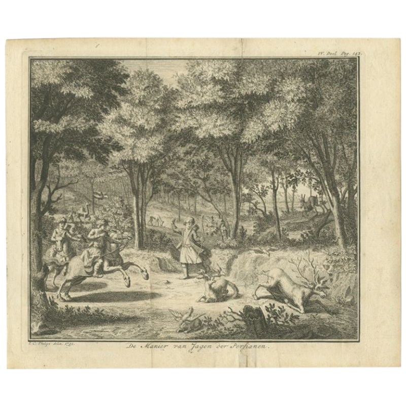
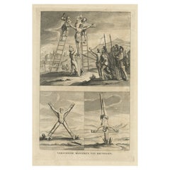
Interesting Original Antique Print of the Hunting Methods of Persians, 1731
Located in Langweer, NL
Antique print titled 'De Manier van Jagen der Persianen'. This print shows the hunting methods of Persians. This print originates from 'Hedendaagsche historie of Tegenwoordige staat ...
Category
Antique 18th Century Prints
Materials
Paper

$175 Sale Price
20% Off
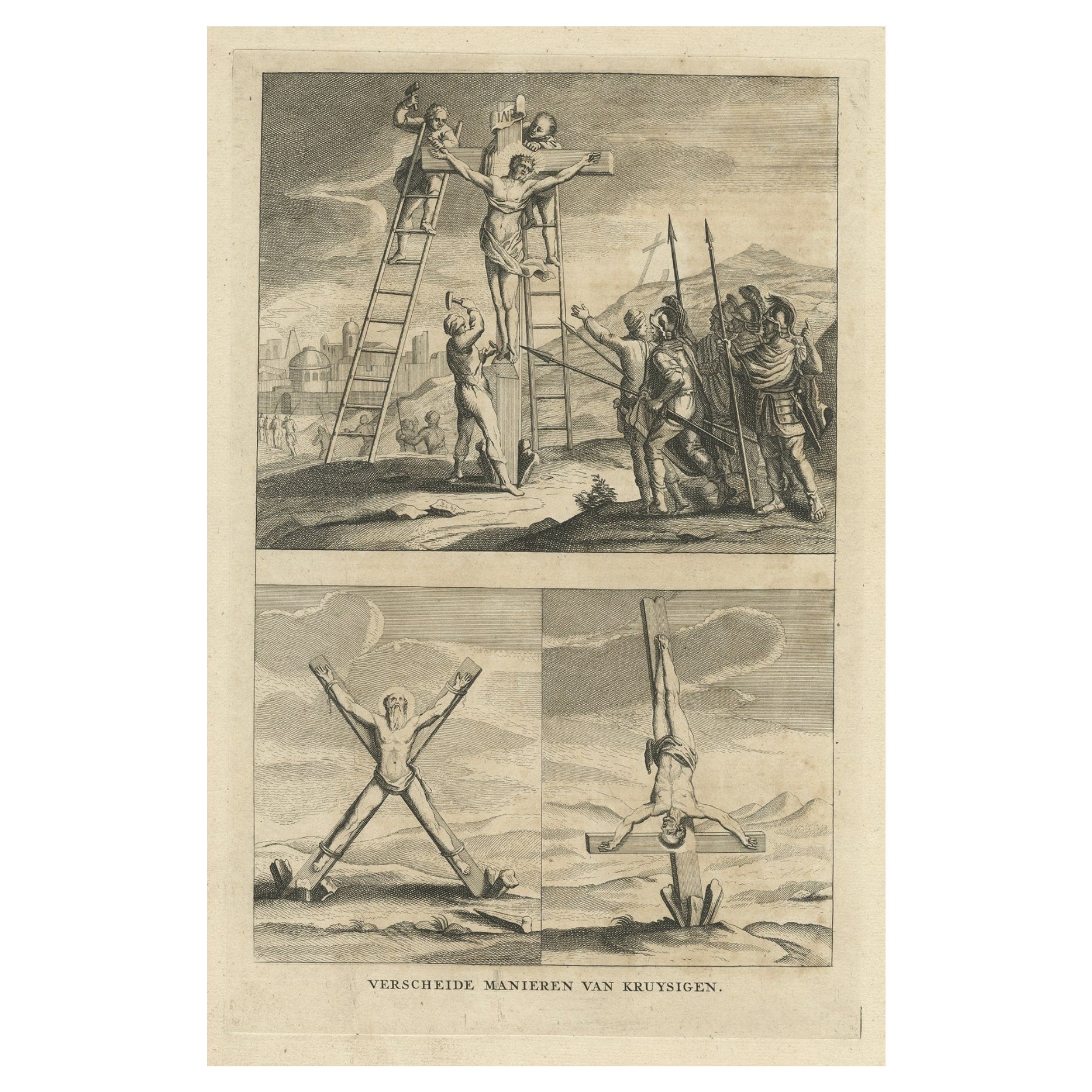
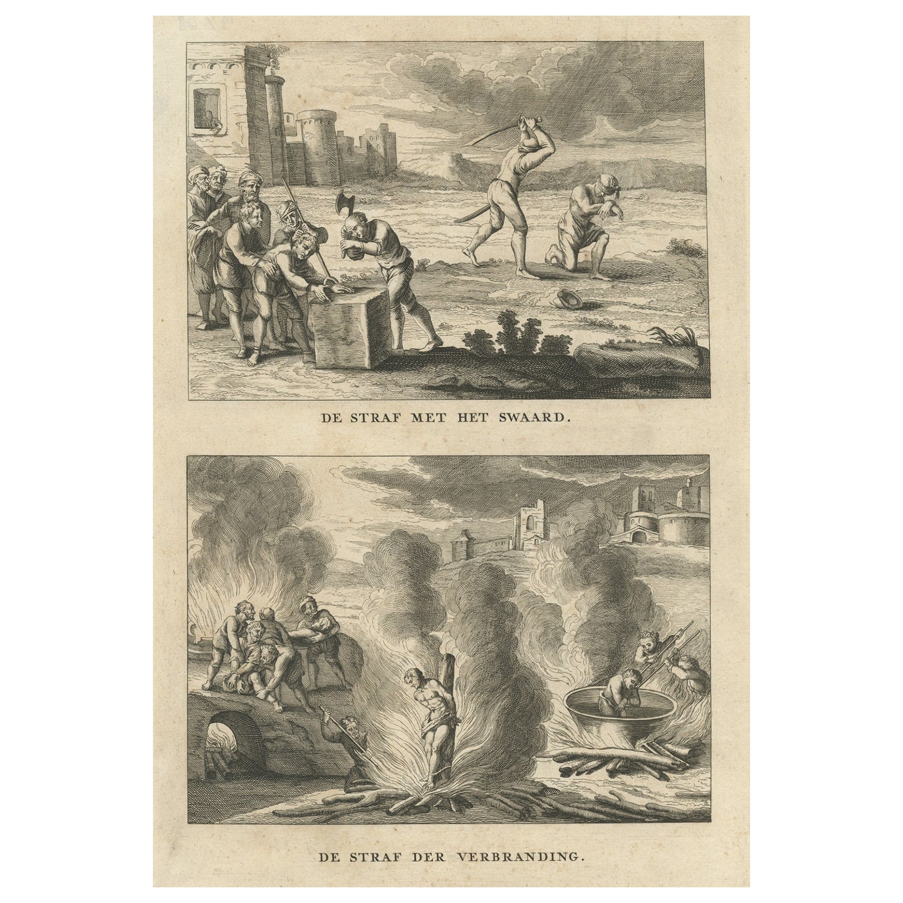
Religious Antique Engraving of the Various Ways of Crucifixion, 1731
Located in Langweer, NL
Description: Three religious images on one sheet titled 'Verscheide Manieren van Kruysigen'.
Various methods of crucifixion. This print depicts religious punishments and originates...
Category
Antique 1730s Religious Items
Materials
Paper
$333 Sale Price
20% Off
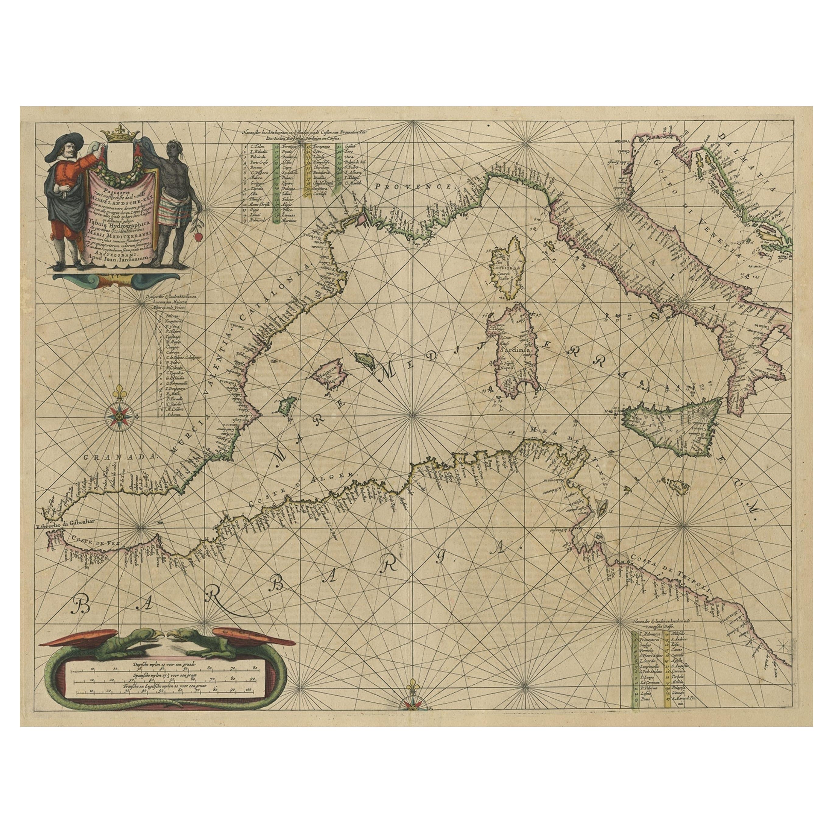
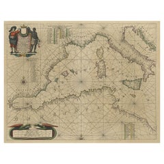
Original Antique Engraving of a Sea Chart of the Western Mediterranean, ca.1650
Located in Langweer, NL
Antique map titled 'Pascaerte van 't westlyckste deel vande Middelandsche-Zee (..)'.
Sea chart of the Western Mediterranean. The map extends from the Straits of Gibralter to Italy ...
Category
Antique 1650s Maps
Materials
Paper
$1,157 Sale Price
20% Off
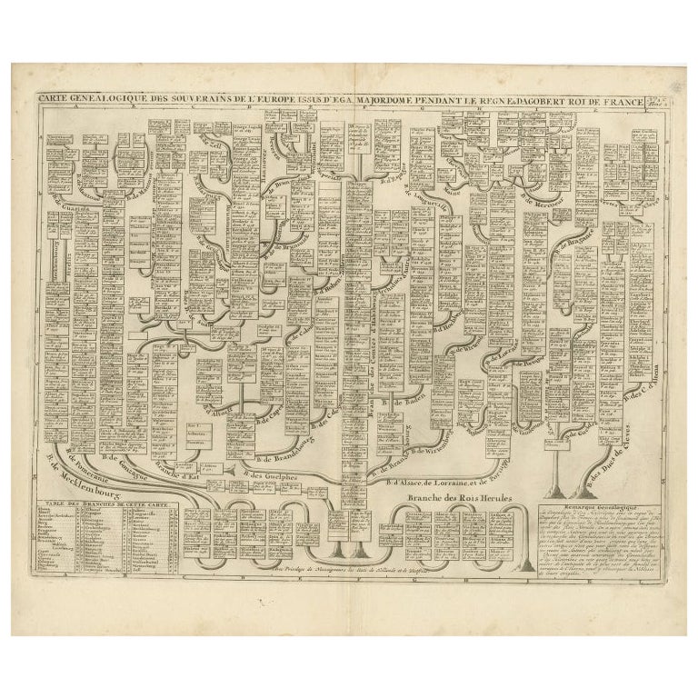
Antique Genealogy Chart of the Leaders of Europe by Chatelain, 1732
Located in Langweer, NL
Antique print titled 'Carte Genealogique des Souverains de l'Europe (..)'. Chart of the royal line of the great Frankish major, Aega. As early as the 14th century the Hapsburgs attem...
Category
Antique 18th Century Prints
Materials
Paper
$259 Sale Price
20% Off
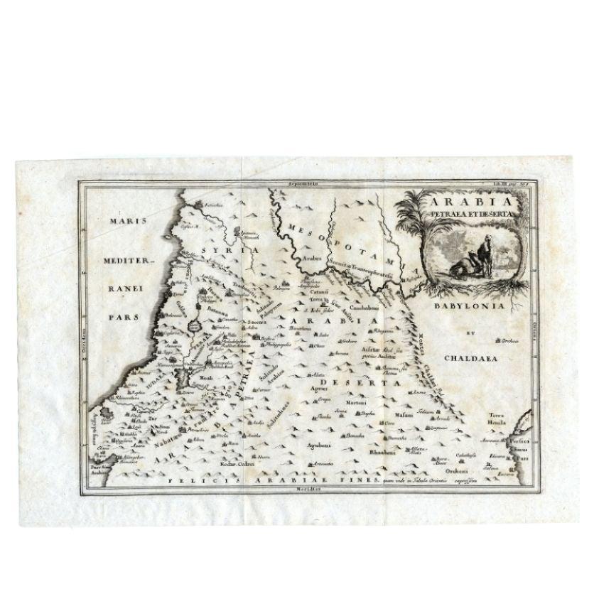
Antique Map of the Arabian Desert by Cellarius, 1731
Located in Langweer, NL
Antique map titled 'Arabia Petraea et Deserta.' Arabian desert with present day Israel, Jordania, Iraq. With decorative cartouche showing dromedaries. T...
Category
Antique 18th Century Maps
Materials
Paper

$162 Sale Price
20% Off
Recently Viewed
View AllMore Ways To Browse
Art Nouveau Barometer
Barometer Inlaid Barometer
German Sundial
Military Compass
Pharmacy Scale
Wooden Barometer
Antique Brass Sundials
Antique Butcher Hook
Antique Medical Box
Antique Pomanders
Gauge Antique Scientific Instruments Gauge Scientific Instruments
German Binoculars
Optician Sign
Paper Mache Anatomical
Surveyors Box
Used Balance Beam Scale
Victorian Wigs
Antique Abacus