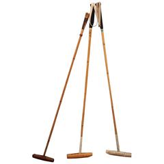
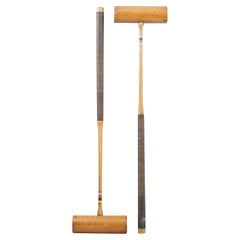
Vintage Set of Polo Mallets
View Similar Items


Want more images or videos?
Request additional images or videos from the seller
1 of 11
Vintage Set of Polo Mallets
$375List Price
About the Item
- Dimensions:Height: 54 in (137.16 cm)Width: 2 in (5.08 cm)Depth: 9.13 in (23.2 cm)
- Sold As:Set of 3
- Place of Origin:
- Period:
- Date of Manufacture:circa 1970
- Condition:Wear consistent with age and use.
- Seller Location:Sag Harbor, NY
- Reference Number:1stDibs: LU225236400463
About the Seller
5.0
Vetted Professional Seller
Every seller passes strict standards for authenticity and reliability
Established in 2006
1stDibs seller since 2016
106 sales on 1stDibs
Typical response time: 1 hour
Authenticity Guarantee
In the unlikely event there’s an issue with an item’s authenticity, contact us within 1 year for a full refund. DetailsMoney-Back Guarantee
If your item is not as described, is damaged in transit, or does not arrive, contact us within 7 days for a full refund. Details24-Hour Cancellation
You have a 24-hour grace period in which to reconsider your purchase, with no questions asked.Vetted Professional Sellers
Our world-class sellers must adhere to strict standards for service and quality, maintaining the integrity of our listings.Price-Match Guarantee
If you find that a seller listed the same item for a lower price elsewhere, we’ll match it.Trusted Global Delivery
Our best-in-class carrier network provides specialized shipping options worldwide, including custom delivery.More From This Seller
View AllFramed Mid-19th Century Wall Map of Long Island, the Hamptons
Located in Sag Harbor, NY
A Framed museum quality find. This large wall map dates to the mid-1800s. Detailed inset maps of, Sag Harbor, East Hampton, Amagansett, Shelter Island and most villages in Long Island. It also has agriculture stats for 1855. Detailed prints of homes on Scuttle Hole in Bridgehampton as well as several other detailed prints. Lists of businesses, distance tables and railroad schedules and stops. The total amount of detailed information about Suffolk County Long Island is staggering. A unique rare New York map...
Category
Antique Mid-19th Century American Maps
Materials
Linen, Paper

$7,100 Sale Price
20% Off
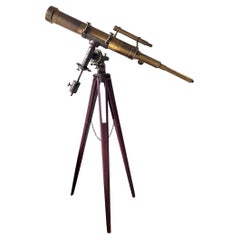
19th C. John Byrne Brass Telescope with tripod
Located in Sag Harbor, NY
19th C. John Byrne brass telescope with tripod. Marked John Byrne New York 1882. 3.5 inch refracting telescope with 43.5 inch main tube. A wonderful piece of history, Optics are not ...
Category
Late 20th Century American Scientific Instruments
Materials
Brass
Antique Textured Glass Lights, ‘Set of Three’
Located in Sag Harbor, NY
Amazing set of three Industrial pendant lights. Beautiful original blue painted caps and original ribbed glass.
Category
Vintage 1940s Chandeliers and Pendants

Large Vintage Sign
Located in Sag Harbor, NY
Large one of a kind wooden sign with fantastic details. Great colors and intricate shapes. Originally hung outside a CT sweet shop.
Category
Mid-20th Century American Signs
Materials
Wood

$944 Sale Price
58% Off
Vintage Bus Roll
Located in Sag Harbor, NY
Authentic bus roll detailing the cities listed, Vancouver, BC, Vallejo, Twin Falls,
Toulumne, Tulsa, Tucson, Travis A.F.B., Tijuana, Stockton, Stevens Point,...
Category
20th Century American Posters
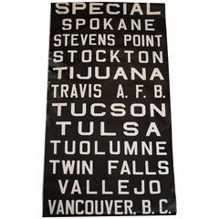
$785
Vintage Bus Roll
Located in Sag Harbor, NY
Authentic bus roll, suitable for framing.
Category
20th Century American Posters
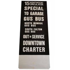
$585
You May Also Like
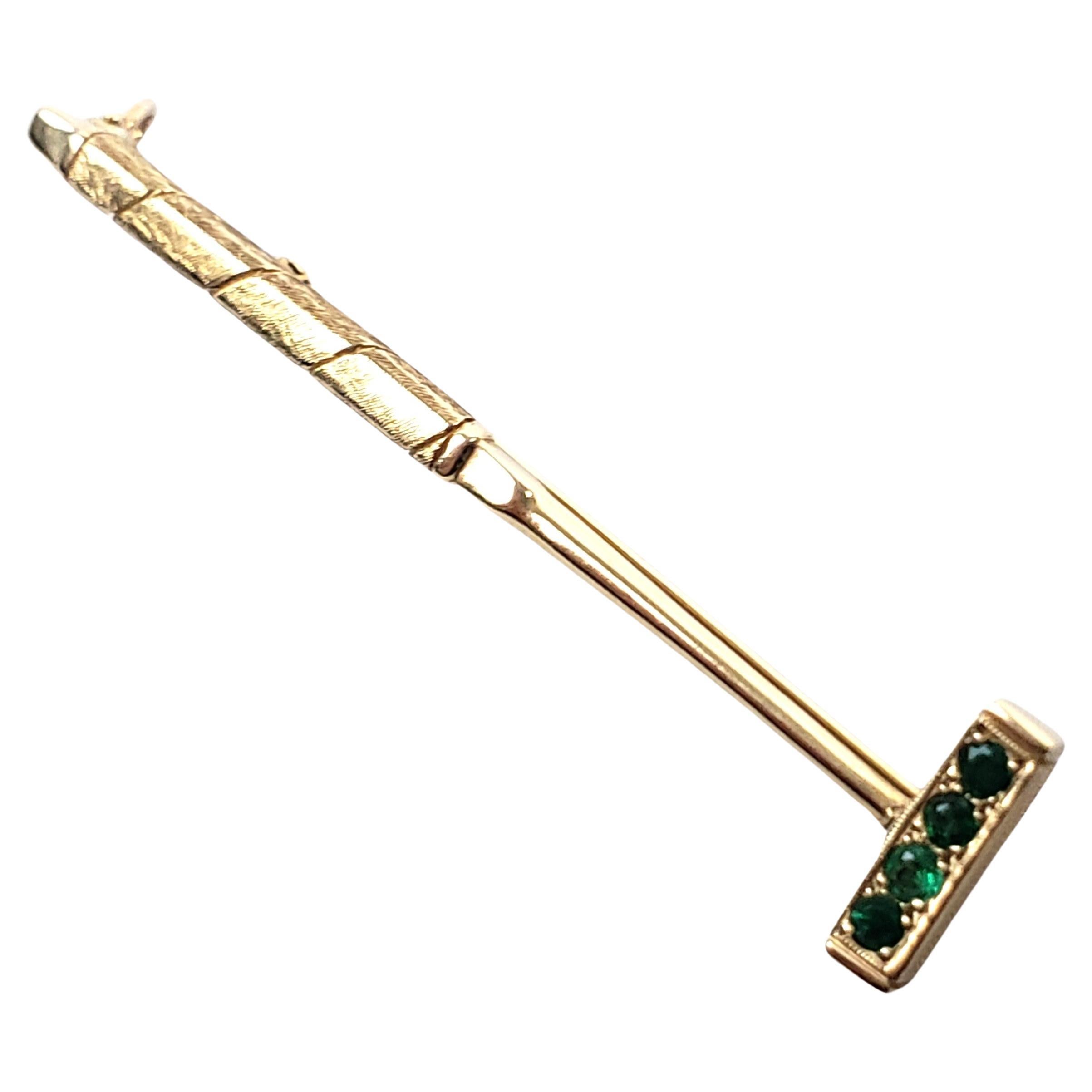
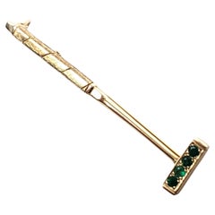
Vintage Jack Vandell 14 Karat Gold & Emerald Polo Mallet Brooch or Pendant
Located in Hamilton, Ontario
This vintage brooch or pendant was made by the well known Jack Vandell studio of the United States and dates to approximately 1970 and done in a Modern style. The piece is composed o...
Category
Late 20th Century American Modern Collectible Jewelry
Materials
Gold
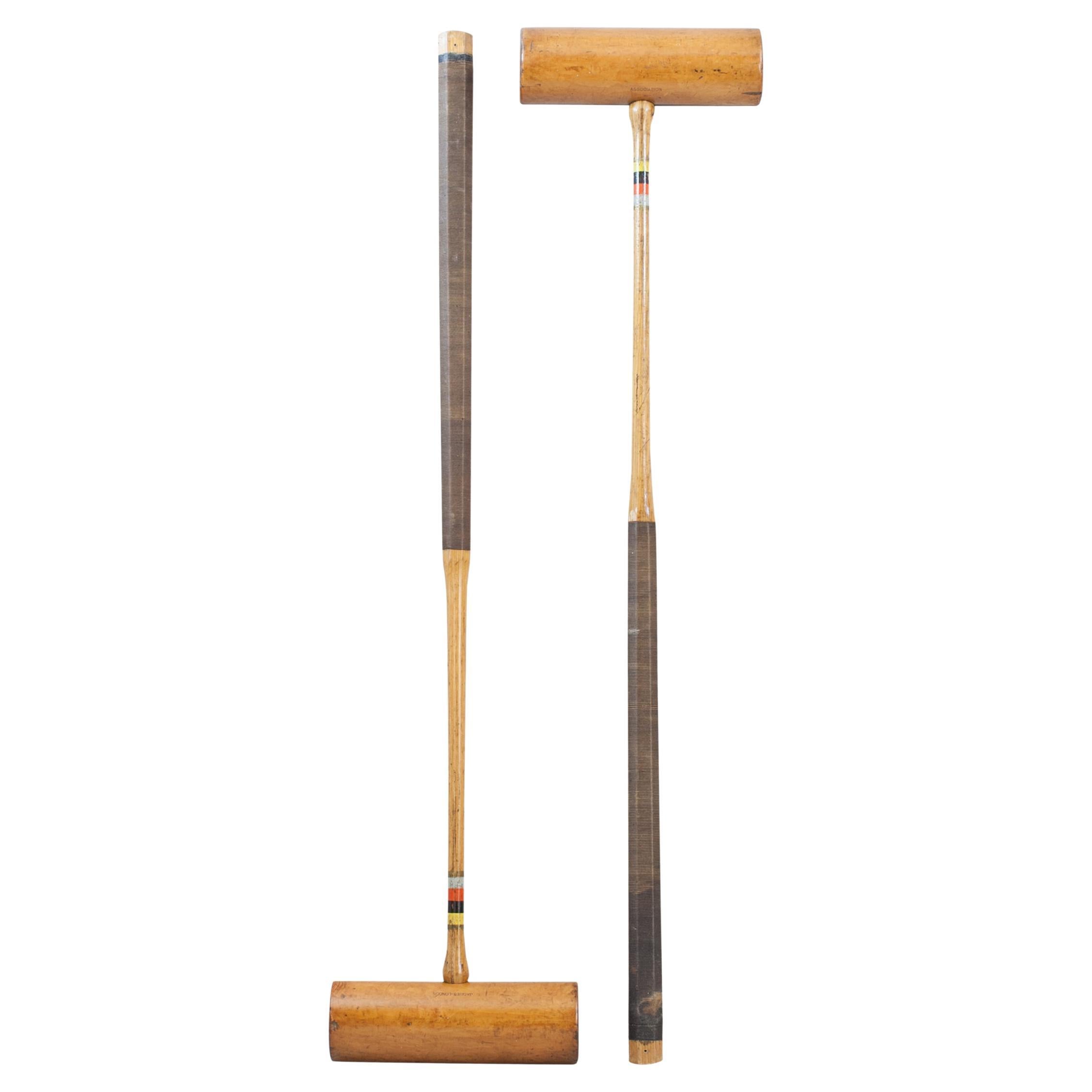
Pair Of Jaques Croquet Mallets
Located in Oxfordshire, GB
Pair of John Jaques Association Croquet Mallets.
A pair of usable Jaques Boxwood croquet mallets, with ebony alignment lines, octagonal ash handles (which helps a player 'feel' the a...
Category
20th Century English Sports Equipment and Memorabilia
Materials
Boxwood, Ash
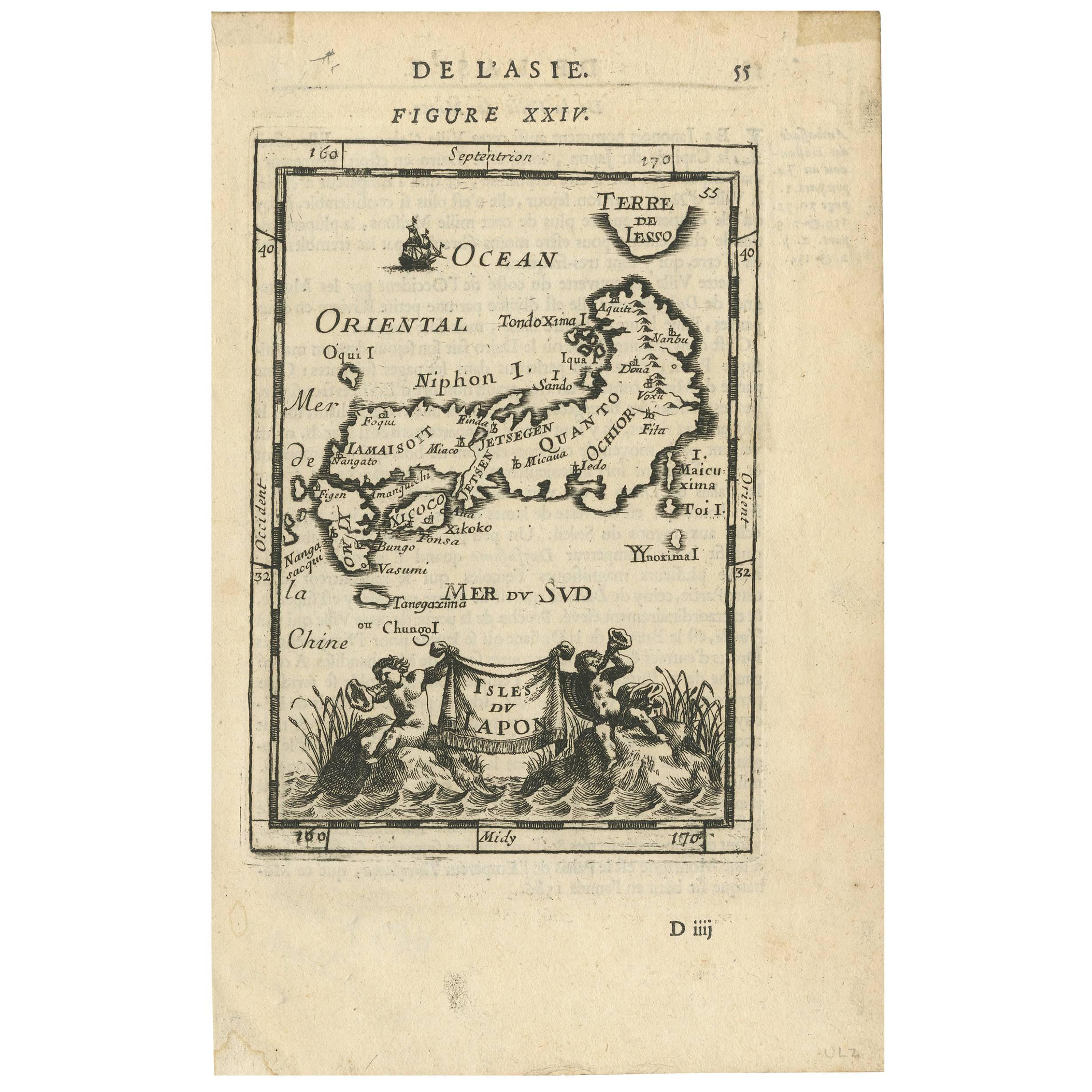
Antique Map of Japan by A.M. Mallet, 1683
Located in Langweer, NL
A charming late 17th century French map with a very decorative title cartouche showing trumpet-blowing cherubs, by Allain Manneson Mallet (1630-1706), a well traveled military engine...
Category
Antique Late 17th Century Maps
Materials
Paper

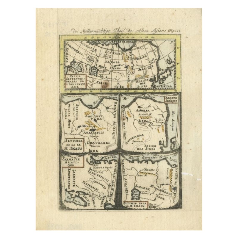
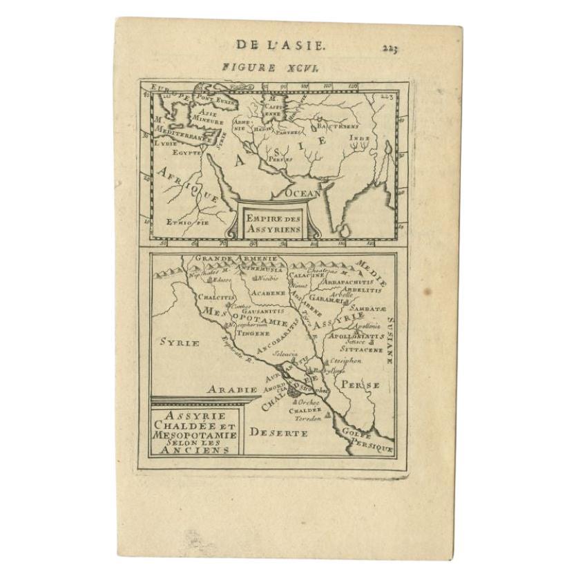
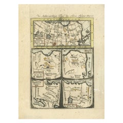
Antique Map of Northern Asia by Mallet, 1719
Located in Langweer, NL
Antique map titled 'Das Mitternächtige Theil des Alten Asien'. This sheet of five miniature maps describes the northern part of Asia in classical times, perhaps circa 150 AD. At the top, an overview map shows the main regions and territories, which are pictured in more detail below. From left to right, the four maps below depict Scythia east of the Imaus (Pamir) Mountains, Serica, Sychia west of the Pamir mountains, and Sarmatia, the last of which borders the Black Sea. Originates from Alain Manesson Mallet's 'Description de l 'Univers' (German edition). Artists and Engravers: Alain Manesson Mallet (1630-1706) was a French cartographer and engineer. He started his career as a soldier in the army of Louis XIV, became a Sergeant-Major in the artillery and an Inspector of Fortifications. He also served under the King of Portugal, before returning to France, and his appointment to the court of Louis XIV. His military engineering and mathematical background led to his position teaching mathematics at court. His major publications were Description de L'Univers (1683) in 5 volumes, and Les Travaux de Mars ou l'Art de la Guerre (1684) in 3 volumes. His Description de L'Universe contains a wide variety of information, including star maps...
Category
Antique 18th Century Maps
Materials
Paper
$93 Sale Price
20% Off
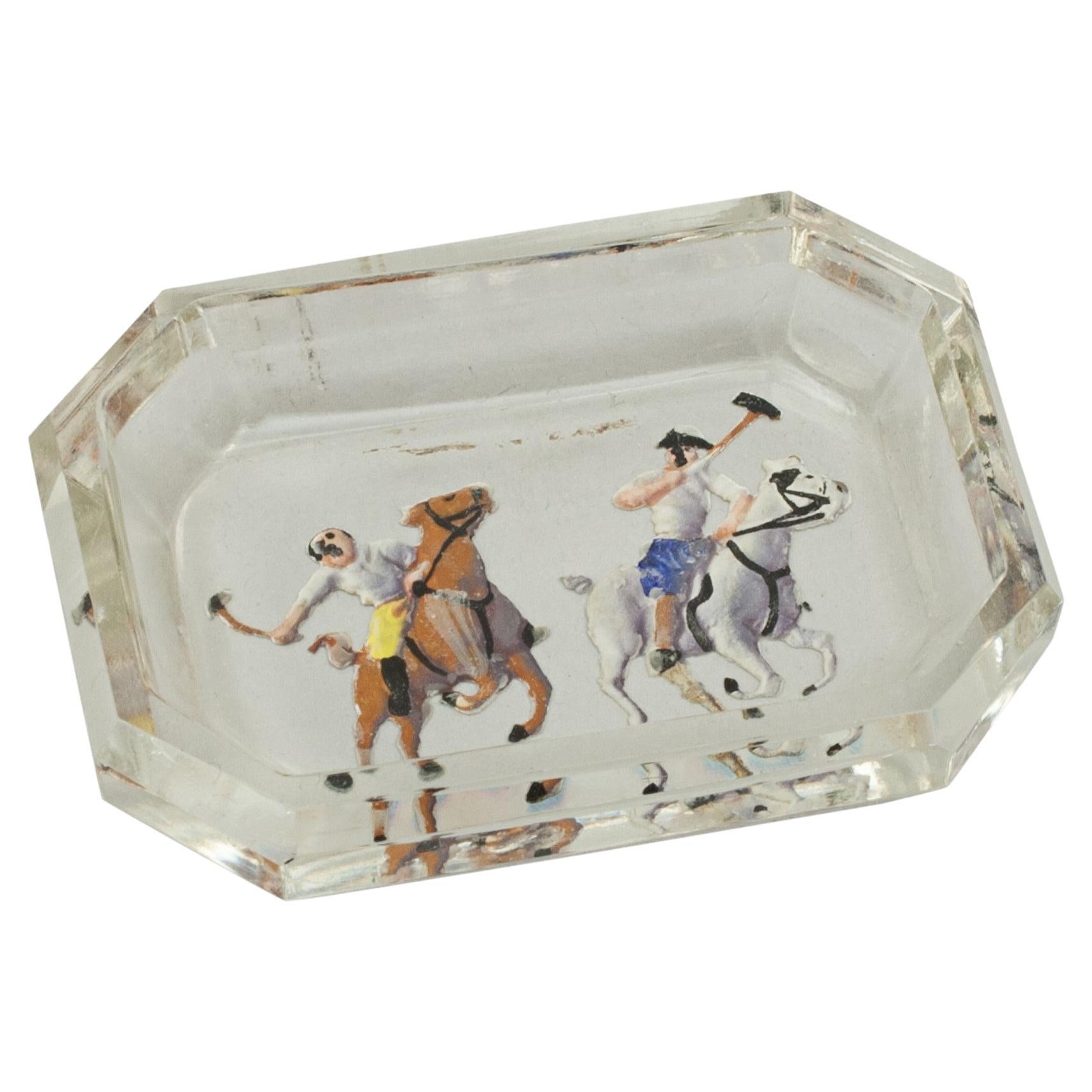
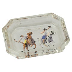
Vintage Intaglio Polo Glass Pin Tray
Located in Oxfordshire, GB
Vintage Intaglio Polo Glass Pin Tray.
A small glass pin tray with intaglio images of polo players set into the base, which have then been painted. The sma...
Category
Vintage 1930s Sports Equipment and Memorabilia
Materials
Glass
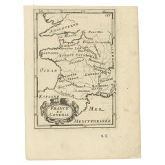
Detailed Antique Miniature Map of France by Mallet, c.1683
Located in Langweer, NL
Antique map titled 'France en General'. BG-11796-55. Originates from Mallet's 'Description de l'Univers'.
Artists and Engravers: Alain Manneson Mallet (1630-1706) spent the first ...
Category
Antique 17th Century Maps
Materials
Paper
$154 Sale Price
20% Off
Recently Viewed
View AllMore Ways To Browse
American Leather Sectional
American Marble Benches
Anfibio Leather Sofa
Anglo Indian Dining Chairs
Animal Lumbar Pillow
Anonima Castelli Plona
Antique Anatomy Chart
Antique Bokara Rugs
Antique Bookcase And Ladder
Antique Botanical Book Plates
Antique Bread Slicer
Antique Butter Crock
Antique Calligraphy Pens
Antique Cast Iron Trolley
Antique China Dogs Ornaments
Antique Chinese Marble Top Carved Rosewood Table
Antique Chinese Mother Of Pearl Inlaid Table
Antique Cleaver