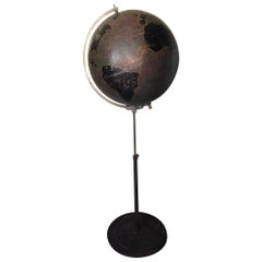
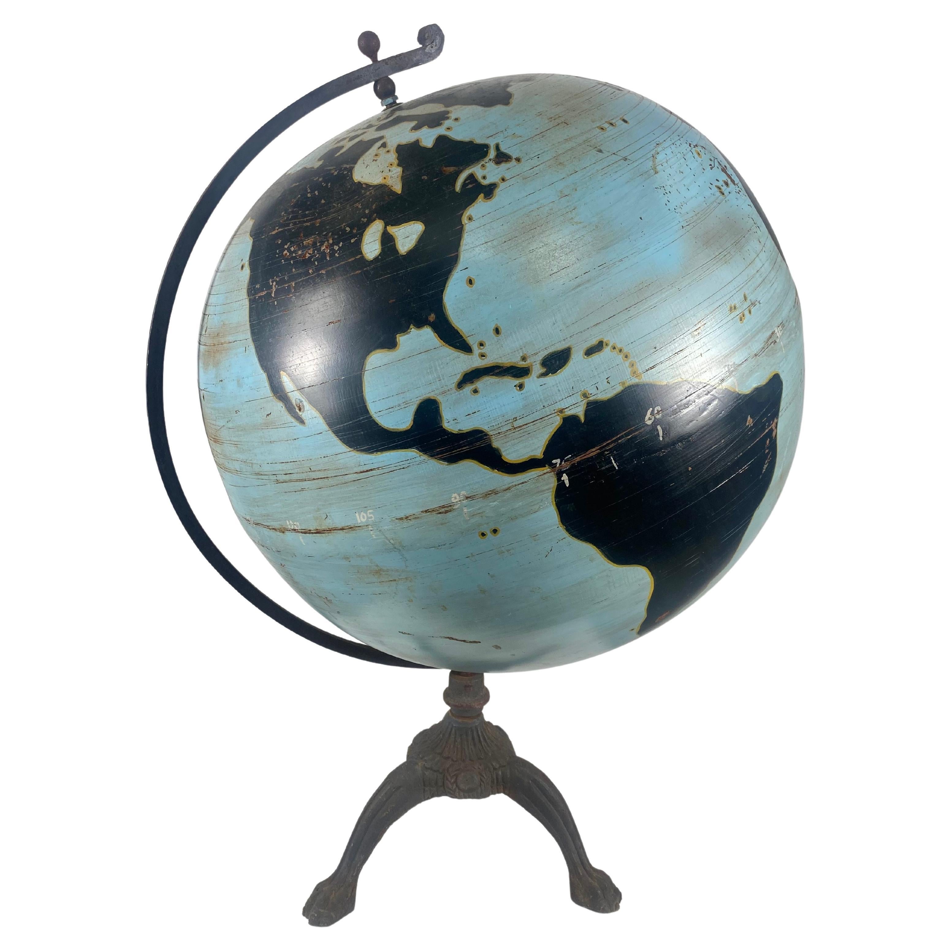
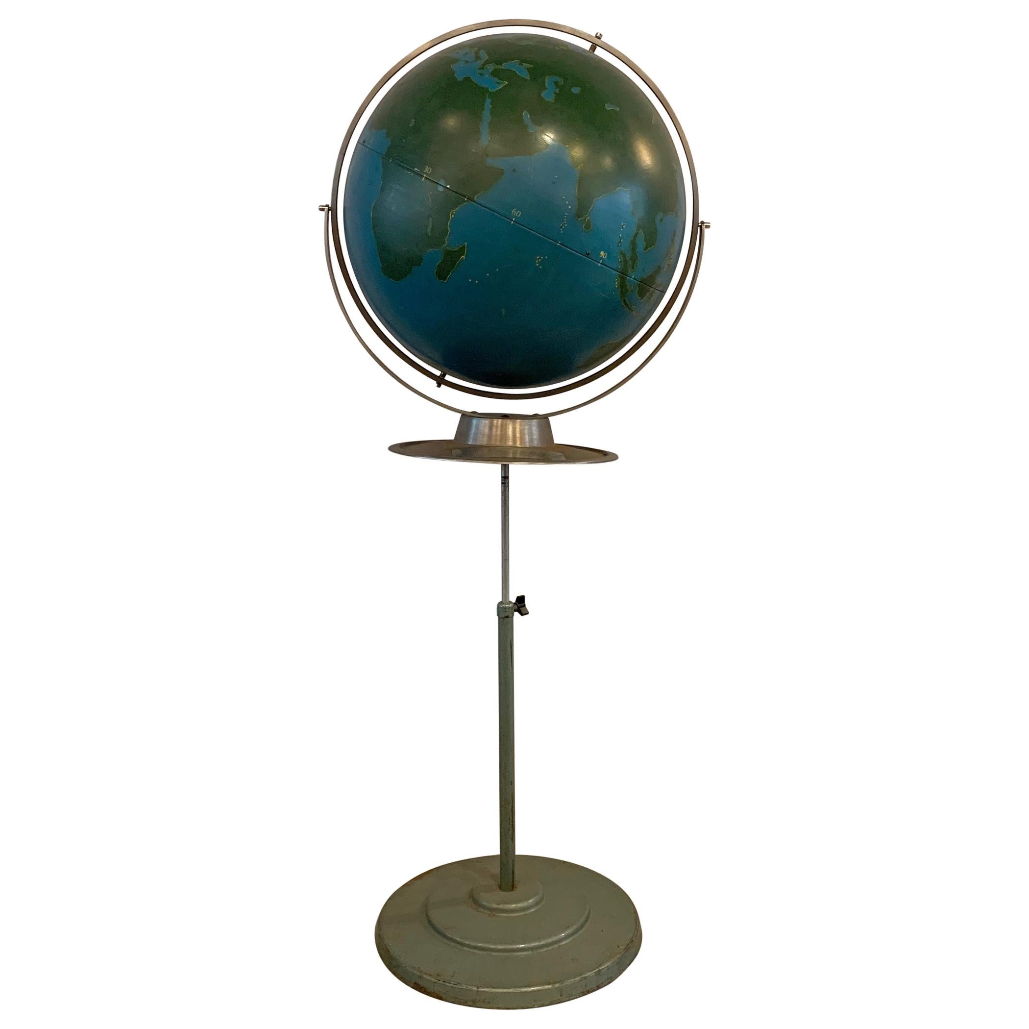
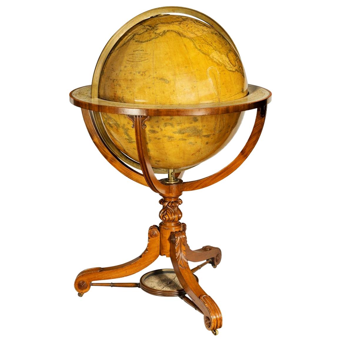
Globe by Denoyer Geppert Used for Military Aviation Training, circa 1920s
View Similar Items
1 of 5
Globe by Denoyer Geppert Used for Military Aviation Training, circa 1920s
About the Item
- Creator:Denoyer-Geppert (Manufacturer)
- Dimensions:Height: 60 in (152.4 cm)Diameter: 24 in (60.96 cm)
- Style:Industrial (Of the Period)
- Materials and Techniques:
- Place of Origin:
- Period:
- Date of Manufacture:1920s
- Condition:Wear consistent with age and use. gorgeous oversize globe with 100 years of brown and black patina from use and aging.
- Seller Location:Madison, WI
- Reference Number:1stDibs: LU923515652102
Authenticity Guarantee
In the unlikely event there’s an issue with an item’s authenticity, contact us within 1 year for a full refund. DetailsMoney-Back Guarantee
If your item is not as described, is damaged in transit, or does not arrive, contact us within 7 days for a full refund. Details24-Hour Cancellation
You have a 24-hour grace period in which to reconsider your purchase, with no questions asked.Vetted Professional Sellers
Our world-class sellers must adhere to strict standards for service and quality, maintaining the integrity of our listings.Price-Match Guarantee
If you find that a seller listed the same item for a lower price elsewhere, we’ll match it.Trusted Global Delivery
Our best-in-class carrier network provides specialized shipping options worldwide, including custom delivery.You May Also Like
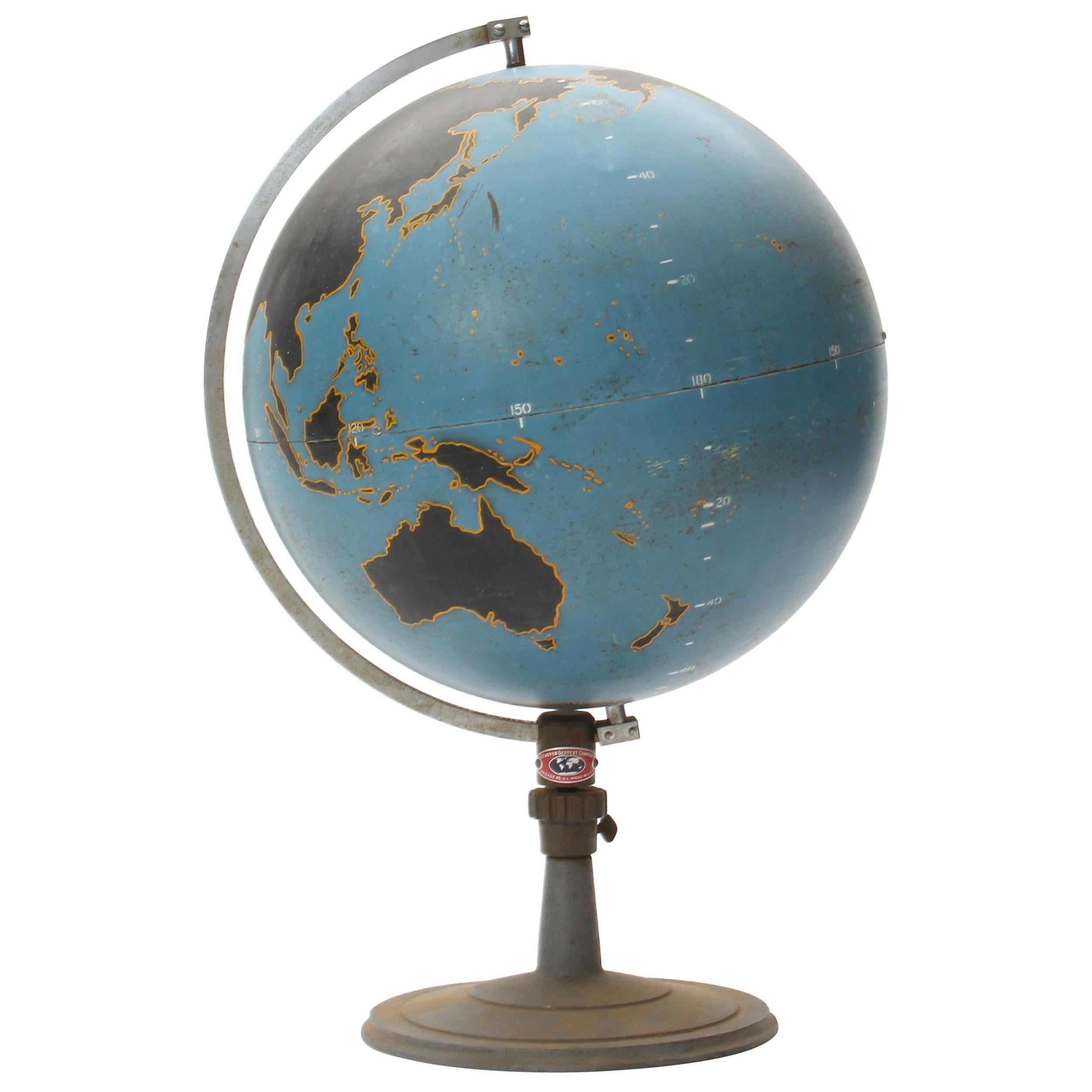
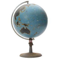
Large 1930s Steel /Cast Iron Military Chalk World Globe Denoyer Geppert
By Denoyer-Geppert
Located in Buffalo, NY
Rare c 1930 steel Denoyer Geppert military chalk globe. Globe alone measures 22" in diameter, Retains original patina. Age appropriate wear. Minor dents.(see photo). Original patina ...
Category
Vintage 1930s American Art Deco Globes
Materials
Steel, Iron

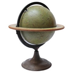
Globe by Denoyer Geppert Company
By Denoyer-Geppert
Located in Sagaponack, NY
A graphic and finely fabricated spun steel teaching globe mounted on a weighted stand.
Category
Vintage 1940s American Mid-Century Modern Globes
Materials
Steel
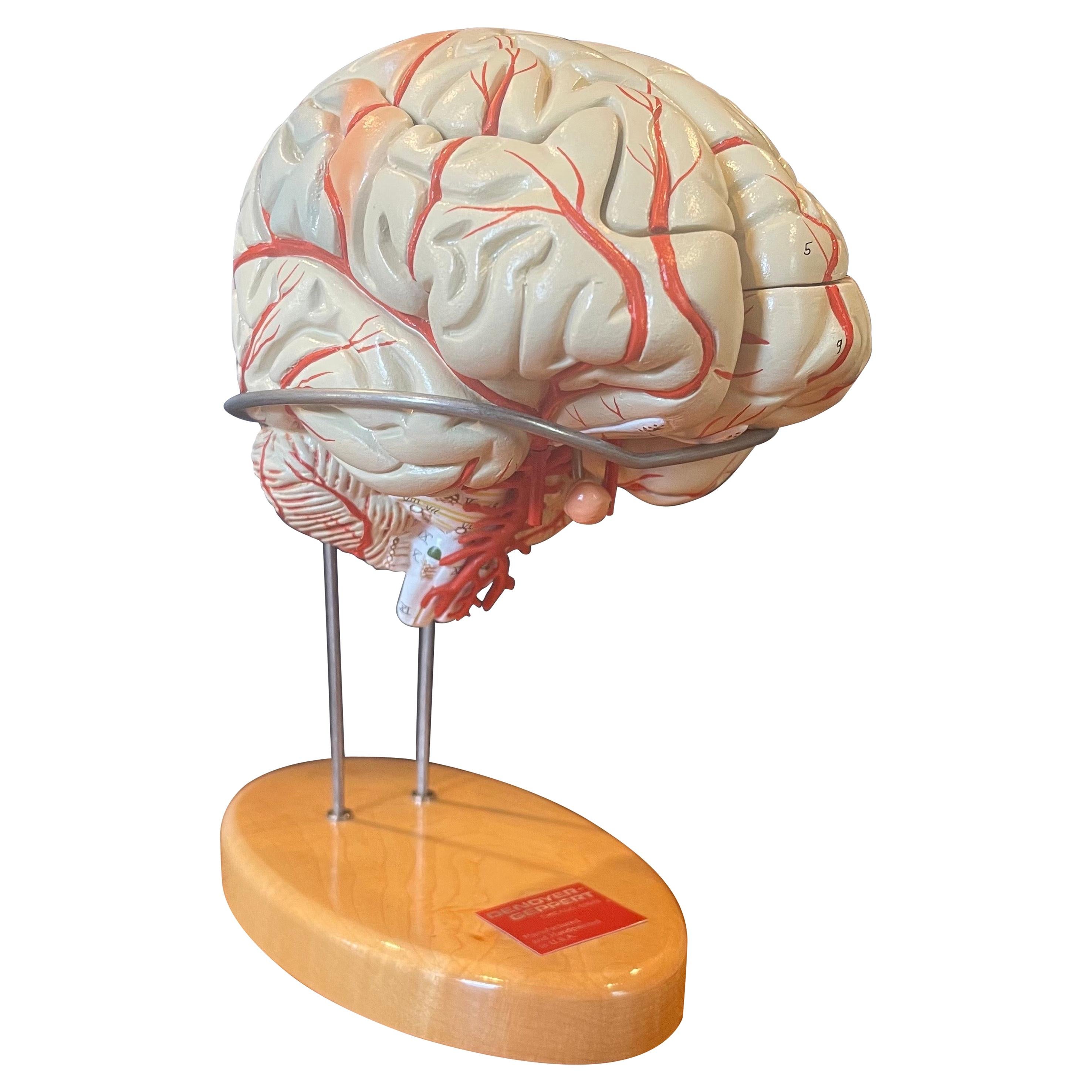
Vintage Hand-Painted Brain Model by Denoyer Geppert
By Denoyer-Geppert
Located in San Diego, CA
Vintage hand painted brain model on stand by Denoyer-Geppert, circa 1990s. The model consists of eight pieces of molded, nonbreakable, vinyl that are conne...
Category
Late 20th Century American Models and Miniatures
Materials
Wood

$380 Sale Price
20% Off
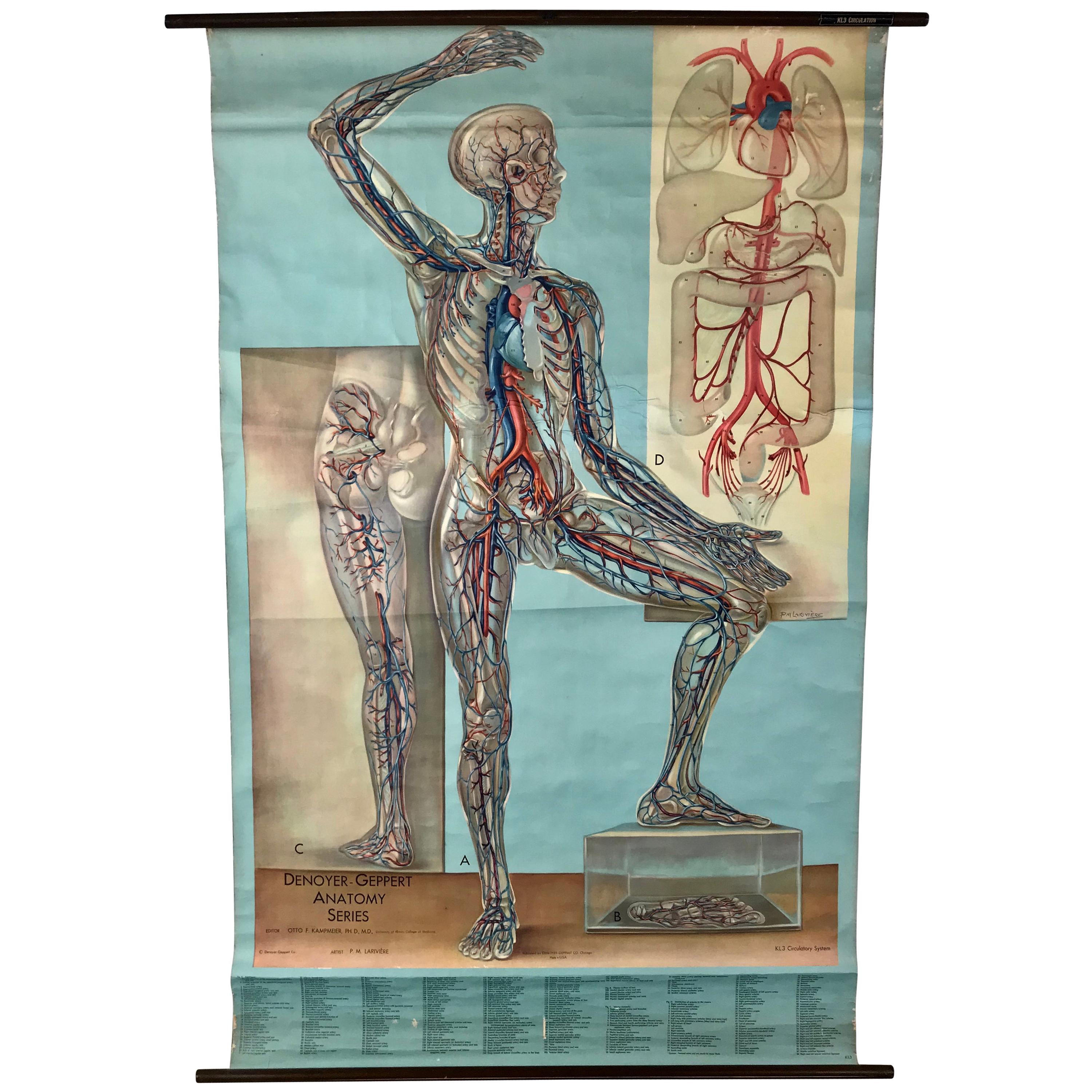
1938 Pull Down Anatomy Chart, Denoyer-Geppert, Artist P.M. Lariviere
By Denoyer-Geppert
Located in Buffalo, NY
1938 pull down anatomy chart, Denoyer-Geppert. Artist P.M. Lariviere. KL3 circulatory system. Stunning image, screenprint on linen.
Category
Vintage 1930s American Industrial Scientific Instruments
Materials
Linen

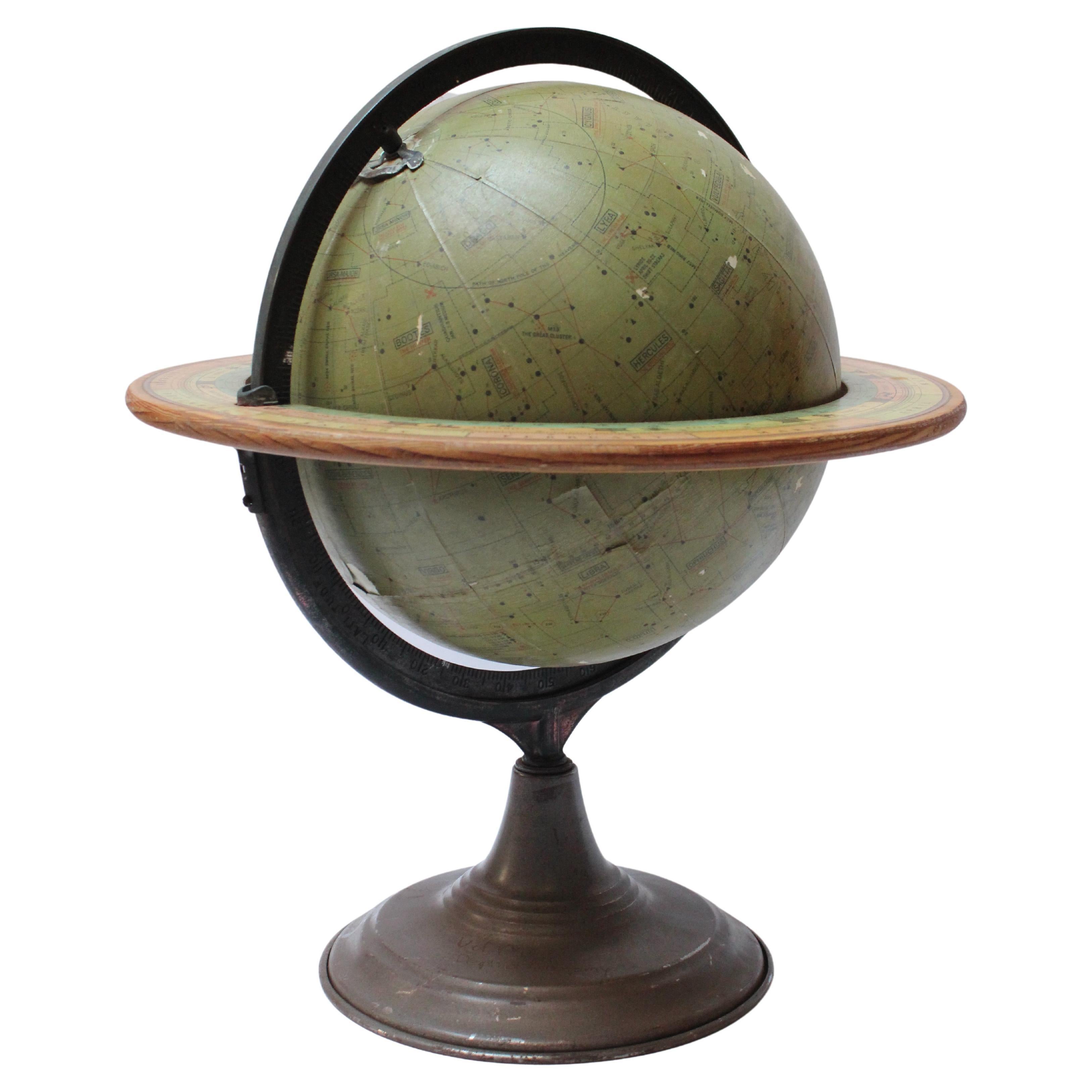
Vintage Dennoyer-Geppert Celestial Globe
Located in Brooklyn, NY
Dennoyer-Geppert Celestial Globe designed by Commander Stubbs RNR (Royal Navy) for classroom astronomy demonstration purposes (ca. 1930, Chicago, IL.). Composed of paper gores in olive green over a hollow metal core, featuring an adjustable cast-metal meridian with bronze finish and a wood horizon...
Category
Vintage 1930s American Art Deco Globes
Materials
Metal
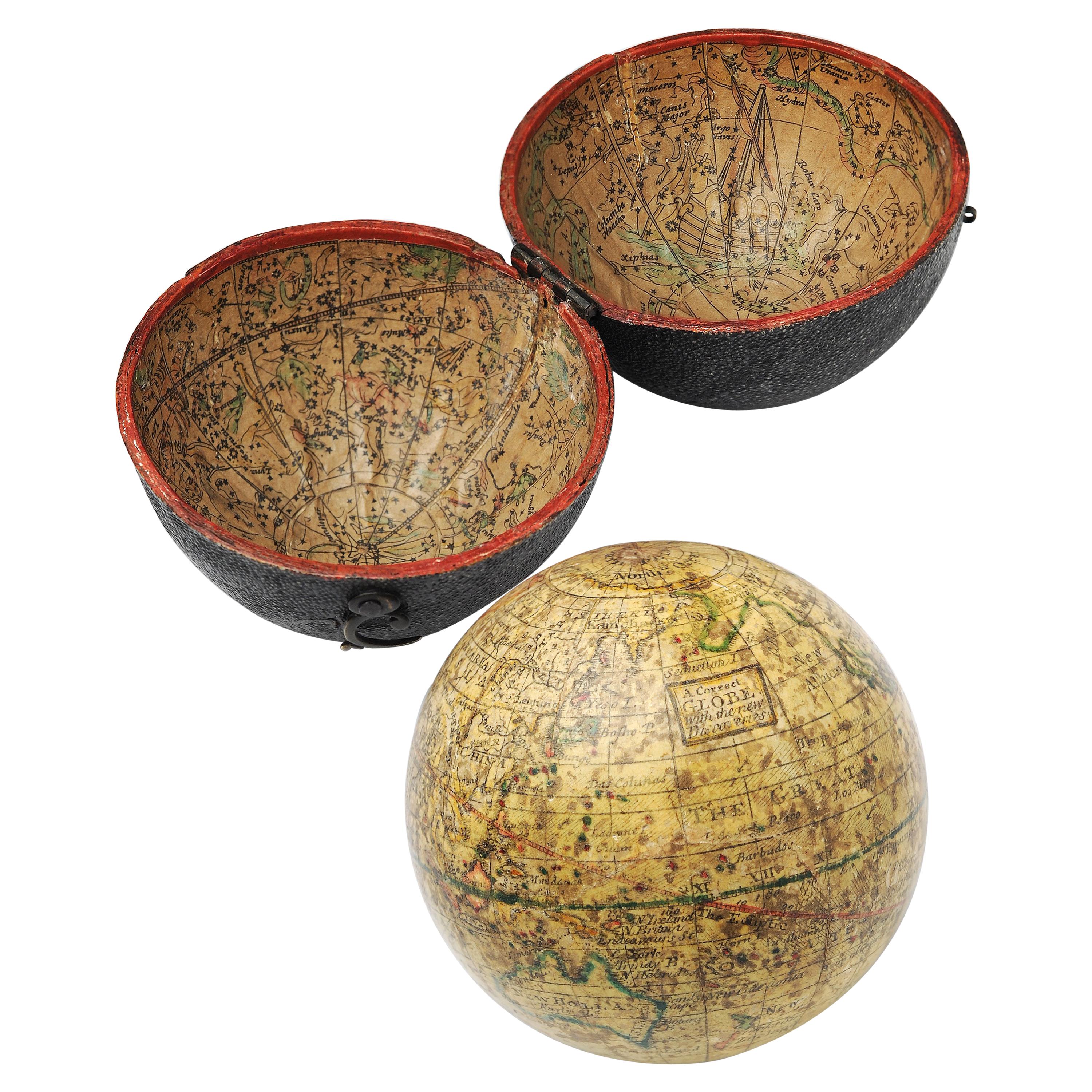
English Pocket Globe, London, Circa 1775-1798
By Herman Moll
Located in Milano, IT
Pocket globe
London, between 1775 and 1798
Re-edition of the globe of Hermann Moll (1678-1732) dated 1719
The globe is contained in its original case, which itself is covered in shark skin.
There are slight gaps in the original paint on the sphere. The case no longer closes.
The sphere measures 2.7 in (7 cm) in diameter whereas the case measures 2.9 in (7.4 cm) in diameter.
lb 0.22 (kg 0.1)
The globe is made up of twelve printed paper gores aligned and glued to the sphere.
In the North Pacific Ocean there is a cartouche with the inscription:
A Correct
Globe
with the new
Discoveries.
The celestial globe is depicted on the inside of the box and is divided into two hemispheres with the cartouche:
A correct globe
with ye new cons
relations of Dr.
Halley & c.
It shows the ecliptic divided into the days of the zodiacal calendar and the constellations represented as animals and mythological figures.
On the globe are delineated the equinoctial line, divided by degrees and hours, the ecliptic and the meridian (passing west of Greenwich). The continents are shaded and outlined in pink, green and yellow. It shows: the Cook routes; a wind rose in the Southern Indian Ocean; Antarctica without land; Africa with Negroland (Hermann Moll is considered the first geographer to name the West African region in his 1727 map. (Encyclopaedia Britannica, ed. 1902, under "States of Central Africa"); Tartary in Central Asia; the Mogul kingdom in northern India; in North America only New England, Virginia, Carolina, Florida, Mississippi are identified; California is already a peninsula; the northwest coast of America is "unknown parts" (Alaska is not described and it is only partially delineated, it was to become part of the United States in 1867); Mexico is named "Spain"; Central South America "Amazone America". Australia (which was to be so named after 1829) is called New Holland. The route of Admiral Anson is traced (1740) and the trade winds are indicated by arrows. (See Van der Krogt, P., Old Globes in the Netherlands, Utrecht 1984, p. 146 and Van der Krogt, P. - Dekker, E., Globes from the Western World, London 1993, pp. 115.)
Elly Dekker, comparing Moll’s 1719 globe and his re-edition (of which the one described above is a sample), identifies the differences between them: the two editions are quite similar to each other, but in the "anonymous" globe, compared to the previous globe of 1719, California looks like a proper peninsula - the reports of the Spanish explorers of the region had given rise to uncertainty over whether it was connected to the mainland or not. The geographical nature of California was confirmed after the explorations of Juan Bautista de Anza (1774-1776). The routes of Dampier's journey were partially erased and the route of Captain James Cook's first voyage was superimposed on them, and the geography of Australasia was adapted accordingly, including the denomination of the Cook Strait. See Dekker, Elly, Globes at Greenwich, 1999.
An important ante quem element is represented by Tasmania: it is not separated from Australia by the Bass Strait...
Category
Antique Late 18th Century English George III Globes
Materials
Shagreen, Paper

Recently Viewed
View AllMore Ways To Browse
Denoyer Geppert
Geppert Globe
Denoyer Geppert Globe
Denoyer Globe
Globes Terrestres Vintage
Denoyer Geppert
Lo Greco
J Didier
Celestial Globe Cary
Pair Globe Cary
Vintage Celestial Globe
Astrological Globe
Floor Terrestrial Globe
Globe Cigarette
Desktop Globe
Floor Globes By Replogle
Girard Et Barrere
Bellerby Globe