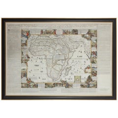
Framed Hand Colored Map of Africa by Nicolas de Fer
View Similar Items


Want more images or videos?
Request additional images or videos from the seller
1 of 3
Framed Hand Colored Map of Africa by Nicolas de Fer
About the Item
- Dimensions:Height: 43.12 in (109.5 cm)Width: 64.18 in (163 cm)Depth: 1.97 in (5 cm)
- Materials and Techniques:Other,Engraved
- Place of Origin:
- Period:Late 17th Century
- Date of Manufacture:1696
- Condition:Wear consistent with age and use.
- Seller Location:Amsterdam, NL
- Reference Number:1stDibs: LU5458220857362
About the Seller
5.0
Vetted Seller
These experienced sellers undergo a comprehensive evaluation by our team of in-house experts.
Established in 1985
1stDibs seller since 2020
19 sales on 1stDibs
Typical response time: 3 hours
More From This SellerView All
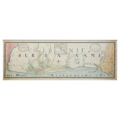
- Extremely Large Hand-Drawn Manuscript Map of Surinam, 1830, History of SlaveryLocated in Amsterdam, NLA unique large hand-drawn map of Surinam by Albrecht Helmut Hiemcke (German, 1760-1839) ? 'Colonie Surinaame', 1830 A large hand-drawn and coloured map of the colony of Suri...Category
Antique Mid-19th Century Surinamer Maps
MaterialsPaper
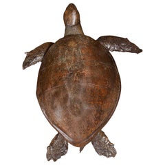
- Giant Victorian Taxidermy Loggerhead Sea TurtleLocated in Amsterdam, NLAn extremely rare giant Victorian taxidermy Loggerhead sea turtle England, 19th century The extremely large animal with a nice patina, with some parts professionally restored and...Category
Antique 19th Century British Victorian Taxidermy
MaterialsTortoise Shell, Animal Skin, Epoxy Resin, Paint
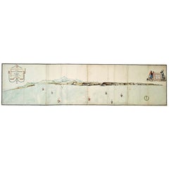
- Very Large Hand-Drawn View of St Iago Cape Verde, by Frederici, 1783Located in Amsterdam, NLJohann Christian Friderici [= Frederici] (Heldburg 1766 - Cape Town 1804) Prospect van het eyland, en de rheede van St. Iago. Geteekend van Johann Christian Friderici / Verbeelding van de inwoonders op St Iago (View of the island, and the roadstead of St. Iago. Drawn by Johann Christian Friderci / Depiction of the inhabitants on St Iago) ?Porto Praia, Cape Verde...Category
Antique Late 18th Century Cape Verdean Dutch Colonial Maps
MaterialsPaper
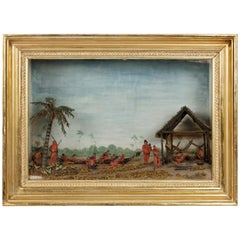
- Rare Anthropological Diorama of Carib Indigenous by Hendrik SchoutenLocated in Amsterdam, NLHendrik Samuel Schouten (1785-1840) A unique diorama depicting Carib Indigenous at the river side Wood, paint on paper, twigs and dried moss Measures: H. 51 x W. 69.5 x D. 20 cm Note: This is the only known diorama by Hendrik Schouten. He became a planter and inherited the Jagtlust plantation from his grandfather Samuel Loske. His older brother Gerrit Schouten...Category
Antique Early 18th Century Models and Miniatures
MaterialsTwig, Wood, Giltwood, Paint, Paper
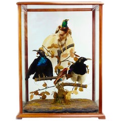
- Victorian Display with Taxidermy Birds of Paradise by Jane C. WardLocated in Amsterdam, NLAn extremely rare Australian Victorian display cabinet with birds of paradise by Jane Catherine Ward (1817-1889) Sydney, circa 1880 Wi...Category
Antique 19th Century Australian Late Victorian Taxidermy
MaterialsOther
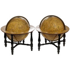
- Pair of Fine Desk Globes by J. Cary, 1816 and 1824Located in Amsterdam, NLA pair of desk globes by J. Cary “Cary’s New Terrestrial Globe delineated from the best Authorities extant; exhibiting the late discoveries toward the North Pole and every improve...Category
Antique Early 19th Century Maps
MaterialsOther
You May Also Like
- Antique Hand-Colored Map of France by J.B. Elwe, 1792Located in Langweer, NLAntique map titled 'Carte Nouvelle du Royaume de France'. Beautiful antique map of France, including the Southern part of England. Decorated with cartouche and 12 coats of arms.Category
Antique Late 18th Century Maps
MaterialsPaper

- Antique Map of Africa by Dufour, circa 1834Located in Langweer, NLAntique map titled 'Afrique'. Uncommon map of Africa. Published by or after A.H. Dufour, circa 1834. Source unknown, to be determined.Category
Antique Mid-19th Century Maps
MaterialsPaper
 $175 Sale Price20% Off
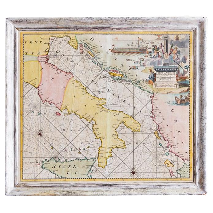
 - 17th Century Nicolas Visscher Map of Southeastern EuropeLocated in Hamilton, OntarioA beautiful, highly detailed map of southeastern Europe by Nicolas Visscher. Includes regions of Northern Italy (showing the cities Bologna, Padua, and Venice), Bohemia, Austria (sho...Category
Antique 17th Century Dutch Maps
MaterialsPaper
 $1,350 Sale Price38% Off
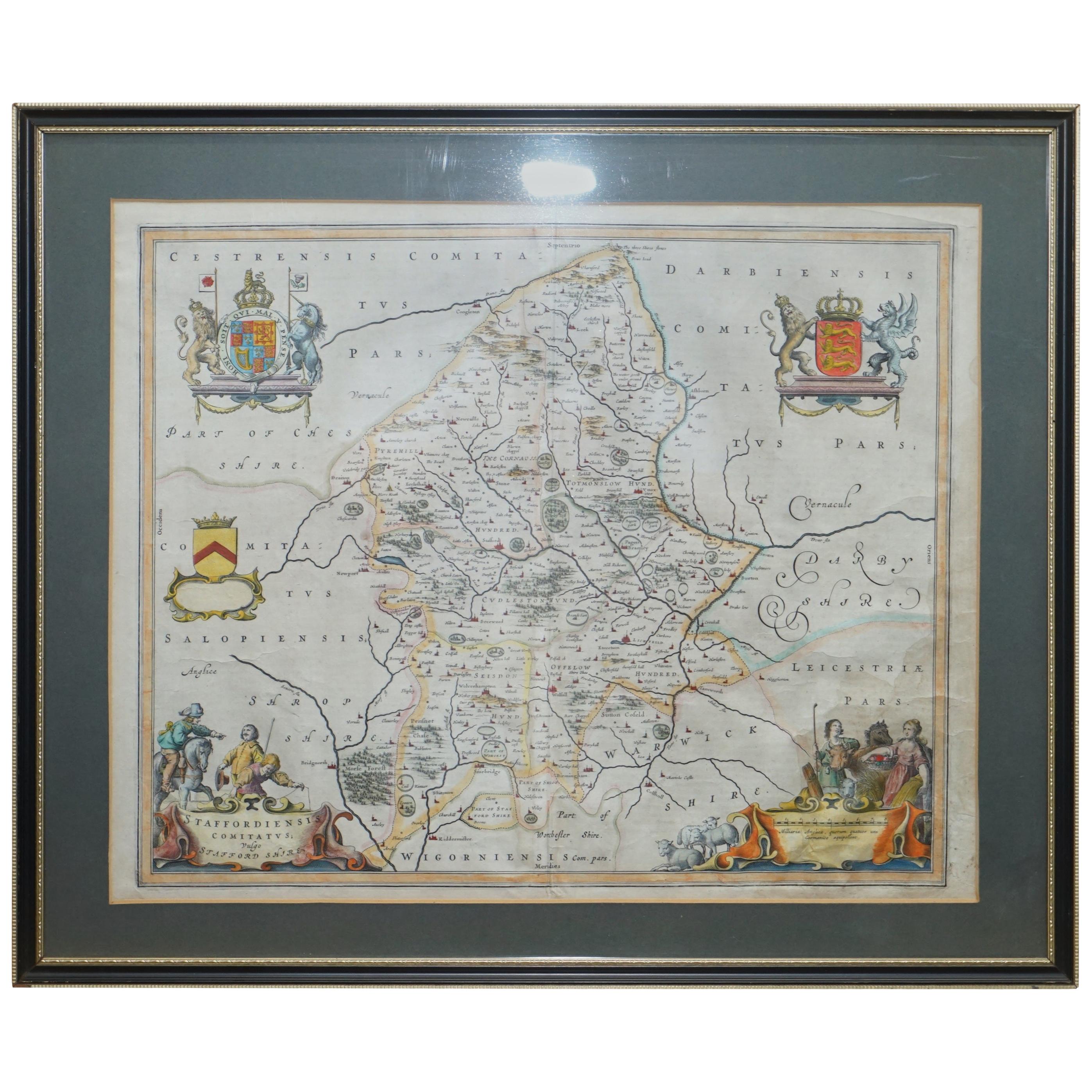
 - Staffordshire 1645 Hand Colored Antique Print Staffordiensis Comitatvs MapLocated in GBWe are delighted to offer for sale this lovely antique Atlas page map of Staffordshire printed in 1645 Amsterdam Staffordiensis Comitatvs Vulgo This o...Category
Antique Early 1800s English Georgian Maps
MaterialsPaper
 $402 Sale Price30% Off
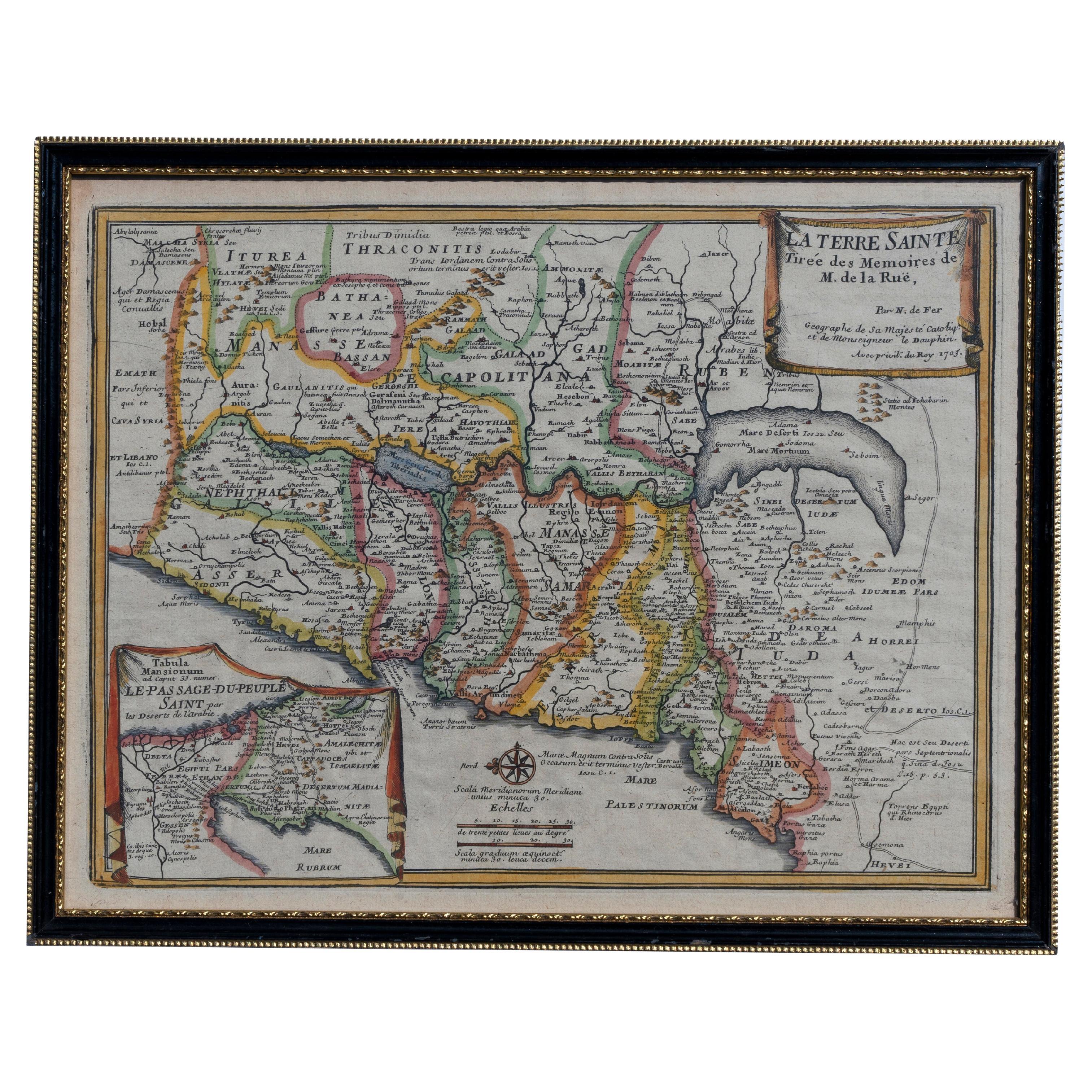
 - Map Holy Land La Terre Sainte Engraved van Loon Published N de Fer 1703 FrenchLocated in BUNGAY, SUFFOLKLa Terre Sainte, The Holy Land, Tiree Des Memoires De M.De.La Rue. Par N. de Fer. Geographe de Sa Majeste Catoliq et de Monseigneur le Dauphin. Avec Privil du Roi 1703 Detailed map of the Holy Land from Nicholas de Fer's L'Atlas Curieux ou le Monde. East is oriented at the top. MAKER Nicolas de Fer 1646-1720 The French cartographer and engraver, Nicolas de Fer, was a master at creating maps that were works of art. The maps that he published were printed during the Baroque period when the decorative arts were characterized by ornate detail. De Fer’s detailed maps and atlases were valued more for their decorative content than their geographical accuracy. Nicolas de Fer was born in 1646. His father, Antoine de Fer, owned a mapmaking firm. At the age of twelve, Nicolas was apprenticed to a Parisian engraver named Louis Spirinx. The family business was starting to decline when his father died in 1673. Nicolas de Fer’s mother, Genevieve, took over the business after the death of her husband. In 1687 the business was passed on to Nicolas and the profits increased after he took over the firm. Nicolas de Fer was a prolific cartographer who produced atlases and hundreds of single maps. He eventually became the official geographer to King Louis XIV of France and King Philip V...Category
Antique Early 1700s French Louis XIV Maps
MaterialsPaper
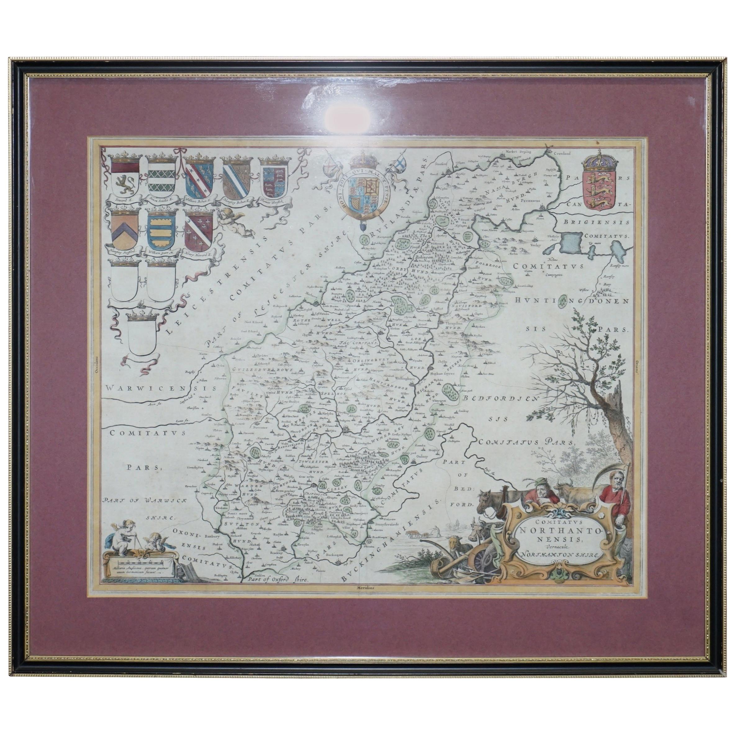
- Double Sided Northamptonshire 1645 Hand Colored Antique Print Map Rare FindLocated in GBWe are delighted to this lovely antique Atlas page map of Northamptonshire printed in 1645 Amsterdam Staffordiensis Comitatvs Vulgo I have three of th...Category
Antique Early 1800s English Georgian Maps
MaterialsPaper
 $402 Sale Price30% Off
