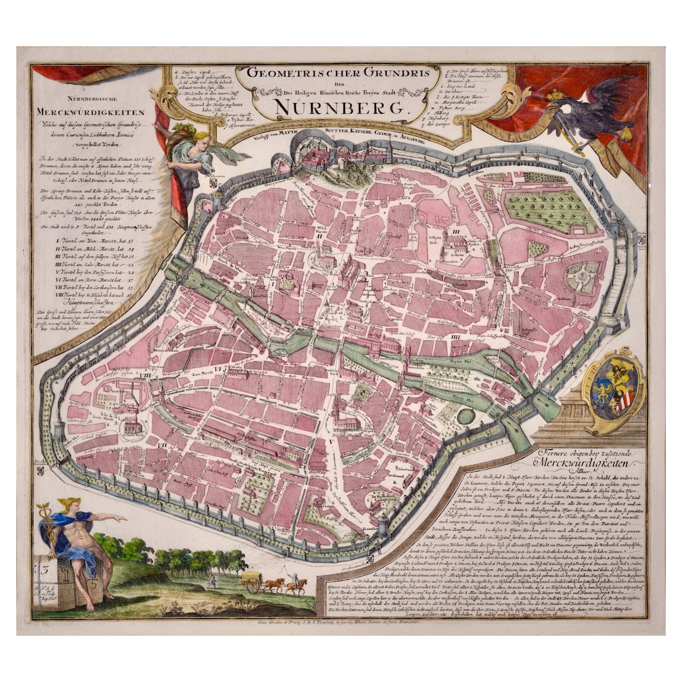
20th Century Reprint of 18th Century Nolli Map of Rome
View Similar Items


Want more images or videos?
Request additional images or videos from the seller
1 of 11
20th Century Reprint of 18th Century Nolli Map of Rome
About the Item
- Dimensions:Height: 76 in (193.04 cm)Width: 90 in (228.6 cm)
- Period:
- Date of Manufacture:20th Century
- Condition:
- Seller Location:Norwalk, CT
- Reference Number:1stDibs: U120416920482
About the Seller
4.4
Vetted Professional Seller
Every seller passes strict standards for authenticity and reliability
Established in 2005
1stDibs seller since 2011
264 sales on 1stDibs
Authenticity Guarantee
In the unlikely event there’s an issue with an item’s authenticity, contact us within 1 year for a full refund. DetailsMoney-Back Guarantee
If your item is not as described, is damaged in transit, or does not arrive, contact us within 7 days for a full refund. Details24-Hour Cancellation
You have a 24-hour grace period in which to reconsider your purchase, with no questions asked.Vetted Professional Sellers
Our world-class sellers must adhere to strict standards for service and quality, maintaining the integrity of our listings.Price-Match Guarantee
If you find that a seller listed the same item for a lower price elsewhere, we’ll match it.Trusted Global Delivery
Our best-in-class carrier network provides specialized shipping options worldwide, including custom delivery.More From This Seller
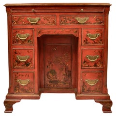
View All18th Century English Dresser with 19th Century Chinoiserie Decoration
Located in Norwalk, CT
Lovely form on this 18th century desk with a beautiful chinoiserie finish added in the 19th century. The color is remarkable with fine figured painting in the Chinese manner, accent...
Category
Antique Mid-18th Century English Chinoiserie Desks and Writing Tables
Materials
Wood
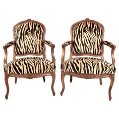
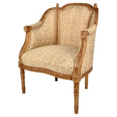
Pair of 18th C French Armchairs in Jacquard Zebra-print Velvet
Located in Norwalk, CT
A handsome pair of French open arm chairs. Lovely patina on hand-carved fruitwood frames. Newly upholstered in a quality jacquard velvet...
Category
Antique Late 18th Century French Louis XV Armchairs
Materials
Upholstery, Fruitwood
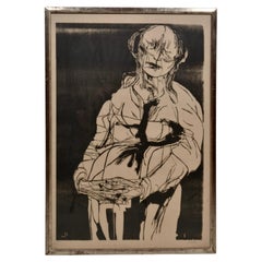
Framed Woodblock Print by Leonard Baskin, USA c 1969
By Leonard Baskin
Located in Norwalk, CT
Titled "Betrayal", this work by Leonard Baskin is a woodblock print on rice paper. It is signed and numbered 45/100. It is presented in an outstanding silver water-gilded frame which...
Category
Vintage 1960s American Mid-Century Modern Prints
Materials
Paper
18th C French Giltwood Bergere with Fortuny Upholstery
Located in Norwalk, CT
A lovely example of a traditional French bergere updated with a Fortuny hand printed upholstery fabric. Original gilding on hand carved frame in very fine condition. Tight seat and f...
Category
Antique Late 18th Century French Louis XVI Bergere Chairs
Materials
Upholstery, Giltwood
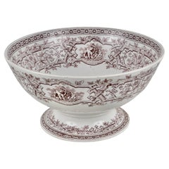
!9th C English Transferware Punch Bowl by Furnival
By Thomas Furnival & Sons
Located in Norwalk, CT
Wonderful large scale on this English bowl. Transferware design featuring the natural motifs, popular in the arts and crafts movement surround more traditional romantic genre scenes...
Category
Antique Late 19th Century Decorative Bowls
Materials
Ceramic
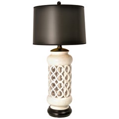
Sculptural Mid-Century Modern Ceramic Lamp
Located in Norwalk, CT
Very Palm Springs! Super glam. A sculptural Mid-Century Modern ceramic lamp, circa 1950s. Black and white chic with new wiring and a new black shade with gold liner. Lamp measures 10...
Category
Vintage 1950s Hollywood Regency Table Lamps
Materials
Ceramic
You May Also Like
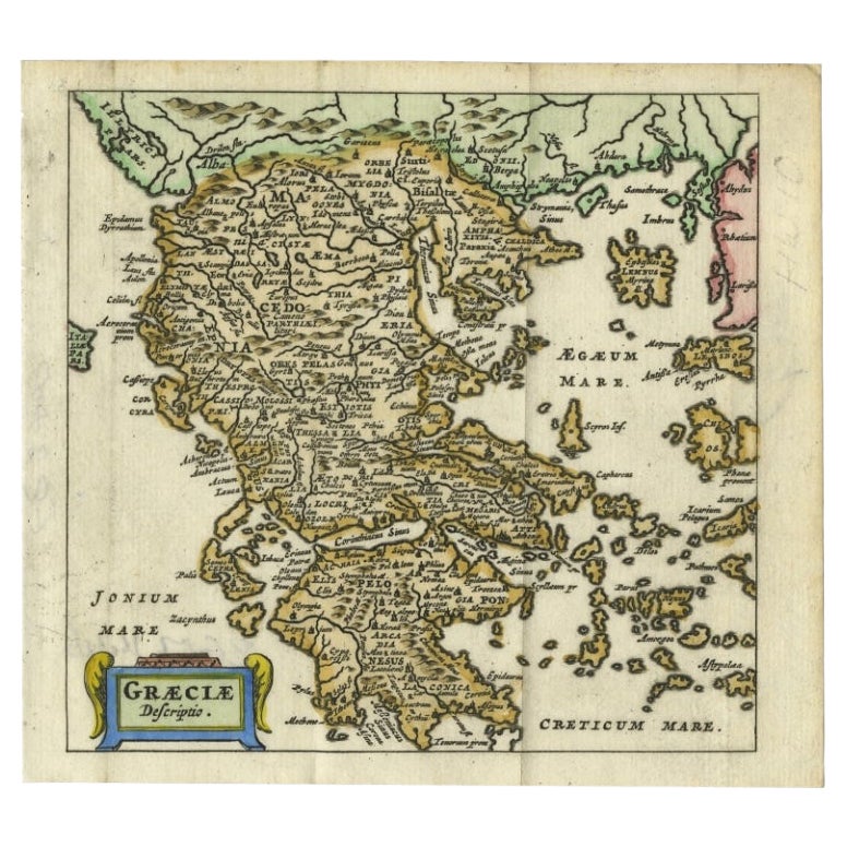
Charming 18th Century Miniature Map of Greece, 1685
Located in Langweer, NL
Antique map titled 'Graeciae Descriptio.' Charming miniature map of Greece from the pocket atlas 'Introductionis in Universam Geographiam tam Veterem qu...
Category
Antique 17th Century Maps
Materials
Paper
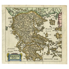
$322 Sale Price
20% Off
Antique 18th Century Map of the Province of Pensilvania 'Pennsylvania State'
Located in Philadelphia, PA
A fine antique of the colony of Pennsylvania.
Noted at the top of the sheet as a 'Map of the province of Pensilvania'.
This undated and anonymous map is thought to be from the Gentleman's Magazine, London, circa 1775, although the general appearance could date it to the 1760's.
The southern boundary reflects the Mason-Dixon survey (1768), the western boundary is placed just west of Pittsburgh, and the northern boundary is not marked.
The map has a number of reference points that likely refer to companion text and appear to be connected to boundaries. The western and southern boundaries are marked Q, R, S, for example. A diagonal line runs from the Susquehanna R to the Lake Erie P. A broken line marked by many letters A, B, N, O, etc., appears in the east.
There are no latitude or longitude markings, blank verso.
Framed in a shaped contemporary gilt wooden frame and matted under a cream colored matte.
Bearing an old Graham Arader Gallery...
Category
Antique 18th Century British American Colonial Maps
Materials
Paper

Scandinavia & Portions of Eastern Europe: 18th Century Hand-Colored Homann Map
By Johann Baptist Homann
Located in Alamo, CA
An early 18th century hand-colored copper-plate map entitled "Regni Sueciae in omnes suas Subjacentes Provincias accurate divisi Tabula Generalis" by Johann Baptist Homann (1663-1724...
Category
Antique Early 18th Century German Maps
Materials
Paper

18th Century Hand Colored Map of Spain and Portugal by Visscher
By Nicolaes Visscher II
Located in Alamo, CA
This is an early 18th century map of Spain and Portugal, with attractive original hand-coloring, entitled "Hispaniae et Portugalliae Regna per Nicolaum Visscher cum Privilegio Ordinu...
Category
Antique Early 18th Century Dutch Maps
Materials
Paper

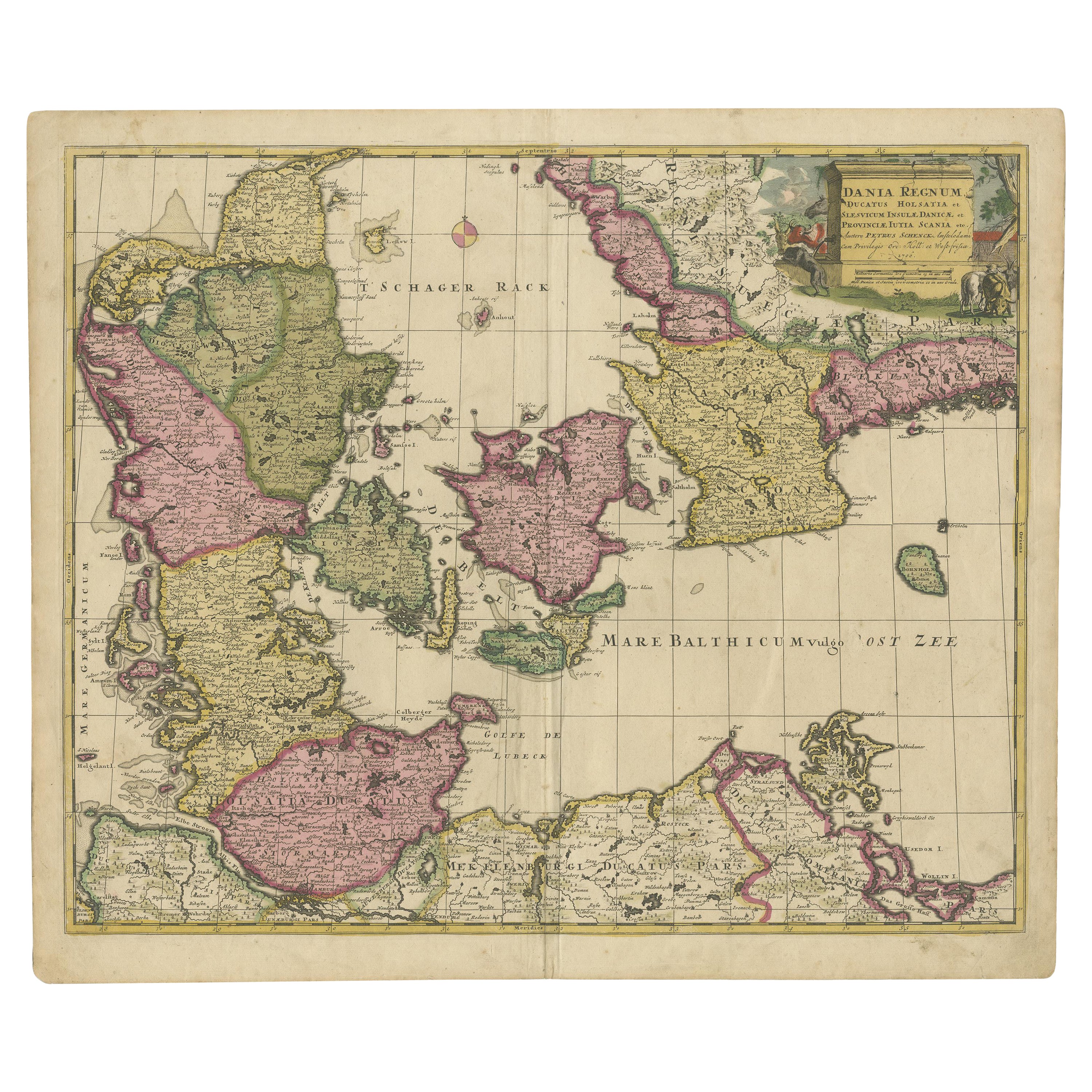
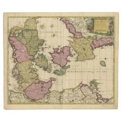
Early 18th Century Map of Denmark in Old Coloring, Published in 1706
Located in Langweer, NL
Denmark. Schenk (Petrus), Dania Regnum Ducatus Holsatia. et Slesvicum Insulae Danicae et Provinciae Jutia Scania etc. Amsterdam, 1706, engraved reticulated map on thick paper with co...
Category
Antique Early 1700s Maps
Materials
Paper
$680 Sale Price
20% Off
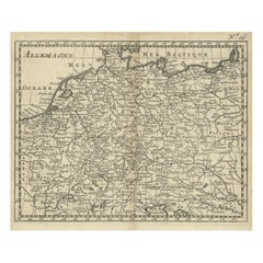
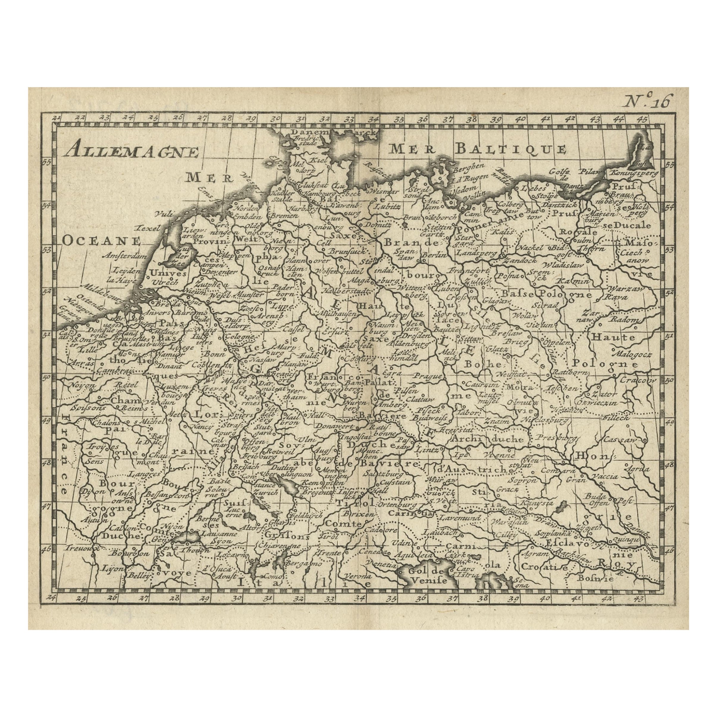
Antique Copper Engraved Map of Germany in the Early 18th Century, c.1740
Located in Langweer, NL
Antique map Germany titled 'Allemagne'.
Rare miniature map of Germany and surroundings. Also depicting the Baltic Sea and the Gulf of Venice. S...
Category
Antique 18th Century Maps
Materials
Paper