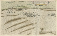
Antique Coastal Chart of The Region of Dunkerque by Blaeu, C.1640
View Similar Items


Want more images or videos?
Request additional images or videos from the seller
1 of 5
Antique Coastal Chart of The Region of Dunkerque by Blaeu, C.1640
About the Item
- Dimensions:Height: 19.69 in (50 cm)Width: 30.12 in (76.5 cm)Depth: 0 in (0.01 mm)
- Materials and Techniques:
- Period:
- Date of Manufacture:circa 1640
- Condition:
- Seller Location:Langweer, NL
- Reference Number:Seller: BGI-002121stDibs: LU3054325895002
About the Seller
5.0
Platinum Seller
These expertly vetted sellers are 1stDibs' most experienced sellers and are rated highest by our customers.
Established in 2009
1stDibs seller since 2017
1,938 sales on 1stDibs
More From This SellerView All
- Antique Map of the Region of Le Mans 'France' by Blaeu, circa 1640By Willem BlaeuLocated in Langweer, NLAntique map titled 'Cenomanorum Galliae regionis typus vulgo le Mans'. This lovely map of the historical province of Maine is centered on the famous city of Le Mans. This region witn...Category
Antique Mid-17th Century Maps
MaterialsPaper

- Antique Map of the Spice Islands 'Moluccas', Indonesia by W. Blaeu, circa 1640By Willem BlaeuLocated in Langweer, NLAntique map titled 'Moluccae Insulae Celeberrimae'. Highly decorative antique map of the Spice Islands (Moluccas) published by W. Blaeu (circa 1640). This map features a large inset ...Category
Antique Mid-17th Century Maps
MaterialsPaper
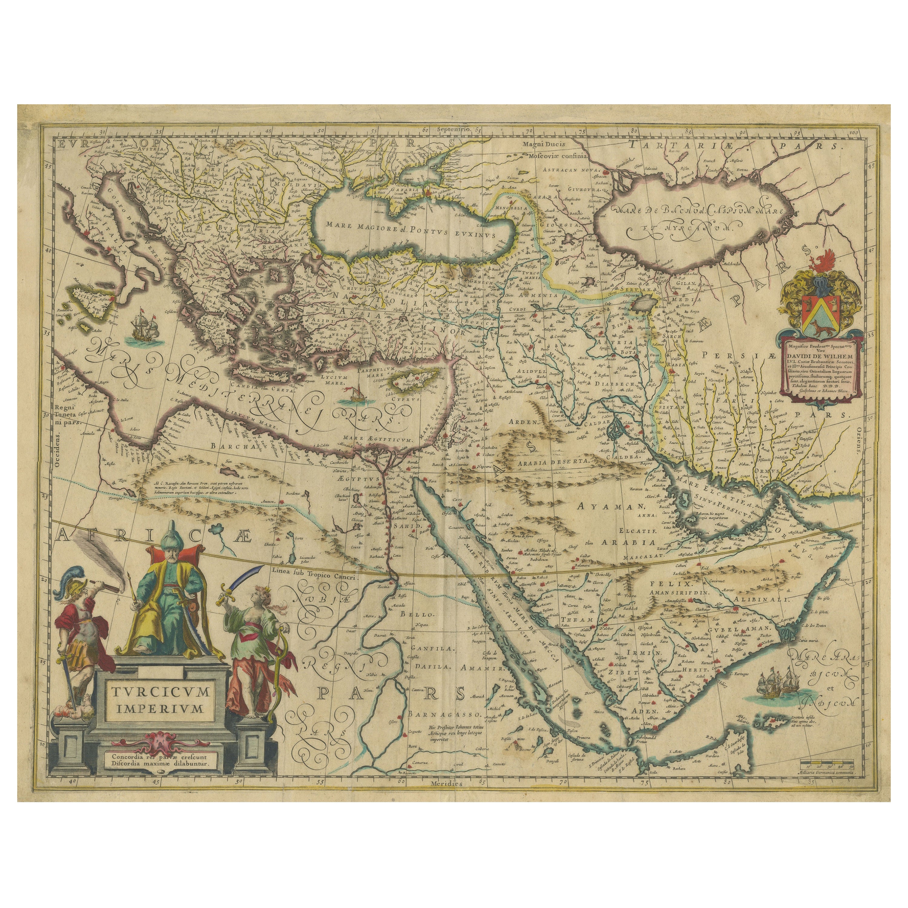
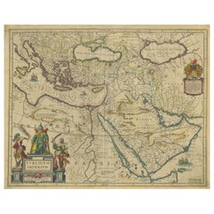
- Imperial Splendor: Antique Map of the Ottoman Empire by Blaeu, circa 1640Located in Langweer, NLThe antique map titled 'Turcicum Imperium' is an original old map of the Ottoman Empire, historically and colloquially known as the Turkish Empire. Here are the key features and deta...Category
Antique Mid-17th Century Maps
MaterialsPaper
- Antique Map of the Region of Blois by Janssonius, 'circa 1640'By Johannes JanssoniusLocated in Langweer, NLAntique map titled 'Description du Blaisois'. Old map of the region of Blois, France. It shows the city of Blois, Amboise, the Loire River and more. Published by J. Janssonius, circa...Category
Antique Mid-17th Century Maps
MaterialsPaper
- Antique Map of the Region of Bourbonnais by Janssonius, circa 1640Located in Langweer, NLAntique map titled 'Bourbonois - Borbonium Ducatus'. Old map of the former region of Bourbonnais, France. It includes the cities of Bourbon, Moulins, Charenton, Brulles, Varennes and...Category
Antique Mid-17th Century Maps
MaterialsPaper
- Antique Map of the Hainaut and Namur Region by Janssonius, 'circa 1640'By Johannes JanssoniusLocated in Langweer, NLAntique map titled 'Comitatuum Hannoniae et Namurci Descriptio'. Old map of the region of Hainaut and Namur, France. Published by J. Janssonius, circa 1640.Category
Antique Mid-17th Century Maps
MaterialsPaper


You May Also Like
- Antique Anatomical Wall Chart Depicting the Human SkeletonLocated in Berghuelen, DEA rare 19th century anatomical wall chart depicting the human skeleton. On the sides On the sides are detailed description in German language. The wall...Category
Early 20th Century German Victorian Prints
MaterialsPaper
- The Normandy Region of France: A 17th C. Hand-colored Map by Sanson and JaillotBy Nicolas SansonLocated in Alamo, CAThis large hand-colored map entitled "Le Duché et Gouvernement de Normandie divisée en Haute et Basse Normandie en divers Pays; et par evêchez, avec le Gouvernement General du Havre ...Category
Antique 1690s French Maps
MaterialsPaper
- 17th Century Hand Colored Map of the Liege Region in Belgium by VisscherBy Nicolaes Visscher IILocated in Alamo, CAAn original 17th century map entitled "Leodiensis Episcopatus in omnes Subjacentes Provincias distincté divisusVisscher, Leodiensis Episcopatus" by Nicolaes Visscher II, published in Amsterdam in 1688. The map is centered on Liege, Belgium, includes the area between Antwerp, Turnhout, Roermond, Cologne, Trier and Dinant. This attractive map is presented in a cream-colored mat measuring 30" wide x 27.5" high. There is a central fold, as issued. There is minimal spotting in the upper margin and a tiny spot in the right lower margin, which are under the mat. The map is otherwise in excellent condition. The Visscher family were one of the great cartographic families of the 17th century. Begun by Claes Jansz Visscher...Category
Antique Late 17th Century Dutch Maps
MaterialsPaper
- Antique Foldable Anatomical Wall Chart Depicting Human MusculatureLocated in Berghuelen, DEAntique Foldable Anatomical Wall Chart Depicting Human Musculature The rare 19th century anatomical wall chart depicts the human musculature and inter...Category
Early 20th Century German Victorian Prints
MaterialsWood, Paper
- Anatomical Wall Chart Depicting the Human Lymphatic and Blood VesselsLocated in Berghuelen, DEA rare 19-carat anatomical wall chart depicting the human lymphatic and blood vessels. On the sides with detailed description in German language. Print...Category
Early 20th Century German Victorian Prints
MaterialsPaper
- 17th Century Hand-Colored Map of a Region in West Germany by JanssoniusBy Johannes JanssoniusLocated in Alamo, CAThis attractive highly detailed 17th century original hand-colored map is entitled "Archiepiscopatus Maghdeburgensis et Anhaltinus Ducatus cum terris adjacentibus". It was published ...Category
Antique Mid-17th Century Dutch Maps
MaterialsPaper


