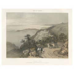
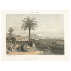
Antique Print of Èze Village in The Nice and Savoy Regions of France, c.1865
View Similar Items


Want more images or videos?
Request additional images or videos from the seller
1 of 6
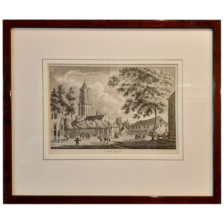
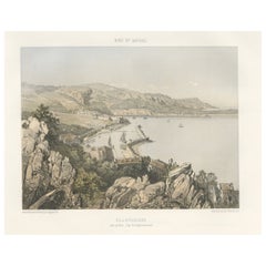
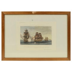
Antique Print of Èze Village in The Nice and Savoy Regions of France, c.1865
About the Item
- Dimensions:Height: 13 in (33 cm)Width: 18.51 in (47 cm)Depth: 0 in (0.01 mm)
- Materials and Techniques:
- Period:
- Date of Manufacture:circa 1865
- Condition:Condition: Good, general age-related toning. Minor wear and foxing, blank verso. Please study image carefully.
- Seller Location:Langweer, NL
- Reference Number:Seller: BG-12882-401stDibs: LU3054329580782
About the Seller
5.0
Platinum Seller
These expertly vetted sellers are 1stDibs' most experienced sellers and are rated highest by our customers.
Established in 2009
1stDibs seller since 2017
1,933 sales on 1stDibs
More From This SellerView All
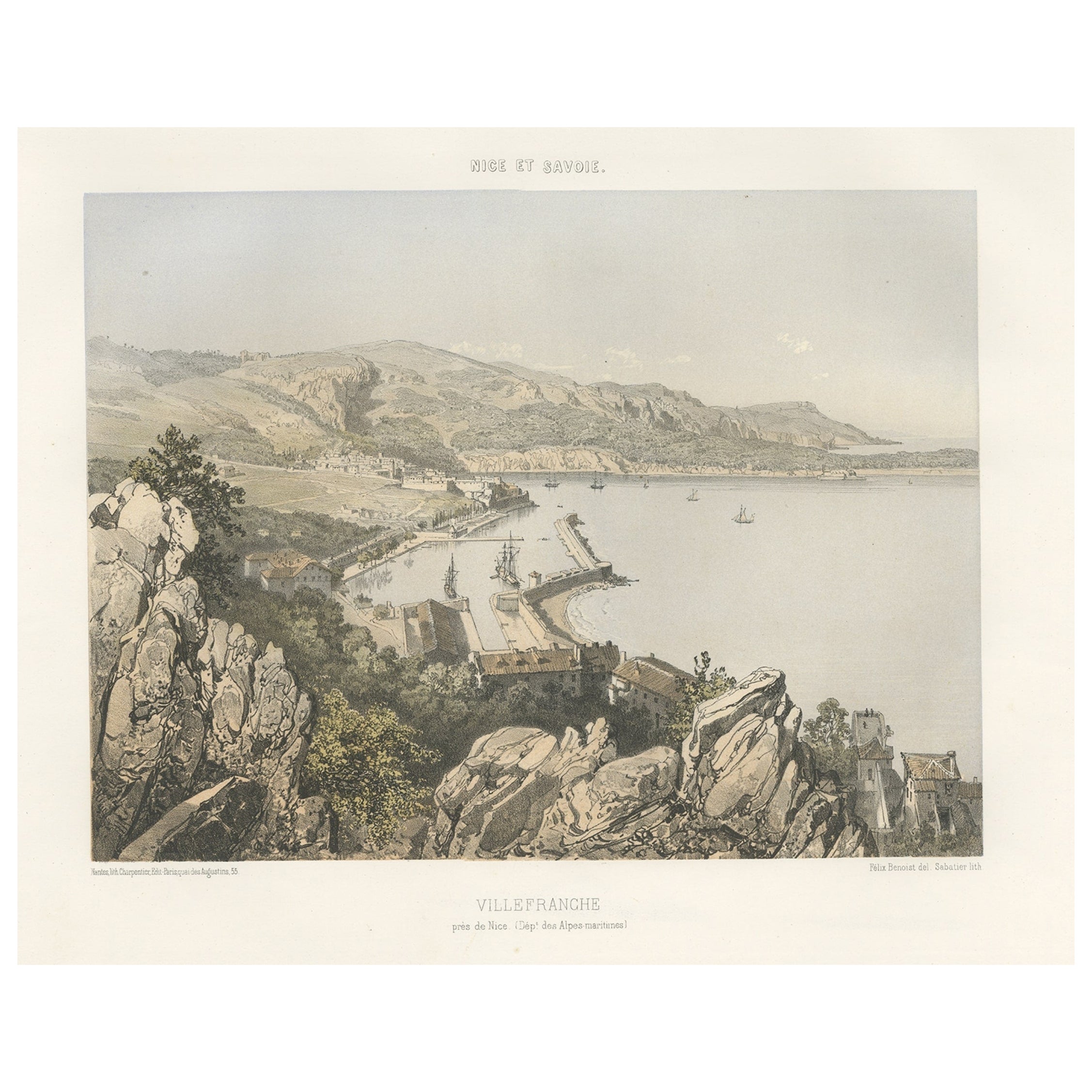
- Antique Print of Villefranche in the Nice and Savoy Region of France, c.1865Located in Langweer, NLAntique print titled 'Villefranche près de Nice'. Original antique print of Villefranche near Nice, France. This print originates from 'Nice Et Savoie, Sites Pittoreques, Monuments, ...Category
Antique 19th Century Prints
MaterialsPaper
- Antique Print of Nice Near Villa Venanson Near Nice in France, c.1865Located in Langweer, NLAntique print titled 'Nice, vue prise de la Villa Venanson'. View of the city of Nice, near Villa Venanson, France. This print originates from 'Nice Et Savoie, Sites Pittoreques, Mon...Category
Antique 19th Century Prints
MaterialsPaper
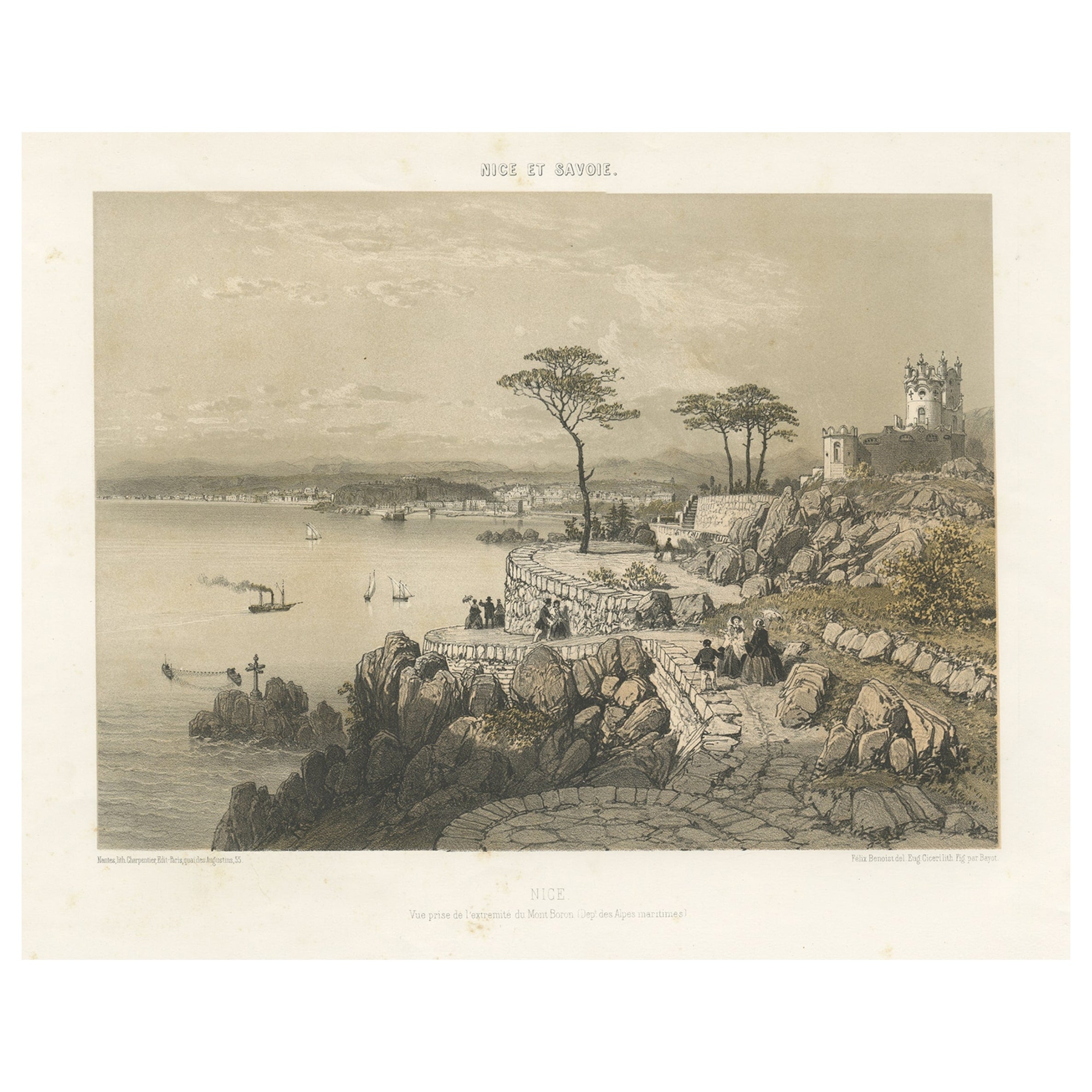
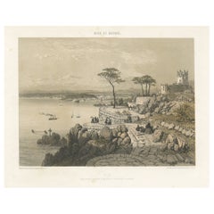
- Decorative Antique Print of Nice Near Mont Boron in France, c.1865Located in Langweer, NLAntique print titled 'Nice, vue prise de l'extremité du Mont Boron'. View of the city of Nice, near Mont Boron, France. This print originates from 'Nice Et Savoie, Sites Pittoreques,...Category
Antique 19th Century Prints
MaterialsPaper
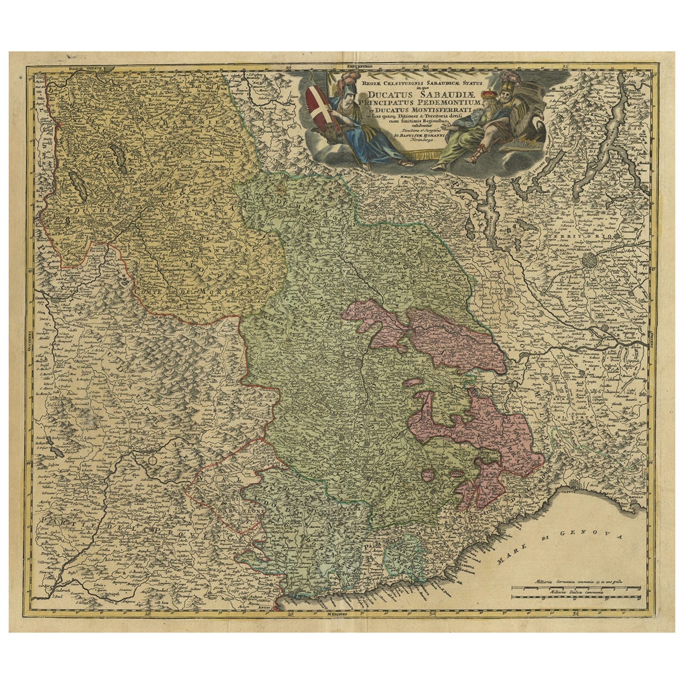
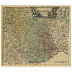
- Antique Map of the Savoy and Piedmont Regions, Centered on Torino, ca.1735Located in Langweer, NLAntique map titled 'Ducatus Sabaudiae, Principatus Pedemontium et ducatis Montisferrati (..).' Map of the Savoy and Piedmont regions, centered on Torino. The map coverage extends...Category
Antique 1730s Maps
MaterialsPaper
 $782 Sale Price20% Off
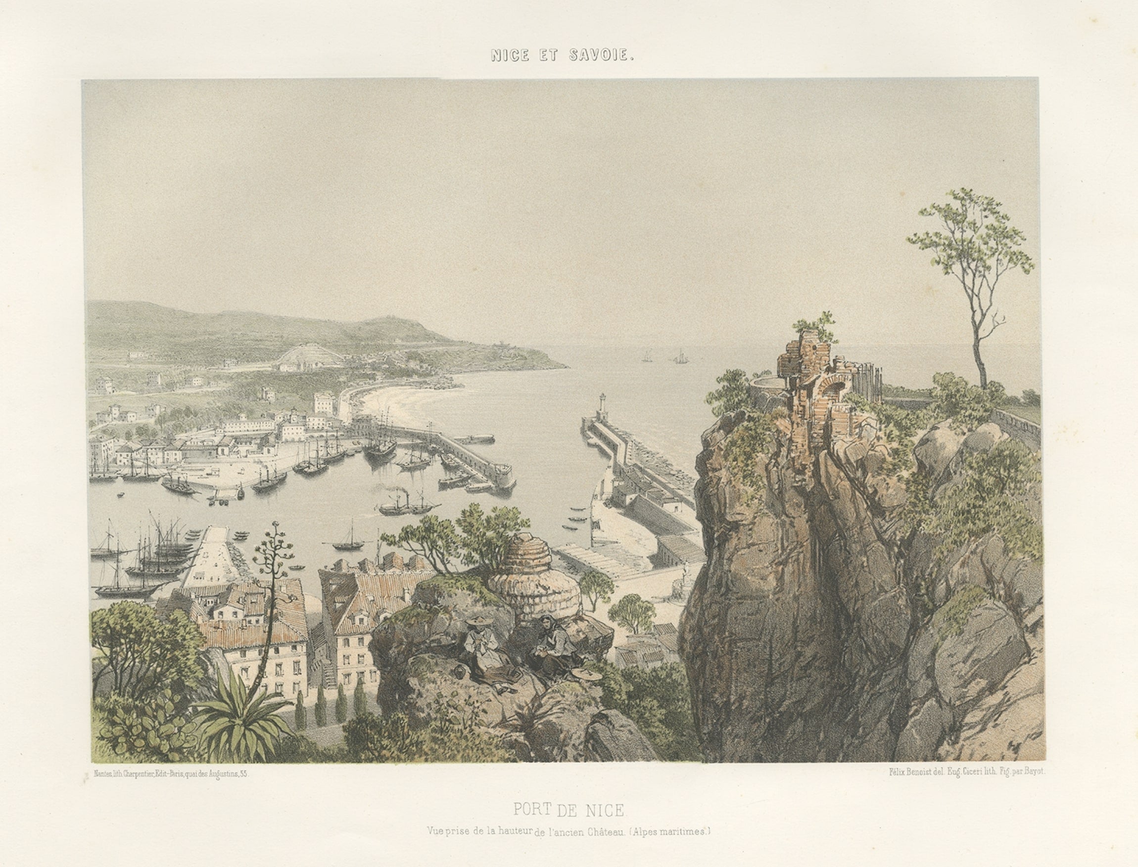
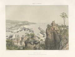
 - Antique Print of the Port of Nice in France, c.1865Located in Langweer, NLAntique print titled 'Port de Nice, vue prise de la hauteur de l'ancien Château'. Original antique print of the port of Nice, France. This print originates from 'Nice Et Savoie, Site...Category
Antique 19th Century Prints
MaterialsPaper
- Antique Map of Champagne and surrounding Regions, FranceLocated in Langweer, NLAntique map titled 'Carte de la Champagne et des Pays Voisins (..)'. Detailed map of Champagne and surrounding regions of Chalons and Soissons, Reims, Vedun, Mouzon, Sean, Charlemont...Category
Antique Mid-18th Century Maps
MaterialsPaper

You May Also Like
- "Lady Washington's Reception, " Engraved by A. H. Ritchie, Antique Print, 1865Located in Colorado Springs, COThis 1865, hand-colored engraving by A. H. Ritchie is entitled Lady Washington's Reception and is based on Daniel F. Huntington's original painting "Th...Category
Antique 1860s American Prints
MaterialsPaper
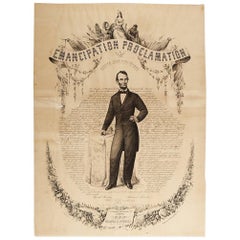
- 1865 Emancipation Proclamation, Antique Lithograph by P.S. Duval and SonLocated in Colorado Springs, COPresented is a lithographic broadside of the text of the Emancipation Proclamation issued on January 1, 1863. This broadside was published in...Category
Antique 1860s American Historical Memorabilia
MaterialsPaper
- 1865 Emancipation Proclamation with Abraham Lincoln Portrait, Antique EngravingLocated in Colorado Springs, COPresented is an elaborate engraved broadside presentation of both the preliminary and final Emancipation Proclamations, dated September 22, 1...Category
Antique 1860s American Historical Memorabilia
MaterialsPaper
- Old Nautical Print Depicting the Bombardment of Cadiz by the French Navy 1823Located in Milan, ITPrint by engraving on copper plate of the first half of the 19th century, depicting the bombardment of Cadiz by the French Navy, 23 September 1823. The print is signed peint par Crep...Category
Antique 1830s French Nautical Objects
MaterialsPaper
- Carnival de Nice France Historical Journal French MemorabiliaLocated in Miami, FLA historical piece of nostalgic journal art dated 1912, Carnival or Carnaval de Nice, France from Le Petit Journal. Two years prior to the First World...Category
Early 20th Century French Art Deco Historical Memorabilia
MaterialsPaper
 $240 Sale Price46% Off
 - 1900 Vintage Lithographic Print of the French Frigate Minerva Oakwood frameLocated in Milan, ITLithographic print of the fight of the French frigate Minerva against two vessels and an English frigate on February 2nd, 1779, taken from the book Historical Gallery of Versailles 430. Chacoane is the engraver. Original print by Victor Gilbert Théodore Gudin...Category
Early 20th Century French Nautical Objects
MaterialsPaper


Recently Viewed
View AllMore Ways To Browse
Alpes Maritimes
Corniche Antique
Haute Savoie
Eze France
Pair Double Doors
Corner Cabinet Glass Door
Textured Doors
Clamp On
Unique Chest On Chest
Tapestry Antique Style
Antique Chest Hand Carved
Antique Pine Corner Cabinet
Mid Century Metal Chest
Vintage Wall Brackets
Chest With White Marble Top
Inlaid Corner Cabinet
Wall Mount Decor
Antique Glass Front Storage