Items Similar to Antique Print of Maria Island located in the Tasman Sea
Want more images or videos?
Request additional images or videos from the seller
1 of 6
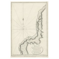
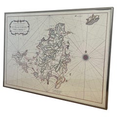
Antique Print of Maria Island located in the Tasman Sea
About the Item
Antique print titled 'Maria Island, Tasmania'. View of Maria Island or 'wukaluwikiwayna', a mountainous island located in the Tasman Sea, off the east coast of Tasmania, Australia. Engraved by T. Heawood after S. Prout. Published by Virtue & Co, circa 1875.
- Dimensions:Height: 8.39 in (21.3 cm)Width: 10.56 in (26.8 cm)Depth: 0.02 in (0.5 mm)
- Materials and Techniques:
- Period:
- Date of Manufacture:circa 1875
- Condition:General age-related toning. Shows some wear, soiling and foxing. Blank verso. Please study image carefully.
- Seller Location:Langweer, NL
- Reference Number:
About the Seller
5.0
Platinum Seller
These expertly vetted sellers are 1stDibs' most experienced sellers and are rated highest by our customers.
Established in 2009
1stDibs seller since 2017
1,929 sales on 1stDibs
Typical response time: <1 hour
- ShippingRetrieving quote...Ships From: Langweer, Netherlands
- Return PolicyA return for this item may be initiated within 14 days of delivery.
More From This SellerView All
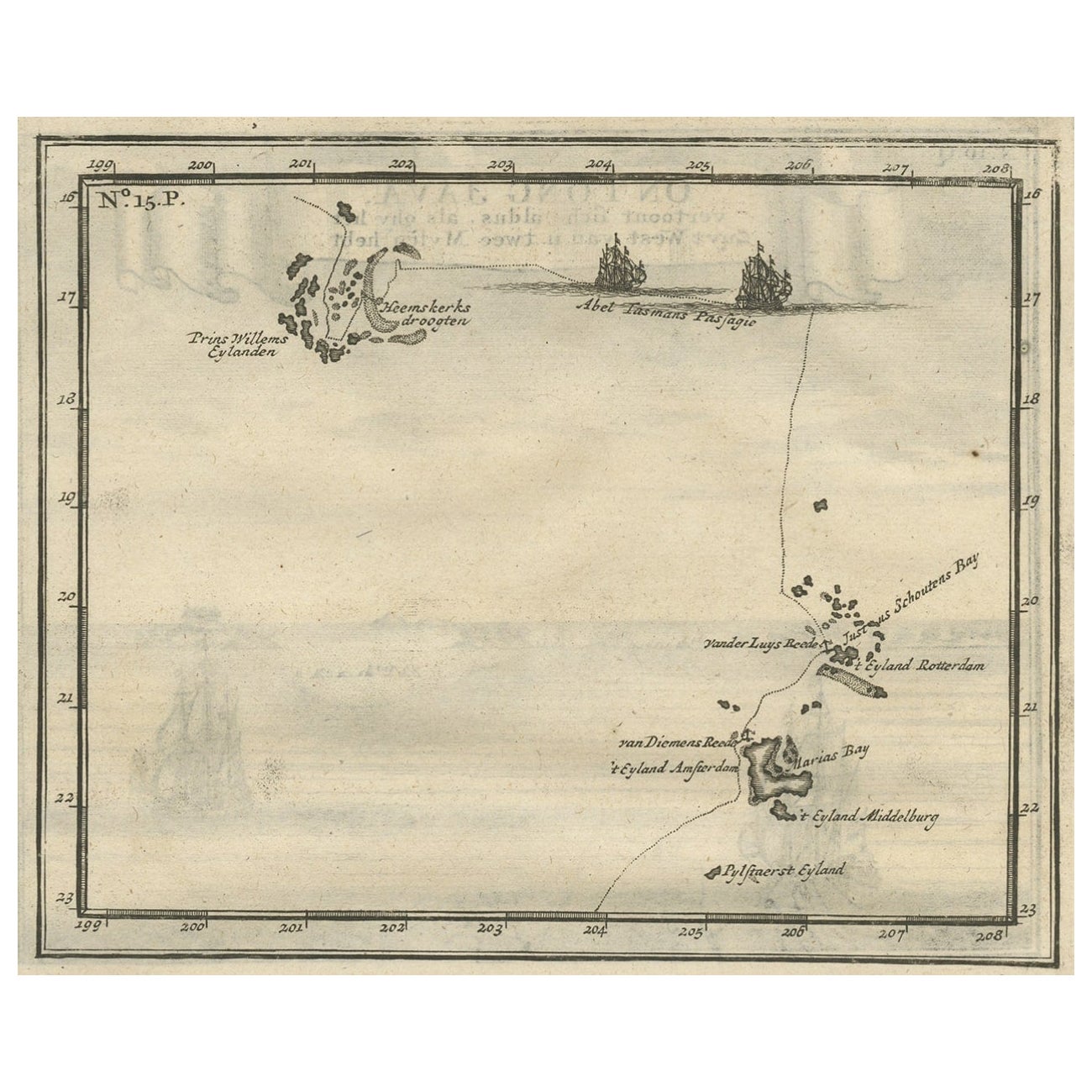
- Antique Map of the Banda Islands and the Route of Abel Tasman, Indonesia, 1726Located in Langweer, NLAntique print Indonesia with an image on each side. The first image depicts Ontong Java, one of the largest atolls on earth. On verso: antique map of the Banda Islands. With the rout...Category
Antique 1720s Maps
MaterialsPaper
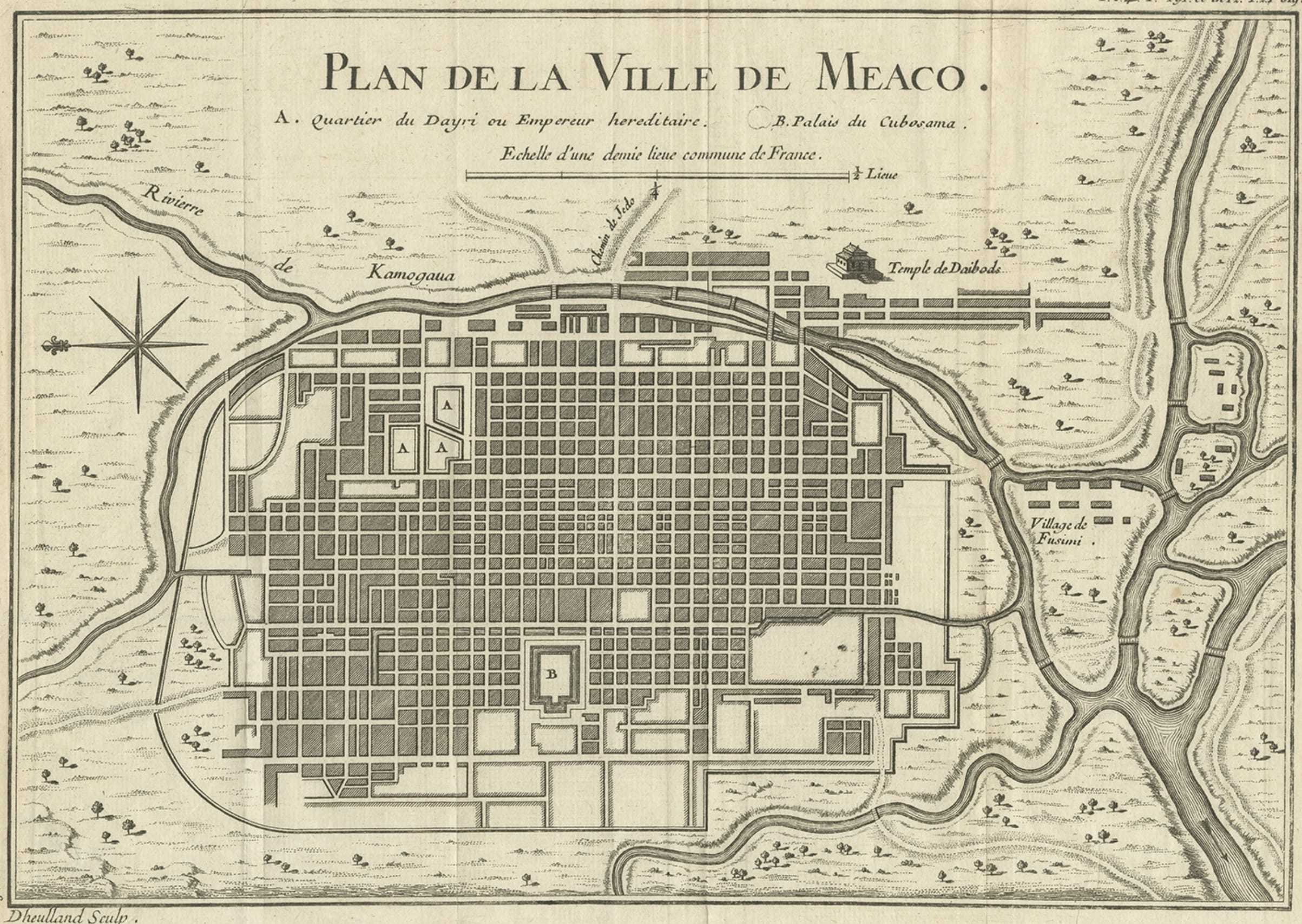
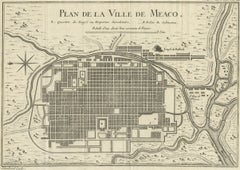
- Antique Map of Kyoto located in The Kansai Region on the Island of Honshu, c1740Located in Langweer, NLAntique map titled 'Plan de la Ville de Meaco'. Detailed plan of Kyoto, located in the Kansai region on the island of Honshu, Japan. This map most likely originates from an edition of 'Histoire et description generale du Japon' by P.F.X. de Charlevoix. Artists and Engravers: Jacques-Nicolas Bellin (1703-1772) was among the most important mapmakers of the eighteenth century. In 1721, at age 18, he was appointed hydrographer (chief cartographer) to the French Navy. In August 1741, he became the first Ingénieur de la Marine of the Depot des cartes...Category
Antique 18th Century Maps
MaterialsPaper
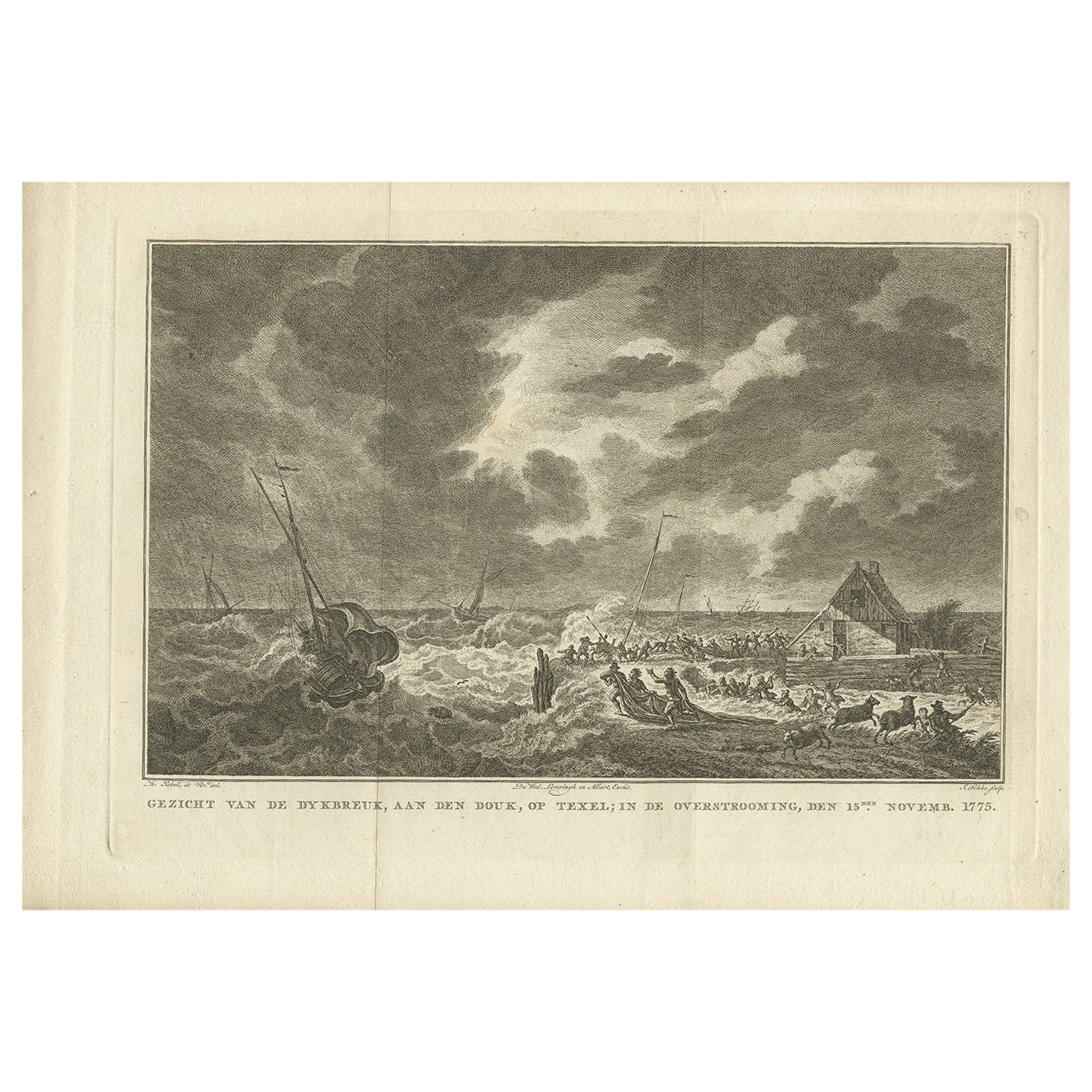
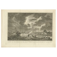
- Antique Print of the Flood at Texel, Island in the Wadden Sea, 1778Located in Langweer, NLAntique print titled 'Gezicht van de dykbreuk, aan den douk op Texel; in de overstrooming, den 15den Novemb. 1775.’ This print illustrates the flood at Texel (The Netherlands). This ...Category
Antique 18th Century Prints
MaterialsPaper
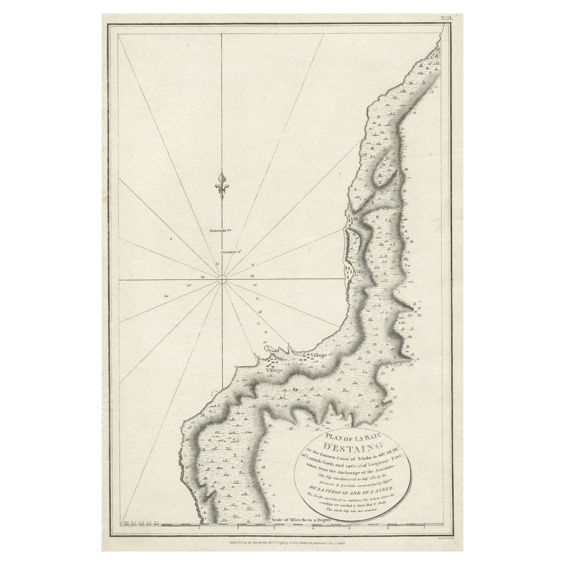
- Antique Map of The Bay of D'Estaing located on the Russian island Sakhalin, 1798Located in Langweer, NLAntique map titled 'Plan of La Baie d'Estaing'. This map shows the bay of D'Estaing located on the Russian island of Sakhalin. La Perouse was selected b...Category
Antique 1790s Maps
MaterialsPaper
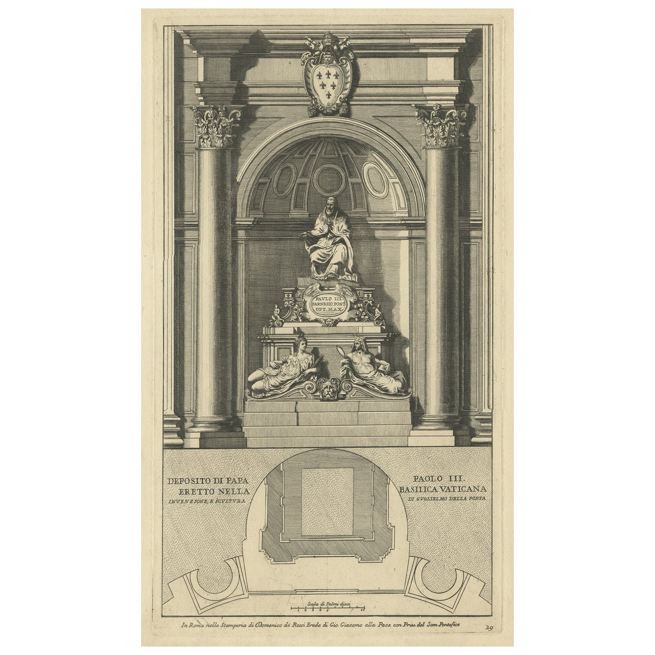
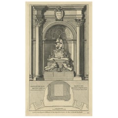
- Antique Print of the Monument to Pope Paul iii Located in the Vatican, c.1710Located in Langweer, NLAntique print titled 'Deposito di Papa Paolo III Eretto nella Basilica Vaticana'. Old print of the monument to Pope Paul III by Giacomo della Porta, locate...Category
Antique 18th Century Prints
MaterialsPaper
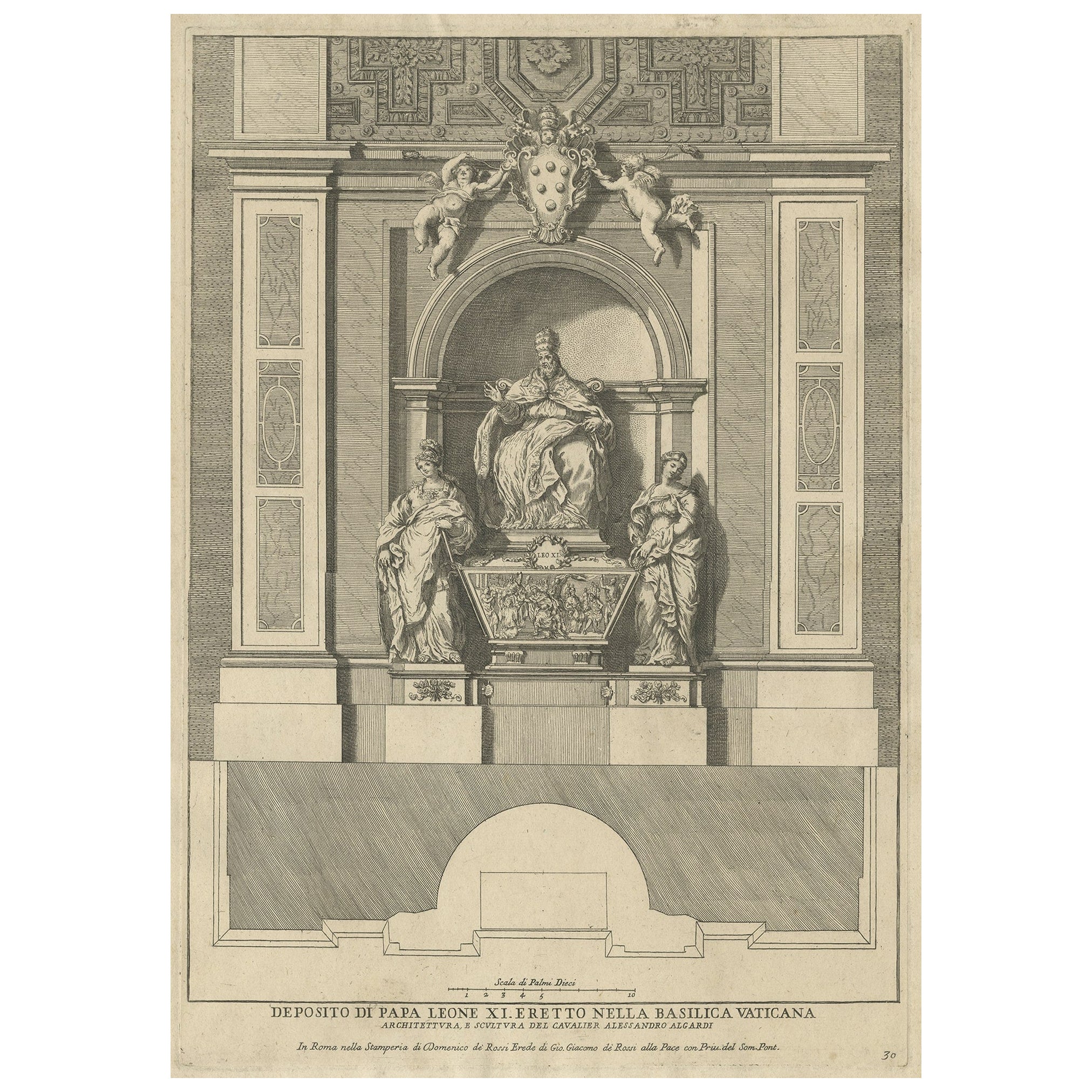
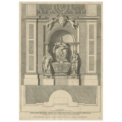
- Antique Print of the Monument to Pope Leo XI, Located in the Vatican, c.1710Located in Langweer, NLAntique print titled 'Deposito di Papa Leone XI Eretto nella Basilica Vaticana'. Old print of the monument to Pope Leo XI by Alessandro Algardi, located i...Category
Antique 18th Century Prints
MaterialsPaper
You May Also Like
- Vintage Map Print of Saint Martin Island in the Caribbean Sea, Written in Dutch.Located in Seattle, WAThe Saint Martin island was originally St.Marthyn to the Dutch. This is a map of the island and surrounding area. Framed within silver toned professional framing. Vintage Condition C...Category
Vintage 1970s Mid-Century Modern Prints
MaterialsMetal
- Engraved MARIA SYBILIA MERIAN - G. E. RUMPHIUS Sea Life Prints [Set of 7]Located in Hawthorne, CASix exquisitely framed sea life prints engraved by Maria Sybilla Merian from G.E. Rumphius, Amsterdam, circa 1800. A unique set of seven beautifully et...Category
Antique Mid-18th Century Dutch Dutch Colonial Paintings
MaterialsPaper
- Hand-Colored 18th Century Homann Map of Denmark and Islands in the Baltic SeaBy Johann Baptist HomannLocated in Alamo, CAAn 18th century copper plate hand-colored map entitled "Insulae Danicae in Mari Balthico Sitae utpote Zeelandia, Fionia, Langelandia, Lalandia, Falstria, Fembria Mona" created by Joh...Category
Antique Early 18th Century German Maps
MaterialsPaper
- Puerto Rico 1910 Original Antique Map Of The Island In A Period Wood FrameLocated in Miami, FLAn antique framed map of Puerto Rico. Very nice antique map of Puerto Rico printed in a folio of two pages. This map was printed in thin pa...Category
Antique Early 1900s Puerto Rican American Classical Prints
MaterialsGlass, Wood, Paper
- Original Antique Print of Queen Henrietta Maria After Van Dyck. C.1850Located in St Annes, LancashireWonderful image after Van Dyck Fine Steel engraving. Published by Virtue C.1850 Unframed.Category
Antique 1850s English Renaissance Prints
MaterialsPaper
- Antique Dutch Prints of the Four ContinentsLocated in Tampa, FLTwo prints of the four continents they are early 19th century, Dutch. In antique hand carved water gilded frames with original glass.Category
Antique Early 19th Century Prints
MaterialsPaper
![Engraved MARIA SYBILIA MERIAN - G. E. RUMPHIUS Sea Life Prints [Set of 7]](https://a.1stdibscdn.com/engraved-ge-rumphius-sea-life-framed-prints-set-of-seven-for-sale/1121189/f_121343611537881359907/12134361_master.jpg?width=240)


Recently Viewed
View AllMore Ways To Browse
Mid 20th Century Commode
Moller Chairs 1970
Wood Medallion
A Pair Of Cabinet Modern Cabinet
French Antique Center Piece
Gold Bedroom Set
Pair Of Glass And Brass Table Lamps
Glass Antique Bottles
Large Antique Lamp
French 1960 To 70s Furniture
Stone Shell
Shades And Finials
3 Light Ceiling Light
Vintage Ball Lamp
Civil War Glasses
Vintage Stamped Brass
One Of A Kind Hand Knotted Runner
Vintage Opaline Lights