Items Similar to Antique Print of Porto Grande Bay on the Island of São Vicente, Cape Verde


Want more images or videos?
Request additional images or videos from the seller
1 of 6
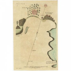
Antique Print of Porto Grande Bay on the Island of São Vicente, Cape Verde
About the Item
Antique print titled 'Vüe de Porto grande dans l'Ile de St. Vincent'. View of Porto Grande Bay, also Mindelo Bay, is a bay on the north coast of the island of São Vicente, Cape Verde. This print originates from Prevost's 'Histoire Generale des Voyages'.
Artists and Engravers: Antoine François Prévost d'Exiles usually known simply as the Abbé Prévost, was a French author and novelist.
Condition: Good, general age-related toning. Some staining (slightly affecting image). Minor wear, blank verso. Please study image carefully.
Date: 1746
Overall size: 19.8 x 25.2 cm.
Image size: 14.1 x 19.4 cm.
Antique prints have long been appreciated for both their aesthetic and investment value. They were the product of engraved, etched or lithographed plates. These plates were handmade out of wood or metal, which required an incredible level of skill, patience and craftsmanship. Whether you have a house with Victorian furniture or more contemporary decor an old engraving can enhance your living space. We offer a wide range of authentic antique prints for any budget.
- Dimensions:Height: 9.93 in (25.2 cm)Width: 7.8 in (19.8 cm)Depth: 0 in (0.01 mm)
- Materials and Techniques:
- Period:
- Date of Manufacture:1746
- Condition:Condition: Good, general age-related toning. Some staining (slightly affecting image). Minor wear, blank verso. Please study image carefully.
- Seller Location:Langweer, NL
- Reference Number:
About the Seller
5.0
Platinum Seller
These expertly vetted sellers are 1stDibs' most experienced sellers and are rated highest by our customers.
Established in 2009
1stDibs seller since 2017
1,938 sales on 1stDibs
Typical response time: <1 hour
- ShippingRetrieving quote...Ships From: Langweer, Netherlands
- Return PolicyA return for this item may be initiated within 14 days of delivery.
More From This SellerView All
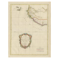
- Original Antique Map of the Cape Verde Islands, 1746Located in Langweer, NLAntique map titled 'Carte Des Isles Du Cap Verd.' Original antique map of the Cape Verde Islands. Decorative cartouche and compass rose. Extends from Isle d...Category
Antique 18th Century Maps
MaterialsPaper
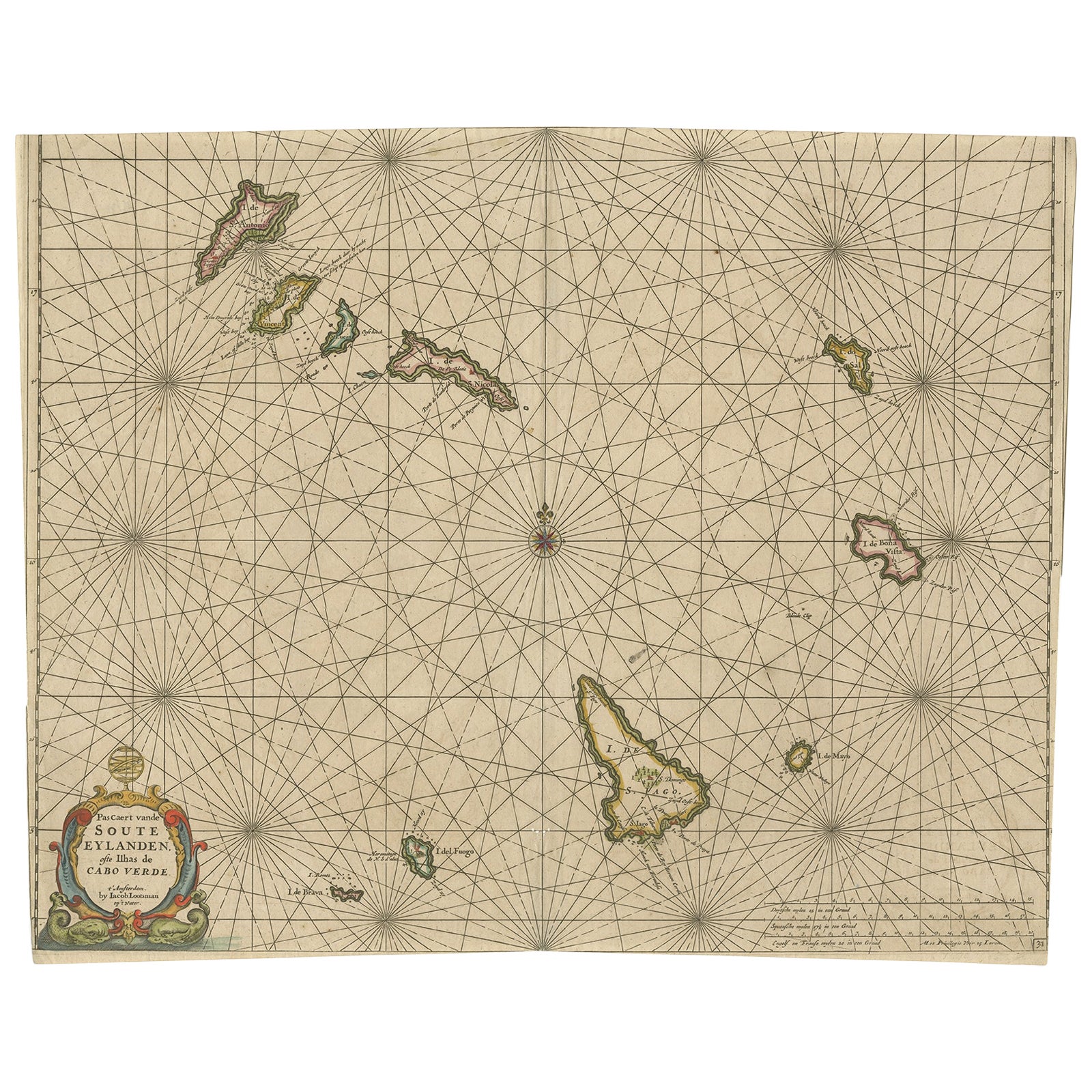
- Antique Map of the Cape Verde Islands, Africa, ca.1670Located in Langweer, NLAntique map titled 'Pascaert van de Soute Eylanden ofte Ilhas de Cabo Verde'. This map depicts the Cape Verde Islands (Africa). Islands titled 'Ile de B...Category
Antique 1670s Maps
MaterialsPaper
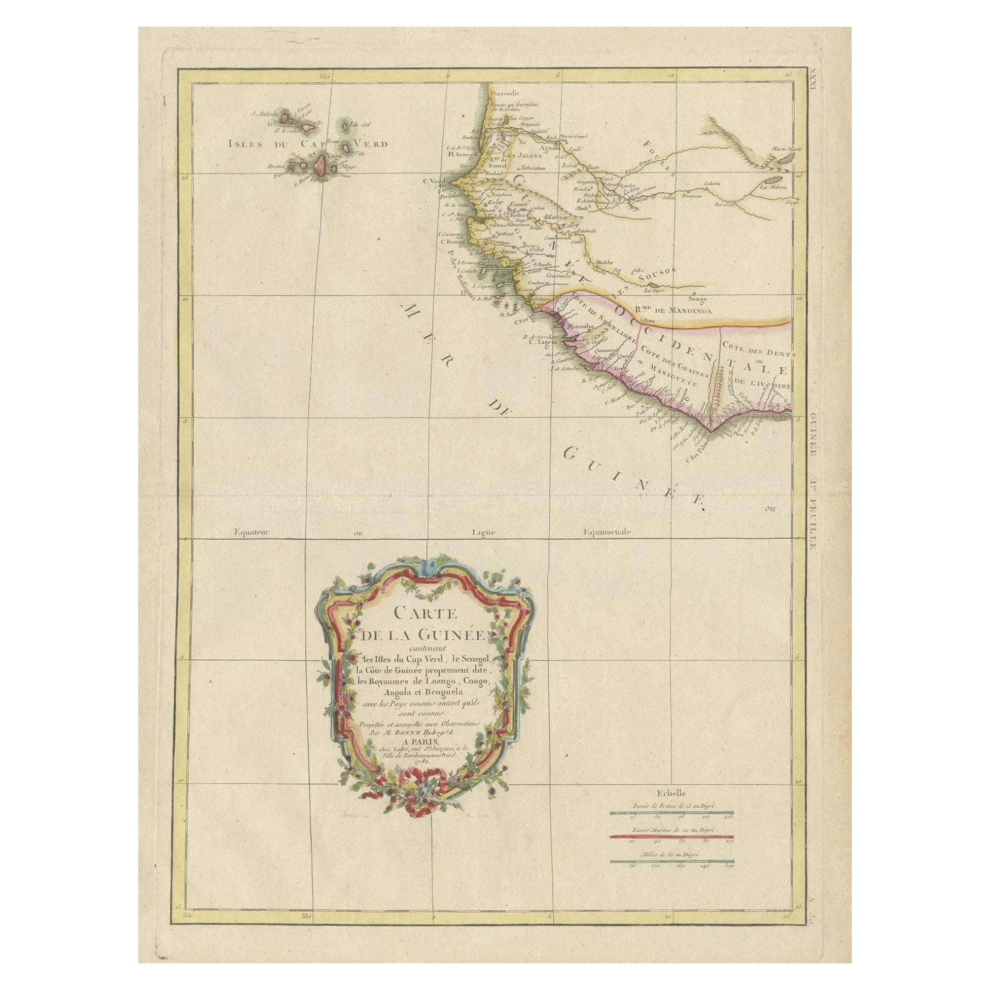
- Antique Map of the Coast of Guinea and the Cape Verde IslandsLocated in Langweer, NLAntique map titled 'Carte de la Guinée (..)'. This map was originally part of a 2 sheet larger map of Eastern Africa, showing the Cape Verde Islands and Senegal. This map originates ...Category
Antique Late 18th Century Maps
MaterialsPaper
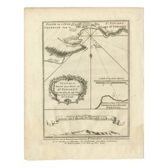
- Antique Map of the Harbour of Praia, Santiago Island, Cape Verde, c.1750Located in Langweer, NLAntique map titled 'A Draught of ye Harbour of Praya in the Island St. Jago (..)'. Uncommon map showing the harbour of Praia on Santiago Island, Cape Verde. Source unknown, to be det...Category
Antique 18th Century Maps
MaterialsPaper
- Antique Print of the Bay of the Island of St. Vincent, Capeverdian IslandsBy Jakob van der SchleyLocated in Langweer, NLAntique print titled 'Oppervlakte van de Baaije van 't Eiland St. Vincent (..)'. View of the Bay of the Island of St. Vincent, one of the Capeverdian Islands. Originates from a Dutch...Category
Antique 18th Century Prints
MaterialsPaper
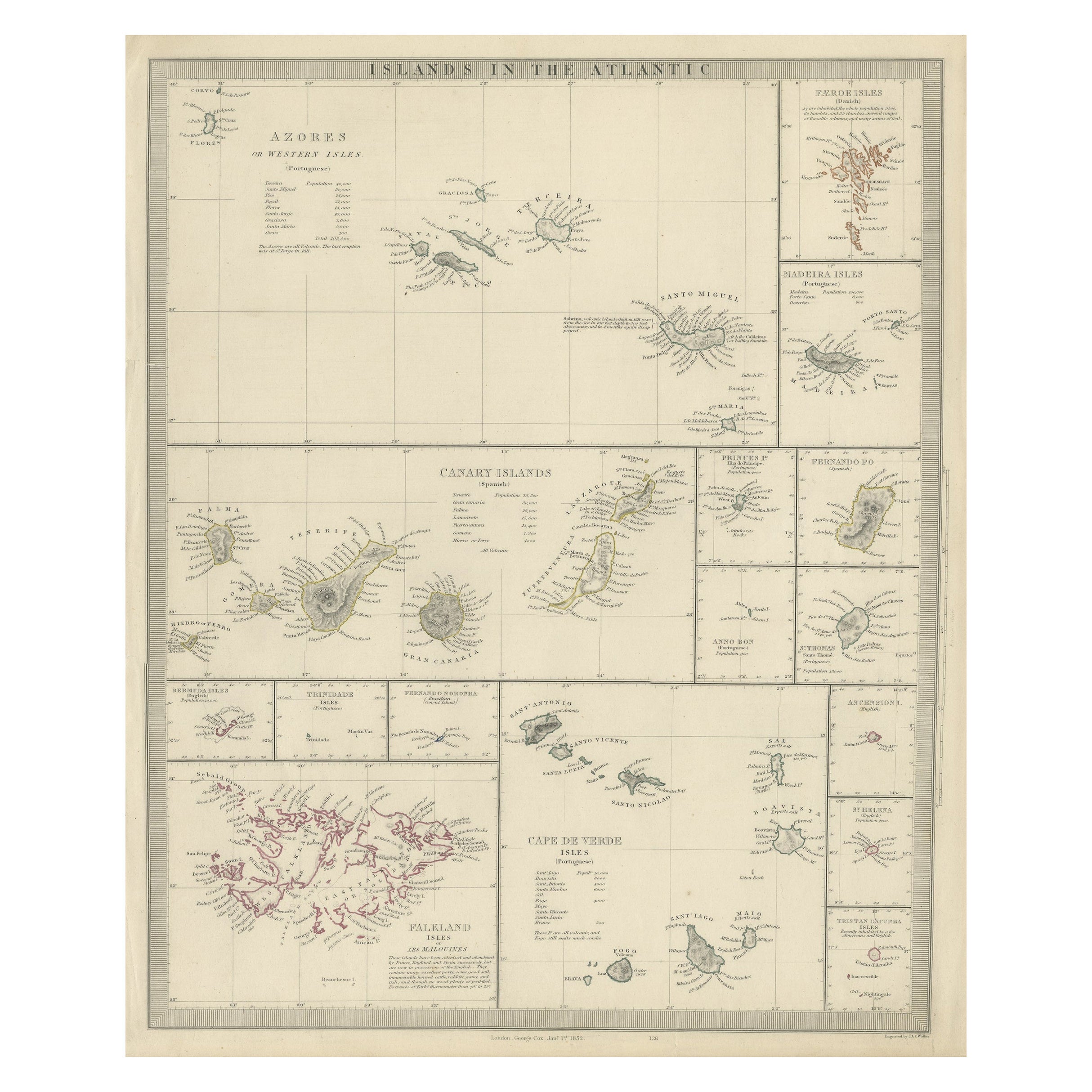
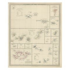
- Antique Map of the Islands in the Atlantic Ocean including Bermuda & Cape VerdeLocated in Langweer, NLAntique map titled 'Islands in the Atlantic'. Steel engraved map of the islands in the Atlantic Ocean. It shows 16 individual maps on one sheet. Covers the Azores or Western Isles, Faeroe Isles, Madeira Isles, Princes Island, Canary Islands, Fernando Po, Anno Bon, St. Thomas, Bermuda Isles, Trinidade Isles, Fernando Noronha, Cape Verde Isles, Ascension Island, St. Helena, Tristan d'Acunha Isles and the Falkland Isles. Engraved by J. & C. Walker. Published by George Cox...Category
Antique Mid-19th Century Maps
MaterialsPaper

You May Also Like
- Antique Print After J.M.W Turner, the Temptation on the Pinnacle, 1835By J.M.W. TurnerLocated in St Annes, LancashireSensational image from a drawing by J.M.W Turner Steel engraving by Goodall From Milton's "Poetical Works" Published 1835 Unframed.Category
Antique 1830s English Romantic Prints
MaterialsPaper
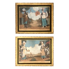
- Antique Dutch Prints of the Four ContinentsLocated in Tampa, FLTwo prints of the four continents they are early 19th century, Dutch. In antique hand carved water gilded frames with original glass.Category
Antique Early 19th Century Prints
MaterialsPaper
- Esteban Vicente Color ScreenprintBy Esteban VicenteLocated in Water Mill, NYEsteban Vicente color screenprint signed in pencil. Framed size listed is unframed.Category
20th Century American Prints
- "Adam and Eve on Island of Peace, " Remarkable WPA-Era Print of Peace Amidst WarLocated in Philadelphia, PAThis print depicts a nude Adam and Eve in a small island of peace and plenty, surrounded by the ravages and storms of World War II. The placid scene at the center, full of innocence ...Category
Vintage 1940s American Art Deco Prints
MaterialsPaper
- Original Antique Print of The Battle of The Boyne, Ireland. C.1850Located in St Annes, LancashireGreat image of The Battle of The Boyne Fine steel engraving after Benjamin West With a highly decorative figural border Published by London printing & Publishing Co.C.1850 Unfram...Category
Antique 1850s English Prints
MaterialsPaper
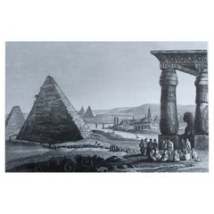
- Original Antique Print of The Pyramids of Egypt. C.1820Located in St Annes, LancashireWonderful image of the Pyramids of Egypt Fine copper-plate engraving Published C.1820 Unframed.Category
Antique 1820s English Egyptian Prints
MaterialsPaper


Recently Viewed
View AllMore Ways To Browse
Golden Associates Antiques
Vintage Playboy Wall Art
Antique Architectural Folios
Bamboo Handle Aluminum
Tudor 1983
Vintage Pull Down Botanical Chart
Disney Clothes
Henrique Steyer
Marc Tobey
Framed Antique Print
Small Wood Engraving
Tiny Decor
Vintage Old Barns
Engraving 17th Frame
17th Century French Engravings
Antique Map Of New Holland
Antique Astrolabes
Sydenham Edwards