Items Similar to Framed Early 19th Century Drawn and Engraved Map of China

Want more images or videos?
Request additional images or videos from the seller
1 of 11
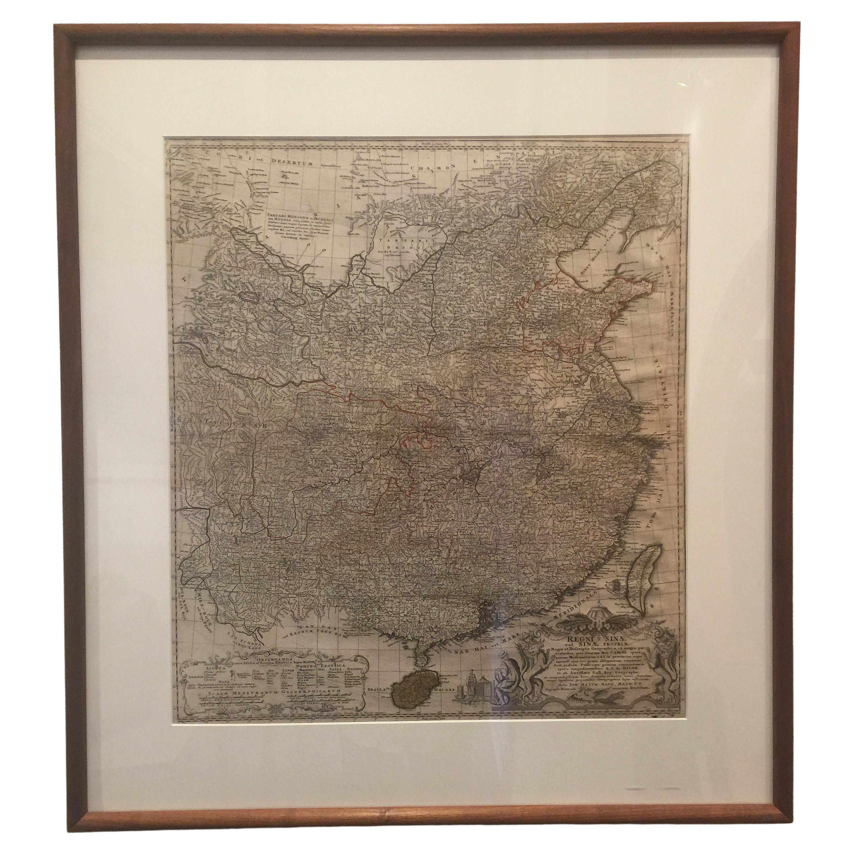
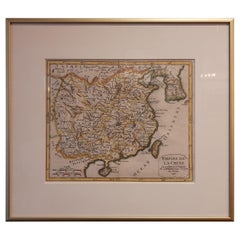
Framed Early 19th Century Drawn and Engraved Map of China
$862.50
$1,15025% Off
£651.33
£868.4325% Off
€745.71
€994.2825% Off
CA$1,218.08
CA$1,624.1025% Off
A$1,329.85
A$1,773.1325% Off
CHF 697.18
CHF 929.5825% Off
MX$16,151.50
MX$21,535.3425% Off
NOK 8,706.70
NOK 11,608.9325% Off
SEK 8,221.44
SEK 10,961.9225% Off
DKK 5,565.91
DKK 7,421.2225% Off
About the Item
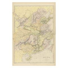
Hand drawn and tinted engraved map of China dated 1815
Created for Thomson's New General Atlas
Edinburgh
Beautifully framed with a linen covered mat.
- Creator:John Knighton Thomson (Author)
- Dimensions:Height: 34.5 in (87.63 cm)Width: 30 in (76.2 cm)Depth: 1 in (2.54 cm)
- Materials and Techniques:Paper,Engraved
- Place of Origin:
- Period:
- Date of Manufacture:1815
- Condition:Wear consistent with age and use. Good antique condition.
- Seller Location:San Francisco, CA
- Reference Number:1stDibs: LU812812798872
About the Seller
4.8
Platinum Seller
Premium sellers with a 4.7+ rating and 24-hour response times
Established in 1986
1stDibs seller since 2005
883 sales on 1stDibs
Typical response time: 2 hours
- ShippingRetrieving quote...Shipping from: San Francisco, CA
- Return Policy
Authenticity Guarantee
In the unlikely event there’s an issue with an item’s authenticity, contact us within 1 year for a full refund. DetailsMoney-Back Guarantee
If your item is not as described, is damaged in transit, or does not arrive, contact us within 7 days for a full refund. Details24-Hour Cancellation
You have a 24-hour grace period in which to reconsider your purchase, with no questions asked.Vetted Professional Sellers
Our world-class sellers must adhere to strict standards for service and quality, maintaining the integrity of our listings.Price-Match Guarantee
If you find that a seller listed the same item for a lower price elsewhere, we’ll match it.Trusted Global Delivery
Our best-in-class carrier network provides specialized shipping options worldwide, including custom delivery.More From This Seller
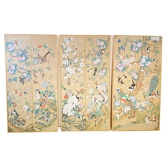
View AllFramed Asian Woven Silk Tapestry, L
Located in San Francisco, CA
An exceptional Asian woven silk tapestry, in a very high quality custom gilt frame with a deep silk mat and interior frame under plexus glass.
Extraordinary colors and design.
Late 1...
Category
Antique Late 19th Century Asian Decorative Art
Materials
Silk
$1,406 Sale Price / item
25% Off
Pair of Italian Piranesi Prints in Mirrored Frames
Located in San Francisco, CA
Pair of black and white Piranesi prints framed in silver mirror with speckling and an outer fillet of giltwood and matted in the same manner, Italy, 1950s.
Category
Mid-20th Century Italian Prints
Materials
Glass, Mirror, Paper
Mid-19th Century Hand Painted Asian Wallpaper Panels
Located in San Francisco, CA
A set of three mounted hand painted wallpaper panels in simple wood frames.
Beautifully and elaborate painted scenes with birds, flowers,...
Category
Antique Mid-19th Century Chinese Chinoiserie Paintings
Materials
Paper
$5,850 Sale Price / set
25% Off
Signed Japanese Meiji Period Table Top Screen, circa 1890
Located in San Francisco, CA
Meiji period Japanese lacquered and hand painted folding table top screen.
The bas relief (heavily textured) sculptural painting of a serene quiet nature setting in an intricately ca...
Category
Antique Late 19th Century Japanese Meiji Paintings and Screens
Materials
Wood, Lacquer, Paint
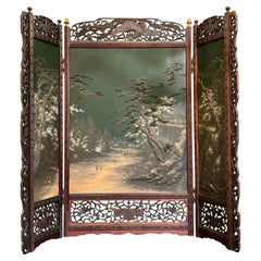
$1,837 Sale Price
25% Off
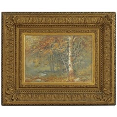
Landscape Watercolor Painting Signed L Douglas, American, Early 20th Century
Located in San Francisco, CA
Beautifully painted landscape forest scene with stream in original giltwood frame, watercolor under glass. Signed in the lower right corner L. Douglas. American, early 20th century.
...
Category
Early 20th Century American Paintings
Materials
Glass, Wood, Paper
Antique Japanese Wood Block Printed Table Top Folding Screen
Located in San Francisco, CA
Antique Japanese small table top four panel folding screen.
Wood block print on paper.
First quarter 20th century.
Perfect to use as wall art.
Category
Early 20th Century Japanese Meiji Paintings and Screens
Materials
Paper
$543 Sale Price
25% Off
You May Also Like
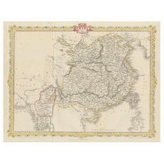
Antique Map of China Including Korea and Taiwan by Vaugondy, 1749
Located in Langweer, NL
Antique map titled 'Empire de la Chine'. Beautiful map of China including Korea and Taiwan (Formosa). This map originates from 'Atlas Universel (..)' by Gilles Robert de Vaugondy, 17...
Category
Antique Mid-18th Century Maps
Materials
Paper
$481 Sale Price
20% Off
Framed Map of China
Located in Greenwich, CT
Map of China, 19th century. European print map of China
Conservation frame with walnut frame
Overall dimension : 28 1/2" wide 31" high 2" depth with fra...
Category
Antique 19th Century European Qing Prints
Materials
Paper

$3,800
Antique Map of China, Also Depicting Formosa 'Taiwan' and Part of Korea, c.1840
Located in Langweer, NL
Antique map titled 'China'. Old map of China, also depicting Formosa (Taiwan) and part of Korea. Source unknown, to be determined.
Artists and Engravers: Anonymous.
Condition: ...
Category
Antique 19th Century Maps
Materials
Paper

$231 Sale Price
20% Off
1851 Tallis Map of China with Tibet, Formosa, and Burma – Engraved by J. Rapkin
Located in Langweer, NL
Title: 1851 Tallis Map of China with Tibet, Formosa, and Burma – Engraved by J. Rapkin
Description: This is a finely engraved and delicately hand-colored map of China, published a...
Category
Antique 1850s Maps
Materials
Paper
$327 Sale Price
20% Off
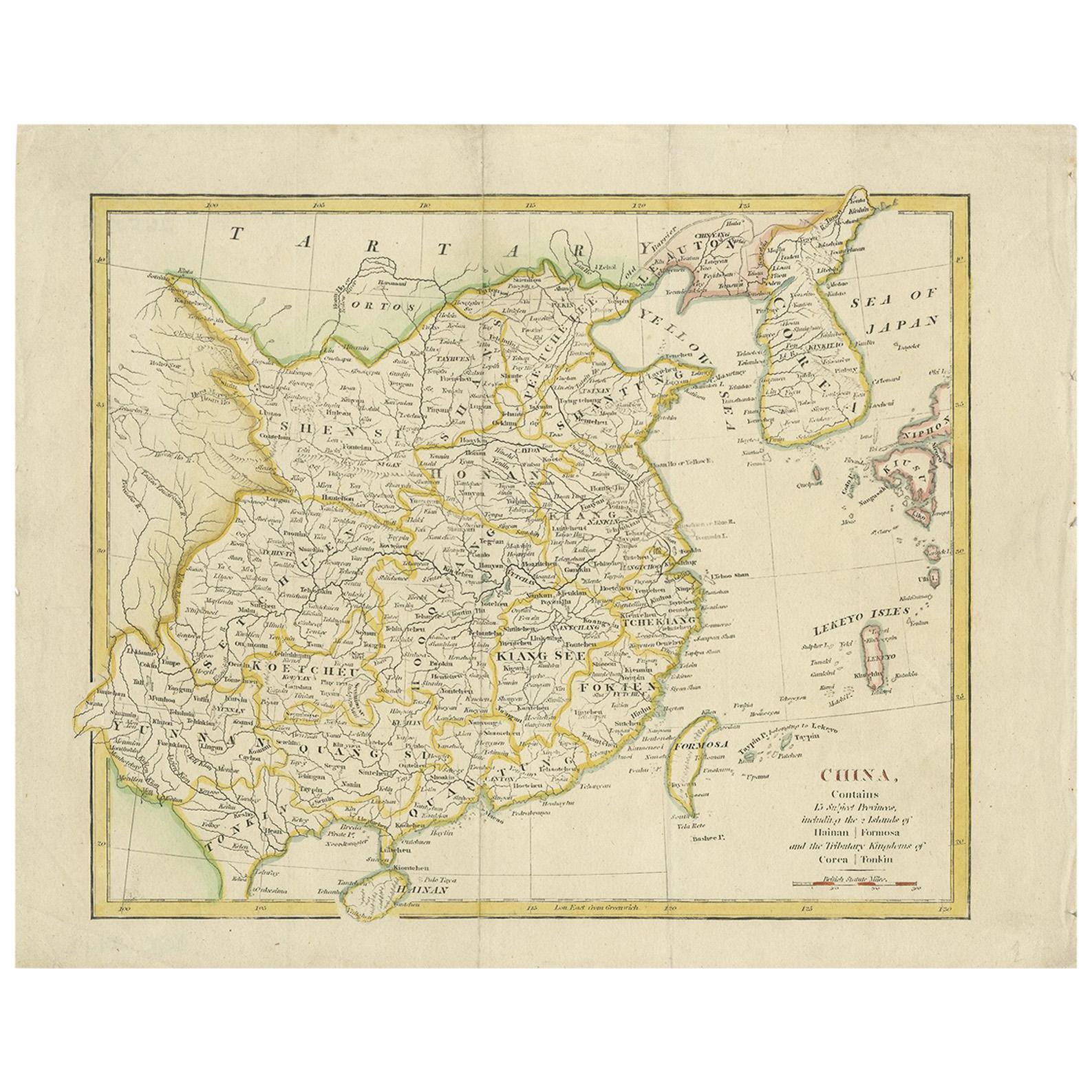
Antique Map of China by Wilkinson '1803'
Located in Langweer, NL
Antique map titled 'China, Contains 15 Subject Provinces Including the 2 Islands of Hainan, Formosa and the Tributary Kingdoms of Korea, Tonkin'. Old map depicting China, extending f...
Category
Antique Early 19th Century Maps
Materials
Paper

$288 Sale Price
20% Off
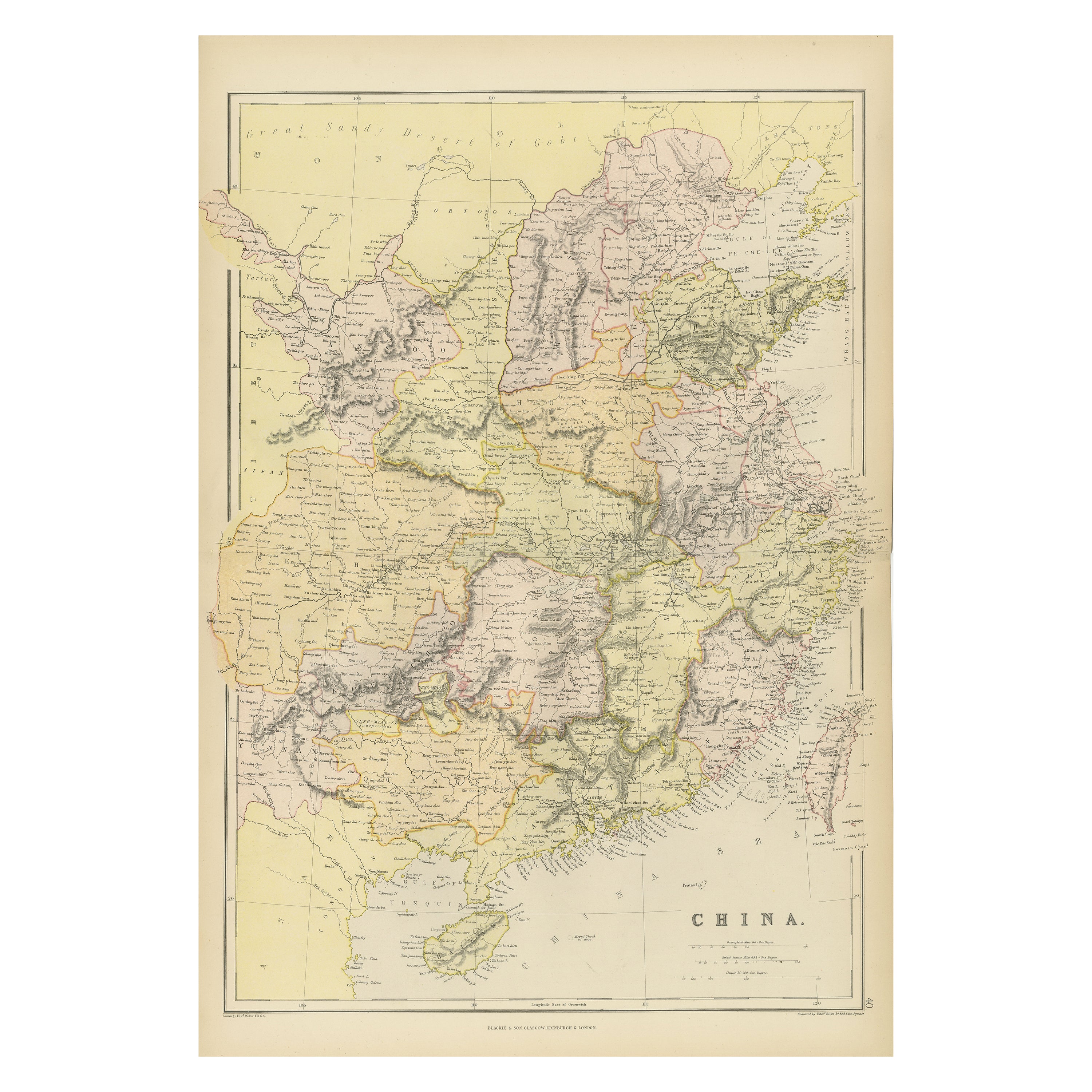
Antique 19th Century Map of China by Blackie & Son, 1882
Located in Langweer, NL
This map is an 1882 Blackie & Son map of China. The title "CHINA." is prominently displayed at the bottom. The map is colored to differentiate various regions, possibly indicating di...
Category
Antique 1880s Maps
Materials
Paper