Items Similar to Frontispiece of Homann's Atlas Novus, Hand-Coloured Engraving, Published in 1720

Want more images or videos?
Request additional images or videos from the seller
1 of 6
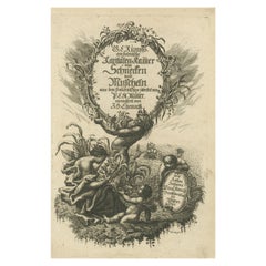
Frontispiece of Homann's Atlas Novus, Hand-Coloured Engraving, Published in 1720
$356.44
$445.5520% Off
£263.72
£329.6520% Off
€296
€37020% Off
CA$492.84
CA$616.0520% Off
A$541.08
A$676.3520% Off
CHF 282.28
CHF 352.8520% Off
MX$6,547.79
MX$8,184.7420% Off
NOK 3,537.96
NOK 4,422.4520% Off
SEK 3,333.69
SEK 4,167.1120% Off
DKK 2,253.75
DKK 2,817.1920% Off
About the Item
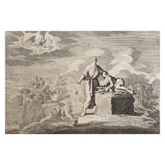
Description: Johann Baptista Homann’s Atlas Novus Frontispiece (Circa Early 18th Century)
This original hand-colored engraving served as the frontispiece for Johann Baptista Homann’s "Atlas Novus", a prominent atlas published in the early 18th century.
The elaborate and allegorical design surrounds a central depiction of the globe, highlighting the continents and global dominions, with Europe prominently shown at the center.
Key Features:
1. Mythological and Allegorical Figures:
- The engraving is rich with mythological and allegorical characters representing different elements of the world and power. At the top, two muscular figures support the heavens, reminiscent of Atlas from Greek mythology.
- Around the globe, various figures represent the continents and the elements of Earth. The figure with a trident likely represents Poseidon (Neptune), symbolizing the seas and the power of maritime exploration, while the crowned figures may represent ruling monarchs or allegories of different empires.
- The presence of other symbolic items, such as the caduceus (staff of Hermes, associated with trade and commerce) and cornucopia (symbolizing abundance), emphasizes the atlas’s focus on global dominion, commerce, and wealth.
2. Central Globe Depiction:
- The globe in the center of the engraving is focused on Europe, Africa, and parts of the Americas. A ship sails the oceans, symbolizing the age of exploration and trade routes that were critical to the expansion of European empires during the time.
3. Title Cartouche:
- Below the central globe is an ornate cartouche that bears the title of the atlas:
Atlas Novus / Terrarum Orbis Imperia / Regna et Status / exactis tabulis geographice demonstrans, (...) Iohannis Baptistae Homanni (...) / Noribergae."
- The title translates to "New Atlas / Empires, Kingdoms, and States of the World / Demonstrated by exact geographical tables, (...) by Johann Baptista Homann (...) in Nuremberg."
- Homann's name is clearly displayed as the creator of the atlas, underscoring his reputation as a leading cartographer of the time.
4. Artist and Engraver:
- More research needed as the signature in the lower right is unclear. Likely refers to Michael Heinrich Rentz (also known as M.H. Rentz), a notable engraver who worked during the 18th century. Rentz was known for his intricate and detailed engravings, and he collaborated with various prominent figures and publishers during that time, including Johann Baptista Homann. It is possible that Rentz (or someone working under a similar name like Rafler) contributed engravings for the Atlas Novus, particularly in the decorative elements or the frontispiece, as Homann’s works often involved contributions from other artists.
5. Symbolism and Artistic Style:
- The use of allegorical figures and classical references reflects the baroque artistic style of the early 18th century. The composition reinforces the idea of Europe’s dominance over the known world, with mythological figures symbolizing knowledge, power, and discovery.
Historical Context:
Johann Baptista Homann (1664–1724) was a leading cartographer of the Holy Roman Empire and founder of a famous mapmaking firm in Nuremberg. His atlases were well-known for their detailed maps and elaborate frontispieces like this one. The "Atlas Novus" was one of his major works, providing a comprehensive geographic overview of the world's empires, kingdoms, and regions during the early modern period.
This engraving encapsulates the spirit of exploration, scientific advancement, and geopolitical power that characterized Europe during the height of the Baroque period. It serves both as a decorative introduction to the atlas and a powerful statement about Europe's perceived global authority at the time.
- Dimensions:Height: 20.08 in (51 cm)Width: 12.01 in (30.5 cm)Depth: 0 in (0.02 mm)
- Materials and Techniques:Paper,Engraved
- Period:1720-1729
- Date of Manufacture:1720
- Condition:Condition: good, given age. General age-related toning and minor defects from handling. All borders have been folded to the back for extra support. Browning and foxing mainly outside the image. Please study scans carefully.
- Seller Location:Langweer, NL
- Reference Number:Seller: BG-023591stDibs: LU3054341511972
About the Seller
5.0
Recognized Seller
These prestigious sellers are industry leaders and represent the highest echelon for item quality and design.
Platinum Seller
Premium sellers with a 4.7+ rating and 24-hour response times
Established in 2009
1stDibs seller since 2017
2,641 sales on 1stDibs
Typical response time: <1 hour
- ShippingRetrieving quote...Shipping from: Langweer, Netherlands
- Return Policy
Authenticity Guarantee
In the unlikely event there’s an issue with an item’s authenticity, contact us within 1 year for a full refund. DetailsMoney-Back Guarantee
If your item is not as described, is damaged in transit, or does not arrive, contact us within 7 days for a full refund. Details24-Hour Cancellation
You have a 24-hour grace period in which to reconsider your purchase, with no questions asked.Vetted Professional Sellers
Our world-class sellers must adhere to strict standards for service and quality, maintaining the integrity of our listings.Price-Match Guarantee
If you find that a seller listed the same item for a lower price elsewhere, we’ll match it.Trusted Global Delivery
Our best-in-class carrier network provides specialized shipping options worldwide, including custom delivery.More From This Seller
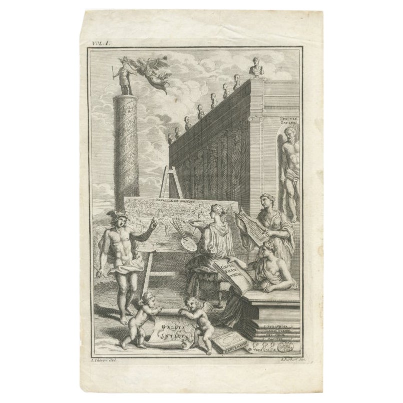
View AllAntique Frontispiece of 'Gallia Antiqua' with Mercury, Herucules Etc, circa 1728
Located in Langweer, NL
Frontispiece to volume one of 'Gallia Antiqua'. It shows an allegorical scene with Mercury standing at left beside a nymph painting the 'Bataille de Soissons'. Tragan's column behind...
Category
Antique 18th Century French Prints
Materials
Paper
$154 Sale Price
20% Off
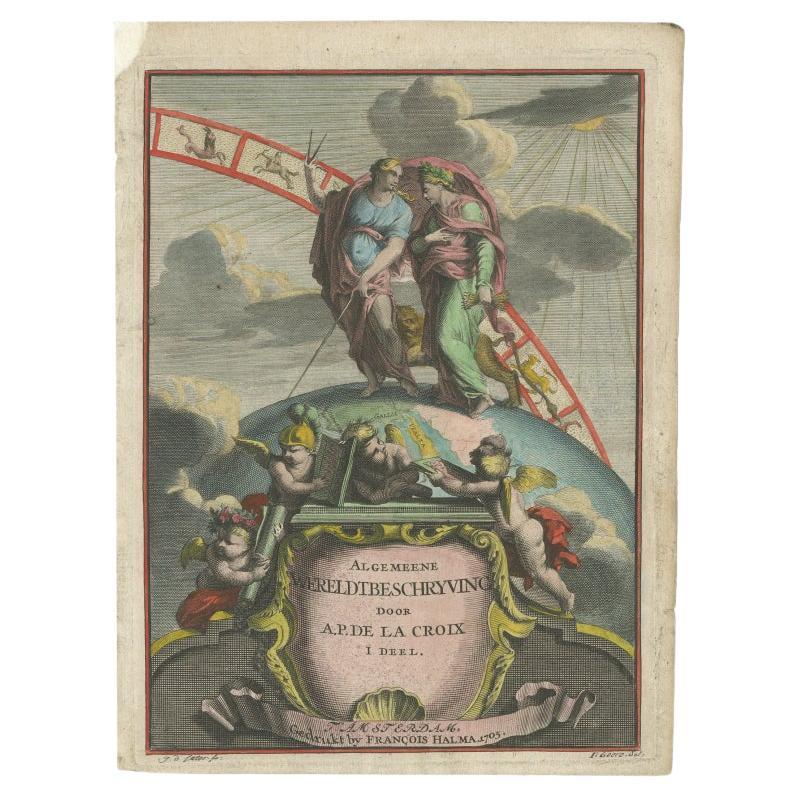
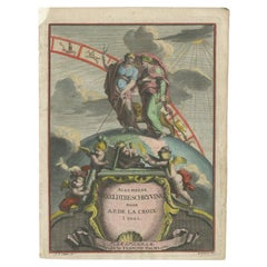
Antique Frontispiece with Allegorical Figures, a Globe and Zodiac Signs, 1705
Located in Langweer, NL
Antique frontispiece titled 'Algemeene Wereldtbeschryving door A.P. de la Croix'. Title page of volume I by A.P. de la Croix. With allegorical figures...
Category
Antique 18th Century Prints
Materials
Paper
$216 Sale Price
20% Off
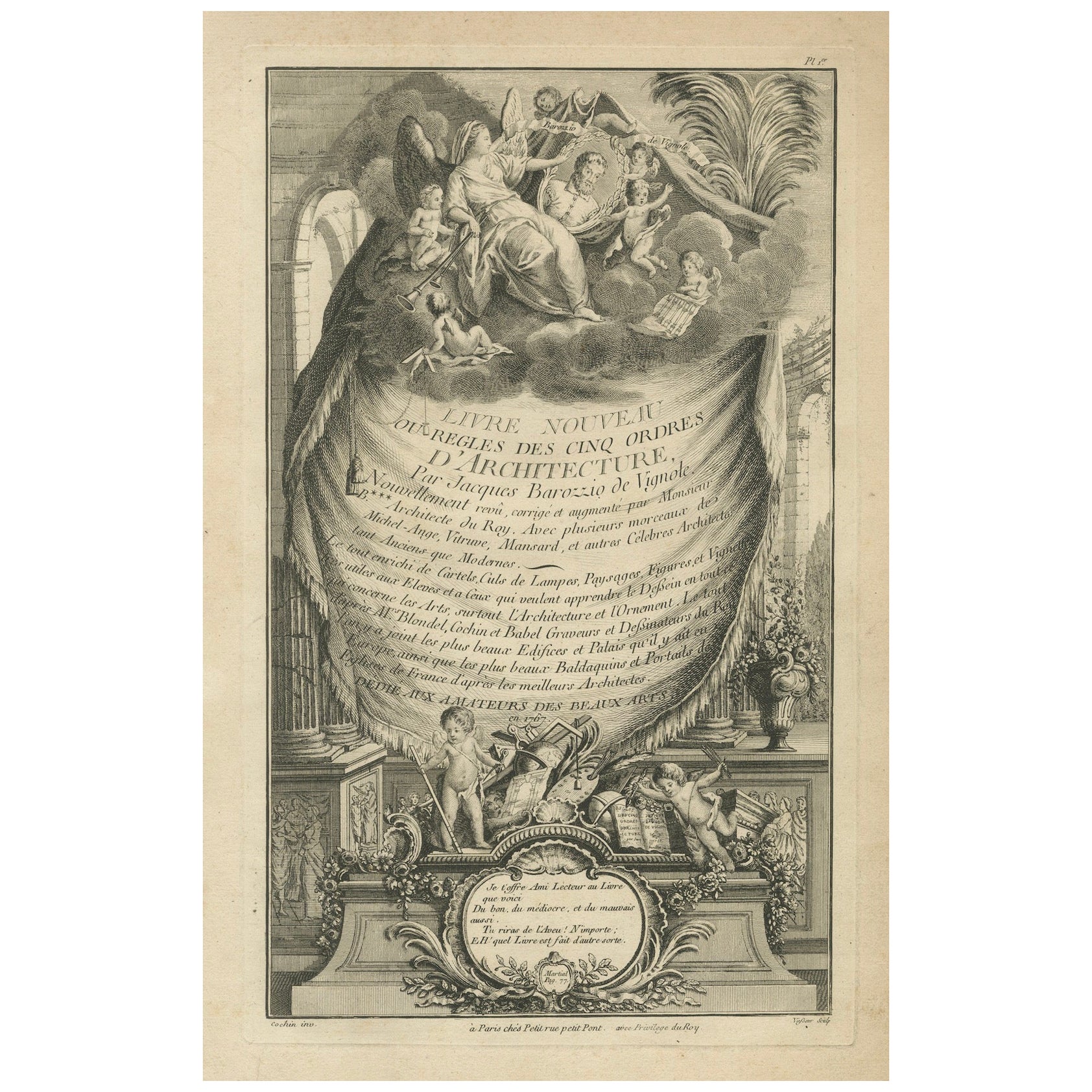
Renaissance Architectural Orders by Vignola's Frontispiece, 1767
Located in Langweer, NL
This image is an intricate frontispiece from a book by Jacques Barozzi de Vignole, known as Vignola, an influential 16th-century Italian architect who was one of the great architect ...
Category
Antique 1850s Prints
Materials
Paper
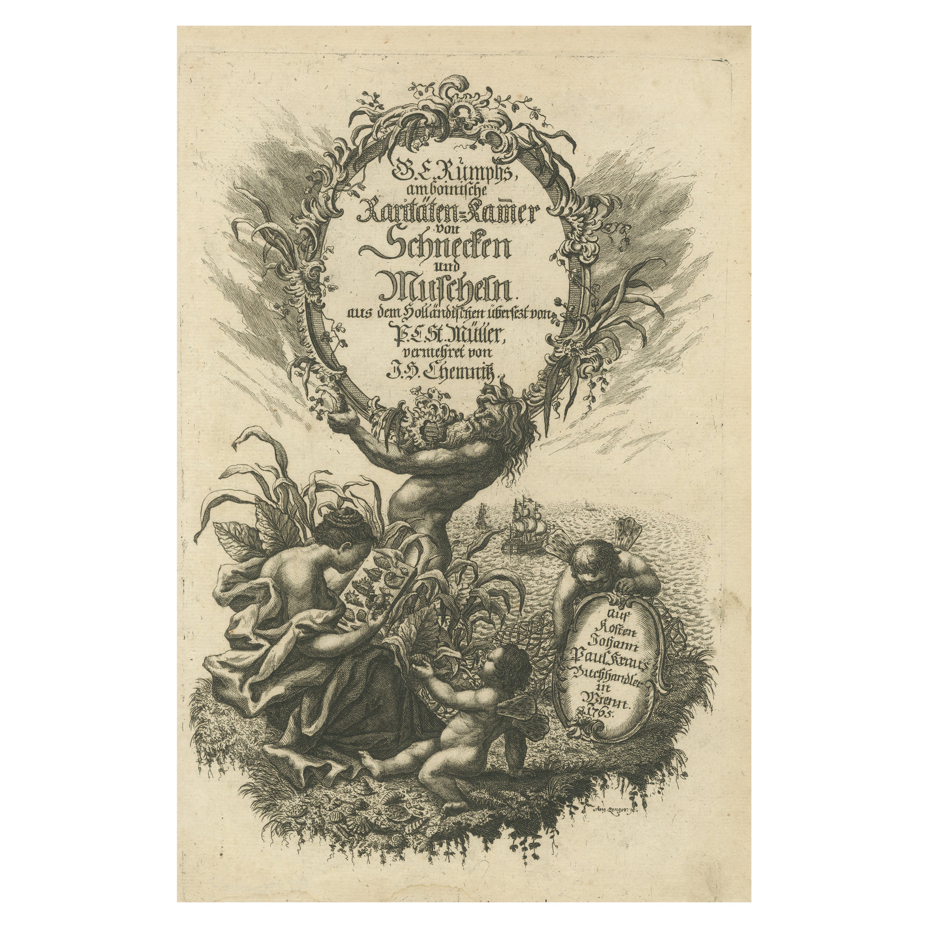
Rare German Frontispiece of Rumphius Cabinet of Curiosities, 1765
Located in Langweer, NL
The Amboinese Cabinet of Curiosities was a work by Georg Eberhard Rumphius, and included many engravings of sea shells and crustaceans.
The German edition of the book was financed ...
Category
Antique 1760s Prints
Materials
Paper
$423 Sale Price
20% Off
Free Shipping
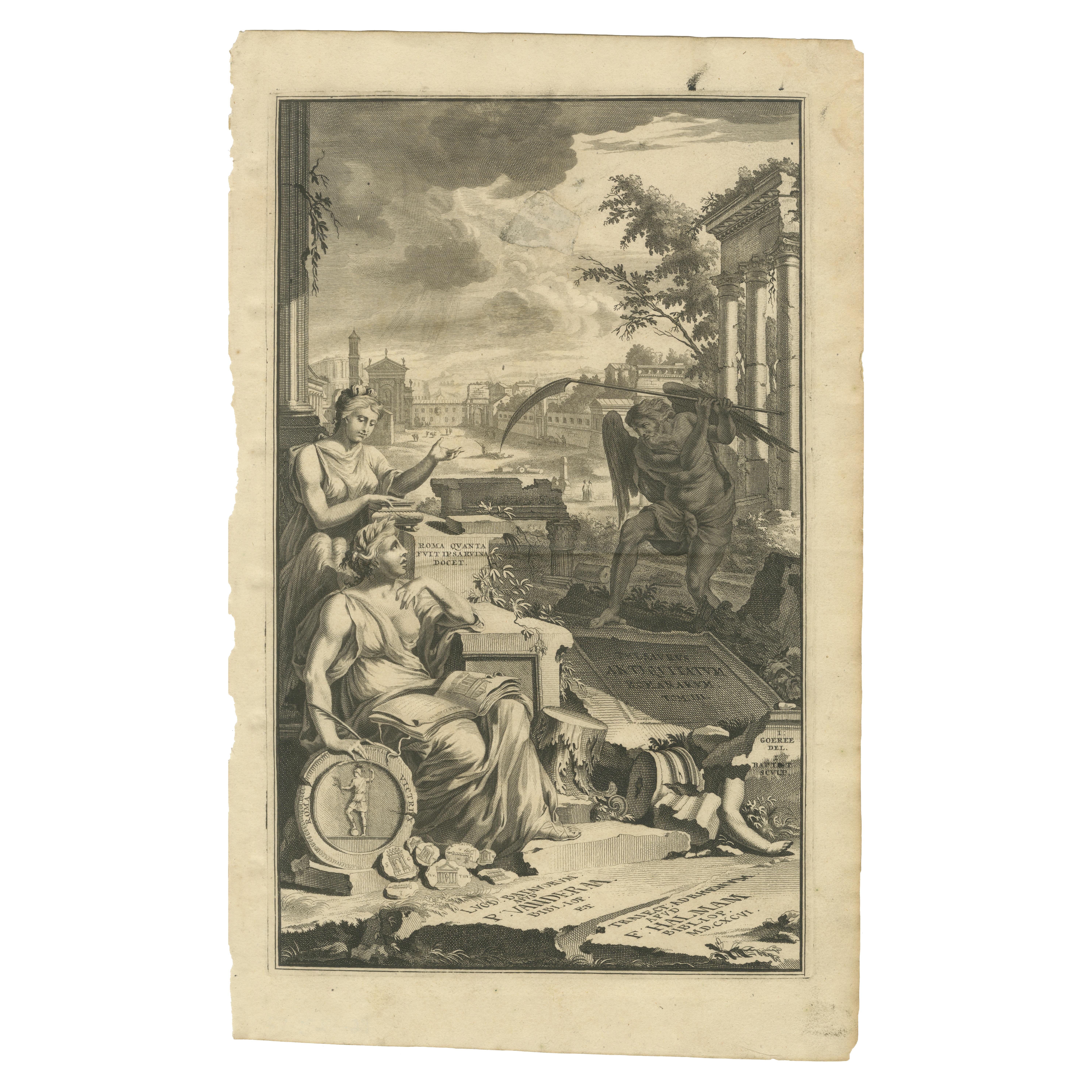
Allegorical Frontispiece of Rome's Ruins, Pieter van der Aa & F. Halma, 1696
Located in Langweer, NL
This engraving is an allegorical frontispiece featuring a depiction of the ruins of ancient Rome, emphasizing the enduring legacy of the city's grandeur through its remnants. The com...
Category
Antique 1690s Prints
Materials
Paper
Allegorical 18th-Century Engraving of America by Johann Hertel, Augsburg c.1750
Located in Langweer, NL
The engraving titled "America" was part of a series representing the four continents, published by Johann Georg Hertel in Augsburg during the mid-18th century. The series includes al...
Category
Antique 1750s Prints
Materials
Paper
You May Also Like
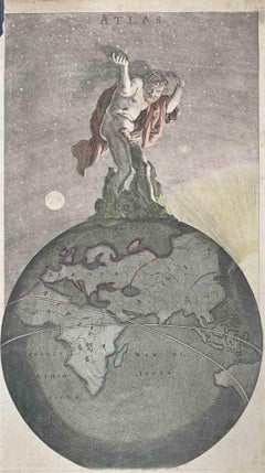
Atlas (Frontispiece) - Etching by Frederick de Wit - 1680 ca
By Frederick de Wit
Located in Roma, IT
This etching with contemporary coloring, depicting Atlas supporting the heavens, was realized by the cartographer Frederick de Wit as frontispiece of the famous Atlas published in Am...
Category
1680s Modern Figurative Prints
Materials
Etching
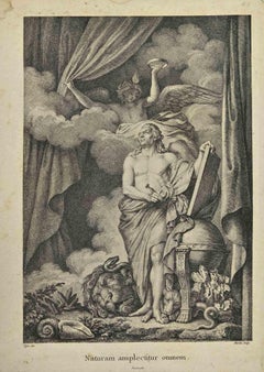
Naturam Omnem - Lithograph by Pajou Augustin - 18th Century
Located in Roma, IT
Naturam Omnem is a print realized by French Pajou Augustin (1730-1809) in the late 18th century.
Lithograph on paper.
Signed on the plate, Ti...
Category
18th Century Modern Figurative Prints
Materials
Lithograph
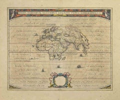
Orbis Terrarum - Etching by Johannes Janssonius - 1650s
By Johannes Janssonius
Located in Roma, IT
Antique Map - Orbis Terrarum is an antique map realized in 1650 by Johannes Janssonius (1588-1664).
The Map is Hand-colored etching, with coeval watercoloring.
Good conditions with...
Category
1650s Modern Figurative Prints
Materials
Etching
Original Antique Print After Jan Luyken, Amsterdam, Genesis IX, 1724
Located in St Annes, Lancashire
Wonderful copper-plate engraving after Jan Luyken
Published by Marten Schagen, Amsterdam. 1724
Text on verso
The measurement given is the paper size.
Category
Antique 1720s Dutch Renaissance Prints
Materials
Paper
Three 18th Century Colored Engravings of Herculaneum Frescos by Nicola Fiorillo
Located in Rochester, NY
Set ancient Roman frescos from the series "Antiquities of Herculaneum", an original etching on paper by Nicola Fiorillo in the 18th Century. Three hand colored copper engravings of classical roman. Each print is matted in a custom made silk mat that matches the clothing. Engraving with two figures measures 21.25" x 18.25". The other two prints measure 20.5" x 16.5". Size includes mat.
# greek Pompeii Grand tour
Category
Antique 18th Century European Prints
Materials
Silk, Paper
Original Antique Print After Jan Luyken, Amsterdam, Genesis XXII. 1724
Located in St Annes, Lancashire
Wonderful copper-plate engraving after Jan Luyken
Published by Marten Schagen, Amsterdam. 1724
Text on verso
The measurement given is the paper size.
Category
Antique 1720s Dutch Renaissance Prints
Materials
Paper
More Ways To Browse
Hermes Caduceus Staff
Used Bridal Veil
Used Tennis Balls
Venetian Bombe
Vintage Apple Blossom
Vintage Asian Art Panels
Vintage Black Ceramic Cats
Vintage Blanket Basket
Vintage Brass Tiger
Vintage Brown Snuff Bottles
Vintage Ceramic Leopard
Vintage Ceramic Rabbits
Vintage Decoupage Paper
Vintage Electric Iron
Vintage Horn Table
Vintage Ibis
Vintage Marble Top Garden Table
Vintage Room Thermometer