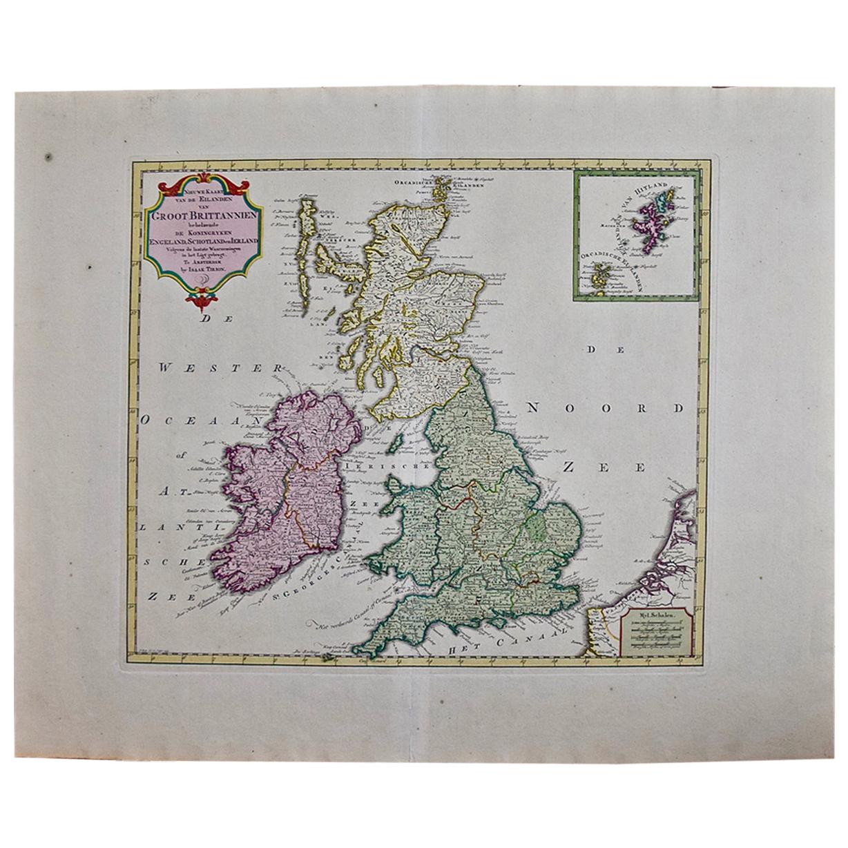
Map of "The Kingdom of Scotland" Printed & Colored by J. Garrett, 19th Century
View Similar Items


Want more images or videos?
Request additional images or videos from the seller
1 of 9
Map of "The Kingdom of Scotland" Printed & Colored by J. Garrett, 19th Century
About the Item
- Dimensions:Height: 17.75 in (45.09 cm)Width: 21.75 in (55.25 cm)Depth: 0.75 in (1.91 cm)
- Place of Origin:
- Period:
- Date of Manufacture:19th Century
- Condition:Wear consistent with age and use. Fold; frame loss.
- Seller Location:Big Flats, NY
- Reference Number:Seller: 629631stDibs: LU239638259773
About the Seller
4.9
Platinum Seller
These expertly vetted sellers are 1stDibs' most experienced sellers and are rated highest by our customers.
1stDibs seller since 2016
2,399 sales on 1stDibs
Typical response time: 5 hours
More From This SellerView All
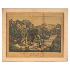
- Antique Currier & Ives Print - The Meeting Of The Waters 19th CBy Currier & IvesLocated in Big Flats, NYAntique Currier & Ives Print - The Meeting Of The Waters 19th C Measures - 25.5"h x 34.25"w x 1.5"d Catalogue Note: Ask about DISCOUNTED DELIVERY RATES available to most region...Category
Antique 19th Century Prints
MaterialsPaper
 $360 Sale Price20% Off
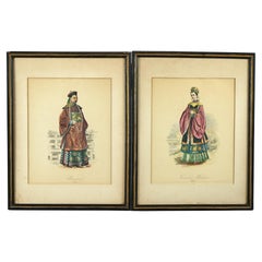
 - Antique Hand Colored Oriental Mandarin Prints, Man & Woman of Royalty, c1900Located in Big Flats, NYAn antique set of hand colored portraits depict a man and woman in royalty garb, framed, signed as photographed, c1900. Measures- 14'' H x 10...Category
Early 20th Century Asian Prints
MaterialsPaper
 $440 Sale Price / set20% Off
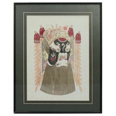
 - Chinese Mixed Media Print of Ceremonial Deity Mask, 20th CenturyLocated in Big Flats, NYA Chinese framed print offers mixed media depiction of ceremonial deity mask, 20th century Measures - 18" H x 14.25" W x 1" D. Catalogue Note: Ask about D...Category
20th Century Chinese Prints
MaterialsMetal
 $440 Sale Price20% Off
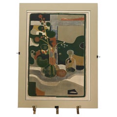
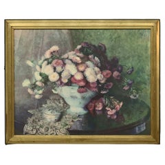
 - Mid Century Modern Abstract Floral Still Life Colored Lithograph, Signed, 20th CLocated in Big Flats, NYMid Century Modern Abstract Floral Still Life Colored Lithograph, Pencil Signed, 20th C Measures- 36''H x 27''W x .25''DCategory
20th Century Mid-Century Modern Prints
MaterialsPaper
 $520 Sale Price20% Off
 - Art Deco Maxfield Parrish Print “The Young Prince Of The Black Isles” C1906Located in Big Flats, NYArt Deco Maxfield Parrish Print “The Young Prince Of The Black Isles” C1906 Measures - 16"H x 13.5"W x .25"DCategory
Early 20th Century Art Deco Prints
MaterialsPaper
 $200 Sale Price20% Off
 - Vintage Floral Still Life Print 20th CLocated in Big Flats, NYA decorative vintage still life print of flowers in a table top vase, seated in giltwood frame, 20th century Measures- 25.25''H x 31.25''W...Category
20th Century Prints
MaterialsWood, Paper
 $360 Sale Price20% Off
You May Also Like
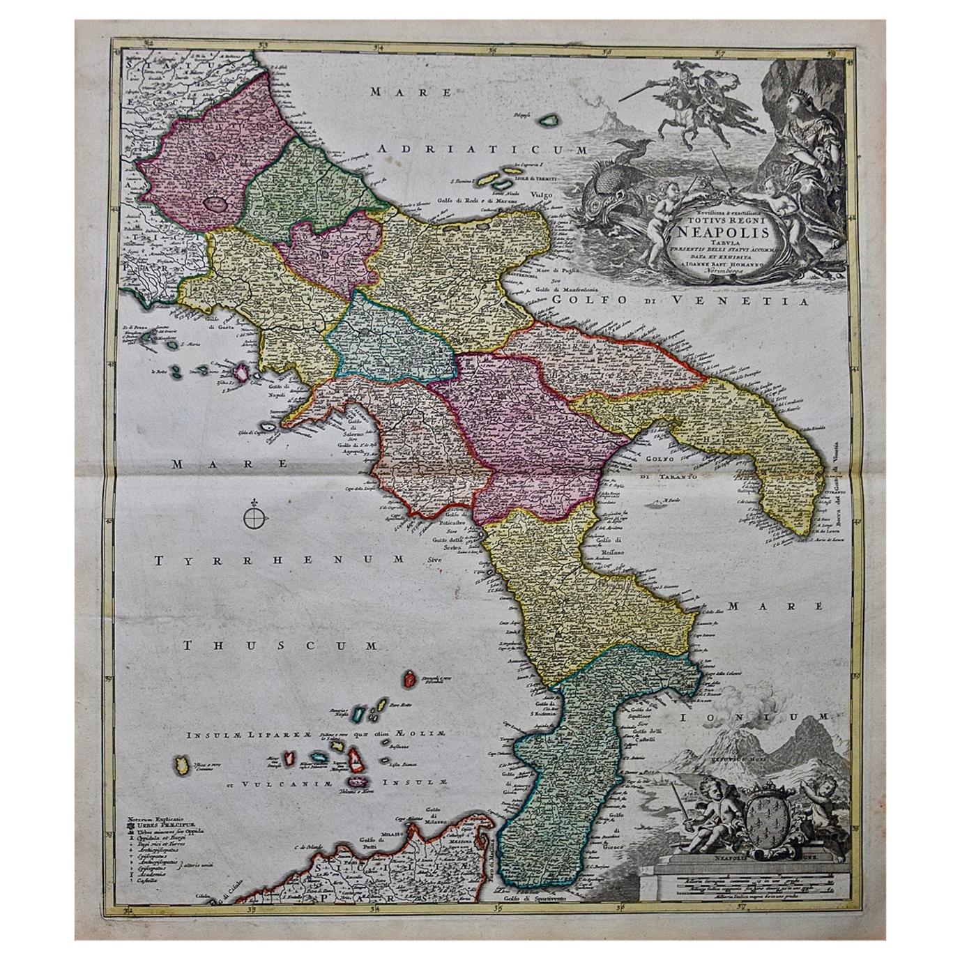
- The Kingdom of Naples and Southern Italy: A Hand-Colored 18th Century Homann MapBy Johann Baptist HomannLocated in Alamo, CA"Novissima & exactissimus Totius Regni Neapolis Tabula Presentis Belli Satui Accommo Data" is a hand colored map of southern Italy and the ancient Kingdom of Naples created by Johann...Category
Antique Early 18th Century German Maps
MaterialsPaper
- Northern Scotland: A 16th Century Hand-colored Map by MercatorBy Gerard MercatorLocated in Alamo, CAA framed hand-colored 16th century map of Northern Scotland by Gerard Mercator entitled "Scotiae pars Septentrionalis", published in Amsterdam in 1636. It is a highly detailed map of the northern part of Scotland, with the northwest Highlands and the cities Inverness and Aberdeen, as well as the Orkney Islands and the Hebrides. There is a decorative title cartouche in the upper left corner. The map is presented in an antiqued brown wood...Category
Antique 16th Century Dutch Maps
MaterialsPaper
- Northern Scotland: A 17th Century Hand-colored Map by MercatorBy Gerard MercatorLocated in Alamo, CAThis is a framed hand-colored 17th century map of Northern Scotland by Gerard Mercator entitled "Scotiae pars Septentrionalis", published in Amsterdam in 1636. It is a highly detailed map of the northern part of Scotland, with the northwest Highlands and the cities Inverness and Aberdeen, as well as the Orkney Islands and the Hebrides. There is a decorative title cartouche in the upper left corner. The map is presented in an antiqued brown wood...Category
Antique 1630s Dutch Maps
MaterialsPaper
- Antique Map of the Kingdom of the Netherlands by Wyld '1845'Located in Langweer, NLAntique map titled 'Holland & Belgium formerly Kingdom of the Netherlands'. Original antique map of the Kingdom of the Netherlands. This map originates from 'An Atlas of the World, C...Category
Antique Mid-19th Century Maps
MaterialsPaper
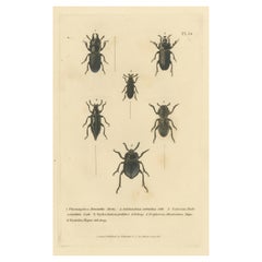
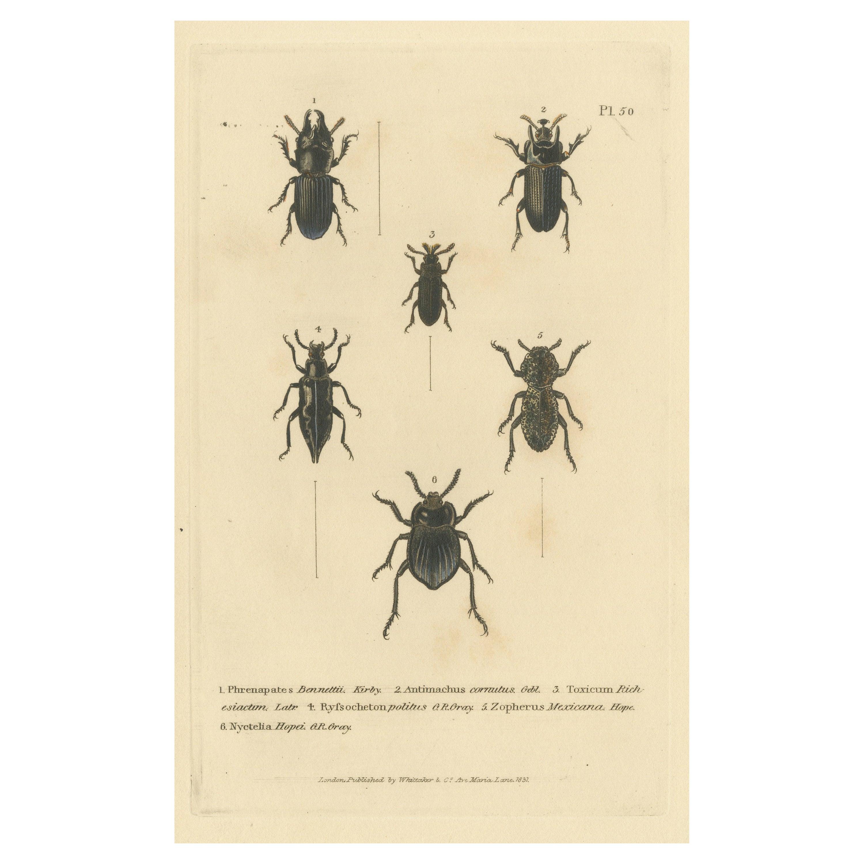
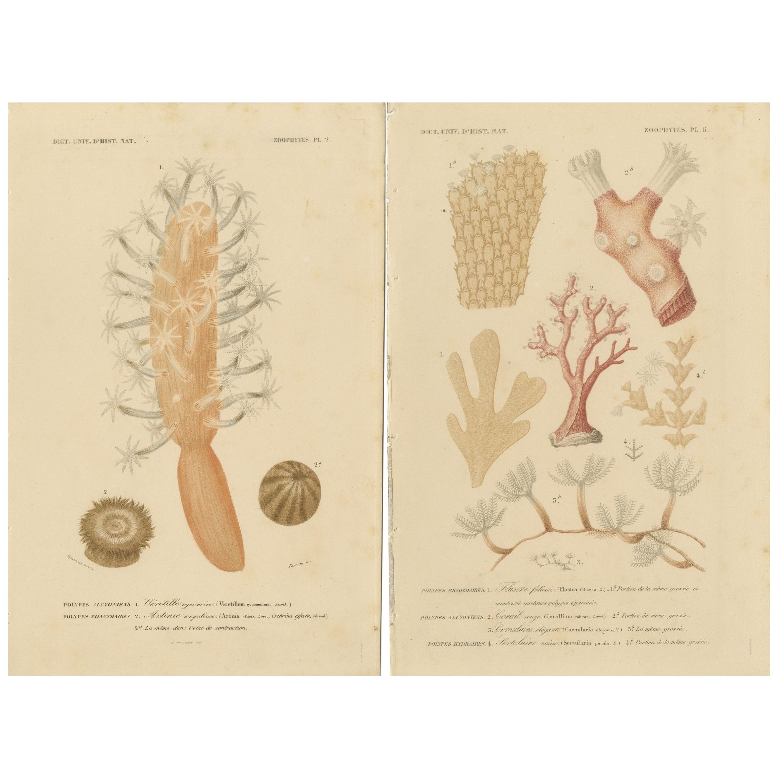
- Beetles of the Early 19th Century: A Cuvier Collection from 'The Animal Kingdom'Located in Langweer, NLThis image is an original antique print from a plate labeled "Pl. 50" featuring six different species of beetles, each meticulously illustrated. The title provided, "Phrenapates Benn...Category
Antique Mid-19th Century Prints
MaterialsPaper
- Antique Map of the Kingdom of Denmark by Wyld '1845'Located in Langweer, NLAntique map titled 'Kingdom of Denmark'. Original antique map of the Kingdom of Denmark. This map originates from 'An Atlas of the World, Comprehending Separate Maps of its Various C...Category
Antique Mid-19th Century Maps
MaterialsPaper
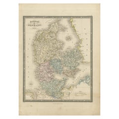 $142 Sale Price35% Off