Items Similar to Monastery Maps of St. Paulus and St. Antonius in the Egyptian Desert – c.1776
Want more images or videos?
Request additional images or videos from the seller
1 of 10
Monastery Maps of St. Paulus and St. Antonius in the Egyptian Desert – c.1776
$289
£213.83
€240
CA$399.60
A$438.71
CHF 228.88
MX$5,309.02
NOK 2,868.61
SEK 2,702.99
DKK 1,827.37
About the Item
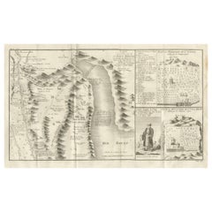
Monastery Maps of St. Paulus and St. Antonius in the Egyptian Desert – c.1776
Description:
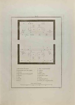
This evocative 18th-century engraving depicts stylized maps of two important early Christian monastic sites in Egypt: the Monastery of St. Paulus (top) and the Monastery of St. Antonius (bottom). These are among the oldest active Christian monasteries in the world, nestled in the Eastern Desert near the Red Sea coast.
The image features two separate map panels rendered as unfurled scrolls. Each "scroll" combines topographic representation with a symbolic layout of the monastery grounds and surrounding landscape. The maps show monastic complexes enclosed by walls, chapels, gardens, and paths leading to isolated hermitages. Prominent churches, palm groves, and desert trails are included, along with visual references to the mountainous terrain surrounding both monasteries. Though not geographically accurate in the modern sense, these schematic views provide an invaluable historical window into 18th-century European perceptions of Coptic Christian heritage.
The Dutch caption at the bottom reads: *Gezigt der Kloosters van St. Paulus en St. Antonius*, or “View of the Monasteries of St. Paul and St. Anthony.” These monasteries were revered pilgrimage sites and spiritual retreats for centuries, dating back to the 3rd and 4th centuries AD, and this image reflects the continued Western fascination with Christian antiquities in Egypt during the Enlightenment.
The engraving is attributed to the Dutch engraver C. Bagerts and likely originates from an illustrated travel account published in the late 18th century, possibly based on the explorations of Frederik Ludvig Norden or other European visitors to the Nile Valley and Egyptian deserts.
Condition:
Good impression on laid paper. Mild age-toning and a vertical centerfold crease from binding. Minor edge wear and a faint spot at the upper margin. Full plate border visible.
Framing tips:
A dark wood frame with a warm cream or light parchment-colored mount will enhance the aged paper tone and emphasize the scroll motifs. Ideal as part of a gallery wall on early Christianity or historical cartography.
Technique: Engraving
Maker: C. Bagerts, Netherlands, c.1776
- Dimensions:Height: 10.75 in (27.3 cm)Width: 9.85 in (25 cm)Depth: 0.01 in (0.2 mm)
- Materials and Techniques:Paper,Engraved
- Place of Origin:
- Period:
- Date of Manufacture:1776
- Condition:Good impression on laid paper. Mild age-toning and a vertical centerfold crease from binding. Minor edge wear and a faint spot at the upper margin. Full plate border visible.
- Seller Location:Langweer, NL
- Reference Number:Seller: BG-14102-341stDibs: LU3054346045282
About the Seller
5.0
Recognized Seller
These prestigious sellers are industry leaders and represent the highest echelon for item quality and design.
Platinum Seller
Premium sellers with a 4.7+ rating and 24-hour response times
Established in 2009
1stDibs seller since 2017
2,641 sales on 1stDibs
Typical response time: <1 hour
- ShippingRetrieving quote...Shipping from: Langweer, Netherlands
- Return Policy
Authenticity Guarantee
In the unlikely event there’s an issue with an item’s authenticity, contact us within 1 year for a full refund. DetailsMoney-Back Guarantee
If your item is not as described, is damaged in transit, or does not arrive, contact us within 7 days for a full refund. Details24-Hour Cancellation
You have a 24-hour grace period in which to reconsider your purchase, with no questions asked.Vetted Professional Sellers
Our world-class sellers must adhere to strict standards for service and quality, maintaining the integrity of our listings.Price-Match Guarantee
If you find that a seller listed the same item for a lower price elsewhere, we’ll match it.Trusted Global Delivery
Our best-in-class carrier network provides specialized shipping options worldwide, including custom delivery.More From This Seller
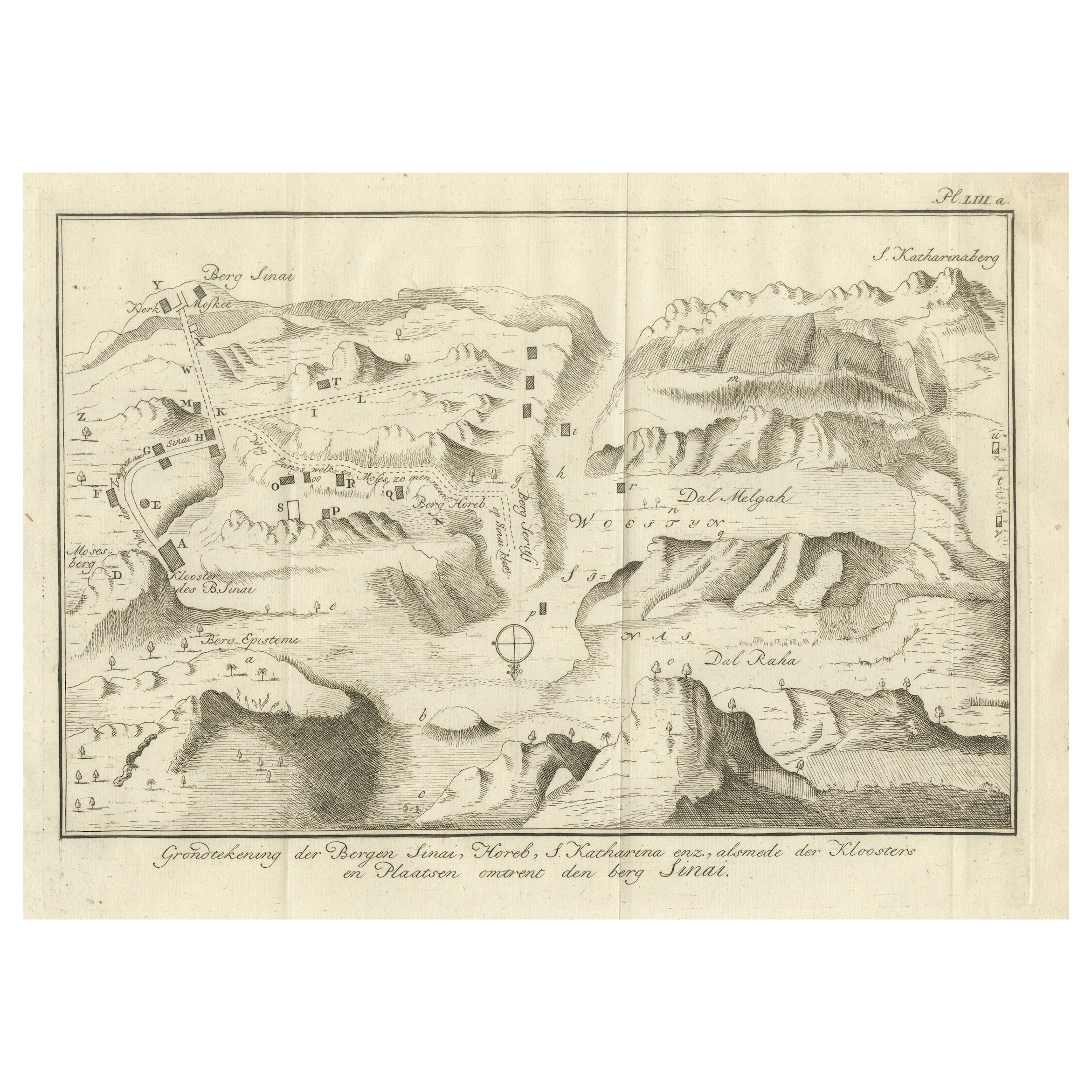
View AllMount Sinai & St. Catherine's – Antique Map of the Sinai Monasteries, 1776
Located in Langweer, NL
Mount Sinai & St. Catherine's – Antique Map of the Sinai Monasteries, 1776
Description:
This finely engraved antique map depicts the mountainous region of the Sinai Peninsula, focus...
Category
Antique Late 18th Century Dutch Maps
Materials
Paper
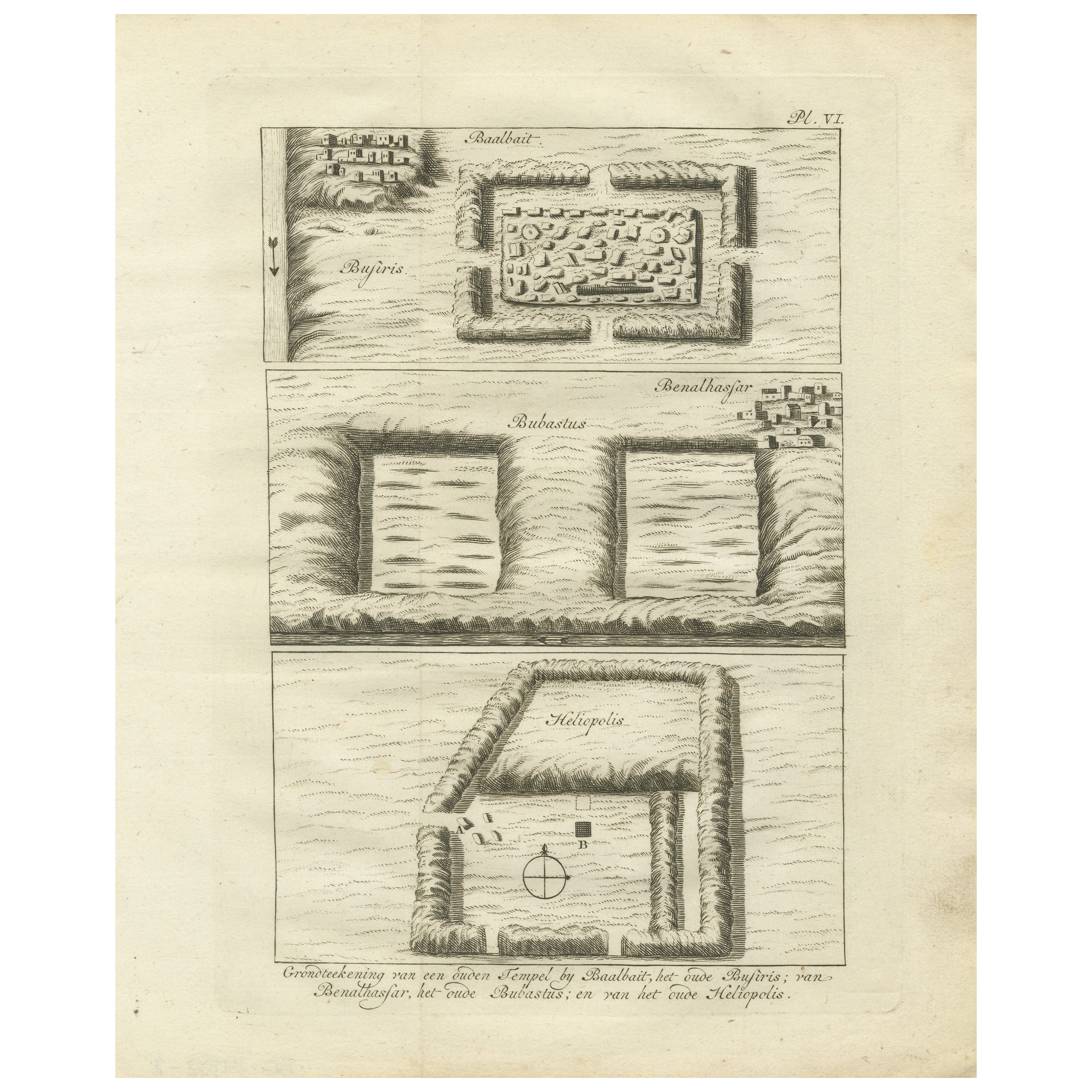
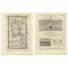
Ancient Temple and Ruin Plans – Egypt, Baalbek, Bubastus, Heliopolis 1776
Located in Langweer, NL
Title: Temple and Ruins Plans Egypt Baalbait Bubastus Heliopolis 1776
Description:
This original engraving from 1776 illustrates schematic plans of ancient Egyptian temple sites and...
Category
Antique Late 18th Century Dutch Prints
Materials
Paper
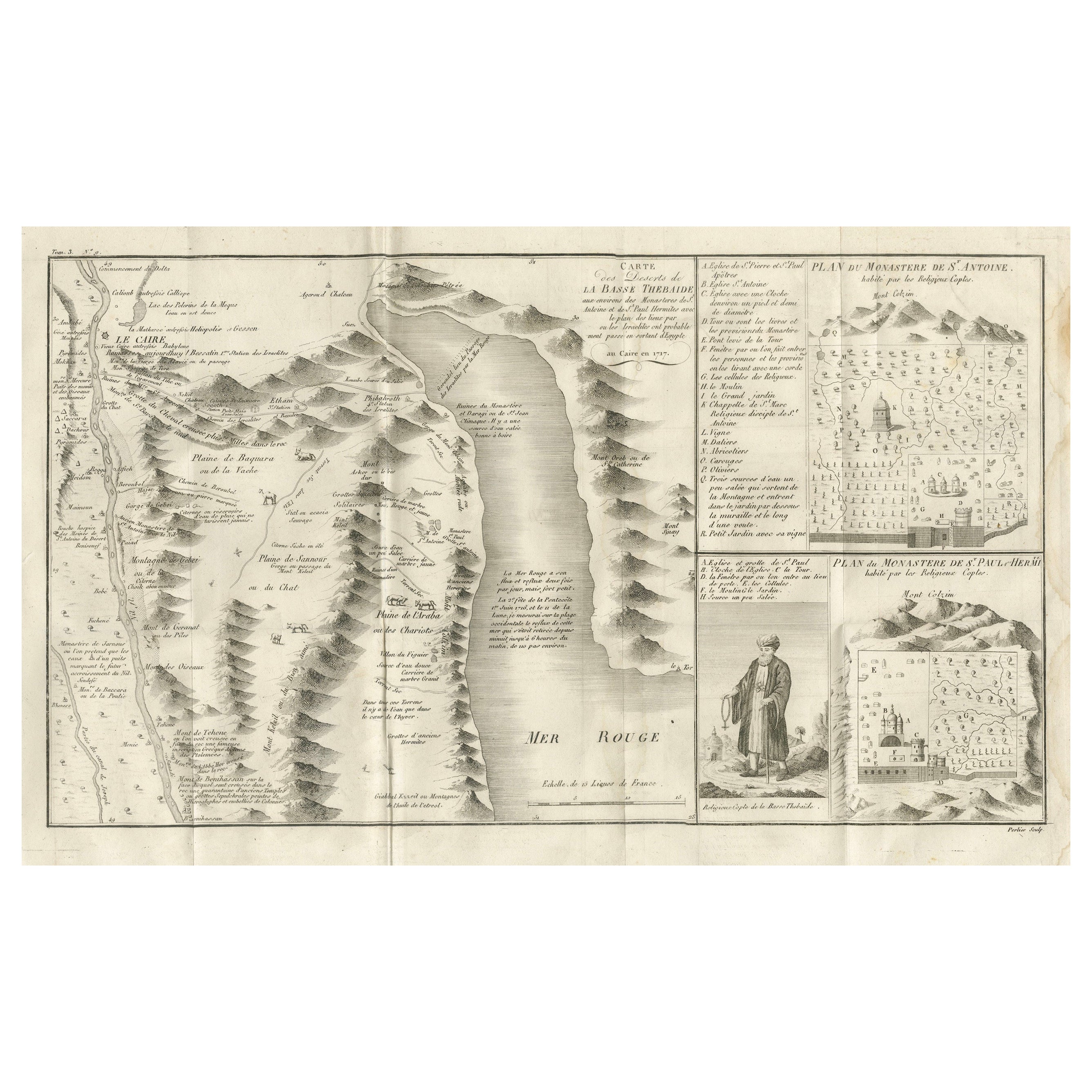
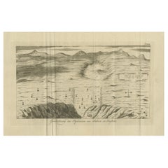
Antique Map of the Red Sea & Basse Thebaide with Monastery Plans, Egypt, 1777
Located in Langweer, NL
Antique Map of the Red Sea & Basse Thebaide with Monastery Plans, Egypt, 1777
This finely detailed 18th-century engraving depicts the coastal and inland geography of the Red Sea reg...
Category
Antique Late 18th Century French Maps
Materials
Paper
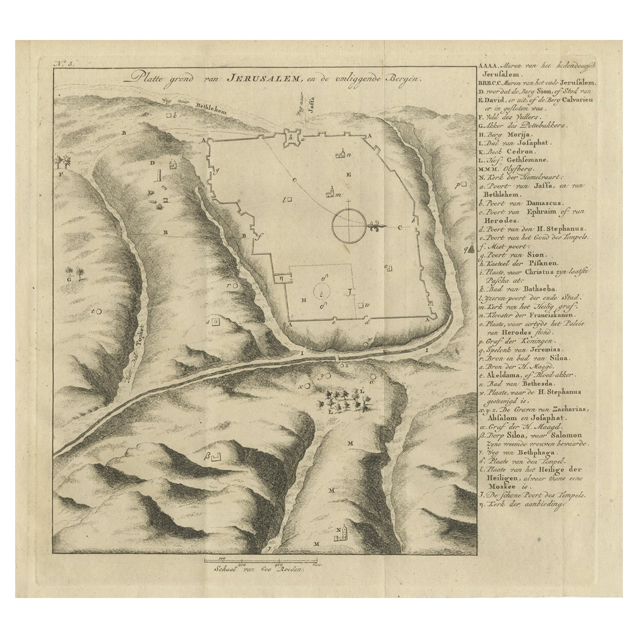
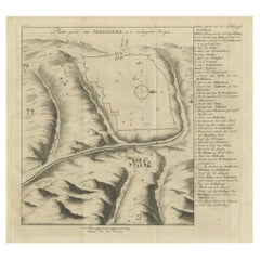
Antique Engraving of a Map or Plan of Jerusalem and Surrounding Mountains, 1773
Located in Langweer, NL
Antique map titled 'Platte grond van Jerusalem, en de omliggende Bergen'. Plan of the city of Jerusalem, with surrounding mountains. Originates from the first Dutch editon of an inte...
Category
Antique 18th Century Maps
Materials
Paper
$260 Sale Price
20% Off
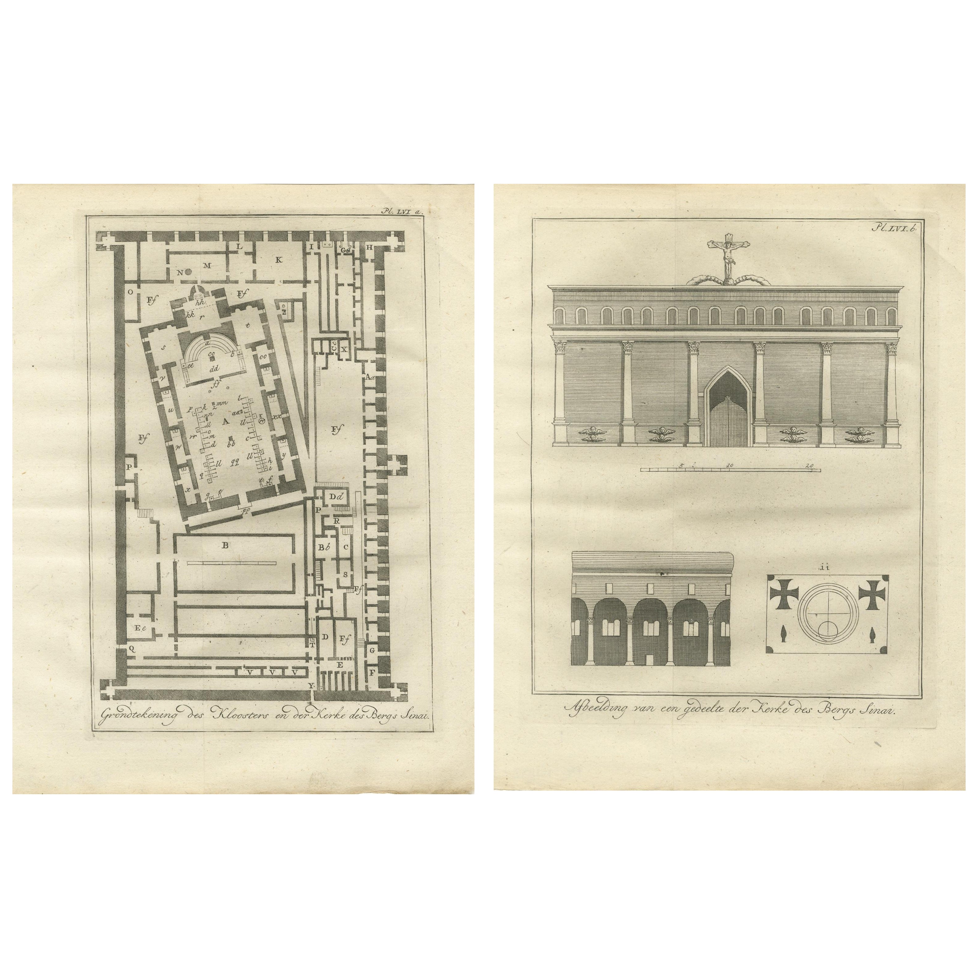
St. Catherine’s Monastery at Mount Sinai – Plan and Elevation Engravings c.1776
Located in Langweer, NL
St. Catherine’s Monastery at Mount Sinai – Plan and Elevation Engravings c.1776
This striking pair of antique engravings offers a rare architectural study of the renowned monastery ...
Category
Antique Late 18th Century Dutch Prints
Materials
Paper
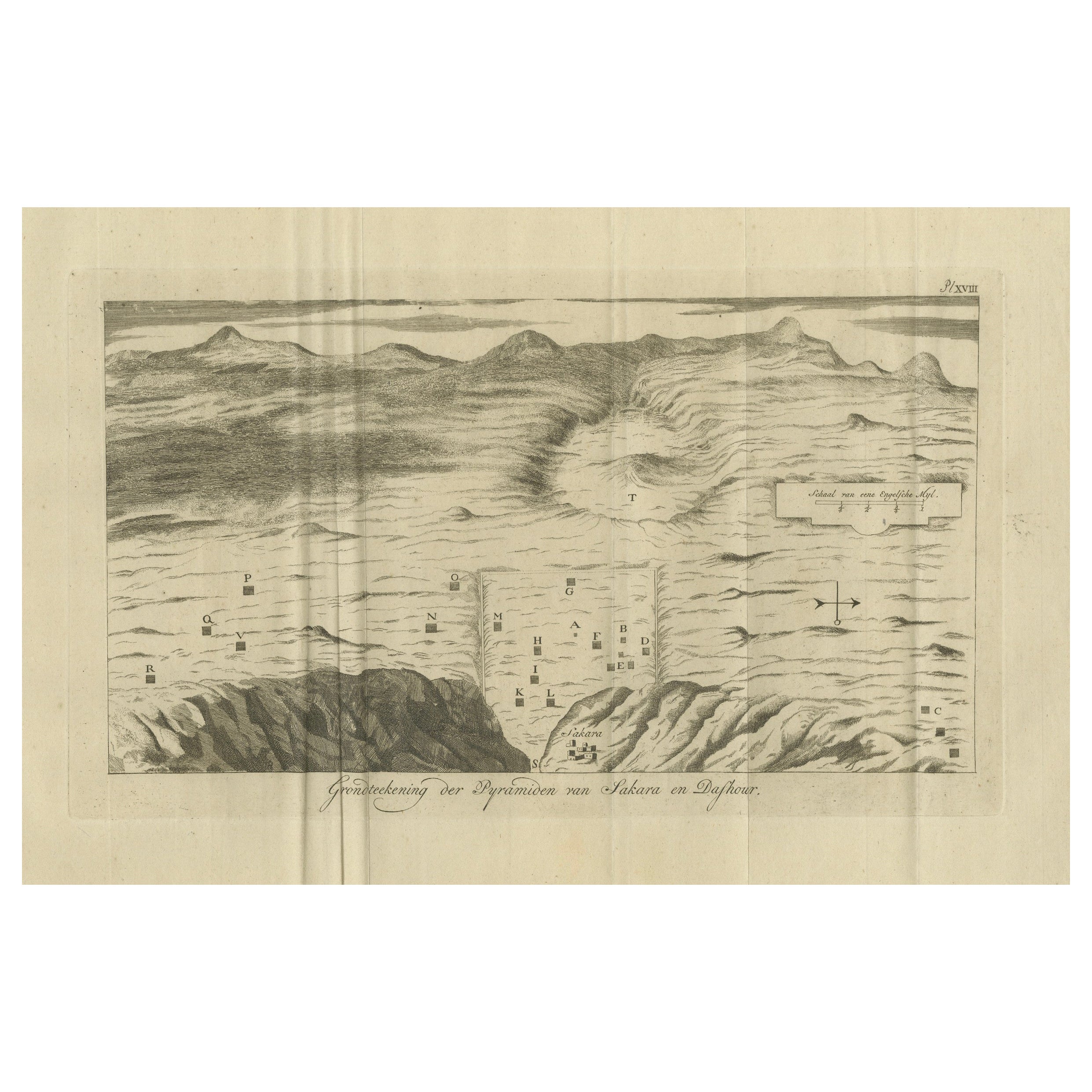
Antique Map of the Pyramids of Saqqara and Dahshur – Egypt, c.1770s
Located in Langweer, NL
Antique Map of the Pyramids of Saqqara and Dahshur – Egypt, c.1710s
Description:
This rare early 18th-century engraving presents a bird’s-eye topographic plan of the pyramids of Saq...
Category
Antique Late 18th Century Dutch Prints
Materials
Paper
You May Also Like
Architectural Roman Map - Etching by Vincenzo Scarpati - 18th Century
Located in Roma, IT
Architectural Roman Map from "Antiquities of Herculaneum" is an etching on paper realized by Vincenzo Scarpati in the 18th Century.
Signed on the plate.
Go...
Category
18th Century Old Masters Figurative Prints
Materials
Etching

Map of Nubia and Abissinia - Original Etching by Antonio Zatta - 1784
Located in Roma, IT
This Map of Nubia and Abissinia is an etching realized by Antonio Zatta in Venice in 1784.
The state of preservation of the artwork is good expect for the worn paper with some littl...
Category
1770s Landscape Prints
Materials
Etching

Map - Etching by Nicola Fiorillo - 18th Century
Located in Roma, IT
Map from "Antiquities of Herculaneum" is an etching on paper realized by Nicola Fiorillo in the 18th Century.
Signed on the plate.
Good conditions with some folding and foxing.
Th...
Category
18th Century Old Masters Figurative Prints
Materials
Etching
1657 Janssonius Map of Vermandois and Cappelle, Ric. A-004
Located in Norton, MA
1657 Janssonius map of
Vermandois and Cappelle
Ric.a004
Description: Antique map of France titled 'Descriptio Veromanduorum - Gouvernement de la Cappelle'. Two detailed maps o...
Category
Antique 17th Century Unknown Maps
Materials
Paper

Li Governi di Borgogna - Ancient Map - 1777
Located in Roma, IT
Li Governi di Borgogna is an original black and white etching on paper, printed by Antonio Zatta in Venice, 1777.
Original Title: Li Governi di Borgogna della Franca Contea e del Ly...
Category
1770s Modern Landscape Prints
Materials
Etching

Antique Map - Mar Di Athiopia - Etching by Johannes Janssonius - 1650s
By Johannes Janssonius
Located in Roma, IT
Antique Map - Mar Di Athiopia is an antique map realized in 1650 by Johannes Janssonius (1588-1664).
The Map is Hand-colored etching, with coeval watercolorang.
Good conditions wit...
Category
1650s Modern Figurative Prints
Materials
Etching

More Ways To Browse
Hand Woven Table Runner
Harold Schwartz For Romweber
Hatcher Collection
Henredon Black Lacquer
Hermes Dupre Lafon
Hermes Horse Head
Horse Sculptures From India
Horse Trophy
House Of Savoy
Hunting Coat
India Silver Bowl
Indian Boat
Indian Brass Chest
Iron Folding Screen
Iron Pig
Italian Bistro
Italian Bone Inlay
Italian Glass Hurricane