Items Similar to Novissima Totius Terrarum Orbis Tabula Map After Nicolaes Visscher Burled Frame


Want more images or videos?
Request additional images or videos from the seller
1 of 13
Novissima Totius Terrarum Orbis Tabula Map After Nicolaes Visscher Burled Frame
About the Item
A stately print after Nicolaes Visscher's Novissima Totius Terrarum Orbis Tabula Map. Neatly framed in burlwood.
Dimensions:
39" x 1" x 33" / Sans Frame - 28" x 22" (Width x Depth x Height)
- Similar to:Nicolaes Visscher II (Artist)
- Dimensions:Height: 33 in (83.82 cm)Width: 1 in (2.54 cm)Depth: 39 in (99.06 cm)
- Materials and Techniques:
- Period:
- Date of Manufacture:Late 20th Century
- Condition:Very Good.
- Seller Location:Dayton, OH
- Reference Number:

About the Seller
4.9
Platinum Seller
These expertly vetted sellers are 1stDibs' most experienced sellers and are rated highest by our customers.
Established in 2010
1stDibs seller since 2020
1,118 sales on 1stDibs
Typical response time: <1 hour
- ShippingRetrieving quote...Ships From: Dayton, OH
- Return PolicyA return for this item may be initiated within 2 days of delivery.
More From This SellerView All
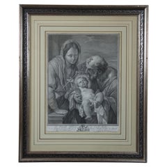
- 18th Century Holy Family Engraving Mathias Oesterreich After Carlo Lotti FramedLocated in Dayton, OHThe Holy Family by Matthias Oesterreich after Carlo Lotti. Matthias was a German Old Masters artist who lived 1716 - 1778. Measures: 20.25” x 2...Category
Antique 18th Century Renaissance Prints
MaterialsPaper
- Antique 1630 Colored Belgium Map Flandria Gallica Flanders Henricus HondiusLocated in Dayton, OH"Antique hand colored map of Flanders, Belgium, circa 1630, engraved by Henricus Hondius. “Henricus Hondius II (1597 – 16 August 1651) was a Dutch eng...Category
Antique Early 17th Century Renaissance Maps
MaterialsPaper
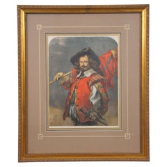
- 1850s Antique Framed Standard Bearer J. Gilbert Hand Colored Engraving FramedLocated in Dayton, OHFramed mid 19th century hand colored engraving depicting a Cavalier / Musketeer holding s staff with flag. Titled "The Standard Bearer" by J. Gilbert "From the Exhibition of Old Wat...Category
Antique 1850s British Colonial Prints
MaterialsPaper
- Antique 1901 National Publishing Company's Road Map of New Jersey GeologicalLocated in Dayton, OHThe National Publishing Company's road map of New Jersey, showing all county and township divisions, cities villages and post-offices, railroads, ste...Category
Antique Early 1900s Victorian Prints
MaterialsPaper
- Antique Architectural Press Cathedral Cityscape Etching After Frank BrangwynBy Frank BrangwynLocated in Dayton, OH"Antique cityscape print “From an Etching by Frank Brangwyn, R.A. A.D. 1922 by The architectural Press. “Frank Brangwyn was born in 1867 in Bruges, Belgium. His family moved back to London in 1875 where he attended school until 1879, when he left as much out of boredom as necessity. His father worked as an architect, muralist, and in other arts-related crafts. Frank helped around the studio and continued his own artistic education by copying drawings at what was to become the Victoria and Albert Museum. His abilities attracted the notice of more established artists and at the age of 15 he was working for William Morris getting rudimentary training and preparing designs for many aspects of Morris' Arts and Crafts output. In 1885, with nothing much more than youthful enthusiasm, he submitted a painting to the Royal Academy Summer Exhibition and was accepted - at the age of 17. Spurred by this success he rented a studio and began a period of productive poverty. With little money, his early work revolved around the sea where traditional subjects for British art were moored and made docile models. This is considered his """"""""grey"""""""" period and the limited palette may be due as much to limited funds as to artistic intent. His 1890 canvas, """"""""Funeral At Sea"""""""" is typical of this period and won a Gold Medal at the 1891 Paris Salon. The young artist was making waves. In 1888, he worked on a freighter for passage to the Near East of Istanbul and the Black Sea. Orientalism was a major force in European art at the time and Brangwyn was as seduced as many artists were with the colors and light of the Mediterranean and African coasts. These trips brought a new palette to his work and something new to British art. The Buccaneers, at right, is from 1892 and the difference between it and his """"""""grey"""""""" period is dramatic. Just as we have movie critics today, art critics proliferated during the 19th century. Walter Shaw Sparrow, in his excellent """"""""Frank Brangwyn and His Work"""""""", devotes several chapters to the reaction of these critics to Brangwyn's art. Opinions were as varied as the two styles shown here, but what is most interesting is the degree of attention being paid to the work of a self-taught 25-year old. Whatever their views of his work, he was not being taken lightly. Not surprisingly, the bright hues and intense light of his new style were not appreciated by the establishment. To put his work in historic perspective, this was a period of Impressionism, Art Nouveau, and the Munich and Vienna Secessions. In British art, Sargent, Whistler, Waterhouse and Draper were popular. Lord Leighton, Burne-Jones and Alma-Tadema were still active. Brangwyn was following none of these men and the critics were at a loss as to how to pigeonhole him. The continental critics in France, Munich and Vienna had no such trouble. He was seen as a most modern and successful artist from the beginning. For his part, Brangwyn followed his own muse and in doing so found himself at the vanguard of the art world. In 1892 he began working as the designer for the new art magazine, """"""""The Graphic"""""""". In 1895 he was asked to paint murals for the notorious gallery, L'Art Nouveau, in Paris. He won medals for his work in Munich and Paris. At the age of 30, while Britain puzzled over how to evaluate his work, the rest of the world viewed him as the definition of modern British art. He illustrated books: """"""""Don Quixote...Category
Vintage 1920s Prints
MaterialsPaper
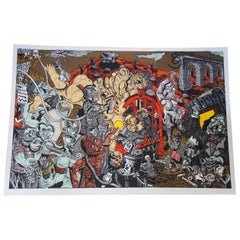
- Limbus Fatu Orum Map of a Mechanical Opera by Jay Bolotin Woodcut Print, 1992Located in Dayton, OHArtist: Jay Bolotin, Georgia Nold, Mark Patsfall Graphics Title: Limbus Fatu’ orum: Map of a Mechanical Opera Date: 1992, 8/25 Woodcut tryptich pr...Category
1990s Expressionist Prints
MaterialsPaper


You May Also Like
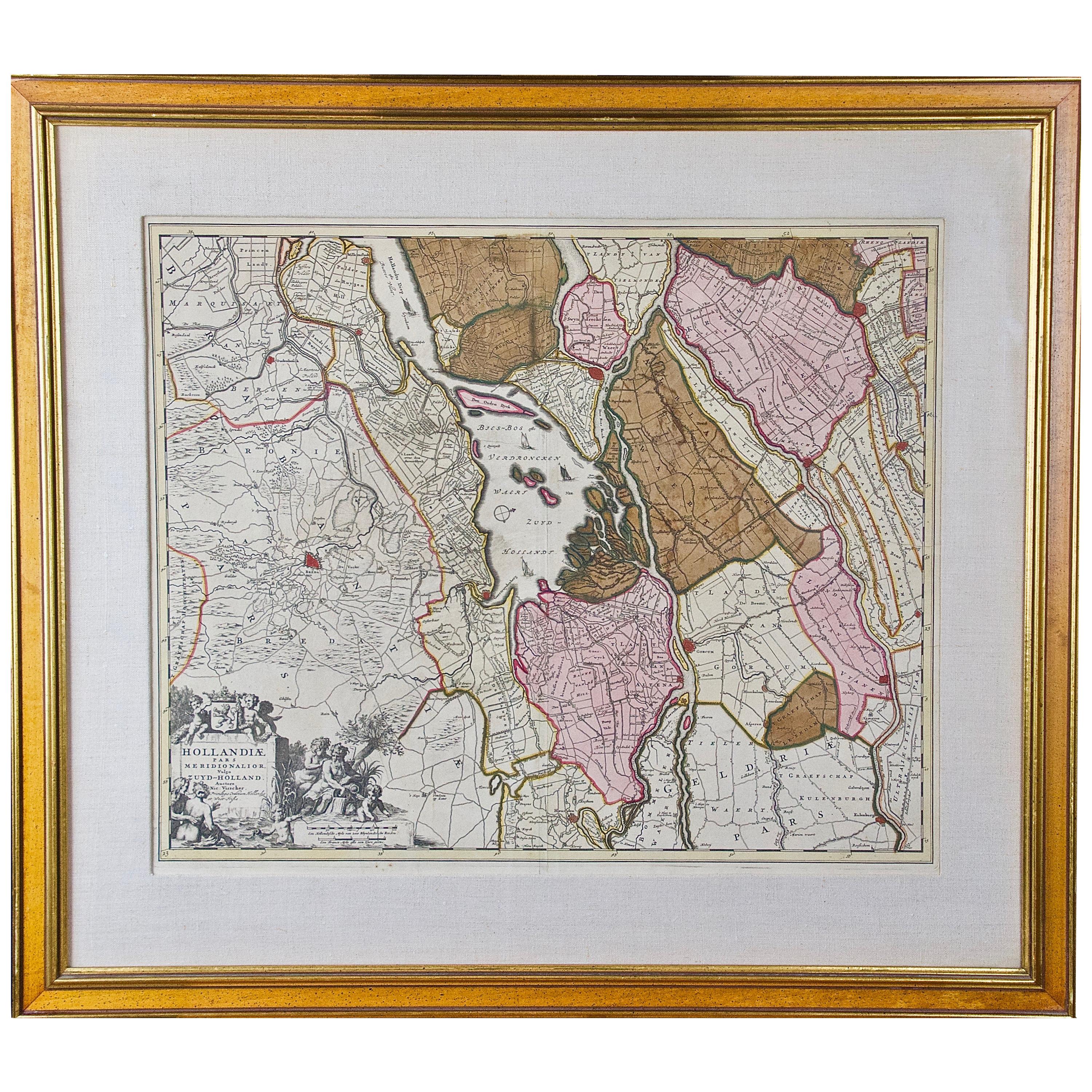
- Hand Colored 17th Century Visscher Map "Hollandiae" Southern HollandBy Nicolaes Visscher IILocated in Alamo, CAA hand colored 17th century map of the southern portions of Holland by Nicolaus (Nicolas) Visscher II entitled "Hollandiae pars Meridionalis, vulgo Zuyd-Holland", published in Amsterdam in 1678. The map shows the region between Breda, Heusden, Gornichem, Gouda, Dordrecht, and Willemstad. It includes a decorative cartouche in the lower left corner. The map is presented in an attractive maple colored wood frame with gold trim and a fabric mat. The Visscher family were one of the great cartographic families of the 17th century. Begun by Claes Jansz Visscher...Category
Antique Early 18th Century Dutch Maps
MaterialsPaper
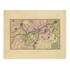
- Antique Map of Friesland ‘The Netherlands’ by N. Visscher, circa 1670By Nicolaes Visscher IILocated in Langweer, NLThis large copper engraved map details the coastline of Friesland and Terschelling. At east is a part of Groningen. The main cities are colored in red. The very decorative cartouches...Category
Antique Late 17th Century Maps
MaterialsPaper
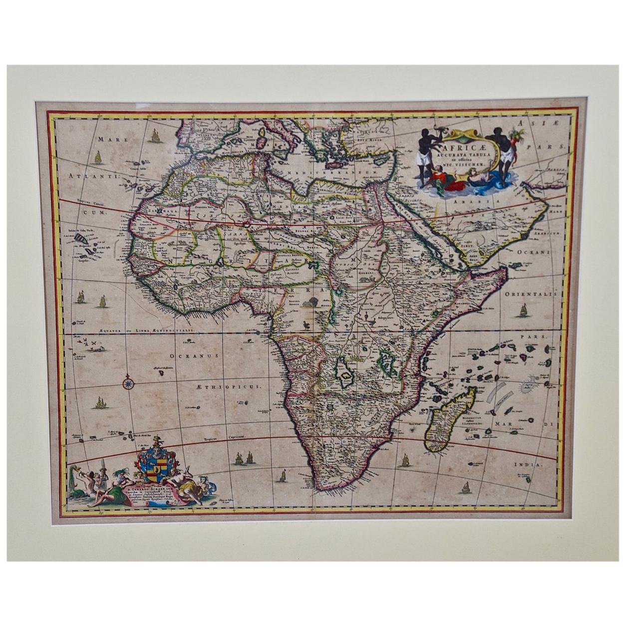
- "Africae Accurata", a Hand-Colored 17th Century Map of Africa by VisscherBy Nicolaes Visscher IILocated in Alamo, CAAn 18th century hand-colored map of Africa entitled "Africae Accurata Tabula ex officina" by Nicolaes Visscher, published in Amsterdam in 1680. This beautiful, colorful and detailed map is embellished by eleven sailing ships, a whale, flying fish and multiple land animals. It includes the Mediterranean Sea and adjacent portions of Portugal, Spain, Italy, Greece and Asia Minor. The map perpetuates several long-standing errors, including the origin of the Nile River from two imaginary lakes in southern Africa, which are shown adjacent to the imaginary Lunae Montes (Mountains of the Moon...Category
Antique Late 17th Century Dutch Maps
MaterialsPaper
- 18th Century Hand Colored Map of Spain and Portugal by VisscherBy Nicolaes Visscher IILocated in Alamo, CAThis is an early 18th century map of Spain and Portugal, with attractive original hand-coloring, entitled "Hispaniae et Portugalliae Regna per Nicolaum Visscher cum Privilegio Ordinu...Category
Antique Early 18th Century Dutch Maps
MaterialsPaper
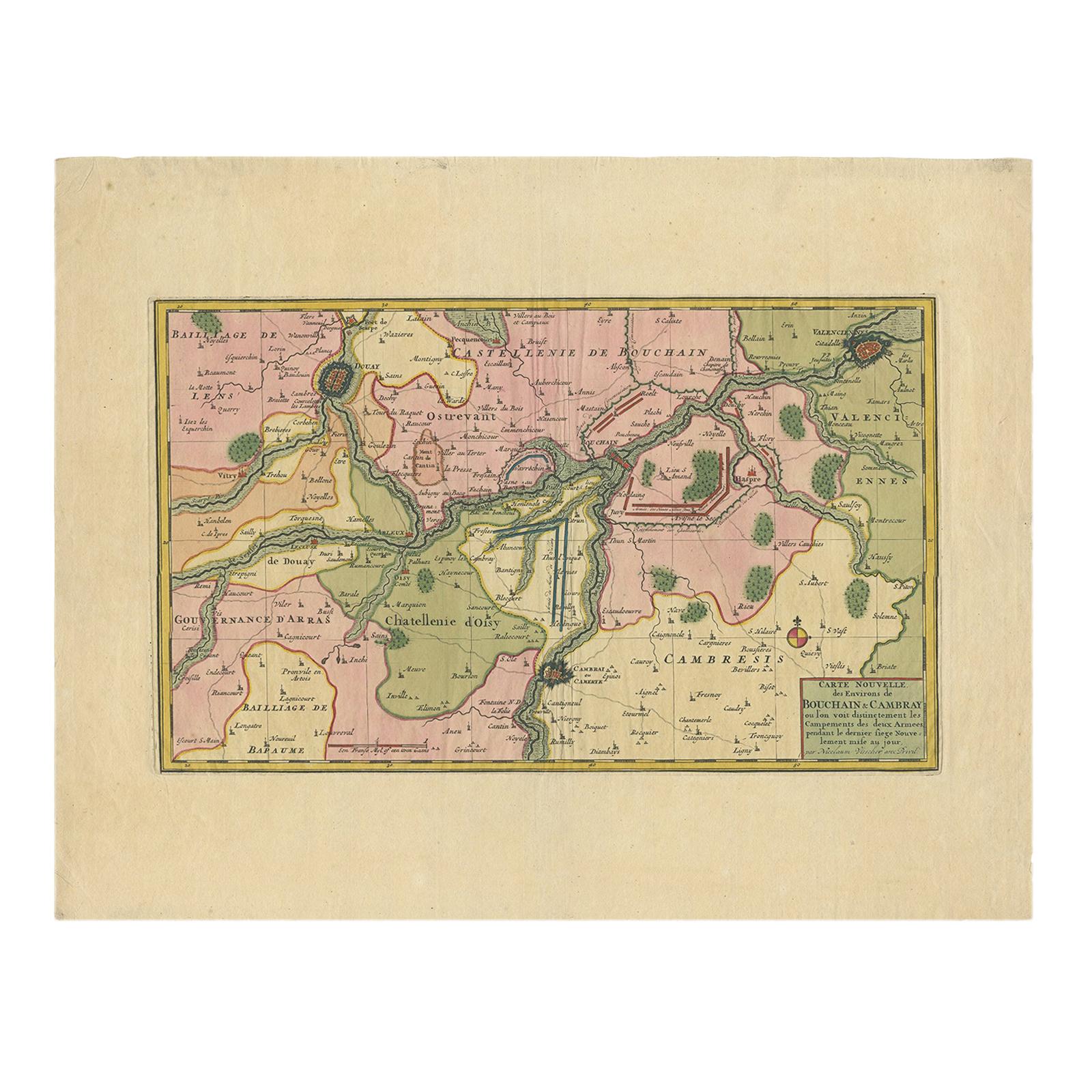
- Antique Map of the Region of Bouchain and Cambrai by Visscher 'circa 1680'By Nicolaes Visscher IILocated in Langweer, NLAntique map titled 'Carte Nouvelle des Environs de Bouchain & Cambray'. Uncommon map of the region of Bouchain and Cambrai (Cambray, France) showing the camps of two armies.Category
Antique Late 17th Century Maps
MaterialsPaper
- 17th Century Hand Colored Map of the Liege Region in Belgium by VisscherBy Nicolaes Visscher IILocated in Alamo, CAAn original 17th century map entitled "Leodiensis Episcopatus in omnes Subjacentes Provincias distincté divisusVisscher, Leodiensis Episcopatus" by Nicolaes Visscher II, published in Amsterdam in 1688. The map is centered on Liege, Belgium, includes the area between Antwerp, Turnhout, Roermond, Cologne, Trier and Dinant. This attractive map is presented in a cream-colored mat measuring 30" wide x 27.5" high. There is a central fold, as issued. There is minimal spotting in the upper margin and a tiny spot in the right lower margin, which are under the mat. The map is otherwise in excellent condition. The Visscher family were one of the great cartographic families of the 17th century. Begun by Claes Jansz Visscher...Category
Antique Late 17th Century Dutch Maps
MaterialsPaper