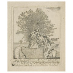
Old Etching of The 'Great' Chestnut Tree at Tortworth, Gloucester, England, 1771
View Similar Items
Want more images or videos?
Request additional images or videos from the seller
1 of 6
Old Etching of The 'Great' Chestnut Tree at Tortworth, Gloucester, England, 1771
About the Item
- Dimensions:Height: 17.33 in (44 cm)Width: 11.82 in (30 cm)Depth: 0 in (0.02 mm)
- Materials and Techniques:
- Period:1770-1779
- Date of Manufacture:1771
- Condition:Wear consistent with age and use.
- Seller Location:Langweer, NL
- Reference Number:Seller: BG-12144 1stDibs: LU3054327350592
About the Seller
5.0
Recognized Seller
These prestigious sellers are industry leaders and represent the highest echelon for item quality and design.
Platinum Seller
Premium sellers with a 4.7+ rating and 24-hour response times
Established in 2009
1stDibs seller since 2017
2,442 sales on 1stDibs
Typical response time: 1 hour
Authenticity Guarantee
In the unlikely event there’s an issue with an item’s authenticity, contact us within 1 year for a full refund. DetailsMoney-Back Guarantee
If your item is not as described, is damaged in transit, or does not arrive, contact us within 7 days for a full refund. Details24-Hour Cancellation
You have a 24-hour grace period in which to reconsider your purchase, with no questions asked.Vetted Professional Sellers
Our world-class sellers must adhere to strict standards for service and quality, maintaining the integrity of our listings.Price-Match Guarantee
If you find that a seller listed the same item for a lower price elsewhere, we’ll match it.Trusted Global Delivery
Our best-in-class carrier network provides specialized shipping options worldwide, including custom delivery.More From This Seller
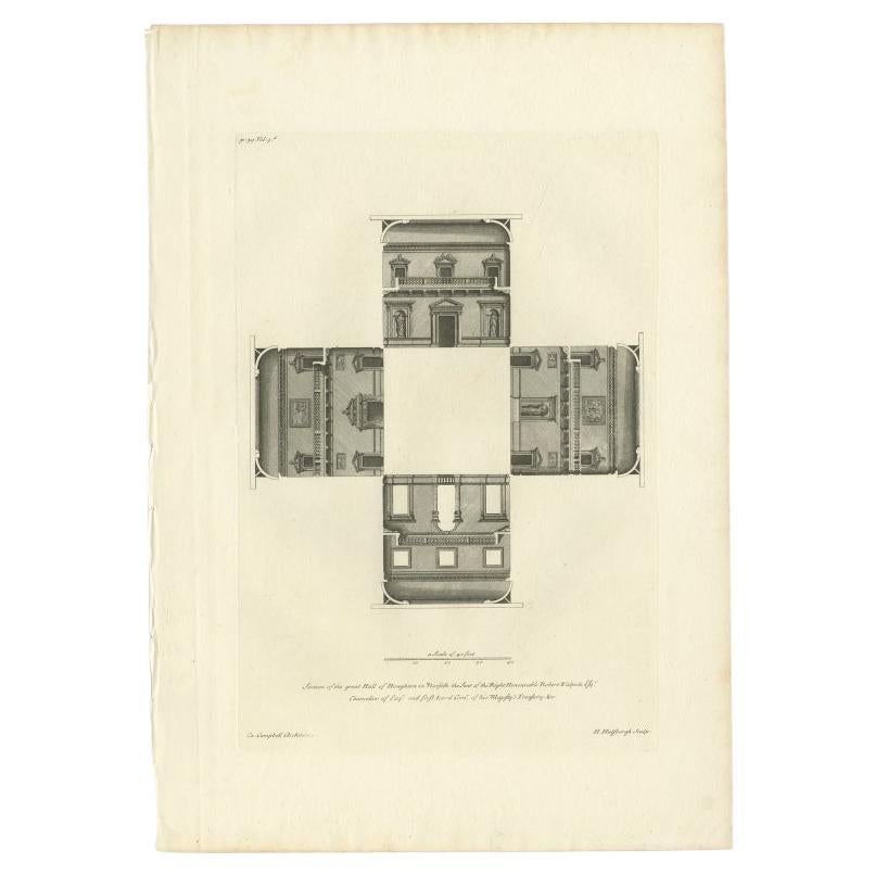
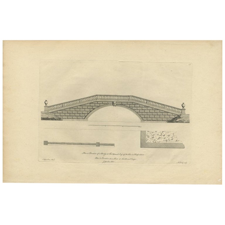
View AllAntique Print of the Great Hall of Houghton Hall, England, 1725
Located in Langweer, NL
Antique print titled 'Section of the great Hall of Houghton in Norfolk (..)'. Section of the Great Hall for Houghton Hall, Norfolk. This print originates...
Category
Antique 18th Century Prints
Materials
Paper
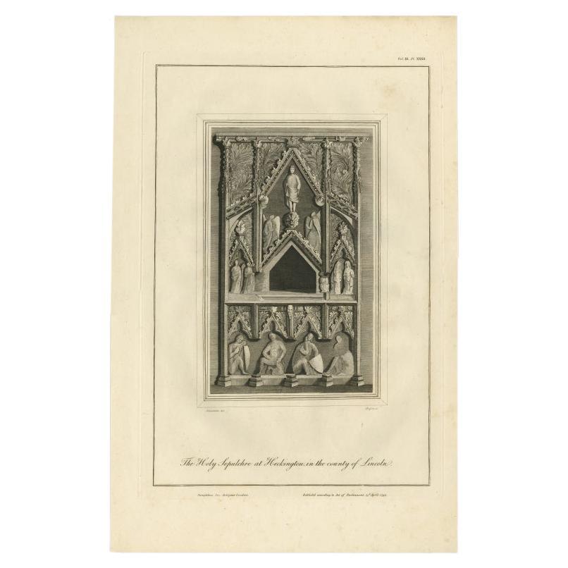
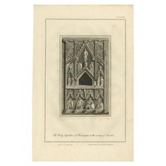
Antique Print of the Holy Sepulchre at Heckington, England, 1795
Located in Langweer, NL
Antique print titled 'The Holy Sepulchre at Heckington, in the county of Lincoln'. Antique print depicting the Holy Sepulchre at Heckington. Artists and...
Category
Antique 18th Century Prints
Materials
Paper
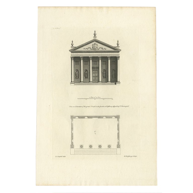
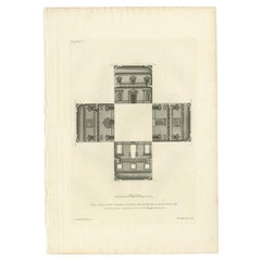
Antique Print of a Design for The Great Temple in Eastbury Park, England, 1725
Located in Langweer, NL
Antique print titled 'Plan and Elevation of the great Temple in the garden at Eastbury'.
Design for Eastbury Park, England. This print originates from 'Vitruvius Britannicus' by ...
Category
Antique 18th Century Prints
Materials
Paper
$203 Sale Price
20% Off
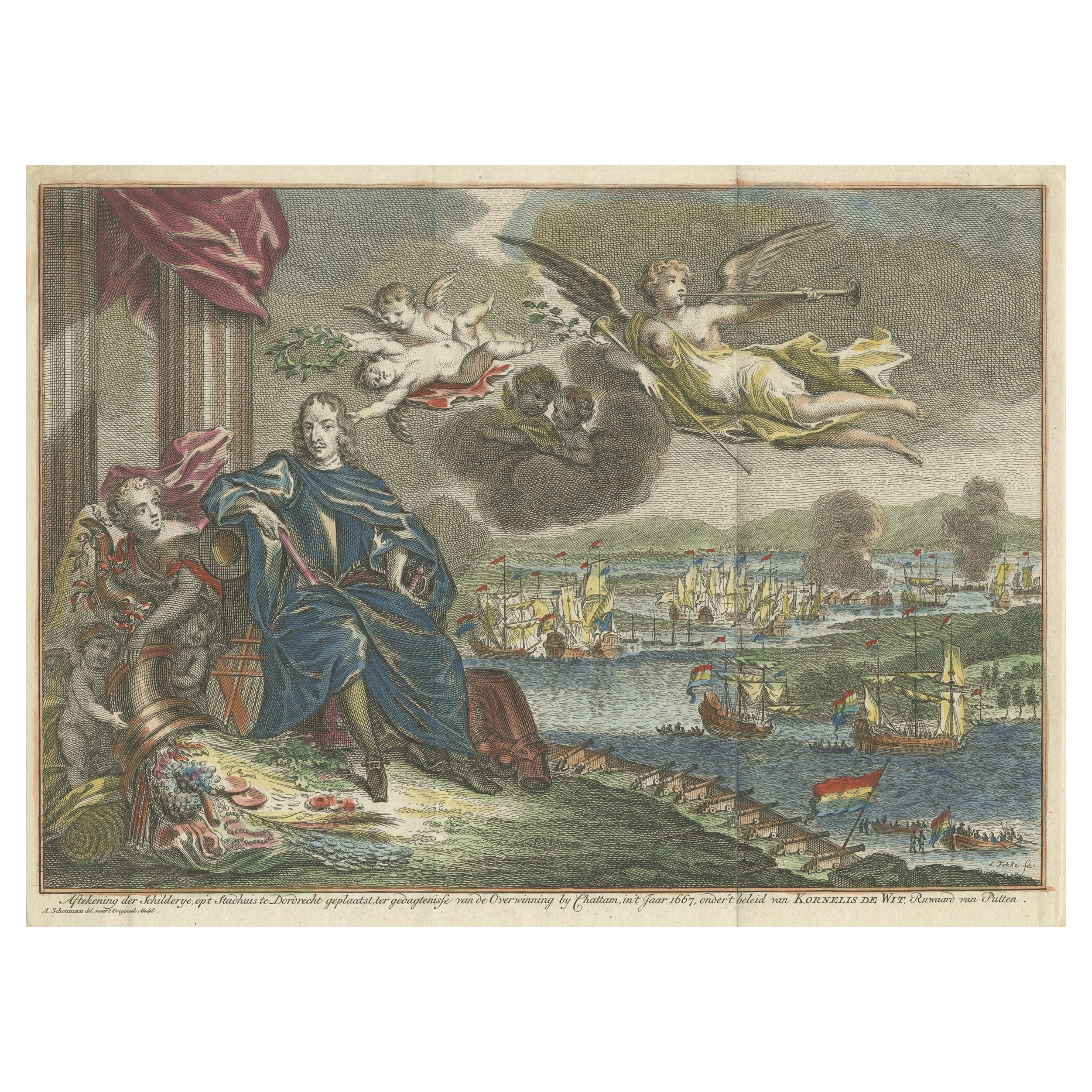
Old Engraving of the Battle of Chatham or Raid on Medway on the Thames, England
Located in Langweer, NL
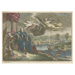
Antique print titled 'Aftekening der Schilderye op 't Stadhuis te Dordrecht (..)'. Scene of the battle of Chattam during one of the many Anglo-Dutch wars. In this battle, the Dutch sailed up the river Thames and destroyed part of the English fleet at anchor in the harbor of Chattam. Pictured in the foreground is the Dutch commander, Cornelius de Wit, being presented with the spoils of war...
Category
Antique 18th Century Prints
Materials
Paper
$407 Sale Price
20% Off
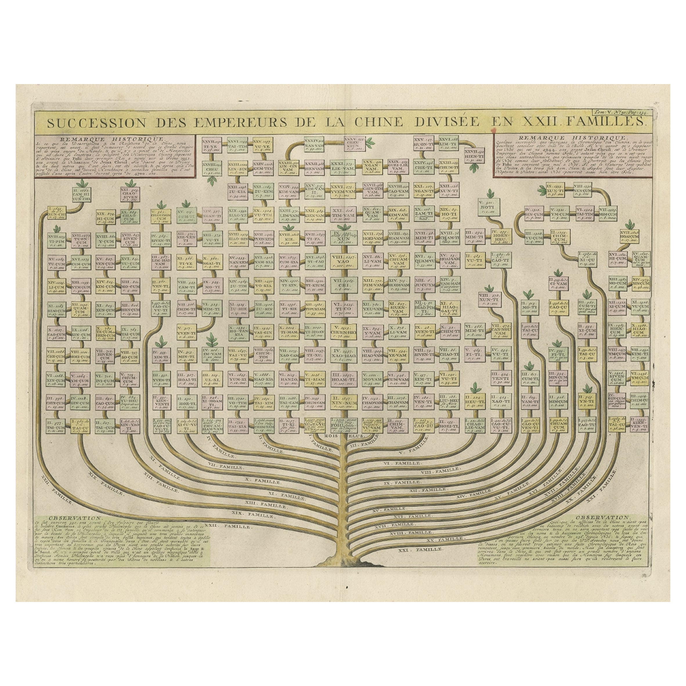
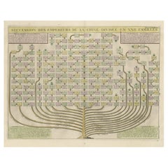
Old Print with a Genealogical Tree of the Chinese Imperial Dynasties, 1732
Located in Langweer, NL
Antique print titled 'Succession des Empereurs de la Chine divisée en XXII Familles'.
Old print with a genealogical tree of the Chinese imperial dynasties. This print originates ...
Category
Antique 1730s Prints
Materials
Paper
$509 Sale Price
20% Off
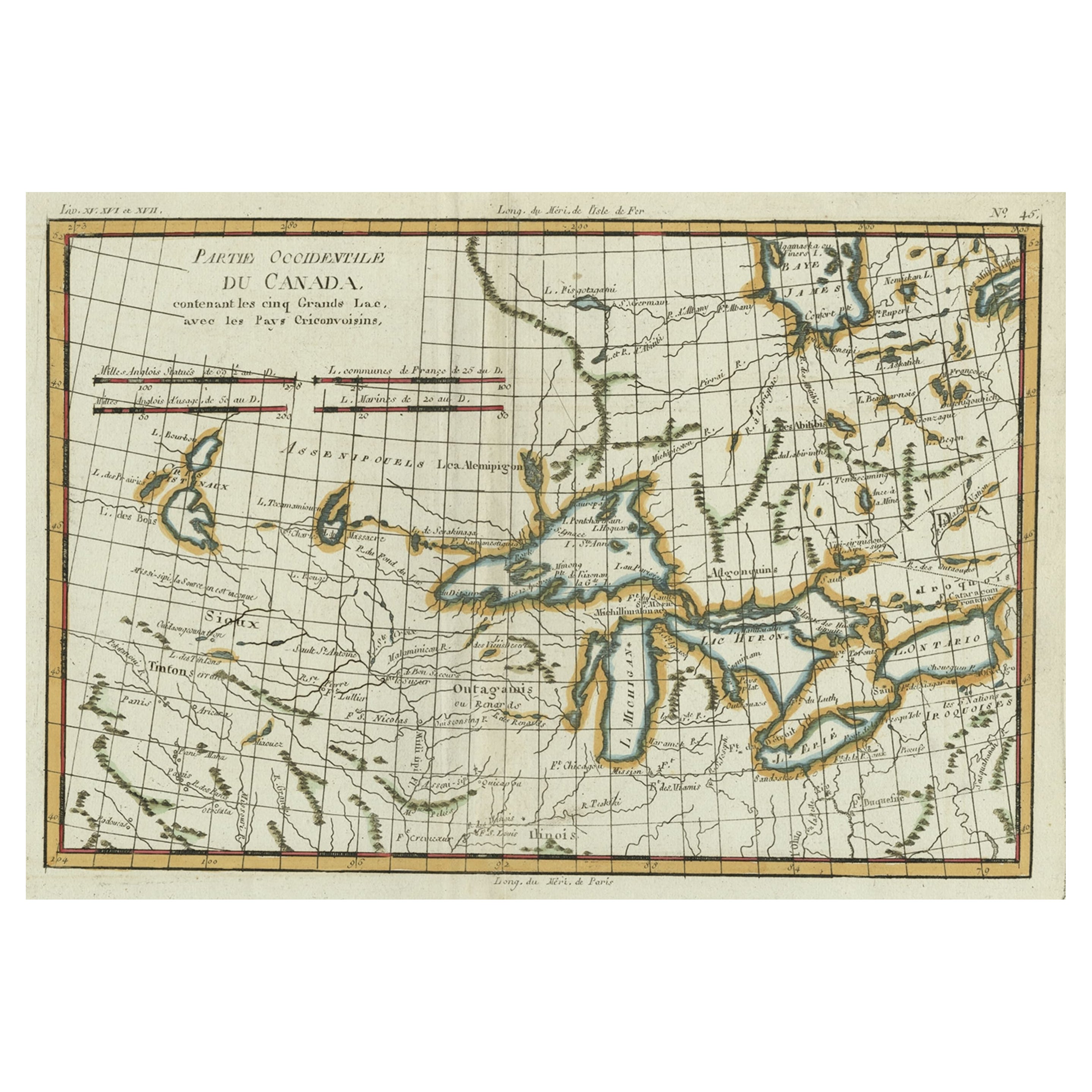
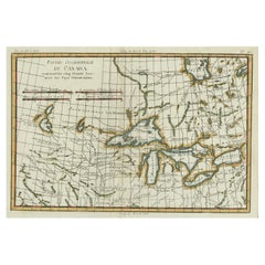
Old Map of the Great Lakes and Upper Mississippi Valley, Northern America, c1780
Located in Langweer, NL
Antique map titled 'Partie Occidentale du Canada'.
A fine example of Rigobert Bonne and Guilleme Raynal's 1780 map of the Great Lakes and upper Mississippi Valley.
A map of c...
Category
Antique 1780s Maps
Materials
Paper
$763 Sale Price
20% Off
You May Also Like
Old Horizontal Map of England
By Tasso
Located in Alessandria, Piemonte
ST/520 - Old rare Italian map of England, dated 1826-1827 - by Girolamo Tasso, editor in Venise, for the atlas of M.r Le-Sage.
Category
Antique Early 19th Century Italian Other Prints
Materials
Paper

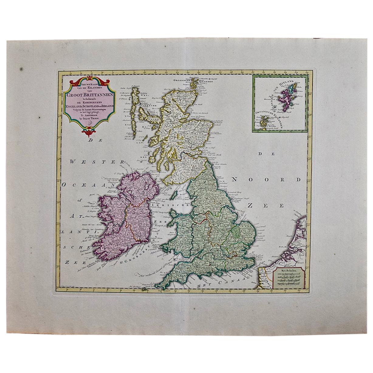
England, Scotland & Ireland: A Hand Colored Map of Great Britain by Tirion
By Isaak Tirion
Located in Alamo, CA
This is a hand-colored double page copperplate map of Great Britain entitled "Nieuwe Kaart van de Eilanden van Groot Brittannien Behelzende de Kon...
Category
Antique Mid-18th Century Dutch Maps
Materials
Paper

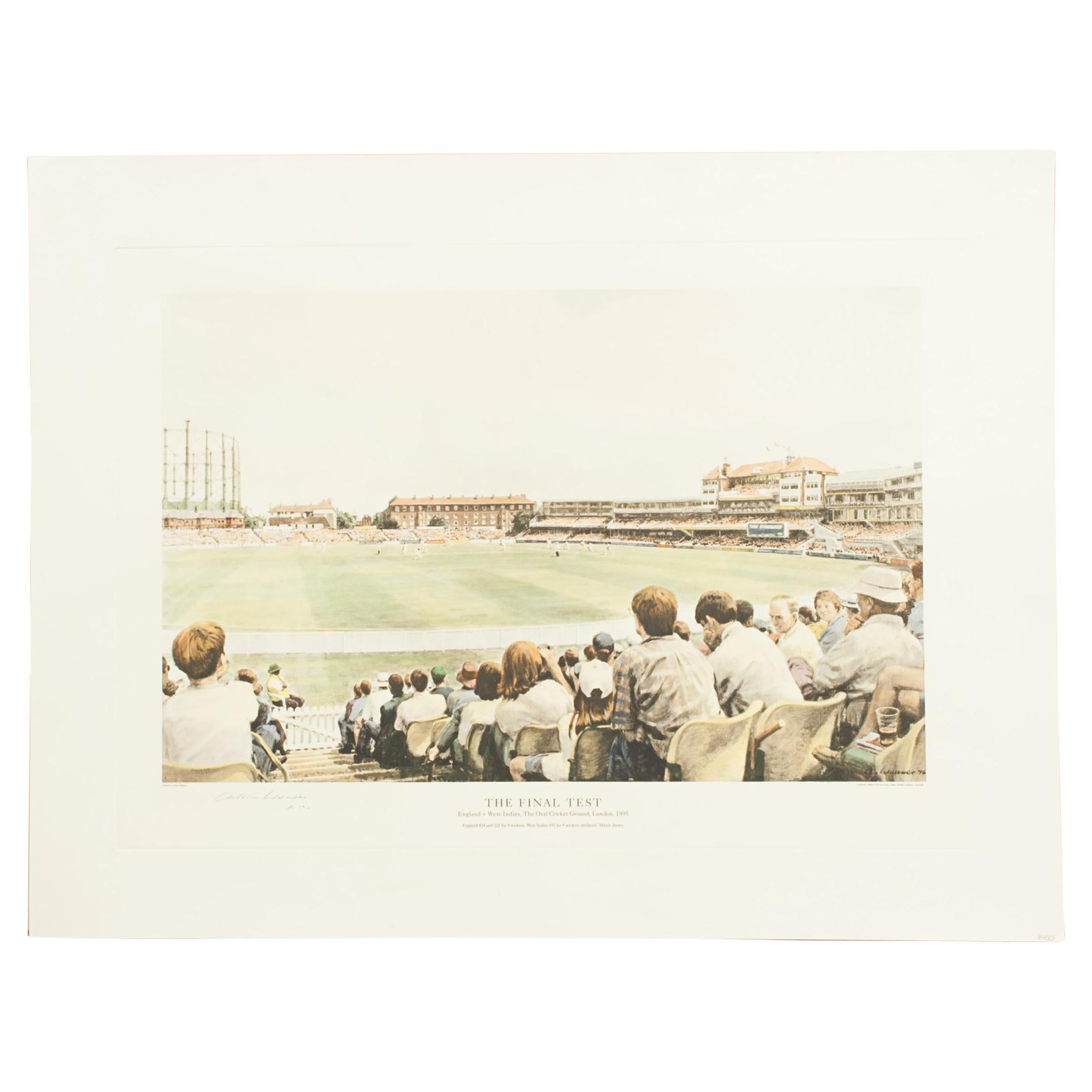
Cricket Print, England v. West Indies at the Oval, by Arthur Weaver
By Arthur Weaver
Located in Oxfordshire, GB
1990's Arthur Weaver Oval Cricket Ground Print, England v West Indies.
A colourful cricket lithograph signed by the artist, Arthur Weaver, of the 'Final Test' at The Oval Cricket Gr...
Category
1990s English Sporting Art Sports Equipment and Memorabilia
Materials
Paper

The Holy Land at the Time of Jesus: A 17th Century Dutch Map by Visscher
By Nicolaes Visscher II
Located in Alamo, CA
This detailed Dutch map entitled "Het Beloofe de Landt Canaan door wandelt van onsen Salichmaecker Iesu Christo, nessens syne Apostelen" by Nicolaes Visscher was published in Amsterd...
Category
Antique Mid-17th Century Dutch Maps
Materials
Paper

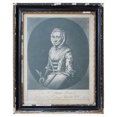
Sarah Porter, "Queen of the Touters at Tunbridge Wells" Engraving, circa 1770
Located in Lowestoft, GB
After Vander Smissen 'Mrs Sarah Porter, Queen of the Touters at Tunbridge Wells', a mezzotint, engraved by William Pether circa 1770, glazed in ebonised, ...
Category
Antique Late 18th Century English Prints
Materials
Glass, Pine, Paper
Large 17th Century Hand Colored Map of England and the British Isles by de Wit
By Frederick de Wit
Located in Alamo, CA
A large hand colored 17th century map of England and the British Isles by Frederick de Wit entitled "Accuratissima Angliæ Regni et Walliæ Principatus", published in Amsterdam in 1680. It is a highly detailed map of England, Scotland, the Scottish Isles...
Category
Antique Late 17th Century Dutch Maps
Materials
Paper
