1 of 3
Pair of Late 18th Century Maps from Italy
$36,000List Priceper set
About the Item
- Dimensions:Height: 85.5 in (217.17 cm)Width: 85.5 in (217.17 cm)Depth: 1 in (2.54 cm)
- Sold As:Set of 2
- Materials and Techniques:
- Place of Origin:
- Period:
- Date of Manufacture:Unknown
- Condition:Wear consistent with age and use.
- Seller Location:Houston, TX
- Reference Number:Seller: Item #12343-841stDibs: LU84709332631
Authenticity Guarantee
In the unlikely event there’s an issue with an item’s authenticity, contact us within 1 year for a full refund. DetailsMoney-Back Guarantee
If your item is not as described, is damaged in transit, or does not arrive, contact us within 7 days for a full refund. Details24-Hour Cancellation
You have a 24-hour grace period in which to reconsider your purchase, with no questions asked.Vetted Professional Sellers
Our world-class sellers must adhere to strict standards for service and quality, maintaining the integrity of our listings.Price-Match Guarantee
If you find that a seller listed the same item for a lower price elsewhere, we’ll match it.Trusted Global Delivery
Our best-in-class carrier network provides specialized shipping options worldwide, including custom delivery.You May Also Like
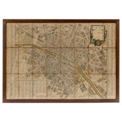
18th Century Map of Paris
Located in Washington, DC
18th century map of Paris.
Category
Antique Late 18th Century French Prints
Materials
Glass, Wood, Paper
Map Of The City Of Geneva, Framed Engraving, Late 18th Century
Located in MARSEILLE, FR
Beautiful engraving representing the city of Geneva corrected in 1775 and 1793
The engraving also presents inserts with the evolution of the city, the plan of ancient Geneva and ...
Category
Antique Late 18th Century Swiss Louis XV Prints
Materials
Paper

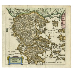
Charming 18th Century Miniature Map of Greece, 1685
Located in Langweer, NL
Antique map titled 'Graeciae Descriptio.' Charming miniature map of Greece from the pocket atlas 'Introductionis in Universam Geographiam tam Veterem qu...
Category
Antique 17th Century Maps
Materials
Paper
Pair of Framed Neoclassical Engravings, Late 18th Early 19th century
Located in MARSEILLE, FR
Pair of framed neoclassical engravings, after works painted by Jean Jacques François Le Barbier (1738 - 1826) and engraved by Jean-Jacques Avril (1744-1831), dated 1789 for the paint...
Category
Antique Late 18th Century French Neoclassical Prints
Materials
Wood, Paper
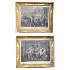
$3,008 / set
H 29.14 in W 34.65 in D 1.97 in
Hand-Colored French Map, Carte des Etats Unis, Par Bonne, Late 18th Century
By Rigobert Bonne
Located in Chappaqua, NY
Hand-colored French map, Carte de la Partie Nord, des Etats Unis, de l'Amérique Septentrionale, late 18th century. A French map of New England published at the end of the Revolutionary War...
Category
Antique Late 18th Century French Louis XVI Prints
Materials
Paper
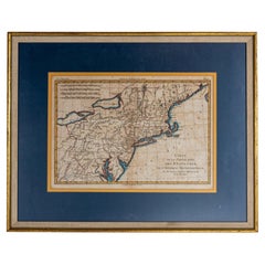
$950
H 16.5 in W 20.13 in D 1 in
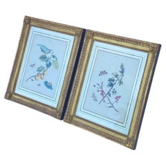
Pair of 18th Century Framed Botanicals
Located in Los Angeles, CA
This pair of 18th century hand tinted lithographs have butterflies and insects throughout. The images themselves are 12" by 9" Framed in 22k giltwood frames by Jerry Solomon.
Category
Antique 18th Century French Neoclassical Prints
Materials
Giltwood, Paper
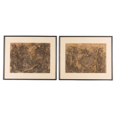
Pair of 18th Century Framed Grisaille
Located in Tetbury, Gloucestershire
Pair of wonderful detailed late 17th Century Grisaille Framed prints.
Professionally mounted.
Category
Antique 18th Century French Neoclassical Prints
Materials
Paper
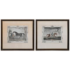
18th Century Pair of English Engravings
Located in Dallas, TX
Superb pair of 18th century English engravings.
Category
Antique 18th Century English Decorative Art
Antique 18th Century Map of the Province of Pensilvania 'Pennsylvania State'
Located in Philadelphia, PA
A fine antique of the colony of Pennsylvania.
Noted at the top of the sheet as a 'Map of the province of Pensilvania'.
This undated and anonymous map is thought to be from the Gentleman's Magazine, London, circa 1775, although the general appearance could date it to the 1760's.
The southern boundary reflects the Mason-Dixon survey (1768), the western boundary is placed just west of Pittsburgh, and the northern boundary is not marked.
The map has a number of reference points that likely refer to companion text and appear to be connected to boundaries. The western and southern boundaries are marked Q, R, S, for example. A diagonal line runs from the Susquehanna R to the Lake Erie P. A broken line marked by many letters A, B, N, O, etc., appears in the east.
There are no latitude or longitude markings, blank verso.
Framed in a shaped contemporary gilt wooden frame and matted under a cream colored matte.
Bearing an old Graham Arader Gallery...
Category
Antique 18th Century British American Colonial Maps
Materials
Paper

$1,250
H 10.25 in W 13.25 in D 0.5 in
Collection of Nine Late 18th Century Italian Botanical Prints by Giorgio Bonelli
Located in Tetbury, Gloucestershire
Collection of nine late 18th Century Italian botanical prints by Giorgio Bonelli.
Giorgio Bonelli was an Italian physician and botanist who taught medicine in Rome. Bonelli publishe...
Category
Antique 18th Century Italian Prints
Materials
Paper

$7,439 / set
H 22.84 in W 17.33 in D 0.4 in