Items Similar to River Systems Map of the World by A.K. Johnston – Educational Print 1852


Want more images or videos?
Request additional images or videos from the seller
1 of 10
River Systems Map of the World by A.K. Johnston – Educational Print 1852
$312.87per item
£231.63per item
€260per item
CA$433.19per item
A$472.94per item
CHF 247.94per item
MX$5,744.04per item
NOK 3,096.41per item
SEK 2,923.84per item
DKK 1,979.44per item
Quantity
About the Item
River Systems Map of the World by A.K. Johnston – Educational Print 1852
This striking 1852 map titled "The River Systems of the World" was created by the noted Scottish geographer Alexander Keith Johnston and published by William Blackwood & Sons in Edinburgh and London. It is Plate 4 from Johnston’s groundbreaking work *The Physical Atlas of Natural Phenomena*, a pioneering example of thematic cartography that visually communicates scientific data on a global scale.
This hand-colored copperplate engraving displays the world’s major river basins, categorized by color to represent the direction of river drainage toward different oceans and inland basins. Each continental landmass is divided by watershed, visually illustrating how rivers flow to the Atlantic, Pacific, Indian, Arctic Oceans, or into interior lakes and deserts. For instance, blue shows drainage toward the Arctic Ocean, brown for the Atlantic, green for the Indian Ocean, and so forth. The result is a vividly segmented and scientifically meaningful depiction of Earth's hydrological patterns.
A fascinating feature of the print is the comparative diagram running along the bottom, showing the relative lengths of the world’s principal rivers such as the Amazon, Nile, Mississippi, Yangtze, and Volga. This allows the viewer to grasp the scale and hierarchy of global river systems at a glance.
Johnston, who served as Geographer in Ordinary to Queen Victoria in Scotland, was renowned for his clarity, precision, and ability to synthesize scientific knowledge into accessible graphic forms. His *Physical Atlas* was one of the first atlases to present natural phenomena using maps rather than text alone, making it a cornerstone of modern data visualization.
This particular map is of special interest to collectors, educators, and designers for its combination of scientific accuracy and striking color composition. It appeals to those interested in geography, environmental science, and historical education, while also offering decorative appeal through its classic layout and 19th-century color palette.
Condition and framing tips:
Very good antique condition with some mild toning and occasional foxing in the margins. The printed area is clean and well-preserved. For framing, a walnut or black frame with a warm cream or ivory mat will bring out the map’s subtle hand-coloring. Pale blue or light earth-toned mats also work well to echo the map’s thematic hues. Ideal for display in a study, library, or educational setting.
- Dimensions:Height: 10.79 in (27.4 cm)Width: 13.59 in (34.5 cm)Depth: 0.01 in (0.2 mm)
- Materials and Techniques:
- Place of Origin:
- Period:
- Date of Manufacture:1856
- Condition:Very good condition. Light overall toning near the margins. The paper remains strong and well-preserved. Folding line as issued.
- Seller Location:Langweer, NL
- Reference Number:Seller: BG-13207-41stDibs: LU3054345385942
About the Seller
5.0
Recognized Seller
These prestigious sellers are industry leaders and represent the highest echelon for item quality and design.
Platinum Seller
Premium sellers with a 4.7+ rating and 24-hour response times
Established in 2009
1stDibs seller since 2017
2,641 sales on 1stDibs
Typical response time: <1 hour
- ShippingRetrieving quote...Shipping from: Langweer, Netherlands
- Return Policy
Authenticity Guarantee
In the unlikely event there’s an issue with an item’s authenticity, contact us within 1 year for a full refund. DetailsMoney-Back Guarantee
If your item is not as described, is damaged in transit, or does not arrive, contact us within 7 days for a full refund. Details24-Hour Cancellation
You have a 24-hour grace period in which to reconsider your purchase, with no questions asked.Vetted Professional Sellers
Our world-class sellers must adhere to strict standards for service and quality, maintaining the integrity of our listings.Price-Match Guarantee
If you find that a seller listed the same item for a lower price elsewhere, we’ll match it.Trusted Global Delivery
Our best-in-class carrier network provides specialized shipping options worldwide, including custom delivery.More From This Seller
View AllEthnographic Map of the World by A.K. Johnston – Races of Man Chart 1852
Located in Langweer, NL
Ethnographic Map of the World by A.K. Johnston – Races of Man Chart 1852
This antique map titled "Ethnographic Map of the World Showing the Present Distribution of the Leading Races...
Category
Antique Mid-19th Century Scottish Prints
Materials
Paper
Antique Map of the River Systems of Europe and Asia by Johnston '1850'
Located in Langweer, NL
Antique map titled 'The River Systems of Europe and Asia showing the boundaries and comparative extent of the river basins'. Original antique map of the river systems of Europe and A...
Category
Antique Mid-19th Century Maps
Materials
Paper

$192 Sale Price
20% Off
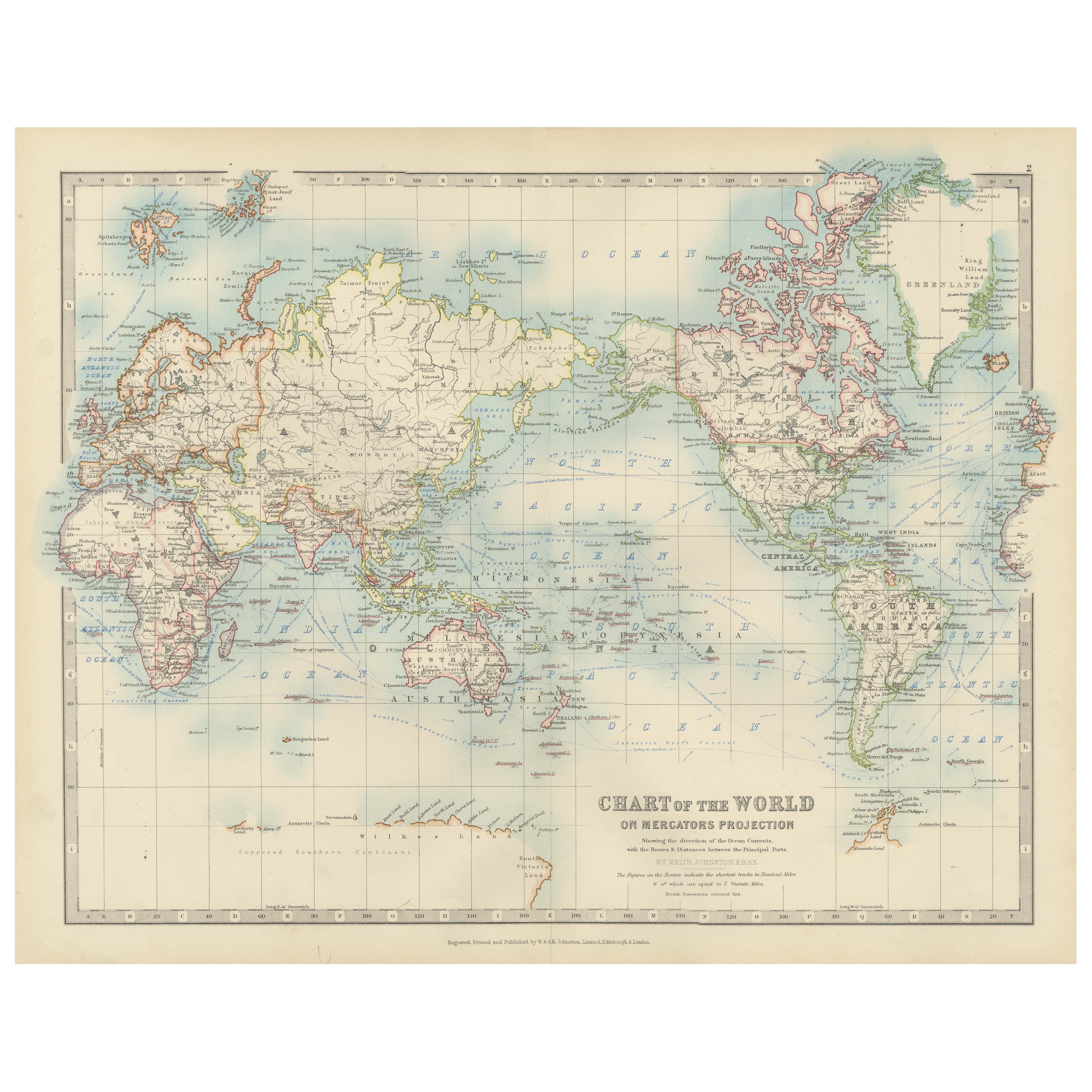
Antique World Map on Mercator's Projection, Ocean Currents and Trade Routes 1903
Located in Langweer, NL
Title: Antique World Map on Mercator's Projection, 1903, Showing Ocean Currents and Trade Routes
Description:
This antique map, titled "Chart of the World on Mercator's Projection,"...
Category
Early 20th Century Maps
Materials
Paper

Antique Map Showing the Religions Around the World by Johnston '1854'
Located in Langweer, NL
Antique map titled 'Moral & Statistical Chart showing the Geographical Distribution of Man According to Religious Belief'. Rare large-size thematic map on the distribution of religio...
Category
Antique Mid-19th Century Maps
Materials
Paper

$938 Sale Price
35% Off
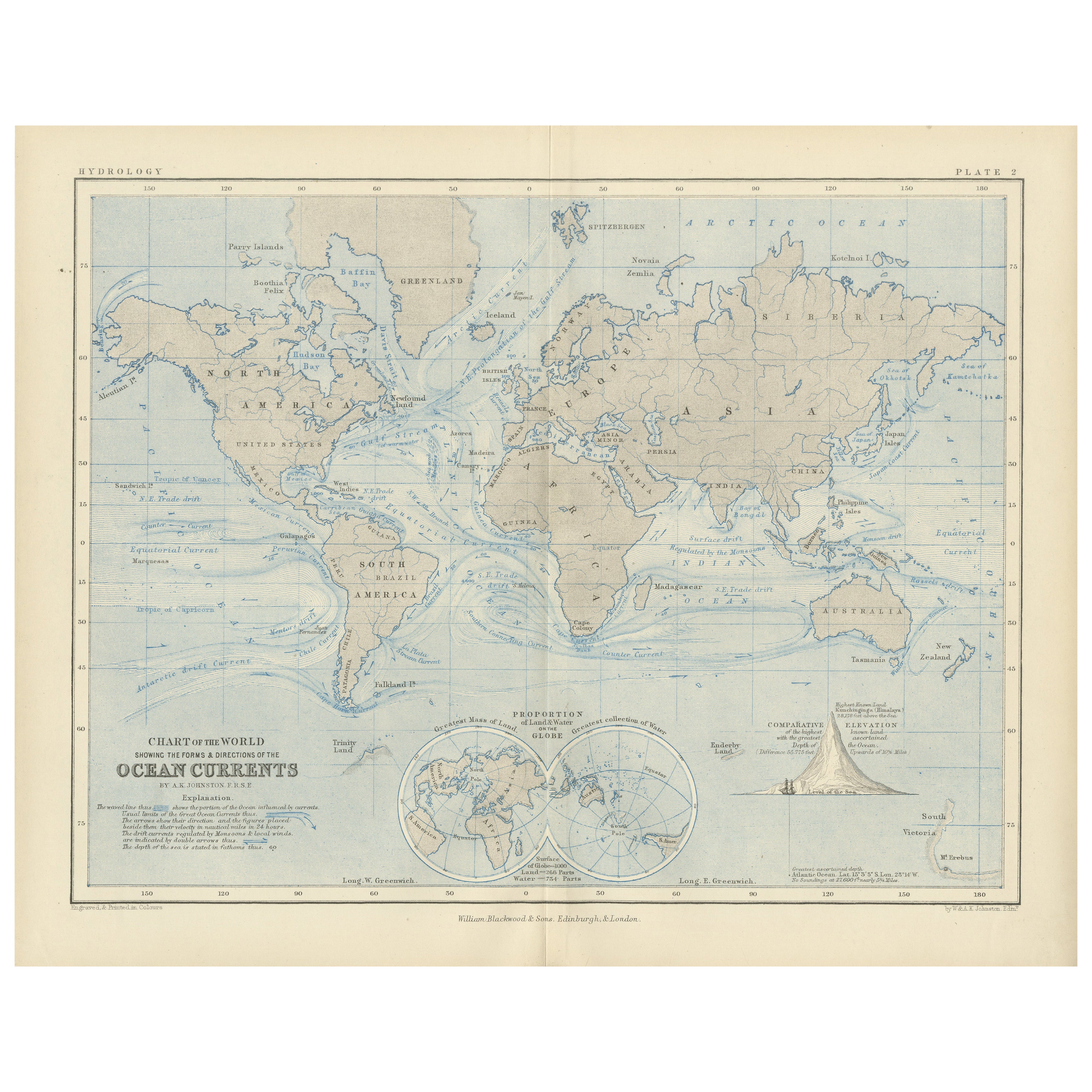
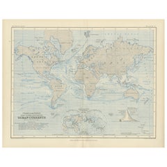
World Map of Ocean Currents by A.K. Johnston, Educational Print 1852
Located in Langweer, NL
World Map of Ocean Currents by A.K. Johnston, Educational Print 1852
This detailed and scientifically rich chart titled 'Chart of the World Showing the Form & Direction of the Ocean...
Category
Antique Mid-19th Century Scottish Prints
Materials
Paper
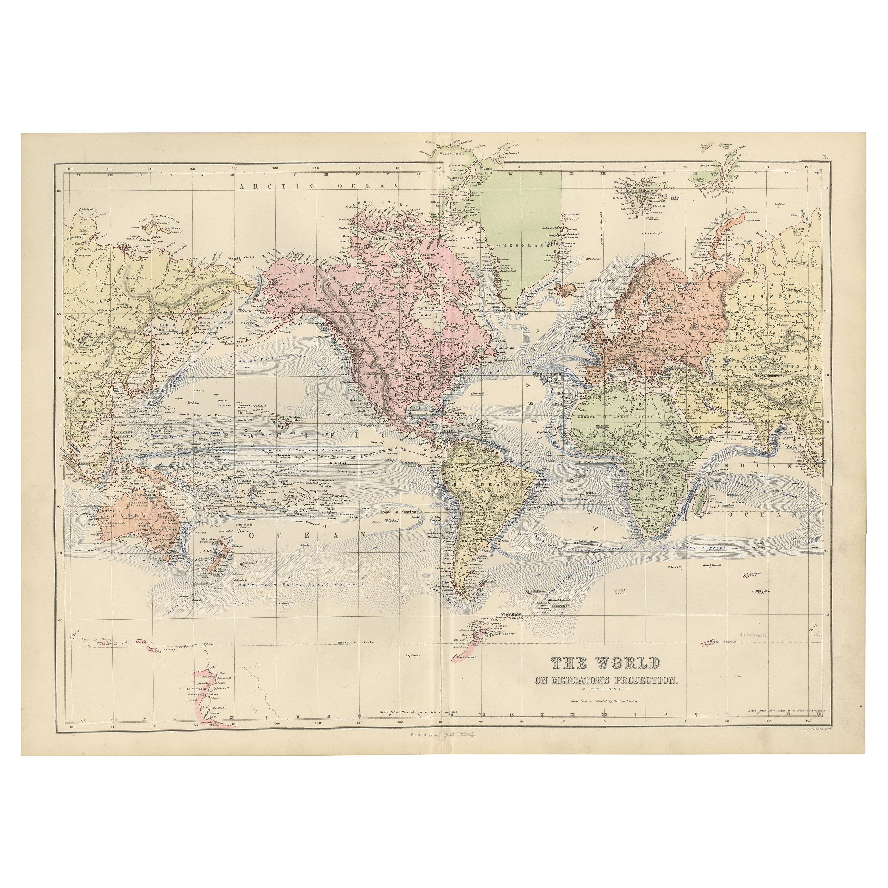
1884 Antique Decorative World Map – Mercator Projection, Victorian Era Print
Located in Langweer, NL
Antique World Map on Mercator’s Projection – Black’s Atlas, 1884
This finely engraved and colored map, titled The World on Mercator’s Projection, was published in the New and Revise...
Category
Antique 1880s Scottish Maps
Materials
Paper

You May Also Like
Original Antique Map of The World by Dower, circa 1835
Located in St Annes, Lancashire
Nice map of the World
Drawn and engraved by J.Dower
Published by Orr & Smith. C.1835
Unframed.
Free shipping
Category
Antique 1830s English Maps
Materials
Paper

1864 Original illustrated planisphere - World Map - Geography
Located in PARIS, FR
Immerse yourself in the epic journey of the past with the Illustrated Historical Planisphere of 1864 by Charpentier! 🗺️ This cartographic treasure transports you through the intrica...
Category
1860s Prints and Multiples
Materials
Linen, Lithograph, Paper

Large Original Antique Map of The World, Fullarton, C.1870
Located in St Annes, Lancashire
Great map of the World. Showing both hemispheres
From the celebrated Royal Illustrated Atlas
Lithograph. Original color.
Published by Fullarton, Edinburgh, C.1870
Unframed.
Rep...
Category
Antique 1870s Scottish Maps
Materials
Paper

Original Antique Map of The Western Hemisphere by Dower, circa 1835
Located in St Annes, Lancashire
Nice map of the Western Hemisphere
Drawn and engraved by J.Dower
Published by Orr & Smith. C.1835
Unframed.
Free shipping
Category
Antique 1830s English Maps
Materials
Paper

Map of the World - Original Etching - 1820
Located in Roma, IT
Map of the World is an Original Etching realized by an unknown artist of 19th century in 1820.
Very good condition on two sheets of white paper joine...
Category
1820s Modern Figurative Prints
Materials
Etching

Original Antique Map of The Eastern Hemisphere by Dower, circa 1835
Located in St Annes, Lancashire
Nice map of the Eastern Hemisphere
Drawn and engraved by J.Dower
Published by Orr & Smith. C.1835
Unframed.
Free shipping
Category
Antique 1830s English Maps
Materials
Paper

More Ways To Browse
Bronze Black Panthers
Bronze Chinoiserie Clock
Bronze Marly Horses
Bronze Singing Bowl
Bronze Sparrow
Brutalist Horse
Brutalist Zodiac
Buddha Head On Black Stand
Buffalo Horn Furniture
Bugatti Sculpture
Buncheong Ceramics
Cabinets Anglo Indian Rosewood
Carrera Dining Table
Carved Bone Elephants
Carved Censer
Carved Indian Chest
Carved Jade Figure
Carved Shell Cabinet