Items Similar to Small Map of Southern Greece Together with Five Greek Religious Scenes, ca.1720


Want more images or videos?
Request additional images or videos from the seller
1 of 6
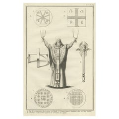
Small Map of Southern Greece Together with Five Greek Religious Scenes, ca.1720
About the Item
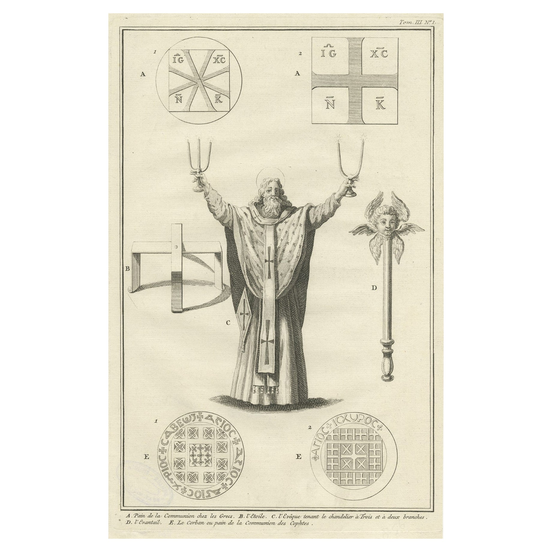
"Carte de la Grece Contenant l'Etat Present de l'Eglise Grecque & ce qui Regarde les Ecclesiastiques", Chatelain, Henry Abraham
Subject: Southern Greece
Period: 1720 (circa)
Publication: Atlas Historique
Color: Hand Color
Handsome chart with a small map of southern Greece (6 x 4.5") together with five Greek religious scenes and columns of French text describing the religion and costumes of the Greek.
- Dimensions:Height: 14.41 in (36.6 cm)Width: 17.01 in (43.2 cm)Depth: 0 in (0.02 mm)
- Materials and Techniques:Paper,Engraved
- Period:1720-1729
- Date of Manufacture:ca.1720
- Condition:A crisp impression with minor toning along the centerfold and a light stain in the text at right.
- Seller Location:Langweer, NL
- Reference Number:
About the Seller
5.0
Platinum Seller
These expertly vetted sellers are 1stDibs' most experienced sellers and are rated highest by our customers.
Established in 2009
1stDibs seller since 2017
1,922 sales on 1stDibs
Typical response time: <1 hour
- ShippingRetrieving quote...Ships From: Langweer, Netherlands
- Return PolicyA return for this item may be initiated within 14 days of delivery.
More From This SellerView All
- Antique Map of Greece with an Inset Map of the Upper Danube Region, c.1720Located in Langweer, NLAntique map titled 'Fluviorum in Europa principis Danubii cum adiacentibus Regnis.' Detailed map of Greece, the Balkans and contiguous parts of the Adriatic and Aegean Seas. The ma...Category
Antique 18th Century Maps
MaterialsPaper
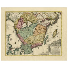
- Antique Map of Southern Sweden by Covens & Mortier, 'circa 1720'Located in Langweer, NLAntique map titled 'Regni Gothiae (..)'. Detailed map of South Sweden. Embellished with beautiful title cartouche with scale and coats of arms. Published in Amsterdam by Covens & Mor...Category
Antique Early 18th Century Maps
MaterialsPaper
- Antique Engraving of Greek Religious Ceremonies, ca.1730Located in Langweer, NLAntique print of various Greek religious ceremonies. With French description. Artists and Engravers: Anonymous Condition: Very good. Stamp on ...Category
Antique 1730s Prints
MaterialsPaper
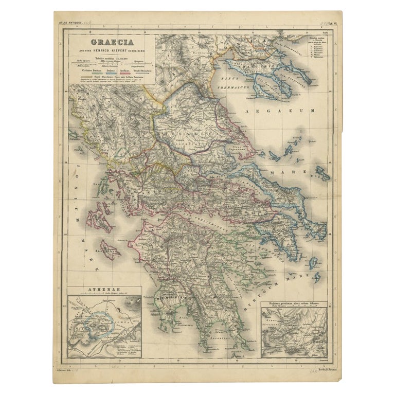
- Antique Map of Greece with Two Small Inset Maps of Athens, c.1870Located in Langweer, NLAntique map titled 'Graecia'. Old map of Greece with two small inset maps of Athens. This map originates from 'Atlas Antiquus, twaalf kaarten behoorende bij de Oude Geschiedenis'. Ar...Category
Antique 19th Century Maps
MaterialsPaper
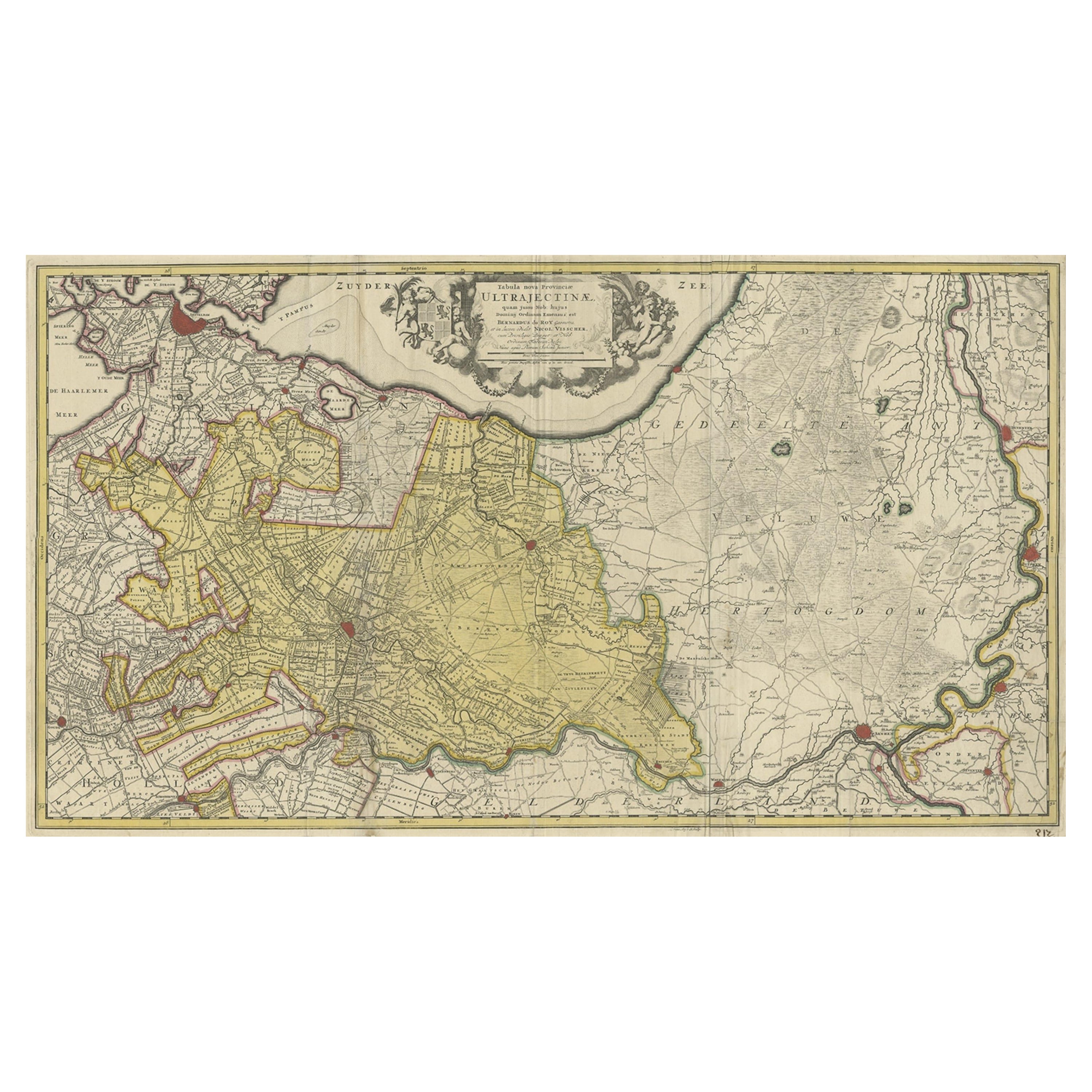
- Original Antique Map of the Province of Utrecht, the Netherlands, ca.1720Located in Langweer, NLAntique map titled ‘Tabula Nova Provinciae Ultrajectinae (..)’. Original antique map of the province of Utrecht, the Netherlands. It shows the region of Amsterdam, Utrecht, Gouda, ...Category
Antique 1720s Maps
MaterialsPaper
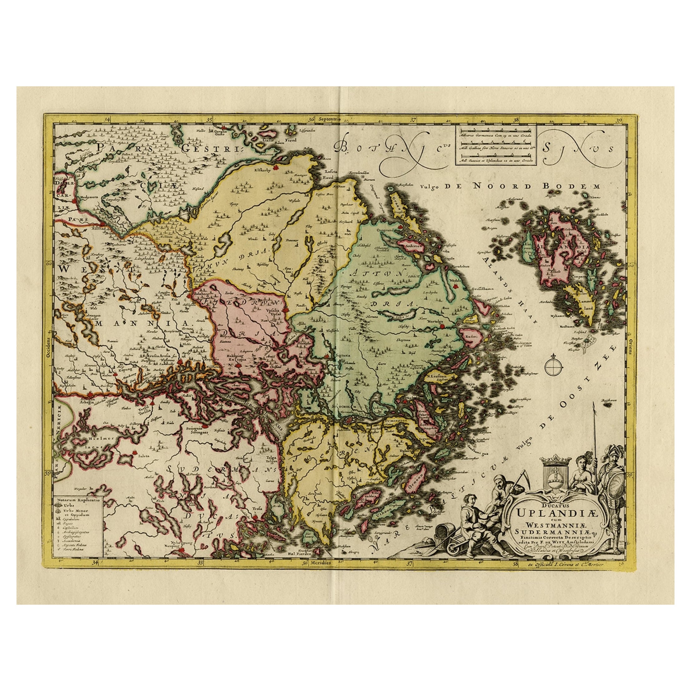
- Original and Decorative Antique Engraved Map of Finland and Sweden, ca.1720Located in Langweer, NLAntique map titled 'Ducatus Uplandiae cum Westmanniae Sudermanniae (..)' This map shows parts of Finland and Sweden. Originally published by Frederick de Wit in the late 1600's. ...Category
Antique 1720s Maps
MaterialsPaper


You May Also Like
- Southern Greece: A Large 17th C. Hand-colored Map by Sanson and JaillotBy Nicolas SansonLocated in Alamo, CAThis large original hand-colored copperplate engraved map of southern Greece and the Pelopponese Peninsula entitled "La Moree Et Les Isles De Zante, Cefalonie, Ste. Marie, Cerigo & C...Category
Antique 1690s French Maps
MaterialsPaper
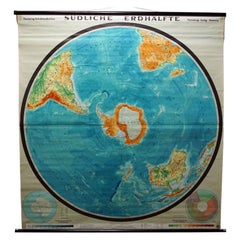
- Southern Hemisphere of the Earth Rollable Map Vintage Wall ChartLocated in Berghuelen, DEA great pull-down map or vintage wall chart illustrating the southern hemisphere of the earth, published by Prof. Dr. C. Troll, Flemmings Verlag Hamburg. Colorful print on paper rein...Category
Mid-20th Century German Country Prints
MaterialsCanvas, Wood, Paper
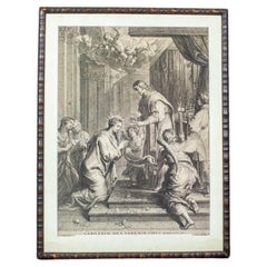
- Engraving in Wooden Frame With Religious Scene - 18th CenturyLocated in Opole, PLEngraving in Wooden Frame With Religious Scene - 18th Century Print based on the painting of the Flemish artist Erasmus Quellin (1607-1678). The matrix was made by Schelte Adams Bol...Category
Antique 18th Century Belgian Prints
MaterialsWood
- Original Antique Map of Ancient Greece, Achaia, Corinth, 1786Located in St Annes, LancashireGreat map of Ancient Greece. Showing the region of Thessaly, including Mount Olympus Drawn by J.D. Barbie Du Bocage Copper plate engraving by P.F Tardieu Original hand color...Category
Antique 1780s French Other Maps
MaterialsPaper
- Original Antique Map of Ancient Greece- Boeotia, Thebes, 1787Located in St Annes, LancashireGreat map of Ancient Greece. Showing the region of Boeotia, including Thebes Drawn by J.D. Barbie Du Bocage Copper plate engraving by P.F T...Category
Antique 1780s French Other Maps
MaterialsPaper
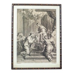
- 18th Century Engraving Depicting a Religious SceneLocated in Opole, PLWe present you an engraving based on a painting by a Flemish painter, Erasmus Quellin (1607-1678). The template was made by Schelte Adams Bolswert (1581-1659). The whole is closed ...Category
Antique 18th Century Belgian Prints