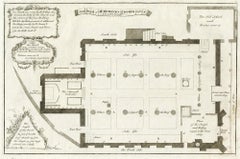
Items Similar to Temple of Philae on the Island of Isis – Ancient Egyptian Plan, c.1710

Want more images or videos?
Request additional images or videos from the seller
1 of 10
Temple of Philae on the Island of Isis – Ancient Egyptian Plan, c.1710
$228.80
£169.28
€190
CA$316.35
A$347.31
CHF 181.19
MX$4,202.97
NOK 2,270.99
SEK 2,139.87
DKK 1,446.67
About the Item
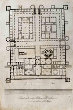
Temple of Philae on the Island of Isis – Ancient Egyptian Plan, c.1710
Description:
This engraved ground plan shows the architectural layout of the Temple of Isis on Philae, the sacred island in the Nile River near Aswan. Titled in Dutch as *De Platte-Grond van den Tempel op het Eiland Philae en Afscheiding van dat Eiland*, the print presents a detailed view of one of the most venerated temple complexes in Ptolemaic Egypt.
The temple is arranged along a longitudinal axis, beginning with a monumental gateway and progressing through open courtyards, hypostyle halls, and sanctuaries. The map meticulously records column arrangements, wall thicknesses, and the relative scale of structures. In the lower section, a walled enclosure labeled “DD” surrounds a sacred mound (“C”) and inner temple marked “H,” likely referencing the mythological burial place of Osiris.
The engraving is adorned with a compass rose and a bar scale (in feet), helping situate the temple's orientation and dimensions. The engraving plate is numbered "Pl. XLIX" in the top right corner, identifying it as part of a larger series.
This plan likely derives from the 1710 travel publication by Cornelis de Bruijn, whose work introduced European audiences to the monumental ruins of Egypt, long before the Napoleonic expeditions and the advent of scientific Egyptology. His plans, though somewhat idealized, reflect a sincere attempt at precision and artistic fidelity based on direct observation.
Condition:
Good condition overall. Fold lines as issued. Slight marginal toning and soft creasing along the edges; no loss of image.
Framing tips:
Display in a black or dark oak frame with a light cream or sand-colored mat. Ideal for libraries, studies, or interior settings that highlight travel, architecture, or classical antiquity.
Technique: Copperplate engraving
Maker: After Cornelis de Bruijn, The Netherlands, circa 1710
- Dimensions:Height: 10.63 in (27 cm)Width: 18.31 in (46.5 cm)Depth: 0.01 in (0.2 mm)
- Materials and Techniques:Paper,Engraved
- Place of Origin:
- Period:
- Date of Manufacture:c.1710
- Condition:Good condition overall. Fold lines as issued. Slight marginal toning and soft creasing along the edges; no loss of image.
- Seller Location:Langweer, NL
- Reference Number:Seller: BG-14102-731stDibs: LU3054346061842
About the Seller
5.0
Recognized Seller
These prestigious sellers are industry leaders and represent the highest echelon for item quality and design.
Platinum Seller
Premium sellers with a 4.7+ rating and 24-hour response times
Established in 2009
1stDibs seller since 2017
2,641 sales on 1stDibs
Typical response time: <1 hour
- ShippingRetrieving quote...Shipping from: Langweer, Netherlands
- Return Policy
Authenticity Guarantee
In the unlikely event there’s an issue with an item’s authenticity, contact us within 1 year for a full refund. DetailsMoney-Back Guarantee
If your item is not as described, is damaged in transit, or does not arrive, contact us within 7 days for a full refund. Details24-Hour Cancellation
You have a 24-hour grace period in which to reconsider your purchase, with no questions asked.Vetted Professional Sellers
Our world-class sellers must adhere to strict standards for service and quality, maintaining the integrity of our listings.Price-Match Guarantee
If you find that a seller listed the same item for a lower price elsewhere, we’ll match it.Trusted Global Delivery
Our best-in-class carrier network provides specialized shipping options worldwide, including custom delivery.More From This Seller
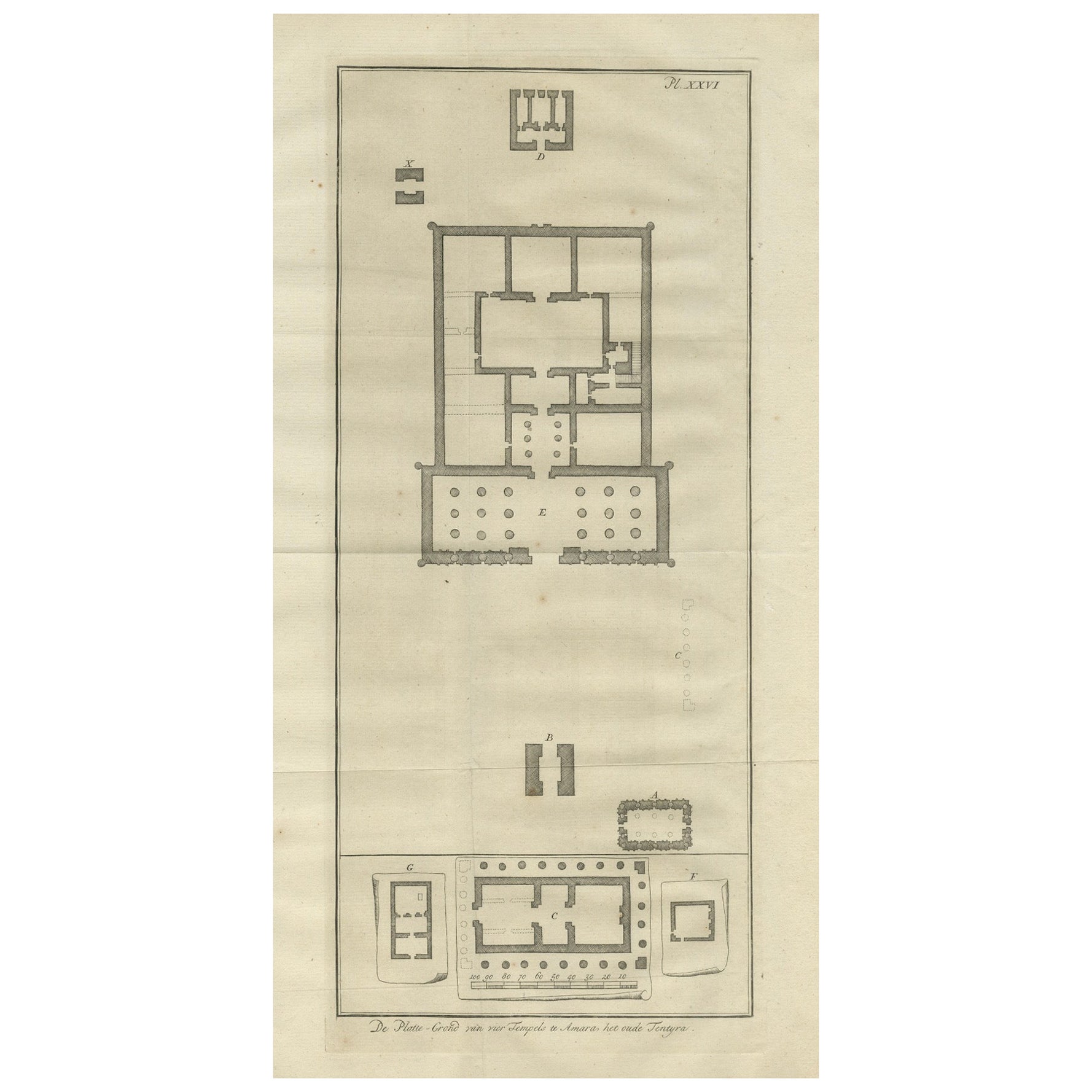
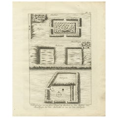
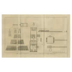
View AllAncient Temple Plans at Amara and Tentyra – Egyptian Architecture c.1710
Located in Langweer, NL
Ancient Temple Plans at Amara and Tentyra – Egyptian Architecture c.1710
Description:
This early 18th-century architectural engraving, titled "De Platte-Grond van vier Tempels te Am...
Category
Antique Early 18th Century Dutch Prints
Materials
Paper
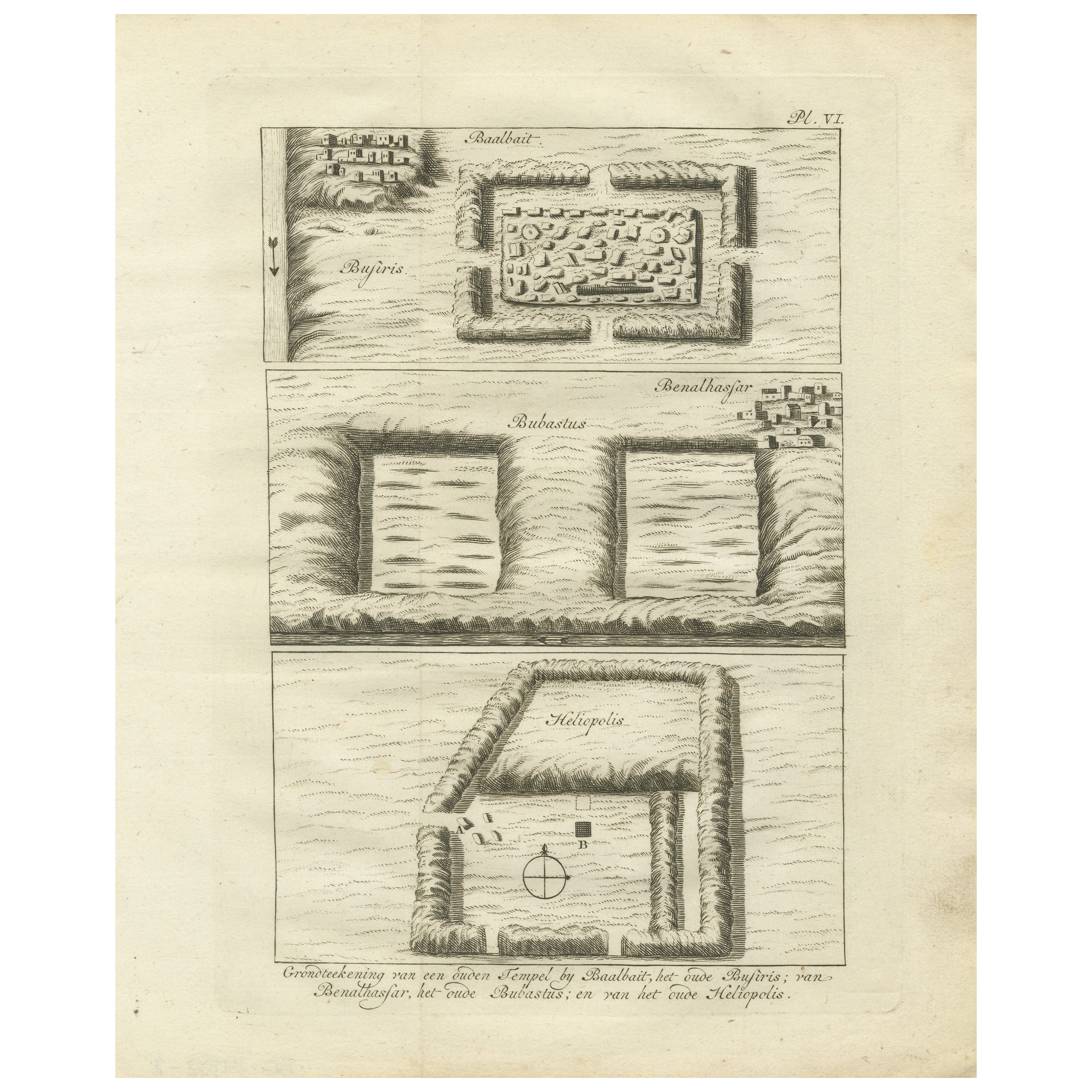
Ancient Temple and Ruin Plans – Egypt, Baalbek, Bubastus, Heliopolis 1776
Located in Langweer, NL
Title: Temple and Ruins Plans Egypt Baalbait Bubastus Heliopolis 1776
Description:
This original engraving from 1776 illustrates schematic plans of ancient Egyptian temple sites and...
Category
Antique Late 18th Century Dutch Prints
Materials
Paper
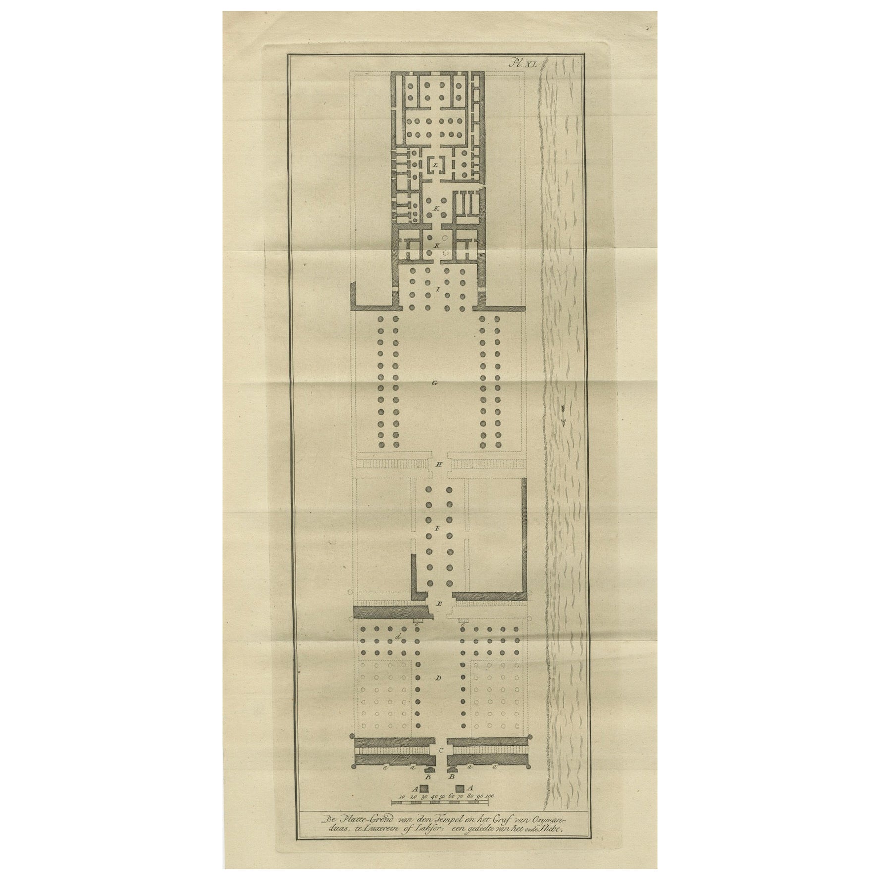
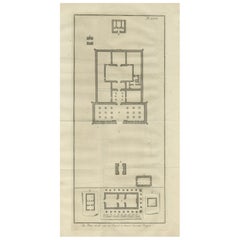
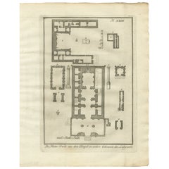
Floor Plan of the Temple of Amun at Luxor – Ancient Thebes, c.1710
Located in Langweer, NL
Floor Plan of the Temple of Amun at Luxor – Ancient Thebes, c.1710
Description:
This antique architectural engraving presents a detailed floor plan of the famous Temple of Amun in L...
Category
Antique Early 18th Century Dutch Prints
Materials
Paper
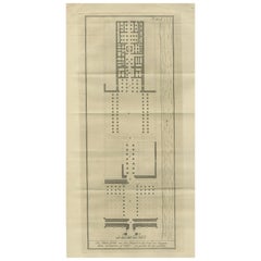
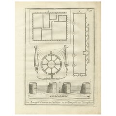
Temple of Jupiter in Thebes – Floor Plan and Gate Elevations, circa 1710
Located in Langweer, NL
Temple of Jupiter in Thebes – Floor Plan and Gate Elevations, circa 1710
This precise architectural engraving, titled "Platte-Grond en Doorsnede des Tempels van Jupiter te Thebe, en...
Category
Antique Early 18th Century Dutch Prints
Materials
Paper
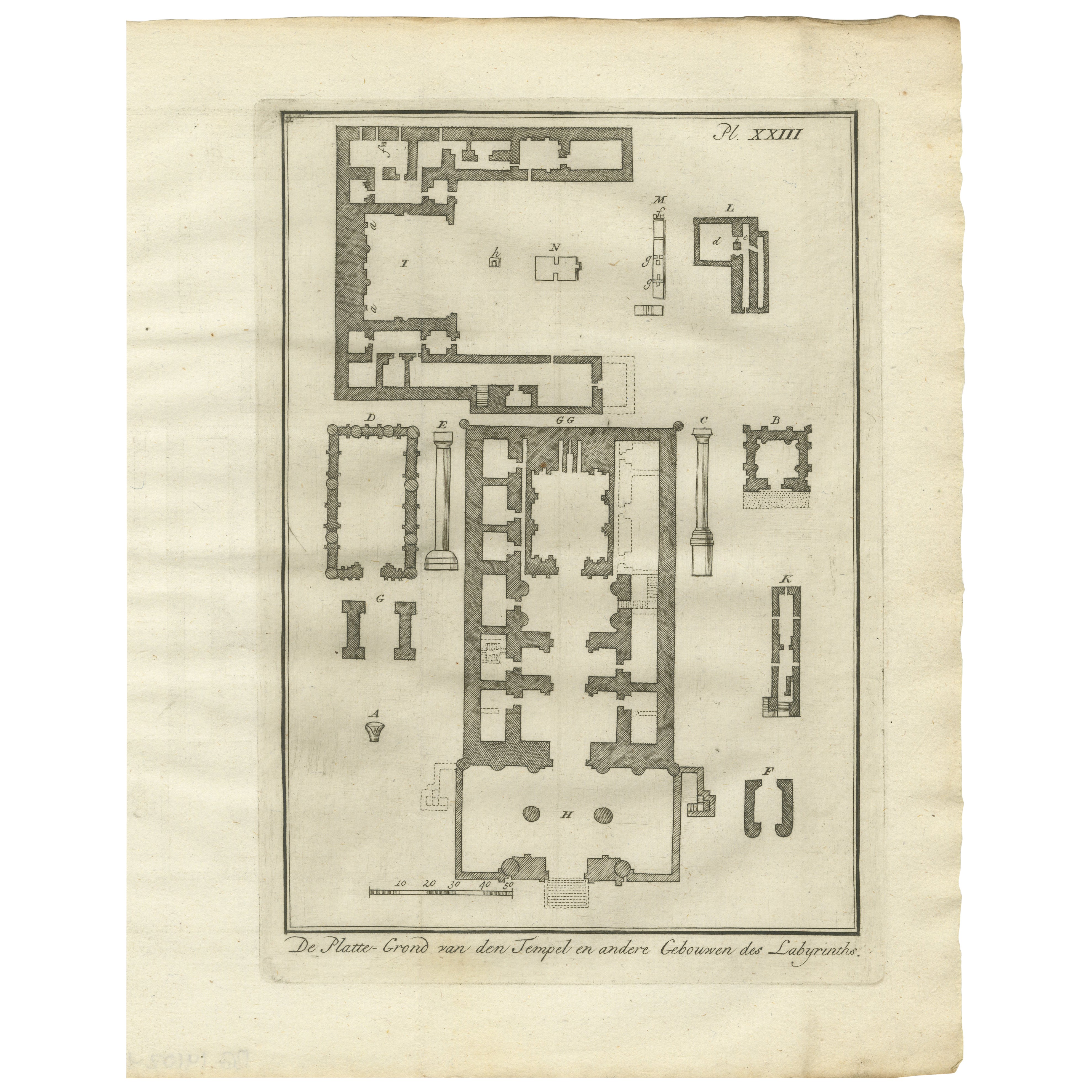
Temple and Buildings of the Labyrinth, Hawara – Floor Plan Engraving, Egypt 1776
Located in Langweer, NL
Title: Temple and Buildings of the Labyrinth at Hawara – Floor Plan Engraving, Egypt 1776
Description:
This 1776 architectural engraving presents a detailed floor plan of the legend...
Category
Antique Late 18th Century Dutch Prints
Materials
Paper
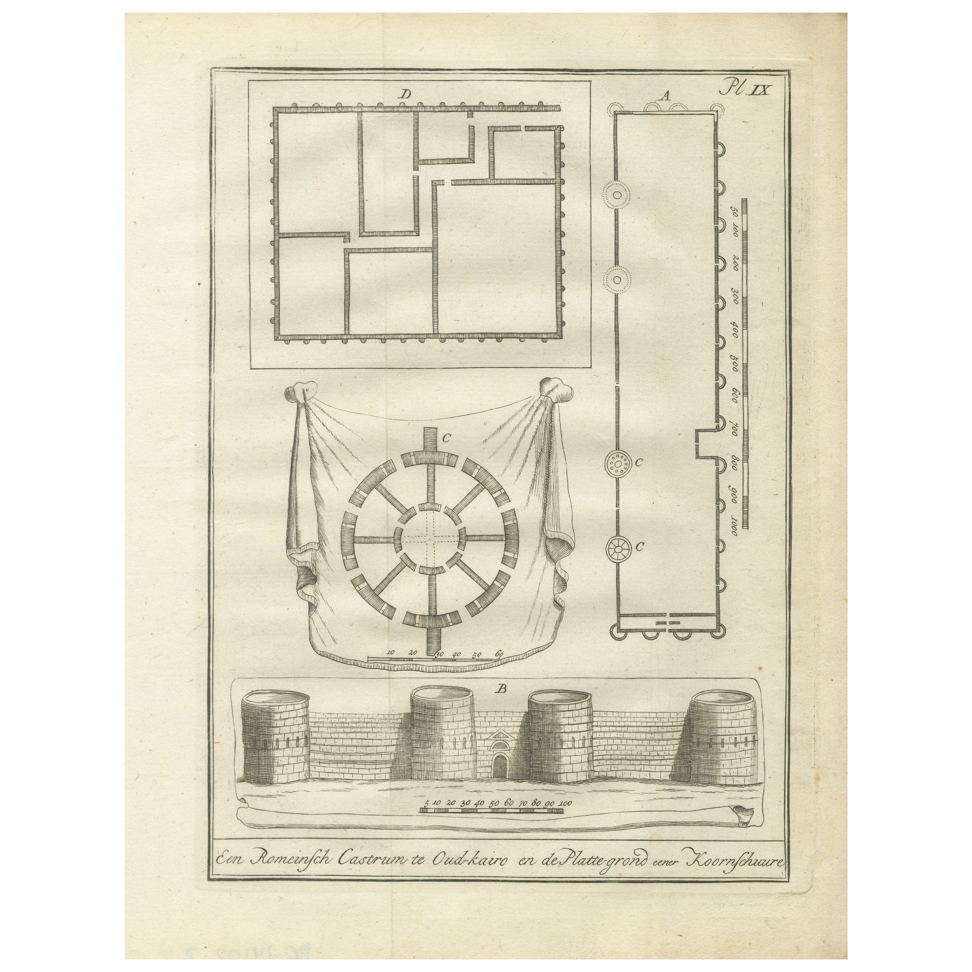
Roman Fortress, Old Cairo and Ancient Granary Plans – Egypt Engraving, 1776
Located in Langweer, NL
Roman Fortress, Old Cairo, and Ancient Granary Plans – Egypt Engraving, 1776
Description:
This original 1776 architectural engraving presents detailed plans and an elevation of a Ro...
Category
Antique Late 18th Century Dutch Prints
Materials
Paper
You May Also Like
Architectural Roman Map - Etching by Vincenzo Scarpati - 18th Century
Located in Roma, IT
Architectural Roman Map from "Antiquities of Herculaneum" is an etching on paper realized by Vincenzo Scarpati in the 18th Century.
Signed on the plate.
Go...
Category
18th Century Old Masters Figurative Prints
Materials
Etching

Plan of Port Siagi - Etching by Joseph Roux - 1795
Located in Roma, IT
Plan of Port Siagi is al colored etching realized by Joseph Roux in 1795.
The title at the top " Plan du Port Siagi"
Passepartout included: 34 x 49
The artwork is hand water-color...
Category
1790s Modern Figurative Prints
Materials
Etching

Map of Palace of Diocletian- Lithograph - 1862
Located in Roma, IT
Uses and Customs - Map of Diocletian's Palace is a lithograph on paper realized in 1862.
The artwork belongs to the Suite Uses and customs of all the peoples of the universe: " Hist...
Category
1860s Modern Figurative Prints
Materials
Lithograph
Roman Temple Fresco - Etching by Fernando Strina - 18th Century
Located in Roma, IT
Roman Temple Fresco from "Antiquities of Herculaneum" is an etching on paper realized by Fernando Strina in the 18th Century.
Signed on the plate.
Good conditions.
The etching bel...
Category
18th Century Modern Figurative Prints
Materials
Etching
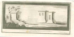
Ancient View of The Ruins of Philae - Original Lithograph - Mid-19th Century
Located in Roma, IT
The Ruins of Philae is an original modern artwork realized in the mid-19th Century.
Original B/W Lithograph on Ivory Paper.
Inscripted on the lower margin in Capital Letters: Die...
Category
Mid-19th Century Figurative Prints
Materials
Paper, Lithograph
The plan of St. Martin's Church, St. Martin in the Fields
By George Vertue
Located in Middletown, NY
London: Society of Antiqauries London, 1744. Engraving on buff wove paper with a large heraldic watermark with Strasbourg lily with a crown and shied and the letters LVG, 9 1/2 x 14 ...
Category
Mid-18th Century English School Landscape Prints
Materials
Handmade Paper, Engraving
More Ways To Browse
Horse Sculptures From India
Horse Trophy
House Of Savoy
Hunting Coat
India Silver Bowl
Indian Boat
Indian Brass Chest
Iron Folding Screen
Iron Pig
Italian Bistro
Italian Bone Inlay
Italian Glass Hurricane
Italian Majolica Dog
Italian Mottahedeh
Italian Renaissance Cassone
Italian Zebra Sculpture
Ivory Carvings
Japan Abstract Art Midcentury