Items Similar to Unusual Chart Showing Traveling Distances Between European Cities, C.1726
Want more images or videos?
Request additional images or videos from the seller
1 of 5
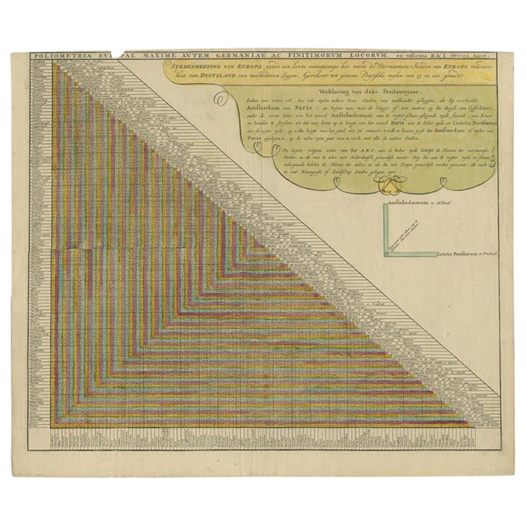
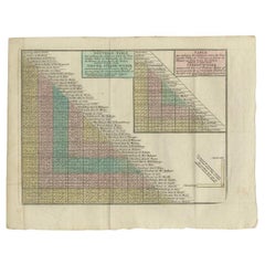
Unusual Chart Showing Traveling Distances Between European Cities, C.1726
About the Item
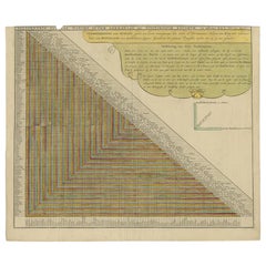
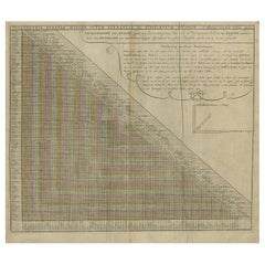
Antique print Europe titled 'Poliometria Europae Maxime Autem Germaniae ac Finitimorum Locorum'.
This unusual chart depicts the traveling distances between various European cities.
Artists and Engravers: Published by R. & I. Ottens, Amsterdam.
Condition: Good, general age-related toning. Original/contemporary hand coloring. Small defect upper margin, please study image carefully.
- Dimensions:Height: 20.87 in (53 cm)Width: 24.02 in (61 cm)Depth: 0 in (0.02 mm)
- Materials and Techniques:
- Period:1720-1729
- Date of Manufacture:circa 1726
- Condition:Wear consistent with age and use. Minor losses. General age-related toning. Original/contemporary hand coloring. Small defect upper margin.
- Seller Location:Langweer, NL
- Reference Number:
About the Seller
5.0
Platinum Seller
These expertly vetted sellers are 1stDibs' most experienced sellers and are rated highest by our customers.
Established in 2009
1stDibs seller since 2017
1,928 sales on 1stDibs
Typical response time: <1 hour
- ShippingRetrieving quote...Ships From: Langweer, Netherlands
- Return PolicyA return for this item may be initiated within 14 days of delivery.
More From This SellerView All
- Antique Chart of Travelling Distances Between European Cities, ca. 1726Located in Langweer, NLAntique print Europe titled 'Poliometria Europae Maxime Autem Germaniae ac Finitimorum Locorum'. This unusual chart depicts the traveling distances between various European cities. ...Category
Antique 18th Century Prints
MaterialsPaper
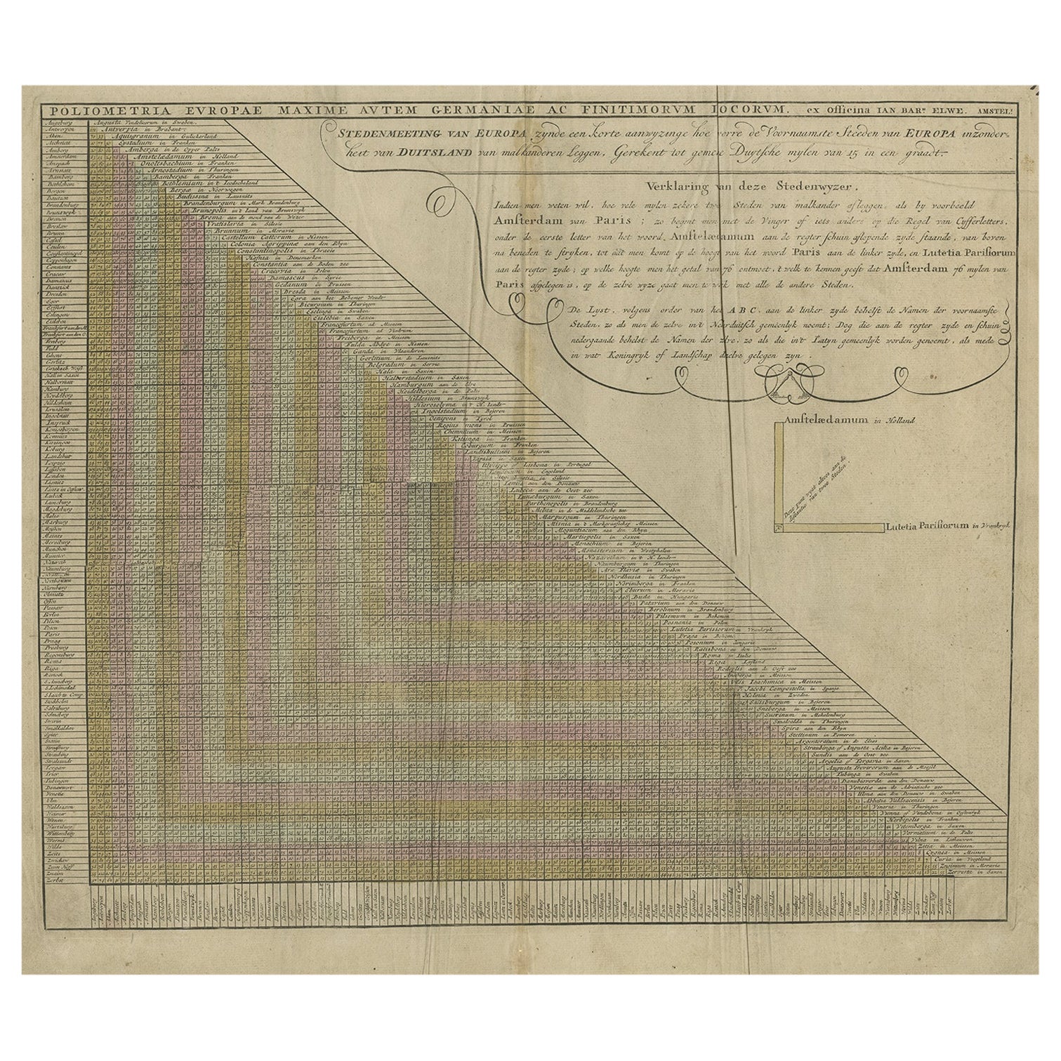
- Antique Chart of Travelling Distances between European Cities, Ca.1792Located in Langweer, NLAntique print Europe titled 'Poliometria Europae Maxime Autem Germaniae ac Finitimorum Locorum'. This unusual chart depicts the traveling distances between various European cities. ...Category
Antique 18th Century Maps
MaterialsPaper
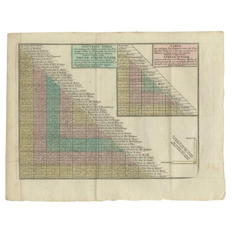
- Antique Distance Table Between the Main Cities of Europe by Keizer & De Lat 1788Located in Langweer, NLAntique print titled 'Nieuwe Steede-Wyser (..)'. Original antique distance table between the main cities of Europe. This print originates from 'Nieuwe Natuur- Geschied- en Handelkund...Category
Antique 18th Century Prints
MaterialsPaper
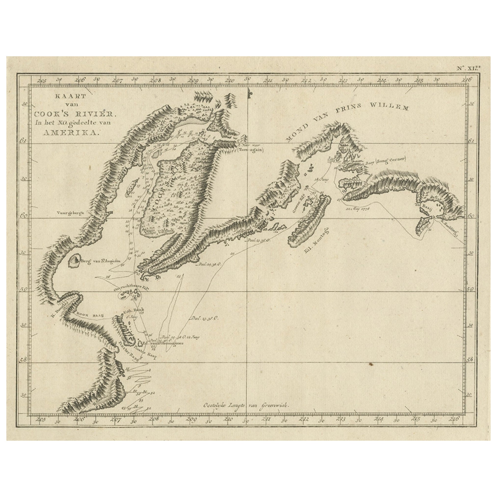
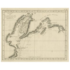
- Original Chart Showing the Region between Cape Grenville and Cape Suckling, 1803Located in Langweer, NLAntique map titled 'Kaart van Cook's Rivier in het N.O. gedeelte van Amerika'. Chart showing the region between Cape Grenville and Cape Suckling, including Whitsuntide Bay, Cape Whitsunday, Smokey Bay, Cape Douglas, Mount St. Augustine, Volcano Mountain, R. Turn-again, Cook's River, Point Possession, Anchor Point, Point Beale Cape Elizabeth...Category
Antique Early 1800s Maps
MaterialsPaper
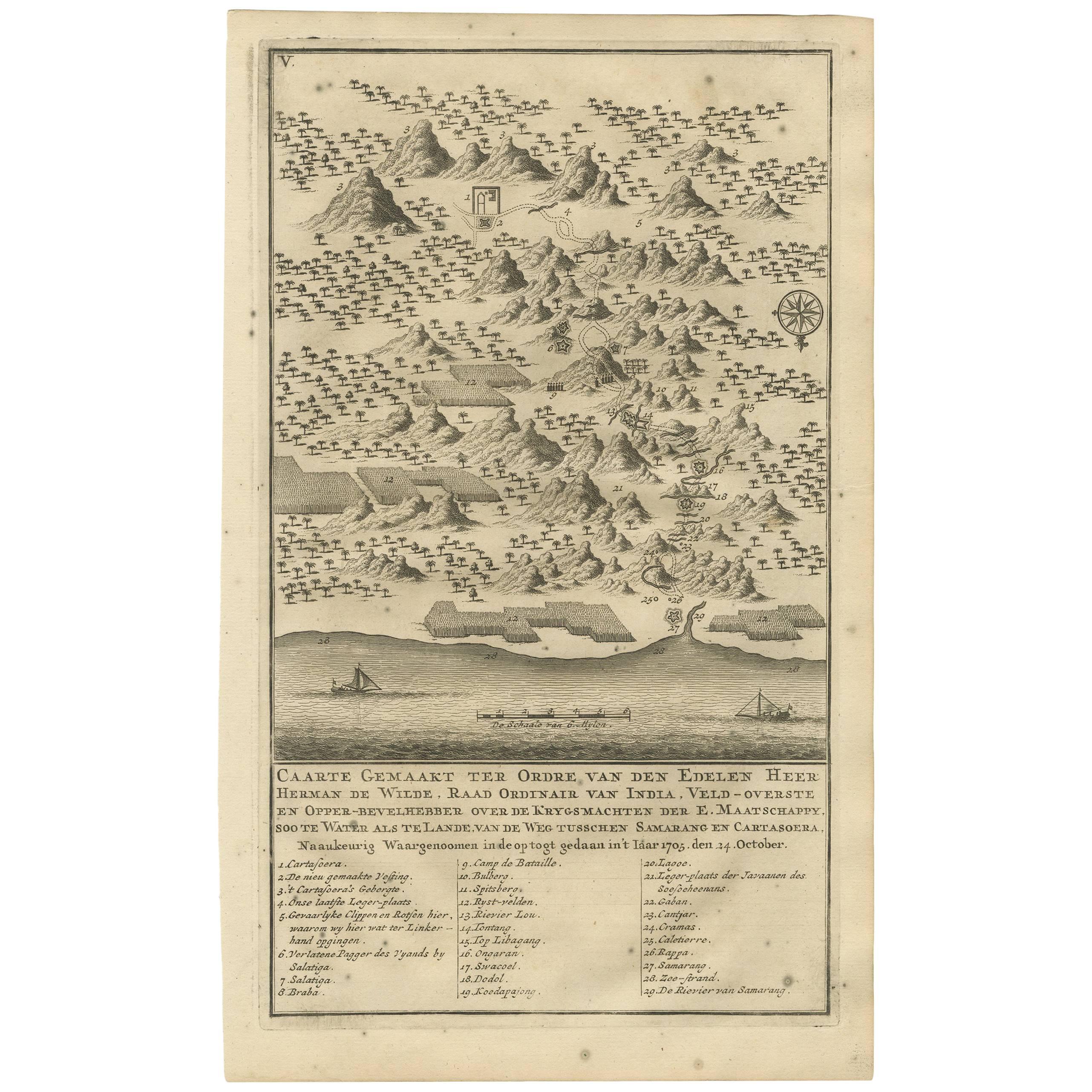
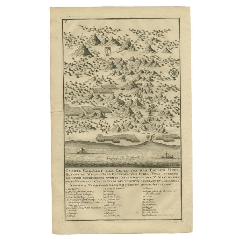
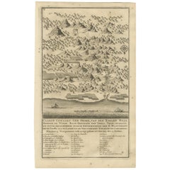
- Antique Map of the Road Between Semarang & Kartosuro by F. Valentijn, 1726Located in Langweer, NLAntique print titled 'Caarte Gemaakt ter Ordre van den Edelen Heer Herman de Wilde ..... Van de weg tusschen Samarang en Cartasoera. ' A map of the road between Semarang and Kartosur...Category
Antique Early 18th Century Maps
MaterialsPaper
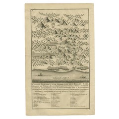
- Antique Print of the Road Between Semarang and Kartosuro, Java, 1726Located in Langweer, NLAntique print titled 'Caarte Gemaakt ter Ordre van den Edelen Heer Herman de Wilde ..... Van de weg tusschen Samarang en Cartasoera.' This print shows a map of the road between Semar...Category
Antique 18th Century Prints
MaterialsPaper
You May Also Like
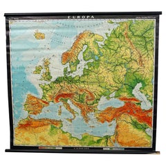
- Europe Map Vintage Rollable Mural Countrystyle Wall Chart DecorationLocated in Berghuelen, DEThe vintage pull-down map shows the European continent / Europe. Published by Haack-Painke, Justus Perthes Darmstadt. Colorful print on paper reinforced with canvas. Measurements: Width 104 cm (40.95 inch) Height 97 cm (38.19 inch) The measurements shown refer just to the canvas and do not include the poles. Background information on the history of school wall charts: The idea to upgrade every day school life by using pictures...Category
Vintage 1970s German Country Prints
MaterialsCanvas, Wood, Paper
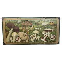
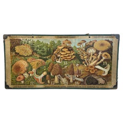
- Mushrooms of Middle Europe Print Cardboard Wall Chart, Germany 1930sLocated in Nuernberg, DEThis rare vintage wall chart shows different types of mushrooms, which are native to middle europe. This kind of wall charts are used as teaching material in German schools. Colorful...Category
Vintage 1930s German Mid-Century Modern Prints
MaterialsPaper
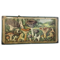
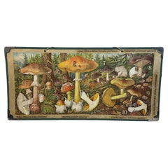
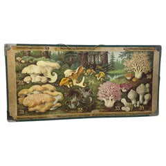
Recently Viewed
View AllMore Ways To Browse
Antique Ac
Silver Midcentury Ring
Antique Jacket
Chinese Antique Cabinet With
Military Metal
Mod Style
Used Solid Wood Kitchen Cabinets
19th Century Wooden Door
Orange Brown Diamond
Over Door Carved Panel
Brown Orange Diamond
American Furniture Antique Cabinet
Antique Bead Work
Tall Open Storage Cabinet
Leaded Cabinet
Paw Cabinet
Display Cabinets French Style
1920 French Door