Items Similar to View of the Island of Tahiti, with Outrigger Canoes and Sailing Catamarans, 1803
Want more images or videos?
Request additional images or videos from the seller
1 of 5
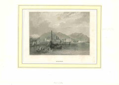
View of the Island of Tahiti, with Outrigger Canoes and Sailing Catamarans, 1803
$629.86
$787.3220% Off
£465.66
£582.0820% Off
€528
€66020% Off
CA$866.36
CA$1,082.9520% Off
A$963.01
A$1,203.7620% Off
CHF 504.79
CHF 630.9920% Off
MX$11,760.71
MX$14,700.8820% Off
NOK 6,302.01
NOK 7,877.5220% Off
SEK 5,929.02
SEK 7,411.2720% Off
DKK 4,019.66
DKK 5,024.5720% Off
About the Item
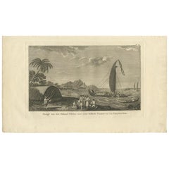
Antique print Polynesia titled 'Gezigt van het eiland Otahiti op den afstand van eene zee-mijl in het Z.O'.
View of the island of Tahiti, with outrigger canoes and sailing catamarans. Originates from 'Reizen Rondom de Waereld door James Cook (..)'.
Artists and Engravers: Translated by J.D. Pasteur. Published by Honkoop, Allart en Van Cleef.
- Dimensions:Height: 10.63 in (27 cm)Width: 20.67 in (52.5 cm)Depth: 0 in (0.02 mm)
- Materials and Techniques:
- Period:
- Date of Manufacture:1803
- Condition:Wear consistent with age and use. Minor losses. Condition: Good, some defects and foxing. Tear at the left, please study image carefully.
- Seller Location:Langweer, NL
- Reference Number:Seller: BG-11487-501stDibs: LU3054327257972
About the Seller
5.0
Recognized Seller
These prestigious sellers are industry leaders and represent the highest echelon for item quality and design.
Platinum Seller
Premium sellers with a 4.7+ rating and 24-hour response times
Established in 2009
1stDibs seller since 2017
2,607 sales on 1stDibs
Typical response time: <1 hour
- ShippingRetrieving quote...Shipping from: Langweer, Netherlands
- Return Policy
Authenticity Guarantee
In the unlikely event there’s an issue with an item’s authenticity, contact us within 1 year for a full refund. DetailsMoney-Back Guarantee
If your item is not as described, is damaged in transit, or does not arrive, contact us within 7 days for a full refund. Details24-Hour Cancellation
You have a 24-hour grace period in which to reconsider your purchase, with no questions asked.Vetted Professional Sellers
Our world-class sellers must adhere to strict standards for service and quality, maintaining the integrity of our listings.Price-Match Guarantee
If you find that a seller listed the same item for a lower price elsewhere, we’ll match it.Trusted Global Delivery
Our best-in-class carrier network provides specialized shipping options worldwide, including custom delivery.More From This Seller
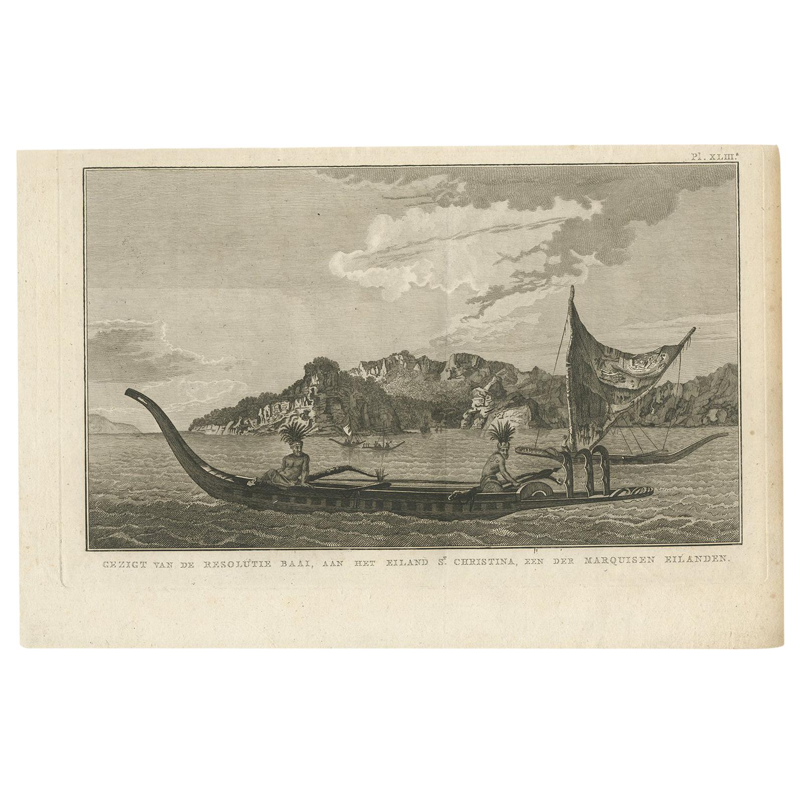
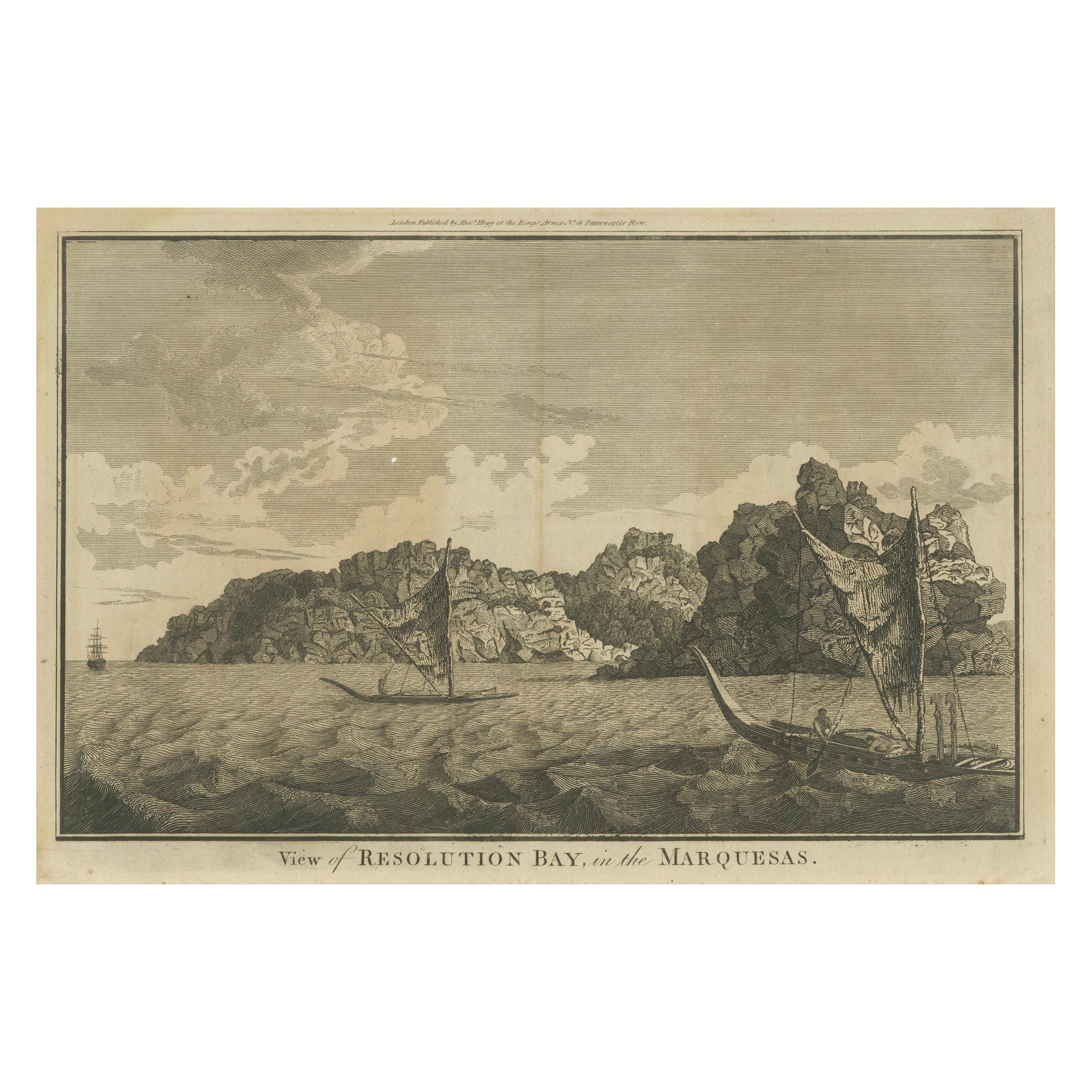
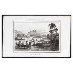
View AllResolution Bay on St. Christina: A Glimpse of the Marquesas in Cook's Voyages
Located in Langweer, NL
Antique print that translates from Dutch to "View of Resolution Bay, on the Island of St. Christina, one of the Marquesas Islands." This is a historical print from the Dutch edition ...
Category
Antique Early 19th Century Dutch Prints
Materials
Paper
$229 Sale Price
20% Off
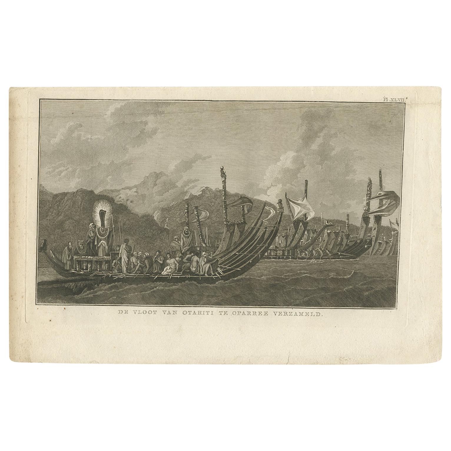
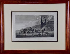
Antique Print of the Fleet of Proas of Tahiti by Cook, 1803
Located in Langweer, NL
Antique print titled 'De Vloot van Otahiti te Oparree verzameld'. This print depicts the fleet of Proas of Tahiti. Originates from 'Reizen rondom de Waereld' by J. Cook. Translated b...
Category
Antique Early 19th Century Dutch Prints
Materials
Paper
$276 Sale Price
20% Off
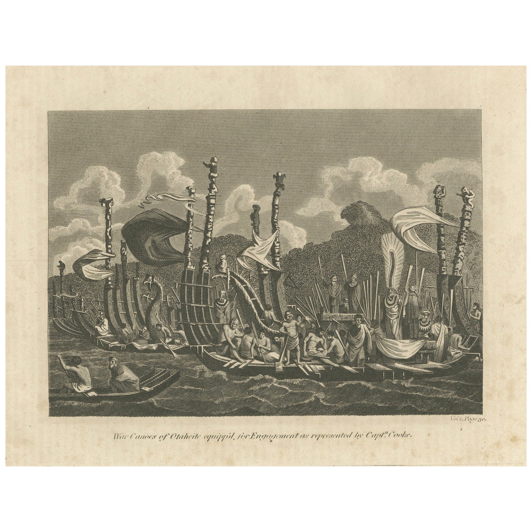
Naval Might of Tahiti: War Canoes Observed by Captain Cook, circa 1817
Located in Langweer, NL
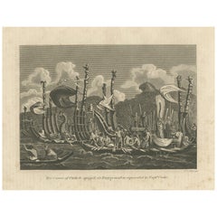
Title: War Canoes of Otaheite equipp'd for Engagement as represented by Captn. Cooke
This detailed engraving depicts the "War Canoes of Otaheite (Tahiti), as represented by Capt'n C...
Category
Antique Early 19th Century Prints
Materials
Paper
$229 Sale Price
20% Off
Free Shipping
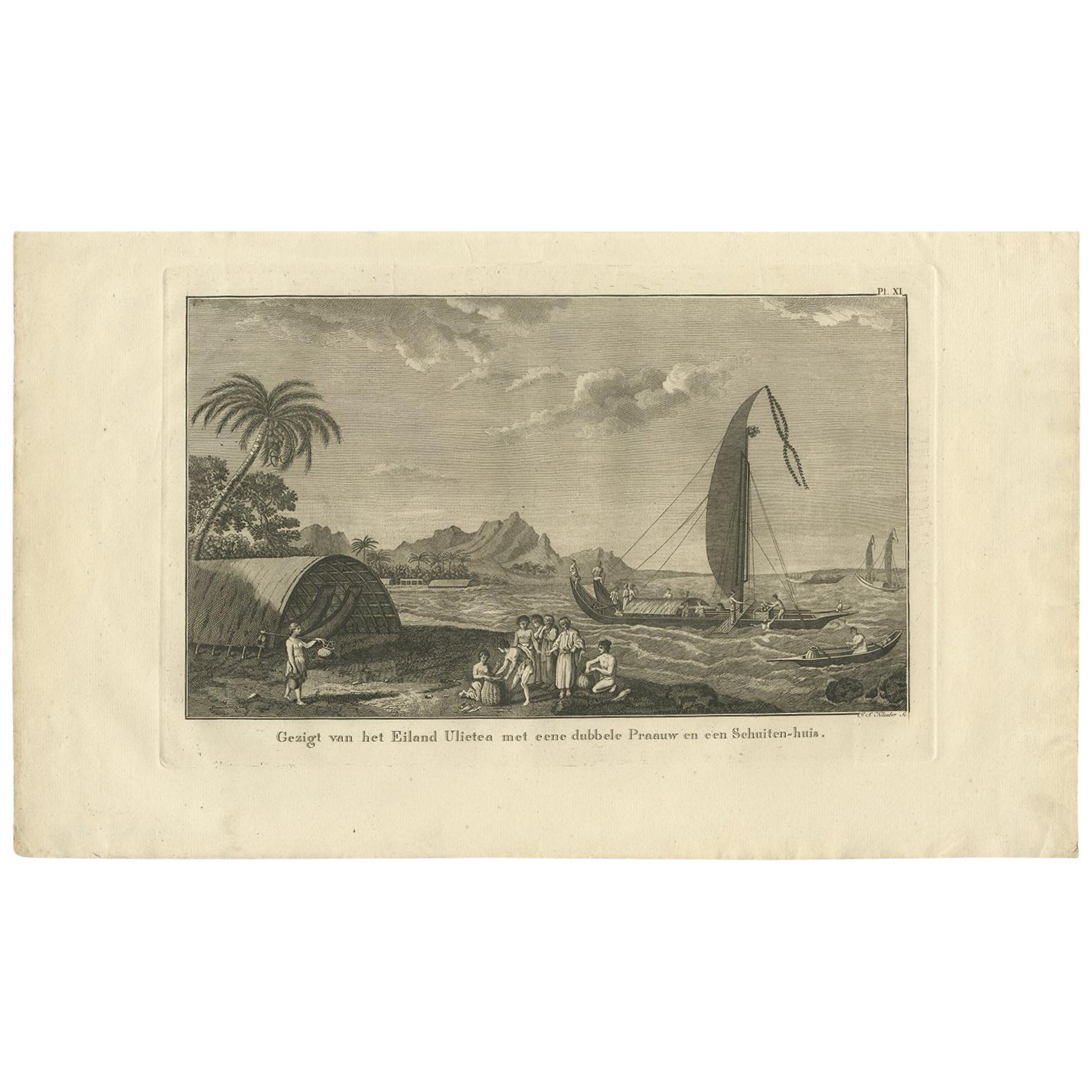
Antique Print of Ulietea in French Polynesia, Cook, 1803
Located in Langweer, NL
Antique print titled 'Gezigt van het Eiland Ulietea met eene dubbele Praauw en een Schuiten-huis'. This print depicts Ulietea, French Polynesia. Also depicts a proa. Originates from ...
Category
Antique Early 19th Century Dutch Prints
Materials
Paper
$238 Sale Price
20% Off
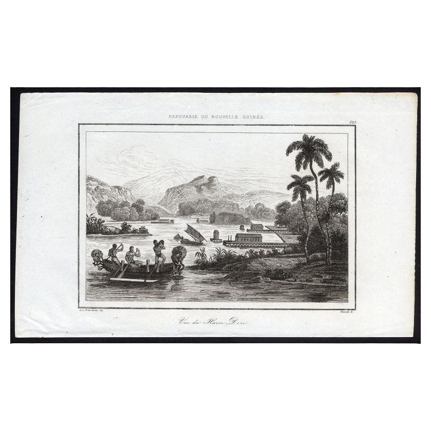
Antique Print of Dory Harbour, New Guinea, 1836
Located in Langweer, NL
Antique print titled 'Vue de Havre Dori - 223, Papouasie ou Nouvelle Guinee'. View of Dory Harbour, New Guinea. This print originates from M.G.L. Domeny de Rienzi's 'Oceanie, ou Cinq...
Category
Antique 19th Century Prints
Materials
Paper
$114 Sale Price
20% Off
Resolution Bay in the Marquesas: Indigenous Canoes and European Exploration
Located in Langweer, NL
This engraving, titled "View of Resolution Bay, in the Marquesas", is a depiction of Resolution Bay in the Marquesas Islands. The scene shows traditional indigenous canoes in the for...
Category
Antique 1780s Prints
Materials
Paper

$95 Sale Price
20% Off
You May Also Like
Sandwich Islands Canoe (Hawaii): Framed 18th C. Engraving Captain Cook's Journal
By John Webber
Located in Alamo, CA
"A Canoe of the Sandwich Islands, the Rowers Masked" is an engraving created by Charles Grignion, from a drawing by John Webber (1752-1793), who was the artist on Captain James Cook's 3rd and final voyage of discovery. It is Plate 65 in the atlas of "A Voyage to the Pacific Ocean Undertaken by the Command of His Majesty, for Making Discoveries in the Northern Hemisphere", the official British Admiralty sanctioned journal published upon completion of the voyage in London in 1784 by Strahan & Cadell.
This famous image of ten Hawaiian rowers transporting a priest who is carrying a feather-covered image of Kukailimoku, the Hawaiian god of war. The priests and paddlers are all wearing gourd masks in their double-hulled canoe with an upright lateen woven sail. Each hull was shaped from a single large Koa log harvested from island rainforests, where they were carved before being transported to the coast.
This engraving is presented in a Koa wood frame and a white mat. There are occasional faint spots, but the print is otherwise in very good condition. Koa is the same wood as was used to make the canoe. Koa wood is legendary in Hawaii. Not only is this amazing wood native to Hawaii, but it is known for the deep rich colors and varied grain pattern. Koa has an honored heritage in Hawaii and is highly revered and sacred. The word “koa” means “warrior” in Hawaiian. The warriors of King Kamehameha the Great, created canoes and weapons from a wood plentiful on the Big Island of Hawaii. This wood became synonymous with the warriors themselves, and it became known as koa. The frame measures 20.75" high, 26.75" wide and 0.88" deep.
There are three other engravings listed from the official journal of Captain Cook's 3rd voyage available that are presented in identical Koa wood frames and mat (LU117324682022, LU117324684052, LU117324684062). They would make a wonderful grouping for a display of 2, 3 or 4 prints. A discount is available for a grouping depending on the number of items included.
Hawaii was discovered by Captain Cook (1728-1779) during this voyage. Hawaii was originally called The Sandwich Islands in honor of The Earl of Sandwich...
Category
1780s Landscape Prints
Materials
Engraving
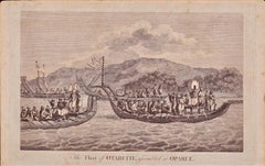
The Fleet of Tahiti displayed for Captain Cook: An Original 18th C. Engraving
By William Hodges
Located in Alamo, CA
"The Fleet of Otaheite, Assembled at Oparee" is an original 18th century engraving from a drawing by William Hodges (1744-1797), who was the artist who accompanies Captain Cook on hi...
Category
1780s Landscape Prints
Materials
Engraving
Ancient View of Rio Janeiro - Original Lithograph - Early 19th Century
Located in Roma, IT
Ancient View of Rio Janeiro is an original modern artwork realized in the first half of the 19th Century.
Original Lithograph on Ivory Paper.
Inscripted on the lower margin: Rio J...
Category
Early 19th Century Modern Figurative Prints
Materials
Lithograph
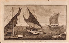
Boats of the Friendly Isles, Tonga: Original 18th C. Engraving from Captain Cook
By William Hodges
Located in Alamo, CA
"Boats of the Friendly Isles" is an original 18th century engraving from a drawing by William Hodges (1744-1797), who was the artist who accompanies Captain Cook on his second voyage...
Category
1780s Landscape Prints
Materials
Engraving
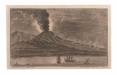
Sescape With Vesuvio and Boats - Etching by Filippo Morghen - 18th Century
By Filippo Morghen
Located in Roma, IT
Seascape With Vesuvio and Boats is an Etching realized by Filippo Morghen (1730-1807).
The etching belongs to the print suite “Antiquities of Herculaneum Exposed” (original title: ...
Category
Late 18th Century Old Masters Figurative Prints
Materials
Etching
Ancient View of Ajaccio - Lithograph - Mid-19th Century
Located in Roma, IT
Ajaccio is an original modern artwork realized in the Mid-19th Century.
Original B/W Lithograph on Ivory Paper.
Inscripted on the lower central margin in Capital Letters: Ajaccio....
Category
Mid-19th Century Modern Figurative Prints
Materials
Lithograph
More Ways To Browse
Reproduction Chest Of Drawers
Ritts Co
Rosewood Secretary Desk
Rosso Antico Marble
S S Normandie
Salt Glaze Jug
Sergio Bustamante Artist
Sheraton Display Cabinets
Ships Wheel Table
Shoe Last
Silent Butler
Silk Banner
Skeleton Clocks
Spalted Wood
Spanish Andalusia
Staffordshire Pottery Figures
Stamped Br
Syrian Brass