Items Similar to Vintage Mural Rollable Map Wall Chart France Benelux Countries South England

Want more images or videos?
Request additional images or videos from the seller
1 of 8
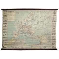
Vintage Mural Rollable Map Wall Chart France Benelux Countries South England
$380
£282.49
€330.70
CA$531.42
A$593.39
CHF 309.53
MX$7,296.57
NOK 3,906.61
SEK 3,677.94
DKK 2,467.03
Shipping
Retrieving quote...The 1stDibs Promise:
Authenticity Guarantee,
Money-Back Guarantee,
24-Hour Cancellation
About the Item
A cottagecore pull-down wall chart map illustrating France and the Benelux countries (the Netherlands, Belgium and Luxemburg) and main parts of Western Europe. Published by Justus Perthes Darmstadt. Colorful print on paper reinforced with canvas.
Measurements:
Width 154.50 cm (75.79 inch)
Height 192.50 cm (60.83 inch)
The measurements shown refer just to the canvas and do not include the poles.
Background information on the history of school wall charts:
The idea to upgrade every day school life by using pictures was supported in the late 18th century by Johann Bernhard Basedow. In 1774 he published a four-volume book "Elementarwerk" which combined pictures, text and information with merely hundred copperplates. Modern printing methods enabled the spread from rich private schools to rural grade schools. From 1820-1836 the oldest mentioned series of wall charts were published with the range of six booklets including 63 large sized charts. The rising 20th century was the golden age for publishers printing wall charts. Artists Masterly performed pictures which combined the subject-specific standards of a scientist with the standards given by an educator and finally created a magnificent art work.
artfour is an owner-managed trading company dealing in Black Forest woodcarvings, antler furniture and an impressive variety of unique decorative items. Our antiques are displayed in a 100 years old barn in southern Germany which we have remodeled ourselves. Antique pieces have been our passion since the 1980s. We ship worldwide, perfectly packed and with money back guarantee. This qualifies us as your preferred partner for Black Forest and antique art.
- Dimensions:Height: 75.99 in (193 cm)Width: 61.03 in (155 cm)Depth: 0.79 in (2 cm)
- Style:Country (In the Style Of)
- Materials and Techniques:
- Place of Origin:
- Period:
- Date of Manufacture:circa 1970
- Condition:Wear consistent with age and use. The wall chart has been utilised and therefore shows age-related traces of usage. During storage the chart might partly be fissured, stained, sometimes smells and may have some old repairs. Please contact us for a detailed report .
- Seller Location:Berghuelen, DE
- Reference Number:Seller: k10801stDibs: LU988721760612
About the Seller
5.0
Platinum Seller
Premium sellers with a 4.7+ rating and 24-hour response times
Established in 1989
1stDibs seller since 2013
634 sales on 1stDibs
Typical response time: 3 hours
- ShippingRetrieving quote...Shipping from: Berghuelen, Germany
- Return Policy
Authenticity Guarantee
In the unlikely event there’s an issue with an item’s authenticity, contact us within 1 year for a full refund. DetailsMoney-Back Guarantee
If your item is not as described, is damaged in transit, or does not arrive, contact us within 7 days for a full refund. Details24-Hour Cancellation
You have a 24-hour grace period in which to reconsider your purchase, with no questions asked.Vetted Professional Sellers
Our world-class sellers must adhere to strict standards for service and quality, maintaining the integrity of our listings.Price-Match Guarantee
If you find that a seller listed the same item for a lower price elsewhere, we’ll match it.Trusted Global Delivery
Our best-in-class carrier network provides specialized shipping options worldwide, including custom delivery.More From This Seller
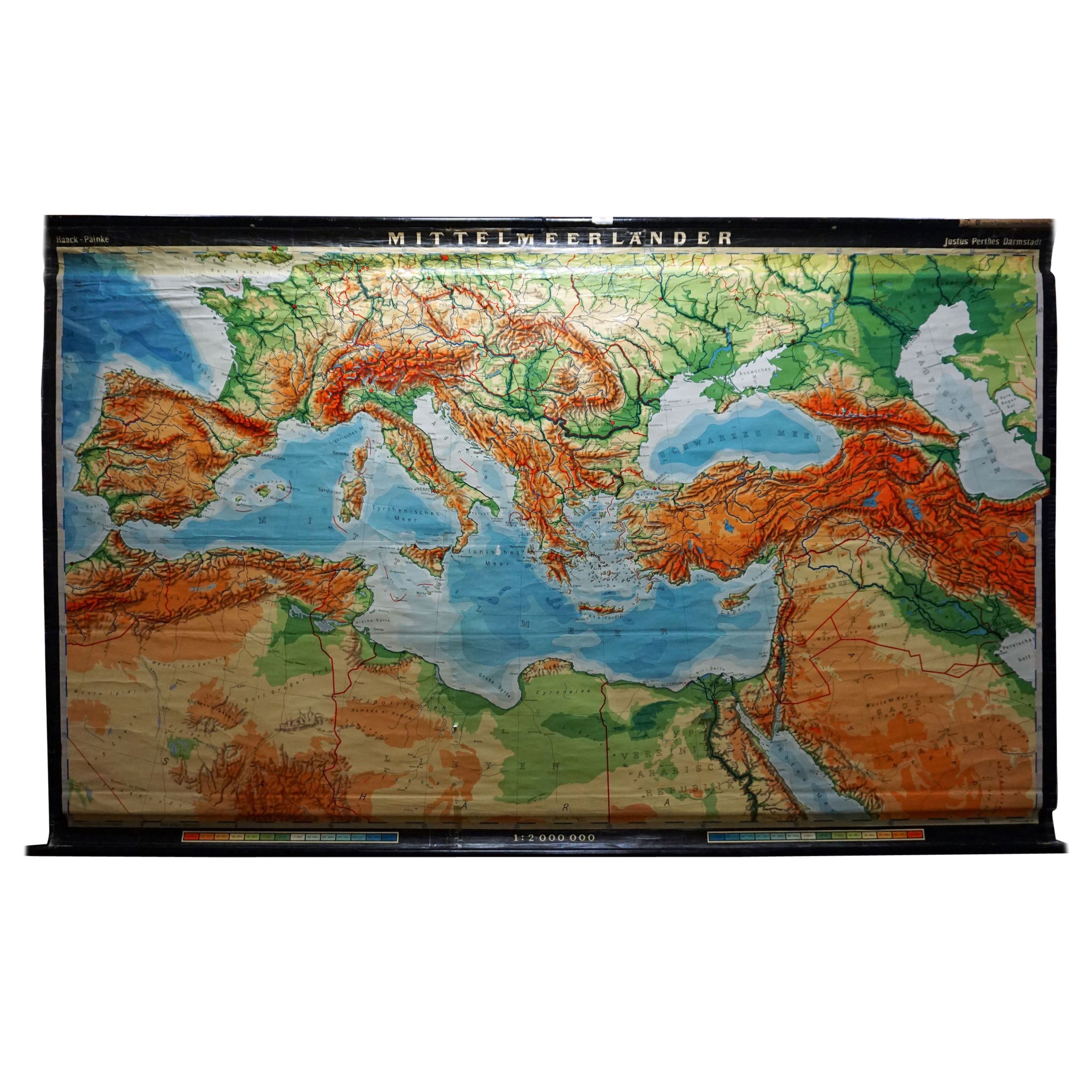
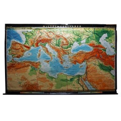
View AllVintage Rollable Map Mediterranean Countries Wall Chart Mural Poster
Located in Berghuelen, DE
A decorative countrycore pull-down map depiciting countries surrounding the Mediterranean sea, published by Haack-Painke, Justus-Perthes. Colorful print on paper reinforced with canvas.
Measurements:
Width 263,50 cm (103.74 inch)
Height 160 cm (62.99 inch)
The measurements shown refer just to the canvas and do not include the poles.
Background information on the history of school wall charts:
The idea to upgrade every day school life by using pictures...
Category
Vintage 1970s German Country Prints
Materials
Canvas, Wood, Paper
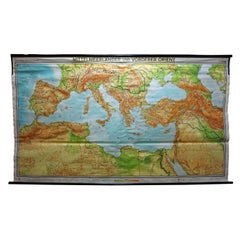
Vintage Mural Map Mediterranean Sea Near East Countries Rollable Wall Chart
Located in Berghuelen, DE
A large countrycore pull-down map showing the countries surrounding the Mediterranean Sea, published by Westermann. Colorful print on paper reinforced with canvas.
Measurements:
Width 269 cm (105.91 inch)
Height 149 cm (58.66 inch)
The measurements shown refer just to the canvas and do not include the poles.
Background information on the history of school wall charts:
The idea to upgrade every day school life by using pictures...
Category
Vintage 1970s German Country Prints
Materials
Canvas, Wood, Paper
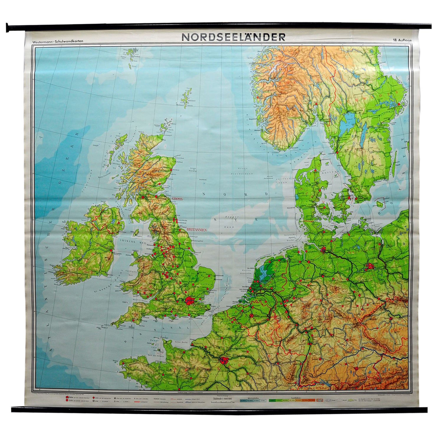
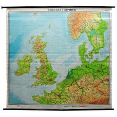
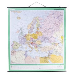
Great Britain Scandinavia Northern France Netherland Germany Mural Map
Located in Berghuelen, DE
The vintage pull-down cottagecore mural map illustrates the North Sea countries with Great Britain and Ireland, Scandinavia (Norway, Sweden, Denmark), Northern France, the Netherland...
Category
Vintage 1970s German Country Posters
Materials
Canvas, Wood, Paper
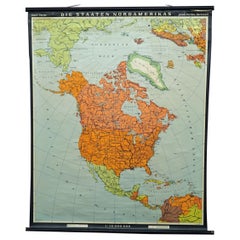
Vintage Map Wall Chart Countries of North America Rollable Mural Poster
Located in Berghuelen, DE
The vintage pull-down school map illustrates the countries / states of North America. Published by Haack-Painke Justus Perthes Darmstadt. Colorful print on paper reinforced with canv...
Category
Late 20th Century German Country Prints
Materials
Canvas, Wood, Paper
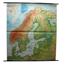
Vintage Rollable Mural Map Wall Chart Print Scandinavia Norway Sweden Finland
Located in Berghuelen, DE
A great impressive cottagecore map illustrating Scandinavia (Norway, Sweden, Finland, Denmark and bordering Baltic Sea countries). Colorful print on paper reinforced with canvas.
Mea...
Category
Mid-20th Century German Country Prints
Materials
Canvas, Wood, Paper
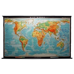
Vintage Mural World Map Earth Poster Pull-Down Wall Chart Poster Print
Located in Berghuelen, DE
A large decorative world map – named our earth, impressive wall chart decoration, published by Justus Perthes. Colorful print on paper reinforced with canvas.
Measurements:
Width 210 cm (82.68 inch)
Height 126,50cm (49.80 inch)
The measurements shown refer just to the canvas and do not include the poles.
Background information on the history of school wall charts:
The idea to upgrade every day school life by using pictures was supported in the late 18th century by Johann Bernhard Basedow. In 1774 he published a four-volume book "Elementarwerk" which combined pictures, text and information with merely hundred copperplates. Modern printing methods enabled the spread from rich private schools to rural grade schools. From 1820-1836 the oldest mentioned series of wall charts were published with the range of six booklets including 63 large sized charts...
Category
Vintage 1970s German Country Prints
Materials
Canvas, Wood, Paper
You May Also Like
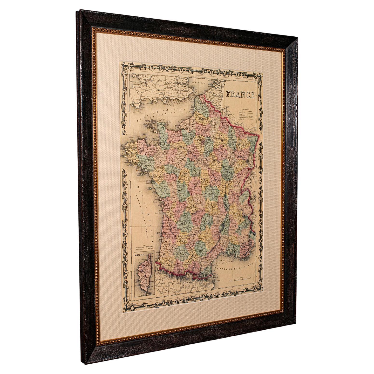
Large Vintage France Map, Continental, Historical Cartography, Late 20th Century
Located in Hele, Devon, GB
This is a large vintage map of France. A Continental, framed example of historical cartography, dating to the late 20th century, circa 1970.
Fas...
Category
Late 20th Century European Mid-Century Modern Prints
Materials
Glass, Wood, Paper

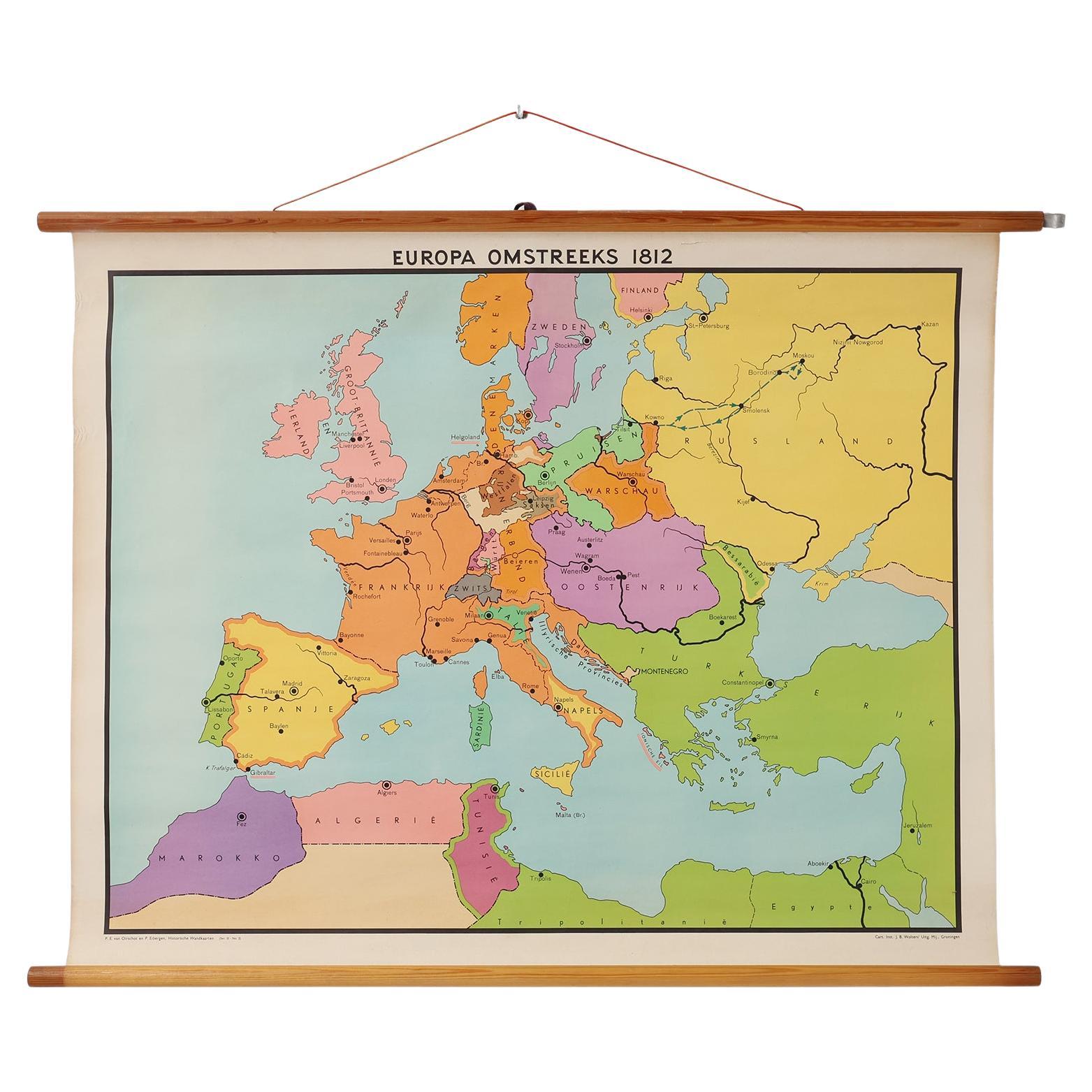
Vintage historical wall map of Europe around 1812, Belgium 1950s
Located in Meulebeke, BE
Belgium / 1950 / school map Europe 1812 / canvas, wood / Mid-century / vintage
Beautiful vintage wall-mounted historical map of Europe around 1812, designed by Inst. J.B. Wolters Mi...
Category
Vintage 1950s Belgian Mid-Century Modern Posters
Materials
Canvas, Wood

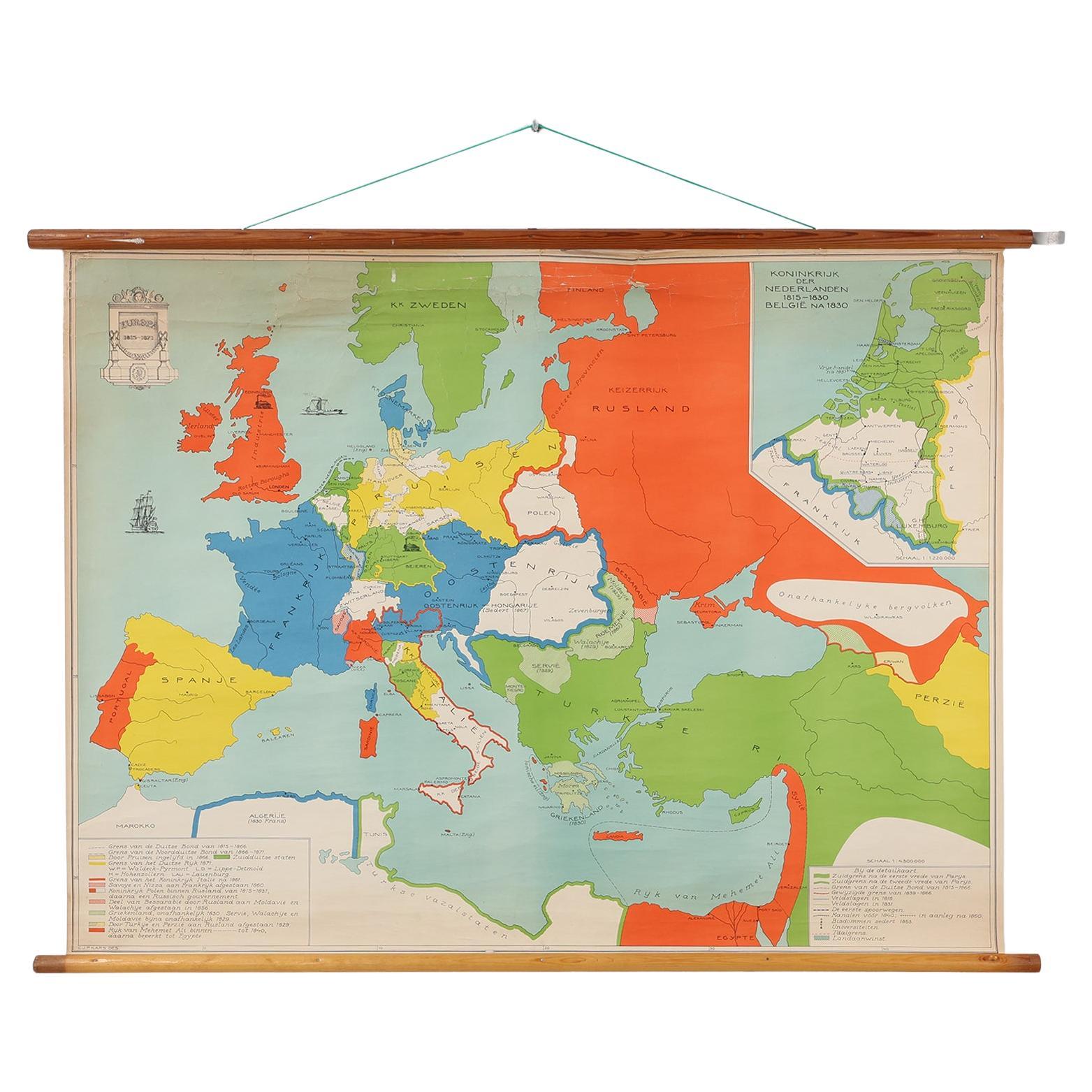
Vintage school wall map of Europe 1815-1871, Belgium 1950s
Located in Meulebeke, BE
Belgium / 1950 / school map Europe 1815-1871 / canvas, wood / Mid-century / vintage
Vintage school map of Europe between 1815 and 1871, designed by C.J.P. Kars in the 1950s. Manufac...
Category
Vintage 1950s Belgian Mid-Century Modern Posters
Materials
Canvas, Wood

Antique Map of France
Located in Dallas, TX
Nice antique map of France in wood frame. This would make a great gift for a collector. A wonderful accessory!
Category
Early 20th Century Decorative Art
Materials
Glass, Wood, Paper

$1,760
Late 20th Century Educational Geographic Map - European Countries
Located in Hook, Hampshire
Late 20th Century Educational Geographic Map – European Countries
Late 20th Century Educational Geographic Map – European Countries. Good quality roll up s...
Category
Late 20th Century Czech Posters
Materials
Cotton
Map of Europe
Located in Los Angeles, CA
28 cities capitol drawings around the border of this Europe political map.
Category
Vintage 1950s Italian Mid-Century Modern Prints
$500