Items Similar to Vintage "View of the Center of Paris Taken from the Air" Lithograph Map

Want more images or videos?
Request additional images or videos from the seller
1 of 19
Vintage "View of the Center of Paris Taken from the Air" Lithograph Map
About the Item
A very stylish "View of the Center of Paris Taken from the Air" lithograph map published by the Paris Ministry of Tourism, circa early 1950s. The piece measures 27" x 43" and shows a detailed aerial view of central Paris and all the historical sights. The map is in good vintage condition with some pin holes in the corners and some small creases; it is mounted to a stiff board backing and would frame nicely. A very cool and rare map that would look great in any room! #2729
- Dimensions:Height: 43 in (109.22 cm)Width: 27 in (68.58 cm)Depth: 0.25 in (6.35 mm)
- Style:Mid-Century Modern (Of the Period)
- Materials and Techniques:
- Place of Origin:
- Period:
- Date of Manufacture:1950s
- Condition:Wear consistent with age and use. Minor losses. The map is in good vintage condition with some pin holes in the corners and some small creases; it is mounted to a stiff board backing.
- Seller Location:San Diego, CA
- Reference Number:Seller: #27291stDibs: LU936632022062
About the Seller
4.9
Platinum Seller
Premium sellers with a 4.7+ rating and 24-hour response times
Established in 2000
1stDibs seller since 2012
4,042 sales on 1stDibs
Typical response time: <1 hour
- ShippingRetrieving quote...Shipping from: San Diego, CA
- Return Policy
Authenticity Guarantee
In the unlikely event there’s an issue with an item’s authenticity, contact us within 1 year for a full refund. DetailsMoney-Back Guarantee
If your item is not as described, is damaged in transit, or does not arrive, contact us within 7 days for a full refund. Details24-Hour Cancellation
You have a 24-hour grace period in which to reconsider your purchase, with no questions asked.Vetted Professional Sellers
Our world-class sellers must adhere to strict standards for service and quality, maintaining the integrity of our listings.Price-Match Guarantee
If you find that a seller listed the same item for a lower price elsewhere, we’ll match it.Trusted Global Delivery
Our best-in-class carrier network provides specialized shipping options worldwide, including custom delivery.More From This Seller
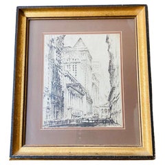
View AllVintage Lithograph of the New York Stock Exchange
By John Haymson
Located in San Diego, CA
Beautiful vintage framed lithograph of the New York Stock Exchange. This piece is evocative and beautiful. This piece was originally provided...
Category
Mid-20th Century American Mid-Century Modern Prints
Materials
Paper
$388 Sale Price
20% Off
"Office at Night" from Walker Art Center Lithograph / Poster by Edward Hopper
By Edward Hopper 1
Located in San Diego, CA
A very hard to find "Office at Night (1940)" lithograph / poster by Edward Hopper from The Walker Art Center, circa 1981. The lithograph is in very good vintage condition with strong...
Category
Antique Mid-19th Century American Prints
Materials
Paper

$300 Sale Price
20% Off
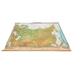
Massive Vintage Wall Map of the Soviet Union 'Sowjetunion' by Karl Wenschow
By Denoyer-Geppert
Located in San Diego, CA
A massive vintage wall map of the Soviet Union (Sowjetunion) published by Karl Wenschow in Munich, Germany, circa 1950s. The map was distributed by De...
Category
Mid-20th Century American Maps
Materials
Paper, Wood
$540 Sale Price
20% Off
Vintage U.S. Air Force Sterling Silver Pilot Air Wings Shirt Pin
Located in San Diego, CA
A very nice mid-century U.S. Air Force sterling silver pilot air wings shirt pin, circa 1940s. The piece is in very good vintage condition with a nice patina and measures 3"W x .75"D...
Category
Mid-20th Century American Mid-Century Modern Aviation Objects
Materials
Sterling Silver

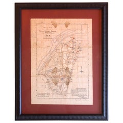
Antique Map of the Royal Botanic Garden & Arboretum Kew in London, England
Located in San Diego, CA
A very nice antique map of the Royal Botanic Garden & Arboretum in London, England, circa 1880s. The map itself measures 12" x 16" and is professionall...
Category
Antique Late 19th Century English Prints
Materials
Paper
$900 Sale Price
25% Off
"L'Ile Verte" from Poesies Antillaises Lithograph by Henri Matisse
By Henri Matisse
Located in San Diego, CA
Gorgeous "L'Ile Verte" (Green Island) from Poesies Antillaises lithograph by Henri Matisse, circa 1972. Excellent fresh impression on pale cream wove Arches paper with bistre ink, un...
Category
20th Century French Mid-Century Modern Prints
Materials
Paper

$4,000 Sale Price
20% Off
You May Also Like
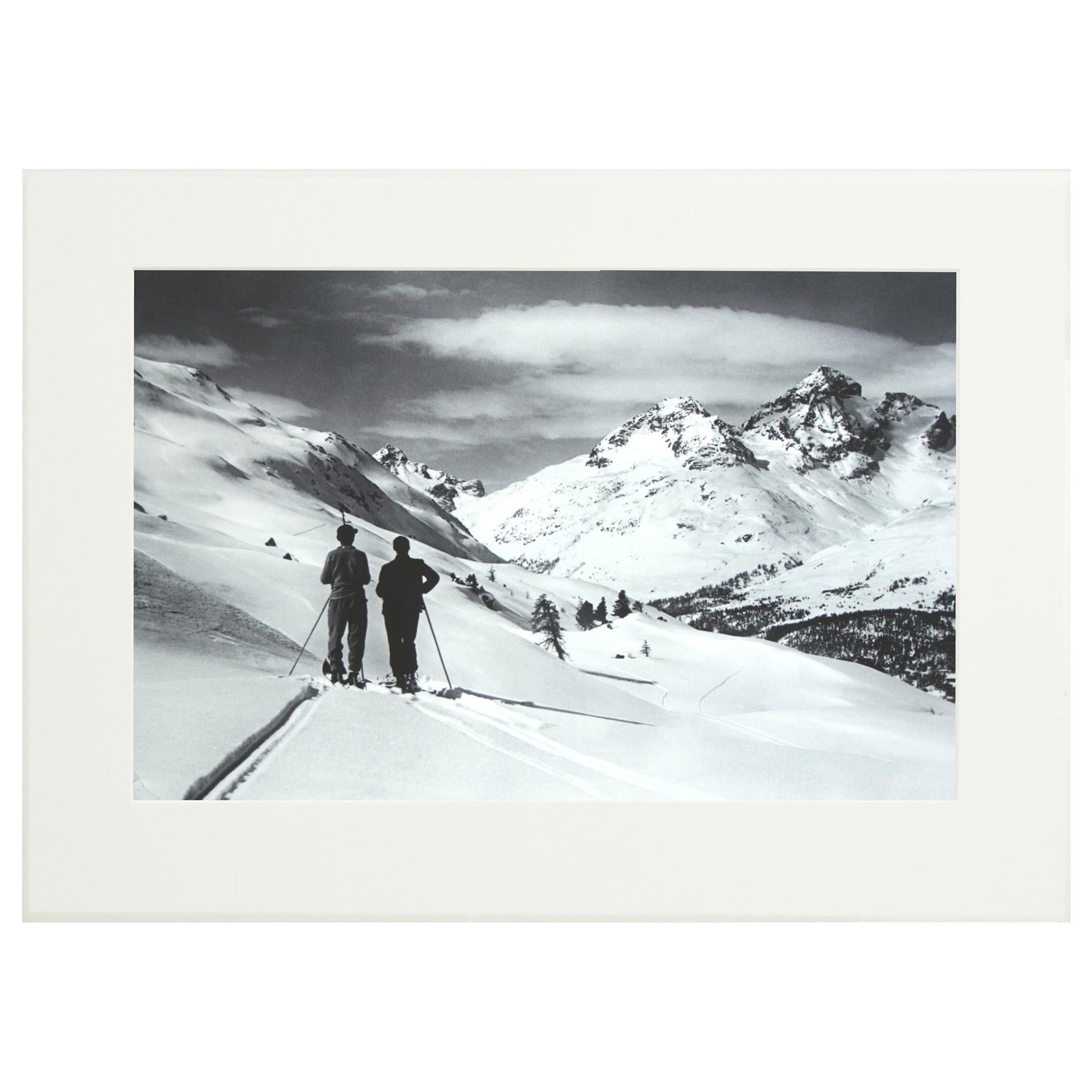
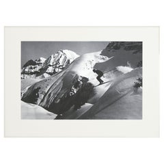
Alpine Ski Photograph, 'Panoramic View', Taken from Original 1930s Photograph
Located in Oxfordshire, GB
Vintage, antique Alpine Ski photograph.
'Panoramic View', a new mounted black and white photographic image after an original 1930s skiing photograph. Black and white alpine photos are the perfect addition to any home or ski lodge, so please do check out our other ski photos...
Category
Vintage 1930s English Sporting Art Sports Equipment and Memorabilia
Materials
Paper

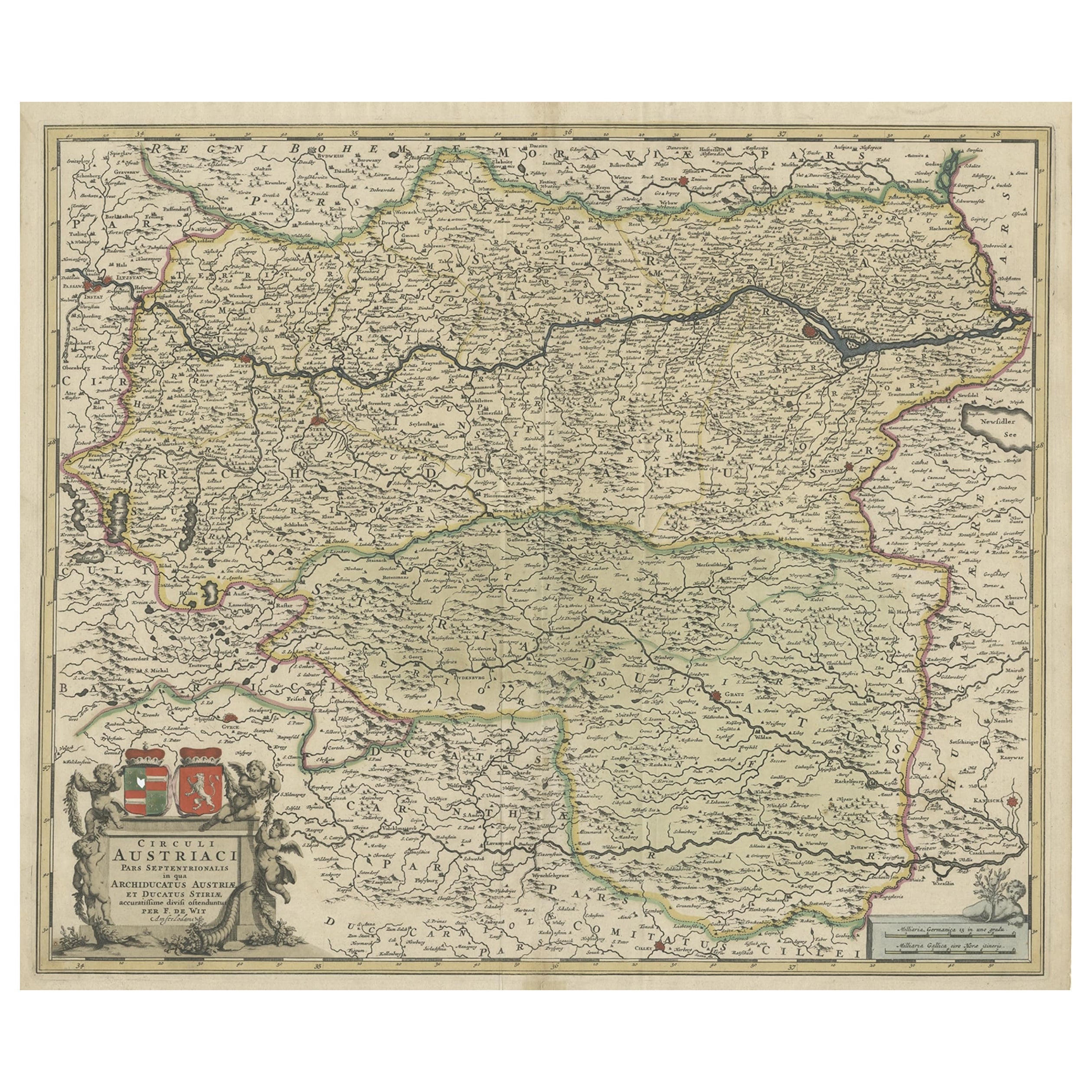
Antique Map of Austria, Centered Around the Danube from Passau to Vienna, C.1690
Located in Langweer, NL
Antique map of Austria titled 'Circuli Austriaci pars septentrionalis in quia archiducatus Austriae et Ducatus Stiriae accuratissime divisi ostenduntur per F. de Wit'.
Detailed m...
Category
Antique 1690s Maps
Materials
Paper
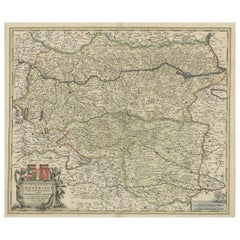
$1,250 Sale Price
20% Off
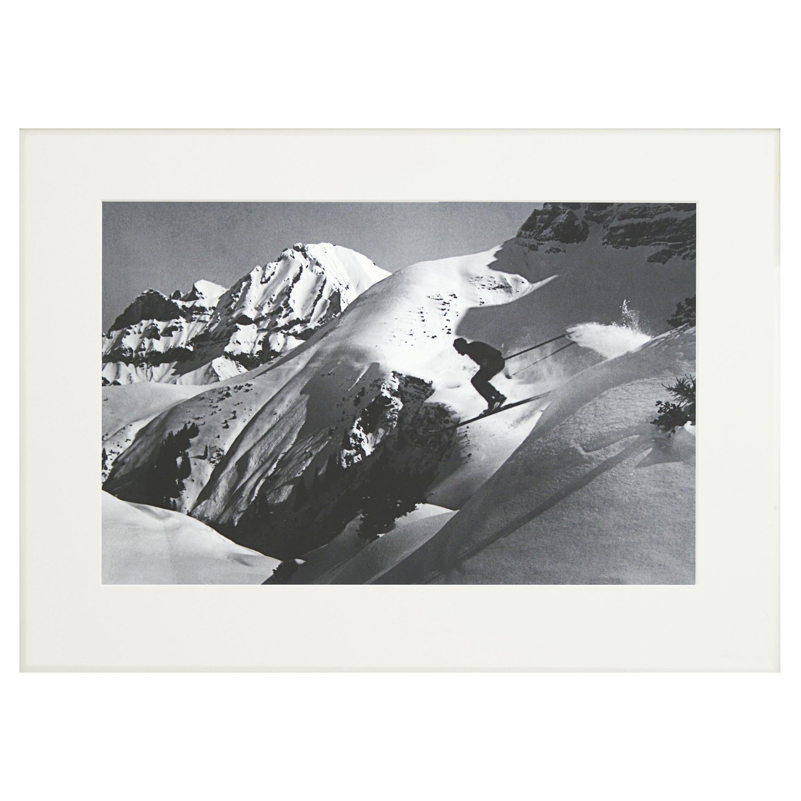
Alpine Ski Photograph, 'THE JUMP' Taken from 1930s Original
Located in Oxfordshire, GB
Vintage, Alpine Ski photograph.
'THE JUMP', a new mounted black and white photographic image after an original 1930s skiing photograph. Prior to being a recreational activity skiing was purely a means of travelling from A to B through the snow, it only started to become the sport it is today in the mid-1800s. The price displayed is for the mounted photo only.
Image size 25.5cm x 40cm = 10 X 15 ½" ".
The alpine photograph...
Category
Vintage 1930s English Sporting Art Sports Equipment and Memorabilia
Materials
Paper
Antique Map Showing the Distribution of the Currents of Air by Johnston '1850'
Located in Langweer, NL
Antique map titled 'Geographical Distribution of the Currents of Air'. Original antique map showing the distribution of the currents of air. This map originates from 'The Physical At...
Category
Antique Mid-19th Century Maps
Materials
Paper

$185 Sale Price
20% Off
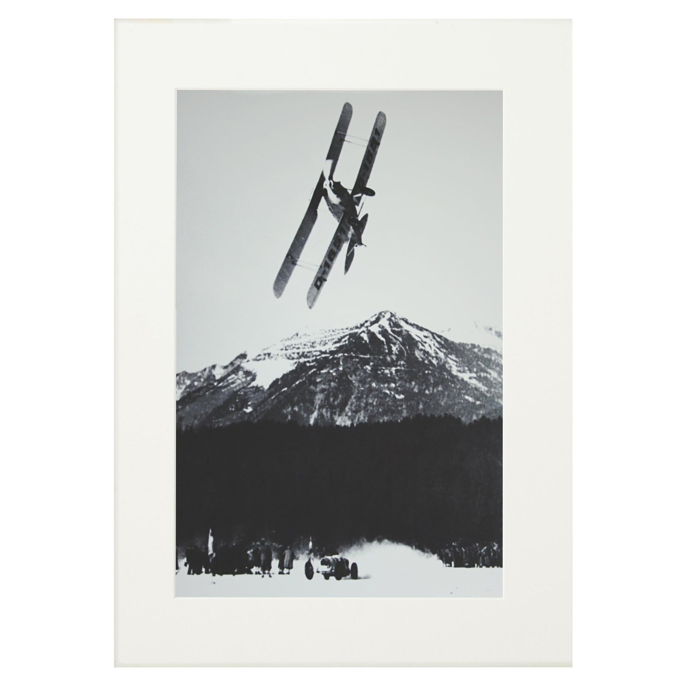
Alpine Ski Photograph, 'The Race' Taken from Original 1930s Photograph
Located in Oxfordshire, GB
Alpine Ski photograph.
'The Race', a new mounted black and white photographic image after an original 1930s photograph. Black & white alpine photos are the perfect addition to any home or ski lodge, so please do check out our other ski photos and winter landscapes. The photo is showing a biplane racing a car on a frozen lake. This amazing photograph was taken in Grainau, a small town in Bavaria, at the foot of Germany's highest mountain, the Zugspitze.
The pilot is General Ernst Udet - the World War I flying ace...
Category
Vintage 1930s British Sporting Art Sports Equipment and Memorabilia
Materials
Paper

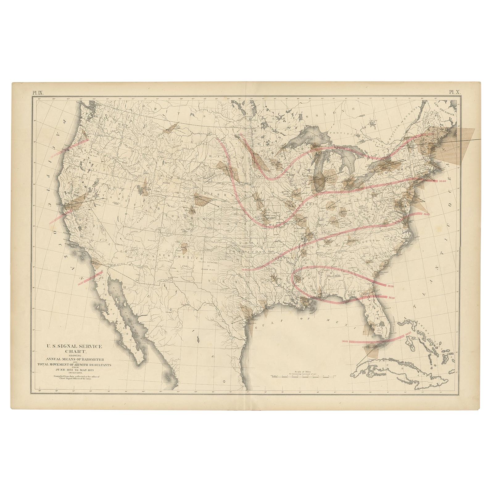
Pl. 9 Antique Map of the Air Movement of the United States by Walker '1874'
Located in Langweer, NL
Antique map titled 'U.S. Signal Service chart, showing annual means of barometer and total movement of air with resultants from June 1872 to May 1873 inclusive. Compiled from data co...
Category
Antique Late 19th Century Maps
Materials
Paper
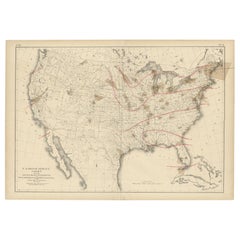
$462 Sale Price
20% Off