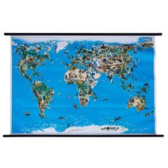
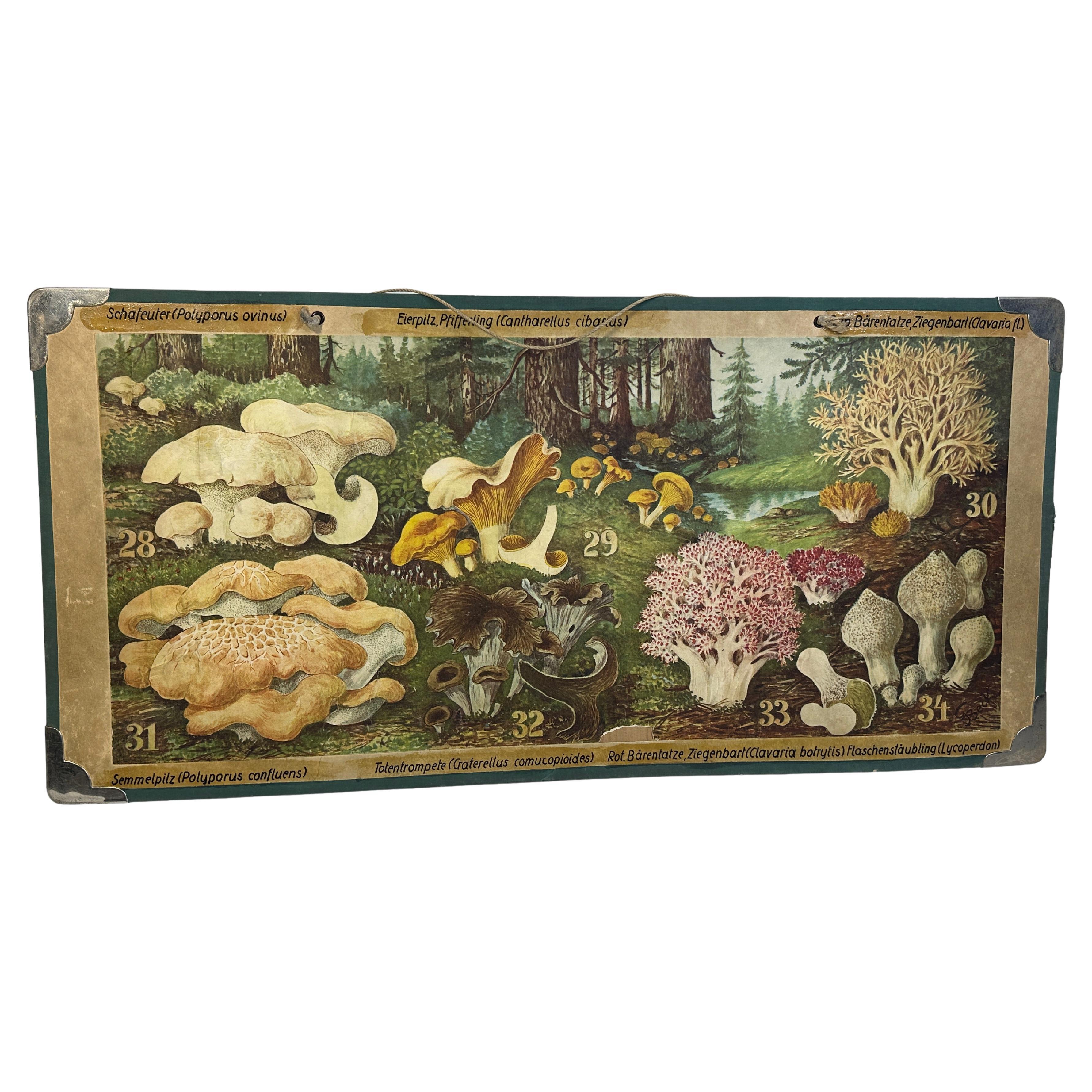
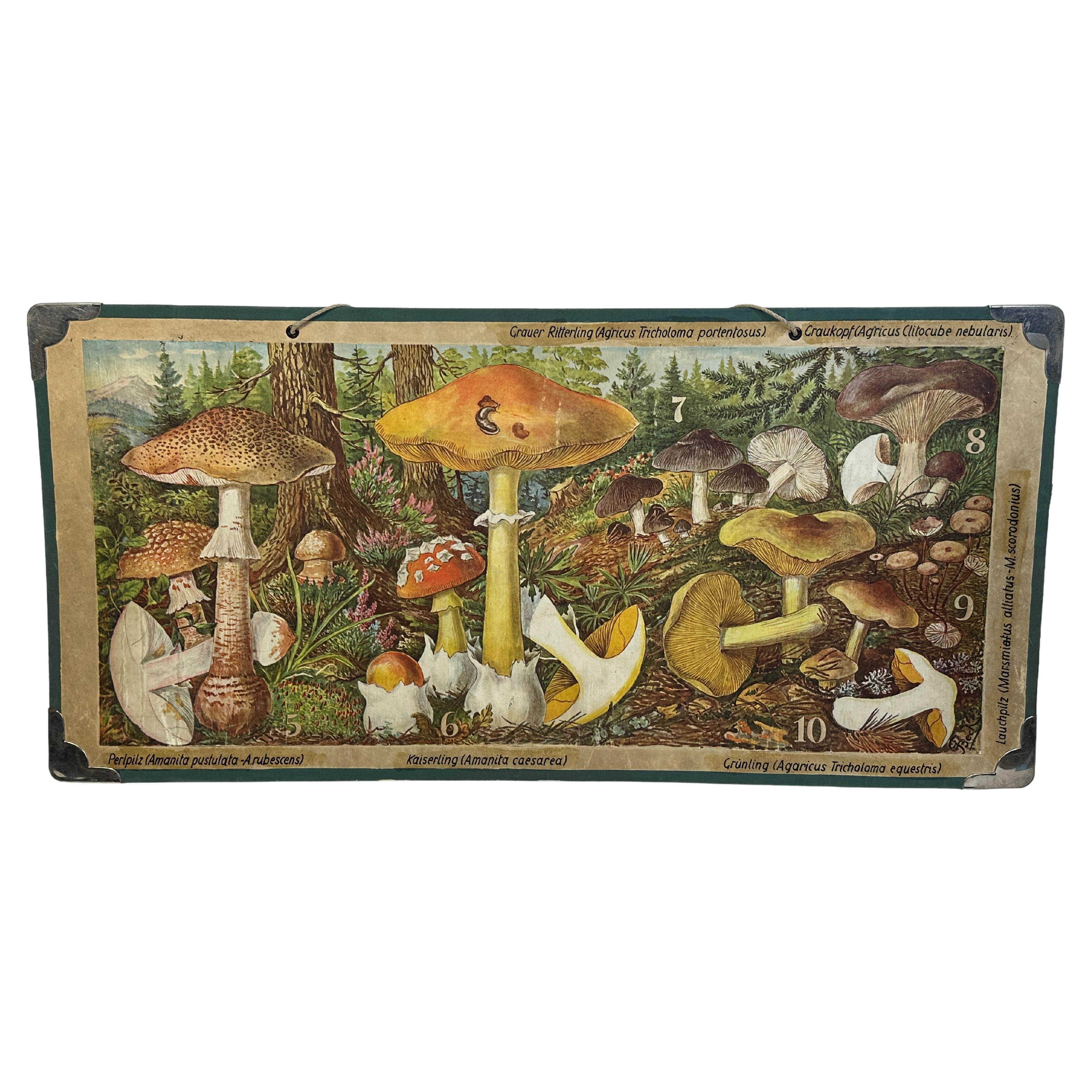
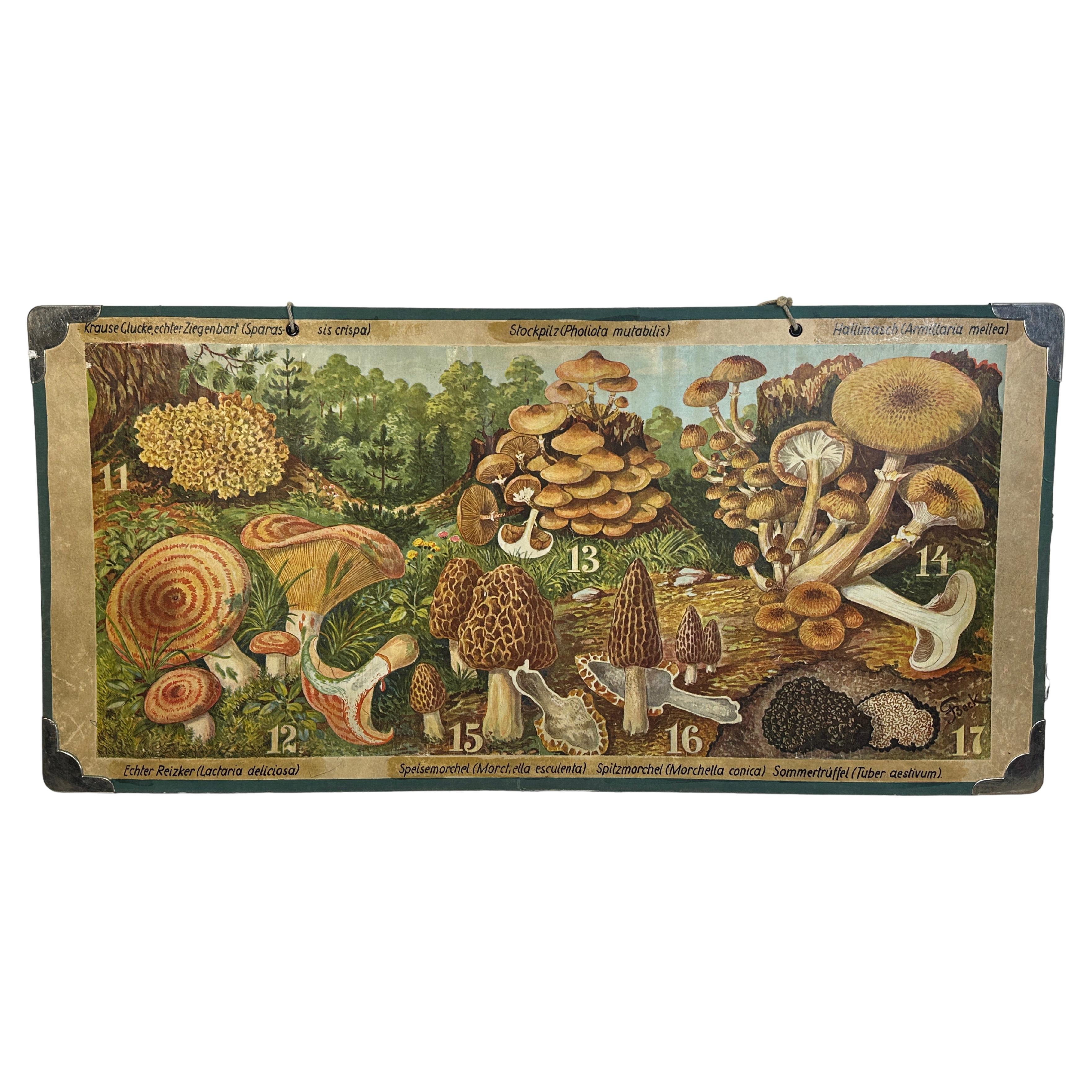
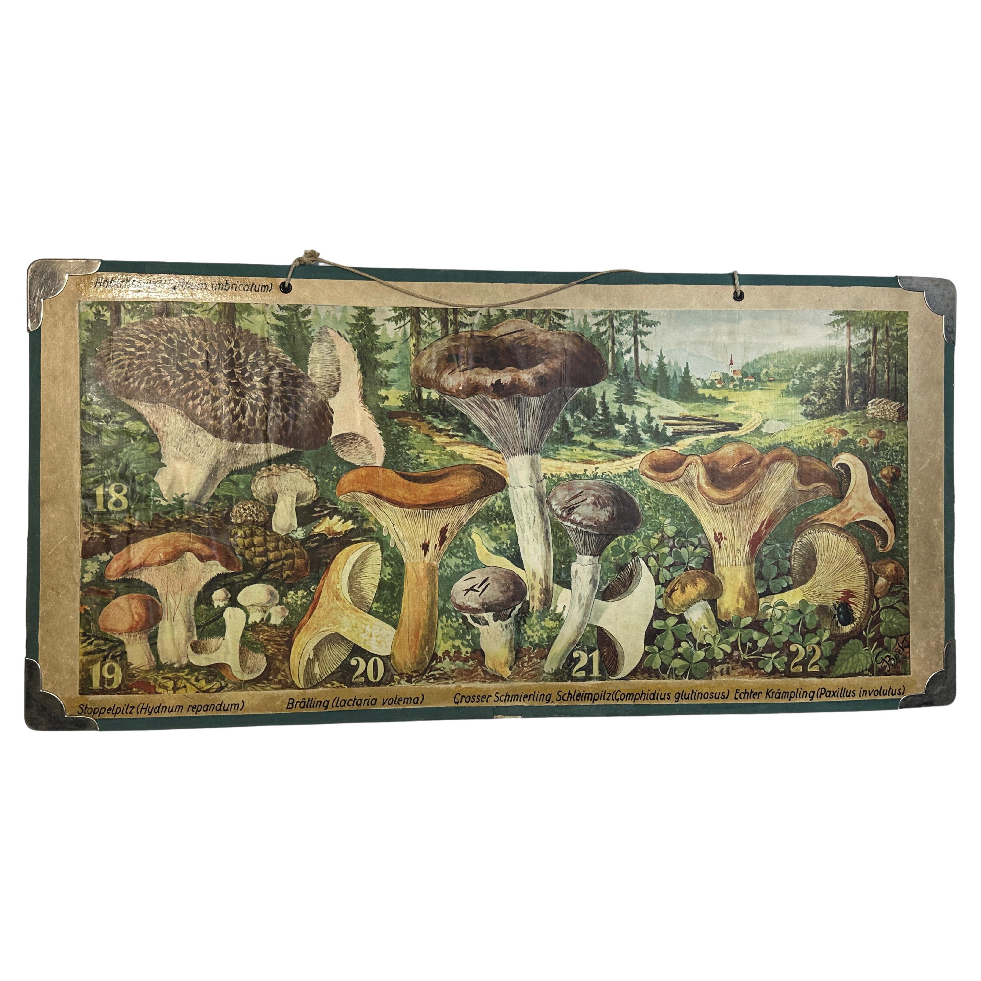
Wall Chart, Animals of the World, 1964, Published by Westermann, Germany
View Similar Items

1 of 10
Wall Chart, Animals of the World, 1964, Published by Westermann, Germany
About the Item
- Creator:Westermann (Maker)
- Dimensions:Height: 51.19 in (130 cm)Width: 81.11 in (206 cm)Depth: 0.12 in (3 mm)
- Style:Other (Of the Period)
- Materials and Techniques:
- Place of Origin:
- Period:
- Date of Manufacture:1964
- Condition:Wear consistent with age and use.
- Seller Location:St. Margarethen, AT
- Reference Number:1stDibs: LU229135994983
Authenticity Guarantee
In the unlikely event there’s an issue with an item’s authenticity, contact us within 1 year for a full refund. DetailsMoney-Back Guarantee
If your item is not as described, is damaged in transit, or does not arrive, contact us within 7 days for a full refund. Details24-Hour Cancellation
You have a 24-hour grace period in which to reconsider your purchase, with no questions asked.Vetted Professional Sellers
Our world-class sellers must adhere to strict standards for service and quality, maintaining the integrity of our listings.Price-Match Guarantee
If you find that a seller listed the same item for a lower price elsewhere, we’ll match it.Trusted Global Delivery
Our best-in-class carrier network provides specialized shipping options worldwide, including custom delivery.You May Also Like
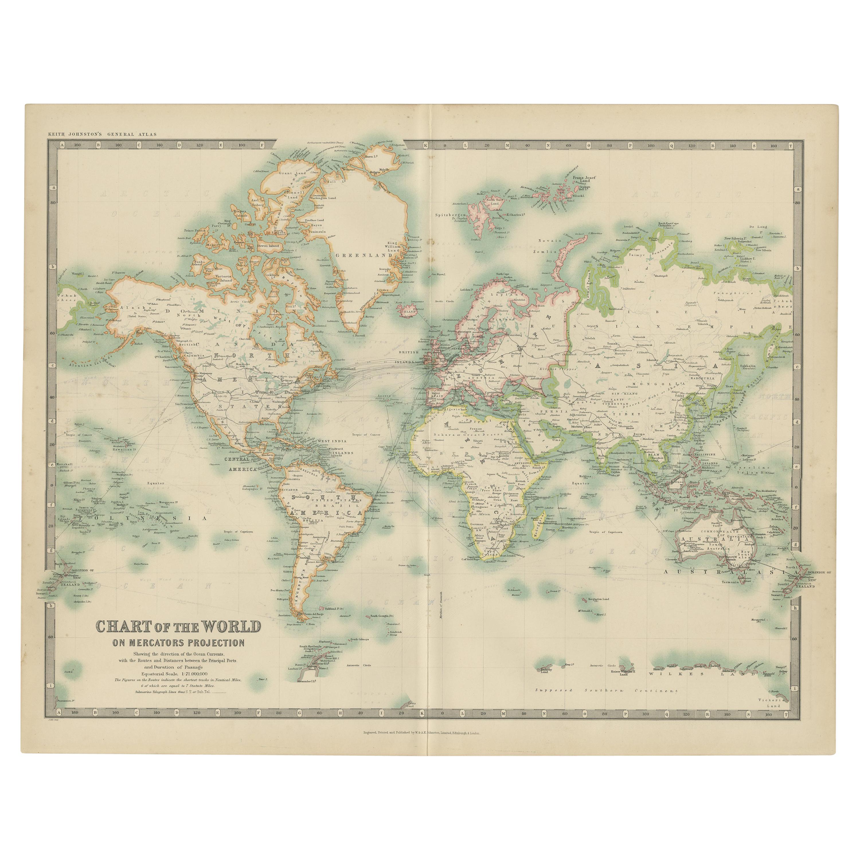
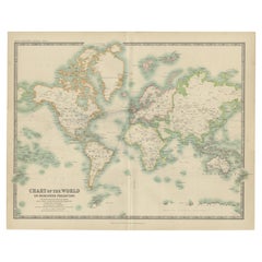
Antique Chart of the World by Johnston '1909'
Located in Langweer, NL
Antique map titled 'Chart of the World on Mercator's Projection Showing the directions of the Oceans Currents with the Routes and Distances Between Principal Ports'. Detailed map of ...
Category
Early 20th Century Maps
Materials
Paper
$275 Sale Price
20% Off
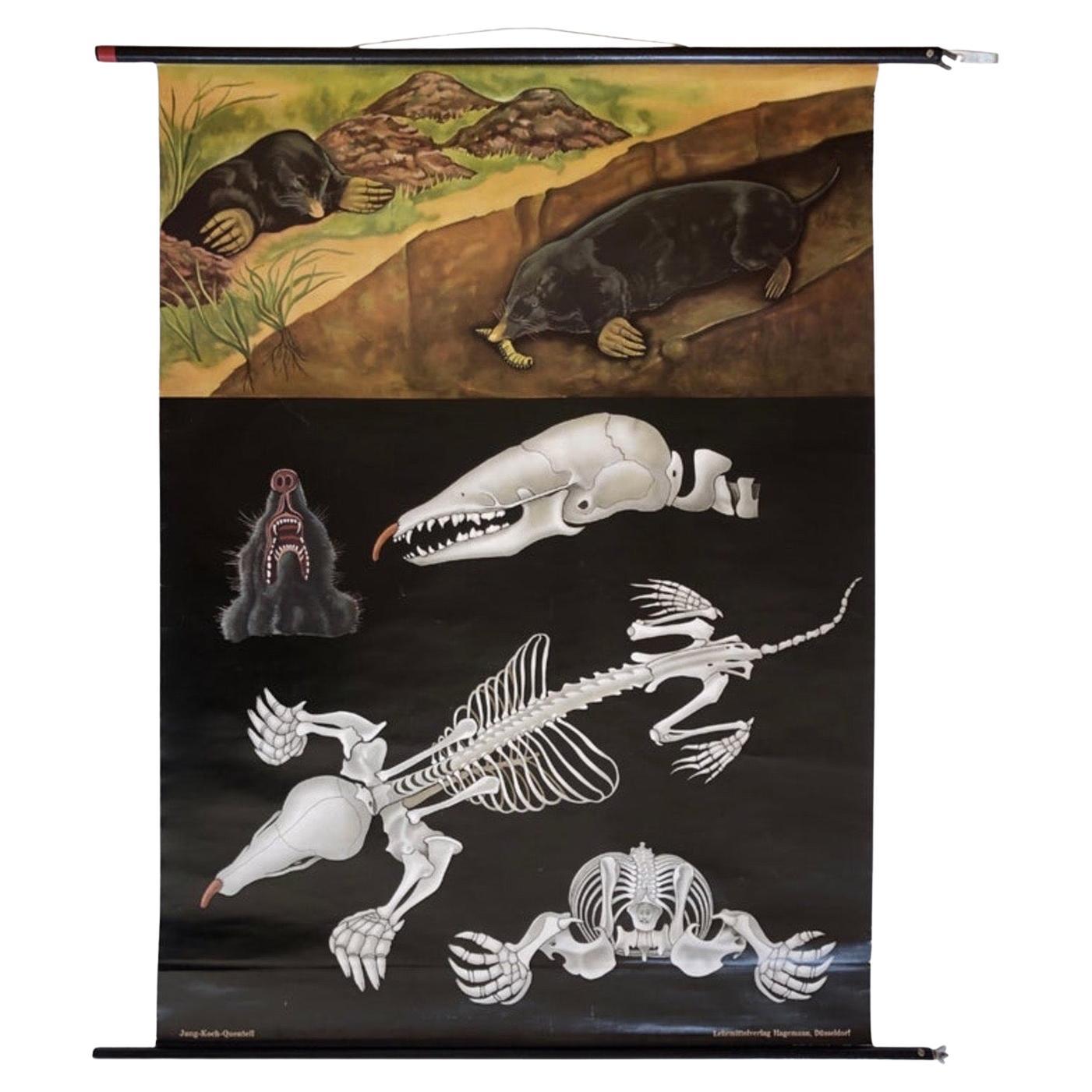
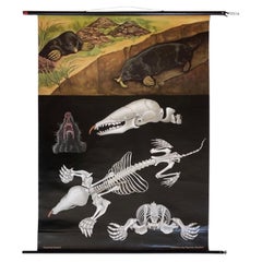
Large Animal Print School Wall Chart of Mole, 1960's, Germany, Vintage
Located in Andernach, DE
Decorative vintage and original school wall chart, made in Germany in the 1960s.
Featuring the mole (latin Talpa europaea europaea) in it's usual looks and habitat, skeleton, skull ...
Category
Mid-20th Century German Mid-Century Modern Prints
Materials
Pine, Paper
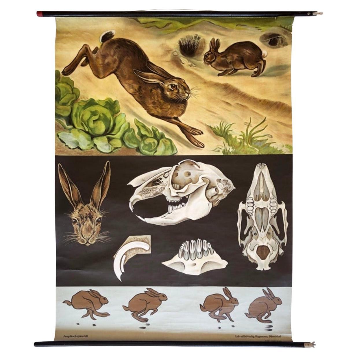
Large Vintage Print of Animal Imagery School Wall Chart of Rabbit 1960's Germany
Located in Andernach, DE
Very decorative antique original German school wall chart, made in Germany 1967.
Featuring the ''common'' wild rabbit (latin Lepus Europaeus) as it runs, bone structure, footprints....
Category
Mid-20th Century German Mid-Century Modern Prints
Materials
Pine, Paper

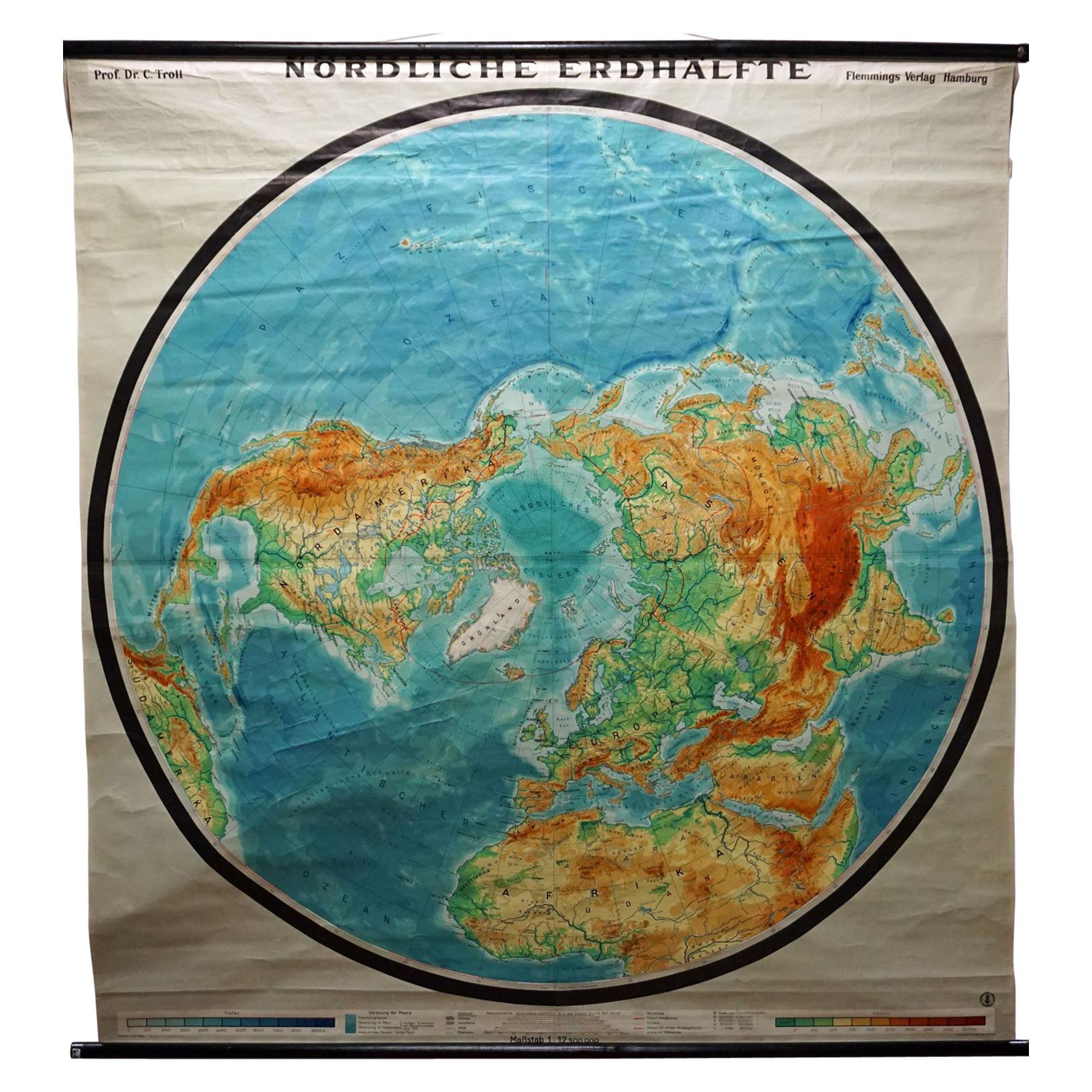
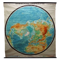
Northern Hemisphere of the Earth Rollable Map Vintage Wall Chart World Mural
Located in Berghuelen, DE
A great pull-down map or vintage wall chart illustrating the northern hemisphere of the earth. Published by Prof. Dr. C. Troll, Flemmings Verlag Ha...
Category
Mid-20th Century German Country Prints
Materials
Canvas, Wood, Paper
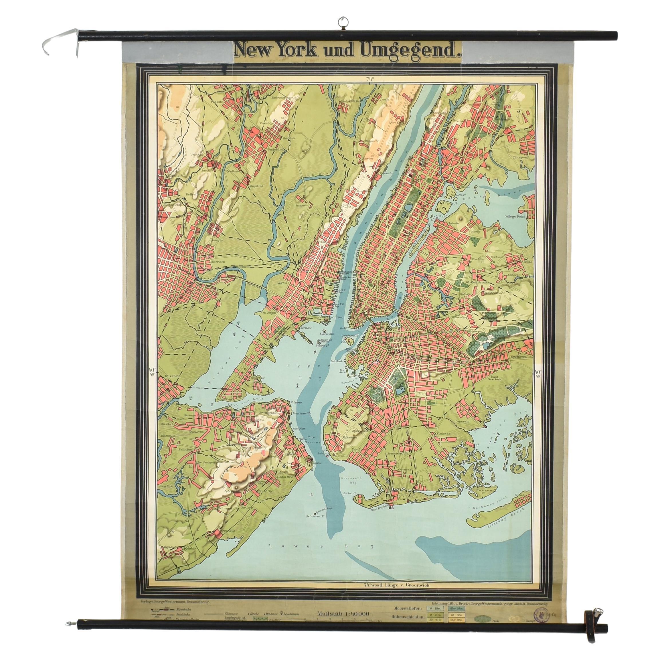
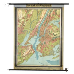
Antique New York Wall Map by Westermann
By Westermann
Located in Stockbridge, GB
Antique New York Map By Westermann
A rare early school pull down wall map of New York. The map shows the city of New York and its suburbs. Prin...
Category
Mid-20th Century British Schoolhouse Posters
Materials
Canvas, Wood
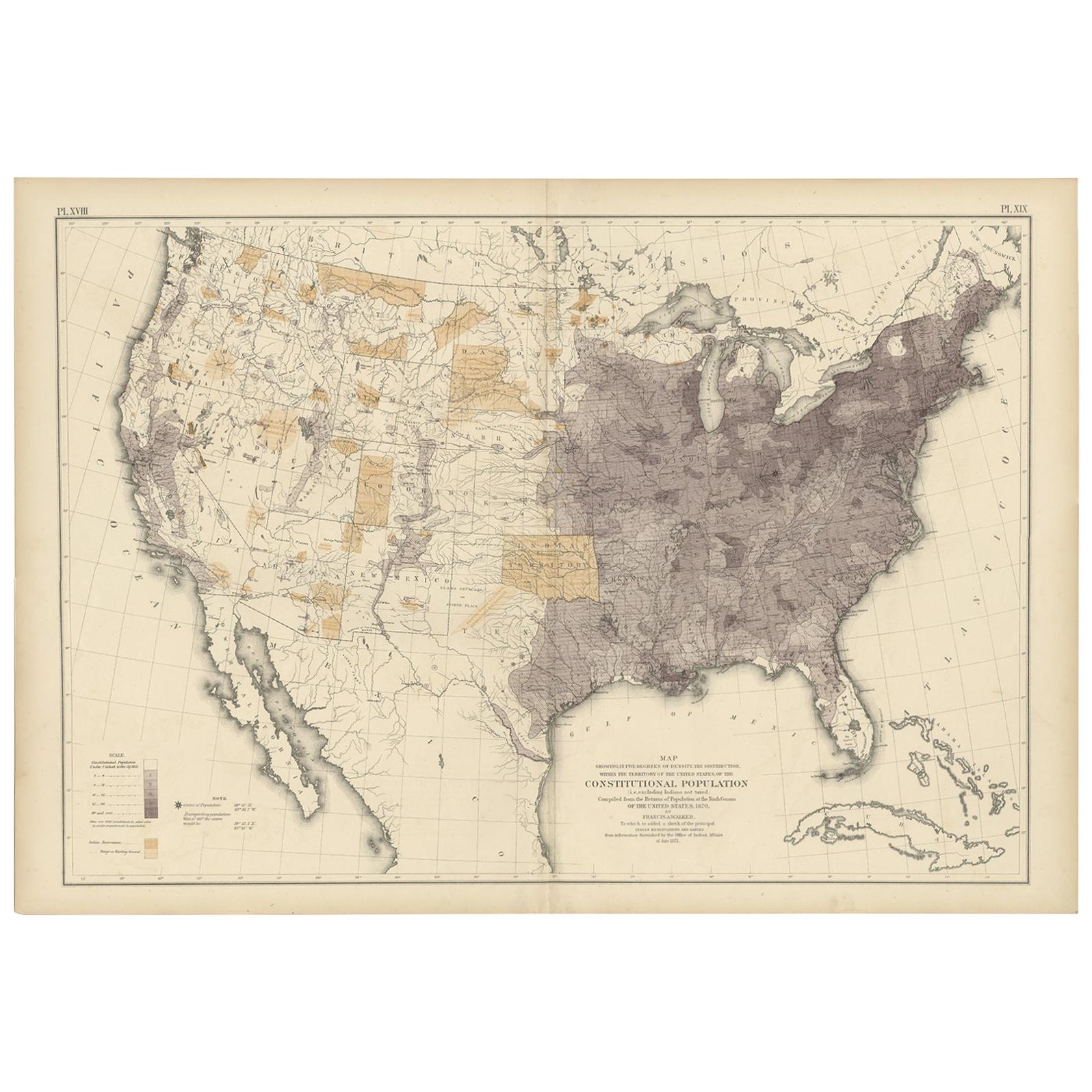
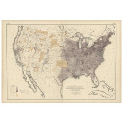
Antique Chart of the US Population in 1870, published in 1874
Located in Langweer, NL
Antique chart titled 'Map showing, in five degrees of density, the distribution, within the territory of the United States, of the constitutional population, i.e., excluding Indians ...
Category
Antique Late 19th Century Maps
Materials
Paper
$826 Sale Price
20% Off