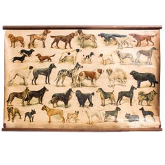
Wall Chart, Breed of Dogs, Educational Chart, 1918
View Similar Items


1 of 1
Wall Chart, Breed of Dogs, Educational Chart, 1918
About the Item
- Dimensions:Height: 25.99 in (66 cm)Width: 38.19 in (97 cm)Depth: 0.04 in (1 mm)
- Materials and Techniques:
- Place of Origin:
- Period:1910-1919
- Date of Manufacture:1918
- Condition:Wear consistent with age and use. Minor structural damages.
- Seller Location:St. Margarethen, AT
- Reference Number:1stDibs: LU229138239213
You May Also Like
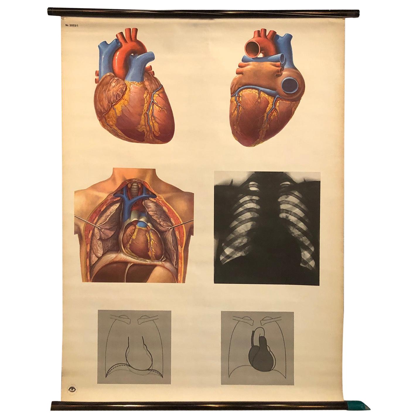
- German Educational Heart Anatomy ChartLocated in Brooklyn, NYGerman, educational, anatomical, roll-up, chart depicting the heart, Das Herz from the Deutsches Hygiene Museum, Dresden is printed on canvas backed paper on copper colored hollow st...Category
Mid-20th Century German Industrial Prints
MaterialsMetal
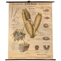
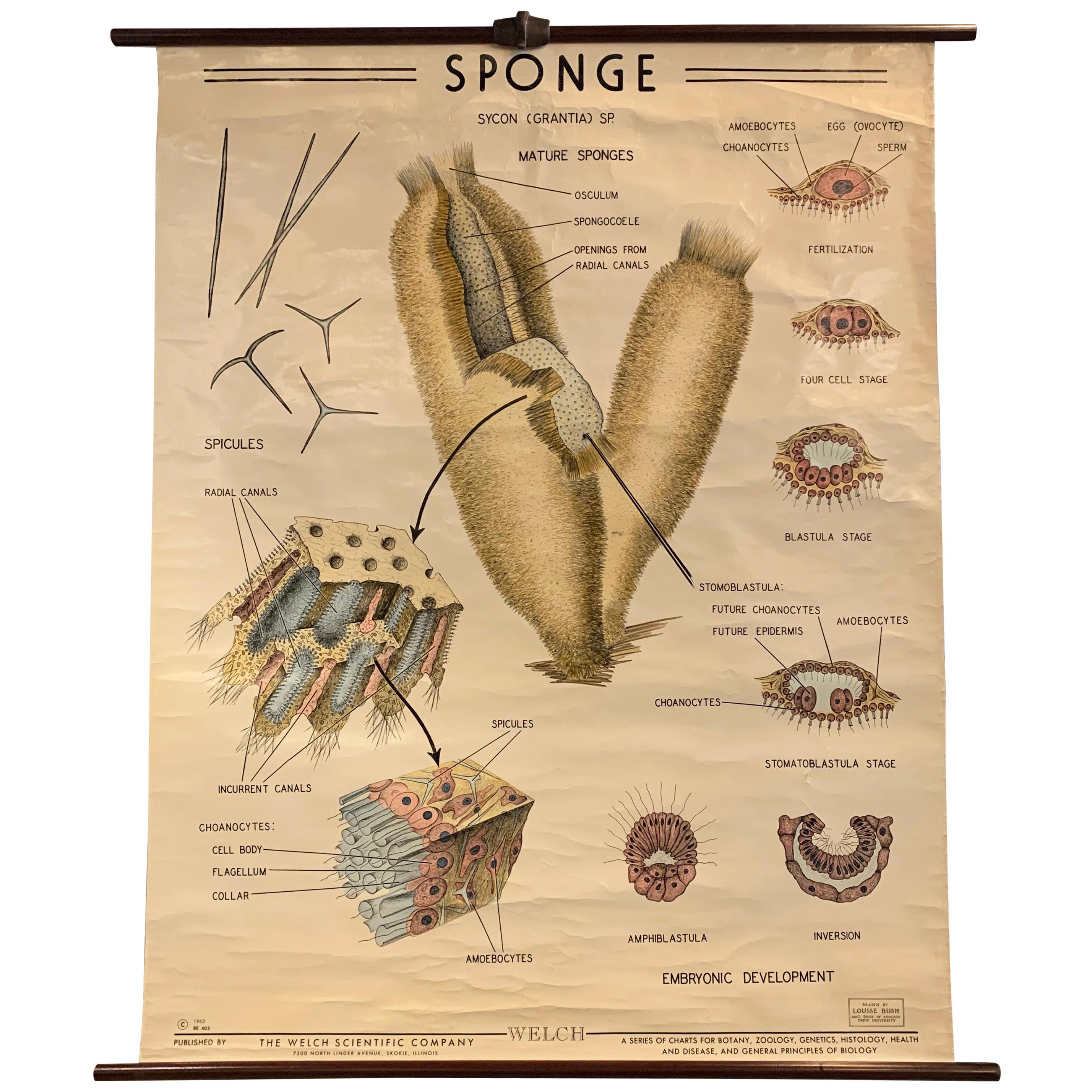
- Educational Zoological Marine Sponge Wall Chart, The Welch Scientific CompanyBy Sargent Welch Scientific CompanyLocated in Brooklyn, NYEducational, scientific, zoological, wall chart depicting the anatomy of marine sponges beautifully illustrated by Louise Bush, Assistant Professor of Zoology, Drew University for Th...Category
Mid-20th Century American Industrial Prints
MaterialsCanvas, Wood
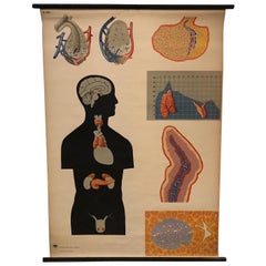
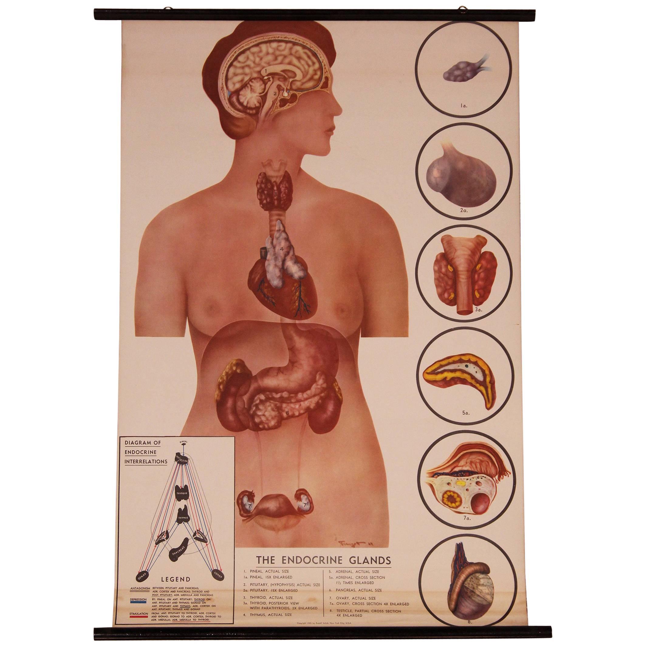
- German Anatomical Educational Endocrine System ChartLocated in Brooklyn, NYGerman, educational, anatomical, roll-up chart depicting glands of the human endocrine system from the Deutsches Hygiene Museum, Dresden is printed on canvas backed paper on hollow s...Category
Mid-20th Century German Industrial Prints
MaterialsCanvas, Wood
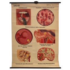
- German Educational Anatomical Sepsis Study ChartLocated in Brooklyn, NYGerman, educational, anatomical, roll-up, chart Sepsis II Medical Study chart the depicting the stages of the bacterial infection is printed on canvas backed paper with maple rods wi...Category
Mid-20th Century German Industrial Prints
MaterialsCanvas, Maple
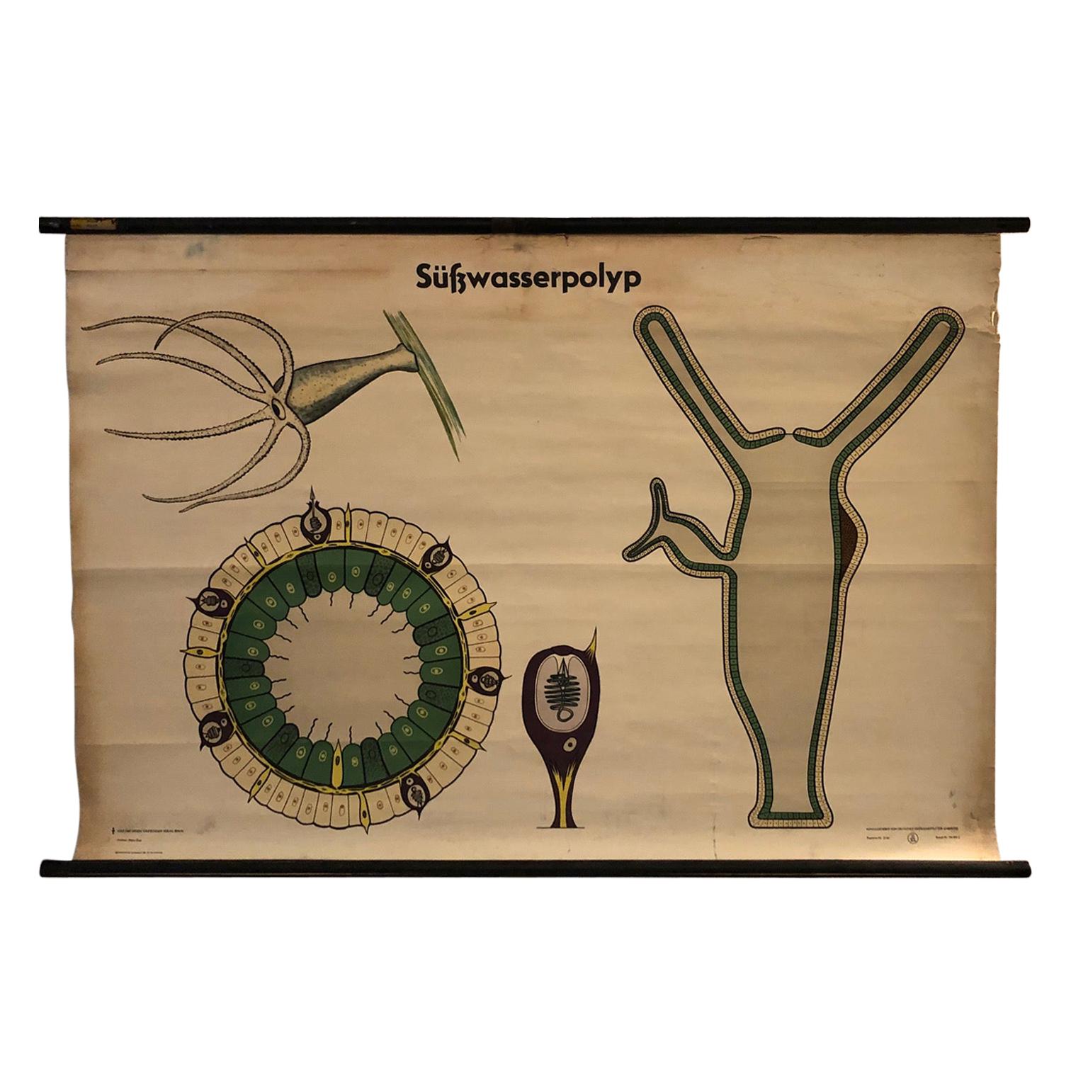
- German Educational Zoological Freshwater Polyp ChartLocated in Brooklyn, NYGerman, educational, zoological, roll-up chart depicting the süßwasserpolyp hydra or freshwater polyp is printed on canvas backed paper with .75 inch diameter painted wooden dowels w...Category
Mid-20th Century German Industrial Prints
MaterialsCanvas, Maple
- Large Sea Chart of the British Islands, 1918Located in Langweer, NLAntique map titled 'The British Islands'. Large sea chart of the British Islands. It shows Ireland, Scotland, England, the Shetland Islands and part of Fra...Category
Vintage 1910s Maps
MaterialsPaper
 $492 Sale Price20% Off