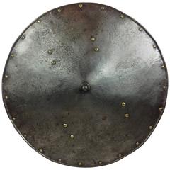
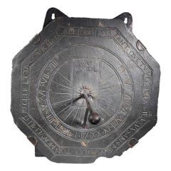
Large Engraved 17th Century European Shield
View Similar Items


1 of 8
Large Engraved 17th Century European Shield
About the Item
- Dimensions:Height: 25.2 in (64 cm)Width: 25.2 in (64 cm)Depth: 1.97 in (5 cm)
- Materials and Techniques:Etched
- Place of Origin:
- Period:
- Date of Manufacture:17th Century
- Condition:Wear consistent with age and use.
- Seller Location:Glamis, GB
- Reference Number:Seller: JW/15/1611stDibs: LU100053888872
You May Also Like
- 17th Century Nicolas Visscher Map of Southeastern EuropeLocated in Hamilton, OntarioA beautiful, highly detailed map of southeastern Europe by Nicolas Visscher. Includes regions of Northern Italy (showing the cities Bologna, Padua, and Venice), Bohemia, Austria (sho...Category
Antique 17th Century Dutch Maps
MaterialsPaper
 $1,350 Sale Price38% Off
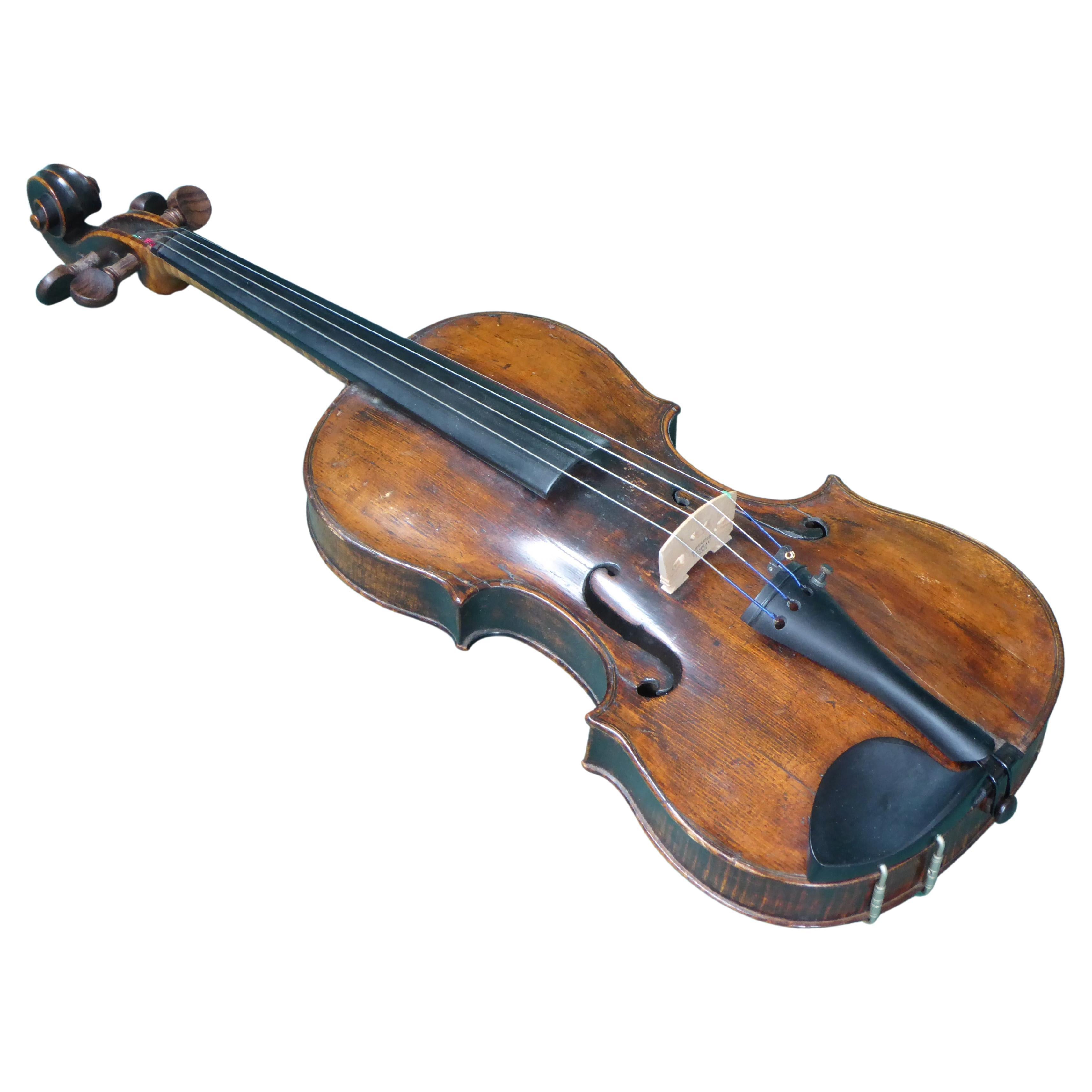
 - 17th. Century ViolinLocated in Perth, GB17th century violin possibly Italian. Dendrochronology says some of the timber is 17th century. There is good voulme, resonance and and tone. We would be happy to send you a recordin...Category
Antique 17th Century Musical Instruments
MaterialsWood
 $19,212
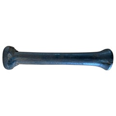
 - 17th Century Norther European Wrought Iron Pestle, 8.5 InchesLocated in Stamford, CTUnusual wrought iron pestle, most are bronze like most mortars. This one is at least 17th century, quite possibly dating to the Gothic period. I have owned two iron mortars in my ti...Category
Antique Early 17th Century German Baroque Scientific Instruments
MaterialsWrought Iron
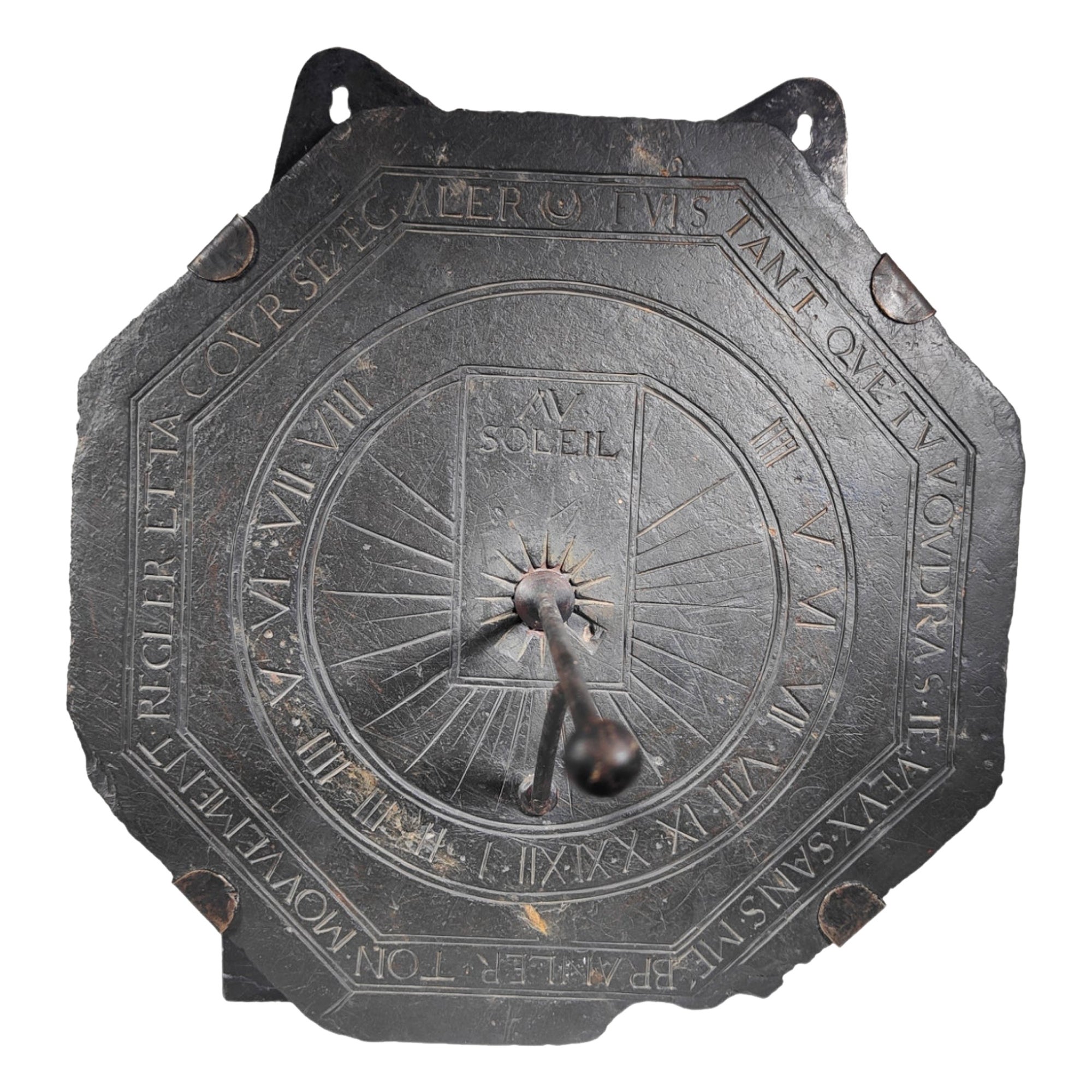
- Large 17th Century French Slate Octagonal SundialLocated in Madrid, ESA Large 17th century French Slate Octagonal Sundial With wrought iron gnomon and profusely engraved with latin letters.Size:39x39 cm.With latter hanging ...Category
Antique Mid-17th Century Scientific Instruments
MaterialsSlate
 $1,977 Sale Price20% Off
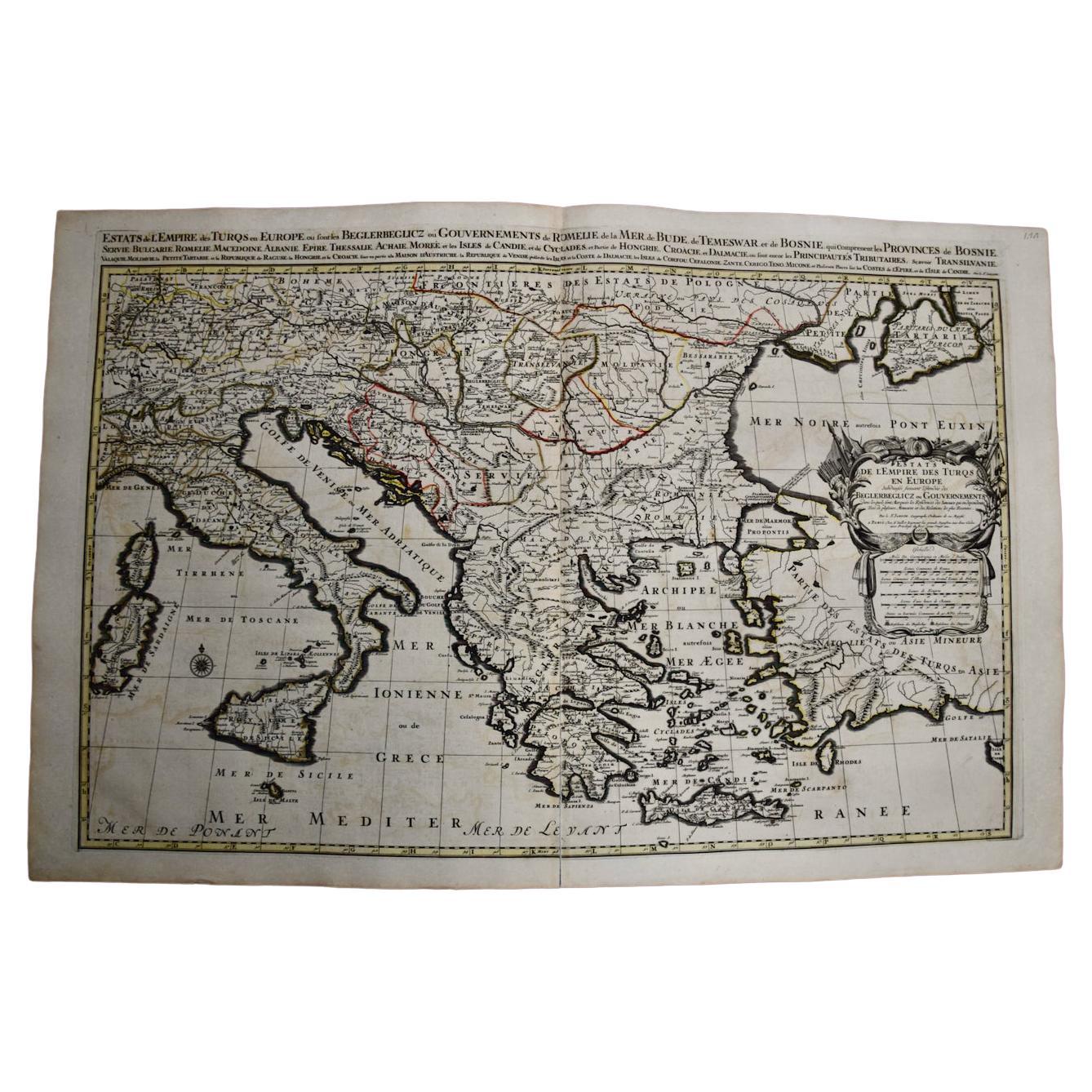
 - Southern & Eastern Europe: A Large 17th C. Hand-colored Map by Sanson & JaillotBy Nicolas SansonLocated in Alamo, CAThis large hand-colored map entitled "Estats de L'Empire des Turqs en Europe, ou sont les Beglerbeglicz our Gouvernements" was originally created by Nicholas Sanson d'Abbeville and t...Category
Antique 1690s French Maps
MaterialsPaper
- Vintage Reproduction 17th Century Map of Europe, American, Cartography, BlaeuwLocated in Hele, Devon, GBThis is a vintage reproduction map of Europe. An American, paper stock cartography print in frame after the work by Blaeuw, dating to the late 20t...Category
Late 20th Century Central American Mid-Century Modern Maps
MaterialsGlass, Wood, Paper