Denmark Maps
2
to
5,191
240
2
2
2
2
1
1
1
2
1
1
1
Item Ships From: Denmark
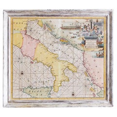
Antique Hand-Coloured Map of Venice with Vintage Frame, Italy, Late 18th Century
Located in Copenhagen K, DK
Italy, late 18th Century
Antique hand-coloured map of Venice.
Measures: H 52 x W 59 cm.
Category
Late 18th Century Italian Antique Denmark Maps
Materials
Other
17th Century Map of Denmark by French Cartographer Sanson, Dated 1658
By Nicolas Sanson
Located in Copenhagen, K
17th century map of Denmark by French cartographer Sanson.
Nicolas Sanson (20 December 1600-7 July 1667) was a French cartographer, termed by some the creator of French geography an...
Category
17th Century French Antique Denmark Maps
Materials
Paper
Related Items
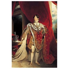
King George IV Authentic Antique Strand of Hair 18th Century / 19th Century
Located in Jersey, GB
In 1811 King George IV (1762-1830) stepped up as Prince Regent in place of his father George III, who was no longer well enough to rule.
An enthusias...
Category
Late 18th Century Antique Denmark Maps
Materials
Other
Free Shipping
H 0.5 in W 0.001 in D 0.001 in
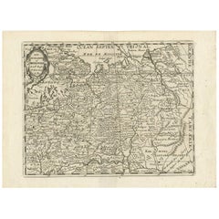
Antique Map of Russia by N. Sanson, 1705
Located in Langweer, NL
A strongly engraved map of European Russia showing its political divisions, major topographical features, cities and towns. Extends to the Sea of Azov and the tip of the Caspian Sea ...
Category
Early 18th Century Antique Denmark Maps
Materials
Paper
17th Century Hand-Colored Map of West Africa by Mercator/Hondius
Located in Alamo, CA
A 17th century hand-colored map entitled "Guineae Nova Descriptio" by Gerard Mercator and Jodocus Hondius, published in their 'Atlas Minor' in Amsterdam in 1635. It is focused on the...
Category
Mid-17th Century Dutch Antique Denmark Maps
Materials
Paper
Original Antique Map of Indonesia, 1861
Located in St Annes, Lancashire
Great map of Indonesia
Drawn and engraved by Edward Weller
Original color
Published in The Weekly Dispatch Atlas, 1861
Repairs to minor e...
Category
1860s English Victorian Antique Denmark Maps
Materials
Paper
Large Original Vintage Map of S.E Asia, with a Vignette of Singapore
Located in St Annes, Lancashire
Great map of South East Asia
Original color. Good condition
Published by Alexander Gross
Unframed.
Category
1920s English Vintage Denmark Maps
Materials
Paper
No Reserve
H 25 in W 19.5 in D 0.07 in
Antique Map of Japan and Korea by Sanson, 'c.1690'
Located in Langweer, NL
Antique map titled 'Les Iles du Iapon (..)'. Original antique map, with beautiful (later) hand coloring, of Japan and the Island of Corey (Korea). Uncommon edition, with '234' at top...
Category
Late 17th Century Antique Denmark Maps
Materials
Paper
Hand-Colored 18th Century Homann Map of the Danube, Italy, Greece, Croatia
By Johann Baptist Homann
Located in Alamo, CA
"Fluviorum in Europa principis Danubii" is a hand colored map of the region about the Danube river created by Johann Baptist Homann (1663-1724) in his 'Atlas Novus Terrarum', publish...
Category
Early 18th Century German Antique Denmark Maps
Materials
Paper
H 20 in W 23.88 in D 0.07 in
Large Original Vintage Map of Italy, circa 1920
Located in St Annes, Lancashire
Great map of Italy.
Original color. Good condition.
Published by Alexander Gross.
Unframed.
Category
1920s English Vintage Denmark Maps
Materials
Paper
17th Century John Speed Map of Denbighshire, c.1610
By John Speed
Located in Royal Tunbridge Wells, Kent
Antique early 17th century British very rare and original John Speed, hand coloured map of Denbighshire, dated 1610, by John Sunbury and George Humble. John...
Category
17th Century British Antique Denmark Maps
Materials
Wood, Paper
18th Century Italian Hand-Carved Polychrome GIlt Holy Water Font
Located in Milan, IT
From Italy, Marche central region, a polychrome carved holy water font mid-18th century, a shaped panel with carved and gilt scrolls and acanthus leaf details. A green edge decoratio...
Category
Mid-18th Century Italian Rococo Antique Denmark Maps
Materials
Poplar
Antique Hand-Coloured Miniature Map of Ancient Europe, c.1685
Located in Langweer, NL
Antique map of Europe titled 'Europe Ancienne, Das alte Europa'. Hand-coloured miniature map with much detail. German subtitle.
Artists and Engravers: Alain Manneson Mallet (1630-...
Category
17th Century Antique Denmark Maps
Materials
Paper
Martinet Engravings, Framed, Set of Three, Late 18th Century
Located in Charlottesville, VA
Set of 3 antique hand-colored bird engravings by Martinet, of Toucan, Calau, and Petit Kakatoes (French), Late 18th Century. Nicely matted and framed. Art: 10" H x 8" W; Frame: 17" ...
Category
Late 18th Century French Antique Denmark Maps
Materials
Paper
Recently Viewed
View AllMore Ways To Browse
Office Depot
Map Sumatra
Scotland Coat Of Arms
Map Of Siam
Catalonia Map
Kiels Antiques
William Wyld
Historic Map Virginia
Antique Map Of Shanghai
Britton And Rey Lithograph
Collectible Barbies
Marthas Vineyard Map
Vintage Marthas Vineyard Map
Buying Design
Old Antique Map
Map Of The Netherlands
Italian Maps
Antique Old World Maps


