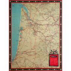
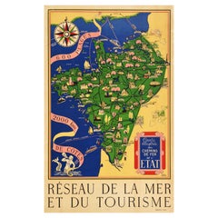
Items Similar to Circa 1935 map illustrated by André Giroux of the P.O Midi railroad network.


Want more images or videos?
Request additional images or videos from the seller
1 of 7
André GirouxCirca 1935 map illustrated by André Giroux of the P.O Midi railroad network.Circa 1935
Circa 1935
$2,371.99
£1,782.78
€2,000
CA$3,286.43
A$3,572.22
CHF 1,912.27
MX$43,179.89
NOK 24,098.31
SEK 22,224.90
DKK 15,235.54
About the Item
Very beautiful map illustrated by André Giroux of the P.O Midi railroad network.
The railway company from Paris to Orleans and the Midi (PO Midi) is the nickname given to the financial, commercial and technical community of interest resulting from the merger in 1934 of the Compagnie des chemins de fer du Midi et du Canal latéral à la Garonne (Midi) and the Compagnie du chemin de fer de Paris à Orléans (PO).
The nationalization of the Compagnies du PO and du Midi and their merger with the other five major French railways on January 1, 1938, put an end to the period of joint operation and gave rise to the Société nationale des chemins de fer français (SNCF).
Map - Railway - Tourism
Paris Orléans Midi
Paul Martial Paris
- Creator:André Giroux
- Creation Year:Circa 1935
- Dimensions:Height: 46.86 in (119 cm)Width: 63 in (160 cm)
- Medium:
- Period:
- Condition:Good condition, light traces of folds, on linen.
- Gallery Location:PARIS, FR
- Reference Number:1stDibs: LU1792211303322
About the Seller
5.0
Gold Seller
Premium sellers maintaining a 4.3+ rating and 24-hour response times
Established in 2021
1stDibs seller since 2022
195 sales on 1stDibs
Typical response time: 1 hour
- ShippingRetrieving quote...Shipping from: PARIS, France
- Return Policy
More From This Seller
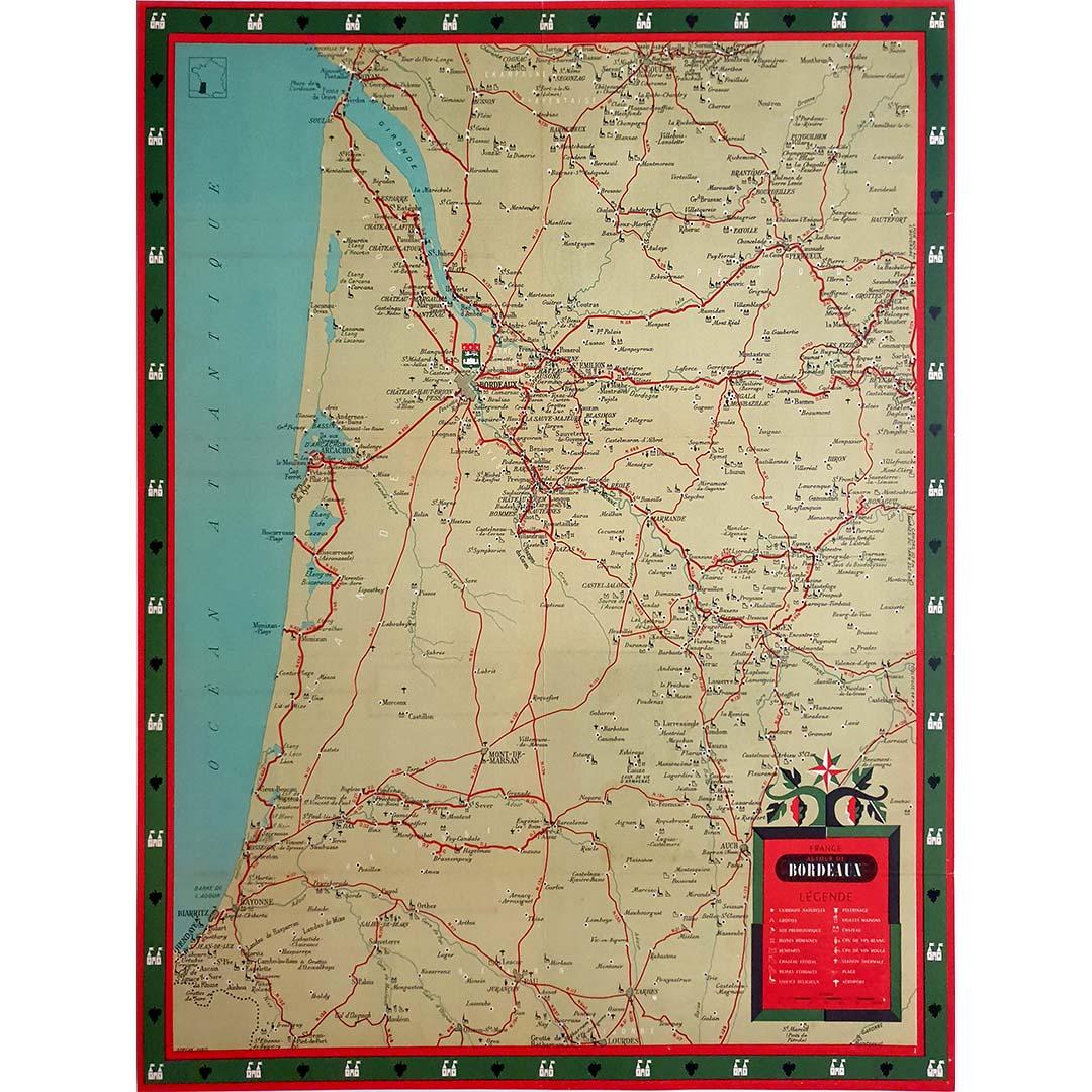
View AllCirca 1950 original illustrated map for "Carte France autour de Bordeaux"
Located in PARIS, FR
The circa 1950 original illustrated map for "Carte France autour de Bordeaux" is an excellent representation of mid-20th century cartography, focusing on the area surrounding Bordeau...
Category
1950s Prints and Multiples
Materials
Linen, Paper
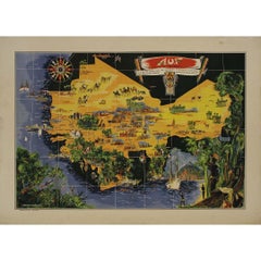
Original map poster by G. Carriat Rolant for AOF (Afrique Occidentale Française)
Located in PARIS, FR
The circa 1950 original map poster by G. Carriat Rolant for AOF (Afrique Occidentale Française) is a notable example of mid-20th-century cartographic art and colonial-era representation. Numbered 584 out of 1000, this limited-edition piece was edited by Paul Bory...
Category
1950s Prints and Multiples
Materials
Paper, Lithograph
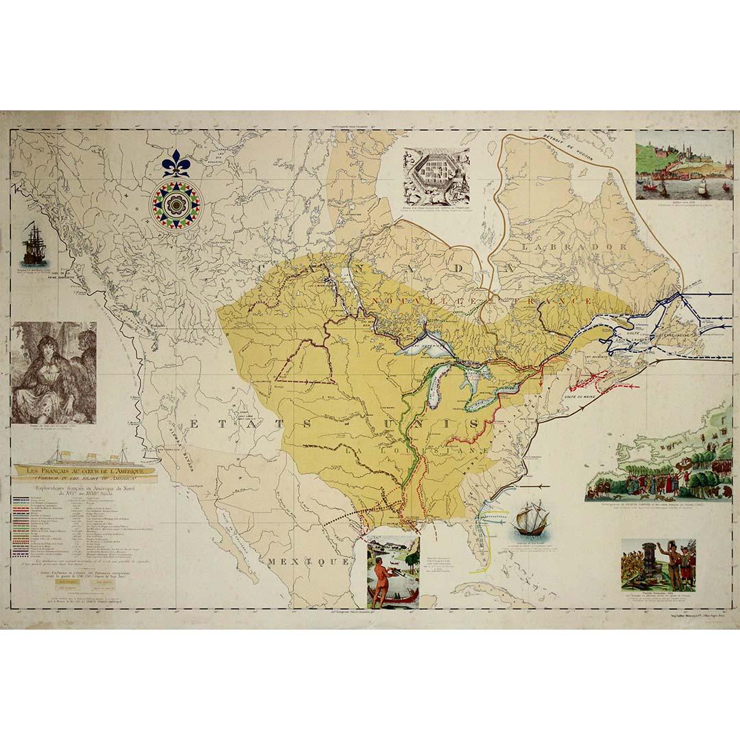
1935 original map French exploration in North America
Located in PARIS, FR
In 1935, a remarkable map titled "Les Français au Cœur de l'Amérique" was produced, highlighting the rich history of French exploration and influence in North America. This map is a ...
Category
1930s Prints and Multiples
Materials
Paper, Lithograph
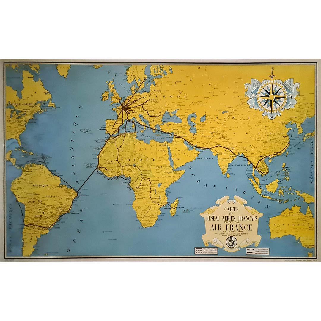
1938 original map titled "Carte du réseau aérien français" Air France
Located in PARIS, FR
The 1938 original map titled "Carte du réseau aérien français" by A. Collinet offers a captivating snapshot of Air France's global aviation network durin...
Category
1930s Prints and Multiples
Materials
Linen, Paper, Lithograph

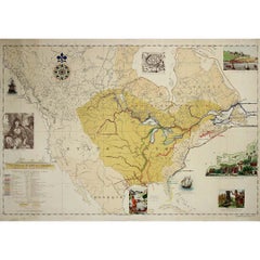
1947 original map Gouvernement Généraux du Poitou, du Pays d'Aunis
Located in PARIS, FR
The 1947 original map Gouvernement Généraux du Poitou, du Pays d'Aunis et de Saintonge Angoumois, created by Louis Larmat and printed by Dorel in Paris, is a beautifully detailed cartographic representation of a historically significant region in western France. This map, part of Larmat’s extensive body of work, is known for its artistic craftsmanship and geographical precision, offering a comprehensive view of the historical administrative regions of Poitou, Aunis, Saintonge, and Angoumois, which played key roles in the political and cultural history of France.
Louis Larmat is celebrated for his contributions to cartography, particularly for his ability to merge historical context, topographical detail, and aesthetic elegance in his maps. His works, especially those focusing on the vinicultural regions of France, are highly respected for their accuracy and artistry. This particular map, although focusing on a more political and historical aspect rather than the wine regions he is most famous for, continues his tradition of detailed regional documentation. Larmat’s cartographic works often transcended the realm of simple geographical depiction, becoming historical documents that encapsulate the cultural essence of the regions they portray.
This map illustrates the general governments (administrative divisions) of the provinces of Poitou, Aunis, Saintonge, and Angoumois, regions that are steeped in history. These areas, situated along France’s western coastline, have been integral to the country’s political, economic, and cultural development over centuries. The region of Poitou, for example, is historically known as the birthplace of Eleanor of Aquitaine...
Category
1940s Prints and Multiples
Materials
Paper, Lithograph

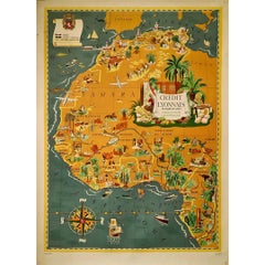
1939 original map Lucien Boucher Crédit Lyonnais Afrique Du Nord Union Française
By Lucien Boucher
Located in PARIS, FR
The 1939 original map by Lucien Boucher, commissioned by Crédit Lyonnais, is a remarkable piece of cartographic art that highlights the regions of North Africa within the French Unio...
Category
1930s Prints and Multiples
Materials
Paper, Lithograph
You May Also Like
Original Vintage Illustrated Map Poster Railway Travel Normandy Brittany Paris
By Lucien Boucher
Located in London, GB
Original vintage travel poster featuring a colourful Illustrated Map of the State Railways Sea and Tourism Network / Carte Illustre des Chemins de Fer ...
Category
Vintage 1930s French Posters
Materials
Paper
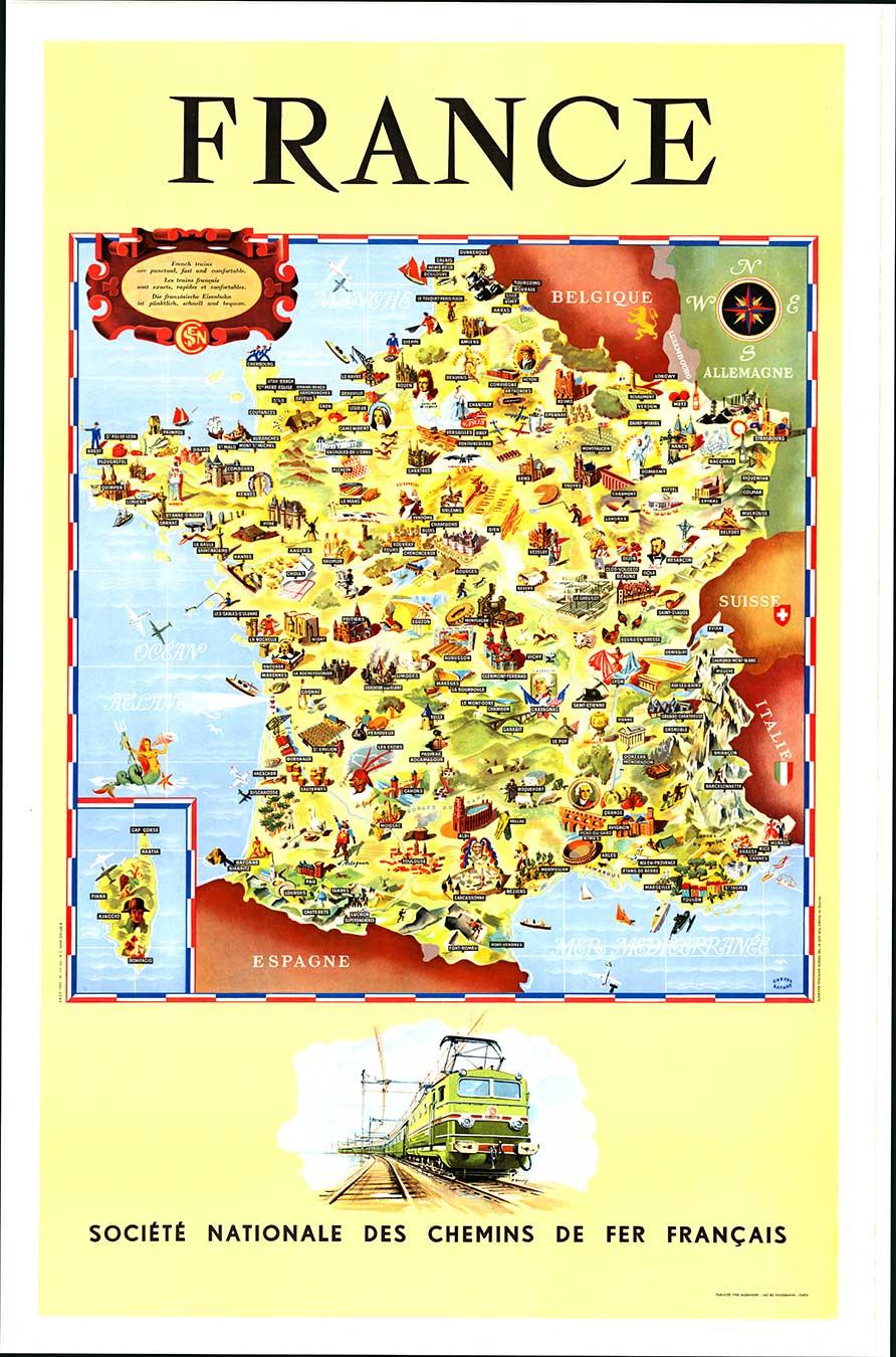
Original Societe Nationale des Chemin Map France, 1953 vintage poster on linen
Located in Spokane, WA
Original French vintage travel poster: "FRANCE, Société Nationale des Chemins de Fer Français." Printed in France by the French National Railroads. Original linen-backed poster; read...
Category
1950s American Modern Landscape Prints
Materials
Lithograph
Original Vintage Rail Travel Map Poster France Map SNCF National French Railway
Located in London, GB
Original vintage rail travel map poster - France Societe Nationale des Chemins de Fer Francais - featuring a colourful illustrated map by Jean Cheval and Alex Batany (as Cheval-Batan...
Category
Vintage 1950s French Posters
Materials
Paper
Antique Map of France by Johnston (1909)
Located in Langweer, NL
Antique map titled 'France'. Original antique map of France. With inset maps of France in provinces, part of the Riviera and Corsica. This map or...
Category
Early 20th Century Maps
Materials
Paper

$237 Sale Price
20% Off
Antique Map of France in Provinces, with Inset of Paris
Located in Langweer, NL
Antique map titled 'France par Provinces'. Original antique map of France in Provinces. It covers from the Flanders in the north to Roussillon in the south and from Brittany in the w...
Category
Antique Mid-19th Century Maps
Materials
Paper
$104 Sale Price
20% Off
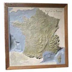
Map of France, 1934
Located in Andrézieux-Bouthéon, FR
Map of France, 1934
Vintage Design
Exceptional, map of France numbered 596 for the reliefs of France, scale 1/1,000,000
That it continues, small crack, visual, only to be noted ...
Category
20th Century French Modern Paintings
Materials
Stone
$1,073
More Ways To Browse
Vintage Illustrated Maps
Railway Map
Antique Marotte
Arman Violin
Building Lithographs
Calder Lithograph Black And White
Camille Claudel
Castillo Jorge
Chalcographie Du Louvre
Claude Weisbuch Lithograph
Eberhard Vintage
Greek Mythology Prints
Howard Hughes
Irish Original Art
Ischia Vintage
Joan Miro Exhibition Poster
Kabbalah Art
Leroy Neiman Screen Prints