Items Similar to illustrated map of Morocco created in 1950 by Delaye
Want more images or videos?
Request additional images or videos from the seller
1 of 8
Delayeillustrated map of Morocco created in 1950 by Delaye1950
1950
$1,541.21
£1,171.13
€1,300
CA$2,162.86
A$2,358.39
CHF 1,225.77
MX$28,233.12
NOK 15,547.73
SEK 14,563.35
DKK 9,903.51
About the Item
Beautiful illustrated map of Morocco created in 1950 by Delaye. Main roads, car tracks, railroads are represented. This illustrated map is printed by Perceval in Rabat.
Map - North Africa
- Creator:Delaye
- Creation Year:1950
- Dimensions:Height: 18.12 in (46 cm)Width: 19.3 in (49 cm)
- Medium:
- Period:
- Condition:Good condition.
- Gallery Location:PARIS, FR
- Reference Number:1stDibs: LU1792210615092
About the Seller
5.0
Gold Seller
Premium sellers maintaining a 4.3+ rating and 24-hour response times
Established in 2021
1stDibs seller since 2022
191 sales on 1stDibs
Typical response time: 3 hours
- ShippingRetrieving quote...Shipping from: PARIS, France
- Return Policy
More From This Seller
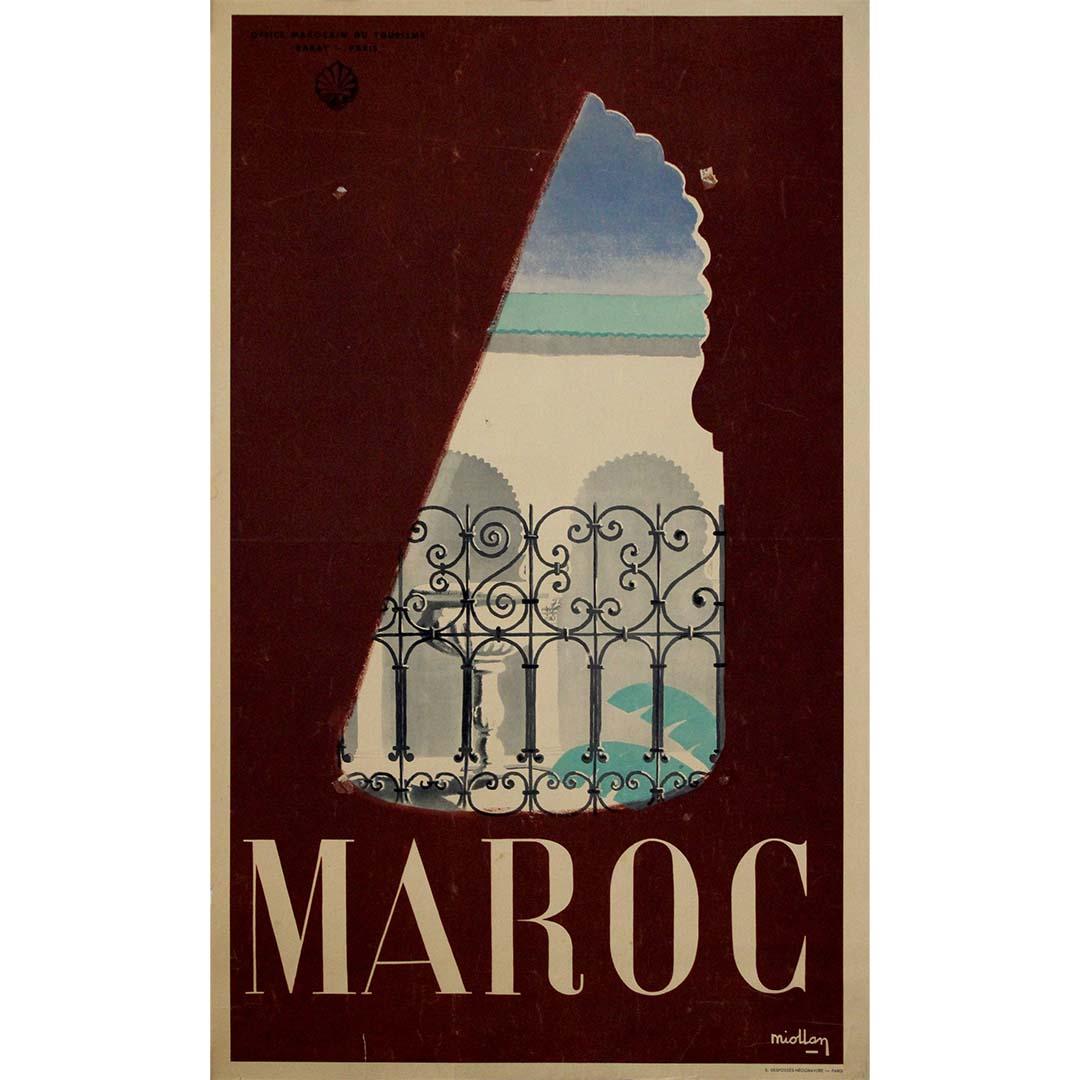
View AllOriginal circa 1950 travel poster by Miollan - Maroc - Morocco
Located in PARIS, FR
This original circa 1950 travel poster by Miollan, commissioned by the Office Marocain du Tourisme, offers a poetic and refined vision of Morocco in the mid-20th century. The composi...
Category
1950s Prints and Multiples
Materials
Paper, Lithograph
Original poster by Falcucci in 1948 for Air Atlas - Morocco - Casablanca
By Robert Falcucci
Located in PARIS, FR
Beautiful poster by Falcucci in 1948 for Air Atlas.
Air Atlas (Compagnie Chérifienne de l'Air) was a Moroccan airline based in Casablanca. Air Atlas was reg...
Category
1940s Prints and Multiples
Materials
Lithograph, Paper, Linen
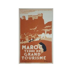
1940 Original poster by Robert Génicot - Morocco Land of Great Tourism
By Robert Genicot
Located in PARIS, FR
Original poster was made in 1940 by Robert Génicot 🇫🇷 (1890-1981) for the Moroccan Office of Tourism.
He was notably an artist appreciated for his drawings of Morocco.
The use of ...
Category
1940s Prints and Multiples
Materials
Lithograph, Paper, Linen
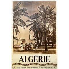
Circa 1930 Original poster Make in Algeria the most beautiful trip of your life
Located in PARIS, FR
Poster produced by the OFALAC, (the Algerian Office of Economic and Tourist Action of the General Government of Algeria), around the years 1955, in order to make the promotion of the...
Category
1930s Prints and Multiples
Materials
Lithograph, Paper, Linen
Original map poster by G. Carriat Rolant for AOF (Afrique Occidentale Française)
Located in PARIS, FR
The circa 1950 original map poster by G. Carriat Rolant for AOF (Afrique Occidentale Française) is a notable example of mid-20th-century cartographic art and colonial-era representation. Numbered 584 out of 1000, this limited-edition piece was edited by Paul Bory...
Category
1950s Prints and Multiples
Materials
Lithograph, Paper
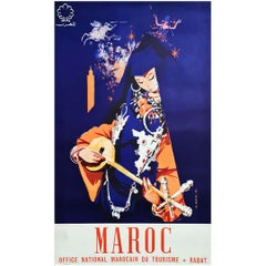
1960 Original poster Maroc - musicienne
Located in PARIS, FR
A very beautiful poster with magnificent colors made by J.G Mantel in 1960 to promote the Folklore Festival of Marrakech.
This festival was created in 1960 by His Majesty King Mohammed V...
Category
1960s Prints and Multiples
Materials
Paper
You May Also Like
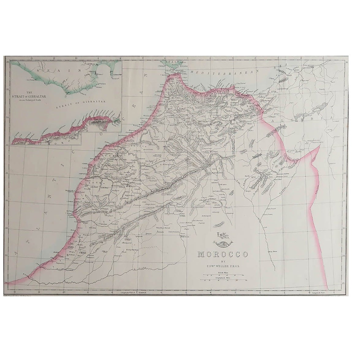
Large Original Antique Map of Morocco. Edward Weller, 1861
Located in St Annes, Lancashire
Great map of Morocco
Lithograph engraving by Edward Weller
Original colour
Published, 1861
Unframed
Good condition.
Category
Antique 1860s English Victorian Maps
Materials
Paper

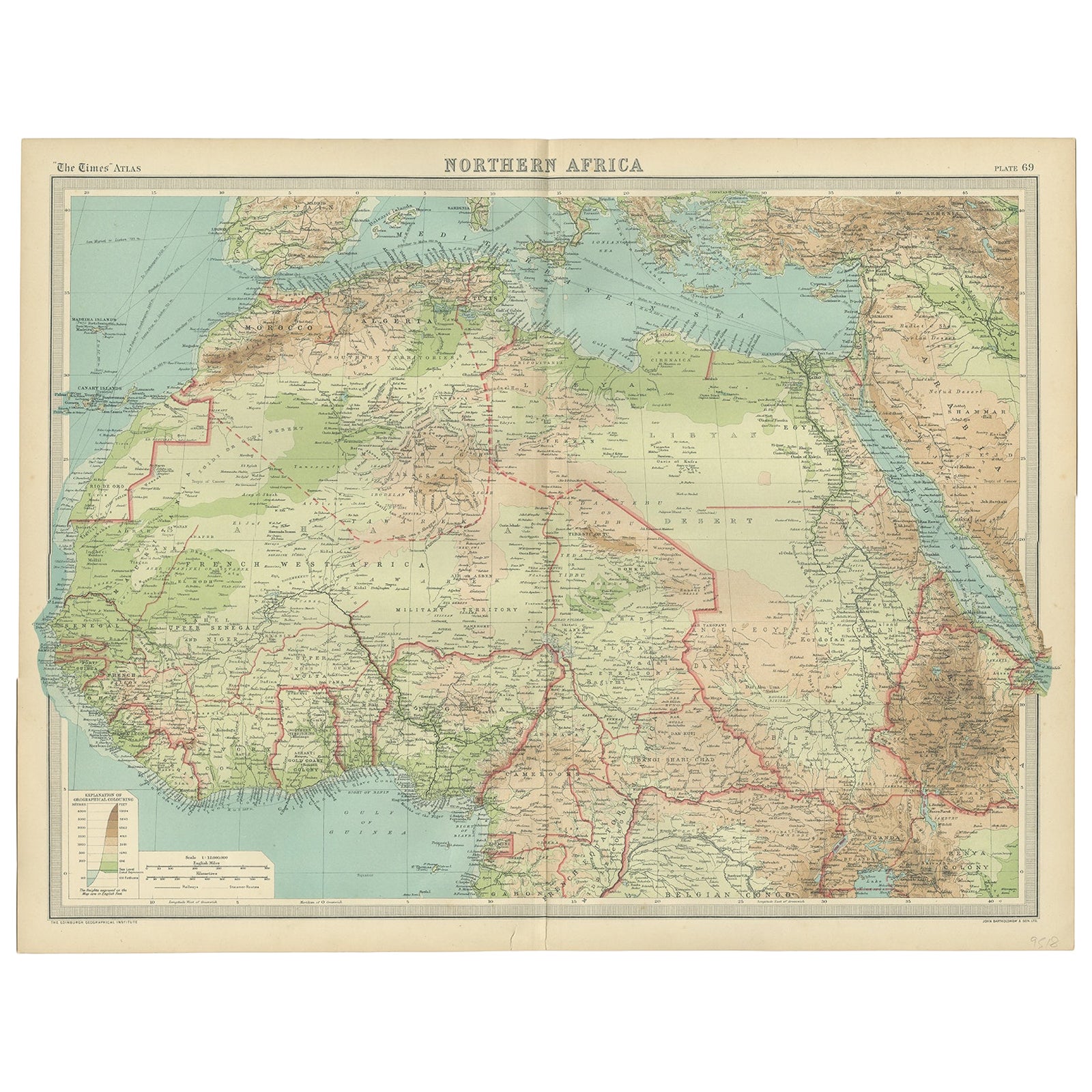
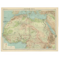
Old Map of North Africa Depicting Libya, Morocco, Algeria, Tunis Etc, 1922
Located in Langweer, NL
Antique map of Africa titled 'Northern Africa'.
Old map of North Africa depicting Libya, Morocco, Algeria, Tunis and surroundings. This map originates from 'The Times' atlas.
...
Category
Vintage 1920s Maps
Materials
Paper
$113 Sale Price
20% Off
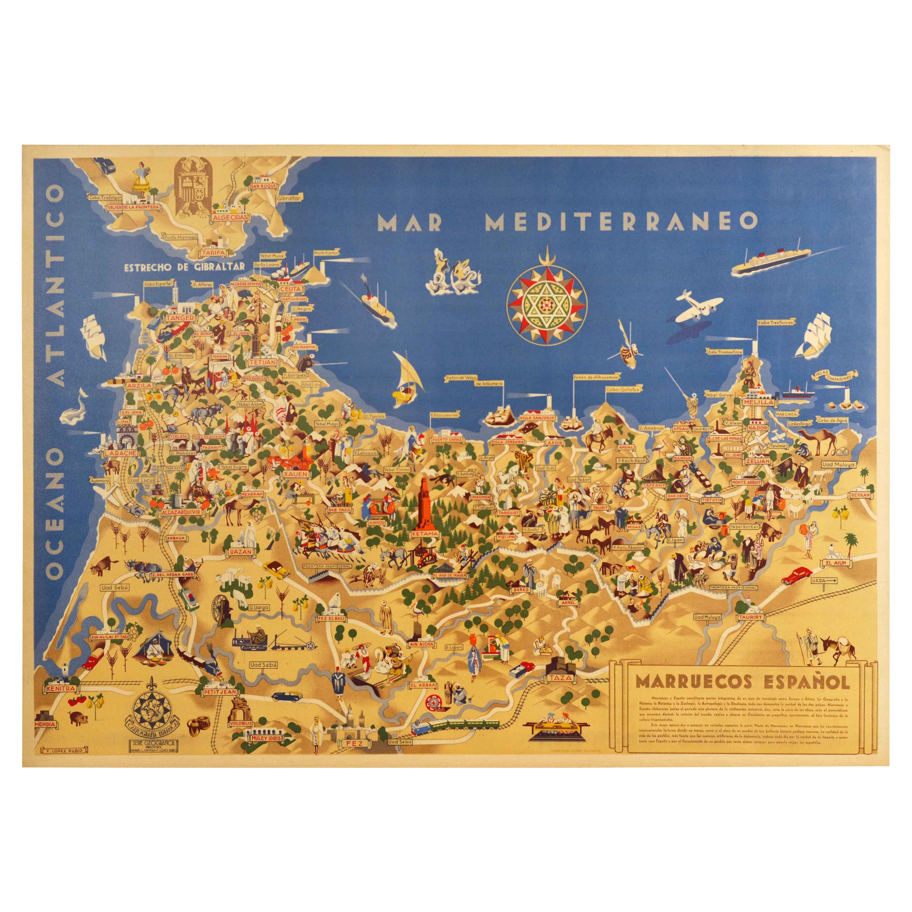
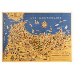
Original Vintage Map Poster Marruecos Espanol Spanish Morocco Illustrated Design
Located in London, GB
Original vintage travel map poster for Marruecos Espanol / Spanish Morocco featuring a great illustration of an outline of the Africa contin...
Category
Vintage 1940s Spanish Art Deco Posters
Materials
Paper
Delaye, Original Vintage Poster, South Morocco Map, Maghreb, Marrakech, 1930
Located in SAINT-OUEN-SUR-SEINE, FR
Original Vintage Poster for South Morocco Map dating from 1930 by Jean Theophile Delaye.
Artist: Jean Théophile Delaye (1896-1970)
Title : Carte Touris...
Category
Vintage 1930s French Art Deco Posters
Materials
Paper

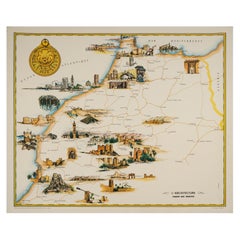
Gayraud, Original Vintage Poster, Morocco Map, Royal Air Maroc, Essaouira, 1950
Located in SAINT-OUEN-SUR-SEINE, FR
Poster created by the artist Gayraud around 1950 and published by Royal Air Maroc to promote tourism in Morocco.
Artist: Gayraud M.
Title: L’architecture – Royal Air Maroc
Date: c...
Category
Vintage 1950s French Mid-Century Modern Posters
Materials
Paper
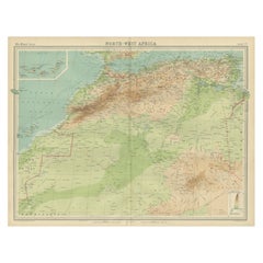
Antique Map of Northwest Africa by Bartholomew, 1922
Located in Langweer, NL
Antique map of Africa titled 'North-West Africa'. Old map of north-west Africa depicting Morocco, Algeria, Tunis and surroundings. This map originates from 'The Times' atlas. Artists...
Category
20th Century Maps
Materials
Paper
$90 Sale Price
20% Off
More Ways To Browse
Illustrated Map
Vintage Illustrated Maps
Vintage African Map
North Africa Map
Morocco Map
Track Cars
Francois Fiedler
Gould Hummingbird
Henri Matisse Signed
Huchet Lithograph
Jacques Villon On Sale
Joan Miro 1973
Joan Miro 1981
John Cross
John Szoke
Keep Calm And Carry On Vintage
Keith Haring Icons
Les Fleurs Du Mal