Items Similar to View of Leiden - Etching by G. Braun and F. Hogenberg - Late 1500

Want more images or videos?
Request additional images or videos from the seller
1 of 6
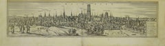
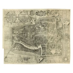
Franz HogenbergView of Leiden - Etching by G. Braun and F. Hogenberg - Late 1500Late 16th Century
Late 16th Century
$563.99
£430.50
€480
CA$795.38
A$873.87
CHF 456.69
MX$10,421.61
NOK 5,782.92
SEK 5,387.28
DKK 3,658.52
About the Item
This map of Leida is an original etching realized by George Braun and Franz Hogenberg as part of the famous Series "Civitates Orbis Terrarum".
The “Civitates Orbis Terrarum” (Atlas of Cities of the World) was the second oldest printed atlas in the history of world cartography and the first atlas totally dedicated to topographical views. The first volume of this collection was published in Cologne in 1572; the following others in 1575, 1581, 1588, and 1598. The sixth and final volume appeared in 1617.
The state of preservation of the artwork is aged with diffused foxings and the middle llne on the folding had been cut and is partially repaired.
Sheet dimension : 40.5 x 54
- Creator:Franz Hogenberg (1540 - 1590, Flemish)
- Creation Year:Late 16th Century
- Dimensions:Height: 15.95 in (40.5 cm)Width: 21.26 in (54 cm)Depth: 0.04 in (1 mm)
- Medium:
- Period:
- Framing:Framing Options Available
- Condition:Insurance may be requested by customers as additional service, contact us for more information.
- Gallery Location:Roma, IT
- Reference Number:Seller: M-1132811stDibs: LU65037308232

Franz Hogenberg
Braun and Hogenberg's 'The Civitates Orbis Terrarum' was the second atlas of maps ever published and the first atlas of cities and towns of the world. It is one of the most important books published in the 16th century. Most of the maps in the atlas were engraved by Franz Hogenberg and the text, with its descriptions of the history and additional factual information of the cities, was written by a team of writers and edited by Georg Braun. The work contained 546 bird-eye views and map views of cities and towns from all over the world. It gave graphic representation of the main features of the illustrated cities and towns, including the buildings and streets. Although the ordinary buildings are stylized, the principal buildings are reproduced from actual drawings created on location. The principal landmarks and streets can still be recognized today. In addition, the maps often include the heraldic arms of the city, the nature of the surrounding countryside, the important rivers, streams and harbors, even depicting stone bridges, wooden pontoons, flat-bottomed ferries, ships and working boats, wharves and jetties, as well as land-based activities, including horsemen, pedestrians, wagons, coaches, and palanquins. Small vignettes are often included which illustrate the trade, occupations and habits of the local inhabitants, such as agriculture, paper-making and textiles, as well as local forms of punishment, such as gibbets, wheels, floggings etc. Large figures dressed in their local costume are often presented out of proportion in the foreground. The aim of the authors was to give as much information as possible in a pleasing visual form. They succeeded in creating maps that were both informative and decorative works of art. The atlas is a wonderful glimpse of life in medieval Europe. Georg Braun (1541-1622) was German Catholic cleric who was born and who died in Cologne, Germany. He was the principal editor of 'The Civitates Orbis Terrarum', acquiring the tables, hiring the artists, and composing the texts. Abraham Ortelius, whose Theatrum Orbis Terrarum of 1570 was the first atlas of maps ever published, assisted Braun in his compilation of the details and maps for the atlas. The Civitates was intended as a companion for the Ortellius' Theatrum, as suggested by the similarity in the titles. Braun was the only survivor of the original team to live to see the publication of last volume (VI) in 1617. Franz Hogenberg (1535-1590) was a Flemish and German painter, engraver, and mapmaker. He was born in Mechelen (also known as Malines) in Flanders, the son of an engraver. After being expelled from Antwerp by the Duke of Alva, he moved to London and then eventually to Cologne, Germany, where he met Georg Braun and Abraham Ortellius. He engraved most of the plates for Ortelius's Theatrum and the majority of those in the Civitates. Many believe that he was responsible for originating the Civitates project.
About the Seller
4.9
Platinum Seller
Premium sellers with a 4.7+ rating and 24-hour response times
1stDibs seller since 2017
7,816 sales on 1stDibs
Typical response time: 1 hour
- ShippingRetrieving quote...Shipping from: Grasse, France
- Return Policy
More From This Seller
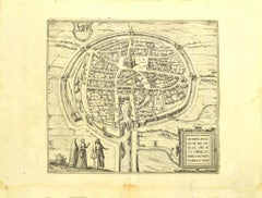
View AllView of Middelburg - Etching by G. Braun and F. Hogenberg - Late 1500
By Franz Hogenberg
Located in Roma, IT
This map of Middelburg (ancient name: Middelbvrgvm) is an original etching realized by George Braun and Franz Hogenberg as part of the famous Series "Civitates Orbis Terrarum".
The ...
Category
16th Century Figurative Prints
Materials
Etching
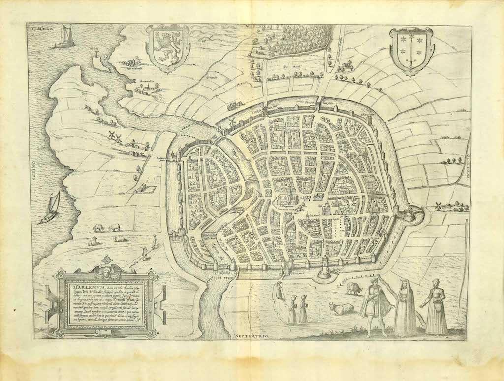
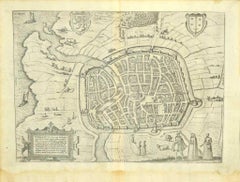
View of Haarlem, The Netherlands - by G. Braun and F. Hogenberg - Late 1500
By Franz Hogenberg
Located in Roma, IT
This vie of Haarlem in the Netherlands (ancient name: Harlemvm) is an original etching realized by George Braun and Franz Hogenberg as part of the Series "Civitates Orbis Terrarum".
...
Category
16th Century Figurative Prints
Materials
Etching
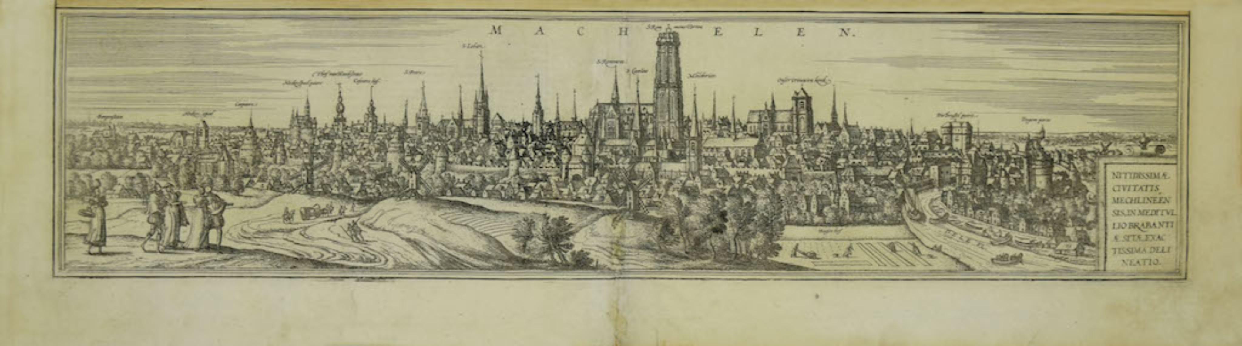
View of Mechelen - Original Etching by G. Braun and F. Hogenberg - 16th Century
By Franz Hogenberg
Located in Roma, IT
This Mechelen is an original etching realized by George Braun and Franz Hogenberg, as part of the famous "Civitates Orbis Terrarum".
The “Civitates Orbis Terrarum” (Atlas of Cities ...
Category
16th Century Modern Figurative Prints
Materials
Etching
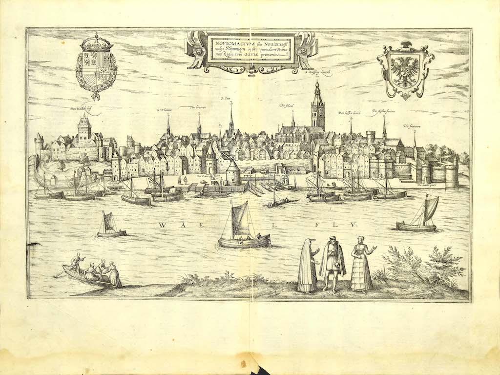
Map of Nijmegen - Etching by G. Braun and F. Hogenberg - Late 16th Century
By Franz Hogenberg
Located in Roma, IT
This map of Noviomagvs is an original etching realized by Georg Braun and Franz Hogenberg as part of the famous series "Civitates Orbis Terrarum".
The state of preservation of the ...
Category
16th Century Figurative Prints
Materials
Etching

Map of the Netherlands - Etching by G. Braun and F. Hogenberg -Late 16th Century
By Franz Hogenberg
Located in Roma, IT
Map of the Netherlands is an original etching realized by George Braun and Franz Hogenberg, as part of the "Civitates Orbis Terrarum".
The “Civitates Orbis Terrarum” (Atlas of Citi...
Category
16th Century Figurative Prints
Materials
Etching

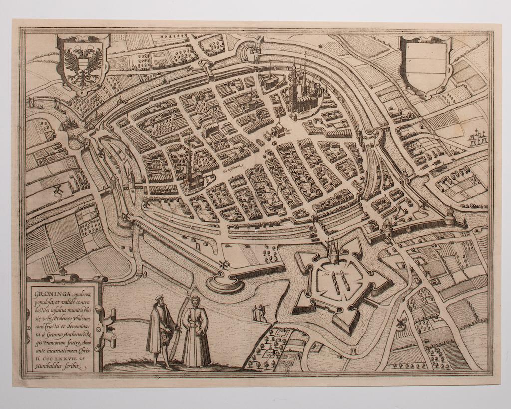
Map of Groningen - Etching by George Braun - Late 16th Century
Located in Roma, IT
This map of Groninga is an original etching realized by George Braun and Franz Hogenberg, and part of the series "Civitates Orbis Terrarum".
The state of preservation of the artwork...
Category
16th Century Figurative Prints
Materials
Etching

You May Also Like
Antique Map of the City of Leeuwarden by Bast, 1603
Located in Langweer, NL
Antique map titled 'Leeuwerden de hooft stadt van Frislant. Leoverdia Metropolis Frisiae (…) 1603.' Very rare plan of Leeuwarden, Friesland, The Netherlands. With several carouches a...
Category
Antique 17th Century Maps
Materials
Paper
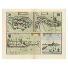
Engravings of the Frisian Cities of Sloten, IJlst, Workum and Hindelopen, c.1650
Located in Langweer, NL
Antique print titled 'Slooten - Ylst - Worcum - Hinloopen'. Three plans and a bird's eye view on one sheet. The plans show the Frisian cities Sloten, IJlst, Workum and the view shows...
Category
Antique 17th Century Prints
Materials
Paper
View of Emden, Germany: A 16th Century Hand-colored Map by Braun & Hogenberg
By Franz Hogenberg
Located in Alamo, CA
This is a 16th century original hand-colored copperplate engraved map of a bird's-eye View of Embden, Germany entitled " Emuda, vulgo Embden vrbs Frisia orientalis primaria" by Georg Braun & Franz Hogenberg, in volume II of their famous city atlas "Civitates Orbis Terrarum", published in Cologne, Germany in 1575.
This is a beautifully colored and detailed map of Emden, a seaport in northwestern Germany, along the Ems River and perhaps portions of over Dollart Bay, near the border with the Netherland. The map depicts a bird's-eye view of the city from the southwest, as well as a view of the harbor and an extensive system of canals. Numerous ships of various sizes, as well as two rowboats containing numerous occupants are seen in the main waterway in the foreground and additional boats line two canals in the center of the city. Two men and two women are shown on a hill in the foreground on the right, dressed in the 16th century style of nobility. Two ornate crests are included in each corner. A title strap-work cartouche is in the upper center with the title in Latin. The crest on the right including Engelke up de Muer (The Little Angel on the Wall) was granted by Emperor Maximilian I in 1495.
This is an English translation of an excerpt of Braun's description of Embden: "In Emden, the capital of East Frisia, rich merchants live in very fine houses. The city has a broad and well-situated harbour, which in my opinion is unique in Holland. Frisia and the whole of the Netherlands, for the ships can anchor here right under the city walls. They have also extended the harbour as far as the New Town, so that up to 400 ships can now find shelter here when the sea is rough."
The emphasis on the harbor and waterways within the city highlights the importance of Emden's place as a seaport at this time. Embden developed from a Dutch/Flemish trading settlement in the 7th-8th centuries into a city as late as late 14th century. In 1494 it was granted staple rights, and in 1536 the harbour was extended. In the mid-16th century Emden's port was thought to have the most ships in Europe. Its population then was about 5,000, rising to 15,000 by the end of the 16th century. The Ems River flowed directly under the city walls, but its course was changed in the 17th century by the construction of a canal. Emden has canals within its city limits, a typical feature of Dutch towns, which also enabled the extension of the harbor. In 1744 Emden was annexed by Prussia and is now part of Germany. It was captured by French forces in 1757 during the Seven Years' War, but recaptured by Anglo-German forces in 1758. During the Napoleonic French era, Emden and the surrounding lands of East Frisia were part of the short-lived Kingdom of Holland.
References:Van der Krogt 4, 1230, State 2; Taschen, Braun and Hogenberg...
Category
16th Century Old Masters Landscape Prints
Materials
Engraving

Rare Antique Map of Leeuwarden, Friesland, The Netherlands, by P. Bast, 1603
By P. Bast
Located in Langweer, NL
Very rare plan of Leeuwarden, Friesland, The Netherlands. With several cartouches and coat of arms. With a legend and compass rose at bottom right. Made by 'Pieter Bast' after the su...
Category
Antique Early 17th Century Maps
Materials
Paper

$3,436 Sale Price
35% Off
Limburg Cityscape 1580: Historical Copper Engraving by Braun and Hogenberg
Located in Langweer, NL
Title: Limburgum Oppidum Galliae Belgicae, vulgo Lympurch, gallicè, Lembor Dr.
Type: Print (Copper Engraving)
Circa 1580
Technique: Colored Copper Engraving
Medium: Handmade Paper
S...
Category
Antique 16th Century German Maps
Materials
Paper

Dutch City Plan of Sloten in Friesland by N. Van Geelkercken, hand-colored 1616
Located in Langweer, NL
Bird’s-Eye View of Sloten in Friesland by Nicolaes van Geelkercken, ca. 1616
This captivating hand-colored engraving presents an early 17th-century bird’s-eye view of the fortified ...
Category
Antique 1610s Dutch Maps
Materials
Paper
More Ways To Browse
Dali Illustrates Casanova
Dali Man Of La Mancha
Dali Othello
Dali Pig And Pepper
Dali Purgatory Signed
Dali Saba
Dali Signed Ecstatic
Dali Skeleton
Dali Spinning Man
Dali The Annunciation
Dali Thus Was Earth Created
Dame Laura Knight On Sale
Danos Flower Shop
Daumier Actualites
David Ham
David Schluss Serigraph
David Shrigley You Are Special
Degas Poster