Items Similar to Totius Africae Accuratissima Tabula - Etching by Frederick de Wit - 1680 ca

Want more images or videos?
Request additional images or videos from the seller
1 of 5
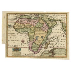
Frederick de WitTotius Africae Accuratissima Tabula - Etching by Frederick de Wit - 1680 ca 1680 ca
1680 ca
$1,434.59
£1,070.67
€1,200
CA$1,978.91
A$2,164.60
CHF 1,139.72
MX$25,843.12
NOK 14,525.91
SEK 13,287.74
DKK 9,142.03
About the Item
This double-page etching with contemporary coloring, entitled Totius Africae Accuratissima Tabula, was realized by the cartographer Frederick de Wit for the famous Atlas published in Amsterdam in ca. 1680.
The state of preservation is fair: central fold reinforced in antiquity on the reverse, stains, browning of the paper and rips along the edge of the page.
Folio, measures ca. cm 51,5x59,8
Inscription on the reverse "Foglio 3 / Africa"
Frederick de Wit was a cartographer who was best known for his atlases and his Dutch town maps. His maps were known for their accuracy and detail, and contributed significantly to the documentation and understanding of the lands explored and discovered in the 17th century. His work had a considerable influence on the diffusion of geographical and cartographic knowledge of the time.
- Creator:Frederick de Wit (1630 - 1706, Dutch)
- Creation Year:1680 ca
- Dimensions:Height: 20.28 in (51.5 cm)Width: 23.55 in (59.8 cm)Depth: 0.04 in (1 mm)
- Medium:
- Movement & Style:
- Period:1680-1689
- Framing:Framing Options Available
- Condition:Insurance may be requested by customers as additional service, contact us for more information.
- Gallery Location:Roma, IT
- Reference Number:Seller: T-1548921stDibs: LU650316386852

Frederick de Wit
Frederick De Wit (1629-1706) was an engraver, cartographer and map dealer who ran a prominent and productive printing business in Amsterdam, founded in 1654 and initially called The Three Crabs and later The White Chart. He published his first atlas in 1662. In 1695 he purchased a large collection of the plates of the prestigious Blaeu publishing business. After his death in 1706, his wife Maria continued in the business for four years before selling it at the auction. A majority of the plates were purchased by Pieter Mortier. His thriving and growing business eventually became Covens & Mortier, one of the largest and most successful cartography and printing businesses of the eighteenth century.
About the Seller
4.9
Platinum Seller
Premium sellers with a 4.7+ rating and 24-hour response times
1stDibs seller since 2017
7,871 sales on 1stDibs
Typical response time: 1 hour
- ShippingRetrieving quote...Shipping from: Grasse, France
- Return Policy
More From This Seller
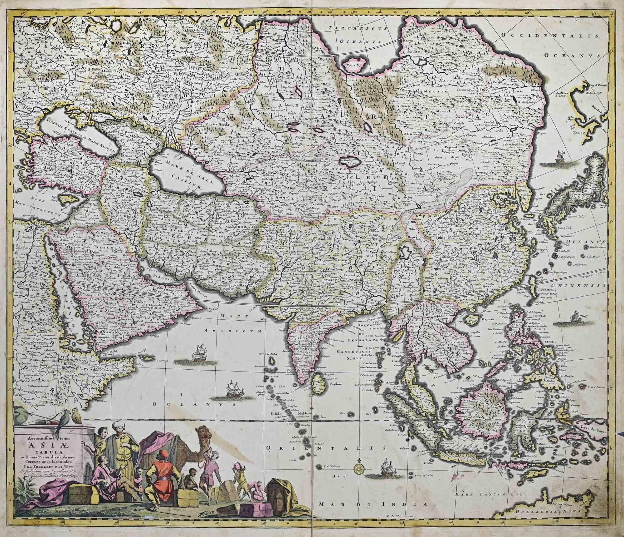
View AllAccuratissima Totius Asiae Tabula - Etching by Frederick de Wit - 1680 ca
By Frederick de Wit
Located in Roma, IT
This double-page etching with contemporary coloring, entitled Accuratissima totius Asiae Tabula, was realized by the cartographer Frederick de Wit for the famous Atlas published in A...
Category
1680s Modern Figurative Prints
Materials
Etching

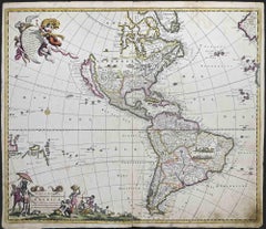
Novissima et Accuratissima... - Etching by Frederick de Wit - 1680 ca
By Frederick de Wit
Located in Roma, IT
This double-page etching with contemporary coloring, entitled Novissima et Accuratissima Septentrionalis ac Meridionalis Americae, was realized by the cartographer Frederick de Wit f...
Category
1680s Modern Figurative Prints
Materials
Etching
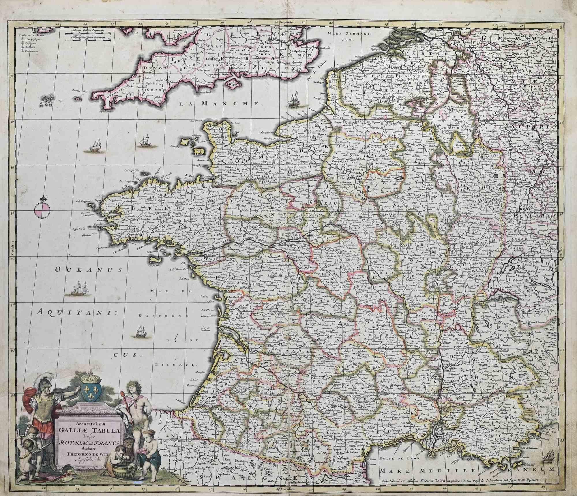
Accuratissima Galliae Tabula - Etching by Frederick de Wit - 1680ca
By Frederick de Wit
Located in Roma, IT
This double-page etching with contemporary coloring, entitled Accuratissima Galliae Tabula [...], was realized by the cartographer Frederick de Wit for the famous Atlas published in ...
Category
1680s Modern Figurative Prints
Materials
Etching

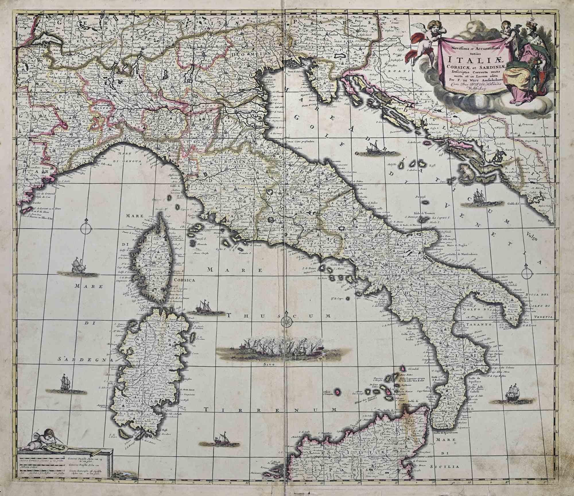
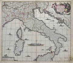
Novissima et Accuratissima Totius.. - Etching by Frederick de Wit - 1680ca
By Frederick de Wit
Located in Roma, IT
This double-page etching with contemporary coloring, entitled Novissima et Accuratissima totius Italiae, Corsicae et Sardiniae, was realized by the cartographer Frederick de Wit for ...
Category
1680s Modern Figurative Prints
Materials
Etching
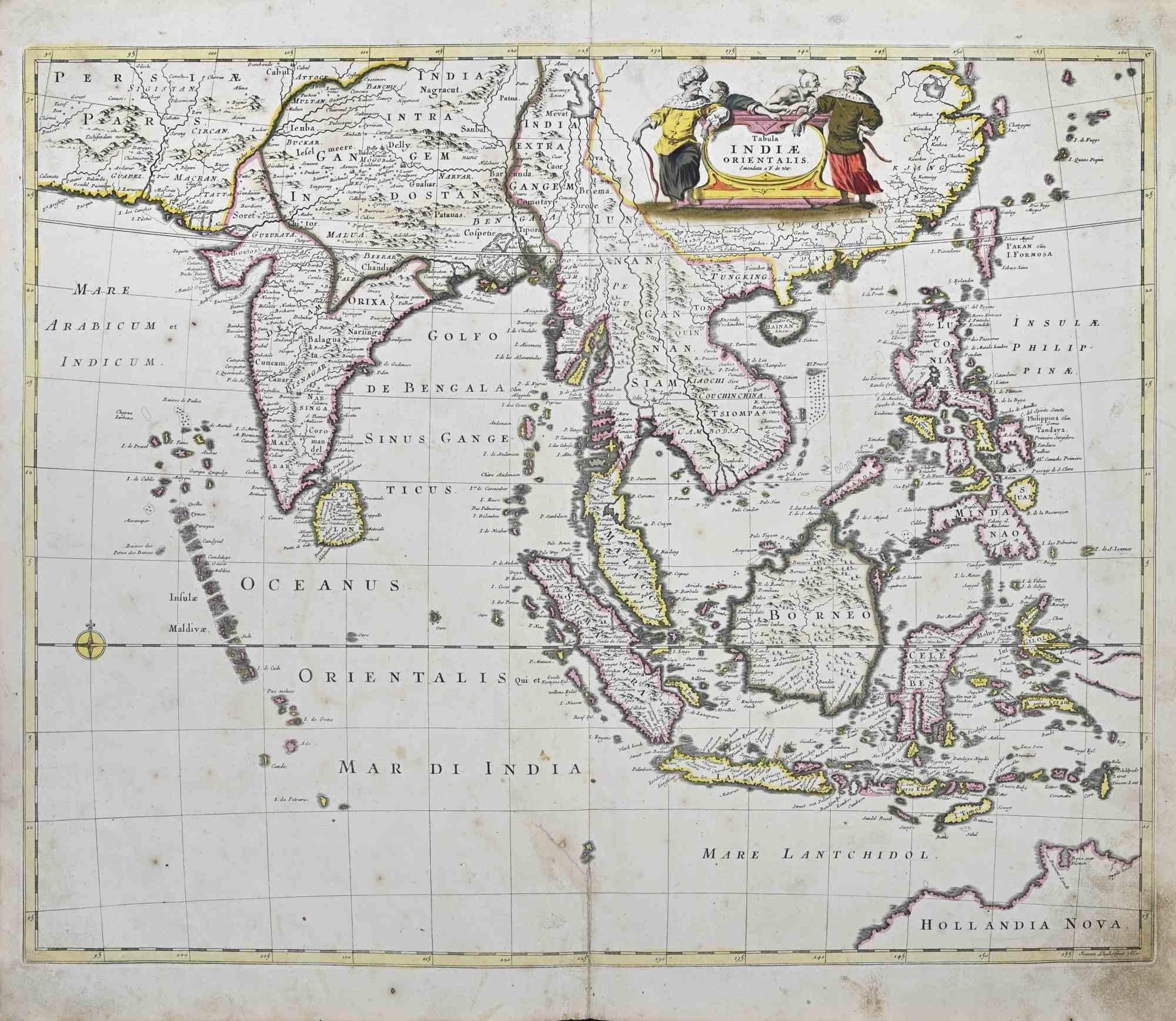
Tabula Indiae Orientalis - Etching by Frederick de Wit - 1680ca
By Frederick de Wit
Located in Roma, IT
This double-page etching with contemporary coloring, entitled Tabula Indiae orientalis, was realized by the cartographer Frederick de Wit for the famous Atlas published in Amsterdam ...
Category
1680s Modern Figurative Prints
Materials
Etching

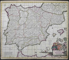
Accuratissima Totius Regni Hispaniae... - Etching by Frederick de Wit - 1680ca
By Frederick de Wit
Located in Roma, IT
This double-page etching with contemporary coloring, entitled Accuratissima Totius Regni Hispaniae Portugalliae, was realized by the cartographer Frederick de Wit for the famous Atla...
Category
1680s Modern Figurative Prints
Materials
Etching
You May Also Like
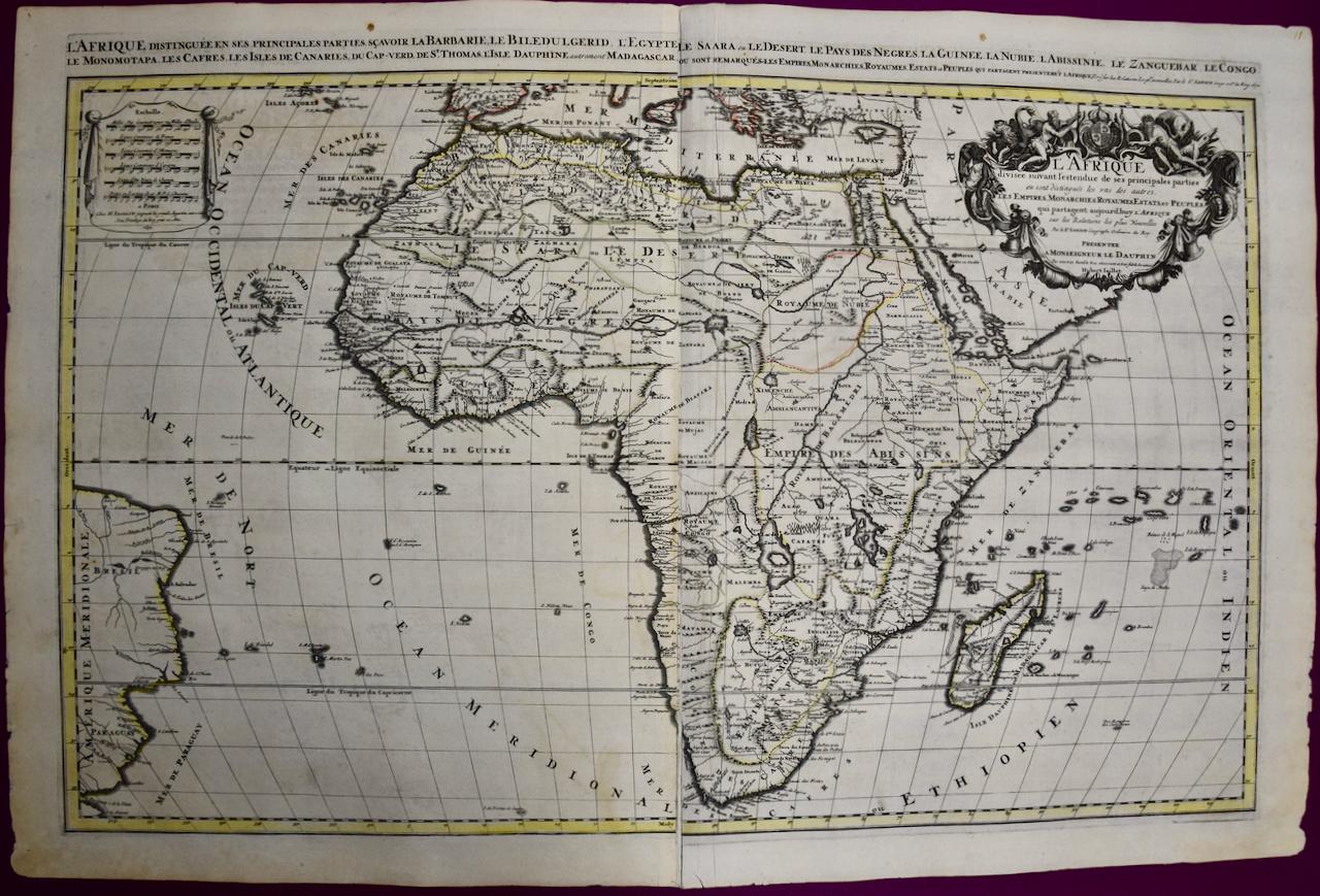
Africa: A Large 17th Century Hand-colored Map By Sanson and Jaillot
By Nicholas Sanson d'Abbeville
Located in Alamo, CA
This large original hand-colored copperplate engraved map of Africa entitled "L'Afrique divisee suivant l'estendue de ses principales parties ou sont distingues les uns des autres, L...
Category
1690s Landscape Prints
Materials
Engraving

"Africa Vetus": A 17th Century Hand-colored Map By Sanson
By Nicholas Sanson d'Abbeville
Located in Alamo, CA
This original hand-colored copperplate engraved map of Africa entitled "Africa Vetus, Nicolai Sanson Christianiss Galliar Regis Geographi" was originally created by Nicholas Sanson d...
Category
1690s Landscape Prints
Materials
Engraving

$1,100 Sale Price
20% Off
Antique Map of Africa with a Decorative Dedication to the Dauphin, 1717
Located in Langweer, NL
Antique map titled 'L'Afrique, Dressée Selon les Dernieres Relat. et Suivant les Nouvelles Decouvertes (..).'
This map is a reduced derivative of De Fer's wall map of Africa (1696-98) with its characteristic thickened west coast. Unusual islands appear in the Atlantic and Indian Oceans including a mythical second island of St. Helena. Monomotapa is shown in the south and the southwest coastline is distorted and there is an incorrect placement and shape of the Cape of Good Hope. In Central Africa is a paragraph concerning the origin of the Nile in Abyssinia, however, the two sub-equatorial Ptolemaic lakes are still shown on the map. The map is graced with a decorative dedication to the Dauphin and a title cartouche featuring lime kilns. The map was first published in 1700. This scarse map originates from: 'Introduction a la geographie - avec unde description historique sur toutes...
Category
Antique 18th Century Maps
Materials
Paper
$672 Sale Price
25% Off
Antique Map of Africa by Janssonius, Rare Paneled Print, Circa 1655
Located in Langweer, NL
Antique map titled 'Africa Nova Tabula Auct Jud. Hondio'. Beautiful and rare paneled map of Africa, Based Upon Hondius' map. The first derivative of the map was issued separately by ...
Category
Antique Mid-17th Century Dutch Maps
Materials
Paper
Africa: A Large 17th Century Hand-Colored Map by Sanson and Jaillot
By Nicolas Sanson
Located in Alamo, CA
This large original hand-colored copperplate engraved map of Africa entitled "L'Afrique divisee suivant l'estendue de ses principales parties ou sont distingues les uns des autres, L...
Category
Antique 1690s French Maps
Materials
Paper

$1,740 Sale Price
20% Off
Antique Map of Africa by Keizer & de Lat, 1788
Located in Langweer, NL
Antique map titled 'Kaartje van Africa (..)'. Uncommon original antique map of Africa. This map originates from 'Nieuwe Natuur- Geschied- en Handelkundige Zak- en Reisatlas' by Gerri...
Category
Antique Late 18th Century Maps
Materials
Paper

$382 Sale Price
20% Off